On Prince Street at Beatty Street, on the right when traveling north on Prince Street.
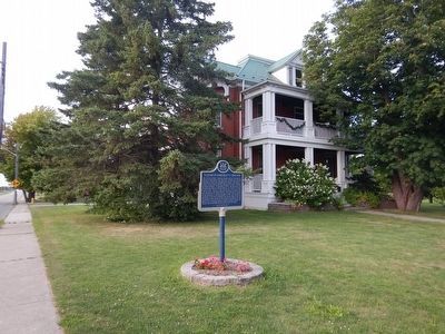
One of the earliest Canadian female medical missionaries, Elizabeth Rabb Beatty was born near Caintown and moved to Lansdowne where she attended local schools. She taught in Leeds County before entering Queen's University, Kingston, to study . . . — — Map (db m87198) HM
On Provincial Highway 137, 0.3 kilometers north of Benson Park Road, on the right when traveling north.
This international bridge system links Canada and the United States across the St. Lawrence River and islands from Ivy Lea, Ontario, to Collins Landing, N.Y. It was opened on August 18, 1938, by William Lyon Mackenzie King, Prime Minister of . . . — — Map (db m124428) HM
On Kellys Road just south of Provincial Highway 15, on the right when traveling south.
In Recognition of
100 Years' Service
1866-1966
Presented
August 2, 1991
———————————
In Recognition of
One Hundred and Fifty Years of Service
Lombardy Agricultural . . . — — Map (db m142073) HM
On Jonas Street, on the right when traveling south.
The carding mill provided the essential service of processing raw wool into soft but strong usable cloth. The mill's placement took advantage of the same flowing water that powered the saw and grist mills upstream. Carding cleans the wool fibers . . . — — Map (db m244334) HM
On Lyndhurst Road, on the left when traveling south.
Development of this community began after the construction of the province's first successful iron smelter and a sawmill in 1801. On the west bank of the river a grist-mill was built in 1827 and a village plot laid out by Charles and Jonas Jones of . . . — — Map (db m244317) HM
On Lyndhurst Road, on the right when traveling south.
This was the site of the first iron smelter in Canada west of Quebec. Furnace Falls took its name from the blast furnace. The iron works were built in remote wilderness conditions in 1801 by Wallis Sunderlin an ironmaster from Vermont. By 1803, . . . — — Map (db m244348) HM
On Cook Street at Lyndhurst Road, on the right when traveling south on Cook Street.
While the existence of local ore was well known and various petitions
had been made for the right to erect a foundry, it was not until
1801 that Wallis Sunderlin, a Vermont founderer, established the first
iron works in Upper Canada . . . — — Map (db m244304) HM
On Lyndhurst Road, on the right when traveling south.
The Lyndhurst Bridge
Reputedly the oldest bridge in existence in Ontario, this structure was built in 1856-57. It was designed by John
Roddick, then an employee of a prominent local mill owner, and erected by contractors Miles . . . — — Map (db m244449) HM
On Church Street at Ontario Highway 2, on the right when traveling south on Church Street.
Described as a writer "having a mission", this novelist, poet and historian authored ten books. Born in Crysler, she was the daughter of an Anglican priest, The Venerable Archdeacon Rupert J. Dumbrille and his wife. She lived in many Eastern Ontario . . . — — Map (db m89998) HM
On County Highway 2 at Church Street (County Highway 2), on the left when traveling east on County Highway 2.
Pax Alma Redit
DOUGLAS RUPERT DUMBRILLE
1889-1974
A Canadian pioneer in early Hollywood, this character actor was born in
Hamilton, Ontario. He frequently vacationed here at "Sprucelawn,” his
father's birthplace.
Sometimes . . . — — Map (db m204922) HM
On Provincial Highway 2 near Church Street, on the right when traveling east.
Built as a house in the 1850s, this sturdy stone building was altered in 1877 by John Dumbrille, when he relocated his general store from across the street in front of his residence "Sprucelawn". In 1879 he was appointed Maitland's postmaster and . . . — — Map (db m89979) HM
On Provincial Highway 2, 3.6 kilometers west of Blue Church Road, on the right when traveling west. Reported missing.
Construction of Homewood was begun in 1800 by Dr. Solomon Jones, a prominent Loyalist, local officeholder and early resident of this region. With its balanced five-bay façade, centre hallway plan and classical detailing, it reflects the influence of . . . — — Map (db m205243) HM
On Provincial Highway 2 west of Church Street, on the right when traveling west.
Born in Lachute, Québec, MacDowell moved to Maitland in 1897. He attended local schools and graduated from the University of Toronto in 1915. During World War I, he enlisted, on January 9, 1915, in the 38th Battalion, C.E.F. On April 9, 1917, during . . . — — Map (db m89999) HM
On Provincial Highway 2, 0.1 kilometers west of Maitland Road, on the right when traveling west.
English text: The barques "Iroquoise" and "Outaouaise", the last French ships of war that navigated Lake Ontario, were built on this point, then called Pointe Au Baril. On 17th August, 1760, the Outaouaise, commanded by Captain La Broquerie, . . . — — Map (db m87011) HM
On Church Street, 0.3 kilometers north of Ontario Highway 2, on the left when traveling north.
Among Augusta Township's earliest settlers were a number of Anglican Loyalists who, by 1785, we're holding services in private houses. The first resident missionary, the Reverend John Bethune, was appointed to this area in 1814. Reverend Robert . . . — — Map (db m90002) HM
On Church Street, 0.1 kilometers north of Ontario Highway 2, on the left when traveling north.
In a building on property contiguous to this site, St. James Lodge No. 74 (originally No. 40) was founded 9 February 1857. The Christian Order of Masonry, then known as the Sovereign Grand Conclave of England and Wales was instituted here 6 March . . . — — Map (db m90000) HM
On Provincial Highway 2 west of Church Street, on the right when traveling east.
In this vicinity, the site of a shipyard used during both the late French and early British periods, a village plot was laid out in 1824 for Jehiel and Ziba Phillips. Adjacent to it George Longley, a recent English emigrant, acquired an estate on . . . — — Map (db m89996) HM
On County Highway 2 just south of Mallorytown Road (County Highway 5), on the left when traveling south.
At only 20 years old, Amasa Whitney Mallory brashly started up Canada's first glassworks in a log structure about 2 km. west of Mallorytown. He had already successfully harvested lumber in the area for 2 years but was destined to . . . — — Map (db m141359) HM
On Thousand Islands Parkway, 2 kilometers east of Mallorytown Road, on the right when traveling east.
During the War of 1812 the St. Lawrence was the life-line of Upper Canada along which virtually all military and civilian supplies were transported from Montréal to Kingston. Fear that the Americans might attempt to block the passage of materiel . . . — — Map (db m87163) HM
On County Highway 2 just east of Guild Road, on the right when traveling west.
Near this site the first glass works was known to have been established in Canada. Production was proven to have been in existence in 1839 to 1840 by way of an article in the newspaper "Our Cheerful Friend" published in Brockville, . . . — — Map (db m141461) HM
On County Highway 5, 0.1 kilometers County Highway 2, on the left when traveling north.
This grove of red maple trees marks the southern entrance to a special memorial roadway which honours the members of our community who lost their lives for us during the two World Wars and the Afghanistan Conflict. Running north from Mallorytown . . . — — Map (db m141881) HM WM
On Provincial Highway 401, on the right when traveling east.
This plaque commemorates the completion of the Macdonald-Cartier Freeway (Highway 401), the longest freeway operated without tolls by a single highway authority in North America.
Covering 510 miles between Windsor on the United States border . . . — — Map (db m115171) HM
On Provincial Highway 401, on the right when traveling west.
This plaque commemorates the completion of the Macdonald-Cartier Freeway (Highway 401), the longest freeway operated without tolls by a single highway authority in North America.
Covering 510 miles between Windsor on the United States border . . . — — Map (db m124488) HM
On Quabbin Road (County Highway 4) 0.8 kilometers north of County Highway 2, on the right when traveling north.
Dedicated to the memory
of those Canadians
who served and died
World War I 1914-1918
Frank Bennett • George W. Mallory
Fred Cook • R. L. McGibon
Morton Hodge • Fred Salter
World War II 1939-1945
Jack Buell • Charles Massey . . . — — Map (db m141879) WM
On Main Street at St. Lawrence Street (Provincial Highway 15/43), on the right when traveling west on Main Street.
Established in 1908 by Ernest Thomas
Pastor of the Methodist Church
Merrickville, Ontario Canada
The first Scout Troop in North America
It was founded under the 1908 Scout Promise:
"On my honour, I will do my duty to God
and the King. . . . — — Map (db m142180) HM
On St. Lawrence Street (Provincial Highway 15/43) at Rideau Canal, on the right when traveling south on St. Lawrence Street.
The Merrickville blockhouse is one of four blockhouses constructed on the Rideau Canal. Its architecture is a typical design utilized throughout British North America. The 3.5 foot (1.06 metres) walls were designed to be strong enough to . . . — — Map (db m142312) HM
On Main Street just west of St. Lawrence Street (Provincial Highway 15), on the right when traveling west.
Why the Canals are Twinned
These two canals were constructed in the early 19th century for military reasons. Both Canals grew into commercial highways, survived as recreational waterways and are now important heritage resources. . . . — — Map (db m142314) HM
On Main Street (Provincial Highway 43) at Elgin Street, on the left when traveling east on Main Street.
In 1793 William Merrick (1760-1844), a Loyalist from Massachusetts, acquired from Roger Stevens a sawmill at the "Great Falls" on the Rideau River. Here he built new mills which formed the nucleus of a small community that grew up before 1816 and . . . — — Map (db m142241) HM
On St. Lawrence Street (Provincial Highway 15) at Main Street (Provincial Highway 43), on the left when traveling south on St. Lawrence Street.
The heritage character and integrity
of this property are protected by a
legal agreement between the owner
and the Ontario Heritage Foundation . . . — — Map (db m142264) HM
On St. Lawrence Street (Provincial Highway 15/43) at Rideau Canal, on the right when traveling south on St. Lawrence Street.
The arrangement of the locks here is unique along the waterway with a small basin set between each lock. These basins were built to allow the locks to follow a natural depression in the ground and therefore minimize the amount of . . . — — Map (db m142341) HM
On St. Lawrence Street (Provincial Highway 15/43) at Main Street, on the left when traveling north on St. Lawrence Street.
This is one of four blockhouses which, with some twelve other "defensible buildings", were constructed along the Rideau Canal. The canal, built 1826-32 by Lieutenant-Colonel John By, Royal Engineers, was designed to serve as an alternative . . . — — Map (db m142181) HM
On St. Lawrence Street (Provincial Highway 15) just south of Drummond Street, on the left when traveling south.
This School Bell,
a replica of the original tower bell
is placed in this Cenotaph Park in
Celebration of our School Reunion
July 1995
Bell donated by: Alley Foundry
Cairn erected by: George Cross
in memory of his father
Plaque . . . — — Map (db m142272) HM
On St. Lawrence Street (Provincial Highway 15) just south of Drummond Street, on the left when traveling south.
This oak tree, planted on
May 13, 2017,
descends from acorns gathered
after the Battle of Vimy Ridge,
April 9-12, 1917.
It honours the memory of those
who served including three soldiers
from Merrickville who died during . . . — — Map (db m142269) HM WM
On Main Street just west of St. John Street, on the left when traveling west.
The first Catholics to settle in Merrickville were the families of the Irish, Scottish and French builders of the Rideau Canal, 1826-32. The area was originally served by priests visiting from Perth and Prescott and later from Smiths Falls and . . . — — Map (db m142243) HM
On St. Lawrence Street (Provincial Highway 15/43) at Rideau Canal, on the right when traveling south on St. Lawrence Street.
When construction of the Rideau Canal began, Merrickville was already an established village and was considered by the authorities to be a logical target for an invader. Consequently Colonel John By urged strong measures for the . . . — — Map (db m142194) HM
On Main Street just west of St. Lawrence Street (Provincial Highway 15), on the right when traveling west.
The Caledonian Canal of Scotland, engineered by Thomas Telford and completed in 1822, is twinned with the Rideau Canal to commemorate their historical link, purpose and function, and to recognize the enduring importance of canals to . . . — — Map (db m142184) HM
On St. Lawrence Street (Provincial Highway 15) at Drummond Street, on the left when traveling south on St. Lawrence Street.
In Loving Memory
of those
who served and died
1914-1918
————————
Spirit that made these Heroes dare
To die or leave their children free,
Bid time and Nature gently spare
The Cairn . . . — — Map (db m142276) HM
On King Street East (County Route 2) close to Russel Street, on the right when traveling east.
This company, incorporated in 1850, built a railway from Prescott to Bytown (Ottawa) for the shipment of lumber and farm products to markets of the north-eastern United States and Montreal. Substantial funds were raised at Bytown, Prescott and other . . . — — Map (db m83430) HM
Near Sophia Street, 0.1 kilometers south of Corrine Street.
On the morning of February 22, 1813, Lieutenant-Colonel "Red George" Macdonell of the Glengarry Light Infantry set out from Prescott with a force of some 480 regulars and militia to capture the strong United States military post at Ogdensburg. The . . . — — Map (db m86971) HM
On King Street East (County Route 2) close to Vankoughnet Street, on the left.
Born in Stamford, Connecticut, he forfeited 500,000 acres near Albany, New York, by taking up arms for the King on the outbreak of the American Revolution. He raised the Loyal (Jessup’s) Rangers and served under Burgoyne. This corps was disbanded at . . . — — Map (db m83429) HM
Near Vankoughnet Street close to King Street East, on the left when traveling south.
English: The first Fort Wellington was erected on this site during the War of 1812 to shelter British regular troops and Canadian militia defending the vital St. Lawrence River transportation route. In February 1813 those soldiers crossed . . . — — Map (db m209406) HM
On East Street at Henry East, on the left when traveling south on East Street.
This frame structure was originally constructed c. 1823 as a commissariat house for the Fort Wellington Garrison. From 1840-1854, the building served as a military hospital; mainly serving the local garrison of the Royal Canadian Rifle Regiment. The . . . — — Map (db m221390) HM
On Railway Avenue at St-Lawrence Street, on the right when traveling west on Railway Avenue.
The Grand Trunk was incorporated in 1853 to run from Sarnia to Portland, Maine. Although it took over existing lines, new ones had to be built, including sections of the key Toronto to Montréal line completed by the noted English . . . — — Map (db m45781) HM
On Centre Street at Dibble Street West, on the left when traveling north on Centre Street.
Harry Horwood came to Canada from England in the early 1850s and started working as a stained glass maker in Toronto. In 1881 he established his own stained glass business in Prescott, first on Water Street and later in the old municipal . . . — — Map (db m242712) HM
Jean Casselman Wadds, a resident of Prescott from 1946 until her death in
2011, was the first woman to serve as Canada's High Commissioner to
the United Kingdom. Appointed by Prime Minister Joe Clark in 1979,
Mrs. Wadds completed her term in . . . — — Map (db m203062) HM
On Provincial Highway 2 at Merwin Lane, on the right when traveling east on Provincial Highway 2.
Born in Connecticut, Sherwood settled in Vermont in 1774. On the outbreak of the American Revolution he was arrested as a Loyalist, but escaped to join the British at Crown Point. He was taken prisoner at Saratoga in 1777, and after being exchanged . . . — — Map (db m86972) HM
On Water Street West at Edward Street South, on the left when traveling west on Water Street West.
One of Canada's first military airmen during the Great War (1914-1918) was Prescott's native son, William F. N. Sharpe. His pioneering role in our country's earliest attempt to organize an air force has earned him a place in Canada's military . . . — — Map (db m242808) HM
On Water Street East just east of Edward Street South, on the right when traveling east.
This Lighthouse Restoration Project
was sponsored by
the Rotary Club of Prescott
as a 50th Anniversary project
in co-operation with the Town of Prescott
and the family of the late G. Judson Newell
a Past Rotarian and a Friend of the . . . — — Map (db m242888) HM
Born and educated in Prescott, Walsh was trained at military schools at Kingston and by 1873 had attained the rank of Major in the militia. In that year he was commissioned in the newly formed North-West Mounted Police. While in charge at Fort . . . — — Map (db m86953) HM
On James Street West at Centre Street, on the right when traveling east on James Street West.
The Grenville County Historical Society Inc. recognizes the contributions of the congregation
of the Anglican Parish of St. John the Evangelist, Prescott on their 175th anniversary in the year 1996.
The Anglican Parish of St. John the . . . — — Map (db m242719) HM
On East Street, 0.1 kilometers north of King Street East (Ontario Highway 2).
The front portion of this structure one of the earliest surviving military buildings in Ontario, was constructed as a residence about 1810 by Colonel Edward Jessup, the founder of Prescott. Following the outbreak of the War of 1812, the stone house . . . — — Map (db m86950) HM
On Centre Street at Water Street West, on the left when traveling south on Centre Street.
Lieut. Colonel 'Red' George Macdonnell crossed the frozen river
with 500 men and some light guns mounted on sleighs in a raid on
Ogdensburgh, New York. The capture of the village was a British
victory that removed the American threat to . . . — — Map (db m242865) HM
On Vankoughnet Street close to King Street East, on the left when traveling south.
World War I
1914-1918
Arthur E. Baker • Howard Baker • Philip V. Blacklock • Cecil Bovaird • Ward W. Burke • John H. Davy • Jacob S. Doyle • G. Harvey Ewart • Ira H. Glasgow • Albert Hurlbert • Royal W. Kingston • Roy Lindsay • John A. . . . — — Map (db m209407) WM
On King Street West (County Highway 2) at George Street, on the left when traveling east on King Street West.
Prescott is a town on the north shore of the Saint Lawrence River in [the] province of Ontario, Canada. The town is a part of the United Counties of Leeds and Grenville. In 2021, it had a population of 4,078. The Ogdensburg-Prescott International . . . — — Map (db m242848) HM
On King Street West at Centre Street, on the left when traveling west on King Street West.
[Original marker as base of clockworks]
The Memorial Clock
on this building was
presented to the
Corporation of Prescott
in memory of
Louis Hasbrouck Daniels
by his widow
Harriet Daniels.
[An identical modern marker]
This . . . — — Map (db m242945) HM
On Edwards Street South at Dibble Street West, on the right when traveling south on Edwards Street South.
English:
Born at Prescott, Scott was admitted to the bar in 1848 and practiced law in Ottawa. As a member of the legislature of United Canada (1857-63) he sponsored the Separate School Act of 1863. Subsequently, he represented Ottawa in . . . — — Map (db m83364) HM
On Windmill Road close to Leeds and Grenville Road (County Route 2), on the right when traveling east.
English: After the 1837 Rebellions many rebels fled to the United States where a few joined American sympathizers in a new attempt to overthrow British rule in Canada. On 12 November 1838 they landed 190 men here and seized this windmill and . . . — — Map (db m83433) HM
On Windmill Road close to Leeds and Grenville Road (County Route 2), on the right when traveling east.
English:
Prelude to the Battle
In 1837 the British army and loyal militia crushed the first armed revolt in Upper and Lowr Canada. Many rebels fled to the United States. The exiles joined with American sympathisers to form a secret . . . — — Map (db m83476) HM
On Provincial Highway 2 at Blue Church Road, on the right when traveling west on Provincial Highway 2.
On January 1, 1790, inhabitants of Augusta and Elizabethtown townships agreed to build a church here in the burying yard of the proposed town of "New Oswegatchie". Subscriptions were inadequate and nothing was built by 1804 when Barbara Heck, the . . . — — Map (db m87008) HM
On Water Street West, 0.1 kilometers west of Centre Street, on the left when traveling west. Reported missing.
Before the completion of the canals between here and Montreal in 1847, Prescott was the eastern terminus of Great Lakes navigation. Established at the head of Galops Rapids in 1810, it soon became a centre for the forwarding, or shipping, trade and . . . — — Map (db m221393) HM
On King Street West (County Highway 2) at Centre Street, on the right when traveling west on King Street West.
Commissioned by the Prescott Bicentennial Committee
and dedicated
December 18th, 2010
'The Prescott People's Place' is composed of over 3000
pictures from Prescott people. This mural was created
by Chuck Street and made . . . — — Map (db m242710) HM
On County Road 2, on the right when traveling east.
Launched February 2, 1868 at
St. John, New Brunswick the Rothesay
is a 65 m. (178') long twin side-wheeler
that initially sailed between Fredericton
and St. John but was later relocated
to service the Montreal to Prescott
route . . . — — Map (db m227967) HM
On Henry Street West just west of Edward Street, on the left when traveling west.
Arthur E. Baker • Howard Baker • Philip O. Blacklock • Cecil Bovaird
Ward W. Burke • John H. Davy • Jacob S. Doyle • Harvey G. Ewart
Ira A. Glasgow • Albert Hurlbert • Royal W. Kingston • William E. Lane
Roy Lindsay • John A. Macdonald • . . . — — Map (db m242784) WM
Near Windmill Road, 0.3 kilometers south of King Street East (County Route 2).
English:
You are standing on a battlefield where men fought and died. This battle took place in November 1838, during the Canadian rebellions. One side fought to "liberate" Canada from British rule. The other side rallied to protect . . . — — Map (db m83497) HM
On County Route 21, 1 kilometer east of County Route 18, on the right when traveling east.
Approximately 500 years ago an Iroquoian agricultural community of about 1600 persons occupied this site. Archaeological excavations suggested approximately 40 communal longhouses, averaging nearly 100 feet in length, stood in this village, . . . — — Map (db m89977) HM
On Rideau River Road (County Highway 19) at Veterans Memorial Highway (National Highway 416), on the right when traveling north on Rideau River Road.
This park is dedicated to the
men and women of the Canadian Armed Forces
for their service and sacrifice
on behalf of Canada in war and peace.
We Will Remember Them
Ce parc est dedie aux
aux hommes et aux femmes
des . . . — — Map (db m181264) WM
On Provincial Highway 15, 0.8 kilometers north of County Highway 32, on the left when traveling north.
In honoured and lasting memory of
these men who gave their lives in the
defence of their country in World War II
1939 — 1945
Sqdn. Ldr. (Chaplain) James G. Brown
Ld. Sto. Alfred C. Dean • F/O Douglas H. Frye
Pte. Hubert . . . — — Map (db m207529) WM
On Water Street south of Spencer Street (County Highway 44), on the left when traveling south.
Downstream from present day Spencerville, the Roebuck area was once home to 1,600 Indigenous people. Based upon research done by Augusta Township we understand that this park is on aboriginal land that was inhabited by Indigenous peoples for . . . — — Map (db m193865) HM
On Centre Street at Murray Street, on the right when traveling west on Centre Street.
By 1821 Peleg Spencer was operating a grist-mill and sawmill on the South Nation River on a Clergy Lot he had leased in 1817, having previously owned a sawmill on the site from 1811 till 1814. David Spencer, son of Peleg, took over the mills in 1822 . . . — — Map (db m89974) HM
On Centre Street (County Highway 21) west of South Street, on the right when traveling west.
This clock was installed in 1956 in honor of Dr. Pember A. MacIntosh B.A., M.D.C.M. in recognition of his services to the community since 1905. — — Map (db m193862) HM
On Centre Street (County Highway 21) west of South Street, on the right when traveling west.
In loving memory of
Our Heroes
who fell in the Great War
1914 - 1918
Their names shall never perish
[World War I Honored Dead]
Pte. Josie Cook, Apr. 22, 1915 • Sgt. Richard Goodin, May 7, 1916
Lieut. W. Roy Kingston, . . . — — Map (db m193874) WM
On Narrows Lock Road (County Highway 14) at the Rideau Canal, on the right when traveling north on Narrows Lock Road.
The construction of the Narrows blockhouse began in 1832 by William H. Tett,
a prominent Newboro merchant. This blockhouse is one of four constructed on the
Rideau Canal. Its architecture is a typical design utilized throughout . . . — — Map (db m207637) HM
On Narrows Lock Road (County Highway 14) at the Rideau Canal, on the right when traveling north on Narrows Lock Road.
Before the arrival of the Royal Engineers, Rideau Lake stretched unbroken
for 35 km (22 miles) between Newboro and the entrance to the Rideau
River, 29 km (18 miles) to the north. There was, and is, no reason for this
lock with its 1 . . . — — Map (db m207654) HM
On Narrows Lock Road (County Highway 14) at the Rideau Canal, on the right when traveling north on Narrows Lock Road.
The Rideau Canal is a series of rivers and lakes connected by man-made channels and locks. There are 18 miles of artificial cut and 47 locks grouped in 23 lock stations, as well as many water control structures. These make the Rideau . . . — — Map (db m207658) HM
On Narrows Lock Road (County Highway 14) close to the Rideau Canal, on the right when traveling north.
The War of 1812 had shown that a successful defence of Canada against an American attack depended upon secure supply lines. The Rideau Canal was built as an alternate to the easily attacked St. Lawrence supply route. Blockhouses were . . . — — Map (db m207659) HM
On Narrows Lock Road (County Highway 14) at the Rideau Canal, on the right when traveling north on Narrows Lock Road.
Before the Rideau Canal was constructed The Narrows was but a shallow portion of one large lake. Original plans called for a channel to permit navigation. However, tough granite and malaria upstream at the Isthmus caused difficulties in . . . — — Map (db m207660) HM
287 entries matched your criteria. Entries 201 through 287 are listed above. ⊲ Previous 100