384 entries match your criteria. The first 100 are listed. ⊳
Entries Containing the Phrase «john brown»
March 1, 2008
A Moving Symbol Marker
RANKED BY RELEVANCE, THEN GEOGRAPHICALLY
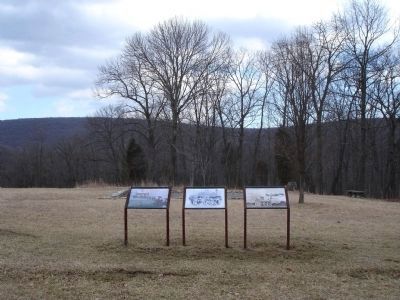
| 1 ► West Virginia, Jefferson County, Bolivar — A Moving Symbol — Harpers Ferry National Historical Park — National Park Service, U.S. Department of the Interior — |
| Near Murphy Road, on the right when traveling south. | |||
| 2 ► Ontario, Chatham-Kent, Chatham — John Brown's Convention 1858 — |
| On King Street East just east of Prince Street South, on the left when traveling east. | |||
| 3 ► California, San Bernardino County, Hesperia — 5 — John Brown Road at The Mojave Trail — 1870 and Prehistoric — |
| On Choiceana Avenue north of Lilac Street, on the right when traveling north. | |||
| 4 ► California, San Bernardino County, Hesperia — 4 — John Brown Road Crossing — At Main Street — 1870 — |
| On Main St, 0.1 miles east of Seventh Avenue, on the right when traveling east. | |||
| 5 ► California, San Joaquin County, Stockton — 513 — John Brown — (California’s Paul Revere) — |
| On Weber Street at Union Street, on the right when traveling east on Weber Street. | |||
| 6 ► Connecticut, Litchfield County, Torrington — John Brown Birthplace — |
| On John Brown Road, 1 mile west of Town Farm Road, on the right when traveling west. | |||
| 7 ► Georgia, Fulton County, Atlanta, Grant Park — John Brown Gordon — 1832 - 1904 — |
| 8 ► Georgia, Fulton County, Atlanta, South Downtown — John Brown Gordon — |
| On Washington Street SW at Martin Luther King Jr Dive NW, on the left when traveling south on Washington Street SW. | |||
| 9 ► Kansas, Douglas County, Lawrence, Lawrence Cultural District — John Brown and the Siege of Lawrence, September 14-15, 1856 — |
| On Massachusetts Street south of 6th Street, on the left when traveling south. | |||
| 10 ► Kansas, Miami County, Osawatomie — John Brown Battleground — |
| 11 ► Kansas, Miami County, Osawatomie — 50 — John Brown Country — |
| On 6th Street at Lincoln Avenue, on the left when traveling north on 6th Street. | |||
| 12 ► Kansas, Miami County, Osawatomie — John Brown of Kansas — |
| On 10th Street at Main Street, on the right when traveling north on 10th Street. | |||
| 13 ► Kansas, Miami County, Osawatomie — John Brown Statue — 1935 — |
| 14 ► Kansas, Wyandotte County, Kansas City, Quindaro Bluffs — John Brown — |
| On 27th Street at Sewell Avenue, on the left when traveling north on 27th Street. | |||
| 15 ► Kentucky, Franklin County, Frankfort — 1653 — Liberty Hall / John Brown (1757-1837) — |
| On Wilkinson Street, on the right when traveling south. | |||
| 16 ► Maryland, Washington County, Dargan — John Brown — |
| On Chestnut Grove Road, on the left when traveling north. | |||
| 17 ► Maryland, Washington County, Dargan — John Brown, 59, Hanged — In Memoriam — |
| On Chestnut Grove Road, 0.7 miles north of Harpers Ferry Road, on the left when traveling north. | |||
| 18 ► Maryland, Washington County, Hagerstown — John Brown — |
| On West Washington Street, on the left when traveling east. | |||
| 19 ► Maryland, Washington County, Williamsport — The John Brown Bell — |
| On East Church Street east of South Conococheague Street (Maryland Route 68), on the right when traveling east. | |||
| 20 ► Massachusetts, Middlesex County, Marlborough — The John Brown Bell — |
| On Main Street, on the left when traveling east. | |||
| 21 ► Michigan, Wayne County, Detroit, Downtown Detroit — S0224 — Frederick Douglass - John Brown Meeting — |
| On St. Antoine Street at Congress Street on St. Antoine Street. | |||
| 22 ► New York, Essex County, Elizabethtown — John Brown’s Body — |
| On Court Street (U.S. 9) at Park Street, on the left when traveling north on Court Street. | |||
| 23 ► New York, Essex County, North Elba — Here Lies Buried John Brown — |
| Near John Brown Road, 0.5 miles south of New York State Route 73, on the right. | |||
| 24 ► New York, Essex County, North Elba — John Brown — |
| On Cascade Road (New York State Route 73) 0.1 miles south of Meadow Lane, on the right when traveling north. | |||
| 25 ► New York, Essex County, Ticonderoga — Colonel John Brown — |
| Near Sandy Redoubt, on the right when traveling east. | |||
| 26 ► New York, New York County, Manhattan, Bowery — John Brown's Body On The Bowery — McGraw and Taylor Undertakers — 163 Bowery — |
| On Bowery north of Broome Street, on the right when traveling north. | |||
| 27 ► New York, Schenectady County, Niskayuna — John Brown Hiking Trails and Mohawk River State Park — |
| Near River Road (County Route 19) south of Line Drive, on the left when traveling south. | |||
| 28 ► Ohio, Ashtabula County, Jefferson — Owen Brown, Son of John Brown — |
| On North Chestnut Street (Ohio Route 46) north of West Jefferson Street, on the left when traveling north. | |||
| 29 ► Ohio, Summit County, Akron — 50-77 — Abolitionist John Brown — (1800-1859) — |
| On Copley Road (Ohio Route 162) at Diagonal Road, on the right when traveling east on Copley Road. | |||
| 30 ► Ohio, Summit County, Hudson — Boyhood home of John Brown — |
| On Ravenna Street at South Main Street on Ravenna Street. | |||
| 31 ► Pennsylvania, Crawford County, Guys Mills, Richmond Township — John Brown Tannery — |
| On John Brown Road, 0.2 miles south of Pennsylvania Route 77, on the left when traveling south. | |||
| 32 ► Pennsylvania, Crawford County, Guys Mills, Richmond Township — John Brown's Tannery — |
| On Pennsylvania Route 77 west of John Brown Road, on the right when traveling north. | |||
| 33 ► Pennsylvania, Franklin County, Chambersburg — Abolitionist John Brown Boards in Chambersburg — Franklin — Civil War Trails — |
| On South Main Street (U.S. 11) at Lincoln Way (U.S. 30), on the right when traveling north on South Main Street. | |||
| 34 ► Pennsylvania, Franklin County, Chambersburg — Frederick Douglass and John Brown — |
| On West Loudoun Street. | |||
| 35 ► Pennsylvania, Franklin County, Chambersburg — John Brown — |
| On East King Street, on the right when traveling west. | |||
| 36 ► Pennsylvania, Franklin County, Mont Alto — John Brown Raid — |
| On Park Street (Route 233) at Slabtown Road on Park Street. | |||
| 37 ► Rhode Island, Providence County, Providence, College Hill — John Brown House — Rhode Island Afro-American Heritage Trail — |
| On Powers Street, on the left when traveling east. | |||
| 38 ► Tennessee, Hamilton County, Chattanooga, Lookout Valley — John Brown's Ferry Tavern, 1803 — |
| Near Browns Ferry Road, 0.2 miles north of Angela Lane, on the left when traveling north. | |||
| 39 ► Texas, Shackelford County, Albany — 13676 — The Rev. John Brown, Clara Barton and the 1886-1887 Drought Relief — |
| Near S. Main Street (U.S. 283) at S. 2nd Street, on the right when traveling north. | |||
| 40 ► West Virginia, Jefferson County, Bolivar — Holy Ground — Harpers Ferry National Historical Park — National Park Service, U.S. Department of the Interior — |
| Near Murphy Road, on the right when traveling south. | |||
| 41 ► West Virginia, Jefferson County, Bolivar — The Murphy Farm — |
| Near Shoreline Drive. | |||
| 42 ► West Virginia, Jefferson County, Charles Town — John Brown Hanging Site — Creation of a Martyr — Prelude to War — |
| On South Samuel Street at East Hunter Street on South Samuel Street. | |||
| 43 ► West Virginia, Jefferson County, Charles Town — John Brown Scaffold — |
| On S. Samuel Street at Hunter Street, on the left when traveling south on S. Samuel Street. | |||
| 44 ► West Virginia, Jefferson County, Charles Town — Site of the Execution of John Brown — |
| Near South Samuel Street just south of Hunter Street, on the left when traveling south. | |||
| 45 ► West Virginia, Jefferson County, Charles Town — The Trial of John Brown — Jefferson County Courthouse — Prelude to War — |
| On George Street (West Virginia Route 115) at Washington Street (West Virginia Route 51), on the right when traveling north on George Street. | |||
| 46 ► West Virginia, Jefferson County, Harpers Ferry — Harpers Ferry / John Brown’s Fort — |
| On Washington Street (Alternate U.S. 340) at Storer College Place on Washington Street. | |||
| 47 ► West Virginia, Jefferson County, Harpers Ferry — John Brown — |
| Near Storer College Place, on the left when traveling south. | |||
| 48 ► West Virginia, Jefferson County, Harpers Ferry — John Brown — |
| On Shenandoah Street at Potomac Street on Shenandoah Street. | |||
| 49 ► West Virginia, Jefferson County, Harpers Ferry — John Brown Fort — |
| On South Potomac Street at Shenandoah Street (County Route 340/9), on the right when traveling east on South Potomac Street. | |||
| 50 ► West Virginia, Jefferson County, Harpers Ferry — John Brown Monument — |
| Near Potomac Street just west of Shenadoah Street (Business U.S. 340), on the right when traveling west. | |||
| 51 ► West Virginia, Jefferson County, Harpers Ferry — John Brown's Last Stand — Harpers Ferry National Historical Park — National Park Service, U.S. Department of the Interior — |
| Near Potomac Street, on the right when traveling west. | |||
| 52 ► West Virginia, Jefferson County, Harpers Ferry — The John Brown Raiders — |
| On Public Way, on the left when traveling north. | |||
| 53 ► Iowa, Cass County, Lewis — Fighting Slavery – Aiding Runaways — John Brown Freedom Trail — December 20, 1858 - March 12, 1859 — |
| 54 ► Iowa, Dallas County, Redfield — Fighting Slavery - Aiding Runaways — John Brown Freedom Trail — December 20, 1858 - March 12, 1859 — |
| On First Street north of Omaha Street, on the right when traveling north. | |||
| 55 ► Maryland, Washington County, Dargan — Kennedy Farm — Staging and Planning John Brown's Harpers Ferry Raid — |
| On Chestnut Grove Road, on the right when traveling south. | |||
| 56 ► Pennsylvania, Chester County, Phoenixville, Tredyffrin Township — Knox’s Quarters — John Brown Farm — |
| On Valley Forge Road (Pennsylvania Route 252), on the left when traveling west. | |||
| 57 ► West Virginia, Jefferson County, Bolivar — Allstadt House — John Brown's Hostages — Prelude to War — |
| On Allstadt Hill Road, 0.2 miles north of Millville Road (County Route 27), on the left when traveling north. | |||
| 58 ► West Virginia, Jefferson County, Charles Town — Edge Hill Cemetery — John Brown Raid Victims — |
| On S Seminary Street at E Congress Street, on the left when traveling south on S Seminary Street. | |||
| 59 ► West Virginia, Jefferson County, Charles Town — Jefferson County Courthouse — Where John Brown Was Tried — Visitors are Welcome. — |
| On North George Street at East Washington Street (U.S. 340), on the right when traveling north on North George Street. | |||
| 60 ► Virginia, Orange County, Locust Grove — John Gordon Proposes a Flank Attack — |
| Near Constitution Highway (State Highway 20), on the right when traveling west. | |||
| 61 ► West Virginia, Jefferson County, Charles Town — George Washington Turner — |
| 62 ► Kansas, Miami County, Osawatomie — 1 — Battle of Osawatomie — |
| 63 ► West Virginia, Jefferson County, Harpers Ferry — Burned, Flooded, and Leveled — Harpers Ferry National Historical Park — National Park Service, U.S. Department of the Interior — |
| On Shenandoah River Drive (Alternate U.S. 340) at High Street (Alternate U.S. 340), on the right when traveling east on Shenandoah River Drive. | |||
| 64 ► West Virginia, Jefferson County, Harpers Ferry — Heyward Shepherd — |
| On Potomac Street at Shenandoah Street (Business U.S. 340), on the right when traveling east on Potomac Street. | |||
| 65 ► Kansas, Douglas County, Baldwin City — The Battle of Black Jack — "Civil War in Kansas!" — |
| On East 2000th Road at North 175th Road, on the right when traveling south on East 2000th Road. | |||
| 66 ► Virginia, Rappahannock County, Amissville — Dangerfield Newby — A Tragic Journey to Harpers Ferry — |
| On Laurel Mills Road (County Route 618) at Richmond Road (County Route 729), on the left when traveling east on Laurel Mills Road. | |||
| 67 ► Kansas, Miami County, Osawatomie — 4 — Battle of Osawatomie — |
| 68 ► Kansas, Miami County, Osawatomie — Battle of Osawatomie — |
| Near Tenth Street, 0.2 miles north of Main Street. | |||
| 69 ► Kansas, Miami County, Osawatomie — 6 — Old Stone Church — Osawatomie Driving Tour — |
| On 6th Street north of Parker Avenue, on the right when traveling north. | |||
| 70 ► Maryland, Dorchester County, Cambridge — Civil War: Abolitionist, Scout, Spy and Nurse — Civil War Era — 1858 - 1865 |
| On Washington Street (Maryland Route 343) at Ocean Gateway (U.S. 50), on the right when traveling west on Washington Street. Reported permanently removed. | |||
| 71 ► Nebraska, Otoe County, Nebraska City — 466 — Mayhew Cabin, 1855 — |
| On 4th Corso (Nebraska Route 2) west of South 19th Street, on the right when traveling west. | |||
| 72 ► New York, Monroe County, Rush — Hallock House — |
| On Rush-Lima Road (New York State Route 15A) at Keyes Road, on the right when traveling north on Rush-Lima Road. | |||
| 73 ► Ohio, Ashtabula County, Austinburg — 8 — The Underground Railroad in Austinburg — |
| On Western Reserve Greenway north of Ohio Route 307, on the right when traveling north. | |||
| 74 ► West Virginia, Jefferson County, Charles Town — John Frederick Blessing — |
| On East North Street east of North Mildred Street, on the right when traveling east. | |||
| 75 ► West Virginia, Jefferson County, Harpers Ferry — "The War That Ended Slavery" — Harpers Ferry National Historical Park — National Park Service, U.S. Department of the Interior — |
| On Shenandoah Street at Potomac Street, on the right when traveling east on Shenandoah Street. | |||
| 76 ► Iowa, Polk County, West Des Moines — Welcome to the Jordan House — |
| Near Fuller Road west of South 19th Street, on the right when traveling west. | |||
| 77 ► West Virginia, Jefferson County, Harpers Ferry — A Nation's Armory — Harpers Ferry National Historical Park — National Park Service, U.S. Department of the Interior — |
| On Hog Alley at Potomac Street, on the right when traveling north on Hog Alley. | |||
| 78 ► Kansas, Linn County, Trading Post — 46 — Marais des Cygnes Massacre — |
| On U.S. 69 near Kansas Highway 52. | |||
| 79 ► Kansas, Miami County, Osawatomie — 5 — Battle of Osawatomie — |
| 80 ► Kansas, Miami County, Osawatomie — 2 — Battle of Osawatomie — |
| 81 ► New York, New York County, Manhattan, Nolita — 200 Years & Counting — 206-8 Bowery — |
| On Bowery at Rivington Street, on the right when traveling south on Bowery. | |||
| 82 ► Rhode Island, Providence County, Providence, Fox Point — 9 & 10 — Tockwotton and the Indiamen / Sails to Rails 1835: Providence's First Train Station — Providence Harbor Walk at Fox Point & India Point — |
| Near India Street at Tockwotton Street, on the right when traveling east. | |||
| 83 ► Virginia, Fredericksburg — Acts of Bravery — |
| Near Gordon W Shelton Boulevard, 0.7 miles north of Willow Lane, on the left when traveling north. | |||
| 84 ► Rhode Island, Providence County, Rumford — Ring of the Green and settlement in the 17th Century — |
| On Newman Avenue (Rhode Island Route 152) at Pawtucket Avenue (Rhode Island Route 1A), on the right when traveling east on Newman Avenue. | |||
| 85 ► Pennsylvania, Franklin County, Waynesboro, Washington Township — The Raid On Harpers Ferry — Captain John Cook And His Capture — |
| Near Charmian Road east of Buchanan Trail East/Waynesboro Road, on the left when traveling east. | |||
| 86 ► Virginia, Winchester — A "Malicious Design" — Burning the Winchester Medical College — |
| On West Boscawen Street (U.S. 50) at North Stewart Street, on the right when traveling west on West Boscawen Street. | |||
| 87 ► Ontario, Chatham-Kent, Chatham — The Abolition Movement in British North America — |
| On King Street East just east of Prince Street South, on the left when traveling east. | |||
| 88 ► California, San Bernardino County, Phelan — 576 — Santa Fe and Salt Lake Trail — 1849 — |
| On Wagon Train Road, 0.5 miles south of California Route 138, on the right when traveling south. | |||
| 89 ► California, San Bernardino County, Yucaipa — 528 — Yucaipa Adobe — |
| On Kentucky Street at Dunlap Boulevard, on the right when traveling east on Kentucky Street. | |||
| 90 ► California, San Diego County, San Diego — 49 — Adobe Chapel of The Immaculate Conception — |
| On Conde Street, on the left when traveling south. | |||
| 91 ► Florida, Volusia County, Daytona Beach — Revolutionary Soldiers Memorial — |
| On North Beach Street north of International Speedway Boulevard (U.S. 92), on the right when traveling north. | |||
| 92 ► Georgia, Whitfield County, Dalton — 151-3 — The McCarty Neighborhood — |
| On Willow Park Drive at Walnut Avenue (Georgia Route 52), in the median on Willow Park Drive. | |||
| 93 ► Kansas, Linn County, Trading Post — Marais des Cygnes Massacre State Historic Site Trail — |
| 94 ► Kansas, Miami County, Osawatomie — Old Stone Church — Ad Astra Per Aspera — [To the stars through difficulties] — |
| On 6th Street north of Parker Avenue, on the right when traveling north. | |||
| 95 ► Kentucky, Mercer County, Harrodsburg — 33 — Magoffin / Mills / Gaither House — |
| On Beaumont Avenue, 0.1 miles north of Dixie Manor, on the left when traveling north. | |||
| 96 ► Maryland, Baltimore, University of Maryland — A Mother’s Grief — |
| Near West Fayette Street at North Greene Street. | |||
| 97 ► Maryland, Prince George's County, College Park — Brown’s Tavern — |
| On Baltimore Avenue (U.S. 1) at Milestone Way, on the right when traveling south on Baltimore Avenue. | |||
| 98 ► Maryland, Washington County, Sandy Hook — Harpers Ferry - Changes through Time — |
| Near Sandy Hook Road. | |||
| 99 ► Michigan, Genesee County, Fenton — L0279 — Tom Walker's Grist Mill — |
| On Parshallville Road near Cullen Road, on the right when traveling west. | |||
| 100 ► New York, Essex County, Ticonderoga — Fort Carillon — |
| Near Sandy Redoubt, on the right when traveling east. | |||
384 entries matched your criteria. The first 100 are listed above. Next 100 ⊳
* Inflectional forms of words are their plurals, singulars, and possessives as well as gramatical tenses and similar variations.