4138 entries match your criteria. Entries 101 through 200 are listed.⊲ Previous 100 — Next 100 ⊳
Entries Containing Any of the Words «arizona» OR «wyoming»
By Bill Kirchner, March 2, 2010
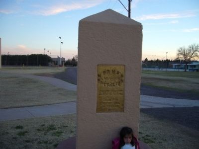
Mormon Battalion Marker
| 101 ► Arizona, Cochise County, Douglas — Mormon Battalion — LDS Church — |
| 102 ► Arizona, Cochise County, Douglas — Mormon Battalion — LDS Church — |
| On Geronimo Trail, on the right when traveling east. | |||
| 103 ► Arizona, Cochise County, Douglas — Mormon Battalion — |
| On Geronimo Trail, on the right when traveling east. | |||
| 104 ► Arizona, Cochise County, Douglas — San Bernardino Ranch — |
| Near East San Bernardino Road at Slaughter Ranch Road, on the right. | |||
| 105 ► Arizona, Cochise County, Dragoon — Confederate Graves at Dragoon Springs — |
| 106 ► Arizona, Cochise County, Dragoon — Dragoon Springs Stage Stop — Land of Legends — Coronado National Forest — |
| On North Old Ranch Road. | |||
| 107 ► Arizona, Cochise County, Dragoon — Texas Canyon Pioneer Cemetery — Final Resting Place of Texas Canyon's earliest settlers and their descendants — |
| On 2080 North Amerind Road, on the right when traveling east. | |||
| 108 ► Arizona, Cochise County, Elfrida — Camp John A. Rucker A Military Outpost — Stood on This Site 1878 - 1880 — |
| Near North Tex Canyon Road, 0.2 miles east of East Rucker Canyon Road, on the left when traveling east. | |||
| 109 ► Arizona, Cochise County, Elfrida — Camp Rucker and the Indian Scouts — |
| On North Tex Canyon Road near East Rucker Canyon Road. | |||
| 110 ► Arizona, Cochise County, Elfrida — Camp Rucker Bakery and Commissary — |
| Near North Tex Canyon Road, 0.8 miles east of East Rucker Canyon Road. | |||
| 111 ► Arizona, Cochise County, Elfrida — Camp Rucker Timeline — |
| Near North Tex Canyon Road near East Rucker Canyon Road. | |||
| 112 ► Arizona, Cochise County, Elfrida — Chief Cochise — |
| Near Ironwood Road. | |||
| 113 ► Arizona, Cochise County, Elfrida — How Camp Rucker received its Name — |
| Near North Tex Canyon Road, 0.8 miles east of East Rucker Canyon Road. | |||
| 114 ► Arizona, Cochise County, Elfrida — Old Camp Rucker Ranch — |
| Near North Tex Canyon Road near East Rucker Canyon Road. | |||
| 115 ► Arizona, Cochise County, Elfrida — Soldiers Hole — |
| On West Gleeson Road, 2.5 miles west of Arizona Highway 191, on the right when traveling west. | |||
| 116 ► Arizona, Cochise County, Gleeson — Historic Gleeson Jail — 1910 - Jail — Gleeson, Arizona — |
| On North High Lonesome Road at West Gleeson Road, on the right when traveling south on North High Lonesome Road. | |||
| 117 ► Arizona, Cochise County, Hereford — Lehner Mammoth Kill Site — |
| On Lehner Road, 2 miles north of Palominas Road & State Highway 92, on the left when traveling east. | |||
| 118 ► Arizona, Cochise County, Hereford — The Coronado Expedition, 1540-42 — |
| Near East Montezuma Canyon Road.. | |||
| 119 ► Arizona, Cochise County, Huachuca City — Fort Huachuca — (1877) — |
| On Arizona Route 90 at milepost 314, on the right when traveling south. | |||
| 120 ► Arizona, Cochise County, Naco — Bisbee Golf Club — |
| 121 ► Arizona, Cochise County, Palominas — Mormon Battalion — |
| Near Arizona Route 92 at milepost 340. | |||
| 122 ► Arizona, Cochise County, Pearce — John Ringo — Historic Site — |
| Near Turkey Creek Road. | |||
| 123 ► Arizona, Cochise County, Pearce — Old Pearce Post Office — |
| On Ghost Town Trail at Pearce Road, on the left when traveling south on Ghost Town Trail. | |||
| 124 ► Arizona, Cochise County, San Simon — Geronimo Surrender Monument — |
| On Arizona Route 80 at milepost 406 near Skeleton Canyon Road, on the right when traveling east. | |||
| 125 ► Arizona, Cochise County, San Simon — The San Simon Rest Area - Percy Jones, Jr. — |
| Near Interstate 10 at milepost 388. | |||
| 126 ► Arizona, Cochise County, San Simon — The San Simon Rest Area - Percy Jones, Jr. — |
| 127 ► Arizona, Cochise County, Sierra Vista — "Unknown Soldiers" — |
| 128 ► Arizona, Cochise County, Sierra Vista — Alvarado Hall — |
| Near Hatfield Street near Rucker Street when traveling east. | |||
| 129 ► Arizona, Cochise County, Sierra Vista — Apache Scout Memorial — |
| On Grierson Avenue north of Hungerford Avenue, on the right when traveling south. | |||
| 130 ► Arizona, Cochise County, Sierra Vista — Arizona Confederate Veterans Memorial — |
| On East Golf Links Road, 0.4 miles west of South Buffalo Soldier Trail, in the median. | |||
| 131 ► Arizona, Cochise County, Sierra Vista — Buffalo Soldier Legacy Plaza — |
| On Smith Avenue at Winrow Street, on the left when traveling west on Smith Avenue. | |||
| 132 ► Arizona, Cochise County, Sierra Vista — Carmichael Elementary School — |
| Near North Carmichael Avenue at School Drive. | |||
| 133 ► Arizona, Cochise county, Sierra Vista — Carmichael General Store/U.S. Post Office — Bill's Trading Post/G & M Stronghold Steakhouse — Daisy Mae's Steakhouse |
| On North Garden Avenue near Sherbundy Street, on the left when traveling north. Reported permanently removed. | |||
| 134 ► Arizona, Cochise County, Sierra Vista — Carmichael House/Sierra Vista Realty — 301 North Garden Avenue — Built in 1927 — |
| On North Garden Avenue near Sherbundy Street, on the right when traveling north. | |||
| 135 ► Arizona, Cochise County, Sierra Vista — Counter Intelligence Corp Memorial — |
| Near Cushing Street east of Cibecue Street. | |||
| 136 ► Arizona, Cochise County, Sierra Vista — Fort Huachuca — |
| On Grierson Avenue at Boyd Avenue, on the right when traveling south on Grierson Avenue. | |||
| 137 ► Arizona, Cochise County, Sierra Vista — Ice Hall — |
| Near Hatfield Street near Rucker Street. when traveling east. | |||
| 138 ► Arizona, Cochise County, Sierra Vista — La Casita Restaurant — 465 East Fry Boulevard — Built in 1937 — |
| Near East Fry Boulevard near North 4th Street. | |||
| 139 ► Arizona, Cochise County, Sierra Vista — Mormon Battalion — LDS Church — |
| On East Charleston Road, on the right when traveling east. | |||
| 140 ► Arizona, Cochise County, Sierra Vista — Mormon Battalion Campsite — |
| On Arizona Route 90 at milepost 329, on the left when traveling east. | |||
| 141 ► Arizona, Cochise County, Sierra Vista — POW/MIA Monument — Missing in Action in Cochise County — |
| Near Buffalo Soldier Trail, 0.5 miles west of Buffalo Soldier Trail and Golf Links Road. | |||
| 142 ► Arizona, Cochise County, Sierra Vista — RC – 12G Crazyhorse — |
| On Hatfield Street at Irwin Street, on the right when traveling south on Hatfield Street. | |||
| 143 ► Arizona, Cochise County, Sierra Vista — U. S. Army Mohawk (OV -1D) — |
| On Hatfield Street at Irwin Street, on the right when traveling south on Hatfield Street. | |||
| 144 ► Arizona, Cochise County, Sierra Vista — Union Soldiers Buried in Historic Cemetery — Southern Arizona Veterans Memorial Cemetery — |
| Near Buffalo Soldier Trail. | |||
| 145 ► Arizona, Cochise County, Sierra Vista — USO Club / NCO Annex / Army Service Club — Landmark Restaurant — |
| On West Fry Boulevard, on the left when traveling west. | |||
| 146 ► Arizona, Cochise County, Sierra Vista — Wheel of Progress — |
| On Arizona Route 92, 1 mile south of Fry Boulevard, on the right when traveling south. | |||
| 147 ► Arizona, Cochise County, St. David — Mormon Battalion — LDS Church — |
| On West Patton Street (Arizona Route 80 at milepost 301) at South Church Street, on the right when traveling east on West Patton Street. | |||
| 148 ► Arizona, Cochise County, Tombstone — Allen English Home — Adobe Home Built in 1882 — |
| On East Toughnut Street at South 3rd Street, on the right when traveling west on East Toughnut Street. | |||
| 149 ► Arizona, Cochise County, Tombstone — Bird Cage Theatre — |
| On East Allen Street, on the right when traveling east. | |||
| 150 ► Arizona, Cochise County, Tombstone — Boothill Graveyard — |
| 151 ► Arizona, Cochise County, Tombstone — 1 — Boothill Graveyard — 1878-1884 — |
| Near State Highway 80 at milepost 316. | |||
| 152 ► Arizona, Cochise County, Tombstone — 18 — Campbell & Hatch Saloon and Billiard Parlor — 1881 — |
| On East Allen Street, on the left when traveling east. | |||
| 153 ► Arizona, Cochise County, Tombstone — 14 — Can Can Restaurant — 1879 — |
| On East Allen Street at South 4th Street, on the right when traveling west on East Allen Street. | |||
| 154 ► Arizona, Cochise County, Tombstone — City Marshall Virgil Earp — |
| On Allen Street. | |||
| 155 ► Arizona, Cochise County, Tombstone — 15 — Cochise County Bank — 1881 — |
| On East Allen Street at South 4th Street, on the right when traveling east on East Allen Street. | |||
| 156 ► Arizona, Cochise County, Tombstone — 33 — Curly Bill Brocius Killed Marshal Fred White Here — |
| On East Allen Street, on the right when traveling east. | |||
| 157 ► Arizona, Cochise County, Tombstone — Edward Schieffelin — 1847-1897 — |
| On West Schieffelin Monument Road, on the right when traveling west. | |||
| 158 ► Arizona, Cochise County, Tombstone — Grand Army of the Republic Memorial — Tombstone, Arizona — |
| Near West Allen Street. | |||
| 159 ► Arizona, Cochise County, Tombstone — 41 — Hoptown — Chinese Section — 1879 — |
| On South 3rd Street south of East Allen Street, on the right when traveling south. | |||
| 160 ► Arizona, Cochise County, Tombstone — 31 — M. Calisher General Store — 1879 — |
| On East Allen Street, on the left when traveling east. | |||
| 161 ► Arizona, Cochise County, Tombstone — 37 — Million Dollar Stope — |
| On Toughnut Street east of 5th Street, on the left when traveling west. | |||
| 162 ► Arizona, Cochise County, Tombstone — 28 — Owl Cafe and Tourist Hotel — |
| On East Allen Street at South 5th Street, on the right when traveling east on East Allen Street. | |||
| 163 ► Arizona, Cochise County, Tombstone — 35 — Rose Tree — Museum — |
| On South 4th Street at Toughnut Street, on the right when traveling north on South 4th Street. | |||
| 164 ► Arizona, Cochise County, Tombstone — Sacred Heart Church — 1881-1945 — |
| On East Safford Street near North 6th Street, on the right when traveling west. | |||
| 165 ► Arizona, Cochise County, Tombstone — 8 — Schieffelin Hall — |
| On East Fremont Street (Arizona Route 80) at North 5th Street, on the right when traveling west on East Fremont Street. | |||
| 166 ► Arizona, Cochise County, Tombstone — 38 — Southern Pacific Train Depot — 1903 — |
| Near South 4th Street, on the left when traveling south. | |||
| 167 ► Arizona, Cochise County, Tombstone — St. Paul's Episcopal Church — Built on this site 1882 — |
| On North 3rd Street near East Safford Street (Arizona Highway 80), on the left when traveling north. | |||
| 168 ► Arizona, Cochise County, Tombstone — 20 — The Grand Hotel — Opened in 1880 — |
| On East Allen Street, on the right when traveling east. | |||
| 169 ► Arizona, Cochise County, Tombstone — 37a — The Mines of Tombstone — |
| On East Toughnut Street at South 5th Street, on the left when traveling west on East Toughnut Street. | |||
| 170 ► Arizona, Cochise County, Tombstone — 27 — The Oriental Saloon — 1880 — |
| On East Allen Street at South 5th Street, on the left when traveling east on East Allen Street. | |||
| 171 ► Arizona, Cochise County, Tombstone — Tombstone City Hall — Opened in 1882 — |
| On East Fremont Street (State Highway 80), on the right when traveling east. | |||
| 172 ► Arizona, Cochise County, Tombstone — 36 — Tombstone Engine Co. No. 1 — 1881 — |
| On East Toughnut Street, on the right when traveling east. | |||
| 173 ► Arizona, Cochise County, Tombstone — Tombstone, Arizona — "The Town Too Tough To Die" — |
| On Allen Street, on the right when traveling east. | |||
| 174 ► Arizona, Cochise County, Tombstone — Veterans Pioneers Settlers — |
| Near Arizona Route 80 at milepost 316. | |||
| 175 ► Arizona, Cochise County, Tombstone — Welcome to Boothill Graveyard — and Jewish Memorial — 1879 — |
| On State Highway 80. | |||
| 176 ► Arizona, Cochise County, Willcox — Ed Riggs — |
| Near Faraway Trail north of East Bonita Canyon Road. | |||
| 177 ► Arizona, Cochise County, Willcox — Erickson Family Cemetery — Sacred To the Memory of These Pioneers — |
| On Bonita Canyon Road, on the right when traveling east. | |||
| 178 ► Arizona, Cochise County, Willcox — Faraway Ranch — |
| Near Faraway Trail north of East Bonita Canyon Road. | |||
| 179 ► Arizona, Cochise County, Willcox — Headquarters Saloon — |
| On East Maley Street (Arizona Route 186) at North Railroad Avenue, on the left when traveling east on East Maley Street. | |||
| 180 ► Arizona, Cochise County, Willcox — In Memory of Lt. Robert G. Westlund — United States Air Force — |
| On North Circle I Road north of Fort Grant Road (Arizona Route 186), on the right when traveling north. | |||
| 181 ► Arizona, Cochise County, Willcox — Neil and Emma Erickson — |
| Near Faraway Trail north of East Bonita Canyon Road. | |||
| 182 ► Arizona, Cochise County, Willcox — 6 — Palace Saloon and Pool Hall, 1905 — |
| On South Railroad Avenue near West Maley Street (Arizona Route 186), on the right when traveling south. | |||
| 183 ► Arizona, Cochise County, Willcox — Railroad Avenue — |
| On East Maley Street (Arizona Route 186) at South Railroad Avenue, on the left when traveling east on East Maley Street. | |||
| 184 ► Arizona, Cochise County, Willcox — Rex Allen Memorial — |
| On North Railroad Avenue, on the right when traveling north. | |||
| 185 ► Arizona, Cochise County, Willcox — The Chiricahua Apache — Chiricahua National Monument — |
| On East Rhyolite Creek Road. | |||
| 186 ► Arizona, Cochise County, Willcox — The Ericksons: Pioneer Settlers — |
| On Bonita Canyon Road, on the right when traveling east. | |||
| 187 ► Arizona, Cochise County, Willcox — 1 — The Schwertner House, 1880 — |
| On East Stewart Street south of North Haskell Avenue (Arizona Route 186), on the right when traveling east. | |||
| 188 ► Arizona, Cochise County, Willcox — The Southern Pacific Railroad Depot, 1880 — |
| On South Railroad Avenue, on the left when traveling south. | |||
| 189 ► Arizona, Cochise County, Willcox — The Toggery, 1925 — |
| On East Maley Street (Arizona Route 186), on the right when traveling east. | |||
| 190 ► Arizona, Cochise County, Willcox — The Willcox Women's Community Center — |
| On West Stewart Street south of North Austin Boulevard, on the left when traveling west. | |||
| 191 ► Arizona, Cochise County, Willcox — 8 — Willcox Commercial Hotel, 1916 — |
| On East Maley Street (Arizona Route 186), on the left when traveling east. | |||
| 192 ► Arizona, Coconino County, Cameron — Cameron — Originally Tanner's Crossing — |
| Near U.S. 89, on the left when traveling north. | |||
| 193 ► Arizona, Coconino County, Flagstaff — "The Gandy Dancer" — |
| On Route 66 at South San Francisco Street, on the right when traveling east on Route 66. | |||
| 194 ► Arizona, Coconino County, Flagstaff — 1956 Plane Crash Mass Grave and Memorial — |
| Near South San Francisco Street when traveling east. | |||
| 195 ► Arizona, Coconino County, Flagstaff — 42-Inch Reflecting Telescope — |
| Near West Mars Hill Road, 0.6 miles west of West Santa Fe Avenue. | |||
| 196 ► Arizona, Coconino County, Flagstaff — A Gathering Place — |
| On Loop Road, on the left when traveling north. | |||
| 197 ► Arizona, Coconino County, Flagstaff — A Legacy of the Past — |
| On Loop Road, on the right when traveling north. | |||
| 198 ► Arizona, Coconino County, Flagstaff — A Village/Abandonment — |
| On Loop Road, on the left when traveling north. | |||
| 199 ► Arizona, Coconino County, Flagstaff — Ancient Landscapes — |
| On Loop Road, on the right when traveling north. | |||
| 200 ► Arizona, Coconino County, Flagstaff — Arizonal Trail - A Tribute to Dale Shewalter — |
4138 entries matched your criteria. Entries 101 through 200 are listed above. ⊲ Previous 100 — Next 100 ⊳