On Drummond Street East at Harvey Street, on the right when traveling west on Drummond Street East.
This house was built in 1823 by James Boulton, one of Perth’s first lawyers. Modelled after "The Grange" in Toronto, the house was designed in the Adamesque style, which was popular in Upper Canada during the 1820’s, with overtones of the . . . — — Map (db m207798) HM
On Basin Street at Tay Street, on the right when traveling north on Basin Street.
The Tay Basin is a central depot for water travel on the Tay. In its youth, it aspired to become a major port for shipping and receiving goods, as it was linked to the newly finished Rideau Canal. The Tay's snies, creeks and swamps were . . . — — Map (db m207906) HM
On Basin Street at Tay Street, on the right when traveling north on Basin Street.
Perth merchants regularly used the Tay Canal between 1834 and 1850. Potash, timber and local produce were shipped to Montreal, and dry goods and manufactured articles were imported.
But the canal steadily fell into disrepair as soon . . . — — Map (db m208017) HM
On Basin Street at Tay Street, on the right when traveling north on Basin Street.
In the wilderness of 19th century Upper Canada, transportation was the key to settlement, growth and prosperity. Waterways, modified with locks and canals, were seen as the solution to many transportation problems. A feverish era of . . . — — Map (db m208032) HM
On Mill Street, on the right when traveling south.
Historically, Perth has always boasted a thriving creative community with music, dance and theatre at the core of activities. That tradition continues today with many residents internationally known as award-winning artists, musicians . . . — — Map (db m233963) HM
On Basin Street at Tay Street, on the right when traveling north on Basin Street.
The landscape in the Tay Basin has changed dramatically over the years. It has gone from an early settlers' campground to shipping docks and from residential housing to a market square.
Once called Perth Landing, its docks bustled with . . . — — Map (db m207886) HM
The three fountains in the Tay Basin are known as the International Friendship Fountains. They were installed in 2004, thanks to the Ontario Small Town and Rural
Economic Development Program (OSTAR-RED) and the generosity of the Rotary Club of . . . — — Map (db m207849) HM
On Basin Street at Tay Street, on the right when traveling north on Basin Street.
The British government established the first Military Settlement in Canada in March, 1816 at Perth upon Tay in response to continuing fears of an American invasion
following the War of 1812. A depot was established with a Superintendent's . . . — — Map (db m207948) HM
On Basin Street at Tay Street, on the right when traveling north on Basin Street.
Perth was created in 1816 as part of a grand British defence strategy which included the Rideau Canal and Fort Henry at Kingston. By 1822 Perth had burst into a vibrant frontier town, the new County Seat for the District of Bathurst . . . — — Map (db m208000) HM
On Mill Street just south of Market Street, on the right when traveling south.
The citizens of Perth are very fortunate to have such a pristine green space in the heart of the downtown core. This beautiful parkland straddles two islands with the Tay River on one side and the Little Tay on the other. It is . . . — — Map (db m233947) HM
On Basin Street at Tay Street, on the right when traveling north on Basin Street.
Enthusiasm for canals in 19th century Canada remained high despite the flurry of railway
construction after 1850. The government continued to maintain canals, including the Rideau Canal, to ensure their competitiveness. This kept alive . . . — — Map (db m208028) HM
On Mill Street just south of Market Street, on the right when traveling south.
Although it is hard to tell at a glance, there are no less than eight bridges connecting Cockburn and Haggart Islands to the mainland in Perth's downtown core - and each bridge has its own personality and history.
Locke's Bridge on . . . — — Map (db m233962) HM
Algonquin/Omàmìwinini People have lived on this river and in this territory for thousands of years. These waterways were elemental to people's seasonal lives, moving into the family's territories in the upper watersheds for the winter and . . . — — Map (db m207879) HM
On Basin Street at Tay Street, on the right when traveling north on Basin Street.
The Tay has seen many tales over the years. Once covered by the salt water of
the Champlain Sea, the banks of the Tay hold the memory of a very different aquatic life from what you see today. The fossils in the bedrock tell the story of a . . . — — Map (db m207937) HM
On Mill Street just south of Market Street, on the right when traveling south.
[Photo captions, counterclockwise from top left, read]
• Spalding & Stewart
• Spalding & Stewart
• McLaren's Distillery
• THE TAY FROM HAGGARTS
• [Trail map and] Legend
The Tay River Trail is an historic pathway and portage . . . — — Map (db m233875) HM
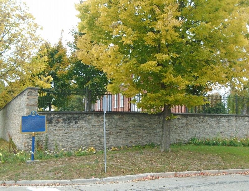
On Drummond Street East at Colbourne Street, on the right when traveling east on Drummond Street East.
Erected by the Lanark County Cheese Producers
in recognition and appreciation of the services of
all those who through legislative educational
commercial or industrial leadership or activity
did lay the foundation and did guide the . . . — — Map (db m207883) HM
On Gore Street East (County Highway 43) at Harvey Street, on the right when traveling east on Gore Street East.
An astute public servant who played a significant role in the development of Western Canada, Morris was born in Perth. In 1861, after establishing a successful law practice in Montreal, he was elected to the legislature as the member . . . — — Map (db m207696) HM
On Basin Street at Gore Street East (County Highway 43), on the right when traveling north on Basin Street.
Before you lies the restored Tay Canal Turning Basin, today part of Parks Canada's Rideau Canal heritage waterway.
The Tay Canal was once the symbol of progress and prosperity to the people of Perth. First operated in 1834, the canal . . . — — Map (db m207782) HM
Killed in Action at
Passchendaele
Nov 4th 1917
Gone But Not Forgotten
Nec Tamen Consumebatur
["Yet it was not consumed" from Exodus 3:2]
[War Medallion]
He Died For Freedom and Honour — — Map (db m233728) WM
On Wilson Street East at Herriot Street, on the right when traveling east on Wilson Street East.
Born at Winston March 27, 1976
Sire: Etretat - Mare: Oekie
Breeder: J. Van Hooydonk
Kalmthout, Belgium
Big Ben's Career Highlights
Did you know...
• Big Ben was Ian Millar's mount for nearly half of Millar's career
Grand Prix . . . — — Map (db m233771) HM
On Drummond Street East at the east bank of the Tay River, on the right when traveling east on Drummond Street East.
This "forest in the making" was planted in 2002 with a variety of ash, oak, pine, walnut, butternut, spruce, dogwood and hackberry. As the trees grow, the understory will continue to evolve from a grass lawn to a forest floor ecosystem.
These . . . — — Map (db m207792) HM
Dedicated to the memory of 400 unmarked indigent
burials contained within this general area.
Most of these people died at the former
House of Industry of Lanark County.
House of Industry Deaths 1903-1935
Richard Adams · Thomas . . . — — Map (db m234461) HM
On Craig Street just south of Gore Street East (County Highway 43), on the left when traveling south.
Here died the victim of the last fatal duel fought in this province,
June 13, 1833. Two law students and former friends, John Wilson and
Robert Lyon, quarrelled over remarks made by the latter concerning a
local school teacher, . . . — — Map (db m233873) HM
On Drummond Street East at Colbourne Street, on the right when traveling east on Drummond Street East.
A prominent Upper Canadian entrepreneur and politician, Cameron was born in Trois-Rivières. He began his business career in Perth, establishing himself as a general merchant and in 1834 co-founding the Bathurst Courier. In 1837 . . . — — Map (db m207786) HM
On Drummond Street East at Colbourne Street, on the right when traveling east on Drummond Street East.
The Mammoth Cheese was more talked about and written about than any other single
exhibit at Chicago's World Fair in 1893. Judged to be near perfection, the cheese garnered 95 points out of a possible score of 100 points, receiving a diploma . . . — — Map (db m207843) HM
On Gore Street East just east of Foster Street, on the left when traveling east.
Built in 1840 of local sandstone, the Matheson House is an outstanding example of early Scottish-Canadian architecture. Its design is imposing, its stonework remarkably fine, and it
occupies a key position in one of the best surviving . . . — — Map (db m233817) HM
On Gore Street East (County Highway 43) at Foster Street, on the left when traveling east on Gore Street East.
[Photo caption reads] Exterior photo of Shaws circa 1940.
This high profile site
was first home to
Roderick Matheson's
harness and saddle
shop in 1818 until
1840 when he
commissioned the
building of this two storey cut stone . . . — — Map (db m233820) HM
On Gore Street East (County Highway 43), on the left when traveling east.
1981 Regional Award of Honour
for the preservation of
Matthews Building, Ontario
—————————————
The heritage character and integrity of this property
are protected by a legal agreement between the
owner and the Ontario Heritage . . . — — Map (db m233867) HM
On Gore Street East (County Highway 43) at Harvey Street, on the right when traveling west on Gore Street East.
The son of Loyalists from the Morrisburg area, Daniel McMartin (1798-1869) established a law practice in Perth in 1823. Well-educated and well-connected, he acquired clients like timber baron Philemon Wright of Hull. McMartin chose a . . . — — Map (db m207667) HM
On Harvey Street at Gore Street East (County Highway 43), on the right when traveling north on Harvey Street.
Begun in 1830 for barrister Daniel McMartin (1798-1869), this imposing house symbolizes the wealth and social aspirations of this member of the Tory elite. Born at Williamsburg of Loyalist stock, McMartin attended John Strachan's . . . — — Map (db m207662) HM
On Gore Street East (County Highway 43) at Tay Street, on the right when traveling west on Gore Street East.
The present townships of Bathhurst, Beckwith and Drummond were settled under the jurisdiction of the Quarter Master General's Department. Scottish emigrants, quartered in barracks at Brockville during the winter of 1815-16, and soldiers . . . — — Map (db m207754) HM
On Gore Street East (County Highway 43) at Market Square, on the left when traveling west on Gore Street East.
Perth's stately town hall is an enduring expression of the vitality and importance of local governments in the 19th century. Erected in 1863-1864, shortly after the town's
incorporation, it recalls an era when such buildings served as . . . — — Map (db m207771) HM
On North Street (County Highway 10) at Drummond Street West, on the right when traveling north on North Street.
One of the most influential Presbyterian clergymen in Upper Canada, Bell was born in Airdrie, Scotland. In 1808, he entered a Congregational academy in London to train for the ministry and, after completing his studies in Scotland and . . . — — Map (db m233976) HM
On Wilson Street East at Church Street, on the right when traveling east on Wilson Street East.
Roman Catholics began to settle in the Perth area from 1816 onwards. They were served by visiting missionary priests until 1823 when Father John Macdonald became the first resident pastor of the new parish which embraced most of the present-day . . . — — Map (db m233870) HM
On Gore Street East (County Highway 43) just east of Foster Street, on the right when traveling east.
Colonel Balderson commissioned this building at the cost of $150,000 in 1914. Touted as the finest theatre between Toronto and Montreal, the new 1000-seat theatre with its opulent opera house décor and grand central lobby opened its doors in . . . — — Map (db m233811) HM
On Basin Street at Tay Street, on the right when traveling north on Basin Street.
The second Tay Canal, like its predecessor, was never the large-scale success anticipated by its supporters. While freight and passenger steamers were a common sight, recreation became the focus for the canal by the 1920s. Today there . . . — — Map (db m208031) HM
On Basin Street at Tay Street, on the right when traveling north on Basin Street.
William Morris, a fiery businessman and local politician, was the driving force behind the creation of the first Tay Canal. When the government refused petitions to construct the canal, the people of Perth, led b[y] Morris, decided . . . — — Map (db m208004) HM
On Gore Street East (County Highway 43) at Basin Street, on the right when traveling west on Gore Street East.
The Old Perth Post Office
The buildings that were previously built here were torn down in 1913, after the government bought a vacant lot from John A. Stewart and three adjacent buildings on this corner. The property sat unused for twenty . . . — — Map (db m207769) HM
On Gore Street East at Herriot Street, on the left when traveling east on Gore Street East.
[Photo caption reads] Early photo of interior of Perth Courier.
This two-and-half-storey stone building is part of what became known as the Kellock Block which was built by John Ellis for Roderick Matheson in 1848. It was host to many . . . — — Map (db m233773) HM
On Gore Street East (County Highway 43) at Market Street, on the left when traveling west on Gore Street East.
For outstanding stewardship of the built heritage
———————————————————————
Attestation d'excellence en gestion du patrimoine bâti — — Map (db m207776) HM
On Drummond Street East at Colbourne Street, on the right when traveling east on Drummond Street East.
The first set of weigh scales was located behind Town Hall. This is the site of the second weigh scale station, operated from 1900-1960 by the Town of Perth. Trucks and
wagons laden with goods would enter from Drummond Street, drive onto . . . — — Map (db m207807) HM
On Gore Street East (County Highway 43) at Herriot Street, on the left when traveling east on Gore Street East.
Morris is acknowledged as a leading force in the founding of Queen's College in 1840 and in the securing of its royal charter in 1841. His considerable reputation for honesty, justice and integrity enabled him successfully to draft and push . . . — — Map (db m233744) HM