By Syd Whittle, May 14, 2016
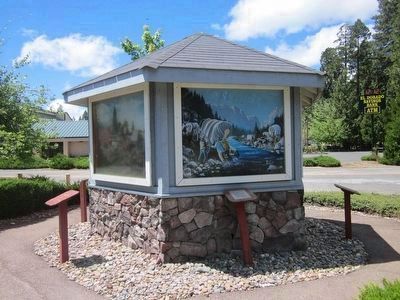
The Mormon Emigrant Trail Marker and Painting Depicting the Event
GEOGRAPHIC SORT Title Sort Marker Number Sort Marker Number Sort N Marker Number Sort T Publication Order Sort Publication Order Sort A Erected Year Sort Most Viewed Sort Most Recent-Interest Sort Most Recently Changed Sort SEE FAQ #33 FOR DESCRIPTIONS
On Pony Express Trail (Lincoln Highway) at Forebay Road, on the right when traveling east on Pony Express Trail (Lincoln Highway).
On Cajon Boulevard, on the right when traveling east.
On California Route 138 at Rastall Road, on the right when traveling west on State Route 138.
On Wagon Train Road, 0.5 miles south of California Route 138, on the right when traveling south.
On National Park Highway/Oregon Trail (U.S. 89), on the right when traveling south.
On Parley Street east of Water Street, on the right when traveling west.
On Water Street at Parley Street, on the right when traveling west on Water Street.
On Water Street at Parley Street, on the right when traveling west on Water Street.
On Parley Street at Water Street, on the right when traveling west on Parley Street.
On South Main Street north of Water Street, on the left when traveling south. Reported permanently removed.
On South Main Street south of Water Street, on the left when traveling south. Reported permanently removed.
On Illinois Route 96, 0.1 miles south of Water Street, on the right when traveling south.
On Water Street at Granger Street, on the left when traveling west on Water Street. Reported permanently removed.
On South Main Street south of Water Street, on the right when traveling south. Reported permanently removed.
Paid Advertisement
On Minnesota Street / Nishna Valley Road, 0.8 miles west of Lewis Road / 1st Street, on the right when traveling west.
On Main Street west of Market Street, on the right when traveling west.
Near Interstate 80 at milepost 270,, 1 miles west of Rose Avenue (County Highway X64), on the right when traveling west.
Near Interstate 35 north of County Highway J52, on the right when traveling north.
On 1st Street (U.S. 69) at Church Street (U.S. 69), on the right when traveling west on 1st Street.
Near Interstate 80 at milepost 237,, 6.3 miles east of Black Hawk Avenue NW, on the right when traveling east.
On Court Avenue (Business U.S. 34) just east of North Main Street, on the right when traveling west.
On Lake Drive at East Sharp Street, on the right when traveling south on Lake Drive.
On Dumfries Avenue, 1.5 miles south of Pioneer Trail, on the right when traveling south.
On Oakland Avenue at Lafayette Avenue, on the right when traveling north on Oakland Avenue.
On 1st Avenue, on the left when traveling west.
On Mt Pisgah Road, 0.5 miles south of 170th Street, on the right when traveling south.
On Jefferson Street (State Highway 2) east of East Street, on the left when traveling east.
On U.S. 73 at Osage Road, on the right when traveling east on U.S. 73.
Near Henry Drive at Interstate 70.
Paid Advertisement
On 15th Street, on the left when traveling east.
On Military Avenue, on the right when traveling east.
On North 30th Street, on the right when traveling south.
On 30th Street, on the right when traveling north.
On 30th Street at Willit Street, on the left when traveling north on 30th Street. Reported missing.
On North 30th Street, on the right when traveling south.
On McKinley Street at 30th Street, on the left when traveling east on McKinley Street.
On 30th Street at Mormon Street, on the left when traveling north on 30th Street.
On Tech Drive at U.S. 34 on Tech Drive.
On Interstate 80 at milepost 316.5, on the right when traveling west.
On West A Street near West Second Street.
Near North Buffalo Bill Avenue, 0.8 miles north of Lincoln Highway (U.S. 30), on the right when traveling north.
On U.S. 30 at 15th Road, on the left when traveling west on U.S. 30.
On U.S. 30 at 15th Road, on the left when traveling west on U.S. 30.
On County Route 98, on the left when traveling west.
Paid Advertisement
On U.S. 26 at Road 104, on the left when traveling north on U.S. 26.
On Route 26 near Road 103, on the right when traveling west.
On Main Street (Route 26/385) near Brown's Creek Road (underpass), on the left when traveling north.
On U.S. 26 near Road 151, on the right when traveling west.
On U.S. 26, 7 miles west of Lisco.
Near South Park Street (State Highway 39) just south of Ewing Avenue, on the right when traveling south.
On U.S. 26 near County Route 4, on the left when traveling west.
On S Beltline Hwy E at U.S. 26, on the right when traveling north on S Beltline Hwy E.
On S Beltline Hwy E at U.S. 26, on the right when traveling north on S Beltline Hwy E.
On S Beltline Hwy E at U.S. 26, on the right when traveling north on S Beltline Hwy E.
On Big Mountain Pass (Utah Route 65), on the right when traveling east.
On Emigration Canyon Road.
Paid Advertisement
Near Interstate 80 at milepost 171, on the right when traveling east.
Near Interstate 80 at milepost 171, on the right when traveling east.
On North Main Street (Utah Route 65) just south of 100 North, on the right when traveling south.
On U.S. 287, 1.7 miles west of Happy Springs Rd, on the right when traveling west.
Near U.S. 287, 1 mile west of California Emigrant Rd, on the right when traveling west.
Near U.S. 287, 1 mile west of California Emigrant Road, on the right when traveling west.
Near U.S. 287, 1 mile west of California Emigrant Road, on the right when traveling west.
Near Wyoming 789 near Wyoming Highway 220, on the right when traveling west.
On Oregon Trail, on the right when traveling west.
Near State Highway 28, 0.7 miles south of Lander-Pinedale Stage Road.
Near State Highway 28, 0.7 miles south of Lander-Pinedale Stage Road.
On Emigrant Trail near Oregon Buttes Road.
Near State Highway 28, 0.7 miles south of Lander-Pinedale Stage Road.
Near State Highway 28, 0.7 miles south of Lander-Pinedale Stage Road.
On Wyoming Route 28, on the right when traveling north.
Paid Advertisement
On Oregon Trail, on the right when traveling west.
On Wyoming 789 (U.S. 287) near Wyoming Highway 135, on the left when traveling west.
Near Wyoming 789 (U.S. 287) near Wyoming Highway 135, on the left when traveling west.
On East Merriam Street (U.S. 26) at Lawton Avernue on East Merriam Street.
On U.S. 29/85 near Road 81, on the right when traveling west.
On West 4th Steet (U.S. 26) near Main Street, on the right when traveling west.
On Sun Ranch Road, 0.7 miles east of Martin Cove Road, on the right when traveling east.
Near State Highway 220 at milepost 63,, 2.5 miles south of Buzzard Rd (County Route 410).
On State Highway 220 near Martin Cove Road, on the right when traveling west.
On Oregon Trail Road near Martin Cove Road, on the right when traveling west.
On Bessemer Bend Road (Route 308) near Speas Road (Route 311), on the right when traveling east.
On Oregon Trail Road (County Route 319) near County Route 308, on the right when traveling south.
On Fort Caspar Road, 0.1 miles west of South West Wyoming Boulevard (Wyoming Highway 258), on the right when traveling west.
Near Fort Caspar Road near South West Wyoming Boulevard (Wyoming Highway 258), on the left when traveling west.
Near Fort Caspar Road near Southwest Wyoming Boulevard (Wyoming Highway 258), on the right when traveling west.
Near Fort Caspar Road near Southwest Wyoming Boulevard (Wyoming Highway 258), on the right when traveling west.
Paid Advertisement
On Wendover Road at Cottonwood Road, on the left when traveling north on Wendover Road.
Near State Highway 28, 7 miles north of Sqaw Road (Route BLM4106).
On Oregon Trail near Squaw Road (Federal Route BLM4106).
Near State Highway 28, 7 miles north of Sqaw Road (Route BLM4106).
Near State Highway 28, 7 miles north of Sqaw Road (Route BLM4106).
116 entries matched your criteria. The first 100 are listed above.
The final 16 ⊳