By TRCP Alliance, June 22, 2013
Bartram’s Trail Marker
GEOGRAPHIC SORT Title Sort Marker Number Sort Marker Number Sort N Marker Number Sort T Publication Order Sort Publication Order Sort A Erected Year Sort Most Viewed Sort Most Recent-Interest Sort Most Recently Changed Sort SEE FAQ #33 FOR DESCRIPTIONS
On Alabama Route 59 at milepost 56, on the right when traveling north.
On Rockville Road (County Road 15) at Stimpson Sanctuary Road, on the right when traveling south on Rockville Road.
On West Fort Toulouse Road, 0.1 miles west of U.S. 231, on the right when traveling west.
On East Laurel Street near South Broad Street (State Route 279), on the right when traveling east.
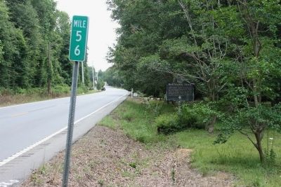
On Forest Road 949, 0.2 miles north of State Route 186, on the left when traveling north.
Near South Royal Street just south of Church Street, on the right when traveling south.
On Alabama Route 165 north of Creek Trail, on the right when traveling north.
On L Street, on the right when traveling south.
On U.S. 89A at milepost 609, on the left when traveling north.
On U.S. 89A at milepost 557, on the left when traveling east. Reported missing.
On U.S. 89A at milepost 538.3, on the right when traveling west.
On Lake Powell Boulevard at Navajo Drive, on the right when traveling north on Lake Powell Boulevard.
On East University Boulevard, 0.2 miles west of North Campbell Avenue, on the right when traveling west.
On Pickens Street (U.S. 165) east of Jack Dante Drive, on the right when traveling east.
Paid Advertisement
On North 2nd Street just north of Oak Street, on the left when traveling north.
On Arkansas Route 1 at Front Street, on the right when traveling east on State Route 1.
On North Center Street (State Highway 31) north of 2nd Street, on the right when traveling north.
On W Vine Street at S. 3rd Street, in the median on W Vine Street.
On South Pine Street south of A Street, on the left when traveling south.
On Benton Street at School Street, on the right when traveling east on Benton Street.
On West Conway Street just west of North Main Street, on the left when traveling west.
On W. Sevier Street at N. Main Street, on the right when traveling west on W. Sevier Street.
On S. Market Street north of W. Smith Street, on the right when traveling north.
On S. Reynolds Road (State Highway 183) 0.1 miles south of Griffis Road, on the right when traveling south.
On 6th Street (State Highway 255) south of Rogers Avenue, on the left when traveling south.
On U.S. 167 near East State Line Road (East Third Street), on the right when traveling south.
On Foothill Boulevard (U.S. 238) at City Center Drive, on the right when traveling north on Foothill Boulevard.
On Carson Pass Scenic Byway (State Highway 88), on the right when traveling east.
Near Bird Street at Huntoon Street.
Paid Advertisement
On Montgomery Street at Huntoon Street, on the left when traveling east on Montgomery Street.
On Montgomery Street, on the left when traveling east.
Near Bird Street at Huntoon Street.
On Montgomery Street at Myers Street, on the left when traveling east on Montgomery Street.
On Montgomery Street near Myers Street, on the left when traveling east.
On Montgomery Street (Business California Route 70) just west of Myers Street, on the right when traveling west.
On 6th Street at K Street, on the right when traveling west on 6th Street.
On La Crescenta Avenue, 0.2 miles north of Interstate 210, on the left when traveling north.
On D Street, 0.1 miles south of Foothill Boulevard (Route 66), on the left when traveling south.
Near Pacific Street, on the right when traveling south.
On South Manthey Road, on the right when traveling west. Reported missing.
On N. Center Street at E. Lindsay Street, on the left when traveling north on N. Center Street.
On Higgins Purisima Road near Cabrillo Highway (California Highway 1).
On Hopmeadow Street (Connecticut Route 10) at Jim Gallagher Way, on the right when traveling south on Hopmeadow Street.
On Main Street at Strong Road, on the left when traveling south on Main Street.
On Orange Center Road at Schoolhouse Lane, on the right when traveling north on Orange Center Road.
Paid Advertisement
On South Broom Street at Sycamore Street, on the left when traveling south on South Broom Street.
Near Constitution Avenue Northwest (U.S. 50) east of 19th Street Northwest, on the right when traveling east.
On State Road A1A, on the right when traveling south.
On North Main Street north of Broad Street (U.S. 98), on the right when traveling north.
Near Manatee Avenue East at 14th Street East.
On South Church Avenue (State Road 37) at SE 1st Street, on the right when traveling north on South Church Avenue.
On King Street at St. George Street, on the left when traveling east on King Street. Reported missing.
On West International Speedway Boulevard (U.S. 92) west of White Street, on the right when traveling west.
On West Granada Boulevard (State Road 40) at North Old Kings Road, on the right when traveling west on West Granada Boulevard.
On North Broad Street (Georgia Route 53) just west of East Stephens Street, on the left when traveling west.
On Concord Road Southwest, 0.2 miles east of East-West Connector, on the right when traveling west.
On Franklin Spings Street (U.S. 29), on the right when traveling west.
On Atlanta Street (Georgia Route 9) at Park Square Court, on the right when traveling south on Atlanta Street. Reported permanently removed.
On East Main Street (State Highway 102), on the right when traveling east.
Near Old Plantation Road at Stable Road, on the left when traveling north.
Paid Advertisement
On East Broad Street (Business U.S. 1) at State Route 24W, in the median on East Broad Street.
On North Patterson Street (Business U.S. 41) just south of East Valley Street, on the left when traveling south.
On South Cherokee Road just south of Memorial Street Southwest, on the right when traveling south.
On Three Island State Park near West Madison Avenue, on the right when traveling south.
On West Euclid Avenue at Dunton on West Euclid Avenue.
On North Dunton Avenue at Euclid Avenue, on the right when traveling north on North Dunton Avenue.
Near Washington Boulevard east of Eastern Avenue.
On Oak Street at South 4th Avenue, on the right when traveling west on Oak Street.
On York Street at South Street, on the right when traveling north on York Street.
On Park Road south of East 5th Street (U.S. 45), on the right when traveling east.
On 1st Street at Webster street, on the right when traveling south on 1st Street.
On East 1st Street at Mississippi Avenue (Illinois Route 3), on the left when traveling east on East 1st Street.
Near Pleasant Ridge Road.
On South 2nd Street south of Madison Street, on the right when traveling south.
On South 2nd Street just south of Madison Street, on the right when traveling south.
On South Clinton Street (U.S. 27) south of East 4th Street, on the left when traveling south.
Paid Advertisement
On South Main Street at West Huntington Street (Indiana Route 18), on the left when traveling north on South Main Street.
On Road 56 south of 5th Street, on the right when traveling north.
On Green Boulevard (U.S. 50) at Park Street, on the right when traveling east on Green Boulevard.
On Main Street (Courthouse Square) at West 6th Street, on the right when traveling south on Main Street (Courthouse Square).
On River Road, 0.1 miles east of N. Jackson Street, on the right when traveling east.
On East Park Drive (U.S. 224) at Warren on East Park Drive.
Near County Road W 500N at State Road 5.
On Jefferson St., 0 miles north of State St., on the left when traveling south.
Near 1200 West Park Drive.
On Jefferson St., 0 miles north of State St. (Road Hunting).
On West Main Street (Ohio River Scenic Byway) (Indiana Route 56) at Broadway Street, on the right when traveling west on West Main Street (Ohio River Scenic Byway).
On Main Street at North 1st Street, on the right when traveling south on Main Street.
On Main Street (Indiana Route 38) at County Route 300, on the right when traveling west on Main Street.
On North 3rd Street just north of East Graham Street, on the right when traveling north.
Near South River Road west of South Newman Road (County Road 300).
Near Illinois Street at Cass Street, on the left when traveling south.
Paid Advertisement
On West Washington Street just west of South Iowa Avenue, on the right when traveling west.
On North Pine Street, on the right when traveling north.
On Broadway at Hawley Street, on the left when traveling south on Broadway.
On Kansas Avenue north of Park Avenue, on the right when traveling north.
Near U.S. 24 at North Walnut Street, on the left when traveling west.
225 entries matched your criteria. The first 100 are listed above.
Next 100 ⊳