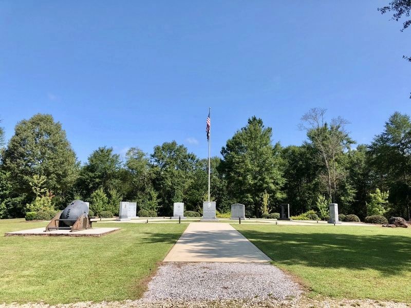
On Pines Church Road just north of Pines Road, on the right when traveling north.
Russell Cemetery AKA Pines Cemetery. Pvt. E. Thompson served in Revolutionary War 1776-1778. Fought at Germantown & White Plains. — — Map (db m285502) HM
Near Church Streeet, on the left when traveling east.
The people of the Second Royal Spanish Presidio supported the American Colonies through their military preparedness and financial contributions following the Royal Spanish Decree of June 21, 1779. Their support directly aided the victory and . . . — — Map (db m63505) HM
On Midway Drive at Barnett Avenue, on the left when traveling north on Midway Drive.
On this site, which was the Dutch Flats Airport,
Charles A. Lindbergh made the first flight of his
Spirit of St. Louis airplane,
constructed in 60 days by dedicated employees of
Ryan Airlines, Inc. The 20-minute flight on 28 April 1927
was . . . — — Map (db m186364) HM
Dedicated to Lt. George H. Derby U.S.A
1823 1861
Humorist, Engineer, and Builder of the first dike to safeguard San Diego Bay as a navigable harbor.
San Diego Chapter D.A.R.
San Diego Chapter S.A.R.
Nov. 3, 1962 — — Map (db m84359) HM
This plaque marks the 250th Anniversary of the founding of the United States of America
1776-2026
May these trees stand as a living testament to our nations history and as a foundation for the next 250 years
Dedicated September 12, . . . — — Map (db m310913) HM
Two plaques have been placed at this memorial.
In This Cemetery is Buried
Capt. William Smith
Born in Virginia, November 14, 1768
Died in Sonoma, May 5 1846
Who served in the Virginia Navy during the American Revolution . . . — — Map (db m102559) HM WM
Near West Jewell Avenue at South Huron Street, on the right when traveling west.
Most historical of Denvers municipal parks. Created in 1882. This site was homesteaded in 1862 by Potato Clark. Jim Beckwourth, Mulatto Daredevil, erected a home in 1860 .6 mile northeast. Sam Browns toll bridge of 1859 located 4 miles . . . — — Map (db m203446) HM
On Farmington Avenue (Connecticut Route 4) at Main Street ( Route 10), on the left when traveling east on Farmington Avenue.
Lest We Forget
In honor and grateful remembrance of our French Allies in the Revolution, whose army, under the command of General Count de Rochambeau, marched past this spot enroute from Newport and Providence, R.I., to join General Washington on . . . — — Map (db m190186) HM
On Monroe Turnpike (Route 111) at Moose Hill Road, on the right when traveling north on Monroe Turnpike.
The
Rochambeau
Route
1781 82
In the Vicinity
French Troops Under
Duc De Lauzun
Enroute From Newport
To Yorktown
Encamped During
June 29 Through
July 1st 1781
Erected by The
Sons of the American Revolution
Gen. Gold . . . — — Map (db m190233) HM
On Main Street (Connecticut Route 149), on the right when traveling south.
Nathan Hale
Scholar Teacher Soldier Martyr
Born Coventry Connecticut, June 6, 1755
Graduated from Yale, 1773
Taught in this
"Little Red School House at the fork in the road"
from November 1, 1773 until May, 1774
Gave his . . . — — Map (db m281550) HM
On Main Street (Connecticut Route 100) at Park Place, on the right when traveling east on Main Street.
Marquis de Lafayette
1757 1834
General in the Continental Army
Camped Here With 2800 Troops
Enroute to Rhode Island
July 26 and 27, 1778
dedicated here by
CT Society Sons of the American Revolution
General David Humphries Branch . . . — — Map (db m35581) HM
On Broad Street at Olive Street, on the left when traveling north on Broad Street.
The patriots whose names this tablet bears and whose remains rest in this burial ground assisted in establishing American independence by their service in the War of the American Revolution
Archelaus Allen Stephen Atwater James Baldwin . . . — — Map (db m271849) WM
On Chapel Street at College Street, on the left when traveling west on Chapel Street.
Upon the Site of this Building
Stood the Home of
Roger Sherman
And Near Here in 1793 he Died
Jurist-Patriot-Statesman
Signer of the Bill of Rights
Articles of Confederation
Declaration of Independence
and the
Constitution of the . . . — — Map (db m34892) HM
On Atlantic Street, on the left when traveling south.
Nathan Hale
Scholar Teacher Soldier Martyr
Born Coventry Connecticut, June 6, 1755
Graduated from Yale, 1773
Taught in this
"The Union School of New London"
from March 1774 until July 1775
Gave his life for his country . . . — — Map (db m48184) HM
On Brookside Road just north of Old Kings Highway North, on the right when traveling north.
1894.
On Sunday, July 22, 1781,
while engaged in public worship
in the building then occupying this site
Rev. Dr. Moses Mather
and fifty men of this congregation were captured
by British troops and taken to New York
There . . . — — Map (db m230983) HM WM
On South Compo Road (Connecticut Route 136) at Post Road East (U.S. 1), on the left when traveling north on South Compo Road.
Here occurred the first engagement between the Continentals and the British Troops when they invaded Connecticut, April - 25 - 1777 — — Map (db m21360) HM
On Harvey Road north of The Sweep, on the right when traveling south.
In 1677, John Grubb (1652-1708) came from Stoke Climsland, Cornwall and settled on the Delaware River at "Grubb's Landing." He was one of the first Englishmen in Delaware.
John and his wife Frances raised nine children: Emanuel Grubb . . . — — Map (db m144195) HM
John Aicken Archibald Alexander Gov. Gunning Bedford
John Bird James Booth, Sr. James Carter
The Rev. Robert Clay Thomas Clay William Clay
Dr. Mark Elliot Stephen Gilbert Isaac Grantham
John Hall William Hazlett . . . — — Map (db m102564) HM WM
On West Church Road south of Spring Valley Road, on the right when traveling west.
Amos Alexander John Alexander Capt. Walter Alexander David Barr Richard Bennett Major James Black Thomas Bradley Jacob Casho Benjamin Cowen William Crawford Levi Davis Samuel Davis John Evans George Gillespie George . . . — — Map (db m292920) HM WM
On Newark Union Road north of Baynard Boulevard, on the left when traveling north.
This plaque is dedicated to all Revolutionary War Patriots buried in the New Ark Union Cemetery. While others are undoubtedly only known by their Creator, the following identified Patriots are buried within this cemetery:
On North Market Street south of East 9th Street, on the left when traveling south.
During the American Revolution Lauzun's Legion spent the winter and spring of 1782-1783 in Wilmington to help guard Philadelphia and Baltimore from British attack. The troops were housed in the Wilmington Academy, located where the Grand Opera . . . — — Map (db m166673) HM
Near North Church Street (U.S. 13) at East 7th Street, on the right when traveling north.
Maj. Daniel Adams
John Brynberg
Peter Brynberg
Dr. Joseph Capelle
Thomas Coxe
Matthew Cripps
James Cunningham
Benjamin Elliot
Lt. John Hendrickson
Timothy Jackson
Maj. Peter Jaquett
Griffith Jordan . . . — — Map (db m174440) WM
Near Delaware Avenue (Delaware Route 52) east of North Adams Street, on the right when traveling west.
This plaque is dedicated to all Revolutionary War hero's that are buried in Wilmington and Brandywine Cemetery. While there may be others who are known only to their creator, the following Patriots have been identified as being . . . — — Map (db m216019) WM
Near Oak Street south of East Hibiscus Boulevard, on the right when traveling north.
We descendants of the heroes of the American Revolution who, by their sacrifices established the United States of America dedicate this Liberty Tree in their honor. — — Map (db m195559) WM
On South Sykes Creek Parkway just north of Fortenberry Road, on the right when traveling north.
"We descendants of the heroes of the American Revolution who, by their sacrifices established the United States of America ” dedicate this Liberty Tree in their honor. — — Map (db m164622) WM
Near East Romana Street south of South 10th Avenue, on the right when traveling east.
Dedicated
to all patriots that through their
service and support established the
United State of America.
Minutemen
"By the rude bridge that arched the flood,
Their flag to Aprils breeze unfurled,
Here once the embattled farmers . . . — — Map (db m177627) WM
Near North G Street at West Belmont Street, on the left when traveling north.
Born June 24, 1782 Frederick County, Virginia Died October 7, 1834 Pensacola, Florida Granddaughter of Betty Washington who was the only sister of George Washington Mary W. Willis was also the mother of Princess Catherine D. Murat of the Court of . . . — — Map (db m298500) HM
In colonial times, patriots often gathered by designated trees to sow the seeds of revolution and freedom. Such trees came to symbolize American liberty. This live oak tree is dedicated to the People of Palm Coast as a living tribute to our . . . — — Map (db m152295) WM
On Coral Way at Toledo Street, on the right when traveling west on Coral Way.
In July 1899, Congregational minister Solomon Greasley Merrick (1859-1911) and his wife Althea (1859-1937) purchased sight unseen the surrounding 160 acres for $1,100. Several months later, Merrick and his son George (1886-1942) came from . . . — — Map (db m73631) HM
On Kings Road (U.S. 1) just north of North Brandies Avenue, on the right when traveling north.
June 30th, 1778, a force of 300 American Cavalry commanded by Colonel Elijah Clarke, participating in General Robert Howe's invasion of Florida, attacked a column of British at this place (Alligator Creek Bridge), but were unable to penetrate the . . . — — Map (db m172581) HM
This Memorial to
Button Gwinnett
Born 1735 Died 1777
Georgia Signer of The Declaration of Independence
President of Georgia
Whose remains, buried in this cemetery, are believed to lie entombed hereunder. Was erected by the . . . — — Map (db m241905) HM
On Louisville Road at Martin Luther King Boulevard on Louisville Road.
Savannah Merchant, organized and commanded Grenadier Company 1772; Member Council of Safety; Fought several battles as Continental Colonel; Captured twice; After release commanded stores at Yorktown; Promoted to Militia Major General, . . . — — Map (db m6440) HM
Near West Jackson Street at North Florida Street, on the right when traveling west.
[south side] Dedicated to the men who sacrificed and fought for our freedom during the American Revolution and are buried in the original county of Early, State of Georgia. Erected by the members of the Joel Early Chapter of . . . — — Map (db m257900) WM
In honor of the brave militia men under Robert Anderson, including Capt. William Baskin, Jr., James Little, John Miller, Joseph Pickens and Lt. Thomas Shanklin, who fought a superior Tory force led by Col. Boyd at the mouth of Van[n]'s Creek and . . . — — Map (db m2760) HM
On Lawrence Road, on the left when traveling north.
In circa 1740, James Oglethorpe established a watch house west of here on the bank of the Frederica River. In 1745, Edward Kimber described this site as a place "from whence they can see Vessels a great Way to the Northward" and it served as a . . . — — Map (db m73889) HM
On Mimosa Drive/W. Point Road 0 miles Frederica Road, on the left when traveling north.
During the American Revolution four heavily-armed row galleys were constructed in Savannah for the Georgia Navy, all underwritten by the Continental Congress. In nearby Frederica River, beginning at dawn on April 19, 1778, Georgia galleys Lee, . . . — — Map (db m10088) HM
His patriotism,
courage and sacrifice
won independence
from colonial rule
for the
United States
of America
American Revolution
1775 ~~ 1783
The 13 Original Colonies
Virginia
Massachusetts
Maryland
Connecticut . . . — — Map (db m113728) HM
On Warm Springs Road at Miller Road, on the right when traveling north on Warm Springs Road.
Born in Maryland, Cooper served in the South Carolina Militia during the American Revolution and participated in battles at Brandywine, Germantown and Stony Point. After the War he moved to Putnam County, Georgia and later to Muscogee County where . . . — — Map (db m17811) HM
On West Lamar Street (Georgia Route 27) 0.1 miles west of South Dudley Street, on the right when traveling east.
The tree was grown from a branch of the original Washington Elm under which George Washington was sworn in as Commander of the Continental Army at Cambridge, Mass. in 1775. Donated to the people of Americus and Sumter County by John H. Gray, . . . — — Map (db m155680) HM
In commemoration
Capt. David Bushnell
Patriot of the Revolutionary War
Born 1740 Connecticut
Died 1826 Georgia
Creator of America's first
wartime submarine The Turtle
David Bushnell studied naval tactics at Yale 1771-1775. . . . — — Map (db m227213) HM WM
The collapse of the Teton River Dam on June 5, 1976 unloosed a savage flood which caused $500,000,000 in damage, took eleven lives, and made thousands homeless in Wilford, Sugar City, Rexburg, Salem, Hibbard, Firth, Blackfoot, and Roberts.
But . . . — — Map (db m84341) HM
On U.S. 95 at milepost 295 near Elk Horn Lane, on the left when traveling north.
Located Sept. 15, 1846 by William Craig mountain man and his Indian wife Isabel.
First permanent white settler in Idaho, 1840, first Nez Perce Indian Agent, 1848; interpreter at Walla Walla Flathead and Blackfoot Councils, 1855 Lieutenant . . . — — Map (db m121603) HM
On Webster Street north of East Harrison Street, on the right when traveling north.
Thomas Hart born in 1757 in Farmington, Connecticut to John Hart and Hildah Gould, enlisted in the Connecticut Troops the first time, May 1, 1775, serving 8 months in Captain Sedgwick's Company. His second service was for three months in . . . — — Map (db m199799) WM
Near North Clark Street at West Wisconsin Street, on the right when traveling north.
In Memory of
David Kennison
The Last Survivor of the
"Boston Tea Party"
who died in Chicago, February 24, 1852, aged 115 yrs, 3 mos, 17 da, and is buried near this spot.
This stone is erected by the Sons of the Revolution, the Sons . . . — — Map (db m10656) HM
On Arlington Heights Road near Cemetery Lane, on the right when traveling north.
[Front (east-facing) side:]
Patriot Miner began his military service in May of 1775 at the age of eighteen. He enlisted for a term of 7 months in the Connecticut Militia, Captain Porter's Company, and fought at Fort St. John and Montreal. He . . . — — Map (db m286403) HM
Near South Washington Street south of West Hillside Road, on the right when traveling south.
John Dudley was born February 25, 1758 in Old Saybrook, Connecticut. In 1776 at the age of 18, he enlisted in the New Hampshire militia and served at Fort Ticonderoga in Colonel Reed's Regiment. There Dudley and the rest of the American troops . . . — — Map (db m230990) HM WM
On Poplar Street east of S 5th Street, on the right when traveling east.
Early settlers of Johnson County included patriots of the Revolutionary War. With this Historical Marker we commemorate the following veterans.
Daniel Chapman - Born July 25, 1756 in Westchester County, New York. Daniel Chapman served the . . . — — Map (db m146585) HM WM
Near Bluff Road (Illinois Route 157) north of Interstate 270.
(front:)
Buried in Nix/Judy Cemetery on hilltop:
Pvt John Nix served with the SC troops under Cpt Davis, Richard Win's Rgt. He served under Cpt Thomas Baker in the battles of Eutaw Springs and Orangeburg.
Pvt Henry Thornhill . . . — — Map (db m151118) HM WM
Pvt. Anthony Alexander Harrison, son of Lovell and Hannah Sanford Harrison, enlisted in Capt. Lucas' CO in Feb 1781. He also served in Capt. Newsome's CO, and the CO commanded by his brother, Capt. Joseph Harrison, Col. Dick's Regt., Gen. . . . — — Map (db m154161) HM WM
On Reinbach Street 0.1 miles south of North Railroad Street, on the left when traveling east.
Bourland Jolly (a.k.a. Boling Jolley) (1766-1844) born in Dinwiddie County, Virginia where he enlisted in the VA. Militia in 1781. He was enlisted by a Captain Connelly and later served under a Col. Lucas at the Siege of Yorktown. After . . . — — Map (db m292353) HM WM
The following three patriots are interred in Section OP. Lots 26. 106, and 214.
ELIJAH SMITH
Born on August 12, 1755, near Trenton, Hunterdon County. New Jersey. Died March 11, 1836 at age 80 in Illinois. Enlisted the first time in 1776 . . . — — Map (db m287414) HM WM
Near North Prospect Road south of East Forrest Hill Avenue, on the left when traveling south.
Captain Zeally Moss is buried in the
Bradley family circle, with his daughter
Lydia Moss Bradley in the Mt. Prospect
area at the southeast corner of the
cemetery. He was born in Loudoun County,
Virginia. on March 6, 1755, the son of
Nathaniel . . . — — Map (db m220299) HM WM
On Southwest Washington Street near Peoria Park District Rock Island Greenway when traveling west.
Lt. John Dusenberry died in Peoria
County, Illinois, on September 26, 1833.
He was buried in the 'Old French Cemetery'
which became Block 35 when the Town
of Peoria was formed in 1835.
Descended from mid-1600s immigrants
from the . . . — — Map (db m259405) HM WM
Near North Princeville Cemetery Road 0.2 miles north of North Sumner Avenue.
This marker commemorates two Revolutionary War veterans, Phineas Bronson and John Montgomery, who lived and died in Princeville, Illinois.
Phineas Bronson was born in Enfield, Connecticut on Nov. 9, 1764. He served in the 3rd Company of the 2nd . . . — — Map (db m150577) WM
Near 46th Avenue (Illinois Route 3) 0.3 miles east of 15th Street, on the right when traveling east.
A true friend of the American cause during the Revolutionary War. His village occupied these and adjacent grounds and withstood a British war party on its way to attack General George Rogers Clark in 1779.
This also commemorates the burning of . . . — — Map (db m201880) HM
(front:)
Three Patriots and their wives are interred in blocks 12 and 13 on the hill north of this site.
Moses Broadwell (1764-1827). Served in 3rd New Jersey Reg't, Continental Army in 1780. The regiment saw action during the New . . . — — Map (db m156871) HM WM
On East 1st Street at Church Street, on the right when traveling east on East 1st Street.
Dedicated to the memory of the men and women of Cahokia who aide George Rogers Clark and his men in defeating the British from 1778 to 1780. Efforts of these patriots and veterans helped secure the territory north of the Ohio River and east of the . . . — — Map (db m171151) HM WM
On Saint Johns Road 0.3 miles east of Jonesboro Quarry Road, on the right when traveling west.
St. John's Cemetery contains the graves of four Revolutionary War Soldiers.
Jacob Hileman, born July 20, 1762 in Northampton Co., Pennsylvania. As a private he served in the 4th company, 3rd battalion. Northampton County Militia in 1778 . . . — — Map (db m207797) HM WM
Two Revolutionary War soldiers are buried in the Northwest corner of this cemetery. John Damron was born in 1757 in Northumberland County, Virginia. He enlisted in the army in 1776, and served in the 9th Virginia Regiment of the Continental Line. In . . . — — Map (db m167453) HM WM
On Spring Street just north of East Court Avenue, on the right when traveling north.
General Lafayette was the official guest of the State of Indiana at Jeffersonville on May 12, 1825 at the house of Former Governor Posey on the West corner of Front and Fort Streets. He was welcomed by the Governor of the the State, by a . . . — — Map (db m221572) HM
Near Riverview Drive south of East Laughery Creek Road, on the right when traveling south.
Col. Archibald Lochry and his regiment were defeated near this site on August 24, 1781 by Chief Joseph Brant and a coalition of Ohio Indians. — — Map (db m222287) HM
Near South Walnut Street just west of North Water Street, on the left when traveling east.
In memory of our
Revolutionary Veterans
Jackson County Indiana
In Memory of Those Who Served
Thomas Alexander Samuel Applegate Christian Branaman Francis Burrell William Chambers Michael Downing Lt. James Guffey Charles . . . — — Map (db m242688) WM
On South 2nd Street at Church Street on South 2nd Street.
Contains the graves (mostly unmarked) of some 4,000 inhabitants of early Vincennes, including soldiers and patriots of the American Revolution who helped Colonel George Rogers Clark to capture nearby Fort Sackville in 1779. The cemetery marks the . . . — — Map (db m176258) HM
Near North Delaware Street north of East Washington Street, on the right when traveling north.
Marion County was named for this Revolutionary General and hero, entering military service in 1775, he made an invaluable contribution to the American cause as commander of South Carolina partisans in the later years of the war. His skill and daring . . . — — Map (db m132869) HM
On Old State Road 56 0.2 miles north of Hartford Pike, on the left when traveling north.
On Aug. 24, 1781, Col. Archibald Lochry and 107 recruits for Gen. Clark were ambushed at Lochry Creek by Joseph Brant's raiders. One-third were killed, the rest captured. Lochry and the wounded were later murdered. — — Map (db m243826) HM
Near South River Road, on the left when traveling west.
This "Liberty Tree" has been planted in honor of those Patriots laid to rest in Tippecanoe County and the State of Indiana whose service and sacrifices helped form this nation during its War for Independence — — Map (db m245689) WM
On North Monroe Street south of West 2nd Street (State Road 28), on the left when traveling south.
This monument is dedicated to those
Patriots laid to rest in Warren County
Indiana whose Service and Sacrifice
helped form our Nation during the
American Revolution
( Row One )
Humphrey Beckett ▫ Richard Biddlecomb . . . — — Map (db m60173) WM
On De la Balme Road at East Old Trail Road, on the right when traveling north on De la Balme Road.
[Front Side of Marker];
With recommendation from Benjamin Franklin, Augustin de La Balme, former French Cavalry officer, came to America to assist in the American Revolution.
In November 1780, allegedly under secret orders from . . . — — Map (db m52817) HM
Front Dedicated to soldiers and patriots of the American Revolution who are buried in IowaDecember 28, 1846 Iowa Our liberties we prize our rights we will maintainReverse George Perkins, N. and S. Carolina, Lee County William . . . — — Map (db m48277) HM
Dedicated to the many veterans who sacrificed for the freedoms we enjoy today.
Flags have traditionally been symbols of persons united in some common association or effort. Within the American heritage, there have been many diverse interests and . . . — — Map (db m56932) HM WM
European interest was first represented in the “New World” by the Viking Banner of Leif Ericson and other intrepid Norse adventurers. This banner, according to tradition, made its way to Iceland, Greenland and presumably North America . . . — — Map (db m56936) HM
During the 1700s, the political and economic interests of the colonists began to enlarge and disputes began to develop with Great Britain. After the defeat of the French and their expulsion in 1763, the colonists could focus even more of their . . . — — Map (db m56943) HM
Near North Waco Avenue. Reported permanently removed.
As secession swept the South, various state banners were created to symbolize the "independence" movement. Soon the Confederacy found it necessary, however, to adopt an appropriate "national" flag. The first was the famous Stars and Bars. During . . . — — Map (db m107792) HM
With the admission of Alaska in 1959 and Hawaii in 1960, the present fifty-star flag came into being. Like other flags of our nation, the fifty-star flag has seen the varied conditions that can beset a dynamic association of peoples. Under it, the . . . — — Map (db m56971) HM
Like the new nation, the first Stars and Stripes would see fuller development with the passage of time. Under the much-debated Articles of Confederation of 1781, it was agreed that America would create self-governing States in the western domain . . . — — Map (db m56959) HM
The obligations and responsibilities of becoming an imperial power as a result of the Spanish-American War quickly multiplied. The international problems that arose in Latin America, in the Philippines, and in China saw the first application of . . . — — Map (db m56970) HM
The United States emerged from the ordeal of the Civil War with deep gulfs of mistrust and bitterness. Reconstruction was lengthy. Then during the 1870's the natural wealth of the country, the industrious people, further expansion beyond the . . . — — Map (db m56967) HM
With the Revolution won and the signing of the Treaty of Paris in 1783, the United States was extended westward to the Mississippi River. To the west of the Mississippi, the French Tricolor waved over French Louisiana until the purchase of that . . . — — Map (db m56947) HM
The first national flag is commonly identified as the Grand Union Flag. Although it was never officially approved or recognized, it was this flag that came to symbolize the growing pride in the name America and the strengthening union between the . . . — — Map (db m56945) HM
There was considerable concern that the addition of a new stripe for each new state would create hopeless confusion. Therefore, Congress established the still current law that provided that after July 4, 1818 the flag would show thirteen stripes . . . — — Map (db m56960) HM
With the signing of the Declaration of Indepenence, the Grand Union was automatically promoted to the status of a national banner and at the same time rendered obsolete. The British ties were snapped and the crosses of St. Andrew and St. George in . . . — — Map (db m56946) HM
400 entries matched your criteria. The first 100 are listed above. Next 100 ⊳