Early September 3, 1814, at Mitchell House, British raiders roused Joseph T. Mitchell and his wife from their bed, shot their horses, and abducted Mitchell. They believed he ws commissary general for all of Maryland.
His was a lesser job as . . . — — Map (db m80628) HM
British Rear Admiral George Cockburn noted Georgetown and Fredericktown “were Places of some…Importance,” and the Sassafras the only upper river “I had not examined and cleared.” He led his full force toward the . . . — — Map (db m155762) HM
From opposite sides of the Sassafras River local militia fired at British raiders advancing toward Fredericktown and Georgetown May 5-6 , 1813. The militia fought only briefly before retreating, but the towns paid dearly. The British reduced . . . — — Map (db m155653) HM
On May 6, 1813, the British landed barges at Turner’s Creek—a village of about 60 people and an active port for grains and flour. Resident John Stavely was forced to lead the enemy vessels to Fredericktown and Georgetown. After destroying . . . — — Map (db m80621) HM
Captain Peter Parker arrived at Swan Creek in the HMS Menelaus August 20, 1814. The British had terrorized towns in the Upper Bay all summer, but Parker came with a special mission---to divert attention from a strike against the U.S. Capital.
While . . . — — Map (db m80634) HM
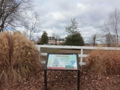
Lieutenant Colonel Philip Reed and his Maryland militia allegedly tried to fool British Troops at anchor off the Chester River. He directed his small force of cavalry to ferry back and forth between mainland and Eastern Neck Island, hoping British . . . — — Map (db m80652) HM
Lieutenant Colonel Philip Reed, buried here in 1829, excelled among Maryland militia officers. Reed countered several of the British hit-and-run raids along the Eastern Shore. His men fended off the enemy’s attack at Worton Creek and claimed victory . . . — — Map (db m80622) HM
Many Washington residents fleeing the British invasion in August 1814 converged on this quiet village. Brookeville also provided a haven for hungry soldiers as they headed for Baltimore following the American Defeat at Bladensburg. . . . — — Map (db m76403) HM
Although never part of an extensive agricultural plantation, the Bostwick House property was the workplace of many people over the centuries. The earliest residents, the Piscataway Indians, left some evidence that the area was used for hunting and . . . — — Map (db m96004) HM
The 7.7 acres that comprise the landscape of Bostwick House provide a welcome respite of open space from the surrounding dense urban environment. The most prominent manmade feature of the land is the wide west lawn that is divided into four broad . . . — — Map (db m96005) HM
This crossroads has become a place for communities to commemorate their residents in service and death. Among the memorials dedicated here is the "Undaunted in Battle" Monument to those who served and died in the War of 1812 and the Battle . . . — — Map (db m78149) HM
This house from the days when Bladensburg was a busy port town where George Washington stopped as he traveled the Old Post Road. On August 24, 1814, the British established an artillery position nearby and fired cannon and rockets at American . . . — — Map (db m61081) HM
British officers stopped at Bostwick House on August 24, 1814, then home of prisoner of war agent Col. Thomas Barclay. From Lowndes Hill, behind the house, British commander Robert Ross observed the American defensive lines.
Bostwick House . . . — — Map (db m95991) HM
The Hilleary-Magruder House was likely one of many sites in town where more than 200 British and American soldiers wounded in the Battle of Bladensburg were taken for treatment and convalescence. Built in 1742 by William Hilleary, later the home of . . . — — Map (db m61106) HM
Around 1763, Jacob and Henrietta Wirt constructed a two story wooden tavern here. During the 18th century, taverns offered dinner, drink, and a comfortable bed to weary travelers. A decade later, Jacob died and left his property, including . . . — — Map (db m78189) HM
Bostwick House is an important, but fragile, historic resource with many community, local, and statewide partners engaged in collaborative planning to restore this significant structure. One of the first efforts at preservation was in 1936 when the . . . — — Map (db m95992) HM
Christopher Lowndes, a prominent English merchant, constructed a small stone building here around 1760. Although he lived at Bostwick on the hill to the east, this property stayed in the Lowndes family until 1883. Over the past 250 . . . — — Map (db m75902) HM
The War of 1812 raged on land and sea, touching every border of the young nation. On August 24, 1814, after two years at war, the Americans faced the British here at Bladensburg.
While the American militia were unable to hold
back . . . — — Map (db m78230) HM
Tobacco was a target along the Patuxent in 1814. The British raided places stocked with hogsheads of tobacco ready for shipment. Filled with dried tobacco leaves, the wooden barrels burned easily. Imagine the spectacle on June 17 when 1,100 . . . — — Map (db m75418) HM
In the stifling heat on August 24, 1814, British soldiers struggled to keep up their march. They rested at Addison Chapel prior to that afternoon’s battle at Bladensburg.
Despite an altered roofline, chapel resembles the 1809 structure seen by . . . — — Map (db m80059) HM
After penetrating two lines of defense, the British rushed toward the third line. Commodore Joshua Barney and Captain Samuel Miller with 400 flotillamen, 114 U.S. Marines, and some militia made a stand with five big guns across Bladensburg . . . — — Map (db m97386) HM
Throughout much of the nineteenth century, the Bladensburg Dueling Grounds were well-known as a place to settle differences. The site was a secluded location, close to taverns, and fell outside of Washington D.C.'s boundaries, where dueling . . . — — Map (db m73130) HM
Standing here, where the 120-foot long wooden bridge would have carried the road between Bladensburg and Washington D.C., a traveler in 1814 would have experienced all manner of travel in and out of the popular community. Established in the . . . — — Map (db m75905) HM
As the militia – local citizens—defended this road, then known as the Bladensburg or Washington turnpike, from approaching British troops in 1814, three historical figures stood in the thick of the battle at or near this point: . . . — — Map (db m73241) HM
U.S. Marines, under Captain Samuel Miller, joined Commodore Joshua Barney’s flotillamen at the third line near here. Colonel William Thornton of the British Light Brigade led a charge and ran directly into the cannons under Barney’s command. A . . . — — Map (db m97388) WM
The Second of three defensive lines blocking the British advance on Washington stretched along here. It was located on the first set of hills overlooking the river. The American militia was unprepared to face seasoned war veterans. Holding firm . . . — — Map (db m69353) HM
The Second of three defensive lines blocking the British advance on Washington stretched along here. It was located on the first set of hills overlooking the river. The American militia was unprepared to face seasoned war veterans. Holding firm . . . — — Map (db m73131) HM
A wooden bridge just upriver became the focal point on August 24, 1814, when American and British forces clashed in the Battle of Bladensburg. The British approached from the east, clarifying their intent -- to invade Washington. The Americans . . . — — Map (db m61108) HM
The War of 1812 raged on land and sea, touching every border of the young nation. On August 24, 1814, after two years at war, the Americans faced the British here at Bladensburg.
While the American militia were unable to hold back the . . . — — Map (db m73190) HM
The War of 1812 raged on land and sea, touching every border of the young nation. On August 24, 1814, after two years at war, the Americans faced the British here at Bladensburg.
While the American militia were unable to hold back the . . . — — Map (db m75958) HM
The War of 1812 raged on land and sea, touching every border of the young nation. On August 24, 1814, after two years at war, the Americans faced the British here at Bladensburg.
While the American militia were unable to hold back the . . . — — Map (db m77080) HM
The War of 1812 raged on land and sea, touching every border of the young nation. On August 24, 1814, after two years at war, the Americans faced the British here at Bladensburg.
While the American militia were unable to hold back the British . . . — — Map (db m97389) HM
On August 24, 1814, American and British forces battled at Bladensburg for three hours. President Madison was on-site, confident his troops would block the British advance on Washington. At the second defensive line he watched the . . . — — Map (db m214693) HM
Bunker Hill Road, or Georgetown Road, was once the route between Georgetown and Bladensburg. It had existed prior to the War of 1812 and was the route by which many of the American troops retreated as the first line fell during the battle. . . . — — Map (db m214690) HM
The War of 1812 raged on land and sea, touching every border of the young nation. On August 24, 1814, after two years at war, the Americans faced the British here at Bladensburg.
While the American militia were unable to hold
back . . . — — Map (db m214694) HM
A series of explosions rocked the Patuxent on August 22, 1814. Commodore Joshua Barney’s armed barges had eluded the British until their escape ended in the shallows of the river. His orders were clear: destroy the flotilla to keep it from enemy . . . — — Map (db m61398) HM
Nottingham was the Chesapeake Flotilla’s base in July and early August 1814. The town was hastily abandoned on August 21 as the British moved in. An enemy rear guard protected this important landing while the main force invaded Washington. British . . . — — Map (db m61406) HM
Explosions at Fort Washington August 27, 1814, surprised British and Americans alike. A British squadron slowly making its way up the Potomac expected resistance from the well-positioned fort. Alexandrians, fearing they were next after Washington’s . . . — — Map (db m96373) WM
Sounds of battle could be heard here from Bladensburg, six miles away, on August 24, 1814. Victorious British troops then moved into Washington, D.C. The sky was already aglow above the city; Americans has torched the Washington Navy Yard to . . . — — Map (db m68566) HM
Exhausted from marching, battling at Bladensburg, and invading Washington, British soldiers stopped to rest. Many slept on Northampton Plantation property on August 26, 1814, before resuming their march to Upper Marlboro.
By August 30, after the . . . — — Map (db m78146) HM
"We have been in a state of continual alarm." - Rosalie Steir Calvert, 1814
From her home on August 24, 1814,
Rosalie Stier Calvert saw rocket fire as the Battle
of Bladensburg raged two miles away. Soon she
would learn of . . . — — Map (db m75327) HM
British soldiers allegedly camped at Trinity Episcopal Church and tore pages from the church registry when they passed through in August 1814. Rector Thomas John Claggett also served St. Thomas Parish in Croom, another church on the British . . . — — Map (db m74979) HM
American and British forces prepared for combat. American troops gathered at nearby Woodyard Plantation. They then marched northwest to an encampment at Long Old Fields.
The British camped in what is now Andrews Air Force Base. Before the . . . — — Map (db m74971) HM
Imagine this scene on August 22, 1814, when explosions erupted on the Patuxent! The U.S. Chesapeake Flotilla scuttled their own vessels when British pursuers approached. With the flotilla destroyed, the British landed about 500 troops at Mount . . . — — Map (db m61405) HM
About 3,200 American Troops waited at Long Old Fields on August 22, 1814,while Brigadier General William Winder Considered his next move. Camped eight miles from Washington, they could respond if the enemy advanced from either the Patuxent or . . . — — Map (db m73986) HM
John Hodges, the wealthy merchant who owned Darnall’s Chance, jailed the British soldiers that his neighbor William Beanes and other citizens arrested on August 27, 1814. The British threatened to “lay the town in ashes” unless their men . . . — — Map (db m74020) HM
Dr. William Beanes, who opposed the war, cooperated with the British when they occupied Upper Marlboro August 22-23, 1814. Beanes reportedly dined with Major General Robert Ross.
Later Ross ordered Beanes taken prisoner for arresting . . . — — Map (db m74972) HM
Kent Island served as an ideal base of operations for the British in August 1813, as it was already an important link between Maryland’s eastern and western shores. The British took over the Kent Island-Annapolis ferry, including a cargo of . . . — — Map (db m80825) HM
About 300 British soldiers approached Queenstown by road on August 13, 1813. Their part in a two-pronged attack involved a steamy march across Kent Island and The Narrows, towing two field cannon. The nighttime march was interrupted near dawn by . . . — — Map (db m80814) WM
British soldiers approaching Queenstown by land August 13, 1813, had to negotiate a thin mile-long causeway through marshes at The Narrows. The only road connection between Kent Island and the Eastern Shore mainland was the crude hand-dug rutted . . . — — Map (db m80824) HM
The British invaded Kent Island on August 5, 1813. British Rear Admiral George Cockburn of the Royal Navy planned an attack on Queenstown by land and water, a pincer attack. Even though this plan was questioned by his fellow commander, British . . . — — Map (db m80689) HM
In April of 1814, British Admiral Cochrane issued a proclamation offering slaves or free blacks service in His Majesty’s armed forces or free passage to settle in a British colony. In August of 1813 Admiral Cockburn had already implemented this . . . — — Map (db m80688) HM
Following the Chesapeake and Leopard affair in 1807 where American sailors were impressed into British service, there was outrage on the Eastern Shore. One of the three American sailors forcibly taken aboard the HMS Leopard was John Stachan, a . . . — — Map (db m80691) HM
On the night of August 13, 300 British troops marched towards Queenstown where a large American militia force was said to be encamped. The cornfields provided a perfect cover for a picket guard of 20 Queen Anne’s County Maryland militia troops . . . — — Map (db m80690) HM
Broad Creek was an obvious landing point for the 2,000-3,000 British troops coming ashore on Kent Island August 5, 1813. This had been a ferry landing since the 1600s. Stores of grain and pens of cattle, hogs, and sheep awaited transport to the . . . — — Map (db m90634) HM
Bounded by the Patuxent and the Potomac, St. Mary’s County felt the squeeze as British invaders attacked along both rivers, plundering towns and plantations at will. Officials petitioned for federal help “to rescue and save us.” Little . . . — — Map (db m81180) HM
Sotterley and other nearby plantations paid a heavy price in the War of 1812. British blockades impeded trade of their principal cash crop -- tobacco -- and enemy raids plundered the region.
In June 1814 British forces landed near Sotterley, . . . — — Map (db m62610) HM
In July 1813, British troops seized St. Clements and St. George Islands and established a base at Point Lookout. From there they repeatedly raided the countryside, terrorizing local residents
They ramped up their assault in the summer of . . . — — Map (db m80392) HM
Imagine the scene here on July 19, 1814, as Breton Bay filled with barges of British Royal Marines intent on attacking Leonardtown. Rear Admiral George Cockburn led the invasion force that came ashore at the town wharf. Raiders also approached the . . . — — Map (db m62640) HM
Both a squadron of the British navy and severe weather challenged the famed Chesapeake Flotilla off Cedar Point on June 1, 1814. The modest fleet of armed barges was assembled by Joshua Barney to harass British ships. With an inadequate professional . . . — — Map (db m62589) HM
This site, where the Chesapeake Bay and Potomac River merge, was an observation post for Americans during the War of 1812. It was also staging area for local militia in early summer of 1813.
Two- to Three-thousand British troops occupied the . . . — — Map (db m62446) HM
Easton expected to be a British target during the War of 1812. A two-story brick armory in the center of town housed cannon, small arms, and military stores to serve all of Maryland’s Eastern Shore. Fort Stoakes, an earthworks built to . . . — — Map (db m154341) HM
The British overtook Tilghman and Poplar islands in the spring of 1813 and again in October 1814. The islands offered ready-access to Annapolis, Baltimore, and other potential targets.
A regiment of a thousand men began building winter barracks on . . . — — Map (db m80685) HM
Local lore hails St. Michaels for "fooling the British" during the War of 1812 by using lanterns to misdirect gunfire high above the town. It is certain that this shipbuilding village successfully fended off two enemy assaults in 1813.
On . . . — — Map (db m158610) HM
Eleven British barges advanced on the small battery guarding St. Michaels at Parrott’s Point August 10, 1813. Their mission was to capture or destroy any armed vessels rumored to be operating on the river.
American defenders fired twice, then . . . — — Map (db m80676) HM
During the War of 1812 the young United States was embroiled in conflict with Great Britain. From 1812 to 1815 Americans fought to protect their rights and economic independence. They faced superior enemy forces on the homefront and the high seas.
. . . — — Map (db m158611) HM
With Alexandria under British control in August 1814, top-ranking U.S. military men gathered at this high point above the city. President Madison conferred with Secretary of the Navy William Jones, Brigadier General John Hungerford, and U.S. Navy . . . — — Map (db m81243) HM
167 entries matched your criteria. Entries 101 through 167 are listed above. ⊲ Previous 100