An important colonial port for shipment of Tobacco. Here in 1765 Zachariah Hood, Maryland’s “Stamp Act” agent, was hanged in effigy. Lafayette’s troops camped here April 17-18, 1781 on the way to engage Cornwallis in Virginia. George . . . — — Map (db m3144) HM
An important colonial port for shipment of Tobacco. Here in 1765 Zachariah Hood, Maryland’s “Stamp Act” agent, was hanged in effigy. Lafayette’s troops camped here April 17-18, 1781 on the way to engage Cornwallis in Virginia. George . . . — — Map (db m3145) HM
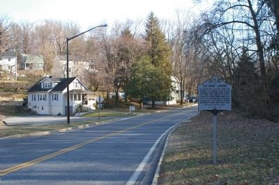
Thomas Spurrier's stood at nearby crossroads connecting two important overland routes in colonial days (now U.S. 1 and MD. 175.) George Washington stopped here at least 25 times between 1789 and 1798. His diary noted July 18, 1795: "Dined and lodged . . . — — Map (db m3236) HM
George Washington
stopped here at least twenty five times between 1789 and 1798. On July 18, 1795, his diary says:
"Dined and lodged at Spurrier's where my sick horse died." — — Map (db m3238) HM
County seat of Kent County. Established in 1706. Situated on the most traveled highway between south and north during the revolutionary period. George Washington made eight known visits here between 1756 and 1793. Rich in Colonial History. — — Map (db m3059) HM
Benefactor of Washington College
Member of the
Board of Visitors and Governors
1784-1789
Honorary Degree Recipient 1789
A gift from the Class of 2000
in commemoration of the
Bicentennial of
George Washington's death . . . — — Map (db m138233) HM
The Chestertown waterfront seems quiet today, but it was a flashpoint in the American colonists' struggle for liberty.
Kent County, long loyal to England, found its ancestral ties weakening with each new generation born on American soil. . . . — — Map (db m138241) HM
On this site stood the tavern erected by William Downs in 1763. Burned in 1893. George Washington stopped here in 1774 en route to and from the first Continental Congress. He traveled this road on his eight visits to Kent County. — — Map (db m155488) HM
Erected by act of Assembly of Maryland, May 1736, on a tract called Tolchester. A base of Continental supplies, 1775 to 1783. Port of Entry and ferry landing. George Washington stopped here enroute to points north and south.
Burned by British . . . — — Map (db m155498) HM
Formerly known as Rock Hall Cross Roads. Main Street is part of first road cut in Kent County in 1675. George Washington passed here eight known times. Tench Tilghman used this route from Yorktown to Philadelphia in October 1781. — — Map (db m3075) HM
In 1790, Congress authorized the establishment of a territory 10 miles square on the Potomac River to be the Capital of the United States. It was President Washington's recommendation to use land on both sides of the river. Surveyor Andrew Ellicott, . . . — — Map (db m154770) HM
Thomas Sprigg, Jr., patented in 1725 as "Woodstock" 1,102 acres here, inherited in 1782 by Sprigg's three granddaughters, Sophia, Rebecca, and Elizabeth. Sophia married John Francis Mercer (later Governor of Maryland, 1801-1803.) in 1794. Nearly . . . — — Map (db m151719) HM
An important stopping place in colonial days. Mentioned by Washington, Lafayette and other noted men after the Revolution. Count de Rochambeau's troops camped here in June 1782 on the return march from the victory at Yorktown. — — Map (db m3574) HM
Around 1763, Jacob and Henrietta Wirt constructed a two story wooden tavern here. During the 18th century, taverns offered dinner, drink, and a comfortable bed to weary travelers. A decade later, Jacob died and left his property, including . . . — — Map (db m78189) HM
Placed in 1791-1792, this is one of forty Aquia Creek sandstone markers outlining the original boundaries of the Federal District as commissioned by President Washington. In 1916, The District of Columbia Daughters of the American Revolution . . . — — Map (db m154783) HM
Home of the Digges Family
(descendants of Edward Digges,
governor of Virginia, 1652–1668)
The most intimate friend of
George and Martha Washington
in Prince George’s County,
where they visited many times. . . . — — Map (db m3663) HM
Following the Revolutionary War, the task of locating the capital of the new nation fell to George Washington. He traveled widely investigating other options, such as Philadelphia and Trenton, but ultimately returned to familiar ground, a site on . . . — — Map (db m171514) HM
(King George's Parish Established 1692)
Credible evidence and honest
tradition record that
Washington
attended services here on
numerous occasions. — — Map (db m3662) HM
Known as “Castle Magruder” where lived Rev. Jonathan Boucher, tutor to “Jackie” Custis.
George and Martha Washington,
Nelly and John Parke Custis, Benedict Calvert, and Robert Eden, last royal governor of . . . — — Map (db m3631) HM
17th century hunting lodge of the Lords Baltimore, 9200 acres acquired in 1751 by the honorable Benedict Calvert, member of the council, son of Charles, Fifth Lord Baltimore. Here, with George Washington present, February 4, 1774, Benedict's . . . — — Map (db m3661) HM
On March 30, 1791, a group of six men, bundled in great coats, could be seen riding on horseback over a "wilderness" on the Potomac River. The leader was George Washington, first President of the United States, who was to approve the site . . . — — Map (db m154948) HM
The home of Ignatius Digges whose daughter Mary, married Thomas Sim Lee, twice Governor of Maryland. Lee died here, 1819. General George Washington visited here four times and Martha Washington once. In the War of 1812 British officers stopped here . . . — — Map (db m62919) HM
George Washington
"lodged" here August 31, 1774, going to
First Continental Congress
May 4, 1775, on his way to
Second Continental Congress
where, on Jun 15, 1775, he was elected "General and Commander-in-Chief of the Army of the . . . — — Map (db m34330) HM
Who died April 15th 1786 in the 42d year of his age. Very much lamented. He took an early and active part in the great contest that secured the independence of the United States of America. He was an Aide-de-Camp to His Excellency General . . . — — Map (db m3172) HM
In commemoration of the first completed monument dedicated to the memory of George Washington.
Citizens of Boonsboro on July 4, 1827 marched behind the Stars and Stripes to this site and built the tower to 15 feet.
They returned to . . . — — Map (db m129050) HM
Background Overshadowed by the Battle of Antietam (near Sharpsburg), which took place three days later and resulted in a loss of 23,000 men, the Battle of South Mountain nevertheless played a crucial role in determining the outcome of . . . — — Map (db m129047) HM
1774
On July 2, 800 citizens meet in Elizabeth Town and pledge to boycott British goods, especially tea. This is done to support the citizens of Boston because their port had been closed by Parliament.
1775
In August, a colonial . . . — — Map (db m146011) HM
December, 1770 - A congregation of German-Swiss refugees organized The First German Reformed Church in Elizabeth Town, Canageschik, Fredrich County, Province of Mereland. The first pastor was Jacob Weimer. Land was acquired from Jonathan Hager, Jr. . . . — — Map (db m20770) HM
George Washington’s diary (while he visited Berkley Springs in 1769) states: “Aug. 30 Old Mr. Flint dined with us” and on Sept. 4: “Rid to the Potomac where my horses were. From thence to Mr. Flint’s and to the Pennsylvania Line, . . . — — Map (db m61485) HM
Volunteer villagers of nearby Boonesboro celebrated their Independence Day July 4, 1827, by building and dedicating this first monument to the memory of George Washington.
Repaired and altered many times over a hundred years by patriotic . . . — — Map (db m1908) HM
Although now part of the Mumma Farm, and known as Mumma Cemetery, this site was first established as a burial ground by the Orndorff family. Living on this farm at the time of his death, Major Christian Orndorff II was buried here in December . . . — — Map (db m89939) HM
Home of Brig. Gen. Otho Holland Williams, Revolutionary War hero and founder, 1786, of Williamsport, and of Col. Elie Williams, president of commission to lay out National Road and chief surveyor Chesapeake and Ohio Canal. President George . . . — — Map (db m3909) HM
These tall cliffs seemed like solid ground when President Washington authorized the construction of Cape Cod’s first lighthouse here in 1797. But over the years, the waves of powerful winter storms have battered the base of this cliff. From time to . . . — — Map (db m141553) HM
Through this place passed General Henry Knox in the winter of 1775 – 1776 to deliver to General George Washington at Cambridge the train of artillery from Fort Ticonderoga used to force the British Army to evacuate . . . — — Map (db m24017) HM
Through this place passed General Henry Knox in the winter of 1775 – 1776 to deliver to General George Washington at Cambridge the train of artillery from Fort Ticonderoga used to force the British Army to evacuate Boston. Erected by the . . . — — Map (db m24013) HM
Through this place passed General Henry Knox in the winter of 1775 – 1776 to deliver to General George Washington at Cambridge the train of artillery from Fort Ticonderoga used to force the British Army to evacuate Boston. Erected by the . . . — — Map (db m24007) HM
Through this place passed
General Henry Knox
in the winter of
1775 – 1776
to deliver to
General George Washington
at Cambridge
the train of artillery
from Fort Ticonderoga used
to force the British Army
to evacuate Boston. . . . — — Map (db m97510) WM
In memory of
Benjamin Church
1756-1832
Soldier of the American Revolution
served in
General Lee’s Life Guard, 1775
General Artemus Ward’s Life Guard and
Captain Burbank’s Artillery, 1776
General Washington’s Life Guard, 1776
Took . . . — — Map (db m106285) HM WM
In 1795, Springfield Armory began manufacturing muskets for the United States Military, on a site where General George Washington authorized weapons to be stored during the Revolutionary War. Within decades, Springfield Armory became the nation's . . . — — Map (db m107114) HM
Through this Place Passed
General Henry Knox
In the Winter of
1775 - 1776
To Deliver To
General George Washington
At Cambridge
The Train of Artillery
From Fort Ticonderoga Used
To Force the British Army
To Evacuate . . . — — Map (db m23756) HM
To the Memory Of
George Washington
Commander-In-Chief Of
The American Army
1775 — 1785
First President of the United States
Who endorsed the location of a magazine and laboratory at Springfield in 1777, personally inspected the . . . — — Map (db m110887) HM
In 1795, Springfield Armory began manufacturing muskets for the United States Military, on a site where General George Washington authorized weapons to be stored during the Revolutionary War. Within decades, Springfield Armory became the nation's . . . — — Map (db m230762) HM
Naismith Memorial Basketball Hall of Fame
The Basketball Hall of Fame promotes and preserves the living history of the sport and basketball and highlights its nearly 400 inductees. The sport was invented in 1891 on the campus of Springfield . . . — — Map (db m230754) HM
Through this Place Passed
General Henry Knox
In the Winter of
1775 - 1776
To Deliver To
General George Washington
At Cambridge
The Train of Artillery
From Fort Ticonderoga Used
To Force the British Army
To Evacuate . . . — — Map (db m23754) HM WM
Site of the Fourth Meeting House built in 1756. Here Washington worshipped in 1775. Constitutional Convention of Massachusetts held here in 1779. Lafayette welcomed here in 1824. — — Map (db m77777) HM
Built in 1759 Headquarters for George Washington 1775 – 1776 . Home of Henry Wadsworth Longfellow Family & Descendants 1837 1950 — — Map (db m19085) HM
Near this spot on July 3, 1775,
George Washington
took command of the American Army
In memory of this event, this gate, was erected A.D. October, 1906 — — Map (db m215363) WM
Christ Church was established in 1759 to serve Cambridge's Anglican community, including students at Harvard College.
Peter Harrison, the preeminent architect of his day, designed this church, King's Chapel in Boston, and Touro Synagogue . . . — — Map (db m215346) HM
Born in Wexford Ireland 1745 Died in Philadelphia 1803 Received first commission from the Continental Congress to command the Lexington 1775 Sailed from Boston on the Raleigh 1778 Acclaimed in Boston in 1780 for victories on the Alliance Appointed . . . — — Map (db m41561) HM
“Don’t fire ‘til you see the whites of their eyes.” The Battle of Bunker Hill, fought here on Breed’s Hill, June 17, 1775, was the first major military confrontation of the Revolutionary War. Although the British won the . . . — — Map (db m18094) HM
In 1789 President George Washington stayed at Joseph Ingersoll's inn at this site while visiting Boston. Massachusetts Governor John Hancock's visit to meet Washington here is regarded as an early acceptance of Federal sovereignty over that of . . . — — Map (db m215167) HM
Sir William Phips 1651 - 1695 First Royal Governor of Massachusetts under the Charter of 1691. One of twenty-six brothers and sisters. A poor boy apprenticed to a ship's carpenter in the North End. In 1687 he recovered from a Spanish galleon . . . — — Map (db m76593) HM
The first building on this site was The New North Meeting House erected in 1714 and enlarged in 1730At the request of General Washington, March 28, 1776 immediately following the evacuation of Boston by the British The Reverend Andrew Eliot, then . . . — — Map (db m76622) HM
Worlds collide in Mackinac’s “Middle Ground” Charles Michel de Langlade was an Odawa war chief, diplomat, fur trader and a French officer. He was one of the most influential people in the Great Lakes during the 1700s, due to his . . . — — Map (db m154700) HM
Planted April 27 1932
This tablet placed
Americanization Day
April 27 1934
By Halvarson-Bowers Aux' 187
Veterans of Foreign Wars — — Map (db m17227) HM
Until 1798, The Mississippi Territory was under Spanish rule. Threatened with banishment to the silver mines of Mexico because of preaching, Richard Curtis, Jr. returned to South Carolina until there was a change in the government. President . . . — — Map (db m105490) HM
"I see that the old flagpole still stands. Have your troops hoist the Colors to its peak, and let no enemy ever haul them down."
Gen. Douglas MacArthur
"To be prepared for war is one of the most effectual means of preserving peace." . . . — — Map (db m88344) WM
Permanent settlers began arriving in the area of present-day Washington, Missouri, in the 1790s. After former United States President George Washington died at his Virginia estate in 1799, numerous cities, counties and a state were named in his . . . — — Map (db m124397) HM
The Mount Vernon Red Maple grows at the Virginia home of George Washington, the nation's first president and commander of the Colonial Army that won the American Revolution. When Washington retired, it was an act that gained attention both at home . . . — — Map (db m237100) HM
James Monroe was born at Monroe's Creek, Westmoreland County, Virginia on April 28, 1758 to Scots-Welsh parents. He attended the College of William and Mary in Williamsburg, Virginia but left school to enlist in the Third Virginia Regiment, . . . — — Map (db m149767) HM
On April 30, 1789, George Washington, standing on the balcony of Federal Hall on Wall Street in New York, took his oath of office as the first President of the United States.
Born in 1732, into a Virginia planter family, he learned the . . . — — Map (db m179401) HM
— Washington — first took command of the American Army under the grandparent of this elm at Cambridge, Mass, July 3, 1775. Raised an given by Maryland D.A.R. Marked by Nevada D.A.R. This tree is planted as part of the two hundredth . . . — — Map (db m160564) HM
Colonel Tobias Lear
was born in this house in 1760.
He was George Washington’s Secretary
from 1783 to 1799.
Washington visited here in 1789.
This tablet is placed by the Society
of the Sons of the Revolution
of the State of New . . . — — Map (db m115969) HM
At Lower Closter Dock – on the riverfront just south of here – a British invasion force of 5,000 troops commanded by Lord Cornwallis landed before dawn on November 20, 1776. Guided by three Bergen County residents, they climbed the . . . — — Map (db m144530) HM
This area named for a Liberty Pole erected here before the Revolution. The strategic junction was the scene of many American and British troop movements, including the 1776 retreat of the Continental Army from Fort Lee, and British activity in 1776 . . . — — Map (db m7012) HM
Beneath these cliffs, Henry Hudson’s Half-Moon was welcomed by the Lenni Lenape Indians on September 3, 1609.
Nearly 167 years later, this giant Bluff Rock became a strategic stronghold in the American War for Independence as the conflict . . . — — Map (db m7707) HM
Fort Lee Road (Main Street) was the main roadway to General Washington’s Headquarters in Hackensack. Supplies and men were in constant movement on the road to re-supply Fort Washington in New York. The Continental Army began it’s “Retreat to . . . — — Map (db m7657) HM
General Washington was in Fort Lee many times during the Battle of New York. His main headquarters was in Hackensack, but had a temporary headquarters in Fort Lee near Anderson Avenue and Elizabeth Street. His main objective in Fort Lee was to . . . — — Map (db m7647) HM
General Gates was commissioned a Brigadier General and was appointed Adjutant General of the Continental Army in 1775 by orders of General Washington. He was in Fort Lee with General Washington in October 1776. — — Map (db m7652) HM
Fort Lee was constructed by General Mercer on October 18, 1776 on orders from General George Washington. Originally called Fort Constitution, it was re-christened Fort Lee in honor of General Charles Lee, second in command of the Continental Army, . . . — — Map (db m7653) HM
(1) July 12 - Fort Lee’s fortifications laid out. Together with Fort Washington on the opposite bank and aided by a river barrier, the twin fortresses are intended to thwart British control of the Hudson.
(2) July 12 - General Howe’s forces . . . — — Map (db m189474) HM
Old Army Road, now called Palisade Road, was used by General Washington and his staff to reach the palisades for observing movement on the Hudson River crossings and New York. The road was also used to re-supply General Knox’s artillery positioned . . . — — Map (db m7658) HM
On July 12th, 1776, the British warships Phoenix and Rose sailed beneath the unarmed Bluff Rock, later named Fort Lee. This provocative action led Congress to order General Washington “By every art and whatever expense to obstruct effectively . . . — — Map (db m7712) HM
(Front of Monument) :
In commemoration of the Soldiers of the American Revolution - 1776 – Erected by the State of New Jersey under the auspices of the Fort Lee Revolutionary Monument Association - 1908 –
(Left of . . . — — Map (db m7348) HM
The Continental Army’s retreat route ran from the bluffs of Fort Lee’s Palisades, site of the American fortifications and nearby encampment, west on Fort Lee Road (present day Main Street) and continued west through the current towns of Leonia, . . . — — Map (db m70433) HM
Archibald Campbell’s tavern stood here. He supplied meals to General Washington when Peter Zabriskie’s home was used as military headquarters between November 13 and November 21, 1776 during the retreat across New Jersey. The army marched down Main . . . — — Map (db m7227) HM
Earliest records of this pioneer Dutch church, dated 1686, mark it as the second oldest in New Jersey. Old stones embedded in the east wall show the initials of founding families and first settlers.
The old burying ground contains the grave of . . . — — Map (db m6820) HM
Hackensack was a small village centered around The Green which served as a strategic point during the American Revolution.
Washington headquartered here in November 1776 while he surveyed the local roads and bridges. — — Map (db m6867) HM
On November 20th 1776, General George Washington and part of the Continental Army on their march from Fort Lee to Trenton passed this way. — — Map (db m93363) HM
This Dutch Colonial house was built by Hendrick Van Allen before the Revolutionary War on a farm that consisted of over two-hundred acres. General George Washington used this house as his Headquarters on July 14-15, 1777, when he moved his troops . . . — — Map (db m12336) HM
1028 entries matched your criteria. Entries 201 through 300 are listed above. ⊲ Previous 100 — Next 100 ⊳