284 entries match your criteria. The first 100 are listed. ⊳
Former U.S. Presidents: #34 Dwight D. Eisenhower Historical Markers
By Sandra Hughes, December 3, 2011
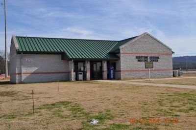
Formation of the George C Marshall Space Flight Center Marker
| 1 ► Alabama, Madison County, Huntsville — Formation of the George C. Marshall Space Flight Center — |
| On Rideout Road, on the right when traveling south. | |||
| 2 ► Alabama, Montgomery County, Montgomery — 5 — Highway Construction Destroys Historic Black Neighborhoods — The Cloverleaf beneath Interstates 65 and 85 — Selma to Montgomery National Historic Trail — |
| On West Jeff Davis Avenue at South Holt Street, on the right when traveling east on West Jeff Davis Avenue. | |||
| 3 ► Alabama, Montgomery County, Montgomery — 9 — Judge Frank M. Johnson: Judicial Fairness in the Age of Segregation — Molton and Montgomery Streets — Selma to Montgomery National Historic Trail — |
| On Montgomery Street at Catoma Street, on the right when traveling south on Montgomery Street. | |||
| 4 ► Alabama, Winston County, Haleyville — The Honorable Frank Minis Johnson, Jr. — |
| On 20th Street at 10th Avenue, on the right when traveling east on 20th Street. | |||
| 5 ► Arizona, Maricopa County, Glendale — City of Glendale Veterans Memorial — |
| On 59th Avenue at Brown Street, on the left when traveling north on 59th Avenue. | |||
| 6 ► Arkansas, Benton County, Bella Vista — United States Commanders in Chief — |
| 7 ► Arkansas, Benton County, Garfield — Remembrance and Reunion — Pea Ridge National Military Park — National Park Service, U.S. Department of the Interior — |
| On Military Park Road (County Road 65), on the right when traveling south. | |||
| 8 ► California, Alameda County, Livermore — Sister City Program — |
| Near Terminal Circle at Airway Boulevard. | |||
| 9 ► California, Alpine County, Woodfords — 805 — The Pony Express - Woodfords — |
| On Old Pony Express Way (California Route 88) east of California Route 89, on the right when traveling east. | |||
| 10 ► California, El Dorado County, Pollack Pines — The Pony Express - Sportsman’s Hall — |
| On Pony Express Trail east of Exit 57 (U.S. 50), on the right when traveling east. | |||
| 11 ► California, Fresno County, Fresno — Lao Hmong American War Memorial — Portrait of a People - Hmong — |
| On Van Ness Avenue, on the right when traveling north. | |||
| 12 ► California, Orange County, Orange — Dwight David Eisenhower — 1890 - 1969 — |
| Near North Tustin Street. | |||
| 13 ► California, Riverside County, Indian Wells — Dwight David Eisenhower — October 14, 1890 - March 28, 1969 — Early Years — |
| On California Route 111 east of El Dorado Drive, on the right when traveling west. | |||
| 14 ► California, Riverside County, Indian Wells — Eisenhower Mountain — |
| Near California Route 111 at Eldorado Drive. | |||
| 15 ► California, San Francisco City and County, San Francisco, Lincoln Park — Western Terminus of the Lincoln Highway — |
| On 34th Avenue near El Camino del Mar, on the left when traveling south. | |||
| 16 ► California, San Joaquin County, Stockton — The Sister City Story — |
| Near Center Street. | |||
| 17 ► California, San Luis Obispo County, Atascadero — Faces of Freedom Veterans Memorial — |
| On California Route 41 at Portola Road, on the left when traveling west on State Route 41. | |||
| 18 ► California, San Luis Obispo County, Avila Beach — Pier Into The Past — History of the Cal Poly Research Pier — |
| On Avila Beach Drive west of Ana Bay Road, on the left when traveling west. | |||
| 19 ► Colorado, Arapahoe County, Littleton — Littleton War Memorial — |
| Near West Lake Ave.. | |||
| 20 ► Colorado, Clear Creek County, Georgetown — The Story of the Eisenhower-Johnson Memorial Tunnels — We went by the book, but the mountain couldn't read — R.C. (Rube) Hopper, 1972 — |
| Near Argentine Street. | |||
| 21 ► Colorado, Garfield County, Glenwood Springs — Building Interstate 70 Through Glenwood Canyon — |
| Near Interstate 70 Frontage Road at milepost 121. | |||
| 22 ► Colorado, Prowers County, Granada — Amache - Granada Relocation Center — |
| Near County Road 235/10 south of West Amache Road. | |||
| 23 ► Colorado, Summit County, Vail Pass — 246 — Vail / Vail Pass Country — |
| On Shrine Pass Road (County Road 16) near Interstate 70. | |||
| 24 ► Connecticut, Fairfield County, Stamford, Downtown — Freedom Shrine — |
| On Atlantic Street at Main Street, on the right when traveling north on Atlantic Street. | |||
| 25 ► Connecticut, Hartford County, Hartford, Front Street District — Dwight D. Eisenhower — |
| Near Prospect Street just north of Arch Street, on the right when traveling north. | |||
| 26 ► Connecticut, Windham County, Canterbury — World War II Commemorative Tree — |
| Near Westminster Road (Connecticut Route 14) at Municipal Drive, on the right when traveling east. | |||
| 27 ► Delaware, Kent County, Camden — Operation Silent Witness — |
| Near Old Camden Road (Alternate U.S. 13) 0.5 miles south of South Dupont Highway (U.S. 13), on the right when traveling south. | |||
| 28 ► District of Columbia, Washington, Northeast Washington, Arboretum — Capitol Columns — |
| Near Elipse Road Northeast at Beechwood Road Northeast, on the left when traveling north. | |||
| 29 ► District of Columbia, Washington, Northeast Washington, Atlas District — 1953 — Dwight D. Eisenhower — ULINE — |
| On 3rd Street Northeast, 0.1 miles north of L Street Northeast, on the left when traveling north. | |||
| 30 ► District of Columbia, Washington, Northeast Washington, Capitol Hill — Alva Belmont House — |
| Near Constitution Avenue Northeast (Alternate U.S. 1) at 2nd Street Northeast, on the right when traveling west. | |||
| 31 ► District of Columbia, Washington, Northeast Washington, Catholic University — History of the Catholic University Law School — 1895-1954 — |
| Near John McCormack Drive Northeast north of Michigan Avenue Northeast, on the left when traveling north. | |||
| 32 ► District of Columbia, Washington, Northeast Washington, Lincoln Heights — 1 — Watts Going On — A Self-Reliant People — Greater Deanwood Heritage Trail — |
| On Division Avenue Northeast at Foote Street Northeast, on the right when traveling north on Division Avenue Northeast. | |||
| 33 ► District of Columbia, Washington, Northwest Washington, Adams Morgan — 8 — Serving the Neighborhood — Roads to Diversity — Adams Morgan Heritage Trail — |
| On Columbia Road Northwest north of Euclid Street Northwest, on the right when traveling south. | |||
| 34 ► District of Columbia, Washington, Northwest Washington, Cleveland Park — Peirce Still House — National Register of Historic Places — 2400 Tilden Street Northwest — |
| On Shoemaker Street Northwest south of Tilden Street Northwest, on the left when traveling south. | |||
| 35 ► District of Columbia, Washington, Northwest Washington, Downtown — Dwight D. Eisenhower Executive Office Building — The White House — National Park Service, U.S. Department of the Interior — |
| On Pennsylvania Avenue Northwest east of 17th Street Northwest, on the right when traveling east. | |||
| 36 ► District of Columbia, Washington, Northwest Washington, Dupont Circle — Taras Shevchenko Memorial — |
| On 22nd Street Northwest north of P Street Northwest, on the left when traveling north. | |||
| 37 ► District of Columbia, Washington, Northwest Washington, Kalorama Triangle — 13 — "Best Addresses" — Roads to Diversity — Adams Morgan Heritage Trail — |
| On 20th Street Northwest at Columbia Road Northwest, on the right when traveling north on 20th Street Northwest. | |||
| 38 ► District of Columbia, Washington, Northwest Washington, Massachusetts Heights — Bishop Aimilianos Laloussis — |
| Near 36th Street Northwest south of Garfield Street Northwest, on the left when traveling north. | |||
| 39 ► District of Columbia, Washington, Northwest Washington, Massachusetts Heights — Saint Sophia Greek Orthodox Cathedral Cornerstone — |
| On 36th Street Northwest north of Massachusetts Avenue Northwest, on the right when traveling north. | |||
| 40 ► District of Columbia, Washington, Northwest Washington, Sheridan-Kalorama — Philippine Ambassador's Residence in the United States — |
| On R Street Northwest east of Massachusetts Avenue Northwest, on the right when traveling west. | |||
| 41 ► District of Columbia, Washington, Northwest Washington, Spring Valley — School of International Service — |
| Near Nebraska Avenue Northwest north of New Mexico Avenue Northwest, on the right when traveling south. | |||
| 42 ► District of Columbia, Washington, Southeast Washington, Navy Yard — 1956 — Dwight Eisenhower — |
| Near Tingey Street Southeast east of New Jersey Avenue Southeast, on the left when traveling east. | |||
| 43 ► District of Columbia, Washington, Southwest Washington, Southwest Federal Center — American Veterans Disabled For Life Memorial — |
| On 2nd Street Southwest at Washington Avenue Southwest, on the right when traveling south on 2nd Street Southwest. | |||
| 44 ► District of Columbia, Washington, Southwest Washington, Southwest Federal Center — Dwight D. Eisenhower Memorial — |
| On Independence Avenue Southwest at 4th Street Southwest, on the right when traveling east on Independence Avenue Southwest. | |||
| 45 ► District of Columbia, Washington, Southwest Washington, Southwest Federal Center — The General Dwight David Eisenhower Plaza — United States Holocaust Memorial Museum — "Loss and Regeneration, 1993" — |
| Near Raoul Wallenberg Place Southwest south of Independence Avenue Southwest, on the left when traveling north. | |||
| 46 ► District of Columbia, Washington, Southwest Washington, The National Mall — World War II Memorial — |
| On 17th Street Southwest north of Independence Avenue Southwest, on the left when traveling north. | |||
| 47 ► Florida, Hillsborough County, East Lake-Orient Park — 1958 Lebanon crisis — Hillsborough County Veterans Memorial Park — |
| Near U.S. 301, 0.2 miles south of East Dr. Martin Luther King Jr. Boulevard, on the right when traveling south. | |||
| 48 ► Florida, Hillsborough County, Tampa — Plant Field — |
| On North Blvd. near W North B Street, on the left when traveling south. | |||
| 49 ► Florida, Miami-Dade County, Florida City — F-739 — Operation Pedro Pan — Operación Pedro Pan — |
| On NW 14th Street at NW 2nd Avenue, on the right when traveling east on NW 14th Street. | |||
| 50 ► Florida, Monroe County, Key West — The Little White House — |
| On Front Street, on the right when traveling south. | |||
| 51 ► Florida, Monroe County, Key West — F-546 — The Little White House — |
| On Front Street at Caroline Street, on the right when traveling south on Front Street. | |||
| 52 ► Florida, Santa Rosa County, Milton — Korea — 1950 - 1953 — Santa Rosa Veterans Memorial Plaza — |
| Near Willing Street, 0.1 miles west of Caroline Street. | |||
| 53 ► Florida, Seminole County, Sanford — Mount Vernon Grove — Featured Tree — Mount Vernon Red Maple — |
| Near West 7th Street just west of Myrtle Avenue, on the right when traveling west. | |||
| 54 ► Georgia, Bibb County, Macon — William Augustus Bootle — Federal Building and United States Courthouse — Dedicated June 29, 1998 — |
| On Mulberry Street (Georgia Route 49) west of 3rd Street Lane, on the right when traveling west. | |||
| 55 ► Georgia, Chatham County, Savannah, Historic District - North — 1 — Ships That Carried the Name Savannah — |
| On East River Street, on the left when traveling east. | |||
| 56 ► Georgia, Chatham County, Savannah, Historic District - South — 25-60 — Louis B. Toomer: Founder of Carver State Bank — |
| Near Barnard Street at West Taylor Street, on the left when traveling north. | |||
| 57 ► Georgia, Chatham County, Savannah, Hutchinson Island — 25-41 — Nuclear Ship Savannah — |
| On International Drive, Hutchinson Island near Savannah River. | |||
| 58 ► Georgia, Chattahoochee County, Fort Benning — 026-5 — "Riverside" — |
| On Vibbert Avenue, 0.1 miles west of Lumpkin Road, on the right when traveling east. | |||
| 59 ► Georgia, Chattahoochee County, Fort Benning — Dwight David Eisenhower — October 14, 1890 ~ March 28, 1969 — |
| On Vibbert Avenue at Austin Loop, on the right when traveling west on Vibbert Avenue. | |||
| 60 ► Georgia, Muscogee County, Columbus — 1918 Diamond Jubilee 1993 Camp Benning / Fort Benning |
| On 15th Street at Dixon Drive, on the right when traveling east on 15th Street. Reported missing. | |||
| 61 ► Georgia, Richmond County, Augusta — St. James United Methodist Church — |
| On Greene Street, 0.1 miles east of 5th Street, on the right when traveling west. | |||
| 62 ► Georgia, Telfair County, McRae-Helena — 134-1 — Marion Bayard Folsom — |
| On College Street, 0 miles west of 2nd Avenue, on the right when traveling west. | |||
| 63 ► Georgia, Tift County, Tifton — The Dwight David Eisenhower Memorial Gardens — A Tribute to the Georgia Interstate Highway System — |
| On Whiddon Mill Road at Agrirama Drive, on the right when traveling west on Whiddon Mill Road. | |||
| 64 ► Georgia, Webster County, Preston — 152-5 — Walter F. George — 1878-1957 — |
| On Hamilton Street (U.S. 280) 0 miles east of Washington Street, on the left when traveling east. | |||
| 65 ► Hawaii, Honolulu County, Honolulu, Naval Station Pearl Harbor — This Sacred Site — World War II Valor in the Pacific National Monument — |
| Near Pearl Harbor. | |||
| 66 ► Hawaii, Honolulu County, Honolulu, Naval Station Pearl Harbor — U.S.S. Arizona Memorial — War Memorial of the Pacific — Pearl Harbor, Hawaii — |
| 67 ► Idaho, Caribou County, Soda Springs — Ground Observer Corps National Campaign — |
| Near East 1st Street South near South Main Street. | |||
| 68 ► Illinois, Madison County, Alton — Freedom Shrine — |
| On Tavernier Way, 0.2 miles south of West MacArthur Drive (Illinois Route 111/140), on the left when traveling south. | |||
| 69 ► Indiana, Daviess County, Washington — 14.1992.1 — Baltimore & Ohio Southwestern Railroad Depot — |
| On South Meridian Street at Depot Street, on the left when traveling south on South Meridian Street. | |||
| 70 ► Indiana, Jefferson County, Madison — 39.2006.1 — Irene Dunne — |
| On East Main Street east of West Street, on the right when traveling west. | |||
| 71 ► Indiana, LaPorte County, La Porte — The Lincoln Highway — America's First Paved Coast-to-Coast Highway — |
| Near Michigan Avenue at Washington Street, on the left when traveling north. | |||
| 72 ► Indiana, Marion County, Indianapolis, Downtown — Indiana Vietnam and Korean Wars Memorial — |
| On North Meridian Street north of East North Street, on the right when traveling north. | |||
| 73 ► Indiana, Marion County, Indianapolis, St. Joseph Historic Neighborhood — Indiana World War II Memorial — |
| On North Pennsylvania Street north of East North Street, on the right when traveling south. | |||
| 74 ► Indiana, Marshall County, Plymouth — Historic Crossroads of America / The Lincoln Highway — |
| On E. Jefferson Street at Cleveland Street, on the right when traveling east on E. Jefferson Street. | |||
| 75 ► Indiana, St. Joseph County, New Carlisle — The Historic Lincoln Highway — Main Street Across America — |
| Near East Michigan Street (U.S. 20) east of South Arch Street, on the left when traveling west. | |||
| 76 ► Iowa, Cerro Gordo County, Mason City — Mason City Area Veterans Monument — • Unseen • Unheard • Unwavering • United • — |
| On Washington Avenue (U.S. 65) south of 1st Street NW, on the left when traveling south. | |||
| 77 ► Kansas, Atchison County, Potter — 4(B) — Historic Fort Leavenworth — Oldest Army Post in Continuous Existence West of the Missouri River — 13 Miles South — |
| On Amelia Earhart Road (U.S. 73) at Kansas Highway 74, on the left when traveling north on Amelia Earhart Road. | |||
| 78 ► Kansas, Dickinson County, Abilene — Dwight David Eisenhower — |
| 79 ► Kansas, Dickinson County, Abilene — Dwight David Eisenhower — |
| On NW 3rd Street at Spruce Street, on the right when traveling west on NW 3rd Street. | |||
| 80 ► Kansas, Dickinson County, Abilene — Eisenhower Memorial — |
| 81 ► Kansas, Dickinson County, Abilene — 5 — Eisenhower Park — |
| On North Pine Street, on the right when traveling north. | |||
| 82 ► Kansas, Dickinson County, Abilene — 30 — Historic Abilene — |
| 83 ► Kansas, Dickinson County, Abilene — Site of Abilene High School — |
| On N.W. 7th Street at Spruce Street, on the right when traveling west on N.W. 7th Street. | |||
| 84 ► Kansas, Dickinson County, Herington — 29 — Dwight David Eisenhower — |
| On U.S. Highway 77 (U.S. 56) 0.1 miles south of Wind Road, on the right when traveling south. | |||
| 85 ► Kansas, Dickinson County, Solomon — Historical Kansas — |
| Near Interstate 70 at milepost 265. | |||
| 86 ► Kansas, Ellis County, Hays — Fort Hays State University War Memorial — |
| 87 ► Kansas, Leavenworth County, Fort Leavenworth — 4(A) — Fort Leavenworth — |
| On Reynolds Avenue east of Gibbons Avenue, on the left when traveling east. | |||
| 88 ► Kansas, Leavenworth County, Fort Leavenworth — The United States Army Command and General Staff College — |
| On Stimson Avenue, on the right when traveling east. | |||
| 89 ► Kansas, Lyon County, Emporia — Alvin J. King — The Father of All Veterans Day — |
| 90 ► Kansas, Stafford County, Quivira National Wildlife Refuge — A Brief History of the Growth of the National Wildlife Refuge System — |
| 91 ► Kentucky, Fayette County, Lexington — George M. Humphrey — 1890 - 1970 — |
| Near East Main street (U.S. 60) at Midland Avenue (U.S. 60), on the right when traveling west. | |||
| 92 ► Kentucky, Fayette County, Lexington — John Hay Whitney — 1904 - 1982 — |
| Near East Main Street (U.S. 60) at Midland Avenue (U.S. 60), on the right when traveling west. | |||
| 93 ► Kentucky, Fayette County, Lexington — Phoenix Park — |
| On East Main Street (U.S. 60) at North Limestone, on the left when traveling north on East Main Street. | |||
| 94 ► Louisiana, Allen Parish, Kinder — Great Louisiana Maneuvers' Blue Army Headquarters — |
| On Ronald Reagan Highway (U.S. 190) near Ninth Street, on the right when traveling west. | |||
| 95 ► Louisiana, Ascension Parish, Gonzales — "The War to End War" — - President Woodrow Wilson — |
| Near South Irma Boulevard, 0.3 miles north of East Worthey Street, on the right when traveling north. | |||
| 96 ► Louisiana, Ascension Parish, Gonzales — The Korean War — |
| Near South Irma Boulevard, 0.3 miles East Worthey Street, on the right when traveling north. | |||
| 97 ► Louisiana, Ascension Parish, Gonzales — The Vietnam War — 1954-1975 — |
| Near South Irma Boulevard, 0.3 miles north of East Worthey Street, on the right when traveling north. | |||
| 98 ► Louisiana, Ascension Parish, Gonzales — WWII - War In Europe — |
| Near South Irma Boulevard, 0.3 miles north of East Worthey Street, on the right when traveling north. | |||
| 99 ► Louisiana, Ascension Parish, Gonzales — WWII - War In The Mediterranean — (North Africa, Sicily, and Italy) — |
| Near South Irma Boulevard, 0.3 miles north of East Worthey Street, on the right when traveling north. | |||
| 100 ► Louisiana, East Baton Rouge Parish, Baton Rouge, Highlands/Perkins — Troy H. Middleton |
| Near Tower Drive south of Dalrymple Drive, on the left when traveling north. Reported permanently removed. | |||
284 entries matched your criteria. The first 100 are listed above. Next 100 ⊳