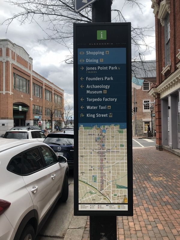
On King Street at South Union Street, on the right when traveling east on King Street.
Few periods of Alexandria's history have been more tumultuous than the War of 1812. During the first decade of the 19th century, Great Britain's interception of American ships, impressment of U.S. seamen, and support of Indian aggression along the . . . — — Map (db m115769) HM
Near Callahan Drive at King Street (Virginia Route 7).
With Alexandria under British control in August 1814, top-ranking U.S. military men gathered at this high point above the city. President Madison conferred with Secretary of the Navy William Jones, Brigadier General John Hungerford, and U.S. Navy . . . — — Map (db m81243) HM
Near Red Hill Road (County Route 677) 1 mile Staunton Hill Road (County Route 619).
After three decades of public service, Patrick Henry retired in 1794 to Red Hill plantation in Charlotte County, which he regarded as "one of the garden spots of the world." He purchased the 700-acre estate and simple story-and-half house in 1794 . . . — — Map (db m128698) HM
On Red Hill Road at Staunton Hill Road (County Route 619) on Red Hill Road.
One mile to the south is Red Hill, Patrick Henry’s last home and burial place. The marble stone covering his grave carries the simple inscription, “His fame his best epitaph.”
Henry came here in 1794 and died at his beloved Red Hill . . . — — Map (db m65398) HM
On Park Street at East Jefferson Street on Park Street.
To the memory and service of three Presidents of the United States
Thomas Jefferson, James Madison and James Monroe
associated with this courthouse in Albemarle County, Virginia — — Map (db m170128) HM
On Park Street north of East Market Street, on the left when traveling north.
This building, in continuous use as a
courthouse for over 200 years, is one of America’s most historic. No other courthouse has been used by three early
American Presidents at the same time, The original wood frame courthouse was erected on a . . . — — Map (db m19723) HM
On Zachary Taylor Highway (U.S. 522) at Twin Mountains Road (Virginia Route 647), on the right when traveling north on Zachary Taylor Highway.
Culpeper County. Area 384 Square Miles. Formed in 1748 from Orange, and named for Lord Culpeper, Governor of Virginia, 1680-1683. The Battle of Cedar Mountain, 1862, was fought in this county.
Orange County. Area . . . — — Map (db m23774) HM
On Historic Sully Way, 0.8 miles south of Air and Space Museum Parkway, on the right when traveling south.
Richard Bland Lee (1761-1827)
First Congressional Representative for Northern Virginia to the first three Federal Congresses
A Commissioner to supervise reconstruction of the War of 1812 damaged buildings in the United States . . . — — Map (db m198261) HM
On Sully Road (Virginia Route 28) near U.S. 50, on the right when traveling north.
The dwelling house at Sully Plantation was built in 1794 by Richard Bland Lee on land that had been patented in 1725. Lee was the first congressman from Northern Virginia and an early member of Phi Beta Kappa. His vote brought the capital city to . . . — — Map (db m216) HM
On Potomac Hills Street, 0.6 miles east of Jeffery Road, on the left when traveling east.
Invasion of Washington City
Following the defeat of American militia forces by British regulars at Bladensburg, Maryland on the afternoon of August 24, 1814, a small British force, consisting mainly of officers, marched into the capital . . . — — Map (db m102960) HM
On Colvin Run Road (Virginia Route 743) east of Robindale Drive, on the right when traveling east.
The United States Congress, attempting to use economic pressure to lift British and French trade restrictions, imposed on American shipping during the Napoleonic Wars, passed the Embargo Act of 1807. Ships were not permitted to leave American . . . — — Map (db m198240) HM
On Dolley Madison Blvd. (Virginia Route 123), on the right when traveling north.
Salona was built on part of the 1719 Thomas Lee 2,862 acre grant known as Langley. During the War of 1812, the estate's owner, the Rev. William Maffitt, reputedly gave refuge to President James Madison as the British burned Washington. Civil War . . . — — Map (db m65488) HM
On South Washington Street (U.S. 29) at Hillwood Avenue (Virginia Route 338), on the right when traveling north on South Washington Street.
The Story of Falls Church
The community located just 10 miles from the nation's capital and today known as Falls Church boasts a history rich in culture and diversity.
The People to 1700
Native Peoples and Their Land
For . . . — — Map (db m206631) HM
Famous ordinary believed to be part of Federal-style mansion built on 145 acres bought for $291 in 1787 by James Wren (part of 1742 208-acre G. Harrison grant). Lying north of Alexandria-Leesburg Rolling Road, tavern operated 1789-1815 under James . . . — — Map (db m2842) HM
Cedar Creek Battlefield and Belle Grove has been designated a Registered National Historic Landmark under the jurisdiction of the Historic Sites Act of August 21, 1935. This site possesses exceptional value in commemorating or illustrating the . . . — — Map (db m92700) HM
Near Belle Grove Road (Virginia Route 727) 0.5 miles west of Valley Pike (U.S. 11). Reported permanently removed.
In 1783, Isaac Hite, Jr. married Nelly Madison Hite of Montpelier, and acquired by grant from his father the 483 acre tract that was to become the center of Belle Grove Plantation. Until the elegant manor house was built between 1794 and 1797, the . . . — — Map (db m44581) HM
On Belle Grove Road (Virginia Route 727) 0.2 miles south of Meadow Mills Road (Virginia Route 624), on the right when traveling north. Reported damaged.
When Isaac Hite, Jr. and Nelly Conway Madison of Montpelier were married in 1783, they received from his father a 48-acre tract that became the centerpiece of Belle Grove Plantation. Old Hall, as it is known today, was already in place at the . . . — — Map (db m158576) HM
On Seminole Trail (U.S. 29) north of Fredericksburg Road (County Route 609), on the right when traveling north.
Greene County. Formed from Orange County in 1838, this rural Piedmont county was named for Gen. Nathanael Greene, Revolutionary War military hero. The county seat of Greene County is Stanardsville. William Donoho and William B. Phillips, . . . — — Map (db m21505) HM
On Spotswood Trail (U.S. 33), on the right when traveling east.
Orange County. Formed from Spotsylvania County in 1734, Orange County, a pastoral Piedmont county, was probably named in honor of William IV, the Dutch prince of Orange, who married Anne, the Princess Royal, daughter of George II of England, . . . — — Map (db m24228) HM
On Ingalls Road just north of Fenwick Road, on the left when traveling south.
Captain Christopher Newport explored the land of the Kecoughton tribe in 1607. English colonists named it Cape Comfort before moving up the James River to settle at Jamestown. Captain John Smith, who surveyed the area between 1607 and 1609, . . . — — Map (db m166619) HM
On Melon Street, 0.1 miles west of Water Street, on the left when traveling south.
After damaging British coastal attacks during
the War of 1812, Pres. James Madison recognized
the need to improve the nation’s coastal defense
and naval power. In 1816, Congress created the
Board of Engineers for fortifications and in . . . — — Map (db m129905) HM
On South Main Street (U.S. 11) 0.1 miles north of Bluestone Drive, on the right when traveling north.
The university was founded in 1908, through the efforts of state senator George B. Keezell, of Rockingham County, as the State Normal and Industrial School for Women at Harrisonburg. In 1924 it became the State Teachers College at Harrisonburg, . . . — — Map (db m39327) HM
On Port Republic Road (Virginia Route 253) at Bluestone Drive, on the right when traveling west on Port Republic Road.
The university was founded in 1908, through the efforts of state senator George B. Keezell, of Rockingham County, as the State Normal and Industrial School for Women at Harrisonburg. In 1924 it became the State Teachers College at Harrisonburg, . . . — — Map (db m39328) HM
On Newtown Road (Virginia Route 721) at Sorghum Road (Virginia Route 660), on the right when traveling north on Newtown Road.
Donald Robertson (1717-1783), born and educated in Scotland, established a private boarding school on his farm two miles southwest of here by 1758. Among his students were James Madison, fourth president of the United States and "Father of the . . . — — Map (db m145379) HM
On James Madison Parkway (U.S. 301) at Walsingham Road, on the right when traveling south on James Madison Parkway. Reported permanently removed.
At this place, Port Conway, James Madison, fourth President of the United States and Father of the Constitution, was born, March 16, 1751. His mother was staying at her paternal home, Belle Grove, 400 yards east when her son was born. Madison's . . . — — Map (db m7297) HM
On James Madison Parkway (U.S. 301) at Walsingham Road, on the right when traveling south on James Madison Parkway.
James Madison, "Father of the Constitution" and fourth president of the United States, was born here at Port Conway on 16 March 1751, in a house that no longer stands. His mother, Eleanor Conway Madison, was visiting her family at their plantation, . . . — — Map (db m133748) HM
On James Madison Parkway (U.S. 301) at Walsingham Road, on the right when traveling south on James Madison Parkway.
King George County. Area 180 Square Miles. Formed in 1720 from Richmond, and named for King George I. James Madison, "Father of the American Constitution" and President of the United States was born in this county. . . . — — Map (db m28334) HM
On US 301 James Madison Parkway, 0.5 miles south of VA 3 Kings Highway, on the right when traveling south.
The site of Port Conway is located five miles south on the Rappahannock River. Francis Conway laid out the town in 1783, and the next year the Virginia General Assembly passed an act establishing it. James Madison, Father of the Constitution and . . . — — Map (db m7290) HM
On Kings Hwy (Virginia Route 3) near Walnut Drive, on the right when traveling west.
Stafford County. Area 274 Square Miles. Formed in 1664 from Westmoreland County and named for Staffordshire, England. From 1739 to 1747 it was the boyhood home of George Washington. In November 1862, the Army of the Potomac . . . — — Map (db m4261) HM
On Gordon Avenue (Virginia Route 231) south of Echo Back Lane, on the right when traveling north.
Orange County. Area 359 Square Miles. Formed in 1734 from Spotsylvania, and named for the Prince of Orange, who in that year married Princess Anne, daughter of King George II. President James Madison lived in this county and . . . — — Map (db m17747) HM
On James Madison Highway (U.S. 15/33), on the right when traveling north.
Orange County. Formed from Spotsylvania County in 1734, Orange County, a pastoral Piedmont county, was probably named in honor of William IV, the Dutch prince of Orange, who married Anne, the Princess Royal, daughter of George II of England, . . . — — Map (db m108411) HM
On Francis Thorton Valley Road (Virginia Route 231) at Nethers Road (County Route 602) on Francis Thorton Valley Road.
Madison County.
In the hills of the Piedmont, along the Blue
Ridge Mountains, Madison County was formed
from Culpeper County in 1792. Madison
County is named for James Madison, the
“father of the American Constitution” and
the forth . . . — — Map (db m104880) HM
On Seminole Trail (U.S. 29) at Hoover Road, on the right when traveling south on Seminole Trail.
Madison County. In the hills of the Piedmont, against the Blue Ridge Mountains, Madison County was formed from Culpeper County in 1792. The county is named for James Madison, the “father of the American Constitution” and the fourth president . . . — — Map (db m21502) HM
On James Madison Highway (U.S. 15) at White Oad Road / Robinson River Road (County Route 721), on the right when traveling north on James Madison Highway.
Madison County. Area 324 Square Miles. Formed in 1792 from Culpeper, and named for James Madison, "Father of the American Constitution" and President of the United States. Governor Spotswood's exploring expedition passed here, . . . — — Map (db m4708) HM
On South James Madison Highway (U.S. 15) at Little Skyline Drive (County Route 674), on the right when traveling south on South James Madison Highway.
Orange County. Formed from Spotsylvania County in 1734, Orange County, a pastoral Piedmont county, was probably named in honor of William IV, the Dutch prince of Orange, who married Anne, the Princess Royal, daughter of George II of . . . — — Map (db m4758) HM
On Interstate 64 at milepost 100, on the right when traveling east.
The commission appointed to select a site for the University of Virginia met 1-4 August 1818 in the tavern that stood nearby. Among the 21 members present were former presidents Thomas Jefferson and James Madison, as well as judges Spencer Roane, . . . — — Map (db m21831) HM
On North Main Street (U.S. 15/33) at East Gordon Avenue (U.S. 15), on the right when traveling north on North Main Street.
Built by Nathaniel Gordon, 1787. Visited by Washington, Jefferson, Madison, Monroe, Philip and James Barbour, Clark, Rives, Randolph, Wirt, Waddell, and other celebrities of Revolutionary, post-Revolutionary, and Confederate War periods. Lafayette . . . — — Map (db m4794) HM
On Germanna Highway (State Highway 3), on the right when traveling west.
Culpeper County. Area 384 Square Miles. Formed in 1748 from Orange and named for Lord Culpeper, Governor of Virginia, 1680-1683. The Battle of Cedar Mountain, 1862, was fought in this county.
Orange County. Area 359 . . . — — Map (db m4322) HM
On Germanna Highway (State Highway 3) at Constitution Highway (State Highway 20), on the right when traveling west on Germanna Highway.
Orange County. Formed from Spotsylvania County in 1734, Orange County, a pastoral Piedmont county, was probably named in honor of William IV, the Dutch prince of Orange, who married Anne, the Princess Royal, daughter of George II of England, . . . — — Map (db m159382) HM
On Constitution Highway (State Highway 20) at County Route 693, on the right when traveling west on Constitution Highway.
After Dolley Madison sold Montpelier in 1844, the estate witnessed many important historic events, few more significant than those of the 1860s. Throughout the winter of 1863 and 1864, as many as 4,500 Confederate troops camped here, part of a . . . — — Map (db m31715) HM
Born to Quaker parents in North Carolina, Dolley Payne lived with her family in Hanover County, Virginia until 1783. Following the death of her first husband, John Todd, she married Congressman James Madison in 1794. As First Lady of the United . . . — — Map (db m63669) HM
Near Montpelier Road, on the right when traveling south.
Slaves who worked in the Madison's household lived in this nearby area known as the "south yard." The yards of these homes, where most of the household activities took place, were in direct sight of the mansion. As a result, the Madisons would have . . . — — Map (db m23968) HM
On Coney Island Road, on the right when traveling south.
In the fields in front of you, archaeologists have found the extremely well-preserved remains of James Madison's plantation farm complex, which served as the hub of the working farm and the home for several generations of field slaves. This complex, . . . — — Map (db m190832) HM
On West Gate Road, on the right when traveling west.
James Madison's grandfather, Ambrose Madison, had his slaves construct Mount Pleasant sometime after 1723. Ambrose moved his family here in 1732 from Virginia's Tidewater and unexpectedly died within a few months. Court records show that three . . . — — Map (db m24115) HM
On Race Barn Road, on the right when traveling north.
The burial ground where you are standing is the final resting lace for many members of Montpelier's enslaved community. Slaves' belief in a spiritual world - originating in African religions - was reinforced by Christianity. This drawing shows . . . — — Map (db m24120) HM
On Montpelier Road, on the left when traveling south.
"And I desire my black Smith Moses, may belong to such of my children as he shall chose if they are willing to take him at a reasonable price." - Will of James Madison, Sr., 1787 The Blacksmith shop, constructed by Madison's father in the . . . — — Map (db m23966) HM
On West Gate Road, on the right when traveling west.
"The advice nearest to my heart and deepest in my convictions is that the Union of the States be cherished an perpetuated." -James Madison, Advice to My Country, 1834 The Madison Family Cemetery is the understated resting place for two of . . . — — Map (db m24117) HM
On Constitution Highway (State Highway 20) at Bloomsbury Road, on the right when traveling west on Constitution Highway.
A mile north is Bloomsbury, estate of the pioneer, James Taylor, ancestor of Presidents James Madison and Zachary Taylor. He was a member of Spotswood's expedition over the mountains in 1716. — — Map (db m4699) HM
On Constitution Highway (State Highway 20) at Clifton Road (County Route 628), on the right when traveling west on Constitution Highway.
Courageous leader of the Baptist Doctrine Ardent advocate of the principles of democracy Vindicator of separation of church and state. Near this spot in 1788, elder John Leland and James Madison, the father of the American Constitution, held a . . . — — Map (db m4697) HM
On West Main Street (State Highway 20) at Madison Road (U.S. 15), on the right when traveling west on West Main Street.
Five miles southwest is Montpelier, the home of James Madison, "Father of the American Constitution" and fourth president of the United States, 1809-1817. Near the house is the tomb of Madison, who died at Montpelier on June 28, 1836. — — Map (db m4703) HM
On Constitution Highway (State Highway 20) at Jacksontown Road (County Route 655), on the right when traveling east on Constitution Highway.
Near this spot are buried James Madison "Father of the Constitution" Fourth President of the United States 1809-1817 and Dolley Madison his wife — — Map (db m24226) HM
On East Old Street at Rock Street, on the right when traveling east on East Old Street.
On April 25, 1871, a British army force of 2,500 soldiers under the command of Genera! William PhilIips attacked Petersburg, hoping to capture the American military supplies here and eventually link up with General Cornwallis’ army coming to . . . — — Map (db m57368) HM
On College Road (County Route 692) 0.3 miles south of Five Forks Road (County Route 658), on the right when traveling south.
You are standing near the site of the original campus of Hampden-Sydney College, which stood on the knoll to your right (see artist reconstruction above). Hampden-Sydney began classes on November 10, 1775, the last college founded in Colonial . . . — — Map (db m54486) HM
On College Road (County Route 692) 0.3 miles south of Five Forks Road (County Route 658), on the right when traveling south.
When Samuel Stanhope Smith, our first president, named the College after English anti-Royalists, he clearly agreed with Patrick Henry’s revolutionary vision. Thus it was logical that Henry should be elected a Founding Trustee in November 1775, . . . — — Map (db m54480) HM
On College Road (County Route 692) 0.3 miles south of Five Forks Road (County Route 658), on the right when traveling south. Reported permanently removed.
Hampden-Sydney College, in continuous operation since November 10, 1775, was established “to form good men and good citizens.” One of the few remaining all-male colleges, it was named for John Hampden (1594-1643) and Algernon Sydney . . . — — Map (db m31324) HM
On College Road (County Route 692) near Via Sacra (County Route 1001), on the right when traveling north.
Hampden-Sydney College, in continuous operation since 10 Nov. 1775, was established "to form good men and good Citizens." It was named for John Hampden (1594-1643) and Algernon Sydney (1622-1683), champions of parliamentary rule in England. Patrick . . . — — Map (db m31334) HM
On College Road (County Road 692) 0.1 miles south of Crawley Drive, on the right when traveling south.
Hampden-Sydney College, in continuous operation since November 10, 1775, was established "to form good men and good citizens." One of the few remaining all-male colleges today, it was named for John Hampden (1594-1643) and Algernon Sydney . . . — — Map (db m181191) HM
On North 12th Street, 0.1 miles north of East Broad Street, on the right when traveling north.
On this site the Virginia Convention ratified the United States Constitution June 25, 1788
In the ratifying convention were Edmund Randolph, James Madison, George Wythe, Henry Lee, John Marshall, Patrick Henry, George Mason and James Monroe . . . — — Map (db m18851) HM
On North 18th Street (U.S. 360) at East Franklin Street, on the left when traveling north on North 18th Street.
Built in 1817, this structure is the oldest commercial building in Richmond. As this building was being built, James Madison, a Virginian, was serving as the 4th President of the United States.
During the Civil War, the Union Army passed by . . . — — Map (db m64131) HM
On South 14th Street (U.S. 60/360) at East Cary Street (Virginia Route 147), on the right when traveling south on South 14th Street.
In 1780, Virginia’s capital was moved from Williamsburg to Richmond to increase its accessibility and avert British attack by sea. On this corner, in commercial buildings confiscated from Loyalists, the General Assembly met until 1788. Here Thomas . . . — — Map (db m82684) HM
On West Beverly Street (Virginia Route 254) east of Church Street, on the right when traveling east.
Known originally as Augusta Parish Church, it was founded in 1746 as the county parish. The Virginia General Assembly met here in June 1781 to avoid capture by British raiders. The present church was erected in 1855 and was used by the Virginia . . . — — Map (db m11782) HM
Near Atlantic Avenue, on the right when traveling south.
The 4th U.S. President, Madison was the author of the Constitution and the Bill of Rights, which earned him the reputation as "Father of the Constitution." Serving during the "Second Revolution," or the War of 1812, he empowered the Navy with three . . . — — Map (db m165891) HM
On Kings Highway (Virginia Route 3) at Trigger Lane (County Route 683), on the right when traveling west on Kings Highway.
King George County. Area 180 Square Miles. Formed in 1720 from Richmond, and named for King George I. James Madison, "Father of the American Constitution" and President of the United States, was born in this county. . . . — — Map (db m22268) HM
Near James Monroe Highway (Virginia Route 205) 0.3 miles north of Old Road, on the right when traveling north.
It is only when the people become ignorant and corrupt, when they degenerate into a populace, that they are incapable of exercising their sovereignty. (James Monroe, 1801)
On James Monroe Highway (Virginia Route 205) north of Old Road, on the right when traveling north.
"The Birthplace of a Nation"
Lying between the Rappahannock and Potomac rivers, the Northern Neck provided fertile land that supported production of tobacco, the first great cash crop of the Virginia colony.
Six counties were formed . . . — — Map (db m176507) HM
On Main Street west of Nelson Street, on the left when traveling west.
"General Nelson…was excelled by no man in the generosity of his nature, in the nobleness of his sentiments, in the purity of his Revolutionary principles, and in the exalted patriotism that answered every service and sacrifice that . . . — — Map (db m61589) HM
On Middleway Pike (West Virginia Route 51) east of Earle Road (West Virginia Route 51/1).
Erected in 1771. The home of Colonel Samuel Washington, County Lieutenant. His brother General George Washington visited here and General Lafayette and Luis Phillipe of France were entertained here. In this house James Madison and Dolly Payne Todd . . . — — Map (db m1914) HM
Major James Gibson
Son of Andrew Gibson and Sarah Hopkins,
was born August 10, 1776, at
Lancaster, Penna. Came to
Winchester, Virginia with
his parents in 1779.
Commissioned by
Governor Cabell in 1807
Captain of Hampshire . . . — — Map (db m103494) HM WM
On Bessemer Bend Road (Route 308) near Speas Road (Route 311), on the right when traveling east.
Throughout history, humans have followed river banks in search of resources to support commerce. Rivers made possible the exploration and mapping of North America. Major waterways served as trade routes for native peoples, corridors for European . . . — — Map (db m91949) HM
170 entries matched your criteria. Entries 101 through 170 are listed above. ⊲ Previous 100