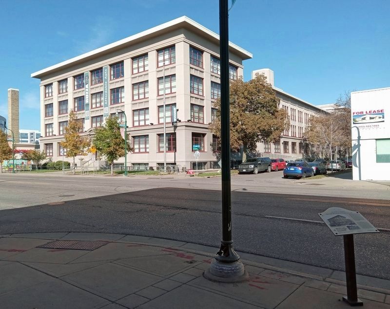
The Self-Threading Needle Company built the building at 1006 West Lake Street in 1907. The Buzza Company, a greeting card and art publishing company, purchased it in 1923, and quickly expanded it by adding two additions and a . . . — — Map (db m240629) HM
In 1922, Russel T. Lund, Sr. started working for Hove's, a neighborhood grocery store at 2923-25 Hennepin Avenue. That fall, he became a partial partner in the cheese and cracker department. In 1939, Lund became a full partner and . . . — — Map (db m243109) HM
Originally built in 1913 as the Lagoon Theater, this 1,500-seat venue was considered to be among the finest movie houses outside downtown. In 1929, the theater was rechristened "The Uptown"; its re-opening publicity declared, "New Uptown . . . — — Map (db m238169) HM
When the Walker Branch of the Minneapolis Public Library opened in 1911, the Hennepin and Lake area was still sparsely developed. T.B. Walker, founder and longtime president of the Library Board, donated the property near the . . . — — Map (db m234838) HM
Albert Abdallah immigrated to the United States as a teenager from Lebanon, arriving in Minneapolis at the turn of the last century. He entered the confectionary business at a soda fountain in downtown Minneapolis, where he met . . . — — Map (db m241711) HM
When the Granada Theater opened in 1928, it was touted as the "most elaborate theater ever constructed outside the loop district in Minneapolis." It was one of the first movie theaters designed by local architects Jack Liebenberg . . . — — Map (db m242607) HM
The Minneapolis Mercantile Company was located on the corner of Lake Street and Colfax Avenue, and offered groceries, meats, and baked goods to area residents. Constructed in 1916, the building housed both the Sandberg family business as . . . — — Map (db m238674) HM
In 1879–81, the Chicago, Milwaukee and St. Paul Railroad (CM&StP) built a line across the city's southern edge. The tracks crossed nearly 50 streets between Cedar Avenue and the lakes, creating many hazards for pedestrians and . . . — — Map (db m238962) HM
Hennepin Avenue was built on the historic ox-cart road between St. Anthony Falls and Lake Calhoun. From 1884 to 1905, the Minneapolis Park Board designated Hennepin Avenue as a parkway, which limited commercial development. By the . . . — — Map (db m235324) HM
The intersection of Lake Street and Lyndale Avenue emerged as one of Minneapolis' earliest commercial areas. A cluster of stores stood at the intersection as early as 1885. Two of its most significant buildings were erected at this . . . — — Map (db m240050) HM
In 1927, Christ Manolis purchased the candy store at the southwest corner of 27th Avenue and Lake Street. Manolis emigrated from Greece at the age of 13 as part of the Great Diaspora—the migration of hundreds of thousands of young Greeks . . . — — Map (db m134537) HM
A Native of Lake City, Minnesota, Elmer "E.B." Freeman opened a small haberdashery shop near East 25th Street and 26th Avenue around 1914. Three years later, he relocated his business to the first floor of the new Coliseum Building at . . . — — Map (db m205069) HM
Since the 1880s, 27th Avenue and Lake Street has been a center of commercial activity. The area was linked to downtown Minneapolis in 1890 when the electric streetcar was extended down Minnehaha Avenue en route to Minnehaha Park. Its . . . — — Map (db m134539) HM
The Lake Theater stood at 2721-23 East Lake from 1915 to the early 1960s. It was part of a group of theaters that obtained films through a "block system," rather than individual film selection. By 1926, this system alarmed the . . . — — Map (db m135079) HM
Holy Trinity Lutheran Church began in 1904 when a group of younger members of St. Peder's Lutheran Church, a Danish-speaking congregation, split from St. Peder's over the issue of English in Sunday school and services. The new church . . . — — Map (db m135064) HM
When it opened in February 1924, the East Lake branch of the Minneapolis Public Library was a vital educational center for the growing neighborhood. East Lake was one of the 13 branch libraries established under the leadership of Gratia . . . — — Map (db m135073) HM
The story of Fire Station No. 21 begins in 1894, when fire engines were large wagons pulled by a team of horses that transported firemen and equipment. Until 1901, the station had only a "chemical engine," an extinguisher unit meant to . . . — — Map (db m134487) HM
Martinus Nelson built a blacksmith shop here in 1888. The smithy serviced local horses and wagons that kept area dairy farms running. Danish immigrant Christian Lauritzen took over in 1898. Business was good in the growing community, and . . . — — Map (db m134477) HM
Early area survey maps from 1839 show a trail roughly corresponding to present-day Minnehaha Avenue running between Fort Snelling and the Falls of St. Anthony. Following the creation of the Minnesota Territory in 1849, the general . . . — — Map (db m134546) HM
Initially known as Centennial School, the original Longfellow School stood on the NE corner of Lake and Minnehaha between 1876 and 1919. In the early 1880s, the City of Minneapolis annexed the area, and the Minneapolis Board of Education . . . — — Map (db m135063) HM
History of Lake Street
When the City of Minneapolis was established in 1856, Lake Street was a mile beyond the southern boundary of the city.
Early Lake Street was home to dance halls, lumberyards, churches, horsesheds and . . . — — Map (db m144127) HM
For nearly 100 years, this site was the location of a farm implements production facility. In 1873, a group of businessmen that included Dorilus Morrison, Minneapolis' first mayor, established Minneapolis Harvester Works. In 1880, the . . . — — Map (db m156974) HM
African American families were among the first to settle in the neighborhood that grew south of East Lake Street. During much of the 20th century, restrictive housing covenants limited where African Americans could buy homes. Minority . . . — — Map (db m134464) HM
In 1905, H.A. Dorsey opened Wonderland Amusement Park on 10 acres between Lake ad 32nd streets and 31st and 33rd avenues. It opened to great fanfare, with 70,000 people attending on opening day. Its attractions included a 120-foot-high . . . — — Map (db m134501) HM
Charles Ingebretsen came to the United States from Norway, working first in New York City as a dockhand, then as an apprentice meat cutter in Fargo. He arrived in Minneapolis around 1907 and entered the meat-selling business. He owned . . . — — Map (db m213245) HM
Ray Truelson, together with his father, Roy, opened drive-in restaurants throughout the Twin Cities, including a Porky's Drive-In at 2107 East Lake Street. The drive-in restaurant concept gained popularity after World War II as Americans . . . — — Map (db m134583) HM
In 1911, Axel Anderson established his lunchroom to serve railroad and streetcar workers employed at the Chicago, Milwaukee and St. Paul Railroad yards, located just a few blocks to the north and at the Lake Street Station of the Twin . . . — — Map (db m134582) HM
In November 1882, Harriet Walker, a civic leader and health care advocate, summoned 44 women to lay plans for what would become Northwestern Hospital for Women and Children. It opened in a rented house at 2504 Fourth Avenue South, . . . — — Map (db m245213) HM
From 1880 to 1930, Minneapolis was the flour-milling capital of the United States, thanks in part to the abundance of wheat grown in farms dotting the state. Introduced by a Mendota fur trader around 1820, wheat quickly became Minnesota's . . . — — Map (db m213825) HM
Upon their arrival in the United States, many rural Greek immigrants demonstrated a preference for the city and its promise of a better life. Like other newcomers, they quickly established culturally supportive organizations. In 1909 a . . . — — Map (db m213679) HM
Norwegian immigrant sisters Pauline and Thomane Fjelde gained renown for winning a gold medal at the 1893 World's Columbian Exposition in Chicago for embroidering the first Minnesota State Flag, which was used until 1957. Pauline's . . . — — Map (db m234625) HM
History of Lake Street
When the City of Minneapolis was established in 1856, Lake Street was a mile beyond the southern boundary of the city.
Early Lake Street was home to dance halls, lumberyards, churches, horsesheds, blacksmiths, . . . — — Map (db m213113) HM
Originally developed to be a stylish boulevard lined with architect-designed homes situated on large lots with generous setbacks, Park Avenue once ranked as Minneapolis' most prestigious residential street.
Throughout the late . . . — — Map (db m233946) HM
Burma-Shave was introduced in 1925 by the Burma-Vita company, owned by Clinton Odell. The brushless shaving cream was advertised in an innovative way: small signs were posted along the edges of roadways, spaced for sequential reading by . . . — — Map (db m134584) HM
Opened in 1910, the Lake Street Station was one of six carhouses used by the Twin City Rapid Transit Company (TCRT) streetcar system that served Minneapolis and St. Paul. At its peak in 1920, TCRT had nearly 530 miles of track and 1,021 . . . — — Map (db m134460) HM
The James J. Ballentine Veterans of Foreign Wars Post 246 was founded in October 1919, in the aftermath of World War I. It was established with 50 charter members in memory of James J. Ballentine, a popular local boy. Born in . . . — — Map (db m239124) HM
George N. Boosalis founded the Town Treat Café in 1940. Boosalis emigrated from Greece in 1914 at age 16, eventually landing in Minneapolis to join the growing number of Greeks working in the restaurant business. He started at his . . . — — Map (db m213171) HM
Soon after arriving in Minneapolis from California, Emil Schatzlein opened his saddle shop at this location in 1907. The Selby-Lake inter-city streetcar had recently opened, and the widespread presence of automobiles was still in . . . — — Map (db m239706) HM