Near Southeast Court Square at East Elm St, on the right when traveling north.
This memorial is dedicated to the nearly 3,000 victims who perished on September 11, 2001 and to the first responders who were willing to sacrifice their lives to save others. It was a day when we all came together as Americans and it brought out . . . — — Map (db m243193) WM
On East Main Street (State Highway 49), on the left when traveling west.
Nathaniel Polk DeShong descended from Huguenot immigrants who settled near the Haw River about a mile and a half north of here. He enlisted on June 21, 1861, at 17 years of age under Capt. James W. Lea “for the War” in the 6th North Carolina State . . . — — Map (db m222823) HM
On North 5th Street (U.S. 70) at South 5th Street (North Carolina Route 119), on the right when traveling east on North 5th Street.
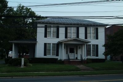
Brigadier general of North Carolina militia, member House of Commons, conventions 1788, 1789, and U.S. Congress. His home stood nearby. — — Map (db m223043) HM
On State Highway 119 at Jim Minor Road, on the right when traveling south on State Highway 119. Reported missing.
(Preface): The Carolinas Campaign began on February 1, 1865, when Union Gen. William T. Sherman led his army north from Savannah, Georgia, after the March to the Sea. Sherman’s objective was to join Gen. Ulysses S. Grant in Virginia to crush . . . — — Map (db m211213) HM
On East Center Street at N. 7th Street, on the right when traveling east on East Center Street.
Colonial trading route, dating from 17th century, from Petersburg, Virginia, to the Catawba and Waxhaw Indians in Carolina, passed nearby. — — Map (db m223046) HM
Near Church Road, 0.1 miles south of Sissipahaw Way, on the left when traveling south.
Saxapahaw was first settled by the Sissapahaw Indians - a hunting and farming tribe. In 1701, explorer and surveyor John Lawson visited the area and described it as "the flower of the Carolinas". In the mid-1700s, the first European settlers came . . . — — Map (db m215840) HM
Near Church Road, 0.1 miles south of Sissipahaw Way, on the left when traveling south.
John Newlin began construction of the Saxapahaw Cotton Mill in 1844. The mill was owned by the Newlin family until it was sold to Edwin Holt in 1873 and was later run by Holt's sons-in-law under the name White-Williamson and Company. The mill . . . — — Map (db m215842) HM
A memorial to British troops who died in the Old Meeting House during Cornwallis encampment here on his retreat from Guilford Courthouse March 1781.
Erected by Troop 46 B.S.A. Henry Overman Leader Who Died Before Completing It. — — Map (db m30558) HM
On East Greensboro-Chapel Hill Road, on the left when traveling east.
Original frontier log dwelling built by Quaker John Allen III. House stood approximately 400 feet southeast. Housed five generations. Moved in 1965 to Alamance Battleground State Historic Site. — — Map (db m30287) HM
Near West Greensboro Chapel Hill Road just north of Sylvan School Road.
Side 1:
Cane Creek Friends Meeting Since 1751
The first Cane Creek Meetinghouse stood about two miles east on land belonging to John Stanfield. The first of four meetinghouses on this site was built in 1764 on land given by William . . . — — Map (db m30682) HM
The Quakers (Society of Friends) were early anti-slavery supporters of the Underground Railroad. Once the war erupted and Alamance County residents chose sides, supporters of the Confederacy regarded the Friends as Unionists. Never attacked directly . . . — — Map (db m45538) HM
Educator, historian, civic leader, farmer, a teacher in the public schools of North Carolina for 32 years. 22 years in this community he motivated his students and the community, his home place stands 2 miles northwest. — — Map (db m30283) HM
A mile south of here is the site of Freedom Hill Wesleyan Methodist Church, a simple frame building that measured 27 by 36 feet and was dedicated in March 1848. When local residents sent a plea for a minister to the Wesleyans in Ohio in 1847, the . . . — — Map (db m46020) HM
Micajah McPherson, a trustee of Freedom Hill Wesleyan Methodist Church and abolitionist, was lynched about a mile and a half southeast of here. Although there are different stories about his lynching, they agree that he was an innocent man lynched . . . — — Map (db m46021) HM
On these grounds, Revolutionaries and Loyalists were buried together in mass graves by people of this neighborhood, who also cared for the wounded in their homes. Additional burials are at Spring Meeting House. — — Map (db m30695) HM
On Snow Camp Road, 0.2 miles south of Greensboro-Chapel Hill Road.
Settled by Quakers in 1749. Cornwallis camped in area after Battle of Guilford Courthouse and used home of Simon Dixon as headquarters. — — Map (db m223102) HM
At this site, Patriot militia commanded by Brigadier General John Butler ambushed loyalist militia commanded by Colonel David Fanning in an effort to free prisoners, whom the Loyalist had captured at Hillsborough the previous day.
Although losses . . . — — Map (db m30696) HM
Near East Greensboro Chapel Hill Road at Stockard Road, on the left when traveling east.
In Memory of the Whig and Tory Soldiers who died in the Battle of Lindley's Mill 14th D. 11 Mo. 1781 and were buried here and on the battlefield
Erected 7th Day 10 Mo. 1979 — — Map (db m223104) HM
On East Greensboro Chapel Hill Road at Bradshaw Trail, on the left when traveling east on East Greensboro Chapel Hill Road.
In 1921 Principal E.P. Dixon started high school classes in nearby vacant cotton gin, naming school for the inventor Eli Whitney.
In 1923 high school classes relocated to building on this site. In 1928 a primary grade school building was . . . — — Map (db m33345) HM
On Hiddenite Church Road, 0.1 miles north of Miller Road, on the right when traveling north.
In 1914 James Paul Lucas, diamond trader, eccentric, and world traveler, settled at this mansion and kept his collection of curiosities. — — Map (db m210424) HM
On State Highway 90, 0.2 miles west of Richard Lane (County Highway 1616), on the right when traveling west.
Noted educator and minister. Founded York Collegiate Institute & numerous academies. Professor at Rutherford College. Grave 5mi. N. — — Map (db m156756) HM
On State Highway 90, 0.6 miles east of Wayfound Church Road, on the right when traveling east.
A gem found only in N.C., named for W.E. Hidden, mineralogist of N.Y., who prospected
in this area about 1880. Mines were nearby. — — Map (db m156754) HM
On North Center Street (County Highway 1605) at Main Avenue Drive, on the left when traveling north on North Center Street.
In memory of those who gave their lives so that we might live
Korean
Brown, Clifford
Fox, J.D.
Matlock, Glenn J.
Wike, Carlie A.
Wike, James W.
Viet Nam
Auton, Bobby M.
Daniels, Lunas J.
Daniels, Robert
Deal, . . . — — Map (db m159548) WM
On North Center Street (County Highway 1605) at Main Avenue Drive, on the left when traveling north on North Center Street.
Alexander County Remembers
World War I
1917 - 1918
James A. Allen •
James Brookshire •
Archie Brown •
Charles Cook •
Otis R. Douglas •
Robert L. Eckard •
Tally Drum •
Roy Flowers •
Jessie Hollar •
Hackett Munday • . . . — — Map (db m159550) WM
On Main Avenue Drive, on the right when traveling west.
The Tower
The Bell and cornerstone were remnants of the Alexander County Courthouse fire that occurred August 11, 1967. The repair of the broken bell was accomplished by Rowe B. Campbell, a local businessman. At a later date, both the Bell . . . — — Map (db m156816) WM
On West Main Avenue (State Highway 90) at South Center Street (County Highway 1605), on the left when traveling west on West Main Avenue.
From 1861-65 the heroic sons and daughters of The Old South, under the greatest generals of all times, Robert E. Lee and Stonewall Jackson, fought with gallantry unequaled in all the annals of history. Not for the preservation of slavery, but for . . . — — Map (db m156819) WM
On West Main Avenue (State Highway 90) at South Center Street (County Highway 1605), on the left when traveling west on West Main Avenue.
At 2:00 o'clock p.m. the belch and roar of this Jones six-pounder ceased and out of the grove on Seminary Ridge, Gettysburg, marched the bravest body of infantry that ever careered the fields of battle, to hurl itself against the Union batteries on . . . — — Map (db m156818) WM
On Main Avenue Drive, on the right when traveling west.
Purchased circa 1850 at a total cost of $68.50, this bell called court into session and lent its voice to many other community events.
Before refrigeration, it announced that fresh meat was for sale and when a fire occurred, it sounded the . . . — — Map (db m156817) HM
On Blue Ridge Parkway at the High Piney Spur Overlook (at milepost 218.6), 1.8 miles the Virginia state line, on the left when traveling south.
The knoll low on the ridge to the right boasts this celestial name. It is well known locally that hunters often sat about a night fire there while they followed the chase in the lowlands. They knew which hound held the lead by the . . . — — Map (db m104662) HM
On Blue Ridge Parkway, 7 miles east of State Highway 18, on the right when traveling east.
You are looking into Basin Creek Cove. The log cabin 1500 feet below was the home of Martin and Janie Caudill and their 14 children. Martin's father, Harrison, who fathered 22 children, lived about a mile down the creek in the community of Basin . . . — — Map (db m162088) HM
Robert Lee Doughton, for whom Doughton Park is named, was born in Alleghany County, North Carolina, November 7, 1863. An original and leading advocate of the establishment and development of the Blue Ridge Parkway, he was a member of the United . . . — — Map (db m91786) HM
On North Main Street (U.S. 21) just north of East Whitehead Street (State Highway 18), on the right when traveling north.
[southwest side]Coast Guard • Army • Air Force • Navy • Marine Corps ☆ Dedicated to the honor and sacrifice of our Men and Women who served our Country in War and Peace ☆[northeast . . . — — Map (db m227326) WM
Near Cherry Street just east of Grayson Street, on the right when traveling east.
Crouse Park Sparta and Alleghany County have a rich heritage of music, crafts and agriculture. Crouse Park, including the Crouse House before you, was donated to the town in 1969. The Park hosts the Crouse House Pickers Monday night jam . . . — — Map (db m182942) HM
On Blue Ridge Parkway (at milepost 232.5), 3 miles west of U.S. 21, on the left when traveling south.
The massive gray rock before you is Stone Mountain, formed about 350 million years ago from intense heat and pressure deep within the earth. Centuries of erosion uncovered the rock and sculptured it into the curious shape it is today.
At one . . . — — Map (db m140553) HM
On Blue Ridge Parkway (at milepost 236.9), on the right when traveling south.
For thousands of years Native Americans cultivated the fertile valleys of the Blue Ridge region including North Carolina. Employing techniques such as “slash and burn” to clear small areas of forested land and fertilize the soil, the . . . — — Map (db m123230) HM
On Main Street (U.S. 52) at Cemetery Street, on the right when traveling south on Main Street.
Free black served as a Baptist pastor at Rocky River Church until law in 1831 barred blacks from public preaching. Buried 500 yards west. — — Map (db m77358) HM
On Andrew Jackson Highway (U.S. 74) at Clark Mountain Road (County Route 1744), on the right when traveling west on Andrew Jackson Highway.
Jurist & Antifederalist leader. Member of court which in 1787 issued the first reported precedent for judicial review. His home stood 3 miles N.E. — — Map (db m77357) HM
On U.S. 52, 0.2 miles south of Old Sneedsboro Road (North Carolina Highway 1829), on the right when traveling south.
North Carolina. Colonized, 1585-87, by first English settlers in America; permanently settled c. 1650; first to vote readiness for independence, Apr. 12, 1776
South Carolina. Formed in 1712 from part of Carolina, which was . . . — — Map (db m42303) HM
On U.S. 52 at Old Sneedsboro Road (North Carolina Highway 1829), on the right when traveling south on U.S. 52.
Laid out 1795. Promoted as inland port town on Pee Dee River by Archibald D. Murphey. Only graveyard remains, five miles southeast. — — Map (db m42309) HM
On Andrew Jackson Highway (U.S. 74) 0.4 miles west of Boylin Road (North Carolina Highway 1420), on the right when traveling west.
Here was established the first district in America for a systematic program of land erosion control. Known as the Brown Creek District because it embraced the area of the Brown Creek Watershed, it heralded the beginning of a national program of soil . . . — — Map (db m42349) HM
On Andrew Jackson Highway (U.S. 74) at Horne-town Road (North Carolina Highway 1259), on the right when traveling east on Andrew Jackson Highway.
President of National Farmers' Alliance, 1889-1892; began Progressive Farmer, 1886; a founder of NCSU and Meredith College. Was born here. — — Map (db m42356) HM
On North Greene Street (North Carolina Route 109) at East Wade Street, on the right when traveling north on North Greene Street.
In 1900, hundreds of astronomers and newspaper reporters from around the world descended on Wadesboro, the perfect place to view and report on a total solar eclipse that occurred on May 28 at 1:54 PM. The goal was the rare opportunity to study the . . . — — Map (db m244591) HM
On Route 74 at South Main Street, on the right when traveling east on Route 74.
Anson County Training School
1920-1960
A facility for education
of children of color.
Woodlawn School
1960-1961
J.R. Faison School
1961-1985 — — Map (db m94987) HM
On North Greene Street (North Carolina Route 109) just north of West Wade Street, on the left when traveling north.
Fulton Allen, better known as blues singer and guitarist Blind Boy Fuller, lost his vision totally in 1927 and had as his only means of support the occasional income from playing guitar. He listened carefully to phonograph records of such popular . . . — — Map (db m244602) HM
On East Caswell Street (U.S. 74) at Greenwood Lane, on the right when traveling east on East Caswell Street.
Eighteenth-century house built by Patrick Boggan, Revolutionary soldier & a founder of Wadesboro. Now historical museum. Located 2 blocks south. — — Map (db m42321) HM
On Andrew Jackson Highway (U.S. 74) at Anson High School Road (North Carolina Highway 1259), on the right when traveling east on Andrew Jackson Highway.
“Father of soil conservation.” First chief of the Soil Conservation Service, U.S. Dept. of Agriculture, 1935-1952. Born 4 miles southwest. — — Map (db m42344) HM
On North Carolina Route 742 at Deep Creek Road, on the right when traveling south on State Route 742.
At present NC 742, Gen. Wm. T. Sherman's Left Wing (14th & 20th Corps or Army of Georgia), under command of Union Maj. Gen. Henry Slocum and Union Cav. Gen. Judson Kilpatrick, converged with approx. 31,000 Union soldiers of Union Left Wing Army . . . — — Map (db m226582) HM
On East Caswell Street (U.S. 74) at North Park Drive, on the right when traveling west on East Caswell Street.
Associate Justice, State Supreme Court, 1878-1887; Member of Congress, 1873-1877; Member of Confederate Congress; legislator. Home is one mile west. — — Map (db m42320) HM
On Healing Springs Road East, 0.3 miles east of Old Highway 16, on the right when traveling east.
1883 The Spring is Discovered The Healing Spring was discovered by Willie Barker, son of Mr. and Mrs. Eli Barker, according to well-accepted tradition. As the story goes, Willie was helping his father plow corn when his father sent him to the . . . — — Map (db m228778) HM
On State Highway 16, 0.1 miles north of Charles Spencer Road (County Route 1534), on the right when traveling north.
Grayson County, Virginia Formed in 1792 from Wythe. Named for William Grayson, one of the first two United States Senators from Virginia. Headwaters of
New River are in this county.
North Carolina North Carolina was one of the original . . . — — Map (db m228775) HM
On Rugby Road (State Highway 194) at Joe Thomas Road, on the left when traveling north on Rugby Road.
North Carolina. Colonized, 1585-87, by first English settlers in America; permanently settled c. 1650; first to vote readiness for independence, Apr. 12, 1776
Virginia. First permanent English colony in America, 1607, one of thirteen . . . — — Map (db m95737) HM
On East Main Street (State Highway 88) at Cherry Street, on the right when traveling west on East Main Street.
American botanist and Harvard professor. In July 1841, investigated the region's flora. Headquarters was in house that stood 50 yds. N. — — Map (db m95736) HM
Near Court Street at Ashe Street, on the right when traveling east.
With European farmlands devastated and farmers called into military service
during WWI, America's European allies turned to us for food. Months before
entering WWI in 1917, the National War Garden Commission was established
to encourage Americans . . . — — Map (db m228823) HM
On Government Circle, 0.1 miles south of U.S. 221, on the right when traveling south.
United States of America
Ashe County, North Carolina
“Our country called, our county answered”
American Revolution
1775-1783
Approximately 40 Ashe County pioneers fought in the Revolutionary War with General
George Washington's . . . — — Map (db m228813) HM WM
On East Main Street (Business U.S. 221) at Academy Street, on the left when traveling east on East Main Street.
Honor Roll
In memory of those who made the supreme sacrifice while serving in wars in which the United States participated prior to World War One
Honor Roll
Ashe County World War One
Ashley, Charlie C. • Bare, Cecil • Barker, John . . . — — Map (db m228821) WM
On State Highway 18 S, 1 mile south of Blue Ridge Parkway, on the right when traveling south.
This plaque is erected and dedicated in honor and appreciation of the forty-six years Dr. Luke has been a minister of the gospel, along with his devoted wife Mary at his side he gave so much and asked so little. In 1927 he was called to preach at . . . — — Map (db m237797) HM
On Tobaccoville Road, on the left when traveling east.
This barn was built on Old Richmond Creek in 1885 by W.W. (Billy) Doub. It was donated to the Village by Mr. W. G. (Jack) Doub on July 14, 1992 in honor of Tobaccoville's first Mayor, Henry Beck. — — Map (db m162114) HM
On Railroad Grade Road (State Road 1100) at South Fork Church Road, on the right when traveling south on Railroad Grade Road.
The early history of Todd is much like that of numerous crossroads communities
throughout northwestern North Carolina. Located where Elk Creek flows into the
South Fork of the New River, it was a logical site for trade, starting with . . . — — Map (db m228892) HM
On Blue Ridge Parkway (at milepost 266.8), on the right when traveling south.
Mount Jefferson looms high over the town of Jefferson for which it is named. It was formerly called Negro Mountain because run-away slaves supposedly hid out there while fleeing north. The summit and slopes of the mountain now make up Mount . . . — — Map (db m140555) HM
On Hickory Nut Gap Road (County Route 1342) west of North Carolina Highway 184, on the left when traveling west.
In 1860 Banner Elk was a small community in the mountains of Watauga County (present-day Avery County). Then called Banner’s Elk, it was named for the local Banner family and the Elk River. During the last years of the Civil War, an organized system . . . — — Map (db m77533) HM
On Main Street West (State Highway 184/194) at Maple Court, on the right when traveling west on Main Street West.
Presbyterian. Founded in 1900 by Edgar Tufts. Named for teacher Elizabeth McRae & benefactor Mrs. S. P. Lees. Senior college since 1988. — — Map (db m98511) HM
On Linville Falls Highway (U.S. 221) at Sloop Mill Dam Road, on the left when traveling west on Linville Falls Highway.
Founded by Mary Martin Sloop, physician, 1913, to serve region's youth. Weaving Room, est. 1920, boosted revival of handicrafts. Campus ½ mi. W. — — Map (db m77493) HM
On Linville Falls Highway (U.S. 221) west of Sloop Mill Dam Road, on the left when traveling west.
Nowhere is The Crossnore School's mission to provide hope and healing in a
homelike residential education setting for children from families in crisis more
lovingly portrayed than through Ben Long's rendering of Mark 10:14, “Suffer the . . . — — Map (db m229252) HM
4872 entries matched your criteria. Entries 101 through 200 are listed above. ⊲ Previous 100 — Next 100 ⊳