2181 entries match your criteria. The first 100 are listed. ⊳
Historical Markers and War Memorials in Montana
By Barry Swackhamer, May 12, 2018
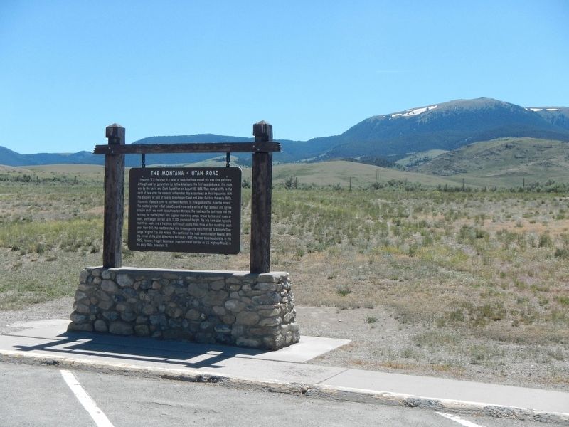
The Montana-Utah Road Marker
| 1 ► Montana, Beaverhead County, Dell — The Montana-Utah Road — |
| On Interstate 15 at milepost 35 near Red Rock Road. | |||
| 2 ► Montana, Beaverhead County, Dillon — "it was mutually advantageous..." — Lewis and Clark at Camp Fortunate — |
| On State Highway 324 near Interstate 15, on the left when traveling east. | |||
| 3 ► Montana, Beaverhead County, Dillon — A Tribute to Sidney Edgerton — Montana's Unsung Hero — |
| On Bannack Road near State Highway 278, on the left when traveling east. | |||
| 4 ► Montana, Beaverhead County, Dillon — Bannack — |
| On Bannack Road. | |||
| 5 ► Montana, Beaverhead County, Dillon — Bannack — |
| On Interstate 15 at milepost 55 near Rebich Lane, on the right when traveling south. | |||
| 6 ► Montana, Beaverhead County, Dillon — Bannack — |
| On MT 278 West, on the right when traveling north. | |||
| 7 ► Montana, Beaverhead County, Dillon — Bannack Historical District — |
| Near Bannack Road (State Highway 278), on the left when traveling east. | |||
| 8 ► Montana, Beaverhead County, Dillon — Beaverhead County World War II Memorial — |
| On North Montana Street (Business Interstate 15) at State Highway 91, on the left when traveling north on North Montana Street. | |||
| 9 ► Montana, Beaverhead County, Dillon — Beaverhead Rock — |
| On 41 near Diamond O Drive, on the right when traveling south. | |||
| 10 ► Montana, Beaverhead County, Dillon — Beaver's Head Rock: Native Road Sign — Lewis & Clark Seek the Shoshone — |
| On State Highway 41 near Diamond O Drive, on the right when traveling south. | |||
| 11 ► Montana, Beaverhead County, Dillon — City of Dillon City Hall — |
| On East Center Street at North Idaho Street, on the right when traveling north on East Center Street. | |||
| 12 ► Montana, Beaverhead County, Dillon — Clark Pocket Compass Monument — |
| Near Clarks Lookout Road west of State Highway 91. | |||
| 13 ► Montana, Beaverhead County, Dillon — Dillon City Hall Historic District — |
| On East Center Street near North Idaho Street, on the left when traveling south. | |||
| 14 ► Montana, Beaverhead County, Dillon — Dillon Implement Company — |
| On North Idaho Street at East Center Street, on the right when traveling north on North Idaho Street. | |||
| 15 ► Montana, Beaverhead County, Dillon — Dillon's Founding — 1880-1930 — |
| On E. Glendale Street at South Washington Street, on the right when traveling north on E. Glendale Street. | |||
| 16 ► Montana, Beaverhead County, Dillon — Distant Features — |
| On Clarks Lookout Road west of State Highway 91, on the right when traveling south. | |||
| 17 ► Montana, Beaverhead County, Dillon — Fortunate Camp — |
| On State Highway 324 near Interstate 15, on the left when traveling east. | |||
| 18 ► Montana, Beaverhead County, Dillon — Grasshopper Creek — |
| Near Bannack Road near State Highway 278, on the left when traveling east. | |||
| 19 ► Montana, Beaverhead County, Dillon — Hotel Andrus — 1917 — |
| On South Idaho Street at East Glendale Street, on the right when traveling west on South Idaho Street. | |||
| 20 ► Montana, Beaverhead County, Dillon — Lewis and Clark Pathfinder Tribute — |
| On South Montana Street, on the right when traveling south. | |||
| 21 ► Montana, Beaverhead County, Dillon — Mapping the Way — |
| On Clarks Lookout Road west of State Highway 91, on the right when traveling south. | |||
| 22 ► Montana, Beaverhead County, Dillon — Martin Barrett House — |
| On South Pacific Street at East Clark Street, on the right when traveling west on South Pacific Street. | |||
| 23 ► Montana, Beaverhead County, Dillon — Medicine Tree — This is a Sheepeater Shoshoni Medicine Tree — |
| Near South Montana Street near East Glendale Street, on the right when traveling east. | |||
| 24 ► Montana, Beaverhead County, Dillon — Nez Perce Camp — |
| Near Bannack Road. | |||
| 25 ► Montana, Beaverhead County, Dillon — Old Trail to the Gold Diggin's — |
| On Interstate 15 at milepost 55 near Rebich Lane when traveling south. | |||
| 26 ► Montana, Beaverhead County, Dillon — Reliable Landmarks — |
| On Clarks Lookout Road west of State Highway 91, on the right when traveling south. | |||
| 27 ► Montana, Beaverhead County, Dillon — Sacajawea — |
| Near State Highway 324 near State Highway 15, on the left when traveling west. | |||
| 28 ► Montana, Beaverhead County, Dillon — Southern Gateway Marker — (Ryan’s Canyon) — |
| On I-15. | |||
| 29 ► Montana, Beaverhead County, Dillon — The First Electric Gold Dredge — |
| Near Bannack Road near State Highway 278, on the left when traveling east. | |||
| 30 ► Montana, Beaverhead County, Dillon — The Lewis and Clark Expedition — |
| Near State Highway 324 near Interstate 15, on the left when traveling east. | |||
| 31 ► Montana, Beaverhead County, Dillon — William Clark — Map Maker — |
| On Clarks Lookout Road west of State Highway 91, on the right when traveling south. | |||
| 32 ► Montana, Beaverhead County, Grant — "Most Distant Fountain" of the Mighty Missouri — |
| Near Lemhi Pass Road near Forest Road 158, on the left when traveling south. | |||
| 33 ► Montana, Beaverhead County, Grant — The Beginning of the "Endless Missouri" — |
| Near Lemhi Pass Road near Forest Road 158, on the left when traveling south. | |||
| 34 ► Montana, Beaverhead County, Jackson — "Hot Spring Valley" — Land of 10,000 Haystacks — |
| Near State Highway 278 near Bull Creek Road, on the right when traveling south. | |||
| 35 ► Montana, Beaverhead County, Jackson — "I now take my leave..." — Clark Heads Toward the Yellowstone |
| On State Highway 278 near County Road 7482, on the right when traveling east. Reported damaged. | |||
| 36 ► Montana, Beaverhead County, Jackson — "The Carroll Ranch" — Stopping point for travelers & cattle drives — |
| On State Highway 278 near Bull Creek Road, on the right when traveling south. | |||
| 37 ► Montana, Beaverhead County, Jackson — A Soul-Searching Birthday — Questions about meaning, fulfillment & purpose — |
| Near State Highway 287 near Big Lake Creek Road, on the right when traveling south. | |||
| 38 ► Montana, Beaverhead County, Jackson — Naturally Sustained Productivity — Past, Present & Future — |
| Near State Highway 278 near Bull Creek Road, on the right when traveling south. | |||
| 39 ► Montana, Beaverhead County, Jackson — Undaunted Stewardship — Serving History and Enhancing the Environment & Economy — |
| Near State Highway 278 near Bull Creek Road, on the right when traveling south. | |||
| 40 ► Montana, Beaverhead County, Jackson — Welcome to Hamilton Ranch — Historic Landscapes Endure — |
| On State Highway 278 near Bull Creek Road, on the right when traveling south. | |||
| 41 ► Montana, Beaverhead County, Lima — Howdy Everyone! Glad to See You — |
| Near Bailey Street at Old US Highway 91 (Harrison Street), on the right when traveling east. | |||
| 42 ► Montana, Beaverhead County, Lima — The Montana Road — |
| Near Bailey Street at Old US Highway 91 (Harrison Street), on the right when traveling east. | |||
| 43 ► Montana, Beaverhead County, Lima — The Tendoy Mountains — |
| Near Bailey Street at Old US Highway 91 (Harrison Street). | |||
| 44 ► Montana, Beaverhead County, Polaris — The Way It Used To Be... Way Back — |
| On Pioneer Mountains National Forest Scenic Bywayt (Forest Road 73) near State Highway 278, on the right when traveling north. | |||
| 45 ► Montana, Beaverhead County, Wisdom — A Perfect Place to Rest — |
| Near Park Entrance Road near State Highway 43, on the left when traveling east. | |||
| 46 ► Montana, Beaverhead County, Wisdom — A Story of Fires... to be continued — |
| On State Highway 43 at May Creek Campground Road, on the right when traveling east on State Highway 43. | |||
| 47 ► Montana, Beaverhead County, Wisdom — Battlefield Landscape — |
| Near Park Entrance Road near State Highway 43, on the left when traveling east. | |||
| 48 ► Montana, Beaverhead County, Wisdom — Big Hole National Battlefield Monument — |
| On Park Entrance Road near State Highway 43, on the left when traveling north. | |||
| 49 ► Montana, Beaverhead County, Wisdom — Big Hole Valley — Land of 10,000 Haystacks — |
| On State Highway 278 near Big Lake Creek Road, on the right when traveling south. | |||
| 50 ► Montana, Beaverhead County, Wisdom — Brave Warriors — |
| Near Park Entrance Road near State Highway 43, on the left when traveling north. | |||
| 51 ► Montana, Beaverhead County, Wisdom — Natural Travel Corridor — On the Eve of Tragedy — Trail Creek — |
| On State Highway 43 at Bitterroot-Big Hole Road, on the left when traveling east on State Highway 43. | |||
| 52 ► Montana, Beaverhead County, Wisdom — Siege Site — |
| Near Park Entrance Road near State Highway 43, on the left when traveling east. | |||
| 53 ► Montana, Big Horn County, Busby — Rosebud Battlefield — |
| On State Highway 314. | |||
| 54 ► Montana, Big Horn County, Busby — Two Moons — |
| On U.S. 212, 0.2 miles south of Russell Lane, on the right when traveling south. | |||
| 55 ► Montana, Big Horn County, Crow Agency — 1984 Archeological Survey — Little Bighorn Battlefield — |
| On Little Bighorn Battlefield Road, on the right when traveling north. | |||
| 56 ► Montana, Big Horn County, Crow Agency — Bear Paw Memorial — |
| On Little Bighorn Battlefield Road, on the right when traveling south. | |||
| 57 ► Montana, Big Horn County, Crow Agency — Bear Paw Monument — 1881 — |
| Near Little Bighorn Battlefield Road, on the right when traveling south. | |||
| 58 ► Montana, Big Horn County, Crow Agency — Calhoun Hill — (Little Bighorn Battlefield) — |
| On Little Bighorn Battlefield Road. | |||
| 59 ► Montana, Big Horn County, Crow Agency — Calhoun Hill — Little Bighorn Battlefield — |
| On Little Bighorn Battlefield Road, on the right when traveling north. | |||
| 60 ► Montana, Big Horn County, Crow Agency — Cheyenne Warrior Markers — Little Bighorn Battlefield — |
| On Little Bighorn Battlefield Road. | |||
| 61 ► Montana, Big Horn County, Crow Agency — Chief Plenty Coups — Last Chief of the Crows — 1848 - 1932 — |
| On U.S. 212 at Frontage Road, on the right when traveling west on U.S. 212. | |||
| 62 ► Montana, Big Horn County, Crow Agency — Companies C & E — (Little Bighorn Battlefield) — |
| On Little Bighorn Battlefield Road. | |||
| 63 ► Montana, Big Horn County, Crow Agency — Companies F and I — (Little Bighorn Battlefield) — |
| 64 ► Montana, Big Horn County, Crow Agency — Crow's Nest — June 25, 1876 — Morning — |
| On U.S. 212, 1 mile east of Interstate 90. | |||
| 65 ► Montana, Big Horn County, Crow Agency — Custer Last Seen — (Little Bighorn Battlefield) — |
| On Little Bighorn Battlefield Road. | |||
| 66 ► Montana, Big Horn County, Crow Agency — Custer’s Advance — Little Bighorn Battlefield — |
| On Little Bighorn Battlefield Road, on the right when traveling south. | |||
| 67 ► Montana, Big Horn County, Crow Agency — Deep Coulee — Little Bighorn Battlefield — |
| On Little Bighorn Battlefield Road, on the right when traveling north. | |||
| 68 ► Montana, Big Horn County, Crow Agency — Deep Ravine — Little Bighorn Battlefield — |
| Near Little Bighorn Battlefield Road, on the right when traveling south. | |||
| 69 ► Montana, Big Horn County, Crow Agency — Deep Ravine — Little Bighorn Battlefield — |
| On Little Bighorn Battlefield Road, on the right when traveling north. | |||
| 70 ► Montana, Big Horn County, Crow Agency — Greasy Grass Ridge — Little Bighorn Battlefield — |
| On Little Bighorn Battlefield Road, on the right when traveling north. | |||
| 71 ► Montana, Big Horn County, Crow Agency — Here We Remember the Fallen — Custer National Cemetery at Little Bighorn Battlefield NM — |
| On Little Bighorn Battlefield Road, on the right when traveling south. | |||
| 72 ► Montana, Big Horn County, Crow Agency — Indian Encampment — Little Bighorn Battlefield — |
| On Little Bighorn Battlefield Road, on the right when traveling south. | |||
| 73 ► Montana, Big Horn County, Crow Agency — Indian Memorial — Little Bighorn Battlefield — |
| On Little Bighorn Battlefield Road, on the right when traveling north. | |||
| 74 ► Montana, Big Horn County, Crow Agency — Keogh – Crazy Horse Fight — Little Bighorn Battlefield — |
| On Little Bighorn Battlefield Road, on the right when traveling north. | |||
| 75 ► Montana, Big Horn County, Crow Agency — Lame White Man Charge — Little Bighorn Battlefield — |
| On Little Bighorn Battlefield Road, on the right when traveling north. | |||
| 76 ► Montana, Big Horn County, Crow Agency — Last Stand Hill, June 25, 1876 — Little Bighorn Battlefield — |
| On Little Bighorn Battlefield Road, on the left when traveling north. | |||
| 77 ► Montana, Big Horn County, Crow Agency — Little Bighorn Battlefield — |
| On Little Bighorn Battlefield Road, in the median. | |||
| 78 ► Montana, Big Horn County, Crow Agency — Little Bighorn Battlefield National Monument — |
| Near Interstate 90 at milepost 510 near U.S. 212. | |||
| 79 ► Montana, Big Horn County, Crow Agency — Little Bighorn Indian Memorial — |
| On Little Bighorn Battlefield Road, on the left when traveling north. | |||
| 80 ► Montana, Big Horn County, Crow Agency — Lone Tipi — June 25, 1876 — Approximately 2:00 p.m. — |
| Near U.S. 212, 1 mile east of Interstate 90. | |||
| 81 ► Montana, Big Horn County, Crow Agency — Medicine Tail Coulee — Little Bighorn Battlefield — |
| On Little Bighorn Battlefield Road, on the right when traveling north. | |||
| 82 ► Montana, Big Horn County, Crow Agency — Medicine Tail Coulee Ford — (Little Bighorn Battlefield) — |
| On Little Bighorn Battlefield Road. | |||
| 83 ► Montana, Big Horn County, Crow Agency — Medicine Tail Ford — Little Bighorn Battlefield — |
| On Little Bighorn Battlefield Road, on the right when traveling north. | |||
| 84 ► Montana, Big Horn County, Crow Agency — Memorial Markers — Little Bighorn Battlefield — |
| On Little Bighorn Battlefield Road, on the left when traveling north. | |||
| 85 ► Montana, Big Horn County, Crow Agency — National Cemetery — |
| On U.S. 212, 1 mile east of Interstate 90. | |||
| 86 ► Montana, Big Horn County, Crow Agency — Peace Through Unity — Little Bighorn Battlefield — |
| On Little Bighorn Battlefield Road, on the right when traveling north. | |||
| 87 ► Montana, Big Horn County, Crow Agency — Reno’s Retreat — Little Bighorn Battlefield — |
| On Little Bighorn Battlefield Road, on the right when traveling south. | |||
| 88 ► Montana, Big Horn County, Crow Agency — Reno’s Valley Fight — Little Bighorn Battlefield — |
| On Little Bighorn Battlefield Road, on the right when traveling south. | |||
| 89 ► Montana, Big Horn County, Crow Agency — Reno's Skirmish Line - Warrior Counterattack — June 25, 1876 — Approximately 3:00 p.m. — |
| Near U.S. 212, 1 mile Interstate 90. | |||
| 90 ► Montana, Big Horn County, Crow Agency — Retreat Crossing — June 25, 1876 — Approximately 4:00 p.m. — |
| Near U.S. 212, 1 mile east of Interstate 90. | |||
| 91 ► Montana, Big Horn County, Crow Agency — Seventh Cavalry Horse Cemetery — |
| Near U.S. 212, 1 mile east of Interstate 90. | |||
| 92 ► Montana, Big Horn County, Crow Agency — Sharpshooter Ridge — |
| Near U.S. 212, 1 mile east of Interstate 90. | |||
| 93 ► Montana, Big Horn County, Crow Agency — The Reno-Benteen Defense — June 25-26, 1876 — |
| Near U.S. 212, 1 mile east of Interstate 90. | |||
| 94 ► Montana, Big Horn County, Crow Agency — Timber Fight — June 25, 1876 — Approximately 3:15 - 3:55 p.m. — |
| Near U.S. 212, 1 mile east of Interstate 90. | |||
| 95 ► Montana, Big Horn County, Crow Agency — Weir Point — Little Bighorn Battlefield — |
| On Little Bighorn Battlefield Road, on the right when traveling north. | |||
| 96 ► Montana, Big Horn County, Crow Agency — Weir Point Fight — (Little Bighorn Battlefield) — |
| On Little Bighorn Battlefield Road. | |||
| 97 ► Montana, Big Horn County, Crow Agency — Wooden Leg Hill — June 25, 1876 — |
| Near U.S. 212, 1 mile east of Interstate 90. | |||
| 98 ► Montana, Big Horn County, Decker — General Crook's Troops — (Rosebud Battlefield/Where the Girl Saved Her Brother) — |
| Near Rosebud Road near State Highway 314, on the right when traveling west. | |||
| 99 ► Montana, Big Horn County, Decker — The Land Speaks — (Rosebud Battlefield/Where the Girl Saved Her Brother) — |
| On Rosebud Road, 1.5 miles west of State Highway 314. | |||
| 100 ► Montana, Big Horn County, Decker — The Time When The People Fought The Soldiers. — |
| Near Rosebud Road near State Highway 314, on the right when traveling west. | |||
2181 entries matched your criteria. The first 100 are listed above. Next 100 ⊳