Born in Virginia, George Boxley, first settler in Adams Township, Hamilton County, came to Indiana, as a fugitive from justice. Accused of helping slaves to escape and fomenting a slave rebellion in 1816 in Spotsylvania County, Virginia, Boxley . . . — — Map (db m216521) HM
We have uncovered multiple dwelling structures,
stockade walls, hearths, storage pits, middens
(trash pits), and thousands of artifacts. Many of the
material cultural items have long since decomposed,
but fragments remain.
Notice the . . . — — Map (db m163108) HM
The park's name evokes its natural prairie environment and pays homage to Native American people who once occupied this site. This unique
environment, nurtured by the White River, has served as an ecological and cultural crossroads throughout . . . — — Map (db m163111) HM
Although much of the day-to-day living was done outside of the home, the family home played an important role in the lives of Strawtown's early Native American communities. The family resided in the home and many of their food items and personal . . . — — Map (db m216812)
Community buildings, as the name implies, belonged to the community and served a different purpose and were larger than a single family home. Community buildings could have served as the meeting place for discussing issues within the tribe. These . . . — — Map (db m216807)
The Oliver Phase people once built a village here at Strawtown Koteewi Park. The Oliver Village site (A.D. 1200-1450) located at Strawtown Koteewi Park is thought to be the beginnings of the Oliver Phase peoples. Based on archaeological evidence, . . . — — Map (db m216817)
This stockade wall and ditch are representative of what was found at Strawtown Koteewi Park. The Oliver Village is often referred to as the Strawtown Enclosure because the village was "enclosed" by a stockade wall and ditch. The ditch was well . . . — — Map (db m216795)
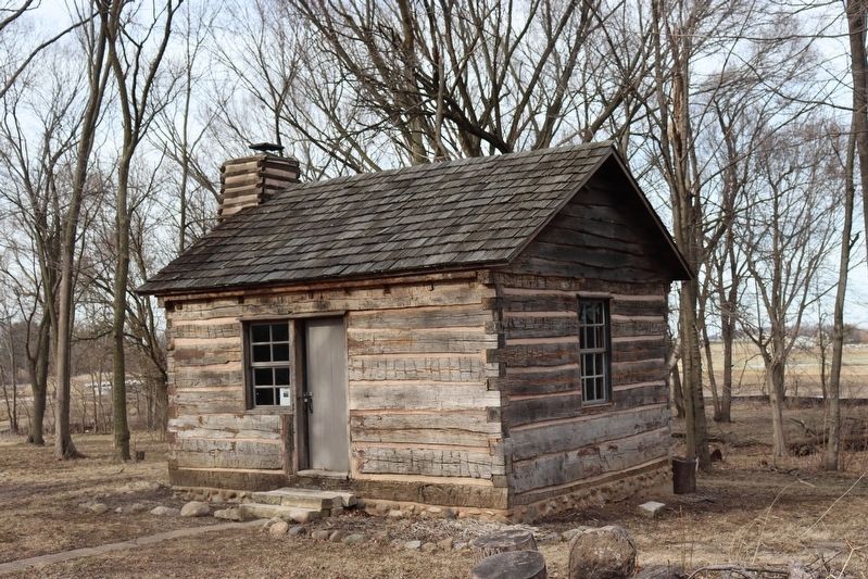
People from many interesting cultures made the area of Strawtown Koteewi Park their home. As you explore this exhibit you will see recreated structures from the Late Woodland time period. Although these structures are not exact replicas of the ones . . . — — Map (db m216792)
In 1837, an enslaved family of three escaped from Missouri; settled six miles north of here 1839 with name Rhodes. In 1844, Singleton Vaughn arrived at their home to claim them; family resisted until neighbors arrived. Vaughn agreed to take . . . — — Map (db m216703) HM
Hancock County created 1828. Named for first signer of Declaration of Independence. Agricultural County, near center of Hoosier State. First settled 1818 in Blue River Township. Greenfield chosen County Seat in 1829. “Green Fields” . . . — — Map (db m32230) HM
First burials date back to founding of Corydon 1808. Col. Thomas L. Posey, a public minded citizen, donated the original ground to the Town of Corydon for burial purposes. The Farquar family added a small addition and the remainder of the cemetery . . . — — Map (db m9718) HM
Plaque A At the dawn of the 1800’s,
Territorial Governor William Henry
Harrison rode horseback through
this valley and grew to admire the
serenity of its hills and streams,
and the intrepid determination of
its pioneer settlers. A . . . — — Map (db m137575) HM
Home of Governor William Hendricks 1822-1825 while he was Governor of Indiana. Front room was Governor's Headquarters. Hendricks was also Secretary of Constitutional Convention. House wa built 1817 by Davis Floyd, Territorial Auditor and Treasurer . . . — — Map (db m9711) HM
Organized 1808 from parts of Knox and Clark Counties. Named in honor of William Henry Harrison who owned land within the County and was Territorial Governor and later ninth President of U.S.
Fourth County formed in Indiana Territory. Original . . . — — Map (db m9750) HM
Oldest continuous County Fair existing in Indiana. First fair held Sept. 11 - 14, 1860. Citizens met jan. 1860, organized Harrison County Agricultural Society, adopted constitution which with amendments governs yet today. Ground purchased Mar. 1860 . . . — — Map (db m9634) HM
Shields, born 1769 in Virginia, served as a private for the entire Lewis and Clark Expedition from October 19, 1803 until October 10, 1806; one of its "Nine Young Men from Kentucky," he was a skilled gunsmith and blacksmith.
The Corps of . . . — — Map (db m9642) HM
Built 1817 - - Home of Col. Thomas Posey, son of Gov. Posey. Col. Posey (1792 - 1863) served as Treasurer of Harrison County; Cashier of Corydon Branch of the Bank of Vincennes; U.S. Military Pension Agent in Indiana; Adjutant General of Indiana; . . . — — Map (db m241643) HM
The story of Corydon begins the story of the State of Indiana.
Corydon lies in a valley between Big Indian and Little Indian creeks. The land had been purchased in 1804 by William Henry Harrison, who was then governor of the Indiana Territory. He . . . — — Map (db m207080) HM
In 1882 the four Bulleit brothers (J.J., V.H., A.L. and Paul) moved to Corydon from New Middletown and started a blacksmith shop, hardware store, and a farm implement store on this block. This building was constructed circa 1890 for a hardware store . . . — — Map (db m241751) HM
Four miles northwest, Squire Boone, wilderness scout, brother of Daniel, settled on Buck Creek in 1804. He built Harrison County's first mill. Squire Boone died in 1815. — — Map (db m126215) HM
Site of the first house erected in Knightstown, Indiana by Waitsel M. Cary In remembrance of him this tablet is given by his grandson Waitsel M. Heaton — — Map (db m241802) HM
Two-story hewn log structure
erected on this site 1824, by
George Barnard cost $247.00
Used until 1834, when
necessary to remove to
larger quarters — — Map (db m200356) HM
This site marks the early home of Judge Joshua H. Mellett Henry County Pioneer in whose memory Nellie Catherine Bundy Bailey his granddaughter dedicated this property in trust to The James Whitcomb Riley Memorial Association in its program of . . . — — Map (db m222229) HM
The Miami Indian village of Ma shock o mo was in this vicinity. Before 1848 the Miamis had sugar camps in the area, where they made sugar and syrup from the maple trees which were abundant. — — Map (db m235188) HM
In the early 1840s, trader David Foster brought his wife Elizabeth and their children to the banks of the Wildcat Creek. Subsequently, he donated 40 acres for a county seat which he built a doublewide log cabin as a trading post and his family home. . . . — — Map (db m200727) HM
Chicago businessman Paul Harris formed the first Rotary Club on Feb. 23, 1905. He named the club "Rotary" because members met in rotation at their various places of business. The Rotary Club of Kokomo received its charter in 1919, and The Rotary . . . — — Map (db m230669) HM
This stone marks the burial place of Kokomo, War Chief of the Miami Indians the former owners of the land along this river, and from whom this city derives its name.
In memory of the early pioneers and settlers of this region who lie in . . . — — Map (db m230883) HM WM
Lessel Long was a Huntington County pioneer, a Union soldier in the Civil War, and a prisoner of war at Andersonville prison (Camp Sumter) where 13,000 prisoners died. After the war he became a manufacturer and merchant in Andrews. In 1886 he . . . — — Map (db m76418) HM
Drover Town, the first addition south of the Little River was platted Aug. 22, 1857 by Henry Drover. It included about 20 of his 160 acres of woodland. Family first names were given to the streets. Additional subdivisions followed. Huntington's . . . — — Map (db m55693) HM
This city, township and county were named for Samuel Huntington, signer of the Declaration of Independence and important political figure in the Revolutionary War era. Records indicate the name was given by Elias Murray, Huntington's nephew, when he . . . — — Map (db m71299) HM
(Side One)
West Lee Wright laid out Medora 1853. Sample of local shale was made into brick “excellent for building and paving” 1904. Medora Shale Brick Company organized 1904. Construction began by 1910, one south of here . . . — — Map (db m74168) HM
10 O'Clock Indian
Treaty Line
Est. 1809 Inset.
Grouseland Treaty
Line Est. 1805 at
A Buried Stone (illegible)6 feet, N 4(illegible)
From This (illegible)
Indiana Centen-
ary Marker
Erected by the . . . — — Map (db m74057) HM
800 feet northwest is the point which marks the junction of the Grouseland Treaty line of 1805 with the Fort Wayne Treaty line of 1809. These and other treaties permitted early white settlement of Indiana. — — Map (db m74056) HM
On June 11, 1813, Col. Joseph Bartholomew, with Lieut. Col. John Tipton and Maj. David Owens as aides, and 137 mounted men of the Indiana Territorial Militia moved northward along this trail from Vallonia (Jackson county) through Tiptonia (now . . . — — Map (db m74073) HM
General Robert H. Milroy, 1816–1890, was appointed colonel of the 9th Indiana Infantry, later promoted to brigadier and major general. He saw extensive action in western Virginia. After the war he served as Indian agent in State of Washington. — — Map (db m2312) HM
Early Quaker settlement established 1836; center of Underground Railroad activity. Meeting house erected here, 1840, on land donated by Enos and Margaret Lewis; used by Congregational Friends, by Spiritualist society, as school, community hall; . . . — — Map (db m214984) HM
A Pennsylvanian who came to Indiana and established himself on the river site where in 1810 he laid out a town for the county seat of Jefferson County and named it Madison in honor of the then president. He was the first territorial representative . . . — — Map (db m195500) HM
Free blacks settled in Madison as early as 1820. The growing black community began businesses and organized churches and schools in this area, later called Georgetown. Risking their own freedom, some free black residents here actively aided slaves . . . — — Map (db m206726) HM
Jefferson County Courthouse [west side]Completed in 1855, the Greek Revival style brick and stone courthouse replaced a smaller octagon shaped courthouse that burned in 1853. In 1869 the roof was rebuilt with the steeper pitch . . . — — Map (db m181158) HM
John Paul [east side]"Colonel" John Paul, founder of Madison, was an energetic, imposing figure. In 1808, with Lewis Davis and Jonathan Lyons, he purchased 691.54 acres for the new town. In 1809 Paul and his family settled in a . . . — — Map (db m181000) HM
Walter Krueger, born in Prussia 1881,
raised in Madison, In
Attended Madison School System
Rose from a Private during the
Spanish-American War to Lt. General
Commanding the 6th Corps. of the Army in WW II.
Attended the Surrender . . . — — Map (db m22059) HM
The Underground Railroad was the path to freedom for slaves escaping bondage in the American South. Its conductors were men and women, both black and white, who aided freedom seekers on the road to liberty. For many freedom seekers, Madison was the . . . — — Map (db m206718) HM
Madison's history is filled with a wide variety of ethnic pioneers and settlers, including Jewish, Irish, German, French and African Americans, qualifying it as a true American melting pot. The first census of America taken in 1790 revealed that 77% . . . — — Map (db m206728) HM
Adam Kellar began constructing a stone mill race on Sand Creek, 1813, and opened grist mill, 1823. Mill was important to local economy and was an impetus for development: state road to mill established, 1834, and Brewersville founded, 1837. . . . — — Map (db m73975) HM
Territorial Governor, William Henry Harrison, in a treaty with Indians held at Vincennes, secured lands which for the first time opened the entire north bank of the Ohio River for settlement. — — Map (db m45881) HM
Jennings County, formed 1816, named in honor of Jonathan Jennings: territorial delegate to Congress, 1809-1816; president of Indiana Constitutional Convention, 1816; first governor of state, 1816-1822; member of United States House of . . . — — Map (db m45807) HM
This site was originally the burial place for Nancy
Kerlin Barnett (1793-1831), an early Johnson County
pioneer who moved to Blue River Township with
her husband William Barnett (1786-1854). She asked
to be buried overlooking Sugar Creek, . . . — — Map (db m237777) HM
What once was a cow path became a muddy plank road later named the Two Cent Road for the toll charged. A gravel route, it angled southwest across Three Notch Road, a wilderness trail blazed by Indians who marked it slashing three . . . — — Map (db m66741) HM
- - - - 1826 - - - -
Built by James Thompson and Isaac Collier.
1850 - Thompson erected larger four-story brick mill. All flour used by Union Army during Civil War ground here.
After a fire in 1872, John A. . . . — — Map (db m66784) HM
In 1824, settler Simon Covert led Thomas Henderson to Big Spring. A church, school and cemetery were envisioned to the south. Henderson outwitted a man seeking this spring site for a whiskey distillery. His family, vanguard of anti-slavery . . . — — Map (db m66766) HM
1831 - - - 1931
Big Spring
Center of
Hopewell Settlement
This building erected by John Hoefgen, in memory of the early settlers, his Mother, Eliza Demott Hoefgen, and Uncle, Albert List, long an Elder in the . . . — — Map (db m66768) HM
A two room log cabin was built on or near this site in March, 1823 by George King, by whose efforts Johnson County was authorized Dec. 31, 1822 and organized March 8, 1823. King donated land for the county seat and Franklin was founded May 22, 1823. . . . — — Map (db m66838) HM
Founded in 1823, is the home of Franklin College, 1834 and the birthplace of two Indiana governors, Paul V. McNutt, 1891, at 599 E. Adams and Roger D. Branigin, 1902, at 205 Yandes. Johnson County Historical Museum at 150 W. Madison, Indiana Masonic . . . — — Map (db m236562) HM
Franklin Township High School served this community as the first public school with grades one through twelve.
Although fire destroyed the building in December 1932, fire did not destroy the burning desire for education that had been . . . — — Map (db m66758) HM
1855 - - - 1889
To commemorate the Ideals and Services of the Old Hopewell Academy and the faithful labors of the Teachers who here through many years brought to the youth of this community inspiration for life . . . — — Map (db m66763) HM
Founder and proprietor of Franklin,
IN. Leader in the establishment of
Johnson County, 1822. Founder of
the First Presbyterian Church, Postmaster, Justice of the Peace and
benefactor of Franklin College as
donor of its original site and . . . — — Map (db m221851) HM
Greenwood was founded Sept. 30, 1823. The original land owners, who were descendants of Dutch immigrants, came from Mercer County, Kentucky. A log cabin was built on or near this site by John B. and Jane Brewer Smock. The first church (Presbyterian) . . . — — Map (db m69294) HM
Presbyterians formed the first church in Greenwood on Dec. 31, 1825, and erected the first church building in Johnson County on or near this site in early 1826. The meeting house and surrounding cemetery occupied two acres of land that were donated . . . — — Map (db m69295) HM
By 1832 neighbors were using this site for family burials.
October 31, 1851, Francis and Rachel Dobbins in consideration of $18 deeded to Hiram Henry, Bethany Presbyterian - Conrad McClain, Hurricane Baptist - Oliver Harbert, Rocklane . . . — — Map (db m69327) HM
Laid out October 31, 1835, as Union Village, Willis Deer and Corbin Utterback, proprietors. Town originated from an early trading point. Providence P. O. Established on June 17, 1880. — — Map (db m66743) HM
First settlement, 1808-1812,
of a religious society of
celibates known as Shakers.
The four hundred members
of this communal group
occupied 1,300 acres seven
miles west of Carlisle. — — Map (db m226327) HM
Site of print shop where
Elihu Stout (1782 - 1860),
Past Grand Master of Masons
in Indiana, established
Indiana Territory's first
newspaper, summer 1804.
Originally The Indiana Gazette,
it was renamed The Western Sun
July 4, 1807. — — Map (db m23277) HM
At historic Vincennes the first Lodge of Freemasons in the present State of Indiana was established, 1809, by the Grand Lodge of Kentucky. Since 1818 it has worked under Indiana charter as Vincennes Lodge No. 1. — — Map (db m61836) HM
On July 4, 1800, the western part of the
Northwest Territory became the Indiana Territory.
It covered land that would eventually be included
in the present states of Indiana, Illinois, Michigan,
Wisconsin, and Minnesota.
Vincennes, on the . . . — — Map (db m23266) HM
Born in Switzerland, Badollet migrated to America in 1780. President Jefferson appointed him Land Registrar of Vincennes in 1804. He served as a delegate to the Indiana Constitutional Convention in 1816, was a charter member Vincennes University . . . — — Map (db m186640) HM
The larger millstone is made from French Buhr cut into wedge-shaped pieces and bound together by a heavy metal loop. A “stand” is made of two similar stones, the “upper stone” rotating on the “nether stone” to . . . — — Map (db m23275) HM
Home of French fur trader Michel Brouillet (1774-1838). French Creole cottage (built circa 1806) is typical of "posts-on-sill" construction technique used by French settlers in Mississippi Valley during eighteenth and early nineteenth centuries. . . . — — Map (db m243614) HM
Through the Patriotism of Charles Gratiot in furnishing material aid, Colonel George Rogers Clark was enabled to keep his forces intact and thus to recapture Fort Sackville in 1779.
Erected in grateful memory by the Huguenot . . . — — Map (db m23305) HM
First resident Presbyterian minister in Indiana Territory, 1808. Headed the first school under the authority of the board of trustees of Vincennes University (a grammar school), 1811-1815. Served as member of board of trustees of Vincennes . . . — — Map (db m48966) HM
(front of statue):
Lt. Francois Marie Bissot
Sieur De Vincennes
June 17 1700 - March 25 1736
Founder of Vincennes
1732
(plaque on rear base of statue):
Sieur De Vincennes sculpture by Bill Wolfe
dedicated . . . — — Map (db m176253) HM
The second State Bank, chartered in 1834,
was a successful and stable venture in
uncertain times. John Ewing of Vincennes
was a leader in its creation.
This branch was built by John Moore
by 1838, saved by the Francis Vigo Chapter,
DAR, . . . — — Map (db m23282) HM
In 1805 Transylvania Presbytery, Kentucky on petition of pioneer settlers in Knox County sent Rev. Thomas Cleland, who thus became the first Presbyterian minister to preach in Vincennes. The service was held at the Council House in the Indian . . . — — Map (db m61838) HM
(inscription on frieze)
George Rogers Clark
and the Frontiersmen
of the American Revolution
The Conquest of the West
(left panel near staircase):
The site of
Fort Sackville
Captured from the British
by George . . . — — Map (db m176259) HM WM
Contains the graves (mostly unmarked) of some 4,000 inhabitants of early Vincennes, including soldiers and patriots of the American Revolution who helped Colonel George Rogers Clark to capture nearby Fort Sackville in 1779. The cemetery marks the . . . — — Map (db m176258) HM
Although the Wabash River begins in Ohio, its 475-mile length in Indiana makes it a thoroughly Indiana river. The Miami Indian tribes named it Wah-Bah Shik-Ki which roughly translates as "pure white" and comes from the white limestone riverbed as . . . — — Map (db m176200) HM
After taking Kaskaskia on July 5, 1778, George Roges Clark, Acting under Virginia authority, sent Father Pierre Gibault, as his envoy, to Vincennes. Gibault convinced the villagers there to take an oath of loyalty to the Americans. In early August, . . . — — Map (db m176262) HM
Marker Plaque Vincennes University was founded in 1801 as Jefferson Academy by William Henry Harrison, Governor of the Indiana Territory and Chartered by the Indiana Territorial Legislature in 1806. The columns of this gateway served as the . . . — — Map (db m23276) HM
Harrison became Governor of Indiana Territory 1800; he administered government of District of Louisiana 1804-1805. In Vincennes, he served as a contact during the expedition; surviving records document his support and his involvement in decisions . . . — — Map (db m23251) HM
Grinding stones from gristmill of Levi Lee, founder of the town of Leesburg. The mill was located in Section 21, Twp. 33N., Range 6E., 2½ mi. S/E of Leesburg on the Tippecanoe River. — — Map (db m72523) HM
This park was named for Samuel Crosson co-founder of Syracuse. In 1834, Samuel Crosson and Henry Ward built the first mill in the county on this site. The mill was destroyed by high water in 1837. The state constructed a cement dam in 1921. Eli . . . — — Map (db m73208) HM
Indians formerly wrapped their dead and secured them in the trees here. At the time of white settlement the wrappings were disintegrating and the bones were falling to the ground. — — Map (db m44937) HM
1837—1937
One hundred years ago, the last tract of land owned by the Miami Indians, who inhabited this territory, was turned over to the government. All titles to land in this vicinity date back to 1837.
This stone commemorates . . . — — Map (db m72590) HM
Samuel Crosson and Henry Ward came to this area in July 1835 and established a grist mill and sawmill on Turkey Creek. They founded Syracuse 11 August 1837. Crosson died at the age of 49 years. The burial site of Henry Ward is unknown. — — Map (db m74874) HM
This third county jail, including a sheriff’s residence, was built in 1870 by Richard Epperson. Chicago architect, George O. Garnsey designed it in Neo-Gothic Style. Rusticated stonework and turrets create the appearance of a small castle to provide . . . — — Map (db m1625) HM
Methodism in Warsaw dates from 1838 when Rev. Richard Hargrave preached in a tamarack pole cabin located at the S.E. Cor. of Center & Hickory Sts. It was followed by a mission, with Rev. Thomas P. Owen, Missionary-in-charge, which for several . . . — — Map (db m195380) HM
The Fourier System of communal living was attempted here between 1843 and 1848. Approximately thirty families lived by rules established in councils of industry, commerce, justice and education. Their "new social order" was a failure. — — Map (db m44878) HM
Large Potawatomi village and first white settlement were here. Lima Twp. had first white settler in county, first white child born, first public school, and first commissioned twp. high school in Indiana. — — Map (db m212714) HM
The Centennial Stone was erected in 1936 to commemorate the one hundredth anniversary of the founding of the Town of LaGrange on June 13, 1836.
LaGrange County was established by act of the Indiana Legislature in 1832, sixteen years . . . — — Map (db m53909) HM