On Maple Street (Massachusetts Route 62), on the right when traveling west.
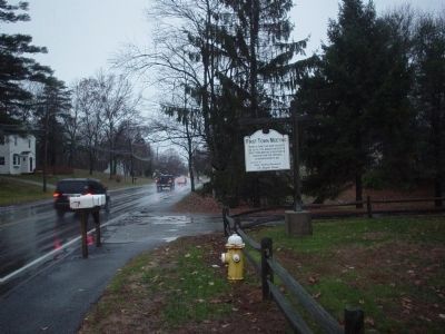
Under a giant oak near this spot on July 9, 1728, Middleton held its first town meeting & received its charter from the province of Massachusetts Bay — — Map (db m48472) HM
On High Street (Massachusetts Route 113) at High Street & Jefferson Street when traveling east on High Street.
First ferry across the Merrimack river from Newbury to Salisbury, established about 1639, and the only route from Boston to the eastern frontier. In 1641 George Carr was appointed ferryman with rights which continued in his family for generations. — — Map (db m47972) HM
On High Street (Massachusetts Route 113), on the right when traveling east.
On this site dwelt Edward Rawson, secretary of the bay colony for thirty-six years, deputy to the General Court for twelve years, elected clerk of the House of Deputies in 1645, he died in Boston 1693. — — Map (db m47984) HM
Near this spot was "Watts Cellar," a landmark before the settlement of Newbury in 1635. An excavation used for the storage of fish by fishermen who visited the New England coast. — — Map (db m47985) HM
On Mt. Pleasant Street (Massachusetts Route 127A) at Main Street, on the right when traveling north on Mt. Pleasant Street.
Named from a bear caught by the tide and killed in 1700. Commercial and shipbuilding center of Rockport for 160 years. First dock built here 1743. Sandy Bay Pier Company organized 1809. Site of Stone Fort and Sea Fencibles Barrack during War of 1812. — — Map (db m48007) HM
On Main Street at Highland Street, on the right when traveling south on Main Street.
Here stood the cabin of Richard Tarr founder of the Tarr Family on Cape Ann. He came to Marblehead in 1680, then settled in Sacco, Maine. Driven thence by Indians, he became the first settler of Sandy Bay (Rockport) in 1690. — — Map (db m48008) HM
On Main Street (Massachusetts Route 1A) south of Summer Street, on the right when traveling north.
Near this spot, their graves unmarked, lie buried
Maximilian and Joseph Jewett
sons of
Edward and Mary (Taylor) Jewett
of Bradford England
They came over in 1638 in the Company led by
Rev. Ezekiel Rogers
which settled the . . . — — Map (db m115313) HM
On Main Street (Alternate Massachusetts Route 1), on the right when traveling north.
The burial ground set apart at the settlement of the
town of Rowley in 1639. Here
are buried Ezekiel Rogers,
Samuel Phillips, Samuel
Shepard, Edward Payson and Jedediah Jewett, the earliest
ministers of the town, and
nearly all the original . . . — — Map (db m115314) HM
Near Derby Street just west of Palfrey Court, on the left when traveling east.
These quiet backyards of historic houses once formed a neighborhood—and a history—all their own.
For a hundred years, a cluster of flats and tenements lined a 200 foot dead-end alley called Custom House Place. Though predominantly Irish in . . . — — Map (db m186240) HM
The Derby House is the oldest brick house still standing in Salem, and one of the finest examples of Georgian colonial architecture in the United States.
Merchant and fleet-owner Richard Derby built the house in 1762 as a wedding present for . . . — — Map (db m62546) HM
On Essex Street just east of North Pine Street, on the right when traveling west.
The Friends Burying Ground is Salem's third oldest and smallest cemetery. Its earliest existing gravestone is dated 1702 for Cestofor Foster. Members of the locally well-known Southwick family are also buried here. On this site in 1718 the Religious . . . — — Map (db m197170) HM
On Charter Street, on the right when traveling east.
Tomb •
Tomb •
Jonathan Ward
Lib'N Harvard College •
Nathaniel Silsbee •
Mary Corry
First Wife Of Ciles Corry
Of Witchcrait Times
1684 •
Mary Cromwell
1683 •
Doraty Cromwell
The Oldest Stone
1673 •
1781 Benjamin . . . — — Map (db m220842) HM
This house, formerly located at 10 Liberty Street, was once the home of Mormon pioneer and local church leader Nathaniel Henry Felt (1816-1887).
Born and raised in Salem, Nathaniel and his brother John ran a tailoring business at 217 Essex . . . — — Map (db m33724) HM
The modest house in front of you is one of the oldest in Salem. Built here in 1672, the Narbonne House is also one of America’s few surviving middle-class homes of the 1600s.
The builder and first owner was a”slaughterer,” or butcher, Later, . . . — — Map (db m62543) HM
On Brown Street at Washington Square, on the left when traveling east on Brown Street.
“I was a means, through grace assisting me, to stop the flight of those few that then were here with me, and that by my utter denial to go away with them, who would have gone either for England, or mostly for Virginia.” — — Map (db m230547) HM
On St Peter Street, on the right when traveling north.
The first congregation of the Church of England gathered in Salem in 1626. Driven underground by the puritans, it re-emerged in 1733 as Saint Peter's Parish, built on land given by Philip English, one of the accused Salem witches. Just before the . . . — — Map (db m47989) HM
Near Derby Street, 0.3 miles south of Orange Street. Reported missing.
If Salem was once a prosperous world seaport, it was not due to the geography of the harbor, but to the enterprise of her seamen, tradesmen, and merchants.
Unlike other major ports such as New York, Salem Harbor had no major river to link it . . . — — Map (db m86541) HM
On Derby Street, on the right when traveling east.
Welcome to Salem Maritime National Historic Site. The site was established in 1938 to preserve the wharves and historic buildings associated with Salem's contributions to the economic development of the young United States.
From its founding in . . . — — Map (db m86459) HM
On Congress Street at Peabody Street, on the right when traveling south on Congress Street.
Salem's Point neighborhood was originally known as Stage Point for wooden fish-drying “stages” along the peninsula.
Stage Point was a center for Salem’s early maritime business, and key to her historic economic development.
. . . — — Map (db m115319) HM
Near Derby Street, 0.2 miles south of Orange Street. Reported missing.
In the late 1700s and early 1800s Salem’s ships reached out to the world. From this wharf alone between 1785 and 1799, shipowner Elias Hasket Derby dispatched 170 trading vessels on pioneering voyages to China, India, the East Indies, and the . . . — — Map (db m86538) HM
Near Derby Street, on the right when traveling east.
If you visited Salem’s waterfront in the late 1700s or early 1800s you would have been impressed not only by the ships and their exotic cargo, but also by the variety of artisans and craftsmen who worked on the wharf. Sail makers, riggers, rope . . . — — Map (db m220594) HM
On Lafayette Rd. at Beach Rd., on the right when traveling north on Lafayette Rd..
Near by stood the house built in 1639 by Robert Pike, a leader in civil and military affairs who represented Salisbury for thirty-seven years in the general court. — — Map (db m75590) HM
On Lafayette Road (U.S. !) 0.2 miles Pike Street (Massachusetts Route 286).
Early name Colchester settled in 1638. Name changed to Salisbury in 1640 in compliment to its Puritan clergyman William Worcester of Salisbury, England. — — Map (db m77223) HM
A ringing anvil and glowing forge were signals that the blacksmith was working. The skill, stamina, and strength of the blacksmith played an important role in constructing machinery and maintaining the ironworkers' equipment. Using simple tools and . . . — — Map (db m86452) HM
Ore, charcoal and rock called gabbro for flux were hauled to this site, and a drying fire was started in the furnace. Within a day or two the water wheels and bellows were set in motion, and the “blast”, once begun, would burn . . . — — Map (db m86192) HM
The discovery of a navigable river at a site which also offered timber and flowing water for power was cause for company investors and site planners to celebrate. Improved roads to this remote area did not exist in the 1600s. Transportation to the . . . — — Map (db m86451) HM
A furnace at full blast kept founders preparing to receive up to a ton of molten liquid iron. Crucible contents were checked frequently and slag impurities that float on top of the heavier molten iron were removed. All preparations had to be . . . — — Map (db m86454) HM
At the forge, porous and brittle cast iron was changed into tough, strong, flexible wrought iron. To the sounds of four water wheels turning, the bellows flapping, and the ground-shaking thump of the power hammer, men toiled to make wrought-iron . . . — — Map (db m86349) HM
On Monument Avenue at Elmwood Road, on the left when traveling north on Monument Avenue.
Elihu Thomson House
Has Been Designated A
National
Historic Landmark
This Site Posesses National Significance
In Commemorating the History of The
United States Of America
1976
National Park Service
United States Department of the . . . — — Map (db m36774) HM
On Howlett Street, on the right when traveling north.
Parson Capen House
has been designated a
National Historc Landmark
This site possesses national signficance
in commemorating the history of the
United States of America — — Map (db m47177) HM
On Boston Street (U.S. 1) at High Street (Massachusetts Route 97), on the left when traveling north on Boston Street. Reported missing.
One half mile west of here is the Parson Capen House. Built in 1683 for the minister and a fine specimen of domestic architecture of the Puritan century. Now the home of the Topsfield Historical Society. — — Map (db m82375) HM
On Main Street (State Highway 1A), on the right when traveling west.
This stone marks the site of
Peter Hill
on which about the year 1638
Reverend Hugh Peter
Pastor of the church in Salem
preached the first sermon in
Wenham
Text from John III.23
"In enon near to Salim because there was . . . — — Map (db m48730) HM
On Main Street (Alternate State Highway 1), on the right when traveling west.
Settled about 1636, called
Enon "Because there was much
water there" (St. John III, 23).
Set off from Salem and name
changed to Wenham 1643 — — Map (db m47221) HM
Settled about 1636, called Enon, "Because there was much water there" (St. John III, 23). Set off from Salem and name changed to Wenham 1643. — — Map (db m48728) HM
On Baileys Lane north of Main Stret (Massachusetts Route 113), on the right when traveling north.
Birthplace of Jacob Bayley, born July 19, 1726. He made a settlement in Vermont on the oxbow of the Connecticut River in 1762, naming it for the place of his birth. — — Map (db m155512) HM
On Northfield Road (U.S. 10), on the right when traveling west.
Built in 1740 on this site. The first Proprietor's Meeting in Fall Town was held here in 1741. The Lieutenant's son Eliakim was shot by Indians in 1747 while working west of the fort walls. — — Map (db m48011) HM
On Old Main Street south of Broughams Road, on the right when traveling south.
Museum admission tickets available at the Visitor Center.
• Built 1734, with alterations.
• Home of Deerfield's second minister.
• Furnishings of the Connecticut River Valley elite. — — Map (db m230672) HM
On Memorial St, 0.1 miles east of Old Main St, on the right when traveling west.
Benjamin Barrett
-Carpenter -
Born 1653 – Died 1690
Soldier with Captain Turner 1676
Settled on Plum Tree Plain Deerfield 1684
Owner of this home Lot No. 27 when he died 1690
This memorial is erected by his lineal . . . — — Map (db m141120) HM
On Old Main Street south of Broughams Road, on the right when traveling south.
Cato, c. 1737 - 1825, son of Jin Cole, enslaved as a child in this house.
Jin Cole, c. 1723 - 1808, captured in Africa at age 12, enslaved in this house.
Titus, 1751, enslaved in this house. — — Map (db m230670) HM
On Main St at Old Main Street, on the left when traveling west on Main St.
Where Mohawk struck Pocumtuck pride,
Sentinel stalks of Indian corn
Still guard the Meadow of our world:
The sad silence of grass-grown graves
A frontier home on the falling ridge
And a cold gray February dawn.
All of America . . . — — Map (db m141333) HM
On Albany Rd at Old Main Street, on the left when traveling north on Albany Rd.
Feb 29, 1703-4
The unfortified house of Benoni Stebbins
standing on this lot was held by
7 men besides women and children
for three hours
against the assault of 200 soldiers
and the wiles of 140 Indians.
under a French . . . — — Map (db m141156) HM
On Memorial St, 0.1 miles east of Old Main St., on the right when traveling west.
Godfrey Nims
Ancestor of All of the
Name of Nims
Settled in Deerfield 1674
Fought under Capt. Turner 1676
Bought this Home Lot 1692
His House Burned, His Wife
and Seven Children Captured
or Killed by Indians in 1704.
This New . . . — — Map (db m141115) HM
On Old Main St, 0.3 miles north of Albany Rd, on the left when traveling north.
The Village of Deerfield is an old settlement on an ancient site.
The Mile-long street before you was originally a Native path. Ancestors of the Pocumtuck, an Algonquin people, lived here in their homeland for at least 8,000 years, . . . — — Map (db m141346) HM
On Old Main St, 0.1 miles north of Albany Rd when traveling north.
John Sheldon 1658 - 1733
Hannah Stebbins 1664 – 1704
Married Nov 5 1679
The Home Of John Sheldon Was On This Lot
Here Feb 29 1704 His Wife And One Child Were Killed
And Four Children Were Taken Captive
By The . . . — — Map (db m143814) HM
On Old Main St, 0.2 miles south of Broughtons Pond Rd, on the left when traveling south.
This Marks the Home Lot where
John Stebbins
Grandson of Rowland the Emigrant
A Permanent Settler of 1652
Lived and Died
__________
A Soldier under Capt. Lothrop
The Only Man Known who Escaped Unhurt
At the Bloody Brooke . . . — — Map (db m141336) HM WM
On Memorial St, 0.1 miles east of Old Main St, on the right when traveling west.
Memorial Hall
Built in 1798
Occupied as Deerfield Academy
Until 1878
Dedicated in 1880 to the
Preservation of the Record of
Early Days in New England
by the
Pocumtuck Valley Memorial Association
This Tablet is Erected on . . . — — Map (db m141125) HM
Near Old Main Street north of Academy Lane, on the left when traveling north.
The interplay of people and nature has shaped this place for generations.
The living things that populate our landscape are part of a continual process of change. Long ago, the Pocumtuck cleared forests of underbrush and set controlled . . . — — Map (db m230720) HM
On Greenfield Road (U.S. 5) north of Main Street, on the right when traveling north.
Indian land called Pocomtuck, settled by men from Dedham in 1671. Attacked by Indians, burnt, and abandoned in 1675. Reoccupied and attacked in 1704 by French and Indians, who took 47 lives, and carried off 112 captives to Canada, of whom 60 were . . . — — Map (db m48012) HM
On Old Main Street near Wells Street, on the left when traveling north.
Indian land called Pocomtuck, settled by men from Dedham in 1671. Attacked by Indians, burnt, and abandoned in 1675. Reoccupied and attacked in 1704 by French and Indians, who took 47 lives, and carried off 112 captives to Canada, of whom 60 were . . . — — Map (db m48773) HM
On Old Main St, 0.2 miles north of Albany Rd, on the left when traveling north.
Old Deerfield Village
has been Designated A
Registered National
Historic Landmark
Under the provisions of the
Historic Sites Act of August 21, 1935
this site possesses exceptional value
in commemorating and illustrating
the . . . — — Map (db m141339) HM
On Albany Road at Old Main Street, on the left when traveling north on Albany Road.
Site of the
Old Indian House
Built by
Ensign John Sheldon 1698
It stood for 144 years
testifying to the tragedy of
Feb. 29, 1703
its stout door
which kept at bay
the French and Indians
13 now safe in Memorial Hall . . . — — Map (db m141341) HM WM
On Main St, 0.1 miles north of Albany Rd, on the right.
Erected In Memory of
Quinton Stockwell
and his wife
Abigail Bullard Stockwell
It was in their house, which stood on
this spot, that the Stockwells boarded
the Reverend Samuel Mather during the
earliest days of . . . — — Map (db m147359) HM
On Old Main St, 0.1 miles south of Albany Rd, on the right when traveling north.
In Memory Of
Rev. Samuel Mather. M.A.
Pioneer Minister of Deerfield 1673 – 75.
Who lived in a house on this site.
Born at Dorchester, 1650. Graduated Harvard College 1671.
Married Hannah, Daughter of Governor Robert Treat
Of . . . — — Map (db m141956) HM
On Old Main Street south of Broughams Road, on the right when traveling south.
Built by John Sheldon 1739. Handed down from sire to son to the present owner.
The longest holding of state in Franklin County. — — Map (db m230688) HM
On Old Main Street north of Academy Lane, on the right when traveling north.
Historic Deerfield is a museum of early New England history and the arts located within one of New England's most historic villages. Visitors come here to tour our museum collections and the carefully preserved old houses in which they are . . . — — Map (db m230732) HM
On Riverview Drive just south of Pine Street, on the right when traveling south.
Riverside Village Historic District has been placed on the National Register of Historic Places in 2017 by the United States Department of the Interior — — Map (db m230570) HM
On Main St. (Massachusetts Route 2A) at US5 & Hwy 2A, on the right when traveling east on Main St..
Settled 1686 by Deerfield residents, incorporated 1753 & made county seat 1811. A major industrial & commercial center at crossroads of major North/South & East/West transportation routes. Home of first American cutlery factory & world's largest tap . . . — — Map (db m59927) HM
On East Hawley Road, on the right when traveling north.
Site of the First Church of Hawley
Erected 1793
Reverend Jonathan Grout 1st Pastor
This memorial placed by the
sons and daughters of Hawley
August 10, 1935 — — Map (db m25876) HM
On Wheeler Avenue at E Road, on the right when traveling north on Wheeler Avenue.
Used to hold stray farm animals until claimed by their owners. A fee was paid for their release. Most colonial towns had a pound; this is one of very few still standing. — — Map (db m73551) HM
On South Maple St., on the right when traveling north.
Site of First Permanent Settlement in Shelburne, Mass. 1760 Martin Severance 1718 - 1810 Scout in French and Indian Wars Scout with Rogers Rangers Revolutionary soldier Marked by Dorothy Quincy Hancock Chapter, Daughters of the American . . . — — Map (db m59639) HM
On Pvt Szot Drive south of Front Street, on the right when traveling south.
Upper Plaque They, too, wanted only to live by the side of this Park and be a friend to man. Instead, off to war they went, by their sense of duty sent, in response to pleas, of peoples, forced to their knees. Some gave all they had others did . . . — — Map (db m56054) WM
The massive building ahead served as Springfield Armory's Main Arsenal, a storage facility for the weapons manufactured here. Constructed between 1847 and 1850 during the term of Commanding Officer James W. Ripley, the building dominated the site . . . — — Map (db m107082) HM
Old First Church has been located in Court Square since the 17th century. It was the twentieth parish formed in the Massachusetts Bay Colony, and was gathered in 1637, the year after Springfield was founded. The first meetinghouse was erected just . . . — — Map (db m158499) HM
In the spring of 1636, a small band of early settlers from Roxbury, Massachusetts ventured up the Connecticut River to settle in Springfield, then known by its Indian name of Agawam. Together they executed an agreement which in part reads: "Wee . . . — — Map (db m158500) HM
On Mountain Road at Skinner State Park Road on Mountain Road.
The park’s westernmost peak, Mt Holyoke, was the site of North America’s first summit house (1821) and the state’s first mountain tramway (1854). Located in the towns of Hadley, South Hadley, Amherst, Belchertown, and Granby, the two parks were . . . — — Map (db m65741) HM
On Bridge Street (Massachusetts Route 9) at Parsons Street, on the right when traveling west on Bridge Street.
In 1660 Medad Pomeroy accepted an offer of tools, an anvil shaped like this replica, and land in exchange for opening a blacksmith shop in Northampton. That anvil was passed through many generations of Pomeroy blacksmiths becoming a symbol of the . . . — — Map (db m194966) HM
On Bridge Street (Massachusetts Route 9) at Pomeroy Terrace, on the left when traveling west on Bridge Street.
Pomeroy Terrace Historic District has been placed on the National Register of Historic Places in 2018 by the United States Department of the Interior — — Map (db m194970) HM
On Jason Street, on the right when traveling south.
Built by Martha, widow of William Russell, about 1680. Occupied until 1890 by her descendants, of whom Jason Russell lost his life in the conflict of April 19, 1775. — — Map (db m43052) HM
On Massachusetts Avenue at Lowell Street, on the right when traveling west on Massachusetts Avenue.
In this neighborhood “The Foot of the Rocks” Henry Wellington, a commissioned officer of the War of 1812-14, and his wife Eliza Teele, natives of this town, made their home in 1819; in honor of his parents, and ancestors, this memorial . . . — — Map (db m18615) HM
On Massachusetts Avenue (U.S. 3) at Mystic Street (Massachusetts Route 60), on the right when traveling west on Massachusetts Avenue.
“Uncle Sam” The birthplace of Samuel Wilson once stood near the main crossroad of the Northwest parish of Cambridge, the center of the district known as Menotomy. Wilson, born on September 13, 1766, was only eight when . . . — — Map (db m45243) HM
On Massachusetts Avenue (Massachusetts Route 2A) at Linnaean Street, on the right when traveling south on Massachusetts Avenue.
At Number 21 Linnaean Street is the Cooper-Austin House built in 1657 at what was then the northern end of the Cambridge Cow Common, by John Cooper, selectman, town clerk, and deacon of the church. — — Map (db m43049) HM
On Gerry's Landing Road at Greenough Boulevard on Gerry's Landing Road. Reported missing.
Here at the river’s edge the settlers of Watertown led by Sir Richard Saltonstall landed July 30, 1630.
Here Reverend George Phillips protest in 1632 against taxation without representation struck the first note of civil liberty heard in this . . . — — Map (db m43365) HM
Washington Street, Somerville, and Kirkland and Brattle Streets, Cambridge, "Skirting marshes and river," follow the old Indian trail from Charlestown to Watertown. Along this way in 1636 went the Reverend Thomas Hooker and his congregation on their . . . — — Map (db m48017) HM
On Mount Auburn Street west of John F. Kennedy Street, on the right when traveling east.
The Founding of Newtowne
Massachusetts Bay Colony
The Puritans of Lincolnshire and East Anglia, England, in anticipation of their emigration to New England, organized the Massachusetts Bay Company in 1628, and obtained a grant of the . . . — — Map (db m215331) HM
On Massachusetts Avenue (Massachusetts Route 2A) at Garden Street, on the right when traveling south on Massachusetts Avenue.
The Pasture
When Cambridge was settled in 1630, the town extended 35 miles into the countryside and all the land outside the village was held in common. The most desirable tracts were distributed to settlers, but some pastures were . . . — — Map (db m215360) HM
On Massachusetts Avenue (Massachusetts Route 2A) at Garden Street, on the right when traveling south on Massachusetts Avenue.
Beginnings
Cambridge was founded in 1630 as a new settlement meant by the Puritan leaders in Boston to be their permanent capital. The site chosen was a low hill three miles up the Charles River and hence safe from attack by sea. Streets . . . — — Map (db m215376) HM
On Massachusetts Avenue (Route 2A) at Garden Street, on the right when traveling south on Massachusetts Avenue.
Newtowne
One of the Neatest and Best Compacted Towns
So wrote William Wood in New England's Prospect in 1633. At this time, sixty families occupied the first planned community in America, in which the houses were required to . . . — — Map (db m215372) HM
On Massachusetts Avenue (Massachusetts Route 2A) at Garden Street, on the right when traveling south on Massachusetts Avenue.
Old Cambridge
The Transformation of Old Cambridge
The Forces of Change and Growth
Before 1900, new public water supplies, sewers, and parks had opened the way for development in and around old Cambridge. Completion of the subway in . . . — — Map (db m215368) HM
On Massachusetts Avenue (Route 2A) at Brattle Street, on the left when traveling west on Massachusetts Avenue.
Site of the early home of a founder of Cambridge (1603 - 1697) and his wife the poet (1612 - 1672) who was the first American woman writer — — Map (db m215406) HM
On Hampshire Street at Portland Street, on the right when traveling east on Hampshire Street.
A mural depicting the people, places and events from the history of Area 4 in Cambridge (historically known as Port and Cambridgeport) — — Map (db m215382) HM
On Mount Auburn Street at Fresh Pond Parkway (Massachusetts Route 2) on Mount Auburn Street.
Here at the river's edge the settlers of Watertown led by Sir Richard Saltonstall landed in June 1630. Later this spot became known as Gerry's Landing, for Elbridge Gerry, signer of the Declaration of Independence and Governor of Massachusetts who . . . — — Map (db m48016) HM
On Barretts Mill Road at Strawberry Hill Road, on the right when traveling west on Barretts Mill Road.
On the morning of April 19, 1775, the British march from Boston which resulted in the outbreak of the Revolutionary War ended here with a search for military stores. Gun carriages found by the light infantry were burned in front of the house. Other . . . — — Map (db m18064) HM
On Lowell Drive, on the right when traveling north.
Here in the house of the Reverend Peter Bulkeley first minister and one of the founders of this town a bargain was made with the Squaw Sachem, the Sacamore Tahattawan and other Indians who then sold their right in the six miles square called Concord . . . — — Map (db m18527) HM
On Monument Sq (Massachusetts Route 62) at Main Street, on the right when traveling south on Monument Sq.
Near this spot stood the ancient oak known as Jethro’s Tree beneath which Major Simon Willard and his associates bought from the Indians the “6 myles of land square” ordered by the General Court for the Plantation of Concord September . . . — — Map (db m18169) HM
On Liberty Street, on the left when traveling south.
Here was the home of the Colonial officer who led the advance to the North Bridge. With British soldiers firing directly at his men, Major John Buttrick gave the order, “Fire, fellow soldiers, for God’s sake, fire!” It was the first . . . — — Map (db m18173) HM
363 entries matched your criteria. Entries 101 through 200 are listed above. ⊲ Previous 100 — Next 100 ⊳