2548 entries match your criteria. The first 100 are listed. ⊳
War of 1812 Topic
By Mark Hilton, January 14, 2017
The next 2 entrances on the right lead to the City of Daphne Village Point Park Preserve.
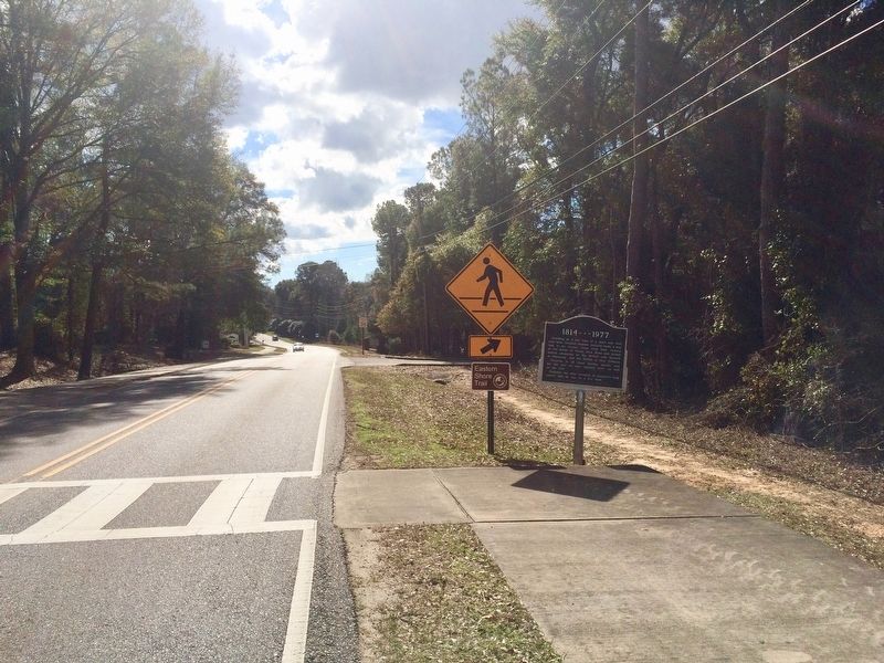
| 1 ► Alabama, Baldwin County, Daphne — 1814 - 1977 — General Andrew Jackson — |
| On Main Street south of Bayfront Park Drive, on the right when traveling south. | |||
| 2 ► Alabama, Baldwin County, Fort Morgan — First Battle of Fort Bowyer — September 14, 1814 — |
| Near Fort Morgan Road (Alabama Route 180) 2 miles west of Dune Drive, on the right when traveling west. | |||
| 3 ► Alabama, Baldwin County, Fort Morgan — Fort Bowyer — 1813-1821 — |
| On Fort Morgan Road (Alabama Route 180) 2 miles west of Dune Drive, on the right when traveling west. | |||
| 4 ► Alabama, Baldwin County, Fort Morgan — Second Battle of Fort Bowyer — February 8-12, 1815 — |
| On Fort Morgan Road (Alabama Route 180) 2 miles west of Dune Drive, on the left when traveling west. | |||
| 5 ► Alabama, Baldwin County, Fort Morgan — The Pride of Seven Flags — |
| On Dixie Graves Parkway near Alabama Route 180 W. | |||
| 6 ► Alabama, Baldwin County, Gulf Shores — Fort Bowyer War of 1812 — |
| On Dixie Graves Highway, on the right when traveling south. | |||
| 7 ► Alabama, Baldwin County, Stockton — The Society War of 1812 in the State of Alabama — |
| Near Alabama Route 225, on the left when traveling north. | |||
| 8 ► Alabama, Baldwin County, Tensaw — Fort Mims Massacre — |
| Near Fort Sims Road, 0.3 miles north of Boatyard Road (County Road 80). | |||
| 9 ► Alabama, Clarke County, Grove Hill — Elijah & Isaac Pugh — |
| On U.S. 84 at milepost 40 at Crescent Road, on the right when traveling east on U.S. 84. | |||
| 10 ► Alabama, Clarke County, Whatley — Kimbell - James Massacre — ←½ mile— — |
| On U.S. 84 at County Road 22, on the right when traveling west on U.S. 84. | |||
| 11 ► Alabama, Colbert County, Cherokee — Chickasaw Hospitality — Natchez Trace Parkway — |
| Near Natchez Trace Parkway (at milepost 327.3), 1.4 miles east of N Pike (County Route 21), on the left when traveling east. | |||
| 12 ► Alabama, Colbert County, Cherokee — Safe Crossing — Natchez Trace Parkway — National Park Service, U.S. Department of the Interior — |
| Near Natchez Trace Parkway (at milepost 327.3), 1.6 miles east of N Pike (County Route 21), on the left when traveling east. | |||
| 13 ► Alabama, Colbert County, Cherokee — Trace Travelers — Natchez Trace Parkway — |
| Near Natchez Trace Parkway (at milepost 327.3), 1.3 miles east of N Pike (County Route 21), on the left when traveling east. | |||
| 14 ► Alabama, Colbert County, Leighton — Alabama's Historic Byler Road — Alabama's First Road — |
| On Main Street at King Street (Old Alabama Route 20), on the right when traveling north on Main Street. | |||
| 15 ► Alabama, Conecuh County, Burnt Corn — John Green Cemetery — Conecuh County — |
| Near County Road 15, 0.2 miles south of Doe Lane. | |||
| 16 ► Alabama, Jefferson County, Clay — Pioneer Massey Cemetery — |
| Near Advent Circle. | |||
| 17 ► Alabama, Jefferson County, Clay — Wear Cemetery — |
| On Old Springville Road / County Road 30, on the left when traveling north. | |||
| 18 ► Alabama, Jefferson County, Hueytown — Bethlehem United Methodist Church — Jefferson County — |
| On Allison-Bonnett Memorial Drive at Tin Mill Road, on the right when traveling west on Allison-Bonnett Memorial Drive. | |||
| 19 ► Alabama, Lauderdale County, Florence — Andrew Jackson's Military Road — 1817 — |
| On County Route 47 at Cox Creek Parkway on County Route 47. | |||
| 20 ► Alabama, Lauderdale County, Florence — General John Coffee — Home Site and Grave — |
| On Cloverdale Road/Co Rd 157. | |||
| 21 ► Alabama, Lauderdale County, Florence — General John Coffee — City of Florence Walk of Honor — |
| Near Hightower Place south of Veterans Drive (Route 133), on the left when traveling south. | |||
| 22 ► Alabama, Lauderdale County, Florence — John Coffee: 1772-1833 — |
| On Surveyor Road, 0.2 miles west of Cloverdale Road, on the left when traveling west. | |||
| 23 ► Alabama, Lauderdale County, Florence — Lauderdale County — |
| On West Alabama Street at South Court Street, on the right when traveling west on West Alabama Street. | |||
| 24 ► Alabama, Lauderdale County, Rhodesville — General John Coffee — |
| On Rock Spring, 0.1 miles east of Natchez Trace Parkway. | |||
| 25 ► Alabama, Lawrence County, Courtland — The Town of Courtland / Early Settlers — 1819 — |
| 26 ► Alabama, Lawrence County, Moulton — A County Older Than The State — Lawrence County — |
| On Court Street (County Route 460) at Market Street (Alabama Route 33), on the right when traveling east on Court Street. | |||
| 27 ► Alabama, Limestone County, Capshaw — Nicholas Davis — |
| On Nick Davis Road (County Road 44) 0.5 miles west of Sanderson Road (County Road 127), on the left when traveling west. | |||
| 28 ► Alabama, Madison County, Huntsville — Andrew Jackson — |
| On Holmes Avenue at Lincoln St., NE on Holmes Avenue. | |||
| 29 ► Alabama, Madison County, Huntsville — Barbary Coast Wars — 1801 - 1805, 1815 — |
| On Monroe Street Northwest at Washington Street Northwest, on the left when traveling east on Monroe Street Northwest. | |||
| 30 ► Alabama, Madison County, Huntsville — Camp Beaty Brahan Spring Park — |
| On Ivy Avenue SW at SW 1st Street, on the right when traveling south on Ivy Avenue SW. | |||
| 31 ► Alabama, Madison County, Huntsville — The Leroy Pope Mansion 1814 — |
| On Echols Street near Adams Street, on the right when traveling west. | |||
| 32 ► Alabama, Madison County, Huntsville — War of 1812 — 1812 - 1815 — |
| On Monroe Street Northwest at Washington Street Northwest, on the left when traveling east on Monroe Street Northwest. | |||
| 33 ► Alabama, Madison County, New Hope — Fort Deposit Trail — |
| On Main Street south of Washington Avenue, on the right when traveling north. | |||
| 34 ► Alabama, Marion County, Hamilton — General Jackson's Military Road — |
| On Berryhill Road, 0.1 miles south of County Road 55, on the right when traveling north. | |||
| 35 ► Alabama, Marshall County, Albertville — Albert Family — |
| Near West Main Street (Alabama Route 205) at Lombardy Street, on the right when traveling west. | |||
| 36 ► Alabama, Mobile County, Dauphin Island — British Occupation of Dauphin Island — February - April 1815 — |
| Near Bienville Boulevard east of Albatross Street, on the right when traveling east. | |||
| 37 ► Alabama, Monroe County, Perdue Hill — Fort Claiborne — Creek Indian War 1813-1814 — |
| On U.S. 84 at Grain Elevator Road and Lena Landegger Highway, on the left when traveling west on U.S. 84. | |||
| 38 ► Alabama, Montgomery County, Montgomery — Naval Heroes of the War of 1812 — Dexter Avenue, Montgomery, Alabama — |
| On Dexter Avenue at South McDonough Street, on the right when traveling east on Dexter Avenue. | |||
| 39 ► Alabama, Morgan County, Decatur — A County Older Than The State, Morgan County — |
| On Cain Street Northeast west of Ferry Street Northeast, on the left when traveling west. | |||
| 40 ► Alabama, Russell County, Crawford — Crockettsville — Crawford, Alabama — |
| On U.S. 80 at Bleeker Road (County Road 79), on the right when traveling west on U.S. 80. | |||
| 41 ► Alabama, Russell County, Fort Mitchell — Fort Mitchell — <----- 5 miles ----- — |
| Near U.S. 165. | |||
| 42 ► Alabama, Shelby County, Chelsea — Old Quinn Burying Ground — |
| On County Road 47 at Whisenhunt Road, on the right when traveling north on County Road 47. | |||
| 43 ► Alabama, St. Clair County, Pell City — None — A County Older Than The State — St. Clair County — |
| On Cogswell Avenue at 18th Street, on the right when traveling west on Cogswell Avenue. | |||
| 44 ► Alabama, Talladega County, Fayetteville — To The Memory of General Jackson — |
| On Gen. Jackson Memorial Dr south of Mallory Cir, on the right when traveling south. | |||
| 45 ► Alabama, Talladega County, Sylacauga — Sylacauga — |
| On South Broadway Avenue (State Highway 21) at Goodwater Highway (County Road 511), in the median on South Broadway Avenue. | |||
| 46 ► Alabama, Talladega County, Sylacauga — Sylacauga Cemetery — Talladega County — |
| On East Ft. Williams Street east of North Broadway Avenue (Alabama Route 21), on the left when traveling east. | |||
| 47 ► Alabama, Tallapoosa County, Alexander City — Menawa, War Chief — about 1766 - 1837 |
| On Our Childrens Highway (State Highway 63) at Walker Ferry Road, on the right when traveling south on Our Childrens Highway. Reported missing. | |||
| 48 ► Alabama, Tallapoosa County, Dadeville — Battle Of Horseshoe Bend — One hundredth anniversary — 1814 - 1914 — |
| On North Broadnax Street at West Cusseta Street, on the right when traveling south on North Broadnax Street. | |||
| 49 ► Alabama, Tallapoosa County, Dadeville — Horseshoe Bend Battle Ground — 12 Miles North — |
| On State Highway 49 north of U.S. 280, on the right when traveling north. | |||
| 50 ► Alabama, Tallapoosa County, Daviston — Futile Escape — Horseshoe Bend National Military Park — National Park Service, U.S. Department of the Interior — |
| On Battlefield Park Tour Road, on the right when traveling south. | |||
| 51 ► Alabama, Tallapoosa County, Daviston — Gun Hill — |
| Near Battlefield Park Tour Road. | |||
| 52 ► Alabama, Tallapoosa County, Daviston — Horseshoe Bend Battleground Monument — |
| Near Battlefield Park Tour Road. | |||
| 53 ► Alabama, Tallapoosa County, Daviston — Jackson Trace — |
| Near Battlefield Park Tour Road. | |||
| 54 ► Alabama, Tallapoosa County, Daviston — Major Lemuel P. Montgomery — "He Acted With The Greatest Gallantry" — March 27, 1814 — |
| Near Battlefield Park Tour Road. | |||
| 55 ► Alabama, Tallapoosa County, Daviston — Tecumseh and the Prophets |
| On Horseshoe Bend Road. Reported missing. | |||
| 56 ► Alabama, Tallapoosa County, Daviston — They Fought to the Last — Horseshoe Bend National Military Park — National Park Service, U.S. Department of the Interior — |
| On Battlefield Park Tour Road, on the right. | |||
| 57 ► Alabama, Walker County, Empire — Black Warrior Town / The Escape — |
| Near Sipsey Road (County Road 22) at Old Town Road, on the right when traveling east. | |||
| 58 ► Alabama, Walker County, Oakman — Tubbs Cemetery — |
| On Blackwood Road south of Kings Mill Road, on the right when traveling south. | |||
| 59 ► Alabama, Wilcox County, Camden — Lieutenant Joseph Morgan Wilcox — |
| On Broad Street (Alabama Route 28) at Fail Street, on the left when traveling north on Broad Street. | |||
| 60 ► Alabama, Winston County, Haleyville — Jacob Pruet’s Stand — |
| On Alabama Route 195 near Layne Hill Drive. | |||
| 61 ► Arkansas, Benton County, Bella Vista — United States Commanders in Chief — |
| 62 ► Arkansas, Benton County, Bella Vista — United States Commanders in Chief — |
| 63 ► Arkansas, Benton County, Bella Vista — War of 1812 — |
| 64 ► Arkansas, Monroe County, Holly Grove — Initial Point of the Louisiana Purchase Survey — |
| On Baseline Road (State Highway 362) 1.8 miles east of U.S. 49. | |||
| 65 ► Arkansas, Pulaski County, Little Rock, Downtown — Gen. James Miller — |
| Near West Markham Street at Ashley Street, on the right when traveling west. | |||
| 66 ► Arkansas, Pulaski County, Little Rock, Downtown — War of 1812 Memorial — |
| Near West Markham Street at Ashley Street, on the right when traveling west. | |||
| 67 ► Arkansas, Sebastian County, Fort Smith — Who Served Here? — Fort Smith National Historic Site — National Park Service, U.S. Department of the Interior — |
| Near Parker Avenue at South 3rd Street. | |||
| 68 ► California, Los Angeles County, Los Angeles, Downtown Los Angeles — Old Ironsides — USS Constitution — |
| On Hill Street at 5th Street, on the right when traveling south on Hill Street. | |||
| 69 ► California, Los Angeles County, Rosemead — John Holt — (1792–1872) — Savannah Memorial Park — |
| Near Valley Boulevard east of Loma Avenue. | |||
| 70 ► California, Los Angeles County, Rosemead — Wiley Wilson — (1899–1878) — Savannah Memorial Park — |
| Near Valley Boulevard east of Loma Avenue. | |||
| 71 ► California, Orange County, Anaheim — Lafitte's Anchor — |
| Near Disneyland Drive. | |||
| 72 ► California, San Diego County, San Diego — Sylvester Pattie — Pathfinder — |
| On Presidio Drive. | |||
| 73 ► California, Solano County, Vallejo, Mare Island — Anna Arnold Key Turner — |
| Near Imhoff Road south of Azuar Avenue, on the right when traveling south. | |||
| 74 ► Connecticut, Fairfield County, Ridgefield — Ridgefield Veterans Monument — |
| On Main Street (Connecticut Route 35) at Branchville Road (Connecticut Route 102), on the left when traveling north on Main Street. | |||
| 75 ► Connecticut, Fairfield County, Stamford, Downtown — Stamford Veterans Memorial — |
| On Atlantic Street at Main Street, on the right when traveling north on Atlantic Street. | |||
| 76 ► Connecticut, Fairfield County, Stamford, East Side of Stamford — Stamford Veterans Monument — |
| On Grove Street at Main Street, on the right when traveling north on Grove Street. | |||
| 77 ► Connecticut, Hartford County, Southington — Southington Veterans Memorial — |
| On Main Street (Connecticut Route 10) at Academy Street, on the left when traveling north on Main Street. | |||
| 78 ► Connecticut, Litchfield County, Barkhamsted, Riverton — Barkhamsted Soldiers Memorial — |
| On Pleasant Valley Road (Connecticut Route 318) at Beach Rock Road, on the right when traveling north on Pleasant Valley Road. | |||
| 79 ► Connecticut, Litchfield County, Bethlehem, Bethlehem Village — Bethlehem War of 1812 Memorial — |
| On Main Street South (Connecticut Route 61) at West Road, on the left when traveling north on Main Street South. | |||
| 80 ► Connecticut, Litchfield County, Goshen — Goshen French and Indian War & Revolutionary War Memorial — |
| On North Street (Connecticut Route 63) at Elementary Drive, on the right when traveling north on North Street. | |||
| 81 ► Connecticut, Litchfield County, North Canaan — North Canaan Veterans Monument — |
| On East Main Street (U.S. 44) at Granite Avenue, on the right when traveling west on East Main Street. | |||
| 82 ► Connecticut, Litchfield County, North Canaan, East Canaan — East Canaan Veterans Monument — |
| On East Canaan Road (U.S. 44) at Lower Road, on the right when traveling east on East Canaan Road. | |||
| 83 ► Connecticut, Litchfield County, Sharon — Sharon Veterans Monument — |
| On Main Street (Connecticut Route 41) at Cornwall Bridge Road (Connecticut Route 4), on the right when traveling south on Main Street. | |||
| 84 ► Connecticut, Middlesex County, Clinton — This Cannon — |
| On East Main Street (U.S. 1) at Liberty Street, on the left when traveling east on East Main Street. | |||
| 85 ► Connecticut, Middlesex County, Clinton — War of 1812 in Clinton — |
| Near Waterside Lane south of Old Harbor Village, on the right when traveling south. | |||
| 86 ► Connecticut, Middlesex County, Essex, Essex Village — British Raid 1814 — Battle Site Essex — |
| On Main Street east of Novelty Lane, on the left when traveling east. | |||
| 87 ► Connecticut, Middlesex County, Middletown — Commodore Thomas Macdonough — |
| On St. John’s Square at St. John’s Street, on the right when traveling east on St. John’s Square. | |||
| 88 ► Connecticut, New Haven County, Madison, Madison Center — Captain Frederick Lee — 1776 - 1831 — Citizen of Madison and Hero of War of 1812 — |
| On Meeting House Lane just west of Island Avenue. | |||
| 89 ► Connecticut, New Haven County, Madison, Madison Center — Frederick W. Lee, Esq — Patriot • Statesman — |
| On Meeting House Lane. | |||
| 90 ► Connecticut, New Haven County, Middlebury — Middlebury Veterans Memorial — |
| On Whittemore Road (Connecticut Route 188) at Village Green, on the left when traveling west on Whittemore Road. | |||
| 91 ► Connecticut, New Haven County, New Haven, Downtown — Col. Decius Wadsworth — |
| Near Grove Street at High Street, on the right when traveling north. | |||
| 92 ► Connecticut, New Haven County, New Haven, East Rock — Soldiers and Sailors Monument — |
| On Davis Street at Ridge Road, on the left when traveling west on Davis Street. | |||
| 93 ► Connecticut, New Haven County, Orange — Orange Veterans Monument — |
| On Orange Center Road at Meetinghouse Lane, on the right when traveling south on Orange Center Road. | |||
| 94 ► Connecticut, New Haven County, Waterbury — Waterbury Veteran’s Monument — |
| On West Main Street at Leavenworth Street, on the left when traveling east on West Main Street. | |||
| 95 ► Connecticut, New Haven County, Wolcott — Kenea Soldiers Monument — |
| On Center Street (Connecticut Route 322) at Kenea Avenue, on the right when traveling east on Center Street. | |||
| 96 ► Connecticut, New London County, Bozrah — Bozrah Revolutionary War & War of 1812 Monument — |
| On Fitchville Road (Connecticut Route 608) at River Road, on the right when traveling east on Fitchville Road. | |||
| 97 ► Connecticut, New London County, New London, Fort Trumbull — War of 1812 — |
| Near East Street, on the left when traveling south. | |||
| 98 ► Connecticut, New London County, Norwich — In Memory of Captain Samuel Chester Reid — |
| On Washington Street at Williams Street, on the left when traveling south on Washington Street. | |||
| 99 ► Connecticut, New London County, Stonington, Mystic — 1941.762 — Bower Anchor — |
| Near Greenmanville Avenue (Connecticut Route 27) at Bruggeman Place, on the right when traveling south. | |||
| 100 ► Connecticut, New London County, Stonington — Battle of Stonington Monument — |
| On Water Street at Omega Street, on the right when traveling south on Water Street. | |||
2548 entries matched your criteria. The first 100 are listed above. Next 100 ⊳