After filtering for Maryland, 1324 entries match your criteria. Entries 101 through 200 are listed.⊲ Previous 100 — Next 100 ⊳
US Civil War Topic
By Allen C. Browne, October 13, 2012
Civil War Magazine Marker
| 101 ► Maryland, Baltimore, Locust Point Industrial Area — Civil War Magazine — |
| Near East Fort Avenue. | |||
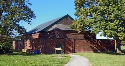
| 102 ► Maryland, Baltimore, Locust Point Industrial Area — Evolution of Fort McHenry — |
| Near East Fort Avenue, on the right when traveling east. | |||
| 103 ► Maryland, Baltimore, Locust Point Industrial Area — Experimental Carriages — |
| Near East Fort Avenue. | |||
| 104 ► Maryland, Baltimore, Locust Point Industrial Area — Outer Battery |
| On East Fort Avenue, on the right when traveling east. Reported permanently removed. | |||
| 105 ► Maryland, Baltimore, Locust Point Industrial Area — The Great Guns of the Fort… The Rodman Cannons — |
| Near Constellation Plaza, 0.3 miles east of Wallace Street, on the right when traveling east. | |||
| 106 ► Maryland, Baltimore, Mid-Town Belvedere — Juneteenth Memorial — |
| On North Charles Street north of West Preston Street, on the left when traveling north. | |||
| 107 ► Maryland, Baltimore, Mount Vernon — Roger B. Taney Monument — Reconciling History — Baltimore's Confederate Monuments |
| On Charles Street. Reported permanently removed. | |||
| 108 ► Maryland, Baltimore, Mount Vernon — The First Unitarian Church of Baltimore — (Universalist and Unitarian) — |
| On West Franklin Street (U.S. 40) at North Charles Street, on the right when traveling west on West Franklin Street. | |||
| 109 ► Maryland, Baltimore, Patterson Park — Patterson Park — Civil War Camp and Hospital — |
| On Patterson Park Avenue. | |||
| 110 ► Maryland, Baltimore, Pigtown — Baltimore & Ohio Railroad — The Mount Clare Shops |
| On West Pratt Street. Reported permanently removed. | |||
| 111 ► Maryland, Baltimore, Pigtown — Camp Carroll — The War Came by Train |
| Near West Pratt Street east of South Schroeder Street, on the right when traveling east. Reported permanently removed. | |||
| 112 ► Maryland, Baltimore, Pigtown — Mount Clare Shops — Nerve Center of "Lincoln's Railroad" — |
| On South Poppleton Street at West Pratt Street, on the left when traveling south on South Poppleton Street. | |||
| 113 ► Maryland, Baltimore, Sharp-Leadenhall — Struggling For Equality — |
| On West Hamburg Street, on the right when traveling east. | |||
| 114 ► Maryland, Baltimore, Stadium Area — Baltimore Regional Trail — A House Divided — War on the Chesapeake Bay — |
| Near West Camden Street near South Howard Street. | |||
| 115 ► Maryland, Baltimore, Stadium Area — Baltimore Riot Trail — Last Shots at Camden Station — Baltimore – A House Divided |
| Near South Howard Street near West Camden Street. Reported damaged. | |||
| 116 ► Maryland, Baltimore, Tuscany-Canterbury — Confederate Women of Maryland |
| On West University Parkway. Reported permanently removed. | |||
| 117 ► Maryland, Baltimore, Tuscany-Canterbury — Confederate Women's Monument — Reconciling History — Baltimore's Confederate Monuments |
| On West University Parkway. Reported permanently removed. | |||
| 118 ► Maryland, Baltimore, University of Maryland — Brig. General Lewis A. Armistead |
| On West Redwood Street, on the right when traveling east. Reported missing. | |||
| 119 ► Maryland, Baltimore County, Catonsville — Address by President Lincoln — At the Dedication of The Gettysburg National Cemetery — November 19, 1863 — |
| Near Frederick Avenue (State Highway 144) at Mallow Hill Road, on the right when traveling east. | |||
| 120 ► Maryland, Baltimore County, Catonsville — Baltimore National Cemetery — National Register of Historic Places — |
| On Frederick Avenue (State Highway 144) at Mallow Hill Road, on the right when traveling east on Frederick Avenue. | |||
| 121 ► Maryland, Baltimore County, Catonsville — Baltimore Regional Trail — A House Divided — |
| Near Frederick Road (Maryland Route 144) at Osborne Avenue, on the right when traveling west. | |||
| 122 ► Maryland, Baltimore County, Cockeysville — Gilmor's Raid — Capturing Cockeysville — Early's 1864 Attack on Washington — |
| Near Paper Mill Road (Maryland Route 145) 0.3 miles east of Arrowwood Road, on the left when traveling east. | |||
| 123 ► Maryland, Baltimore County, Halethorpe — The Relay House — |
| On Viaduct Avenue at Soouth Rolling Road, on the left when traveling north on Viaduct Avenue. | |||
| 124 ► Maryland, Baltimore County, Kingsville — Ishmael Day’s House — |
| On Sunshine Avenue, 1 mile east of Harford Road (Maryland Route 147), on the left when traveling east. | |||
| 125 ► Maryland, Baltimore County, Lansdowne — Lansdowne Christian Church — Hull Memorial |
| On Clyde Avenue at Baltimore Avenue, on the right when traveling east on Clyde Avenue. Reported permanently removed. | |||
| 126 ► Maryland, Baltimore County, Lansdowne — Lansdowne Christian Church — Hull Memorial — |
| On Clyde Avenue just east of Baltimore Avenue, on the right when traveling east. | |||
| 127 ► Maryland, Baltimore County, Long Green — Maj. Gen. Isaac Ridgeway Trimble, C.S.A. — |
| On Dulaney Valley Road at Ravenshurst Circle, on the right when traveling south on Dulaney Valley Road. | |||
| 128 ► Maryland, Baltimore County, Lutherville-Timonium — History of The Greenspring Quarry — |
| On Quarry Lake Drive at Travertine Drive, on the left when traveling west on Quarry Lake Drive. | |||
| 129 ► Maryland, Baltimore County, Owings Mills — In Memory of William Maxwell Wood, MD — |
| Near St. Thomas Lane at Garrison Forest Road. | |||
| 130 ► Maryland, Baltimore County, Owings Mills — Jewish Armed Forces Memorial — |
| On Associated Way south of Garrison Forest Road, on the left when traveling north. | |||
| 131 ► Maryland, Baltimore County, Phoenix — Glen Ellen — Maj. Harry Gilmor's Childhood Home — Early's 1864 Attack on Washington — |
| On Dulaney Valley Road at Loch Raven Drive, on the left when traveling east on Dulaney Valley Road. | |||
| 132 ► Maryland, Baltimore County, Pikesville — The Old United States Arsenal — |
| On Reisterstown Road (Maryland Route 140) at Sudbrook Lane, on the right when traveling north on Reisterstown Road. | |||
| 133 ► Maryland, Baltimore County, Reisterstown — Colonel William Norris — (1820-1896) — |
| On Cockey’s Mill Road at Reisterstown Road (Route 140), on the right when traveling east on Cockey’s Mill Road. | |||
| 134 ► Maryland, Baltimore County, Relay — Masterpiece of the Early B&O Railroad — |
| Near Washington Boulevard (U.S. 1) at South Street. | |||
| 135 ► Maryland, Baltimore County, Relay — Relay — |
| On S. Rolling Road, 0.1 miles south of Francis Avenue, on the right when traveling south. | |||
| 136 ► Maryland, Baltimore County, Towson — Lynching in America / Lynching of Howard Cooper — Community Remembrance Project — |
| On Courthouse Court at Bosley Avenue (Maryland Route 45), on the left when traveling south on Courthouse Court. | |||
| 137 ► Maryland, Baltimore County, Towson — The Home of Governor Augustus W. Bradford — |
| On Charles Street (Route 139) at Charlesbrook Road, on the right when traveling south on Charles Street. | |||
| 138 ► Maryland, Calvert County, Lusby — Cove Point Lighthouse — 3.4 miles — |
| On Cove Point Road (Maryland Route 497) 3.4 miles east of Solomons Island Road (Route 2 / 4) when traveling east. | |||
| 139 ► Maryland, Calvert County, Lusby — Morgan Hill Farm — |
| On Sollers Wharf Road at Wohlgemuth Road, on the right when traveling south on Sollers Wharf Road. | |||
| 140 ► Maryland, Caroline County, Denton — Emancipation's Close Call — Did Union Troops Suppress the Vote? — |
| On Market Street at North 2nd Street, on the right when traveling west on Market Street. | |||
| 141 ► Maryland, Caroline County, Denton — John Wilkes Booth — Escape of an Assassin — War on the Chesapeake Bay |
| On 2nd Street at Gay Street, on the right when traveling north on 2nd Street. Reported permanently removed. | |||
| 142 ► Maryland, Caroline County, Denton — Maryland's Eastern Shore — Hundreds of Enslaved and Free Black Men Enlisted |
| On North 2nd Street at Gay Street, on the right when traveling north on North 2nd Street. Reported permanently removed. | |||
| 143 ► Maryland, Caroline County, Denton — Nest of Traitors — The Denton Arrests |
| On River Landing Road, 0.4 miles north of New Bridge Road (Maryland Route 328), on the right when traveling north. Reported missing. | |||
| 144 ► Maryland, Caroline County, Denton — Revolution or Fraud? — Emancipation in Caroline Co. |
| On Market Street at 2nd Street, on the right when traveling west on Market Street. Reported permanently removed. | |||
| 145 ► Maryland, Caroline County, Denton — The Denton Arrests — "Arresting … treasonable characters" — |
| On Crouse Park Lane west of Gay Street (Maryland Route 404), on the right when traveling west. | |||
| 146 ► Maryland, Caroline County, Denton — War Along the Chesapeake — A Divided Region — |
| On North 2nd Street just south of Gay Street (Maryland Route 404), on the right when traveling north. | |||
| 147 ► Maryland, Caroline County, Federalsburg — A Paradise For Smugglers — Nanticoke River, 1861-1863 — |
| On South Main Street (Maryland Route 308) north of Smith Street, on the right when traveling north. | |||
| 148 ► Maryland, Caroline County, Federalsburg — Civil War Memorial — |
| Near Bloomingdale Avenue (Maryland Route 315) west of Old Denton Road, on the right when traveling west. | |||
| 149 ► Maryland, Caroline County, Greensboro — Letter to Lincoln — Chaos on the Eastern Shore — |
| On Main Street (Maryland Route 480) at Bernard Avenue, on the left when traveling south on Main Street. | |||
| 150 ► Maryland, Caroline County, Hillsboro — Frederick Douglass — Tales of Horror — |
| On Main Street (Alternate Maryland Route 404) 0.4 miles west of Ridgely Road (Maryland Route 480), on the left when traveling west. | |||
| 151 ► Maryland, Caroline County, Preston — The Underground Railroad — Seed of War — |
| On Linchester Road, 0.1 miles north of Maryland Route 331, on the right when traveling south. | |||
| 152 ► Maryland, Carroll County, Finksburg — Sandy Mount United Methodist Church — 1827 - 1977 — |
| On Old Westminster Pike at Sandymount Road, on the right when traveling south on Old Westminster Pike. | |||
| 153 ► Maryland, Carroll County, Manchester — Army of the Potomac — July 3 1863 — |
| On York Street just west of B Street, on the right when traveling west. | |||
| 154 ► Maryland, Carroll County, Manchester — June 30 1863 — |
| On York Street west of B Street, on the right when traveling west. | |||
| 155 ► Maryland, Carroll County, Manchester — Manchester — |
| On Main Street (Maryland Route 30) at Westminster & York Streets, on the left when traveling north on Main Street. | |||
| 156 ► Maryland, Carroll County, Manchester — Manchester — Meade's Pipe Creek Plan — Gettysburg Campaign |
| On Manchester Road (Maryland Route 27) 0.3 miles west of Main Street (Maryland Route 30), on the right when traveling west. Reported missing. | |||
| 157 ► Maryland, Carroll County, Manchester — Manchester — Meade's Pipe Creek Plan — Gettysburg Campaign — |
| On York Street at Long Lane, on the left when traveling east on York Street. | |||
| 158 ► Maryland, Carroll County, Middleburg — Army of the Potomac — June 29 1863 — |
| On Middleburg Road (State Highway 77), on the right when traveling east. | |||
| 159 ► Maryland, Carroll County, Middleburg — Middleburg — Meade's Pipe Creek Plan — Gettysburg Campaign — |
| On Middleburg Road (State Highway 77), on the right when traveling west. | |||
| 160 ► Maryland, Carroll County, Mount Airy — Civil War Memorial — |
| On South Main Street. | |||
| 161 ► Maryland, Carroll County, Mount Airy — Mount Airy — History — |
| On South Main Street (Maryland Route 808) just south of Center Street, on the left when traveling north. | |||
| 162 ► Maryland, Carroll County, Mount Airy — Mount Airy — Under the Barrels — Gettysburg Campaign — |
| On South Main Street (Maryland Route 808), on the right when traveling north. | |||
| 163 ► Maryland, Carroll County, New Windsor — Gen. Bradley T. Johnson's Raid — Looting in New Windsor — Early's 1864 Attack on Washington — |
| On Main Street (Maryland Route 31) at Green Valley Road, on the left when traveling east on Main Street. | |||
| 164 ► Maryland, Carroll County, New Windsor — New Windsor — Village by Moonlight — Gettysburg Campaign — |
| On Main Street (Maryland Route 31) at Green Valley Road (Maryland Route 75), on the left on Main Street. | |||
| 165 ► Maryland, Carroll County, Sykesville — Hood’s Mill — |
| On Old Washington Road (Maryland Route 97) 0.2 miles south of Eden Mill Road, on the right when traveling south. | |||
| 166 ► Maryland, Carroll County, Sykesville — Sykesville — Capturing Joe Hooker — Gettysburg Campaign — |
| On Main Street (Maryland Route 851), on the right when traveling north. | |||
| 167 ► Maryland, Carroll County, Taneytown — 1st Lieutenant John E. Buffington — |
| On Roberts Mill Road east of Pump House Road, on the left when traveling east. | |||
| 168 ► Maryland, Carroll County, Taneytown — Army of the Potomac — June 30, 1863 — |
| On West Baltimore Street (State Highway 140) at Park Road, on the left when traveling west on West Baltimore Street. | |||
| 169 ► Maryland, Carroll County, Taneytown — Army of the Potomac — July 1, 1863 — |
| On West Baltimore Street (State Highway 140) at Park Road, on the left when traveling west on West Baltimore Street. | |||
| 170 ► Maryland, Carroll County, Taneytown — Bridgeport — |
| On Maryland Route 140, 0.1 miles east of Bullfrog Road, on the left when traveling west. | |||
| 171 ► Maryland, Carroll County, Taneytown — Extra! Extra! — "Mount and Spur for Gettysburg" — |
| On East Baltimore Street. | |||
| 172 ► Maryland, Carroll County, Taneytown — Meade’s Headquarters — |
| On Francis Scott Key Highway (Maryland Route 194) 1 mile north of Taneytown Pike (Route 140), on the right when traveling north. | |||
| 173 ► Maryland, Carroll County, Taneytown — Taneytown — Meade’s Pipe Creek Plan — Gettysburg Campaign — |
| On West Baltimore Street (State Highway 140) at Park Road, on the left when traveling west on West Baltimore Street. | |||
| 174 ► Maryland, Carroll County, Union Bridge — Union Bridge — Reynolds’ Last Journey — Gettysburg Campaign — |
| On Main Street, on the left when traveling north. | |||
| 175 ► Maryland, Carroll County, Union Mills — Defiance at Union Mills — "I'm a Union man!" — Gettysburg Campaign — |
| Near Littlestown Pike (Maryland Route 97). | |||
| 176 ► Maryland, Carroll County, Union Mills — Gettysburg Campaign — Invasion and Retreat |
| Near Littlestown Pike (Maryland Route 97). Reported permanently removed. | |||
| 177 ► Maryland, Carroll County, Union Mills — Gettysburg Campaign — Invasion and Retreat — |
| Near Littlestown Pike (Maryland Route 97) 0.4 miles north of Saw Mill Road West, on the right when traveling north. | |||
| 178 ► Maryland, Carroll County, Union Mills — Union Mills — Built 1797 on the site of an earlier mill by Andrew and David Shriver Jr. — |
| On Littlestown Pike (Maryland Route 97) 0.1 miles south of Old Hanover Road, on the right when traveling north. | |||
| 179 ► Maryland, Carroll County, Union Mills — Union Mills — "Shining lights" — Gettysburg Campaign — |
| Near Littlestown Pike (Maryland Route 97) 0.4 miles north of Saw Mill Road West, on the right when traveling north. | |||
| 180 ► Maryland, Carroll County, Union Mills — Union Mills — "Shining lights" — Gettysburg Campaign |
| Near Littlestown Pike (Maryland Route 97). Reported permanently removed. | |||
| 181 ► Maryland, Carroll County, Uniontown — Army of the Potomac — June 29 1863 — |
| On Uniontown Road (State Highway 77) at Trevanion Road (State Highway 84), on the right when traveling east on Uniontown Road. | |||
| 182 ► Maryland, Carroll County, Uniontown — Headquarters Second Corps Army of the Potomac — |
| On Uniontown Road, 0.5 miles east of Maryland Route 84, on the right when traveling east. | |||
| 183 ► Maryland, Carroll County, Uniontown — Uniontown — “Patriotic, but Paralyzed” — Gettysburg Campaign — |
| On Uniontown Road, 0.1 miles Maryland Route 84, on the right when traveling east. | |||
| 184 ► Maryland, Carroll County, Westminster — A Final Tribute — Battle of Westminster — Corbit's Charge, June 29, 1863 — |
| On Court Place, on the left when traveling east. | |||
| 185 ► Maryland, Carroll County, Westminster — Aftermath of Battle — Hospitals and Graves — Gettysburg Campaign — |
| Near North Court Street. | |||
| 186 ► Maryland, Carroll County, Westminster — Army of the Potomac — July 3 1863 — |
| Near North Court Street. | |||
| 187 ► Maryland, Carroll County, Westminster — Army of the Potomac — June 29, 1863 — |
| Near North Court Street. | |||
| 188 ► Maryland, Carroll County, Westminster — Corbit’s Charge — |
| On Main Street (Maryland Route 32) at Washington Road (Maryland Route 32), on the right when traveling south on Main Street. | |||
| 189 ► Maryland, Carroll County, Westminster — Corbit's Charge — “Suicidal Bravery” — Gettysburg Campaign — |
| On East Main Street (Maryland Route 32), on the right when traveling east. | |||
| 190 ► Maryland, Carroll County, Westminster — Divided Loyalties — The Neal Family — Gettysburg Campaign |
| On Liberty Street (Maryland Route 27) at West Main Street (Maryland Route 32), on the right when traveling north on Liberty Street. Reported permanently removed. | |||
| 191 ► Maryland, Carroll County, Westminster — Divided Loyalties — A U.S. Flag Goes South — |
| Near North Court Street. | |||
| 192 ► Maryland, Carroll County, Westminster — Engagement at Westminster — War at the Almshouse — Gettysburg Campaign |
| On South Center Street, on the right when traveling south. Reported damaged. | |||
| 193 ► Maryland, Carroll County, Westminster — Gen. Bradley T. Johnson's Raid — A Ransom Cancelled — Early's 1864 Attack on Washington — |
| On Emerald Hill Lane just north of Longwell Avenue, on the right when traveling north. | |||
| 194 ► Maryland, Carroll County, Westminster — Gettysburg Campaign — Invasion & Retreat — |
| On East Main Street at North Court Street, on the right when traveling east on East Main Street. | |||
| 195 ► Maryland, Carroll County, Westminster — Gettysburg Campaign — Invasion & Retreat — Maryland Civil War Trails |
| On Liberty Street (Maryland Route 27) at East Main Street, on the left when traveling south on Liberty Street. Reported permanently removed. | |||
| 196 ► Maryland, Carroll County, Westminster — History Is Also Now — |
| On East Main Street south of Longwell Avenue, on the left when traveling south. | |||
| 197 ► Maryland, Carroll County, Westminster — Neal Home — |
| On East Main Street north of Longwell Avenue, on the right when traveling north. | |||
| 198 ► Maryland, Carroll County, Westminster — The Opera House — |
| On East Main Street at Lincoln Road, on the left when traveling north on East Main Street. | |||
| 199 ► Maryland, Carroll County, Westminster — The Rosser Raid — "Welcome into my home!" — Antietam Campaign 1862 — |
| On West Main Street at Carroll Street, on the left when traveling north on West Main Street. | |||
| 200 ► Maryland, Carroll County, Westminster — The Trumbo-Chrest House — 297 East Main Street — |
| On East Main Street south of Manchester Avenue, on the right when traveling north. | |||
1324 entries matched your criteria. Entries 101 through 200 are listed above. ⊲ Previous 100 — Next 100 ⊳