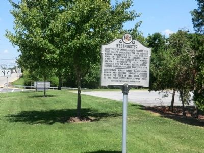
County seat of Carroll County, founded 1764 first called Winchester for its founder William Winchester (1710-1790), who was born in Westminster, England (now a part of Greater London) Westminster Academy incorporated 1839 (later absorbed into the . . . — — Map (db m75698) HM
During the Civil War, railroads for the first time attained strategic importance for transporting troops and equipment. On July 1, 1863, Gen. Herman Haupt, chief of U.S. Military Railroads, assumed control here of the Western Maryland Railroad to . . . — — Map (db m13828) HM
The home of John A. J. Creswell who nominated James Buchanan for President in 1856 and turned Republican in 1861. He was successively Assistant-Adjutant General of Maryland, member of the House of Representatives, Senator and Postmaster by . . . — — Map (db m145436) HM
Boyhood home of William Whann Mackall. Appointed to the U. S. Military Academy in 1834. Resigned from the U. S. Army, joined the Confederacy and served on the staffs of Generals Albert Sydney Johnston, Braxton Bragg and Joseph E. Johnston. General . . . — — Map (db m145439) HM
On April 18-19, 1861, a week after the bombardment of Fort Sumter, South Carolina, Confederate sympathizers attacked U.S. Army forces en route to Washington in Baltimore, 35 miles southwest of here. On the second day shots were fired and soldiers . . . — — Map (db m145865) HM
(Main Text)
Soon after the Civil War erupted in April 1861, Perryville became an important Union staging area. Adjacent to Fort Dare here, a riverside plantation was confiscated from Confederate sympathizers and immediately transformed . . . — — Map (db m145891) HM
Built 1813, probably by Daniel Megredy. Lafayette was entertained here in 1824. Later owned by Cornelius Smith (1792–1858), farmer and philanthropist who financed road construction to create jobs for the unemployed and aided public education . . . — — Map (db m127920) HM
Born at this house at Creswell’s Ferry, now Port Deposit, in 1828, John Creswell graduated from Dickinson College and became a lawyer. He was elected to the General Assembly in 1861, became Adjutant General in 1862, was elected to Congress that same . . . — — Map (db m145442) HM
On August 30, 1861 Battery B of the Union Army under the command of Capt. Alonzo Snow was organized at Port Deposit, composed mainly of men from this town and vicinity. The Battery rendered important service to the Federal forces in the Civil War, . . . — — Map (db m145871) HM
In the summer of 1861, in prosperous Port Deposit, men volunteered for an artillery battery to fight for their beloved Union. Capt. Alonzo Snow led the approximately 155-man unit. Organized in September, Snow's Battery left the Eastern Shore in May . . . — — Map (db m145880) HM
General Lafayette and his army camped around this tree April 12, 1781. A Civil War cavalry unit later occupied the site. The oak, over 500 years old, was owned by the Thomas Richards family for over a century. A huge limb fell August, 1964, . . . — — Map (db m145616) HM
John Wilkes Booth and his accomplice Harold hid in a thick woods on Samuel Cox's farm. (One mile north →) for several days before escaping to Virginia after Lincoln's assassination April 14, 1865. — — Map (db m129023) HM
John Wilkes Booth and David Herold remained hidden from April 16 to 21, 1865 in a nearby pine thicket, while Union troops searched for them. Thomas A. Jones brought them food and the newspapers. — — Map (db m39524) HM
After assassinating President Abraham Lincoln on April 14, 1865, John Wilkes Booth and his accomplice, David A. Herold, fled Washington for Southern Maryland, a hotbed of Confederate sympathizers. After leaving the home of Dr. Samuel A. Mudd near . . . — — Map (db m39528) HM
Mid-18th century farm house (with alterations after 1800) was home of Col. Samuel Cox. This southern sympathizer fed and sheltered fugitives John Wilkes Booth and David E. Herold before dawn on Easter Sunday, April 16, 1865 following Booth's . . . — — Map (db m4458) HM
After leaving Dr. Samuel A. Mudd's house on April 15, 1865, John Wilkes Booth, the assassin of President Abraham Lincoln, and his accomplice David E. Herold avoided Zekiah Swamp and made a wide arc around the village of Bryantown. Unsure of their . . . — — Map (db m129036) HM
(Right Banner)
After leaving Dr. Samuel A. Mudd's house on April 15, 1865, John Wilkes Booth, the assassin of President Abraham Lincoln, and his accomplice David E. Herold avoided Zekiah Swamp and made a wide arc around the village of . . . — — Map (db m129045) HM
)
1666
Hugh Thomas receives a 600 acre patent to "Rich Hill." )
1666—1714
Beginnings )
1714—1807
Brown Family Era )
(Image of Dr. Gustavus Brown) )
Scottish immigrant Dr. Gustavus Brown builds the house.
1729 . . . — — Map (db m129049) HM
Camp Stanton was established in this area, October, 1863, for the recruiting and training of the Seventh, Ninth, Nineteenth and Thirtieth United States Colored Infantry. — — Map (db m4112) HM
Nearby stood Camp Stanton, a Civil War-era recruiting and training post for African American Union soldiers. Named for Secretary of War Edwin Stanton, the camp was established in August 1863. Although black soldiers had served in the nation’s armed . . . — — Map (db m195735) HM
Imagine the now-quiet fields south of Rt. 231 full of activity that signified a revolutionary shift in American society. Shouted commands and gunfire filled the air as Black men, some formerly enslaved, learned to march and fire their weapons as . . . — — Map (db m214802) HM
On November 13, 1864, here at St. Mary’s Catholic
Church, Dr. Samuel A. Mudd was introduced to John
Wilkes Booth, the future assassin of President Abraham Lincoln. Booth had come to Charles County to
contact the Confederate underground here and . . . — — Map (db m924) HM
This building is the Bryantown Tavern, constructed about 1815. On April 15, 1865, the morning after President Lincoln’s assassination, Lt. David D. Dana made it his headquarters while pursuing John Wilkes Booth, the assassin, with a detachment of . . . — — Map (db m4500) HM
This building is the Bryantown Tavern, constructed about 1815. On April 15, 1865, the morning after President Abraham Lincoln's assassination, Lt. David D. Dana made it his headquarters while pursuing John Wilkes Booth, the assassin, with a . . . — — Map (db m181678) HM
Site of a Union Battery, November, 1861 to March 1862. The movements of Confederate troops across the Potomac River in Virginia were observed from a balloon above this point. — — Map (db m19569) HM
Maintained headquarters here at Chicamuxen Methodist Church from October, 1861, to March, 1862, when over 12,000 Union troops were camped along the Potomac River in Charles County. — — Map (db m14774) HM
Birthplace of Admiral Raphael Semmes C.S.N. Appointed a midshipman U.S.N., 1826. He served in the Mexican War with distinction. Joining the Confederate Navy, 1861. He commanded the noted Confederate raider the "Alabama." — — Map (db m129255) HM
Home of Confederate Mail Agent, Thomas A. Jones, who helped to shelter, and aided the escape of John Wilkes Booth and David Herold in their flight, April 16th to 21st 1865. — — Map (db m129119) HM
On this location Maj. R. G. Watson and his daughter Mary, both Confederate agents, lived and carried on a direct mail and slave route between the North and the South during the entire Civil War. Because of the unobstructed view from these cliffs, . . . — — Map (db m5938) HM
The home of Major Roderick G. Watson is two miles north of this marker. At the start of the Civil War many persons crossed the Potomac River to Virginia in this area. From 1862 to the end of the war, Thomas A. Jones served as a Confederate agent . . . — — Map (db m3827) HM
After assassinating President Abraham Lincoln on April 14, 1865, John Wilkes Booth and his accomplice, David A. Herold, fled Washington for Southern Maryland, a hotbed of Confederate sympathizers. Concealed for several days in a pine thicket two . . . — — Map (db m128807) HM
John Wilkes Booth and David Herold set out from here for the Virginia shore during the night of April 21, 1865, in a boat supplied by Thomas A. Jones. — — Map (db m128809) HM
Divided loyalties and ironies tore at Marylander’s hearts throughout the Civil War: enslaved African-Americans and free United States Colored Troops; spies and smugglers; civilians imprisoned without trial to protect freedom; neighbors and . . . — — Map (db m24540) HM
Divided loyalties and ironies tore at Marylanders' hearts throughout the Civil War: enslaved African Americans and free United States Colored Troops; spies and smugglers; civilians imprisoned without trial to protect freedom; neighbors and . . . — — Map (db m186732) HM
Birthplace of Acting Brigadier General Joseph Lancaster Brent, C.S.A. (1826-1909). He served in the Trans-Mississippi Department during the Civil War and took part in the siege of Vicksburg. — — Map (db m7216) HM
Divided loyalties and ironies tore at Marylander’s hearts throughout the Civil War: enslaved African-Americans and free United States Colored Troops; spies and smugglers; civilians imprisoned without trial to protect freedom; neighbors and families . . . — — Map (db m1104) HM
In this center of Confederate activity, at the Brawner Hotel, Detective Captain William Williams unsuccessfully offered Thomas Jones $100,000 reward for information that would lead to the capture of John Wilkes Booth. — — Map (db m128825) HM
Port Tobacco was the home and place of business of George Atzerodt. Although he failed to murder Vice President Andrew Johnson, he was convicted and executed for his role in the plot to assassinate President Abraham Lincoln.
Part . . . — — Map (db m128954) HM
Home of Miss Olivia Floyd, Confederate agent, and her brother Robert Semmes Floyd, C.S.A. killed in action. Both are buried in St. Ignatius Church Yard two miles south. — — Map (db m39523) HM
A landing on Mattawoman Creek used from December, 1861 to March, 1862 to unload supplies for a brigade of New Jersey troops encamped nearby. — — Map (db m6082) HM
This house was the home of Dr. Samuel Alexander Mudd and his wife, Sarah Frances Dyer. Early on the morning of April 15, 1865, John Wilkes Booth arrived here with a companion, David E. Herold, and asked Mudd to set Booth’s broken leg. Afterward, as . . . — — Map (db m921) HM
Divided loyalties and ironies tore at Marylanders’ hearts throughout the Civil War: enslaved African-Americans and free United States Colored Troops; spies and smugglers; civilians imprisoned without trial to protect freedom; neighbors and families . . . — — Map (db m922) HM
Home of Captain William Fendlay Dement. 1st Maryland Artillery, C.S.A. He served with distinction at Seven Pines, Second Manassas, Cedar Run, Harper's Ferry, Gettysburg, Appomattox, and Sharpsburg. Buried at Pomfret. — — Map (db m39521) HM
Dr. Mudd set the broken leg of Wilkes Booth who escaped from Washington after Lincoln's assassination on April 14, 1865. Dr. Mudd was tried and imprisoned on Dry Tortugas Island. — — Map (db m8932) HM
A year after her escape, Harriet made it her mission to, with the help of God, free her family from slavery. In December 1850, she secretly planned her first rescue.
Harriet Tubman's niece, Kessiah Bowley, and her two children were to be . . . — — Map (db m204997) HM
The Slavery Conflict Deepens
During the 1850's the deep-rooted conflict between pro-slavery and anti-slavery Americans intensified. The 'abolitionists' were united around the common long-run goal of abolishing slavery. But they differed . . . — — Map (db m109916) HM
During the Civil War, U.S. Col. James Wallace, commander of the 1st Regiment, Eastern Shore Maryland Volunteers, used this building as his headquarters. The regiment which camped east of here, drew most of its members directly from the Eastern . . . — — Map (db m113141) HM
During the Civil War, Union Co. James Wallace (1818-1887), 1st Regiment, Eastern Shore Maryland Volunteers, used this building as his headquarters. The unit, which camped east of here, enlisted most of its members from the Eastern Shore. It . . . — — Map (db m205006) HM
Although isolated from Maryland's largest population centers, the Eastern Shore was important to the state's role in the Civil War and exemplified the citizens' divided loyalties.
In the years before the war, enslaved African-Americans here . . . — — Map (db m8331) HM
Welcome to Dorchester County! When the Civil War intruded into quiet communities, residents here, as elsewhere on the Eastern Shore, faced difficult choices.
Before the war, enslaved African Americans here began escaping bondage via the . . . — — Map (db m190251) HM
In this cemetery is the grave of Thomas Holliday Hicks, Governor of Maryland 1858-1862 and United States Senator from Maryland 1862-1865. At the beginning of the Civil War during his tenure as governor, the position of Maryland was more important . . . — — Map (db m3971) HM
This monument, erected by the state in 1868, honors Thomas Holliday Hicks, a native and life resident of Dorchester County. Late in 1860, and early 1861 as Maryland’s first Civil War governor, he opposed the doctrines of secession and coercion. In . . . — — Map (db m113146) HM
The "Moses of her People", Harriett Tubman of the Bucktown District found freedom for herself and some three hundred other slaves whom she led north. In the Civil War she served the Union army as a nurse, scout and spy. — — Map (db m3956) HM
Originally “Crossroads,” later “New Market.” Post for trading with Indians erected 1767. In Revolution, “New Market Blues,” volunteer militiamen, were organized in this supply center for Continental army. South on . . . — — Map (db m3979) HM
Anna Ella Carroll was born on Maryland's Eastern Shore in 1815. Often called an unofficial member of President Abraham Lincoln's cabinet, she was a Unionist author and newspaper reporter who had traveled extensively throughout the South and Midwest . . . — — Map (db m45304) HM
Anna Ella Carroll, sometimes called an unofficial member of Abraham Lincoln's cabinet, is buried in the Old Trinity Church graveyard. Carroll, born on Maryland's Eastern Shore in 1815, remains an enigma, but there is no question that she . . . — — Map (db m205116) HM
On Saturday, September 6, 1862, the Army of Northern Virginia was spread along the entire length of Buckeystown Turnpike all the way to Frederick. The soldiers camped in the fields on either side of the road on the evenings of September 5-6, and by . . . — — Map (db m152272) HM
C.S.A. Jackson's Command Maj. Gen. Thomas J. Jackson, Commanding. (September 15-16, 1862.) Gen. Jackson, with Ewell's and Jackson's Divisions, left Harpers Ferry late in the afternoon of September 15th, reached Sharpsburg on the morning of the . . . — — Map (db m185586) HM
In June 1864, Union Lieutenant General Ulysses S. Grant was intent on destroying Confederate General Robert E. Lee's army at Petersburg, Virginia. Lee saw an opportunity to capture undefended Washington, D.C. He sent Lieutenant General Jubal A. . . . — — Map (db m213594) HM
Roads are a record of those who have gone before.
—Rebecca Solnit
Monocacy has always served as an important crossroads. Here, you'll travel along the same routes used by Civil War soldiers and . . . — — Map (db m213596) HM
Union troops pursuing the Confederate army to Virginia after the Battle of Gettysburg in July 1863 crossed the Potomac River here. Called Berlin at the time of the Civil War, this town truly experienced the challenges of life on the border. Both . . . — — Map (db m1863) HM
This is the earliest known cemetery in the city of Brunswick. Historical records indicate burials here from 1799 or earlier. The oldest standing gravestone is marked "M.C. 1810." Most of the recorded burials took place between 1890 and 1910. The . . . — — Map (db m173616) HM
On the south end of this park, the road from Urbana to Buckeystown crossed the Monocacy River over a stone bridge. Some of the Confederate troops camped here on September 6, 1862, while some crossed the bridge to bivouac on a knoll overlooking the . . . — — Map (db m1737) HM
Just before the Confederate line along Mountain Church Road gave way, Brigadier General Howell Cobb arrived in Crampton’s Gap with his Georgia and North Carolina troops. After meeting with Colonel Thomas Munford, who had been directing the battle, . . . — — Map (db m2060) HM
Fresh from victory at the Second Battle of Manassas, Gen. Robert E. Lee’s Army of Northern Virginia crossed the Potomac River on September 4-6, 1862, to bring the Civil War to Northern soil and to recruit sympathetic Marylanders. Union Gen. George . . . — — Map (db m1958) HM
Colonel Joseph J. Bartlett, the Commander of the Second Brigade of Franklin’s First Division, found himself in a curious position. As a brigade commander, Bartlett chose both the field across which Franklin’s Corps would attack and the formation . . . — — Map (db m2151) HM
The Battle of South Mountain struck Crampton’s Gap late in the afternoon of September 14, 1862, when Union Gen. William B. Franklin finally ordered an attack against Confederate Gen. Lafayette McLaws’s force here. As the Confederate defensive line . . . — — Map (db m1909) HM
General Robert E. Lee directed Major General Lafayette McLaws to close in on the Federal garrison at Harper’s Ferry via Elk Ridge, west of South Mountain. McLaws’ route from Frederick took him through Middletown, where he turned southwest on the . . . — — Map (db m153126) HM
The treatment of soldiers killed in action depended on which army held the battlefield after the guns fell silent. At South Mountain a few men from each Union regiment were assigned to burial details. To prevent the spread of disease, they lined up . . . — — Map (db m2145) HM
Union surgeons turned Burkittsville, a quiet rural village of some 200 people, into a hospital complex after the September 14, 1862, Battle of Crampton’s Gap. The building in front of you, the German Reformed Church, was Hospital D. . . . — — Map (db m190155) HM
The first settlers in this area cleared their farm land and raised their families along two Indian trails that crossed here. Joshua Harley, one of these pioneers and a veteran of the American Revolution, started the settlement’s first dry goods . . . — — Map (db m190153) HM
Captain R. Preston Chew organized Chew’s Ashby Artillery, the first “horse artillery” in the Confederate army, in November 1861. He named it for Colonel Turner Ashby. Chew’s battery boasted a 3 in ordinance rifle, a 12-pounder smoothbore . . . — — Map (db m168571) HM
Cobb’s Brigade McLaw’s Division C.S.A. ——•••—— At 1 P.M. on September 14, 1862, Cobb’s Brigade under Gen. Howell Cobb of Athens, GA. marched from Sandy Hook to Brownsville at the west foot of . . . — — Map (db m1964) HM
"It was here that so many of the Legion were killed and taken prisoners. When once over the fence there was no escape. Surrender or utter annihilation were the only alternatives."
Southern Confederacy, Atlanta GA, September 30, 1862 . . . — — Map (db m158629) HM
Between September 4th and 7th, 1862, the Army of Northern Virginia, General Robert E. Lee, Commanding, crossed the Potomac near Leesburg, and occupied Frederick, Maryland. On the 10th a movement was made to surround and capture the Union forces at . . . — — Map (db m2020) HM
(September 14, 1862) Upon the approach of the Sixth Corps, Army of the Potomac, from Jefferson, Col. T. T. Munford, Commanding Cavalry Brigade, prepared to dispute its advance through this Pass. Mahone’s Brigade, Lt. Col. Parham, Commanding, was . . . — — Map (db m2023) HM
“I fired into the head of the column. I cut their colors down and I think I must have killed several of them. They come very nigh getting me several times.” Edgar Richardson, Troup Artillery
September 14, 1862 was not a good day for . . . — — Map (db m158560) HM
1st, 2nd, 3rd, 4th Infantry and Hexamer’s Battery
September 14, 1862
Late in the afternoon the brigade advanced from the fields north and west of Burkittsville, charged up the mountain, carried this point and followed the enemy to the . . . — — Map (db m2061) HM
George Alfred Townsend, known by his pen name of “GATH,” was born in Georgetown, Delaware, in 1841. One of the youngest and most renowned special correspondents of his time, he reported on politics and war in both the . . . — — Map (db m2038) HM
None of the structures you see here in Crampton’s Gap existed during the battle on September 14, 1862. George Alfred Townsend constructed all the stone buildings and walls, as well as the Correspondents’ Arch, between 1884 and 1896. Townsend, . . . — — Map (db m1931) HM
C. S. A. Maj. Gen. Lafayette McLaws' Command (September 12-13, 1862) McLaws’ Command consisted of Kershaw’s, Barksdale’s, Semmes’ and Cobb’s Brigades of his own Division and R. H. Anderson’s Division of six Brigades-Wilcox’s, Mahone’s, . . . — — Map (db m2021) HM
(Left Side) On September 4, 1862, General Robert E. Lee, hoping to shorten the war by winning a decisive victory on Northern soil, crossed the Potomac River into Maryland. Lee planned to draw the Army of the Potomac through South Mountain into . . . — — Map (db m2039) HM
In July 1862 Congress authorized the president to present medals to soldiers of the United States Army for gallant and meritorious service. On September 14, 1862, two soldiers so distinguished themselves during the fighting at Crampton’s Gap that . . . — — Map (db m2152) HM
(Front Side): The Mell Rifles, Co. D, Cobb’s Legion Infantry, was raised in Athens, GA. in July 1861, by Patrick Hues Mell, Baptist minster and Vice Chancellor of the University of Georgia. After Mell resigned due to his wife’s death, . . . — — Map (db m2044) HM
On September 14, 1862, this area was an open field belonging to George W. Padgett. A wooden, rail fence lined the road on the east. A low, stone wall bordered the field to the west. As the shattered remnants of Brigadier General Howell Cobb’s force . . . — — Map (db m2144) HM
U. S. A. Sixth Army Corps. Major Gen. W. B. Franklin, Commanding (September 14, 1862) The Sixth Corps consisted of two Divisions commanded by Major Generals H. W. Slocum and W. F. Smith. On the march of the Army of the Potomac through Maryland, . . . — — Map (db m2024) HM
“As the enemy pressed on the right the Fifteenth took position behind a rock fence, with instructions to hold it, which they did until the enemy succeeded in forcing the Georgia regiments (which formed the right of the brigade) back and . . . — — Map (db m159933) HM
"At about ten o'clock we saw the first of the Yankee host about three miles away, approaching our gap cautiously and slowly. As they drew near the whole country seemed to be full of bluecoats. They were so numerous that it looked as if they were . . . — — Map (db m158440) HM
In September, 1862, after the second Battle of Manassas, Gen. Robert E. Lee led his victorious Confederates on their first invasion of the North. At Frederick, Md. he boldly divided his army. Three columns (No. 1) were to surround and capture the . . . — — Map (db m2032) HM
"The charge was maintained to the top of the mountain, up an almost perpendicular steep, over rocks and ledges, through the underbrush and timber, until the crest, overlooking the valley beyond, was gained."
Colonel Joseph J. . . . — — Map (db m204508) HM
The house served as Union Gen. William B. Franklin's 6th Corps Headquarters on the afternoon of September 14th, 1862 during the Battle of Crampton's Gap. Owned by the Burkittsville Preservation Association, Inc. a 501c3 non-profit, 2 West . . . — — Map (db m173630) HM
On the evening of September 13, 1862, Confederate cavalry under Brigadier General Wade Hampton and Colonel Thomas Munford occupied the Crampton’s Gap/Burkittsville vicinity. Early on the 14th, Major General J.E.B. Stuart, en route to Harpers Ferry, . . . — — Map (db m2150) HM
Organized in 1858 as the National Artillery, this unit changed its name to the Troup Light Artillery in honor of the former Georgia governor George W. Troup. It became a part of Cobb’s Legion when the war began. During the Maryland Campaign, the . . . — — Map (db m2143) HM
Speed - Heed
Sept. 14 - 62 - 96
To the Army Correspondents
and Artists 1861-65
Whose toils cheered the fireside
Educated provinces of rustics into
a bright nation of readers
and gave incentive to narrate
distant wars and . . . — — Map (db m13977) HM
Fresh from victory at the Second Battle of Manassas, Gen. Robert E. Lee’s Army of Northern Virginia crossed the Potomac River on September 4–6, 1862, to bring the Civil War to Northern soil and to recruit sympathetic Marylanders. Union Gen. . . . — — Map (db m4028) HM
After stunning victories at Fredericksburg and Chancellorsville, Virginia, early in May 1863, Confederate Gen. Robert E. Lee carried the war through Maryland, across the Mason and Dixon Line and into Pennsylvania. His infantry marched north through . . . — — Map (db m4033) HM
You are at the foot of Sugarloaf Mountain, where on September 5-6, 1862, Union observers watched the Army of Northern Virginia cross the Potomac River to invade Maryland. A signal station had been established here in the summer of 1861, one in a . . . — — Map (db m245994) HM
1324 entries matched your criteria. Entries 201 through 300 are listed above. ⊲ Previous 100 — Next 100 ⊳