After filtering for Georgia, 387 entries match your criteria. The first 100 are listed. ⊳
Cemeteries & Burial Sites Topic
By David Seibert, November 20, 2008
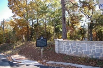
Gospel Pilgrim Cemetery Marker looking northeast toward Old Hull Road
| 1 ► Georgia, Athens-Clarke County, Athens — 29-6 — Gospel Pilgrim Cemetery — |
| On Fourth Street, 0.1 miles north of Bray Street, on the right when traveling north. | |||
| 2 ► Georgia, Athens-Clarke County, Athens — In Memory of Unknown Enslaved Individuals — |
| Near South Jackson Street just north of Baldwin Street, on the right when traveling north. | |||
| 3 ► Georgia, Athens-Clarke County, Athens — Lt. Col. Jefferson M. Lamar, C.S.A. — |
| Near Cemetery Street, 0.2 miles east of East Campus Road. | |||
| 4 ► Georgia, Athens-Clarke County, Athens — Oconee Hill Cemetery — |
| On Cemetery Avenue, 0.2 miles east of East Campus Drive, on the right when traveling east. | |||
| 5 ► Georgia, Athens-Clarke County, Athens — Old Athens Cemetery — |
| On South Jackson Street, 0.1 miles north of Baldwin Street, on the right when traveling north. | |||
| 6 ► Georgia, Athens-Clarke County, Athens — Old Athens Cemetery — ca. 1810 — National Register of Historic Places — |
| On South Jackson Street, 0.1 miles north of Baldwin Street, on the right when traveling north. | |||
| 7 ► Georgia, Atkinson County, Pearson — Salem Church — |
| On Salem Church Road (County Route 29) 0.5 miles east of U.S. 221, on the left when traveling east. | |||
| 8 ► Georgia, Baldwin County, Milledgeville — Cedar Lane Cemetery — |
| On Lawrence Road at Central Shop Road, on the right when traveling south on Lawrence Road. | |||
| 9 ► Georgia, Baldwin County, Milledgeville — 005-28 — Cemetery Square |
| On Franklin Street (Bypass Route 441), on the right when traveling east. Reported missing. | |||
| 10 ► Georgia, Baldwin County, Milledgeville — Memory Hill Cemetery — |
| On W. Franklin Street (U.S. 441) near S. Liberty Street, on the left when traveling west. | |||
| 11 ► Georgia, Baldwin County, Milledgeville — The Unknown Soldiers of Brown Hospital — |
| Near S. Liberty Street continued. | |||
| 12 ► Georgia, Barrow County, Wiinder — William Pentecost — Born Nov. 4, 1762 – Died Jan. 27, 1839 — |
| On Georgia Route 82 at milepost 4,, 0.1 miles east of Steed Road, on the right when traveling east. | |||
| 13 ► Georgia, Barrow County, Winder — Concord Methodist Cemetery — |
| On West Athens Street (Georgia Route 211) 0 miles east of Church Street, on the left when traveling east. | |||
| 14 ► Georgia, Barrow County, Winder — Russell House — |
| On Atlanta Highway SE (U.S. 29) 0 miles east of Russell Cemetery Road, on the right when traveling east. | |||
| 15 ► Georgia, Bartow County, Adairsville — Major John Lewis — Born in Va. 1757 — Died in Ga. 1840 — |
| On Woody Road, 0.1 miles west of Old U.S. 41. | |||
| 16 ► Georgia, Bartow County, Allatoona — Grave of the Unknown Hero — |
| Near Old Alltatoona Road SE, 0.4 miles north of Allatoona Landing Road SE, on the right when traveling north. | |||
| 17 ► Georgia, Bartow County, Allatoona — The Memorial Field — |
| Near Old Allatoona Road SE, 0.4 miles north of Allatoona Landing Road SE, on the right when traveling north. | |||
| 18 ► Georgia, Bartow County, Cartersville — Amos T. Akerman — |
| On South Tennessee Street (Georgia Route 293) 0 miles north of Brook Drive, on the right when traveling north. | |||
| 19 ► Georgia, Bartow County, Cartersville — 008-54 — Etowah (Tumlin) Mounds — |
| On Indian Mound Road, 0.8 miles east of Douthit Ferry Road, on the left when traveling south. | |||
| 20 ► Georgia, Bartow County, Cartersville — Friendship Cemetery — |
| On Georgia Route 293, 0.1 miles north of Old River Road, on the right when traveling north. | |||
| 21 ► Georgia, Bartow County, Cartersville — Pierce Manning Butler Young, (1836-1896) — |
| Near North Erwin Street, 0.1 miles east of Cassville Road (Georgia Route 293). | |||
| 22 ► Georgia, Bartow County, Cartersville — Sam P. Jones — 1847-1906 — |
| Near West Main Street (Georgia Route 113) west of South Public Square, on the right when traveling west. | |||
| 23 ► Georgia, Bartow County, Cassville — 008-39B — Confederate Dead — |
| On Cassville-White Road at Shinall Gaines Road NW, on the right when traveling east on Cassville-White Road. | |||
| 24 ► Georgia, Bartow County, Cassville — Confederate Memorial Cassville Cemetery — |
| Near Chunn Facin Road NW at Shinall Gaines Road, on the right when traveling east. | |||
| 25 ► Georgia, Bartow County, Cassville — 008-40 — Grave of Gen. William Tatum Wofford — |
| Near Cassville-White Road at Shinall Gaines Road NW. | |||
| 26 ► Georgia, Bartow County, Euharlee — Black Pioneers Cemetery — Circa 1830 – 1900 — |
| On Covered Bridge Road SW, 0.2 miles south of Euharlee Road SW, on the right when traveling north. | |||
| 27 ► Georgia, Bartow County, Kingston — 008-39 — Confederate Memorial Day — |
| On East Railroad Street at Shaw Street, on the left when traveling west on East Railroad Street. | |||
| 28 ► Georgia, Bartow County, Kingston — 008-40 — Unknown Confederate Dead — |
| On Johnson Street, 0 miles east of Cemetery Street, on the left when traveling south. | |||
| 29 ► Georgia, Bartow County, Rydal — Pine Log Church Historic District — |
| On Pine Log Road NE, 0.1 miles west of U.S. 411, on the right when traveling west. | |||
| 30 ► Georgia, Bibb County, Macon — 011-10 — Alfred Holt Colquitt — |
| Near Riverside Drive (U.S. 23) at Jones Street. | |||
| 31 ► Georgia, Bibb County, Macon — 011-8 — Confederate Memorial Day in Macon — |
| Near Riverside Drive (U.S. 23). | |||
| 32 ► Georgia, Bibb County, Macon — 011-20 — General Edward Dorr Tracy, Jr. — 1833 – 1863 — |
| Near Riverside Drive (U.S. 23) at Jones Street. | |||
| 33 ► Georgia, Bibb County, Macon — John Basil Lamar — |
| Near Riverside Drive (U.S. 23) at Jones Street. | |||
| 34 ► Georgia, Bibb County, Macon — Macon Defensive Fortifications — The War Comes Home — Wilson's Raid Heritage Trail — |
| 35 ► Georgia, Bibb County, Macon — Oak Ridge Cemetery — Established 1840 — |
| On Madison Street north of Riverside Drive, on the left when traveling north. | |||
| 36 ► Georgia, Bibb County, Macon — Oak Ridge Cemetery — 1840 to 1865 — |
| On Madison Street north of Riverside Drive (U.S. 23), on the left when traveling north. | |||
| 37 ► Georgia, Bibb County, Macon — Oak Ridge Cemetery — 1866 To Present — |
| Near Madison Street, 0.2 miles north of Riverside Drive (U.S. 23). | |||
| 38 ► Georgia, Bibb County, Macon — Rose Hill Cemetery — "Recollection in a bouquet of yesterday" — |
| Near Jones Street at Riverside Drive (Georgia Route 87), on the right when traveling west. | |||
| 39 ► Georgia, Bibb County, Macon — Rose Hill Cemetery — |
| On Jones Street at Riverside Drive, on the right when traveling west on Jones Street. | |||
| 40 ► Georgia, Bibb County, Macon — Unknown, But Not Forgotten — |
| Near Madison Street, 0.1 miles north of Riverside Drive (U.S. 23). | |||
| 41 ► Georgia, Bibb County, Macon — William Bartram Trail — Traced 1773–1777 — Deep South Region — |
| On the park road south of Emery Highway (U.S. 80). | |||
| 42 ► Georgia, Bleckley County, Cochran — 012-2 — Longstreet Methodist Church — ← — |
| On Longstreet Church Road, 0.5 miles south of Broadhead Road, on the left when traveling north. | |||
| 43 ► Georgia, Brantley County, Waynesville — Confederate Soldiers Memorial — |
| Near George Kirkland Road/Mineral Springs Road, 0.1 miles east of Browntown Road, on the left when traveling east. | |||
| 44 ► Georgia, Brooks County, Quitman — 014-2 — West End Cemetery — |
| On Thomasville Road (U.S. 84) 0 miles west of South Laurel Street, on the right when traveling east. | |||
| 45 ► Georgia, Bryan County, Keller — 15-1 — Bryan Neck Presbyterian Church — |
| On Belfast-Keller Rd, on the left when traveling west. | |||
| 46 ► Georgia, Bryan County, Richmond Hill — Burnt Church Cemetery — |
| On Bryan Neck Road (Georgia Route 144) 0.1 miles south of Belfast River Road, on the right when traveling south. | |||
| 47 ► Georgia, Bryan County, Richmond Hill — George W. McAllister — |
| On Bryan Neck Road (Georgia Route 144) 0.1 miles south of Belfast River Road, on the right when traveling south. | |||
| 48 ► Georgia, Bryan County, Richmond Hill — The Clay Family of Bryan Neck — |
| On Bryan Neck Road (Georgia Route 144) 0.1 miles south of Belfast River Road, on the right when traveling south. | |||
| 49 ► Georgia, Bulloch County, Arcola — 016-2A — John Abbot (1751-1839) — Ornithologist, Entomologist, Artist — ⅓ Mi. → — |
| On Arcola Road (County Route 582) at McElveen Cemetery Road (County Route 327), on the left when traveling south on Arcola Road. | |||
| 50 ► Georgia, Bulloch County, Arcola — John Abbot 1751 - 1840 — |
| On McElveen Kendrick Pond Road (County Route 358) 0.2 miles east of McElveen Cemetery Road (County Route 357), on the left when traveling east. | |||
| 51 ► Georgia, Bulloch County, Portal — Upper Lotts Creek Primitive Baptist Church and Cemetery — Bulloch County, Georgia — |
| On Portal Highway at Westside Road, on the right when traveling north on Portal Highway. | |||
| 52 ► Georgia, Bulloch County, Statesboro — Eastside Cemetery — |
| On Unnamed Cemetery Road, 0 miles north of Northside Drive East (U.S. 80), on the right when traveling east. | |||
| 53 ► Georgia, Bulloch County, Statesboro — Rigdon’s Mill / The Rigdon Cemetery — |
| On Old Hardy Place Road at Lakeview Road, on the right when traveling east on Old Hardy Place Road. | |||
| 54 ► Georgia, Bulloch County, Statesboro — William Charles “Willie” Heddleston — |
| Near Northside Drive East (U.S. 80) at Turner Street, on the right when traveling north. | |||
| 55 ► Georgia, Burke County, Blythe — Hopeful Baptist Church — Cemetery & Historic Acreage — National Register of Historic Places — |
| On Winter Road, 0.2 miles west of Mark Walden Road, on the left when traveling west. | |||
| 56 ► Georgia, Burke County, Sardis — First McCanaan Baptist Church — |
| On McCanaan Road, 0.4 miles east of Murray Hill Road, on the right when traveling east. | |||
| 57 ► Georgia, Burke County, Sardis — Original Site Sardis Baptist Church — |
| On Old Sardis Road west of Cemetery Street, on the right when traveling west. | |||
| 58 ► Georgia, Burke County, Sardis — 124-21 — Sardis Baptist Church — |
| On Pine Street at Burke Street, on the right when traveling north on Pine Street. | |||
| 59 ► Georgia, Camden County, St. Marys — The Tragic Acadians — St. Marys History Walk — |
| Near Bartlett Street near St Marys Street West, on the left. | |||
| 60 ► Georgia, Catoosa County, Fort Oglethorpe — MT-465 — John Ingraham's Grave — |
| On Alexander Bridge Road north of Brotherton Road, on the left when traveling north. | |||
| 61 ► Georgia, Catoosa County, Fort Oglethorpe — The Cost of Chickamauga — |
| On Alexander Bridge Road, 0.2 miles north of Brotherton Road, on the left when traveling north. | |||
| 62 ► Georgia, Catoosa County, Resaca — History of Nathan Anderson Cemetery — |
| Near Christian Road south of Lafayette Street, on the right when traveling south. | |||
| 63 ► Georgia, Catoosa County, Ringgold — Catoosa County Veterans — |
| Near Christian Road south of Lafayette Street, on the right when traveling south. | |||
| 64 ► Georgia, Charlton County, Folkston — 024-4 — Sardis Church — <--- 2 mi. ---<<<< — |
| On Okefenokee Parkway (Georgia Route 23) at Spanish Creek Road (County Route 45), on the right when traveling south on Okefenokee Parkway. | |||
| 65 ► Georgia, Chatham County, Savannah — Julia Denise Backus Smith — Savannah's Fastest Female Runner Marathoner: — |
| Near Greenwich Road east of Bonaventure Road when traveling east. | |||
| 66 ► Georgia, Chatham County, Savannah — The Old Bonaventure Waterworks and Garden — |
| Near Greenwich Road east of Walz Way, on the right when traveling east. | |||
| 67 ► Georgia, Chatham County, Savannah, Historic District - North — 025-17B — Archibald Bulloch — |
| Near East Oglethorpe Ave. | |||
| 68 ► Georgia, Chatham County, Savannah, Historic District - North — Button Gwinnett — |
| Near East Oglethorpe Avenue. | |||
| 69 ► Georgia, Chatham County, Savannah, Historic District - North — Captain Denis Cottineau de Kerloguen — |
| Near Abercorn Street, on the right when traveling north. | |||
| 70 ► Georgia, Chatham County, Savannah, Historic District - North — 025-20 — Colonial Park — |
| Near Oglethorpe Ave at Abercorn St, on the right. | |||
| 71 ► Georgia, Chatham County, Savannah, Historic District - North — 025-31 — Dr. Wm. A. Caruthers (1802-46) — Early American Novelist — |
| On Hull Street at Bull Street, on the left when traveling west on Hull Street. | |||
| 72 ► Georgia, Chatham County, Savannah, Historic District - North — 025-22 — Duellist's Grave — |
| Near E. Oglethorpe Ave.. | |||
| 73 ► Georgia, Chatham County, Savannah, Historic District - North — 025-21 — Edward Greene Malbone — (1777-1807) — |
| Near East Oglethorpe Avenue. | |||
| 74 ► Georgia, Chatham County, Savannah, Historic District - North — 025-29 — Gen. Samuel Elbert (1740-1788) — |
| Near E. Oglethorpe Ave.. | |||
| 75 ► Georgia, Chatham County, Savannah, Historic District - North — Great Yellow Fever Epidemic of 1820 — |
| On E. Oglethorpe Ave, on the right when traveling east. | |||
| 76 ► Georgia, Chatham County, Savannah, Historic District - North — 025-24 — Hugh McCall (1767-1823) — Early Georgian Historian — |
| Near East Oglethorpe Ave.. | |||
| 77 ► Georgia, Chatham County, Savannah, Historic District - North — 25-15 — James Habersham — |
| Near E. Oglethorpe Ave.. | |||
| 78 ► Georgia, Chatham County, Savannah, Historic District - North — 025-37 — James Johnston — Georgia's First Newspaper Publisher & Printer — |
| Near East Oglethorpe Avenue. | |||
| 79 ► Georgia, Chatham County, Savannah, Historic District - North — 025-50 — Joseph Clay, Patriot — |
| Near East Oglethorpe Ave.. | |||
| 80 ► Georgia, Chatham County, Savannah, Historic District - North — 025-14 — Joseph Habersham (1751-1815) — John Habersham (1754-1799) James Habersham, Jr. (1745-1799) — |
| On E. Oglrthorpe Ave.. | |||
| 81 ► Georgia, Chatham County, Savannah, Historic District - North — 025-85 — Joseph Vallence Bevan — (1798-1830) — Georgia's First Official Historian — |
| Near East Oglethorpe Avenue. | |||
| 82 ► Georgia, Chatham County, Savannah, Historic District - North — 025-11 — Nathanael Greene, Maj. Gen., Continental Army — John Maitland, Lt. Col., 71st Regt. of Scotch Foot — |
| Near East Oglethorpe Ave.. | |||
| 83 ► Georgia, Chatham County, Savannah, Historic District - North — Original 1733 Burial Plot — |
| On W Oglethorpe Ave at Bull St., in the median on W Oglethorpe Ave. | |||
| 84 ► Georgia, Chatham County, Savannah, Historic District - North — Savannah's First Burying Ground — |
| On West York Street, on the right when traveling east. | |||
| 85 ► Georgia, Chatham County, Savannah, Historic District - North — 025-4 — Tomo-Chi-Chi's Grave — |
| On Bull Street near East Presidents Street, on the left when traveling north. | |||
| 86 ► Georgia, Chatham County, Savannah, Historic District - North — 025-44 — William Scarbrough — Promoter of the First Transatlantic Steamship — |
| Near East Oglethorpe Avenue. | |||
| 87 ► Georgia, Chatham County, Savannah, Kayton/Frazier Area — De Lyon - De La Motta Cemetery — |
| On Cohen Street, 0.1 miles east of West Boundry Street. | |||
| 88 ► Georgia, Chatham County, Savannah, Kayton/Frazier Area — Old Jewish Burial Ground — |
| On Cohen Road at West Boundry Street, on the right when traveling south on Cohen Road. | |||
| 89 ► Georgia, Chatham County, Savannah, Kayton/Frazier Area — 025-17A — Sailors' Burial Ground — |
| Near May Drive. | |||
| 90 ► Georgia, Chatham County, Savannah, Laurel Grove/Railroad Area — Silence — |
| Near West Anderson Street. | |||
| 91 ► Georgia, Chatham County, Savannah, Midtown — Laurel Grove South Cemetery — |
| Near Kollock Street. | |||
| 92 ► Georgia, Chatham County, Savannah, Yamacraw Village — 025-89 — Andrew Bryan — |
| On West Bryan Street, on the right when traveling west. | |||
| 93 ► Georgia, Chatham County, Thunderbolt — Bonaventure Cemetery — |
| On Greenwich Road at Stoddard Way when traveling east on Greenwich Road. | |||
| 94 ► Georgia, Chatham County, Thunderbolt — Colonials at Bonaventure — |
| On Near Noble Jones Drive. | |||
| 95 ► Georgia, Chatham County, Thunderbolt — Solomon's Lodge No. 1 — Free and Accepted Masons — Savannah, Georgia — |
| On Bonaventure Road. | |||
| 96 ► Georgia, Chatham County, Tybee Island — Burial Sites of Immortal 600 — |
| Near Islands Expressway (U.S. 80). | |||
| 97 ► Georgia, Chatham County, Tybee Island — Final Resting Place — Fort Pulaski National Monument — |
| On Fort Pulaski Road, 1 mile north of U.S. 80, on the right when traveling north. | |||
| 98 ► Georgia, Chatham County, Tybee Island — Immortal Six Hundred — |
| Near Fort Pulaski Road, on the right when traveling north. | |||
| 99 ► Georgia, Cherokee County, Canton — Dallas Scott Hudgens, Jr. — 1923-2000 — |
| Near Mount Caramel Church Lane, 2 miles east of Fincher Road (Georgia Route 108) when traveling east. | |||
| 100 ► Georgia, Clay County, Fort Gaines — 030-5 — In the Confederacy — |
| On Bluff Street, 0 miles south of Commerce Street, on the right when traveling south. | |||
387 entries matched your criteria. The first 100 are listed above. Next 100 ⊳