775 entries match your criteria. Entries 101 through 200 are listed.⊲ Previous 100 — Next 100 ⊳
Peace Topic
By Richard E. Miller, April 16, 2009
"Japanese Stone Lantern - Lighting the Way" Marker
| 101 ► District of Columbia, Washington, Southwest Washington, The Tidal Basin — Lighting the Way — Japanese Stone Lantern — National Mall & Memorial Parks, National Park Service, U.S. Department of the Interior — |
| On Independence Avenue Southwest east of West Basin Drive Southwest, on the right when traveling east. | |||
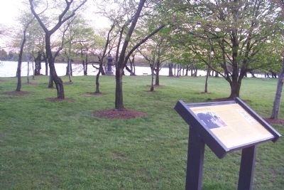
| 102 ► District of Columbia, Washington, Southwest Washington, The Tidal Basin — Martin Luther King, Jr. Memorial — National Mall and Memorial Parks, Washington, D.C. — National Park Service, U.S. Department of the Interior |
| On Independence Avenue Southwest at West Basin Drive Southwest, on the left when traveling east on Independence Avenue Southwest. Reported permanently removed. | |||
| 103 ► District of Columbia, Washington, Southwest Washington, The Tidal Basin — The Gift of Friendship — Japanese Pagoda — National Mall & Memorial Parks, National Park Service, U.S. Department of the Interior — |
| Near Ohio Drive Southwest south of West Basin Drive Southwest, on the right when traveling south. | |||
| 104 ► District of Columbia, Washington, Southwest Washington, The Tidal Basin — The Gift of Trees — National Mall and Memorial Parks — National Park Service, U.S. Department of the Interior |
| Near Maine Avenue Southwest south of Independence Avenue Southwest, on the right when traveling south. Reported damaged. | |||
| 105 ► Florida, Brevard County, Titusville — Striving For Peace Throughout The World — |
| Near E Broad St near Indian River Ave. | |||
| 106 ► Florida, Flagler County, Palm Coast — “All Gave Some, Some Gave All” — |
| Near Palm Coast Parkway NW at Corporate Drive, on the right when traveling west. | |||
| 107 ► Florida, Indian River County, Vero Beach — Peace Tree — Veterans Memorial Island Sanctuary — |
| Near Dahlia Lane, 0.1 miles Riverside Park Drive. | |||
| 108 ► Florida, Leon County, Tallahassee, Capitol Hill — Florida Sri Chinmoy Peace State — |
| On Monroe Street at Pensacola Street on Monroe Street. | |||
| 109 ► Florida, Marion County, Ocala — Allies Victorious — Ocala - Marion County Veterans Memorial Park — |
| Near East Fort King Street, 0.1 miles south of East Silver Springs Boulevard. | |||
| 110 ► Florida, Okaloosa County, Hurlburt Field — Operation Uphold Democracy — |
| Near Independence Road. | |||
| 111 ► Florida, Orange County, Gotha — Eternal Flame of Peace — Dedicated April 8, 1973 by Major Glendon W. Perkins and Captain Ralph Thomas Browning — |
| On Woodlawn Cemetery Road north of Wilson Avenue, on the right when traveling south. | |||
| 112 ► Florida, Orange County, Orlando — Mohandas K. Gandhi — 1869 - 1948 — |
| Near North Eola Drive at East Central Boulevard, on the left when traveling north. | |||
| 113 ► Florida, Orange County, Orlando — Rev. Martin Luther King, Jr. — 1929 - 1968 — Tinker Field History Plaza — |
| On South Tampa Avenue at West South Street, on the right when traveling north on South Tampa Avenue. | |||
| 114 ► Florida, Seminole County, Sanford — Civil War — 1861-1865 — |
| On Seminole Boulevard north of North Park Avenue, on the right when traveling west. | |||
| 115 ► Florida, Seminole County, Sanford — Martin Luther King Jr. — |
| On Martin Luther King Jr Boulevard at West Fifth Street, on the left when traveling south on Martin Luther King Jr Boulevard. | |||
| 116 ► Florida, Seminole County, Sanford — Martin Luther King Jr. — |
| On Martin Luther King Jr Boulevard at Country Club Road, on the right when traveling south on Martin Luther King Jr Boulevard. | |||
| 117 ► Florida, St. Johns County, St. Augustine, Lincolnville — 112 M.L. King Avenue — ACCORD Freedom Trail — |
| On Martin Luther King Avenue near Pomar Street, on the right when traveling south. | |||
| 118 ► Florida, St. Johns County, St. Augustine, Lincolnville — 156 M.L. King Avenue — ACCORD Freedom Trail — |
| On Martin Luther King Avenue. | |||
| 119 ► Georgia, Chatham County, Savannah, Hutchinson Island — 25-41 — Nuclear Ship Savannah — |
| On International Drive, Hutchinson Island near Savannah River. | |||
| 120 ► Georgia, Cook County, Adel — Cook County Veterans Memorial — |
| On North Hutchinson Avenue (U.S. 41) at East 2nd Street, on the right when traveling north on North Hutchinson Avenue. | |||
| 121 ► Georgia, Fulton County, Atlanta, Grant Park — Colonel Joseph F. Burke — November 2, 1845 - April 24, 1927 — |
| Near Oakland Avenue SE at Martin Luther King, Jr. Drive SE. | |||
| 122 ► Georgia, Hancock County, Sparta — 070-6 — Shoulder-bone Creek Treaty — |
| On Georgia Route 16 at Georgia Route 77, on the right when traveling west on State Route 16. | |||
| 123 ► Georgia, Lowndes County, Valdosta — Spanish American War Veterans Memorial — |
| On North Ashley Street (Business U.S. 41) just north of West Central Avenue (U.S. 84/221), on the left when traveling north. | |||
| 124 ► Georgia, Oconee County, Watkinsville — 108-6 — Jeannette Rankin’s Georgia Home — |
| On Mars Hill Road, 0.2 miles west of Hog Mountain Road (Georgia Route 53), on the right. | |||
| 125 ► Georgia, Richmond County, Augusta — The Rotary Club of Augusta — |
| On Broad Street (Georgia Route 104) just east of 8th Street, on the right when traveling east. | |||
| 126 ► Georgia, Sumter County, Plains — Jimmy and Rosalynn Carter — Jimmy Carter National Historic Site — |
| On West Church Street (U.S. 280) just east of Woodland Drive, on the left when traveling east. | |||
| 127 ► Georgia, Tift County, Tifton — The Olympic Torch Paused at this Site — |
| On Main Street South (Love Avenue) (U.S. 41) just north of 1st Street East, on the right when traveling north. | |||
| 128 ► Hawaii, Hawaii County, Kailua-Kona — The Lei Makers — Lark Grey Dimond-Crates — Bronze, 1997 — |
| Near Kupipi Street, 0.4 miles north of Keahole Airport Road, on the right when traveling south. | |||
| 129 ► Hawaii, Honolulu County, Honolulu, Waialae - Kahala — Millennium Peace Garden — Leahi — |
| On Diamond Head Rd at 18th Avenue, on the right when traveling north on Diamond Head Rd. | |||
| 130 ► Hawaii, Honolulu County, Pearl Harbor, Naval Station Pearl Harbor — U.S.S. Missouri — Instrument of Surrender, WWII — |
| Near Kamehameha Highway (Hawaii Route 99) 0.8 miles south of Ford Island Boulevard. | |||
| 131 ► Illinois, Coles County, Charleston — Coles County War Memorial — |
| On 7th Street at Monroe Avenue, on the left when traveling north on 7th Street. | |||
| 132 ► Illinois, Cook County, Elmwood Park — Peace — |
| On Conti Parkway, 0.2 miles west of Grand Avenue. | |||
| 133 ► Illinois, Cook County, Evanston — Archange Ouilmette — |
| On Sheridan Road at Central Street, on the right when traveling north on Sheridan Road. | |||
| 134 ► Illinois, DeWitt County, Clinton — DeWitt County War Memorial — |
| On Lincoln Square Circle, on the left. | |||
| 135 ► Illinois, Douglas County, Arcola — Hippie Memorial Dedication Speech — |
| Near North Oak Street at East Jefferson Street. | |||
| 136 ► Illinois, Knox County, Lafayette — Fraker's Grove — |
| On Illinois Route 17, 0.6 miles west of Golf Course Road, on the right when traveling east. | |||
| 137 ► Illinois, LaSalle County, Oglesby — René Robert Cavelier Sieur de La Salle — 1643-1687 — |
| 138 ► Illinois, McDonough County, Macomb — Civil War Soldier Monument at Chandler Park — |
| On North Lafayette Street south of East Calhoun Street (U.S. 67/136), on the left when traveling south. | |||
| 139 ► Illinois, Monroe County, Columbia — Gedern - Columbia Sister Cities since 1993 — |
| On South Main Street at Cherry Street, on the right when traveling east on South Main Street. | |||
| 140 ► Illinois, Monroe County, Waterloo — Porta Westfalica — Waterloo's Sister City — |
| On North Main Street south of First Street, on the left when traveling south. | |||
| 141 ► Illinois, Peoria County, Peoria — Military Services Memorial Plaza — |
| On NE Water Street near Murray Barker Bridge, on the left when traveling west. | |||
| 142 ► Illinois, Stephenson County, Cedarville — Cedarville — |
| On North Stephenson Street north of Woodland Drive, on the left when traveling east. | |||
| 143 ► Illinois, Vermilion County, Danville — Major Kenneth D. Bailey — Congressional Medal of Honor — |
| On North Hazel Street south of Cherry Street, on the right when traveling south. | |||
| 144 ► Illinois, Vermilion County, Georgetown — Georgetown Parade of Patriots Monument — Patriot Park — |
| On Main Street at East West Street, on the right when traveling north on Main Street. | |||
| 145 ► Illinois, Vermilion County, Ridge Farm — The Treaty Between Harrison and the Indians — |
| On County Road 1720 E, 0.4 miles south of County Highway 16, on the left when traveling south. | |||
| 146 ► Indiana, Allen County, Fort Wayne — Jail Flats |
| Reported missing. | |||
| 147 ► Indiana, Allen County, Fort Wayne, Brookview Civic — I Have A Dream — |
| On South Clinton Street (U.S. 27) just south of East 4th Street, on the right when traveling south. | |||
| 148 ► Indiana, Allen County, Fort Wayne, Wayne Township — Takaoka and Fort Wayne Time Capsule — |
| On East Main Street near South Barr Street, on the right when traveling west. | |||
| 149 ► Indiana, Benton County, Fowler — Indian Boundary Line — 1818 to 1832 — |
| On 3000 County Road 300 E (State Road 55) at County Road E 300 N, on the right when traveling north on 3000 County Road 300 E. | |||
| 150 ► Indiana, Benton County, Fowler — 04.1966.1 — New Purchase Boundary — (Treaty of St. Mary's) — |
| On State Road 18 west of County Road N200W, on the right when traveling east. | |||
| 151 ► Indiana, Delaware County, Muncie — American Legion Post No. 19 Veterans Memorial — |
| On East Wysor Street, on the right when traveling north. | |||
| 152 ► Indiana, Fayette County, Connersville — Twelve Mile Line — |
| On State Road 44 at South Gabbard Road, on the right when traveling east on State Road 44. | |||
| 153 ► Indiana, Floyd County, New Albany — Floyd County World Peace Honor Roll — |
| On East Market Street east of East 10th Street, on the left when traveling east. | |||
| 154 ► Indiana, Fountain County, Hillsboro — Hillsboro Service Memorial — |
| Near North Park Street north of East Hayes Street. | |||
| 155 ► Indiana, Gibson County, Princeton — Declaration of Friendship — Tahara City, Japan & Princeton, Indiana — |
| On West State Street just west of North West Street, on the right when traveling east. | |||
| 156 ► Indiana, Harrison County, Corydon — Dedicated In Everlasting Tribute — Corydon War Memorial — |
| On North Capitol Avenue (State Road 62) at East Walnut Street, on the right when traveling north on North Capitol Avenue. | |||
| 157 ► Indiana, Howard County, Kokomo, Downtown — Nobel Peace Prize, 1964 — Dr. Martin Luther King Jr. — |
| Near North Apperson Way at North Lafountain Street, on the right when traveling south. | |||
| 158 ► Indiana, Knox County, Vincennes — Chief Tecumseh — 1768 - 1813 — |
| On Hart Street west of 1st Street, on the left when traveling west. | |||
| 159 ► Indiana, Lake County, Gary — Atty. Hall's Historic Patriotic Peace Flower and Rose Gardens and Mini-Forest Preserve — "The Wisdom of Love" — |
| On Madison Street north of Madison Lane, on the right when traveling north. | |||
| 160 ► Indiana, Lake County, Gary — 45.2019.1 — Rep. Katie Hall (1938-2012) / Origin of Dr. MLK Day Law — |
| On Madison Street south of West 19th Avenue, on the left when traveling south. | |||
| 161 ► Indiana, LaPorte County, La Porte — American Revolutionary Bicentennial — 1776 - 1976 — |
| On Michigan Avenue south of State Avenue, on the right when traveling south. | |||
| 162 ► Indiana, Lawrence County, Mitchell — Vincennes Tract Line — |
| On Indiana's Historic Pathways - North Spur (U.S. 50) 0.4 miles east of Connerly Cemetery Road, on the left when traveling west. | |||
| 163 ► Indiana, Madison County, Elwood — 48.2001.1 — Wendell Willkie — |
| Near Callaway Park Drive. | |||
| 164 ► Indiana, Marion County, Indianapolis, Downtown — International House — |
| On Limestone Street north of Porto Alegre Street, on the right when traveling south. | |||
| 165 ► Indiana, Marion County, Indianapolis, Irvington — 49.2020.2 — Grace Julian Clarke — 1865-1938 — |
| On South Audubon Road close to Julian Avenue, on the left when traveling south. | |||
| 166 ► Indiana, Marion County, Indianapolis, Near Northside — 49.2005.1 — Robert F. Kennedy Speech on Death of Martin L. King — |
| Near East 17th Street at Broadway Street. | |||
| 167 ► Indiana, Marion County, Indianapolis, Wholesale District — Martin Luther King Jr. — (January 15, 1929 - April 4, 1968) — |
| On East Washington Street at South Pennsylvania Street, on the left when traveling west on East Washington Street. | |||
| 168 ► Indiana, Monroe County, Bloomington — Warren Henegar — Lord Make me an instrument of Your Peace — |
| On West Kirkwood Avenue at North College Avenue, on the right when traveling west on West Kirkwood Avenue. | |||
| 169 ► Indiana, Orange County, Orleans — Orleans Area War Memorial — Veterans of All Wars |
| On South Maple Street north of West Washington Street, on the left when traveling north. Reported permanently removed. | |||
| 170 ► Indiana, Putnam County, Greencastle — The U.N. Tree — |
| On South Bloomington Street (U.S. 231) just south of Maple Avenue, on the left when traveling south. | |||
| 171 ► Indiana, Scott County, Scottsburg — Scott County War Memorial — |
| On East McClain Avenue east of South Main Street, on the right when traveling east. | |||
| 172 ► Indiana, Tippecanoe County, Lafayette — Camp Tippecanoe — 1861 - 1865 |
| On Fourth Street (State Road 25) at Hickory Street, on the right when traveling south on Fourth Street. Reported missing. | |||
| 173 ► Indiana, Vermillion County, Newport — Vermillion County Indiana - - War Memorial — |
| On Market Street at South Main Street, on the left when traveling east on Market Street. | |||
| 174 ► Iowa, Page County, Clarinda — Sister Cities — |
| On Main Street at 16th Street / Glenn Miller Avenue, on the right when traveling west on Main Street. | |||
| 175 ► Iowa, Polk County, Des Moines, East Village — 平和と友情の鐘 — Bell of Peace and Friendship — |
| Near East Court Avenue south of Dey Street, on the right when traveling east. | |||
| 176 ► Iowa, Polk County, Des Moines, East Village — Japanese Bell of Peace and Friendship — 平和と友情の鐘 — |
| Near East Court Avenue south of Dey Street, on the right when traveling east. | |||
| 177 ► Iowa, Scott County, Davenport — Farnam & 5th Street — The Celtic Heritage Trail |
| On Farnam Street at Federal Street on Farnam Street. Reported unreadable. | |||
| 178 ► Iowa, Worth County, Northwood — 21 — Historic Northern Iowa / Carrie Lane Chapman Catt - (1859 - 1947) — |
| Near Wheelerwood Road, 0.2 miles north of Iowa Highway 105. | |||
| 179 ► Kansas, Allen County, Iola — Iola Police Department — |
| On Jackson Street west of North Street, on the left when traveling east. | |||
| 180 ► Kansas, Barber County, Medicine Lodge — 69 — Medicine Lodge Peace Treaties — |
| On U.S. 160 at the entrance to Memorial Peace Park, on the right when traveling east on U.S. 160. | |||
| 181 ► Kansas, Barber County, Medicine Lodge — Peace Treaty Memorial — |
| On Main Street at 1st Avenue, on the right when traveling north on Main Street. | |||
| 182 ► Kansas, Cowley County, Arkansas City — 1996 Olympic Torch Relay — Arkansas City — Heart of the Flame — |
| On Summit Street (U.S. 77) north of Maple Avenue, on the left when traveling north. | |||
| 183 ► Kansas, Ford County, Dodge City — H.B. (Ham) Bell — |
| On Spruce Street at 4th Avenue, on the left when traveling west on Spruce Street. | |||
| 184 ► Kansas, Ford County, Dodge City — Wyatt Earp — |
| On Wyatt Earp Boulevard at Central Avenue, on the left when traveling east on Wyatt Earp Boulevard. | |||
| 185 ► Kansas, Ford County, Dodge City — Wyatt Earp — |
| On Spruce Street at 4th Avenue, on the left when traveling west on Spruce Street. | |||
| 186 ► Kansas, Labette County, Oswego — Osage Indian Village — Circa 1841 — |
| On 4th Street near Commercial Street, on the right when traveling east. | |||
| 187 ► Kansas, Leavenworth County, Leavenworth — A Lasting Friendship — |
| On Esplanade Street, on the right when traveling north. | |||
| 188 ► Kansas, Marion County, Goessel — 31 — The Mennonites in Kansas — |
| On Bison Road (State Highway 15) at 130th Street on Bison Road. | |||
| 189 ► Kansas, Marion County, Peabody — Mennonite Centennial Memorial — 1874 - 1974 — |
| On Walnut Street at 1st Street, on the left when traveling south on Walnut Street. | |||
| 190 ► Kansas, McPherson County, Lindsborg — Dag Hammarskjöld — 1905 - 1961 — Swedish Diplomat, Peacemaker, UN Secretary General — |
| 191 ► Kansas, McPherson County, Moundridge — III — Anabaptist - Mennonite Faith & Life — |
| On Aztec Lane, 0.2 miles east of 18th Avenue, on the left when traveling west. | |||
| 192 ► Kansas, McPherson County, Moundridge — VI — Growth of This Pioneer Group — |
| On Aztec Lane, 0.2 miles east of 18th Avenue, on the left when traveling west. | |||
| 193 ► Kansas, McPherson County, Moundridge — In Memory of the Swiss Mennonite Congregation — |
| On 18th Avenue, 0.1 miles north of Arrowhead Road, on the right when traveling north. | |||
| 194 ► Kansas, McPherson County, Moundridge — VII — The Challenge & Hope of the Future — |
| On Aztec Lane, 0.2 miles east of 18th Avenue, on the left when traveling west. | |||
| 195 ► Kansas, McPherson County, Moundridge — II — The Swiss (Yolhynian) Mennonites — |
| On Aztec Lane, 0.2 miles east of 18th Avenue, on the left when traveling west. | |||
| 196 ► Kansas, Montgomery County, Caney — “Walking Stick” Cannon — |
| On Taylor Avenue near Hooker Street, on the left when traveling west. | |||
| 197 ► Kansas, Montgomery County, Coffeyville — Charles Brown — In Memory Of — |
| 198 ► Kansas, Montgomery County, Coffeyville — Charles T. Connelly — In Memory Of — |
| 199 ► Kansas, Montgomery County, Coffeyville — Dalton Gang and Defenders Graves — |
| 200 ► Kansas, Montgomery County, Coffeyville — George B. Cubine — In Memory Of — |
775 entries matched your criteria. Entries 101 through 200 are listed above. ⊲ Previous 100 — Next 100 ⊳