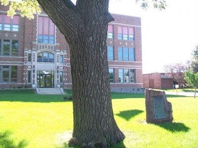
On School Street (State Highway 25) south of Division Street, on the right when traveling north.
Determined and authenticated by
the Historical Department of Iowa, 1911.
This monument was erected in 1917 by
the Iowa Daughters of the American Revolution
in memory of the pioneers who followed
this trail and its tributaries.
We cross . . . — — Map (db m86922) HM
On Lincoln Highway (U.S. 30) 0.3 miles east of Delta Avenue (County Road M68), on the left when traveling east.
Union Pacific Railroad in Iowa Iowa crews began laying the first rails in 1854. A year later, the first locomotive was shipped across the Mississippi River by ferry. As with the Pacific line, the U.S. government was instrumental in . . . — — Map (db m186198) HM
On Minnesota Street / Nishna Valley Road, 0.8 miles west of Lewis Road / 1st Street, on the right when traveling west.
Beginning in February of 1846, the vanguard of the Church of Jesus Christ of Latter-day Saints (the Mormons) struggled across southern Iowa on the way to their "New Zion" in the Rocky Mountains.
The trek from Nauvoo, Illinois, to Kanesville . . . — — Map (db m93813) HM
Beginning in February of 1846, the vanguard of the Church of Jesus Christ of Latter-day Saints (the Mormons) struggled across southern Iowa on the way to their "New Zion" in the Rocky Mountains.
The trek from Nauvoo, Illinois, to Kanesville . . . — — Map (db m93882) HM
On Main Street west of Market Street, on the right when traveling west.
Determined and authenticated
by the Historical Department of Iowa, 1911.
This monument was erected in 1917 by the
Iowa Daughters of the American Revolution
in memory of the pioneers who followed
this trail and its tributaries.
We cross . . . — — Map (db m93819) HM
Near Interstate 80 at milepost 270,, 1 miles west of Rose Avenue (County Highway X64), on the right when traveling west.
Marker Front: The land on which Iowa City is located was a wilderness when it was selected and surveyed for the capital of the Territory of Iowa in 1839. The cornerstone of the new capitol building was laid by Governor Lucas on July 4, 1840. . . . — — Map (db m224357) HM
Near Interstate 35 at milepost 32,, 2.9 miles north of Elk Street, on the right when traveling north.
From the late 1840s through the 1860s, an exodus of more than 70,000 Mormons passed by here on their way to their "New Zion" in Utah. Starting from Nauvoo, Illinois in February 1846, the first group of at least 13,000 Mormons crossed into Iowa to . . . — — Map (db m235830) HM
Near Great River Road (State Highway 76) 2 miles north of U.S. 18, on the right when traveling north.
This rock marks the beginning of the Old Military Trail first used in the summer of 1840 by troops from Fort Crawford in Wisconsin when building Fort Atkinson in Iowa. It served as a highway for the movement of troops and supplies from Fort Crawford . . . — — Map (db m44190) HM
Near North 10th Street north of Hickman Road (U.S. 6), on the right when traveling north.
Waukee History
Adapted from "The Road to Waukee's Future" By Deborah Mikelson (Originally published in the July 2014 issue of myWaukee Magazine)
Looking Back-The Very Beginning
The first people to lay the cornerstone for . . . — — Map (db m236582) HM
On 1st Street (U.S. 69) at Church Street (U.S. 69), on the right when traveling west on 1st Street.
From the late 1840s through the 1860s, an exodus of more than 70,000 Mormons passed by here on their way to their "New Zion" in Utah. Starting from Nauvoo, Illinois in February 1846, the first group of at least 13,000 Mormons crossed into Iowa . . . — — Map (db m72391) HM
On Washington Street at North 6th Street, on the right when traveling west on Washington Street.
Built in 1894, Burlington, Iowa’s Snake Alley is unbelievably crooked — boasting five half-curves and two quarter-curves that span 275 feet! The street rises over 58.3 feet at a 21% grade and has 1100 degrees of turns! Ripley’s . . . — — Map (db m175883) HM
On Main Street at West 1st Street, on the left when traveling south on Main Street.
Terminus of the Old Military Road from Dubuque to the Northern boundary of Missouri Authorized by Congress 1839 Marked by Iowa Daughters of the American Revolution 1937 — — Map (db m150707) HM
The Lincoln Highway, the nation's first east-west transcontinental highway, has an intimate history with Greene County. Stretching from New York City to San Francisco, its original construction was essentially a private promotional effort, created . . . — — Map (db m168843) HM
On West Main Street (State Highway 44) just west of North 1st Street, on the right when traveling west.
Background The Western Skies Scenic Byway, dedicated in 1998, is among the first state designated scenic byways in Iowa. The Byway is 142-miles long, traveling through Harrison, Shelby, Audubon and Guthrie Counties, and 14 rural . . . — — Map (db m238319) HM
Near Lincoln Highway (U.S. 30) just west of Monroe Avenue, on the right when traveling west.
In 1912, there were approximately one million motor vehicles registered in the United States but few good roads. Most of the roads outside of urban areas were dirt that turned to mud when wet. Long-distance travel by car was still very much a . . . — — Map (db m162418) HM
Near Interstate 80 at milepost 237,, 6.3 miles east of Black Hawk Avenue NW, on the right when traveling east.
Marker Front: The land on which Iowa City is located was a wilderness when it was selected and surveyed for the capital of the Territory of Iowa in 1839. The cornerstone of the new capitol building was laid by Governor Lucas on July 4, 1840. . . . — — Map (db m224362) HM
On South Military Street just north of Hubbell Street, on the right when traveling north.
Before 1839 no roads connected Dubuque and Iowa City. Travelers often became lost. Lyman Dillon, Esq., from Cascade, Iowa plowed a furrow between the two cities. The 100 mile furrow, known as Dillon’s Furrow is the longest on record. Dillon’s Furrow . . . — — Map (db m238900) HM
On River Road north of Rand Park Terrace, on the left when traveling north.
To the memory of the pioneers who entered Iowa by Keokuk the Gate City and either settling in our state or passing farther west travelled over the well-worn road known as the Mormon Trail. With this tablet the Daughters of the American Revolution . . . — — Map (db m185392) HM
On West Mount Vernon Road (County Road E48) 0.8 miles west of Smyth Road, on the right when traveling west.
This is the site of the first and only seedling mile of concrete
pavement in the state of Iowa on the Lincoln Highway. The Linn
County Engineer at the time was R. W. Gearhart and the project
was constructed by Ford Paving Company of Cedar . . . — — Map (db m161620) HM
On North Washington Street (County Highway X20) just north of East Main Street (County Highway E48), on the right when traveling north.
Lisbon is a small community that is full of rich history dating back a long way. Early records show the first settlers were arriving in the mid 1830's. It is said the community was named after Lisbon, Ohio where some of the first settlers came . . . — — Map (db m184817) HM
Near East Main Street (County Highway E48) at North Washington Street (County Highway X20), on the right when traveling east.
As of 1900, the United States had an excellent rail network but no system of long-distance highways. Private associations made the earliest attempts to blaze "auto trails," giving them colorful names and emblems. The most famous road across Iowa . . . — — Map (db m184820) HM
On 1st Street Southwest at Old Lincoln Highway (10th Avenue Southwest), on the left when traveling east on 1st Street Southwest.
The Lincoln Highway ran through the central business districts of hundreds of small towns and cities across the U.S., giving substance to slogans proclaiming the highway as the "Nation's Main Street." To small-town merchants, the Lincoln Highway . . . — — Map (db m184844) HM
On West Mount Vernon Road (County Road E48) 0.1 miles south of Irish Lane, on the left when traveling south.
At first, the Lincoln Highway through Iowa consisted mainly of dirt roads, which were fine when dry but impassable when wet. Motorists were advised against trying to cross Iowa in rainy weather.
The goal of the Lincoln Highway Association (LHA) . . . — — Map (db m158227) HM
On Court Avenue (Business U.S. 34) just east of North Main Street, on the right when traveling west.
Determined and authenticated by the Historical Department of Iowa, 1911. This monument was erected in 1917 by the Iowa Daughters of the American Revolution in memory of the pioneers who followed this trail and its tributaries. We cross the prairie . . . — — Map (db m176631) HM
On John Wayne Drive at Court Avenue, on the right when traveling north on John Wayne Drive.
In the early 1850's this was the site of Winterset's first hotel. Berger's Hotel was a story-and-a-half log cabin that soon became a stagecoach stop.
Later known as the Bare Block, this building has had many businesses: several grocery stores, . . . — — Map (db m72680) HM
On John Wayne Drive near Court Avenue, on the right when traveling north.
This is one of the few one-story buildings around the square. Uses of this building include a grocery store, a confectionary, restaurants, including the Club Cafe, a health food and gift shop. For many years there was a bus stop on this end of . . . — — Map (db m72676) HM
On 1st Avenue north of Court Avenue, on the left when traveling north.
From the 1870's through 1890's, groceries were sold on the main floor. In 1874, S.B. Wheelock advertised among other things, oranges, lemons, cigars, parlor brooms, boneless cod fish and candy. That year, Wheelock received a new delivery wagon . . . — — Map (db m72775) HM
On John Wayne Drive north of Court Avenue, on the right when traveling north.
1n 1886 there was a restaurant in the north side of the original building and a harness shop in the south side. A dry goods store in the north side and a jewelry store in the south side occupied the double store building in 1899. The Evening Star . . . — — Map (db m72533) HM
On Jefferson Street west of John Wayne Drive, on the right when traveling west.
Grocery stores operated here in the late 1800's. By 1907, a bakery with an oven in the basement had been added, as well as a jewelry store. It later became a hardware store with a tin shop in the rear. A pool hall, a farm and auto parts store, . . . — — Map (db m72470) HM
On Court Avenue west of John Wayne Drive, on the left when traveling west.
This building housed a general store in 1886, a clothing shop in 1893, and boots and shoes were sold here in 1907. By 1916 it was a grocery store.
The Western Auto Store was located here from the 1920s until the early 1960s when, in need of . . . — — Map (db m72741) HM
Near Lincoln Street west of Houston Avenue, on the right when traveling west.
When Pella was founded in 1847, transportation and shipping were limited to horse-drawn conveyances. Consequently, mercantile trade and the importing or exporting of goods was extremely limited and expensive. Money was also scarce, as almost every . . . — — Map (db m236385) HM
On Lombard Street just south of East 2nd Street (Business U.S. 61), on the right when traveling south.
Great River Road (marker north side) Charles H. Young of Muscatine devoted most of his life to the establishment of the Great River Road. In 1916, the idea of a scenic highway was conceived and an organization formed. Charles . . . — — Map (db m175878) HM
On Sheridan Avenue at Railroad Street, on the right when traveling east on Sheridan Avenue.
The railroad was king, and southwest Iowa became part of the realm when the Burlington Railroad crossed the landscape from Mount Pleasant to Red Oak in 1867.
Chartered as a land grant railroad, the Burlington advertised and promoted the sale . . . — — Map (db m87584) HM
Near Northwest 86th Street, 0.2 miles south of Swanson Boulevard, on the right when traveling south.
On this day, Walnut Creek rose out of its banks reaching a record crest of 13.41 feet (flood stage is 12 feet). The flooding followed two storms that moved through portions of Iowa sending several river systems above flood stage and 5 inches of rain . . . — — Map (db m236235) HM
On Pleasant Street west of 12th Street, on the right when traveling west.
People lived and worked here. They shopped and prayed here. They gathered here to celebrate life. Welcome to what was Iowa's most vibrant Black community — the historic Center Street neighborhood, stretching from 15th Street to Keosauqua Way. . . . — — Map (db m235901) HM
On Pioneer Trail at Dumfries Avenue, on the right when traveling east on Pioneer Trail.
Some 10,000 goldseekers ferried the Missouri River at Council Bluffs in 1849. The settlement was "only a little Burg between two high bluffs," but over the next two decades it became the preferred "jumping off" point for thousands of overland . . . — — Map (db m93961) HM
Near Interstate 80 at milepost 300,, 1.9 miles east of Interstate 74, on the right when traveling east.
Marker Front: In 1829, William C. Redfield declared that Davenport lay opposite the future terminus of a “geographical trunk-line route” between the Atlantic and the Mississippi. Nine years later, in 1838, the Iowa Sun and Davenport and . . . — — Map (db m224582) HM
Near Interstate 80 at milepost 300,, 1.1 miles west of Middle Road, on the right when traveling west.
Marker Front: In 1829, William C. Redfield declared that Davenport lay opposite the future terminus of a “geographical trunk-line route” between the Atlantic and the Mississippi. Nine years later, in 1838, the Iowa Sun and Davenport and . . . — — Map (db m224581) HM
On 11th Street west of 19th Avenue, on the right when traveling west.
Early tractors were massive and expensive. Their steel lug wheels gave poor traction and a rough ride. Lugs were prohibited on many roads.
1926 Hoyle Pounds modified a Fordson tractor with zero pressure truck tires on special rims to improve . . . — — Map (db m234252) HM
On Lincoln Highway (Business U.S. 30) at East 5th Street, on the right when traveling east on Lincoln Highway.
This bridge, constructed in 1915, was an early advertisement for the Lincoln Highway, which was the first successful effort to mark, promote, and build an automobile highway spanning the United States. Initiated in 1913 as a memorial to the . . . — — Map (db m126563) HM
On New York Street (U.S. 34) at Park Street, on the right when traveling west on New York Street.
Frank Phillips always had a warm spot in his heart for Creston. When the town observed its 75th anniversary in 1947, he remarked, "In my opinion there is no place like the home plate, which is Creston to me."
Frank & Jane Phillips visited . . . — — Map (db m87045) HM
On Mt Pisgah Road, 0.5 miles south of 170th Street, on the right when traveling south.
(front of main marker)
Mt. Pisgah - Mormon Pioneer Way Station
Between 300 and 400 Mormon pioneers perished here from 1846 to 1852. Having been driven from their homes by armed mobs, they stopped here on their westward trek, named it . . . — — Map (db m20995) HM
On U.S. 65/69, 0.2 miles south of Carpenter Street, on the right when traveling south.
Erected in 1933 by Ross & Louis Hastie for the Standard Oil Company and operated until 1943 Members of the Warren County Historic Preservation Commission Ron Fine • Tina Rhodes • Susan Brockway Gary Hutchison • Patrick Dunn Donors of $100.00 . . . — — Map (db m188100) HM
On Jefferson Street (State Highway 2) east of East Street, on the left when traveling east.
Beginning in February of 1846, the vanguard of the Church of Jesus Christ of Latter-day Saints (the Mormons) struggled across southern Iowa on the way to their "New Zion" in the Rocky Mountains.
The trek from Nauvoo, Illinois, to Kanesville . . . — — Map (db m90402) HM
On River Bluffs Scenic Highway /Hiawatha Pioneer Trai (U.S. 52), on the right when traveling west.
On June 7, 1848, Hamilton Campbell, with his wife and two year old son, arrived at this site, and so became Winneseik County’s first white settler. Campbell travelled by oxen team and covered wagon over the Old Military Trail road to arrive at the . . . — — Map (db m203148) HM