By William Fischer, Jr., July 31, 2015
The Mormon Trail Marker
| On School Street (State Highway 25) south of Division Street, on the right when traveling north. |
| On Lincoln Highway (U.S. 30) 0.3 miles east of Delta Avenue (County Road M68), on the left when traveling east. |
| On Minnesota Street / Nishna Valley Road, 0.8 miles west of Lewis Road / 1st Street, on the right when traveling west. |
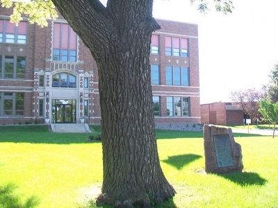
| On Main Street west of Market Street, on the right when traveling west. |
| Near Interstate 80 at milepost 270,, 1 miles west of Rose Avenue (County Highway X64), on the right when traveling west. |
| Near Interstate 35 at milepost 32,, 2.9 miles north of Elk Street, on the right when traveling north. |
| Near Great River Road (State Highway 76) 2 miles north of U.S. 18, on the right when traveling north. |
| Near North 10th Street north of Hickman Road (U.S. 6), on the right when traveling north. |
| On 1st Street (U.S. 69) at Church Street (U.S. 69), on the right when traveling west on 1st Street. |
| On Washington Street at North 6th Street, on the right when traveling west on Washington Street. |
| On Main Street at West 1st Street, on the left when traveling south on Main Street. |
| On East Lincolnway Street. |
| On West Main Street (State Highway 44) just west of North 1st Street, on the right when traveling west. |
| Near Lincoln Highway (U.S. 30) just west of Monroe Avenue, on the right when traveling west. |
| On Main Street (County Route V64) at Maple Ave (County Route H43), on the right when traveling south on Main Street. |
| Near Interstate 80 at milepost 237,, 6.3 miles east of Black Hawk Avenue NW, on the right when traveling east. |
| On West Main Street at North High Street, on the right when traveling west on West Main Street. |
| On South Military Street just north of Hubbell Street, on the right when traveling north. |
| On River Road north of Rand Park Terrace, on the left when traveling north. |
| On West Mount Vernon Road (County Road E48) 0.8 miles west of Smyth Road, on the right when traveling west. |
| On West Mount Vernon Road (County Road E48) 0.3 miles east of O'Connor Road, on the right when traveling east. |
| On North Washington Street (County Highway X20) just north of East Main Street (County Highway E48), on the right when traveling north. |
| Near East Main Street (County Highway E48) at North Washington Street (County Highway X20), on the right when traveling east. |
| On 1st Street Southwest at Old Lincoln Highway (10th Avenue Southwest), on the left when traveling east on 1st Street Southwest. |
| On West Mount Vernon Road (County Road E48) 0.1 miles south of Irish Lane, on the left when traveling south. |
| On South First Avenue (State Highway 1), on the right when traveling north. |
| On Court Avenue (Business U.S. 34) just east of North Main Street, on the right when traveling west. |
| On John Wayne Drive at Court Avenue, on the right when traveling north on John Wayne Drive. |
| On John Wayne Drive near Court Avenue, on the right when traveling north. |
| On 1st Avenue north of Court Avenue, on the left when traveling north. |
| On John Wayne Drive north of Court Avenue, on the right when traveling north. |
| On Jefferson Street west of John Wayne Drive, on the right when traveling west. |
| On Court Avenue west of John Wayne Drive, on the left when traveling west. |
| On Old Highway 163, 0.2 miles north of Orchard Ave, on the left when traveling north. |
| On State Highway 14 at Hayes Dr, on the right when traveling south on State Highway 14. |
| Near Lincoln Street west of Houston Avenue, on the right when traveling west. |
| On Lombard Street just south of East 2nd Street (Business U.S. 61), on the right when traveling south. |
| On Sheridan Avenue at Railroad Street, on the right when traveling east on Sheridan Avenue. |
| On Maple Street at Sheridan Avenue, on the right when traveling north on Maple Street. |
| Near Northwest 86th Street, 0.2 miles south of Swanson Boulevard, on the right when traveling south. |
| On Pleasant Street west of 12th Street, on the right when traveling west. |
| On Pioneer Trail at Dumfries Avenue, on the right when traveling east on Pioneer Trail. |
| Near Interstate 80 at milepost 300,, 1.9 miles east of Interstate 74, on the right when traveling east. |
| Near Interstate 80 at milepost 300,, 1.1 miles west of Middle Road, on the right when traveling west. |
| On 11th Street west of 19th Avenue, on the right when traveling west. |
| On Lincoln Highway (Business U.S. 30) at East 5th Street, on the right when traveling east on Lincoln Highway. |
| On New York Street (U.S. 34) at Park Street, on the right when traveling west on New York Street. |
| On Mt Pisgah Road, 0.5 miles south of 170th Street, on the right when traveling south. |
| On U.S. 63 at Angle Rd, on the right when traveling south on U.S. 63. |
| On U.S. 65/69, 0.2 miles south of Carpenter Street, on the right when traveling south. |
| On South Main Street south of East Smithfield Street, on the left when traveling south. |
| On Jefferson Street (State Highway 2) east of East Street, on the left when traveling east. |
| On Museum Road at Kenyon Road (Iowa Highway 20), on the left when traveling north on Museum Road. |
| On River Bluffs Scenic Highway /Hiawatha Pioneer Trai (U.S. 52), on the right when traveling west. |
| On Orchid Avenue (U.S. 65) at Freeborn Minnesota County Road 106, on the right when traveling north on Orchid Avenue. |
| On Railroad Street at Garfield Street, on the left when traveling east on Railroad Street. |