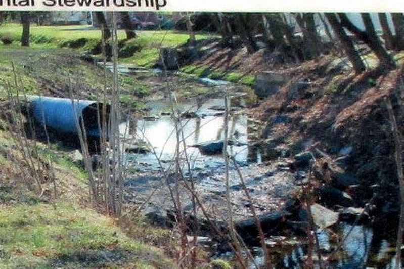
The stream you are looking at is known as Stevens Run. This 2.2 mile Pennsylvania stream, sometimes dry, is a tributary of Rock Creek and part of the Chesapeake Bay Watershed. It originates on the Gettysburg battlefield to the south (your right) . . . — — Map (db m198481) HM
Samuel Swartz built and operated a creamery on this site in 1898, with milk and cream from local dairy farmers. The creamery manufactured ice cream, becoming famous for "Barlow Ice Cream." In 1909, C.D. Dougherty purchased the business, later . . . — — Map (db m192378) HM
"It seems Captain Selfridge of Company H, had taken some of his men's canteens and gone on ahead to Spangler's Spring to fill them, when he discovered "Johnnies" also there filling their canteens. He backed out with the best grace he could . . . — — Map (db m13603) HM
When Eisenhower would come (to the farm), and especially if he had a hard day or a hard week at the office, … we’d walk down by the flag pole all the way down to the creek, over to the pond. CPO Walter West, U.S. Navy, who was . . . — — Map (db m64394) HM
Army of the Potomac United States Battalion of Engineers Captain George H. Mendell commanding With the Army of the Potomac in the Gettysburg Campaign from the Rappahannock to the Potomac and engaged in arduous duties from June 13th to July 18th . . . — — Map (db m15955) HM WM
Below this bridge was the first lock and dam built (1878-1885) on the Ohio River. This was the world's largest movable dam yet constructed, and included the world's first rolling lock gate and widest lock chamber. Built and operated by the United . . . — — Map (db m40201) HM
'Place of Beginning' at which the county survey commenced junction of Flaugherty Run and Ohio River created from Washington and Westmoreland counties. Approved by the General Assembly Sept. 24, 1788
Dedicated Sept. 24, 1988. — — Map (db m80705) HM
Here were the boatyards of John and Samuel Walker, a major center for building boats for western waters. A ship launched in 1793 at these yards reached Philadelphia via New Orleans. — — Map (db m41772) HM
One of the nation's earliest and most successful river navigation systems, its series of locks and dams, begun in 1838, has provided year-round navigation between Pittsburgh and Fairmont, West Virginia. Millions of tons of coal shipped through the . . . — — Map (db m56942) HM
Side A
E.V. Babcock - The Father of Allegheny County Parks
We have E.V. Babcock to thank for starting Allegheny County's remarkable park system. Edward Vose Babcock (1864-1948) was born and raised on a farm near Fulton, New York. He . . . — — Map (db m114185) HM
From whom McKeesport derives its name, first permanent white settler at the forks of the Monongahela and Youghiogheny Rivers in 1755. The Colonial Government granted to him exclusive right of ferrage over these rivers April 3, 1769, called . . . — — Map (db m29962) HM
The northern end of town has long been identified with Jonathon Hulton, an early settler who arrived in 1845. The first train station on the Allegheny Valley Railroad was constructed on Hilton's property, and the small village that grew up around it . . . — — Map (db m213345) HM
Oakmont is situated on the riverbank of the scenic Allegheny River. The waterway has provided recreation to Oakmont's residents for over 100 years.
In the 1880s and 90s, sculling races were held on the river. Racers from all over the world . . . — — Map (db m213350) HM
Commemorating the destruction of the Battleship Maine in Havana Harbor Cuba February 15, 1898 and to the Soldiers, Sailors and Marines of Allegheny County who participated in the Spanish American War of 1898-1899 which followed this disaster. . . . — — Map (db m41048) HM WM
Twenty-four residents of Allegheny County lost their lives by the sinking of Graham's Ferry near the site of this bridge on May 12, 1909.
August Wolf • James Cotter Jr • Albert E Graham • Frank Neeld • Emil Yehle • Nicholas A Brucker • Clarence . . . — — Map (db m138820) HM
Point of Confluence
Nature itself has conspired to render the Ohio hereabouts a place of consequence and importance, and the rendezvous of all the people of North America that are within reach of it.
John Mitchell 1756 . . . — — Map (db m156277) HM
On August 31, 1803, Captain Meriwether Lewis and his crew set off from Pittsburgh at a point near here on their heroic journey to the Pacific coast. The goals of the expedition were to find a water route to the Pacific Ocean, to collect specimens . . . — — Map (db m174435) HM
The first steam boat built west of the Alleghenies, the "New Orleans" was launched Oct. 15, 1811, near this site at Suke's Run. Pittsburgh became a center for steamboat construction and a gateway for 19th-century westward expansion. — — Map (db m48357) HM
Has been designated a Registered National Historic Landmark
Under the provisions of the Historic Sites Act of August 21, 1935. This site possesses exceptional value in commemorating and illustrating the history of the United States. — — Map (db m43571) HM
The three identical bridges spanning the Allegheny
River are the only known example of a triple set of bridges constructed side-by-side across a major river. They were built between 1926 and 1928 when the War Department ruled that bridges over . . . — — Map (db m74213) HM
Fountain
The Point State Park fountain opened in 1974 and immediately became a famous symbol of Pittsburgh's strength. The fountain's welcoming column of water soars high above Point State Park, highlighting the unique geographical . . . — — Map (db m156271) HM
During World War II, Dravo's shipyard here was a leader in the manufacture of Landing Ship Tanks--LSTs--for the United States Navy. Dravo's over 16,000 workers produced a total of 145 LSTs. This and four other inland yards, all using techniques . . . — — Map (db m40280) HM
Conceived as a "Sculpture Park" within a "Sculpture Park", the varied elements that have contributed to Pittsburgh's growth are represented by forms which symbolize a paddlewheel (the rivers), a crucible (primary metals), the Golden Triangle . . . — — Map (db m156086) HM
A celebration of the three rivers and the molten metals that have been major forces in shaping Pittsburgh's industrial history.
Collection of Museum of Art, Carnegie Institute
[Additional plaque on the base of the sculpture:] . . . — — Map (db m156088) HM
The Pennsylvania Canal across Pennsylvania was an engineering triumph with a spectacular 37-mile railroad portage over the Allegheny Mountains. For half a century between 1820 and the Civil War, packet boats pulled by mules navigated through the . . . — — Map (db m191483) HM
In the early 1700s, the Allegheny River formed a boundary: lands claimed by European nations were to the east, and lands claimed by Native Americans were to the west.
Near this site in 1783, James Robinson, the first permanent European settler . . . — — Map (db m191484) HM
Few cities have the visual drama of Pittsburgh, or so rich a collection of national memories. At the Pittsburgh Point two rivers converge: The Allegheny River flowing from the north and the Monongahela River from the south. These rivers drain the . . . — — Map (db m78366) HM
James Laughlin, one of the founders of Jones & Laughlin, constructed the first Eliza Furnace, a stone blast furnace for smelting iron. Built in 1858 before the Civil War, Eliza marked the city's emerging iron and steel industry and was the first . . . — — Map (db m191485) HM
Brady St. Bridge was a through-cantilever bridge designed by Albert L. Schultz in 1896 for highway and streetcar traffic crossing the Monongahela River. It was the first city-erected bridge that was toll free. The railings were recovered by the . . . — — Map (db m156281) HM
Riverboat pilot Holmes Harger operated a steamboat ferry on 22nd Street. Not only did ferries provide passage across the rivers but the boats also traveled to and from landing sites all along the rivers. Before the ferries, people crossed on foot at . . . — — Map (db m152181) HM
In 1841, a privately owned company called the Monongahela Navigation Company built the first navigation dam on the Monongahela River. This dam and Lock #1 became the first of 15 lock and dam complexes built on the Monongahela River by 1904. Lock #1 . . . — — Map (db m152178) HM
The cement pad beneath your feet was once the floor of the Pump House for Jones & Laughlin's No. 2 Open Hearth Shop. Pump houses were an integral part of the steelmaking process. Water, used for cooling of the metal and machinery, was pulled from . . . — — Map (db m94103) HM
The Pennsylvania Canal was Pittsburgh's most important transportation system until the 1850s when railroads began to replace the old canal system. Irish workers dug the canal across the state from the Susquehanna River near Harrisburg to the . . . — — Map (db m174462) HM
Three rivers draining the western slopes of the Allegheny Mountains meet at the Pittsburgh Point. The Monongahela flows from the mountains of West Virginia and the Allegheny comes down from northern Pennsylvania. Together the two rivers join to form . . . — — Map (db m152155) HM
On March 16, 1936, the weather was warmer than usual. Torrential rains had followed a cold and snowy winter, leading to the rapid melting of snow and ice on the upper Allegheny and Monongahela Rivers and their tributaries. The waters were already . . . — — Map (db m174408) HM
On Aug. 31, 1803, Captain Meriwether Lewis launched a 50-foot “keeled boat” from Fort Fayette, 100 yards downriver. This marked the beginning of the 3-year expedition commissioned by President Jefferson, which opened America to westward . . . — — Map (db m42181) HM
The loading basin and western terminus of the State-built railroad, canal, and Portage over the Alleghenies uniting eastern and western Pennsylvania was here. Built in 1826-1834. In 1857 sold to the Pennsylvania R.R. — — Map (db m42182) HM
Named for the hazelnut trees that once grew on the banks of the Monongahela River, Hazelwood possessed a natural beauty that George Washington noted in his early journals. Originally Native American territory, Hazelwood was purchased through the . . . — — Map (db m94065) HM
Steamboats pushing coal barges transported vast amounts of bituminous coal from Pittsburgh to ports along the Ohio and Mississippi Rivers to New Orleans. Before the Ohio River locks and dams were built, low water was the major transportation problem . . . — — Map (db m174422) HM
Riverman, author, historian, America's foremost authority on inland waterways. Captain Way lived close to this spot, on River Avenue. Reared in Edgeworth on land settled by the Way family before 1800, he was the first president of the Sewickley . . . — — Map (db m39944) HM
On September 1, 1803, Meriwether Lewis described this area in his journal as he began his expedition West. Reaching Woollery's Trap about 5 o'clock in the evening, he wrote, "after unloading again and exerting all our force we found it . . . — — Map (db m176757) HM
Prior to settlement, a native american presence evident in this vicinity. What is now Freeport and west of the Allegheny River, did not belong to Pennsylvania until the purchase of 1784. The "Depreciation Lands", surveyed out of this purchase were . . . — — Map (db m114803) HM
Operating at the Pa. Mainline Canal from 1829 to 1853, it was an integrated freight and passenger service using canalboats, wagons, railroads, and steamships. It was one of the most extensive and successful freight forwarding companies in Pa., . . . — — Map (db m146984) HM
A state-owned canal system, built 1826-34, to connect Philadelphia, Pittsburgh, and Erie. This 104-mile division ran from Johnstown to Pittsburgh and was part of the canal’s mainline. In 1827, Dam #1 was constructed at Leechburg, and it supplied the . . . — — Map (db m114801) HM
Parker is the only city in Armstrong County and is located in its extreme northwestern portion. The city was named for Judge John Parker, lead surveyor of Lawrenceburg and founder/owner of Parker's Landing-the two villages combined to create Parker. . . . — — Map (db m177577) HM
Rivers:
1785/1964 - With the opening of the Indian lands on the north side of the Ohio River, ferries began operating
to carry settlers and goods across. Some of the earliest included: Chrisler's Ferry (Shippingport) and Thomas
Smith's . . . — — Map (db m177039) HM
Source of water to Beaver Borough 1802-1886. From hillside springs, pipes bored from logs carried water to the center of town. First reservoir, built 1845 from native stone, still stands. — — Map (db m49427) HM
Founded 1859 as Homewood Junction of Pittsburgh, Fort Wayne and Chicago and Erie and Pittsburgh Railroads. Named for Ironmaker James Wood.
Incorporated in 1910. Post Office was known as Racine Pennsylvania. Historic Saint Cloud Hotel, . . . — — Map (db m49401) HM
Built here in Old Sharon were covered keel boats for a proposed expedition by Aaron Burr to annex the American southwest from Spanish America. Suspicions were aroused against him and he was tried for treason but was acquitted. — — Map (db m45796) HM
Built 1805 by early settler Stephen Stone III, a retired schooner captain who traded in New England and the West Indies. A nearby village, Stonesville was laid out in 1810. The house was in the Stone family until 1880. — — Map (db m51136) HM
In 1780 John White ran a grist mill on Raccoon Creek. Water power ran the mill until a 1912 flood destroyed the dam then steam power until 1920. White's Mill decided the boundary of Beaver County in 1800 to become the village of Murdocksville. — — Map (db m51604) HM
Moving from Phillipsburg, Stephen Phillips and Jonathan Betz built a three acre yard for building of steamboats and barges in 1832, on land bought from Abner Lacock. The firm changed ownership many times in the next forty years. 138 boats and . . . — — Map (db m47392) HM
As Lewis wrote in his journal, "The Perogue was loaded as his (has) been my practice since I left Pittsburgh....an hour after we had got under way....found she had sprung a leek and had nearly filled; as her load consisting of articles of . . . — — Map (db m204301) HM
This striking waterfall is the result of geologic activity some 18,000 years ago. Immense glaciers covering this region began melting, sending floodwaters down Clarks Run. Eventually, the creek cut deeply through the overlying rock and soil until it . . . — — Map (db m167529) HM
Mill Creek was an important part of pioneer life during the early settlement of Hookstown and the surrounding area. Numerous saw mills, woolen mills and grain mills utilized the water power of Mill Creek to operate, thus the basis for its name. — — Map (db m53892) HM
Established in 1859 by George Washington Cook. Operated by the Cook family until 1918. Then sold to the Flemings. Bought by Christy and Morrow in 1919. Known as Shippingport Ferry until (last trip April 1964), bridge built across Ohio River. — — Map (db m51427) HM
Beaver Division built 1831-1834. Two locks at Rochester, five in New Brighton and two at Eastvale overcame the falls of the Beaver River. The canal was extended to Erie in 1834. Canal traffic ceased in 1871. Few remains are visible today. — — Map (db m45790) HM
The great Ohio River - and the Beaver River that flows into it - played important roles in attracting settlers to the Rochester area. Two hundred years ago, the rivers here served as main transportation routes, sources for industrial water power and . . . — — Map (db m55923) HM
The Beaver Division of the Pennsylvania Canal System was one of the most important developments in early Beaver County history. This combination of a canal and slack water navigation system began at the mouth of the Beaver River and extended to . . . — — Map (db m206673) HM
In the 1880s, the heart of Rochester lay on the flat stretch of land along the Ohio River. The main road, Water Street, was a perfect location for businesses for many reasons. Proximity to the rivers and railroads meant heavy supplies could . . . — — Map (db m55906) HM
Before bridges, ferry boats did a brisk business transporting passengers and their goods from shore to shore. But sometimes even ferries couldn't get through the area's frozen rivers in winter time.
It was in 1815 that the first bridge . . . — — Map (db m55159) HM
One of the first river bridges constructed in Beaver County was the Big Beaver Tall Bridge, which connected the thriving manufacturing town of Bridgewater with its smaller suburb of "East” Bridgewater in 1815. This wooden, covered bridge lasted just . . . — — Map (db m206720) HM
Medicinal values of these springs discovered about 1796. It soon became a leading resort visited by numerous notables. James Buchanan used the Springs as his summer White House while President. — — Map (db m202853) HM
The Bedford Springs Historic District consists of a mineral springs resort established c.1806 by Dr. John Anderson. The district's oldest extant buildings are the stone Nawgel's Mill, c.1796, and the log Miller's House, c.1800. In 1804, Nawgel . . . — — Map (db m202855) HM
Generating pristine water for centuries, The Black Spring is named for the Black family who lived on the land over 200 years ago. Producing over 600,000 gallons of water per day, it supplies nearby Red Oak Lake as well as potable water used to . . . — — Map (db m224848) HM
The Iron Spring, which also has been called Fletcher's Spring or the Upper Spring issues forth copiously from a fissure in limestone outcroppings on the upper part of Shober's Run. This highly mineralized water is similar to the nearby Mineral . . . — — Map (db m224849) HM
Nearby water gaps have made this an important transporation corridor for thousands of years. Native American trails, 18th century military roads, the Pennsylvania Road, the Chambersburg and Bedford Turnpike, the Lincoln Highway, US 30, and the . . . — — Map (db m52667) HM
On his first visit to America
1682 - 1684
came farthest north
on Schuylkill River
fifty miles up
from the Falls of Schuylkill
to or near the mouth of Monocacy Creek
three fourth of a mile
south-[direction erased] of this marker . . . — — Map (db m25202) HM
In memory of
Anthony Sadowski
Born c.1669 in Poland
Died April 22, 1736
Whether or not he opened an Indian trading post on the shores of Lake Erie, and gave his name to Sandusky, Ohio, here lies the greatest Polish frontiersman of . . . — — Map (db m25276) HM
An Early Riverside Settlement
The Schuylkill River played an important role in the settlement and growth of Amity and Union Townships. A shallow crossing at this location allowed people and wagons to ford the river and may have been one . . . — — Map (db m160535) HM
Ahead of you is a large wooden trough called a flume, part of the west headrace. Water from surrounding Hopewell land flowed down this flume and spilled into buckets on the water wheel, providing a reliable source of water to power the blast . . . — — Map (db m24027) HM
This is a photo of the canal and tow path approaching Jacob Geiger’s mill. Mr. Geiger’s mill was steam operated and located on Schuylkill Avenue, the street that angles off just below the WWII monument north of State Street. The mill was later . . . — — Map (db m138473) HM
Pictured here is the east end of the covered bridge that crossed both the canal and Schuylkill River about one hundred yards north of the present bridge that allows State Street to extend into Tilden Township. In the fall and winter the east and . . . — — Map (db m138474) HM
Leesport Lock House has been placed on the National Register of Historic Places in 1977 by the United States Department of the Interior — — Map (db m161052) HM
Scotch Elm (Ulmub Latifolia)
planted October 27, 1911
by the
Boys High School
in memory of
Admiral Winfield Scott Schley U.S.N.
— — Map (db m160580) WM
Site History
Historically, Angelica Creek collected surface runoff and groundwater from a predominantly forested watershed and conveyed this flow to the Schuylkill River, a tributary of the Delaware River. During the Industrial Revolution, . . . — — Map (db m160556) HM
In 1976, Charles Howard Hiester donated his unique private collection of canal memorabilia
to Berks County. Howard was a fourth generation canalman that grew up in his grandfather's
boatyard at the foot of 6th Street in Reading, PA. In 1986, the . . . — — Map (db m211928) HM
The 8" Rodman Gun and 40 Columbiad shells have been a fixture at the intersection of 5th Street and Centre Avenue next to the Lebanon Valley Railroad since 1922 when they were brought to Reading to recognize city residents for their support to . . . — — Map (db m160642) HM
As the Battle of Chancellorsville, Stoneman's Corps, including Gregg's Division, was dispatched on a raid around Lee's left flank to destroy facilities in his rear. The raid lasted nine days and caused a lot of destruction in the rear of the Army . . . — — Map (db m203743) HM
The Port of Reading was one of a number of major inland port towns located along the navigable waterways in Pennsylvania. It was at Reading that the Union Canal joined with the Schuylkill Navigation System. The Union Canal extended along the . . . — — Map (db m84491) HM
The Junction between the Schuylkill Navigation System and the Union Canal
Jackson's Lock was Number 84 of the 120 original locks along the Schuylkill Navigation System. The Schuylkill Navigation System, created by the Schuylkill Navigation . . . — — Map (db m161103) HM
The Fix Gerber Cemetery - From 200 Graves to 51 Tombstones
Imagine standing here in the early 1800's looking towards Reading across the Schuylkill River. Travel was by foot, horse and buggy, or by stagecoach. To your left, a wooden covered . . . — — Map (db m160559) HM
Connecting Progress and History
In 1690, there were few navigable inland waterways in the Quaker colony established by William Penn. Penn recognized the need for a route by which to access and settle the lush countryside and harvest its . . . — — Map (db m160655) HM
Lenni Lenape: The Original People
Thousands of years before the first Europeans arrived in Northern America. North American Indians known as Lenni Lenape occupied parts of New Jersey, Delaware, and Pennsylvania, including Reading and Berks . . . — — Map (db m161109) HM
Creek History:
During the construction of the Reading Public Museum in 1927, an aesthetic reflecting pool was created. This pool required the installation of a dam that would capture water to create a pond, later called Mirror Lake.
As . . . — — Map (db m161114) HM
The First Felix Dam
To create the 108 mile Schuylkill Navigation system, a series of dams, locks, and canals were constructed along the River. Felix Dam (No. 16) and Rothermel's or Ritz's Lock (Lock No. 42) were built north of Reading past . . . — — Map (db m161128) HM
The First Settlers
The Lenni-Lenape, or "original people", were the first to inhabit the banks of Ganshowahanna, or "falling waters", their name for the Schuylkill River. The Lenni-Lenapes in this area were members of the peaceful tribes . . . — — Map (db m161131) HM
"Too Thick to Navigate, Too Thin to Cultivate" — Unknown
To fuel the industrial revolution beginning around 1870, the Schuylkill County mines processed coal and dumped their culm, or waste, into huge piles in the . . . — — Map (db m161122) HM
Boating and Swimming
The pool behind the Felix Dam was about four miles long, creating a 132 acre lake holding 480 million gallons of water. While popular for motor boating and water skiing from the 1960s to the 1990s, in the early 1900s . . . — — Map (db m161134) HM
The Second Felix Dam
The first Felix Dam was left to deteriorate underwater when construction of the second Dam was completed in 1855. Later, the Schuylkill Canal was abandoned in 1916 and commercial use of the second Felix Dam ended when . . . — — Map (db m161124) HM
Birth of the Schuylkill Navigation Company
After a few false starts, the Schuylkill Navigation Company was chartered by the state legislature "to authorize the Governor to incorporate a Company to make lock navigation on the river Schuylkill" . . . — — Map (db m161123) HM
This canal was operated from 1828-1884. It connected the Schuylkill at Reading with the Susquehanna at Middletown. Remains of tow path can be seen .3 mile southeast of here, along the Tulpehocken Creek. — — Map (db m84506) HM
872 entries matched your criteria. The first 100 are listed above. Next 100 ⊳