In Southern Adams County as the pioneers came into the new country, the necessity of school was realized. The McHugh school was built near this site in 1837 or 1838 and is reputed to be the first public school in Adams County along with the Gorsline . . . — — Map (db m227615) HM
Near Coldwater Road at E. Ludwig Road, on the right when traveling south. Reported missing.
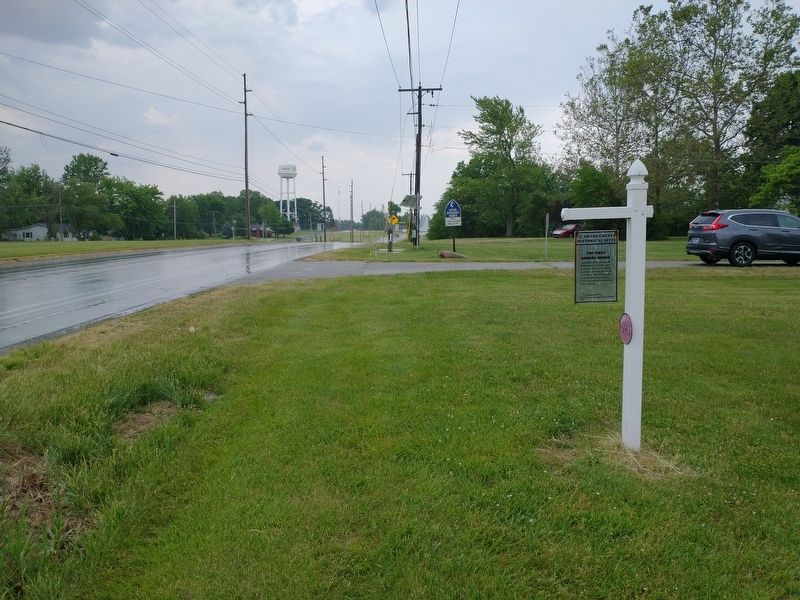
The Rural Branch School of the Church was located adjacent to the cemetery. School was conducted from 1844 to 1920. The building and grounds were sold to the State for the interchange of Highways I 69 and U.S. 27. — — Map (db m76433) HM
On South Barr Street south of East Washington Street, on the right when traveling south.
This YMCA logo, established in the late 1800's combined the YMCA's Christian emphasis
with an equilateral triangle which stood for man's essential spirit, mind and body.
John 17:21 That all of them may be one, Father, just . . . — — Map (db m197197) HM
On East State Boulevard east of St. Joseph Boulevard, on the left when traveling east.
This stone sentinal continues to watch over the land as it has since 1889. Its presence is a monument to those souls who lived, learned and played here.
The "State Sschool" was home to thousands of children and adults with intellectual and . . . — — Map (db m225929) HM
On Thieme Drive, on the right when traveling south.
Established in 1846 as the Fort Wayne Female College on grounds donated by Wm. Rockhill.
In 1855 the college consolidated with the Fort Wayne Collegiate Institute for Young Men and it was then call the M.E. College.
In 1890 the college grounds . . . — — Map (db m100138) HM
On S. Calhoun Street, on the right when traveling north.
St. Mother Theodore Guerin founded the first
catholic school in Fort Wayne on this site
in 1846. Her community, The Sisters of
Providence, taught young people of
Fort Wayne for over 125 years. She was canonized
a Saint October 15, 2006
. . . — — Map (db m197229) HM
On West Washington Boulevard at Fairfield Avenue, on the right when traveling east on West Washington Boulevard.
The Roman Catholic Parish of St. Paul was established at this site in 1864 for German-speaking Catholics of the then northwestern part of Fort Wayne.
Over the course of 138 years, this property also served the needs of St. Paul . . . — — Map (db m197185) HM
On 3rd Street (Indiana Route 46) west of Lafayette Avenue, on the right when traveling west.
Our Pioneer Heritage
Here, from the days of the frontier, the covered wagon, the Indian Wars, come reflections which make us feel humbly grateful for the vision, courage and sacrifice of our pioneer forebears which made possible the community . . . — — Map (db m242295) HM
Near E. Harrison St (State Road 46) at N. Jackson St.
Founded 1847 A.D.
by
Citizens of Hartsville. It was taken over by the Church of the United Brethren in Christ in 1849 - Opened as a college in 1850 - Burned January 30, 1898 - It was one of the first co-educational colleges in America.
. . . — — Map (db m63807) HM
On E. Harrison St (State Road 46) at N. Jackson St, on the right when traveling west on E. Harrison St.
Original site of coeducational United Brethren school founded 1850 as Hartsville Academy by public act of Indiana General Assembly. Campus moved four blocks south, circa 1865; destroyed by fire, January 1898. Many graduates became distinguished . . . — — Map (db m63805) HM
On South Main Street at East Green Street, on the right when traveling north on South Main Street.
This plaque is erected in honor of the Montpelier alumni who taught in Montpelier schools
Adrian Burris Geary 1898 • Bessie Slater 1899 • Mary Dailey Black 1900 • Grace A Maddox 1903 • Charles B. Anthony 1907 • Grace Kitterman Smith 1908 • . . . — — Map (db m238632) HM
On West Main Street (U.S. 136) west of North High Street, on the right when traveling west.
Prominent educator and statesman Herman B. Wells was born in Jamestown, Indiana. During the Great Depression, he directed research for the Indiana Bank Commission, producing state banking reforms. In 1938, Wells was elected President of Indiana . . . — — Map (db m175678) HM
On South Michigan Street (Indiana Route 29) just north of College Street, on the left when traveling north.
Burlington High School Polar Cubs The Polar Cubs played basketball games in a gymnasium built here from 1928 to 1961. The Poral Cubs shared a gym with the local men’s team above the current Beck’s Pub from 1910-1928. The Polar Cubs played host . . . — — Map (db m231960) HM
On South Meridian Road at County Road E500S, on the right when traveling south on South Meridian Road.
When settlers first came to the County, children were taught in the home either by the parents or by a teacher hired by them. When there was a sufficient number of children in the community to justify a special building, a school district would . . . — — Map (db m217007) HM
On Michigan Street (Indiana Route 29) north of Baltimore Street, on the right when traveling north.
Deer Creek High School. Deer Creek, Indiana. Washington Township of Carroll County, Indiana provided a quality education for the Deer Creek High School students and the North Central Elementary School students until closing in . . . — — Map (db m232366) HM
On W. North Washington Street, on the right when traveling east.
How Would You Like To Sit On A Log Bench All Day?
The structure before you depicts a one room log school house of 1834. If you
were between the ages of 5 and 21 in rural Indiana in the 1830s you would have
attended a one room school very . . . — — Map (db m163328) HM
Near West North Washington Street at North Charles Street, on the right when traveling east.
Papermaking developed in China around 100 AD. The process is based on using any plant
fiber or cellulose based material which has been processed (beaten) and mixed with water.
Cotton, hemp and linen are commonly used. The hand dipping process . . . — — Map (db m163316) HM
Near West North Washington Street at North Charles Street, on the right when traveling east.
Along the Monon Tracks
This building originally served as the post
office in Sleeth, a rural community in
Carroll County about nine miles northwest
of Delphi. Sleeth was also known as
McCoy's Station on the Louisville, New
Albany, & . . . — — Map (db m163341) HM
On North Street at 4th Street, on the right when traveling west on North Street.
Site of first Masonic Temple in northern Indiana. Of brick construction, cornerstone of two-story building was laid 1829 by General John Tipton, P.G.M.,completed 1837. Ground floor used for school purposes many years. Razed 1895. — — Map (db m35489) HM
On West Street north of Summit Street, on the right when traveling north.
Coeducational school founded 1884 by William W. Borden primarily to serve children of southern Indiana farmers. Low-cost, progressive program included teacher preparation and laboratory-based scientific studies. School closed 1906. Borden also . . . — — Map (db m74115) HM
Near Market Street at E. Main Street, on the left when traveling north.
Old Borden Tavern
Here William W. Borden’s mother kept a tavern 1824 to 1851. As a memorial to his parents, the Old Tavern, which was built in 1819, was incorporated into the buildings of the Borden Museum.
Borden Museum
Erected . . . — — Map (db m74116) HM
Near Jersey Avenue, 1 mile south of Ohio River Scenic Byway (Indiana Road 62), on the right when traveling south.
… our parks and preserves are not mere picnicking places. They are rich storehouses of memories and reveries. They are a solace to the aged and an inspiration to the young. – Richard Lieber, Founder, Indiana State . . . — — Map (db m206872) HM
On Wall Street north of East 8th Street, on the left when traveling north.
Built in 1891 to educate Colored students, grades 1 through 12. The classic two-story building, designed by Arthur Loomis, opened with 10 classrooms, separate entrances and stairways for boys and girls. The building was remodeled in 1949.
The . . . — — Map (db m206907) HM
On South Maish Road north of East Wabash Street (U.S. 421), on the right when traveling north.
Hall of Famer Everett Case, known for his basketball strategies and promotion of the sport, began his high school coaching career at age 19. After stints at Columbus and Smithville, he coached Frankfort for 17 seasons starting in 1922. He led his . . . — — Map (db m238480) HM
On East Clinton Street west of Sycamore Street, on the right when traveling east.
Old Stoney was built in 1892 and served as the Frankfort High School. On February 24, 1922 there was a fire that completely gutted the building, leaving only the four walls. Using the original walls, the building was rebuilt and reopened on . . . — — Map (db m232389) HM
On Road 56 south of 5th Street, on the right when traveling north.
Aurora was laid out by Jesse L. Holman, trustee for the “Aurora Association for Internal Improvements” in 1819. Judge Holman was an early statesman, preacher, educator, and federal justice.
His son, U.S. Congressman William S. Holman served . . . — — Map (db m22105) HM
On West Main Street at College Street, on the left when traveling west on West Main Street.
On this ground stood
Moores Hill College
Founded January 10, 1854
Administration of the college was vested in a board of trustees appointed by the Conference of the Methodist Church. Following the destruction of Moore Hall in 1915, the . . . — — Map (db m222230) HM
On West Main Street at College Street, on the left when traveling west on West Main Street.
Original college building,
directly southwest of this
point, was erected 1854-56
with financial assistance by
Freemasons of Allen Lodge
No. 165, who used third floor
as meeting hall until edifice
destroyed by fire, 1915. — — Map (db m222244) HM
On River Greenway, 0.2 miles south of County Road 60, on the left when traveling east.
This wooden statue is a tribute to Phil Carpenter, a local
leader in DeKalb Eastern School District who was instrumental
in the creation of the St. Joe River Greenway in 2001.
The project was crafted by our local artist, David Drake.
. . . — — Map (db m186257) HM
On South Burlington Drive, 0.2 miles north of County Road 500, on the left when traveling north.
The first school house in Delaware County was erected in a trackless forest one half mile west of this site. “Indian Jim,” the last of the Delaware tribe remaining in this county, a highly respected resident
hewed the black walnut logs . . . — — Map (db m141163) HM
On West University Avenue west of North McKinley Avenue, on the right when traveling west.
To meet Muncie’s higher education needs, the Ball Brothers gave land, money, and the building here to the state in 1918. Their gift became the Indiana State Normal School Eastern Division and was renamed Ball Teachers College in their honor in 1922. . . . — — Map (db m231197) HM
On East Highland Avenue at North Wolfe Street, on the right when traveling east on East Highland Avenue.
Structure, circa 1893, is Muncie's oldest standing public school building. Purchased by church congregation, circa 1928. Rallying point in August 1930 when bodies of two African-American men, lynched in Marion, were brought to Muncie for embalmment . . . — — Map (db m31346) HM
On East Jackson Street (Indiana Route 32) east of South Jefferson Street, on the right when traveling east.
1986 Althea Stoeckel Award
presented to:
Muncie Public Library
Main Branch
Listed on the National Register
of Historic Places
June 17, 1976
for the
interior renovation of the main library
301 E. Jackson Street
presented by . . . — — Map (db m222324) HM
On Courthouse Square (East Side) at East 6th Street, on the left when traveling north on Courthouse Square (East Side).
From 1830 until it burned in 1839, a log building on this site served as the first Court house in Jasper and as the first school, which was taught by Simon Morgan, the County Clerk. — — Map (db m47410) HM
On East Jackson Boulevard at Elkhart Avenue, on the left when traveling east on East Jackson Boulevard.
Side One:
Charles Gerard Conn began the musical instrument industry in Elkhart; city has been called the Band Industry Capital of the World. By 1874 producing rubber mouthpiece; was granted patent 1875; began producing musical . . . — — Map (db m30747) HM
On S. 2nd Street at W. High Street, on the right when traveling north on S. 2nd Street.
Elkhart Carnegie Public Library
1903-1963
Second and High Streets
Local Financial Supporters: A.H. Beardsley, G.B. Pratt, Sr. And the City of Elkhart
Head Librarian: Katherine Sage
In February 1901, backed by a promise from . . . — — Map (db m75445) HM
On S. 2nd Street at W. High Street, on the left when traveling north on S. 2nd Street.
Elkhart High School was designed and built to match the existing Central School Building (bottom photo), creating a unified pair of buildings covering the whole block of High St. between Second and Third Streets.
Central School became a . . . — — Map (db m75446) HM
Near S. Main Street (State Road 15) 0.2 miles south of E. Kercher Road.
(Side One)
A History of the Winona
In the early 1900's, Indiana had more miles of electric train lines than any other state in the United States. The lines blossomed primarily at Indianapolis, radiating out to transport people . . . — — Map (db m70504) HM
On S. 15th Street at Greencroft Drive, on the right when traveling south on S. 15th Street.
Goshen College began as the Elkhart Institute of Science, Industry and the Arts on Elkhart's South Main Street in 1894, but moved to the Maple City and changed its name in 1903; the location chosen was easily accessible to rail transportation. The . . . — — Map (db m72592) HM
On S. 8th Street at E. Purl Street, on the right when traveling south on S. 8th Street.
The current Chandler School is located on the site of the former Madison Street School, one of Goshen's first schools, opened in 1849. Miss Emma Chandler was the first principal from 1871 to 1898. In 1874, a four room addition was completed, but the . . . — — Map (db m69804) HM
On S. 5th Street at E. Jefferson Street, on the right when traveling north on S. 5th Street.
This building served as Goshen High School from 1904 until the spring of 1923. Construction was completed in 1904 with a budget of $50,000. By 1920 this building was considered too small and land was purchased from the Wurster Estate on Lincolnway . . . — — Map (db m72594) HM
Near S. Main Street (State Road 15) north of Egbert Road, on the right when traveling north.
The history of Waterford School dates back to a log cabin one mile west of town in about 1830. The first school built in town was a frame building erected on the southwest corner of Egbert Road and South Main Street in 1836. A new one-story brick . . . — — Map (db m69802) HM
On East Spring Street west of East 3rd Street, on the right when traveling west.
Andrew Carnegie rose from humble beginnings in Scotland to become one of America’s most famous philanthropists. From his first job at 13 in a cotton mill to his position as head of The Carnegie Steel Company, Carnegie remembered his path to . . . — — Map (db m46793) HM
On Division Street at East 18th Street, on the right when traveling east on Division Street.
Side 'One'
Because of the growing number of African-American school-age children, the New Albany School Board authorized a new elementary school for them June 1884. It opened here 1885. An 1869 Indiana law had mandated education of colored . . . — — Map (db m46620) HM
Near East Main Street (Indiana Route 111) at State Street, on the right when traveling east.
As early as 1808, the area we know as New Albany was considered a good location for a settlement near the Ohio River and The Falls of The Ohio. The original 826 ½ acre tract of land — part of Clark’s grant — was between the Grant line and the foot . . . — — Map (db m194347) HM
On Grenadier Drive west of University Drive, on the right when traveling west.
As part of a system of extension centers across the state, Indiana University established the Falls City Area Center in Jeffersonville in 1941 to offer IU classes locally. With the expansion of the WWII defense industry along the Ohio River, the . . . — — Map (db m206979) HM
On Division Street west of East 18th Street, on the left when traveling west.
Enslaved blacks seeking freedom crossed the Ohio River from Louisville to New Albany almost from the founding of the Indiana town. The Indiana Constitution of 1816 prohibited slavery. Because of the large number of blacks crossing the river, the . . . — — Map (db m46766) HM
On East Spring Street west of East 3rd Street, on the right when traveling west. Reported missing.
Side 'One'
New Albany School Board organized a public library on May 8, 1884. This library building, supported with funds from Andrew Carnegie, opened on March 2, 1904 with 11, 125 volumes. Building is Neoclassical style, constructed of brick . . . — — Map (db m46768) HM
On West Spring Street at West 1st Street, on the left when traveling west on West Spring Street.
In 1880, an 1822 school building on this site became Scribner High School for African-American students, under an 1869 Indiana law mandating public education for African-American children and allowing segregated schools. Modern facility completed . . . — — Map (db m46624) HM
On South Perry Street, on the left when traveling south.
Ladies Library Association of Attica, created 1885, deeded its library building to city; city library opened 1902 with a collection of 1,500 books. Funds from Andrew Carnegie made it possible to build a new library here on land originally owned . . . — — Map (db m3317) HM
Near South Perry Street, on the left when traveling south.
Doctor – Educator – Builder – Financier.
Attica, Indiana Doctor, 1839–1845
Founder: Indiana Hospital for Insane.
Chicago Mercy Hospital: City of Evanston, Ill.
Northwestern University - U. of Denver.
Rush . . . — — Map (db m9947) HM
On 1050 North, 0.1 miles west of County Road 400W, on the right when traveling west.
This original stone and bell donated to the Tangier community by the family of Paul E. Patton who graduated with the class of 1950 — — Map (db m163064) HM
On U.S. 41 at County Road E 100 N, on the right when traveling north on U.S. 41.
Famous orator - Representative in Congress, 1861-66, 1869-73; U.S. Senator, 1877–1897; chief promoter of the building of the Library of Congress. — — Map (db m3232) HM
On U.S. 41 at State Road 32, on the right when traveling south on U.S. 41.
John Gilmore entered first land in Township — 1826.
Alanson Savage built steam saw mill produced timbers for “Plank Road” — 1840.
Rev. Jones organized Methodist Church — 1852.
Early Families: Furrs, Booes, . . . — — Map (db m3805) HM
On East 10th Street east of Franklin Avenue, on the left when traveling east.
Site of Brookville College erected 1852 - - 1872. “Julia Dumont Society” founded here December 16th 1853. Original building purchased by Brookville and served as Public School 1873 - - 1912. Building razed 1912 and present . . . — — Map (db m44698) HM
On Main Street (U.S. 52) north of East 9th Street, on the right when traveling north.
Dedicated in 1912, starting with approximately 600 books; collections and services have expanded to meet needs of local patrons. One of 1, 679 libraries built in U.S. with funds from philanthropist Andrew Carnegie. Indiana built more Carnegie . . . — — Map (db m44694) HM
On Main Street (State Road 52), on the right when traveling north.
Built by John D. Howland circa 1856~1857. Later owned and occupied by John H. Farquhar, Merchant, Member of Congress; Aaron C. Miller, Merchant; John C. Hitt, Banker; Dr. John R. Goodwin, Banker, Civil War Surgeon, Paymaster in the Department of the . . . — — Map (db m94158) HM
On East 5th Street at Mill Street, on the right when traveling east on East 5th Street.
Purchased by Town of Brookville in 1863. Used for school purposes both public and private until 1873. John Tarkington, father of Booth Tarkington, distinguished Indiana author, attended school here. — — Map (db m222207) HM
On Main Street at East 9th Street, on the right when traveling north on Main Street.
In 1893 a public spirited group of businessmen and educators decided that Rochester, Indiana, was a strategic location for a Normal College. Those who spearheaded the promotion were Dr. W. S. Shafer, Prof. George Suman and Prof. W. H. Banta. The . . . — — Map (db m35490) HM
On West State Street just west of North West Street, on the right when traveling east.
WHEREAS, the citizens of the City/County of Princeton, Gibson County, Indiana, USA and Tahara-cho, Japan do mutually agree to establish a Friendship city/county affiliation to deepen the friendship and confidence between our countries and to . . . — — Map (db m190737) HM
On County Road 500W south of Road 100N, on the right when traveling south.
Side 'One'
Settled in late 1840s by Joshua and Sanford Lyles, former slaves from Tennessee. African Methodist Episcopal Church (since 1860) and schools (1865-1958) played important roles in sustaining the community. On land donated by Joshua . . . — — Map (db m47805) HM
On E. Washington St at N. Walnut St on E. Washington St.
Built circa 1888. Occupied by civic leaders (Nixon Winslow, Levi Scott, and Joseph Patterson) who made significant contributions to Fairmount's economic, educational, and cultural development. Patterson was community's medical doctor, 1889-1913. . . . — — Map (db m63799) HM
On W. North A St at N. Grant St, on the right when traveling west on W. North A St.
This Richardsonian Romanesque style structure, built 1900-1902, reflects the area's prosperity during the natural gas boom. The town of Harrisburg had been renamed Gas City in 1892. — — Map (db m63801) HM
On Railroad Street, on the right when traveling east.
Chip Jaggers was born in Trenton, New Jersey, and spent most of his young life in Cincinnati, Ohio. He attended Taylor
University from 1965-1969, and after graduation he took a job as a youth director at a large church in Hamilton, Ohio. There
he . . . — — Map (db m215234) HM
On South Main Street (Indiana Route 22) south of Railroad Street, on the left when traveling north.
The first church in Upland actually preceded the founding of the town. On the original plat map of Upland, dated 1867, the Friends Church is shown just south of the railroad on Main Street. The Jefferson Church, a short distance from Upland, was . . . — — Map (db m215111) HM
On Railroad Street, on the right when traveling east.
David Martz was born in Van Buren, Indiana, and graduated from Van Buren High School in 1962. He
attended International Business College in Fort Wayne graduating in 1965, and then attended
Huntington College graduating with a degree in Physical . . . — — Map (db m215233) HM
On South Main Street (Indiana Route 22) south of Railroad Street, on the right when traveling south.
Don Odle was born in Indiana in 1920. He played guard for Selma High School from 1935 1938, where he was the leading scorer in Delaware County. He went on to earn his BA from Taylor University, where he also played basketball and led the Trojans . . . — — Map (db m215215) HM
On South Main Street (Indiana Route 22) south of Railroad Street, on the left when traveling north.
Jacob Furnshell Bugher was born in Guernsey County, Ohio, on January 19, 1826. Growing up, he received his education at the common schools within Guernsey County. At the age of twenty, Mr. Bugher became a teacher, a career in which he was to . . . — — Map (db m215209) HM
On Railroad Street, on the right when traveling east.
Jay and Janie (Smith) Kesler were both raised in South Bend, Indiana, but the two never met as children, and
Janie's family later moved to Mishawaka. As teenagers, both Jay and Janie were involved in their local Youth
for Christ chapters.
Jay . . . — — Map (db m215231) HM
On Railroad Street, on the right when traveling east.
John Bragg was born in Upland, Indiana, and he spent most of his youth in Fort Wayne. He played in the
Fort Wayne summer baseball league every year, which honed his skills and his love of athletics and competition. John graduated from Fort Wayne's . . . — — Map (db m215230) HM
On Main Street (Indiana Route 22) south of Railroad Street, on the right when traveling south.
Milo A. Rediger (1913-1988) served as president of Taylor University from 1965-1975 and again from 1979-1981, and was the driving force behind Taylor becoming accredited institutionally in 1947. During his years in leadership, he oversaw ten new . . . — — Map (db m215212) HM
On Railroad Street, on the right when traveling east.
Sidney "Sid" Hall was born in 1954 in Portland, Indiana, to Arthur and Wanda Hall. Sid first lived in Upland as
a student at Taylor University, and he remained in Upland after graduating in 1977, taking his first job in the
university's Buildings . . . — — Map (db m215229) HM
On Railroad Street, on the right when traveling east.
While many of the local benefits of the 1890s Gas Boom have faded, the siting of
Taylor University in Upland is one legacy that remains to this day. Taylor was founded
in 1846 in Fort Wayne as a women's college by the Methodist Episcopal Church. . . . — — Map (db m215107) HM
On South Main Street south of Railroad Street, on the left when traveling north.
Thaddeus C. Reade (1846-1902) served as the president of Taylor University from 1891 to 1902, led the relocation of the institution from Ft. Wayne to Upland in the summer of 1893, wrote a biography of Samuel Morris, sustained the University with . . . — — Map (db m215210) HM
On West North Street at Magnolia Street, on the right when traveling west on West North Street.
Kokomo native Ryan White was diagnosed with AIDS in 1984 after contracting the virus from a contaminated hemophilia treatment. He faced intense discrimination from his community in a time of fear and misunderstanding about AIDS and was prevented . . . — — Map (db m216621) HM
On West First Street west of South Main Street, on the right when traveling west.
Born in Virginia, George Boxley, first settler in Adams Township, Hamilton County, came to Indiana, as a fugitive from justice. Accused of helping slaves to escape and fomenting a slave rebellion in 1816 in Spotsylvania County, Virginia, Boxley . . . — — Map (db m216521) HM
On West Main Street, on the right when traveling west.
The architect recognized for this design is George William Gordon (1872-1935), a Greenfield resident. Gordon is also responsible for the designs of many other Hancock and surrounding county establishments, ie: churches, schools and residences. The . . . — — Map (db m241675) HM
On Union Chapel Road, on the left when traveling north.
Renovated in the late 1900’s and is presently being kept mowed in the loving memory of the following school mates who departed much too early in their lives: Kenneth R. Gerdon, Sherley M. Snyder Watson, Chester Gene Gerdon.
May they rest in . . . — — Map (db m126307) HM
Near Old Indiana 135 south of W. Heidelberg Rd. NW, on the right when traveling south.
On July 9, 1863, along this wooded ridge - - - from the “Laconta” Road extending across the “Mauckport” Pike to the old “New Amsterdam” Road - - - occurred the only Civil War battle in Indiana. It was between Gen. . . . — — Map (db m9721) HM
On North Elm Street, on the right when traveling north.
In the home of Reuben W. Nelson two blocks east of here, eleven Master Masons representing the nine lodges of Indiana assembled Dec. 3, 1817 and called a meeting at Madison to organize a Grand Lodge. — — Map (db m9616) HM
On East Chestnut Street, on the right when traveling east.
This building was constructed in 1903-04 by Oscar Wright for use as the Corydon Post Office. The sandstone was quarried from the Pilot Knob Quarry west of Corydon. An outside stairway led to the second floor where dentist Dr. Thomas VanHook . . . — — Map (db m241745) HM
On Summit Street at Hill Street, on the right when traveling east on Summit Street.
The Leora Brown School is one of Indiana's oldest standing black elementary/secondary schools. It was built in 1891 at a cost of $1100.00 and bore the name Corydon Colored School. It had no water or electricity, and students shared a room, divided . . . — — Map (db m207090) HM
On North Capitol Avenue west of West Chestnut Street, on the left when traveling north.
This Neo-Classical building, with the north section constructed in 1910 by the Corydon National Bank, has been rated outstanding by the Historic Landmarks Foundation. After the bank folded in 1922, the Old Capital Bank & Trust Company purchased the . . . — — Map (db m241737) HM
On Summit Street west of Hill Street, on the right when traveling east.
Facility built 1891 as elementary and secondary school for African Americans. Originally known as Corydon Colored School; first graduation was on May 14, 1897.
Renamed 1987 for Leora Brown Farrow, a teacher at the school, 1924 - 1950. . . . — — Map (db m9627) HM
On North Capitol Avenue at East Cherry Street, on the right when traveling north on North Capitol Avenue.
This 2 ½ Ton artillery piece was captured by American forces on the Western Front in 1918.
Made by the Fried. Krupp Co. Essen, Germany in 1917. The largest arms manufacturer in the world at that time.
It could fire a 93 lb. high . . . — — Map (db m9679) HM
On East Main Street (U.S. 36) near North Wayne Street, on the right when traveling west.
Organized 1876 at Ladoga as second private Indiana normal school specializing in teacher training. Based on Alfred Holbrook's techniques at his normal college in Lebanon, Ohio which pioneered teacher training in America. Central Normal College was . . . — — Map (db m239) HM
On South Indiana Street at East Broadway Street on South Indiana Street.
(Side one):
At May 1902 meeting newly-formed Library Board authorized lot purchase and tax levy to support a public library as required by philanthropist Andrew Carnegie for funding. Designed by S. C. Dark of Indianapolis in Classical . . . — — Map (db m238) HM
Near North Adams Street north of East Carey Street, on the left when traveling north.
Built 1876 Listed 1976
has been placed on the
National Register
of Historic Places
by the United States
Department of the Interior — — Map (db m221880) HM
On North Bell Street just north of East Elm Street, on the right when traveling north.
Named after statesmen and former slave, Frederick Douglass, this school opened in 1920.
That year the Kokomo School Board recommended that all African-American students in first through seventh grades enroll only at Douglass.
With no . . . — — Map (db m205336) HM
346 entries matched your criteria. The first 100 are listed above. Next 100 ⊳