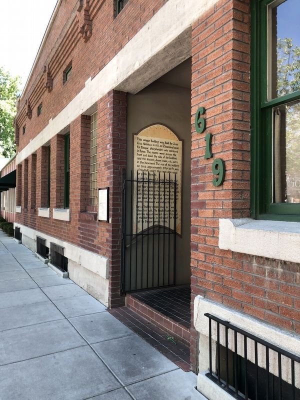
The play was intense and furious: men smacking a leather-covered ball with their hands, or whipping their paddles, or palas, through the air. The sport, pelota, was brought to Idaho by early Basque immigrants. Juan and Juana Anduiza . . . — — Map (db m119131) HM
Higher than any other dam from 1915 until 1934, Arrowrock Dam still is an essential part of Boise Valley's irrigation system.
Located six miles upstream from here, Arrowrock is 350 feet high and 1,150 feet wide. Built at a cost of $4,725,000 . . . — — Map (db m22597) HM
In the late 1800s, Idaho Territory needed to attract homesteaders to farm the Boise Valley. At the time, the area was dry sagebrush desert. A young engineer, Arthur Foote, designed a great canal system that was to allow the Boise River to . . . — — Map (db m119027) HM
In 1850, at age seventeen, Jesus Urquides joined the California gold rush to Stockton and the Sierra Nevadas.
In 1860, striking out on his own, he followed the rush to Walla Walla, Lewiston, and The Dalles.
Boise Basin’s 1863 gold rush lured . . . — — Map (db m110696) HM
The Canyon House was located across the Boise River from where you are standing. The house was designed and built by Arthur De Wint Foote in 1885, using funds from literary works by his wife, Mary Hallock Foote. As Chief Engineer for the Idaho . . . — — Map (db m119029) HM
Hunt’s party laid the groundwork for future trapping expeditions across the Snake River Plain. Donald Mackenzie, who accompanies Hunt and later joined the British North West Company, returned to establish trade relations with resident Indian bands. . . . — — Map (db m71834) HM
Beaver pelts lured the first Euro-Americans deep into the American West. In 1810, only four years after Lewis and Clark completed their epic journey, John Jacob Astor established the Pacific Fur Company. He soon financed sea and land expeditions to . . . — — Map (db m71832) HM
In 1879, with the death of his friend Antonio de Ocampo, the packer Urquides inherited Ocampo’s city lot at 115 Main Street.
Here along a canal he built a home for his wife, Adelaida, their sons, Arthur and Manuel and daughter, Maria . . . — — Map (db m110693) HM
In 1946 Jack Morgan and his brother Ed purchased the logging division at New Meadows, Idaho, from Boise Payette Lumber Company.
The new company was called
J. I. Morgan, Inc.
In the years that followed, the company was . . . — — Map (db m110379) HM
(This marker consists of series of photographs and their captions.)
The community of Lava Hot Springs is located at a strategic crossroads between the Rockies, the Great Basin, and the West. The year-round availability of natural hot . . . — — Map (db m108259) HM
In 1921, William Godfrey and CJ Lundgren registered the Lead Bell Mining Company, Portneuf District with 1,000,000 shares at par value 10 cents. Operated 1925-1938. Sd (sic) Colton, Pres. Drecilla Godfrey, Sec. Wm Godfrey, Mgr. Mined Lead, Zinc, . . . — — Map (db m108257) HM
McCammon's mogul
(two photos at bottom left)
In 1865 William H. Murphy operated a toll bridge on the Portneuf River mainly used by miners traveling from Utah to the Montana goldfields. Murphy and his wife Catherine Scott Murphy . . . — — Map (db m108261) HM
A registered national historical landmark Indian and trapper trading post established by Nathaniel J. Wyeth in 1834 and sold to Hudson's Bay Company in 1837 It was the vital point on the Oregon and California immigration trails and in establishing . . . — — Map (db m108304) HM
Fort Hall, Keystone on the Oregon Trail, America's road to destiny, was located 14 miles north of this site. It was dedicated by Nathaniel J. Wyeth, Bostonian, on Aug. 5th 1834. Unable to compete with Hudson's Bay Co., Fort Boise; Wyeth sold the . . . — — Map (db m108305) HM
Discovered in 1812 by trappers returning home from Astoria, Oregon, this valley and its large lake soon became an important fur trade center.
Donald Mackenzie, Jim Bridger and a host of famous beaver hunters operated here. Two major summer . . . — — Map (db m105867) HM
"Here we found pure water, sufficient for all of us and our cattle. Here we found oceans of grass and thousands of acres of rich, level land covered with wild flax." P.V. Crawford, July 8, 1851
Strong Building and Stock Chevrolet
This red brick building, note the brickwork circles, was built for Lish Strong by the Tueller brothers of Paris, Idaho. It became known as the Strong Building. Part of the upper level was also used for . . . — — Map (db m90911) HM
To load their wagons with salt from the salt springs on Crow Creek, Mormon settlers of Bear Lake Valley followed the Native American Indian trail over this pass about 1865.
In 1868, The Church of Jesus Christ of Latter-day Saints Apostle Charles C . . . — — Map (db m105896) HM
Within five years after Apostle Charles C Rich was called to establish a settlement in Bear Lake Valley, 1868, he looked at western Wyoming as a possible expansion of the Mormon community. By 1879 the Bear Lake Stake of the Church of Jesus Christ of . . . — — Map (db m105895) HM
Schmid Building
Carl (Charles) Schmid, a tailor from Freienstein, Switzerland opened a tailor shop in Montpelier in 1892. He named his business Chas Schmid, The Tailor. He made men's suits and coats and did repairs, alterations and dry . . . — — Map (db m90910) HM
Welcome to the Historic Downtown Montpelier Business District on Washington Street!
Take a few minutes to enjoy a walking tour filled with interesting information about this area and its place in history. Also, spend a few minutes visiting . . . — — Map (db m90878) HM
The Crow Creek Road was the link between the Mormon settlements of Bear Lake and Star Valley for 50 years. The 100-mile round trip between Afton, WY and the railhead at Montpelier ID would take a team of horses from 3 to 7 days depending on the . . . — — Map (db m105897) HM
Early sheriff and mayor Fred Cruikshank owned the first Model T Ford Agency in 1909.
Bear Lake Motors
Early sheriff and mayor Fred Locke Cruikshank was the owner of the first Model T Ford Agency in 1909 and closed it down in . . . — — Map (db m90908) HM
“I have always felt I was at a disadvantage in making a living for my self and family if I did not have a wagon and team.” – John Nield Diary
John and Sarah Broadbent Nield moved their family to Star Valley in 1888 over the . . . — — Map (db m105901) HM
Early Montpelier was well known for its pine trees placed down the center of Washington Street. As U.S. Highway 89 became more popular to the traveling public, the trees were finally cut down amid much discussion throughout the town.
Rich . . . — — Map (db m90907) HM
The streetscape of Montpelier has changed through the years. The early years of this Oregon Trail town began with only horse power including wagons and horseback. Streets were packed dirt with hitching posts. With the advent of the horseless . . . — — Map (db m90880) HM
Grove C. Gray built a brick building in 1907 to house the second bank of Montpelier. On June 25, 1910, two men attempted to rob this bank by dynamiting the vault. While attempting to dynamite the vault, they jostled a loaded pistol that was on top . . . — — Map (db m90909) HM
By 1881, just five years following the opening of the Crow Creek Freight Road, freighters had started calling this canyon by that name. Snowslides were frequent on snowy, windy days as drifts would build up on the shale ridge. Unable to hold the . . . — — Map (db m105894) HM
Bank of Montpelier's Impact on Local Banking History
Residents of Bear Lake county have discussed the Butch Cassidy bank robbery for years with varied endings. Not unlike fishermen's boastings, tales of the exact amount of Butch's loot will . . . — — Map (db m90879) HM
Clinging to the white shale formation a mile east (on the Crow Creek Rd.) is the White Dugway. There was moisture in the shale and when frost had it in its grip the road was very slippery. Freighters learned to be cautious as a wagon or sleigh could . . . — — Map (db m105899) HM
Loggers used the splash dam system in the Marble Creek basin between 1915 and 1931.
In 1923, Rutledge Lumber Company spent $16,352.25 building the dam depicted in this mural.
Splash dams stored enough water to “flush” logs down . . . — — Map (db m109997) HM
“A locomotive without wheels…”
The Willamette donkeys were fueled by wood or oil, which generated steam to turn drums that were spooled with cable.
Cables of 8,000 to 12,000 feet length were common.
Because of the long . . . — — Map (db m109998) HM
St. Maries, named by Jesuit Father Pierre DeSmet during the 1840s, sits at the confluence of the "Shadowy" St. Joe and St. Maries rivers. It was recognized as a settlement in the 1880s. Incorporated as a village in 1902, and as a city in 1913, it . . . — — Map (db m122624) HM
The Saint Maries River Valley was said to have the largest single stand of white pine in the world. Homesteaders and lumberjacks flocked here by wagon road and boats to take advantage of vast stands of western white pine, fir, tamarack and cedar. . . . — — Map (db m122621) HM
First habitation in this region was built by Nathaniel J. Wyeth on Snake River 14 miles west of this monument July 15, 1834 and named for Henry Hall, senior member of Wyeth's firm.
The original stockade, 80 feet square was purchased by Hudson's . . . — — Map (db m124481) HM
General Stores have been in wide use since the late 1860's. Some of the first General Stores were created in Paris, France as a means of attracting more business. The settling of the Wild West was a contributor to the growing number of General . . . — — Map (db m140455) HM
Rich strikes in 1879 led to a rush in the lead and silver mines of this valley. The famous Minnie Moore Mine alone produced a total of $8.4 million worth of ore.
Mining quickly brought a railroad and prosperity. The Ketchum smelter pioneered . . . — — Map (db m110115) HM
The original building on this site, called the Bullion Block, was constructed in 1882. It was at this time that Hailey became the county seat of Alturas County after a bitterly fought election with Bellevue, and the existing county seat, Rocky Bar. . . . — — Map (db m110109) HM
J.C. Fox, the original owner of the building and one of Hailey's founders, had it erected in 1920 after operating a general store three doors up the street for almost forty years. He served as mayor for two years and was vice-president of the Hailey . . . — — Map (db m110113) HM
The J.J. Tracy Building was built as a drug store in 1906 by John J. Tracy. Already a pharmacist at the age of twenty-two, Tracy migrated to the West, spending three months in Kelton, Utah where he met William T. Riley, an entrepreneur and early . . . — — Map (db m110111) HM
After Warren P. Callahan located a rich lead-silver mine here, April 26, 1876, thousands of eager treasure-hunters joined in a rush to Wood River in 1880
Successful prosectors discovered valuable lodes from here to Bellevue. Galena has a . . . — — Map (db m110052) HM
The Payette River is named for Francois Payette, a French-Canadian trapper and early explorer of the major tributaries of the Snake River. At that time, British, Canadian, and American fur companies competed for the region's abundant natural . . . — — Map (db m119236) HM
This building was originally George Kettler's Blacksmith shop, built in 1889 with ox and horse shoeing sheds on both sides. As the horse and buggy gave way to the automobile, it became an early garage. In 1947, it was acquired by Tom and Florence . . . — — Map (db m119110) HM
This roaring metropolis was founding early in October, 1862, about ten weeks after gold was discovered in Boise basin.
By the next summer, this was the largest city in the Northwest, with 6,275 people -- 5,691 of them men! Families followed, and . . . — — Map (db m22601) HM
Henrietta
Tugboat for Hope Lumber
Original Thornton School
Spring Creek ca 1909
1894 Flood Changed Landscape
Destroyed buildings along the tracks
Floodwaters at level of present highway
. . . — — Map (db m73480) HM
...the falls
As you look down at the Pend Oreille (Pond O'Ray) River and Albeni Falls Dam (Albany) you may be looking for the falls. In 1887 a 26 year-old French Canadian farmer living in Blanchard, Idaho, also wondered where the falls . . . — — Map (db m109902) HM
Harnessing the Flow
During the year, the Corps of Engineers regulates the flow of water through the dam.
Water is released from Lake Pend Oreille to maintain seasonal lake elevations and to adjust for rain and snowmelt.
Water at . . . — — Map (db m109906) HM
Canadian explorer David Thompson noted a point of sand in his diary in 1809 which he believed to be near where the city of Sandpoint is today.
Settlement began in Sandpoint in the 1880s, but it was the panhandle's timber wealth that brought . . . — — Map (db m122665) HM
After German Field Marshall Erwin Rommel’s North African Army surrendered on May 13, 1943, the allies had approximately 275,000 prisoners-of-war in their possession.
During 1945, 15,000 of the prisoners lived and worked in Idaho.
Rupert, Idaho . . . — — Map (db m110477) HM
Harnessing water for power
Electricity and fast-flowing rivers are inseparable in the Pacific Northwest. In the early 1900s, harnessing the power of water to supply Bonners Ferry's ever-increasing demand for electricity was challenging. . . . — — Map (db m122658) HM
The Kootenai Valley Railroad, a subsidiary of the Great Northern, connected the main line from a spur near Bonners Ferry to the southern end of Kootenay Lake in British Columbia. Completed in 1899, its purpose was to connect with the Canadian Kaslo . . . — — Map (db m122716) HM
In the early days, this area was forested with vast swaths of huge virgin timber. As timber became less available along waterways, logging spur lines and railroad sidings were constructed to access more distant timber. Many logging camps sprang up . . . — — Map (db m122720) HM
This Pelton Wheel provided the power to generate the first electricity from the foot of Myrtle Creek 6 miles west of town, for the Village of Bonners Ferry from 1906 – 1921. — — Map (db m109851) HM
Railroads brought many changes to rural life, providing access to roadless areas. Depots were built in towns like Leonia, Meadow Creek, and Addie. Passenger cars carried people comfortably on business and pleasure trips, dramatically reducing travel . . . — — Map (db m122719) HM
During the 1920s, the Bonners Ferry Water and Light Department made multiple improvements to the Moyie River and Myrtle Creek power plants, but relying on hydroelectric power alone has its drawbacks. Generating electricity depended on river . . . — — Map (db m122661) HM
In 1905 Inland Empire construction magnate, D.C. Corbin, set out to build a railway line from Spokane to the international border. His plan was import coal from British Columbia to markets in eastern Washington.
The Spokane International Railroad . . . — — Map (db m122717) HM
Since 1949, more nuclear reactors – over 50 of them – have been built on this plain than anywhere else in the world.
This 900-square-mile Idaho National Laboratory is the birthplace of the Nuclear Navy. Commercial power reactor . . . — — Map (db m70447) HM
The historic Guffey Bridge is an elegant Parker-through truss railroad bridge, the State’s largest artifact, and the site of the most spectacular train wreck in Idaho.
The Boise, Nampa and Owyhee Railroad (BNO), was organized by owner Col. Wm. . . . — — Map (db m73344) HM
Blocked by lava eruptions at least 140,000 years ago, the Bear River was diverted from draining into the Snake River system.
It was forced to drain southward into what were then lakes Thatcher and Bonneville and is now the Great Salt Lake.
. . . — — Map (db m109914) HM
Two miles east is located the dam and headworks of the canal system. Incorporation was effected Feb. 4, 1899 for the purpose of irrigating this valley. First filing on Bear River to supply the canal was Mar. 4, 1897. To perfect the right it was . . . — — Map (db m140280) HM
Founded by a Dutch pioneer about 1884, Henry thrived as a center for cattle ranchers of the area and the transient sheep operators.
A large sheep-shearing corral was built one mile south of Henry.
It operated about 60 days each year as large . . . — — Map (db m109951) HM
Many Oregon & California bound emigrants mention seeing ten to twelve foot hight white mounds and cones in their diaries and journals while passing through the Soda Springs area in the mid-1800s. Often, one of the first natural curiosities that . . . — — Map (db m106251) HM
The magnet of gold
In 1870, high in the remote Caribou Range of the middle Rocky Mountains, in southeastern Idaho, gold was discovered by intrepid gold-seekers. Tales of gold and wealth drew thousands to the West during the mid-19th century . . . — — Map (db m106213) HM
Southeast Idaho is a major phosphate-producing region and phosphate mining has been an important industry here since the turn of the 20th century.
1920s world-wide demand for metals and chemicals
During the 1920s, world-wide demand for . . . — — Map (db m106697) HM
Only memories remain...
In 1920, the ambitious Anaconda Copper Mining Company built the community of Conda to house its phosphate miners and their families. About 300 people resided in Conda during the mining heyday. The town closed in . . . — — Map (db m106695) HM
The gently sloping mound around the geyser is travertine. The stone often develops into flights of pools enclosed within little dams.
These dams form through a mix of water and carbon dioxide which makes carbonic acid, and dissolved calcium . . . — — Map (db m109952) HM
The year was 1885 when Cassia County purchased an unfinished hovel for its first courthouse. Idaho was still a territory - a place where disagreements were at times decided by the business end of a gun. Sparked by disputes between cattle and . . . — — Map (db m124028) HM
When completed in 1904, Milner Dam raised Snake River 38 feet to divert water into major north and south side canals.
A gravity system unmatched in size in national reclamation development, this project irrigates 360,000 acres of land. Twin . . . — — Map (db m31636) HM
In 1898, after rail service from Lewiston reached Lenore, a tramway was begun to ship grain from Camas Prairie (1600 feet above) to a new freight stop directly across the river.
Previously, grain wagons descended a long steep hill from the . . . — — Map (db m109760) HM
David Fraser, a young merchant, came to the area with a pack string headed for Pierce City, the gold rush area, to open a store in the Spring of 1863. Some people of the area encouraged Fraser to open the store here as a lot of the miners had moved . . . — — Map (db m121417) HM
Ever since the first cross-cut saws were heard in the remote forests of Clearwater County in the late 1800s, the Clearwater River played a major role in the timber industry of this area. The river served as a means of transportation and by the early . . . — — Map (db m159486) HM
Orofino is situated on the north and south banks of the Clearwater River.
The area’s mild climate and convenient location made it a thriving Nez Perce village site long before Lewis and Clark stopped here in 1805.
Lumberjack Days
. . . — — Map (db m109888) HM
During the gold rush boom, the population exceeded 6,000. At that time Pierce was actually located in Washington Territory. In 1861, Pierce became the first established gold rush town in Idaho, and the county seat of Shoshone County. In 1862, the . . . — — Map (db m121513) HM
Hearing rumors of gold in the hills, Captain Elias Davidson Pierce started his first journey from Walla Walla to this area on August 12, 1860, with a crew of ten. The crew included: Benthnel Farrell (18), Horace Dodge (22), Joseph L. Davis (37), . . . — — Map (db m121490) HM
Near here, the initial pond of the Yankee Fork Gold Dredge was constructed to allow the assembly of the massive four-story floating machine. It was a major operation to transport the equipment and pieces needed to build the dredge. Some pieces were . . . — — Map (db m110005) HM
Thoughts of dredging the Yankee Fork began in 1899 when business groups bought up placer claims along the creek and were revived up again in 1904 when the Boston & Boise Dredge Company drilled test holes. Rising gold prices stimulated interest again . . . — — Map (db m109989) HM
Workers on the dredge included the winch men, stern and bow oilers, and the gold man. A ground crew cleared the area ahead of the digging and helped set the "deadmen." The dredge master oversaw the entire operation, deciding were to dig, when to . . . — — Map (db m109988) HM
The first prospectors on the Yankee Fork searched for small particles of gold known as "placer gold." Eroded from exposed ore veins in surrounding hillsides, placer gold washed down valley walls and collected in stream channels. Prospectors used . . . — — Map (db m109987) HM
The large piles of rock and gravel around you were left over from dredge mining operations that took place in the 1940s and early 1950s.
The 4-level Yankee Fork dredge floated in water as it dug its way upstream, extracting gold and silver . . . — — Map (db m109991) HM
The dredge operated 24 hours a day, 365 days a year, using only 3 men per shift. The winch man (1) was in charge, controling (sic) the dredge from his vantage point four stories above the deck. From there he could raise and lower, and vary the speed . . . — — Map (db m109948) HM
Starting in 1872, the valley bottom along the Yankee Fork, was hand placered in the search for free gold. Later, the Snake River Mining Company tested the ground along the stream and found gold still remained in the deep gravels. After obtain the . . . — — Map (db m109949) HM
Lack of development and limited government services in the western territories created opportunities for entrepreneurs like Alex Toponce. Arriving from France at age seven, Toponce traveled west and by age 18 had worked as a bullwhacker. By 1860 he . . . — — Map (db m109783) HM
Founded in 1878, Challis provided a vital link to the outside world for the remote mining camps of the Yankee Fork and Bayhorse Mining Districts. Supply wagons arrived in Challis from Corinne, Utah and later Blackfoot, Idaho, with goods for delivery . . . — — Map (db m109702) HM
Travel on the Toll Road remained difficult due to the road's roughness. Pulling heavy loads over the road's two summits often fell upon oxen, The crack of the bullwhacker's whip and snort of laboring beasts were common sounds. You may still see . . . — — Map (db m109779) HM
This Valley was discovered in 1822 by an expedition of Hudson's Bay Company trappers led by Michel Bourdon. Bourdon had come to the Northwest with David Thompson, who had started the Idaho fur trade in 1808-9. Trappers searched everywhere for . . . — — Map (db m59949) HM
Completion of the Toll Road in 1879 brought a period of prosperity to the Yankee Fork. Now heavy equipment needed to construct a mill could be transported in and large quantities of gold bullion shipped out to market. It also allowed goods and . . . — — Map (db m109781) HM
Lead-silver mineral discoveries 12 miles north of here on Bayhorse Creek in 1864 and 1872 led Joel E. Clayton to locate a large smelter here in 1880.
Doubled in size in 1888, Clayton's smelter has enough variety of ores from local mines to . . . — — Map (db m110016) HM
Crushing ore played a major role in the gold refining process. Different types of crushing methods were employed and changed with the times. Arrastras used a circular floor of tightly laid blocks of stone as a grinding surface. Ore was spread thinly . . . — — Map (db m109836) HM
The difficult work of mining required the use of many rugged and reliable tools that could stand up to the physical demands of day-to-day use. It was also a necessity to have equipment that was simple enough to be repaired and maintained on site. . . . — — Map (db m109868) HM
Custer boasted many different types of businesses including a brewery, carpenter shop, butcher shop, dentist, lawyer, barbershop, post office, general stores, hotels , boarding houses and saloons. The west end of town served as the business district . . . — — Map (db m109905) HM
The vibrating jig liberated the heavy minerals from most of the lighter waste material as water was forced upward through a screen with a shot bed consisting of lead shot or old nuts and bolts. Pulsating action combined with water caused the lighter . . . — — Map (db m109867) HM
First mention of a livery stable appeared in R.L. Polk's 1902 Business Directory, listing Kenneth McKenzie as owner. To keep a horse cost $1.50 per day. Feed bought in over the 24-mile "hay trail" from Stanley Basin contributed to the high . . . — — Map (db m109898) HM
In 1879, Col. William Birelie Hyde and William Grayson of San Francisco purchased the Custer Mining Company and constructed of a twenty stamp mill began. All of the heavy equipment for the mill was brought over the newly established Toll Road by . . . — — Map (db m109834) HM
Almost anything and everything was purchased at the general store. In 1888 prices for groceries were listed as cabbage, 25¢ per pound; potatoes and bacon, each 20¢ per pound; ( the rest of the marker is not legible because of the sun's . . . — — Map (db m109901) HM
Miners on the Yankee Fork started their mining endeavors with gold pans, shovels, rockers and hammers. As mining practices changed, more tools were needed. Varied mining methods, including hydraulic and hard rock, also created a demand for other . . . — — Map (db m109944) HM
William and Margaret Dunn operated the hotel of many years, and Mrs. Dunn did all the cooking. On the first floor, a bar room extended across the front of the building, with a separate hallway that led back to a washroom, kitchen and a large dining . . . — — Map (db m109899) HM
In 1881, 52 men worked in the mill with the different machinery and refining processes. Imagine the noise generated by the numerous pounding stamps and other machinery as it crushed and processed the ore. Each month, more than 300 cords of wood were . . . — — Map (db m109866) HM
Bell came to Custer in 1879 as the new bride of George Thompson. They lived in a two-room log house behind their furniture and upholstery store that was connected by a walkway to the upper story of the family business. Belle lived in Custer more . . . — — Map (db m109904) HM
Cliff City and White Knob were bustling mining towns established west of Mackay in the late 1800s.
After copper was discovered in the White Knob Mountains in 1879, Cliff City and White Knob sprang up to support the mines. The boomtowns . . . — — Map (db m140071) HM
Known as Goddin's River in the days of the fur trade. This stream originally was named for the trapper who discovered it.
Thyery Goddin, a prominent Iroquois who explored this river in 1819 or 1820, had come here with Donald Mackenzies fur . . . — — Map (db m109705) HM
204 entries matched your criteria. The first 100 are listed above. Next 100 ⊳