Presented to the citizens of Los Angeles County in December 1916 by Captain Allan Hancock with a request that the scientific
features be preserved.
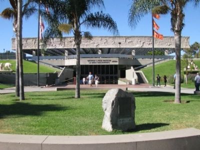
First historic reference to the tar pools recorded in the diary of Gaspar de Portolá on August . . . — — Map (db m126874) HM
Today, Ballona Lagoon is a 16-acre remnant of a formerly extensive coastal wetland. Like other southern California wetlands, urbanization has reduced its size and degraded its habitat over the last century. Historically, Ballona was much larger . . . — — Map (db m128456) HM
One of the most outstanding geological features in California, extending for over 650 miles from Point Arena, north of San Francisco, to south of San Gorgonio Pass, between twenty and thirty miles deep and more than a mile wide in some locations. . . . — — Map (db m149749) HM
The Palos Verdes Peninsula is an up lifted block of land forced out of the sea at a rate of about 0.4 millimeters per year over the last 2 million years. Once an island, the peninsula is encircled by thirteen wave cut terraces. These broad "benches" . . . — — Map (db m42124) HM
Some of the world’s richest waters exist right off California’s coast. An explosion of life occurs here due to a combination of the sun’s energy, wind, ocean currents, and contours of the sea floor. Microscopic phytoplankton form the base of the . . . — — Map (db m63362) HM
For thousands of years Native Americans lived in the Bay Area harvesting animals, salt, and acorns. The changes they made to the landscape were limited. They used fire to shape oak woodlands and grasslands. cultivated plants, and collected salt . . . — — Map (db m102474) HM
Providing a narrow entrance to the west coast's most defensible harbor, the strategic value of the Golden Gate is readily apparent. Between 1776 and 1846, Spanish, then Mexican, guns defended the harbor entrance. Starting in 1846, American soldiers . . . — — Map (db m102777) HM
Originally named Tower Rock, May Rock is the largest outcropping of quartz along the Mother Lode. This 82 foot high formation contains no gold ore. Most gold ore within quartz is at greater depths in the earth.
It was part of Colonel John C. . . . — — Map (db m46375) HM
From the crest of the ridge of a few hundred feet behind this point members of the Mariposa Battalion under the leadership of Major James D. Savage looked into Yosemite Valley on March 27, 1851.
Alarmed by the encroaching tide of California Gold . . . — — Map (db m47417) HM
Ever-Changing Scene
In Yosemite, you may never witness the same scene twice.
This grand show is eternal. It is always sunrise, somewhere; the dew is never all dried at once; a shower is forever falling; vapor ever rising. Eternal . . . — — Map (db m63596) HM
A Burning Tradition
Miwok people, who called themselves Ahwahneechee, lived in Yosemite Valley for thousands of years. Their traditional practice of regularly burning the meadows and oak woodlands of the Valley contributed to the open . . . — — Map (db m63597) HM
At certain times of the year some of the Valley’s waterfalls disappear. Bridalveil keeps flowing even in late summer, when Yosemite Falls begins to dry up.
Above Yosemite Falls the terrain is largely bare granite; runoff is rapid. Bridalveil . . . — — Map (db m63589) HM
You are standing on the site of two famous Yosemite landmarks: McCauley’s Mountain House (1872-1969) and the Glacier Point Hotel (1917-1969). Both structures were built from trees cut down near this site. They both burned to the ground on the . . . — — Map (db m100858) HM
Where the Old Village once stood, little evidence remains. In its heyday, thousands of tourists arrived on horseback, in wagons, and in early Model T Fords. They danced, bathed, and slept here. Today this is hard to imagine, as the meadow seems so . . . — — Map (db m65527) HM
People have been coming to Glacier Point for generations to see one of the most spectacular views on earth. For a panoramic vista of Yosemite Valley, walk along the trail to Glacier Point, located ¼ mile from where you’re now standing. Along the . . . — — Map (db m63610) HM
Convict Lake and Creek are so named as the result of an encounter here September 17, 1871, between Robert Morrison, Benton Merchant and member of a posse of citizens, and three convicts who had escaped from the Carson City, Nevada, State . . . — — Map (db m19879) HM
Crowley Lake, widely known for its trout fishing, has yielded more than 40 tons of fish the first week of fishing season. It was named for Father Crowley, a beloved Catholic priest. who traveled this area extensively.
The White Mountain Range, . . . — — Map (db m72570) HM
extended from Bishop south for 100 miles. The valley was inhabited by Indians for many years. Joseph Walker in 1833 was the first white man to discover the valley. In 1845 John C. Fremont named the valley, a river and a lake, after Richard Owens, an . . . — — Map (db m50058) HM
Devils Postpile stands not only as an unusual geologic wonder but as a monument to the visionary efforts of a dedicated conservationist. In 1910, under U.S. Forest Service management, engineer Walter L. Huber received an application from mining . . . — — Map (db m63616) HM
Even though Monterey cypress trees prefer this area's rugged bare granite headlands, the Lone Cypress is a testament to the hardiness of these trees. It has withstood Pacific storms and winds for roughly 250 years. Fences and cables now offer added . . . — — Map (db m8476) HM
Soldiers once guarded this shoreline against sea-borne attack, but one force proved too powerful to stop. Coastal erosion, the wearing away of these bluffs and beaches by ocean waves, has been steadily moving the coastline inland here since sea . . . — — Map (db m157374) HM
Soldiers once guarded this shoreline against sea-borne attack, but one force proved too powerful to stop. Coastal erosion, the wearing away of these bluffs and beaches by ocean waves, has been steadily moving the coastline inland here since sea . . . — — Map (db m157375) HM
Decades of logging, grazing, recreation, and foot traffic brought Asilomar's dune ecosystem to the brink of extinction. When the Young Women's Christian Association (YWCA) established the Asilomar summer camp grounds in 1913, the dunes became a . . . — — Map (db m63773) HM
History
“I don’t believe I have adequate words to describe the real beauty of Donner Pass. As we stood looking down I had a floating sensation… I lost all fear as I looked at one of the most beautiful blue lakes (Donner Lake) I have . . . — — Map (db m81894) HM
America's Largest Nordic Ski Resort Opens
When Royal Gorge opened in the 70's, Nordic skiing in the U.S. was in its infancy. Since then, the sport has grown to near European popularity and Royal Gorge became renowned the world over, boasting . . . — — Map (db m129654) HM
This section weighs five tons and measures 7½ feet in diameter. The original tree, estimated to have been 200 feet tall, was part of a sub-tropical forest 55 to 70 million years ago in what is now Colorado. Scientists believe it to be of the Redwood . . . — — Map (db m155279) HM
In early descriptions it was known as Cerrito De Las Ranas, meaning the Hill of the Frogs. In the 1890s this hill became the scene of mining excitement. Its soil composition, very red in color, had caused early American settlers to name it Red Hill. . . . — — Map (db m51966) HM
History
Fire! Fire at Cascade! Call Cisco
Snowsheds solved one problem and opened up an industry of snow shovelers, maintenance workers, carpenters, line walkers and fire lookouts. 24 hours a day, high on Red Mountain, lookouts scanned . . . — — Map (db m129442) HM
Dedicated to Susan Cooley-Gilliom
This was Susan's favorite spot for photographing and painting the South Yuba River, which she cherished in all season. When Placer Legacy first began negotiations to preserve this land, Susan was a key . . . — — Map (db m105153) HM
At 10,834 feet, San Jacinto Peak is the second highest peak in southern California. Its north face rises over the desert floor, creating one of the steepest escarpments in the United States. The peak also helps create a landscape of extremes. Mount . . . — — Map (db m210759) HM
Earthquake Faults Crisscross this land and shape its restless landscape.
The San Andreas fault cuts along the eastern side of the Coachella Valley. From where you are standing it runs parallel to Interstate 10 toward the base of . . . — — Map (db m212019) HM
When rain falls on a vernal pool grassland, some water sinks into the ground and the rest flows into streams or into depressions in the landscape. The water cannot move deeper into the ground in a vernal pool grassland because a hardpan blocks its . . . — — Map (db m52708) HM
Was discovered on February 22, 1907 by James Marshall Couch while prospecting for quicksilver on a fifty dollar grubstake for shares from R.W. Dallas and Tom Sanders. On July 30, 1907 mineralogy Professor George D. Louderback identified it as a new . . . — — Map (db m63910) HM
Ecology is all about how all things around us interact and affect each other, from rocks to plants to animals. Here is a place rich with different ecological interactions. How many can you see?
Millions of years ago, most of California was under . . . — — Map (db m71565) HM
Amboy Crater, formed of ash and cinders, is 250 feet high and 1500 feet in diameter. The crater is in one of the youngest volcanic fields in the United States. Six distinct periods of eruptions created the resulting nested group of volcanic cinder . . . — — Map (db m78561) HM
Six panels are mounted on a base, which tell the story of Route 66 . Reading from left to right - Panel 1: The Story of Route 66
Commissioned in 1926 and soon dubbed "The Mother Road," Route 66 was a great asphalt . . . — — Map (db m33446) HM
Over 400 years ago, as the Spanish adventurer Cabrillo was
exploring what is now Southern California, the mighty pine
above you had just peeked through the soil. By the time
Benjamin Davis Wilson discovered our valley in 1845, this tree
had . . . — — Map (db m197487) HM
Located on the hills above San Bernardino, the Arrowhead has been an important landmark for centuries. It is believed to be a natural feature but its true origin is unknown. The distinctive arrowhead shape is visible because the white sage, . . . — — Map (db m126067) HM
Do you recognize the Trona Pinnacles
from more than a dozen hit movies?
Over thirty film projects a year
are shot among the tufa
pinnacles, including backdrops for
car commercials and sci-fi movies such
as Star Trek V, The Gate II, . . . — — Map (db m212574) HM
Rising from the bottom of what was once an ancient lakebed, the Trona Pinnacles represent one of the most unique geologic landscapes in the California Desert. Over 500 of these tufa or calcium carbonate spires are spread out over a 14 square mile . . . — — Map (db m50221) HM
San Francisco was an ancient river valley were creatures who grazed and browsed and stalked their prey, left their bones. (text on the horizontal surface)
20,000 years ago you could have walked to the Farallon Islands... . . . — — Map (db m92829) HM
This tablet marks the shore line of San Francisco Bay at the time of the discovery of gold in California, January 24, 1848. Map reproduced above delineates old shore line. — — Map (db m638) HM
The shore line of San Francisco Bay reached a point twenty-five feet northeasterly from this spot at the time gold was discovered by James W. Marshall at Coloma, California, January 24, 1848.
Map of old water line shown on tablet on opposite . . . — — Map (db m71806) HM
Imagine how the Glen Canyon Park used to be part of the open rolling hills far south of San Francisco and how you might feel if you came across this 70 acre, 500 foot deep canyon for the first time, protected by the winds down with its own . . . — — Map (db m143531) HM
Swift tides, treacherous rocks, dense fog, and a narrow harbor entrance have always made San Francisco’s coast and port difficult to navigate. Over 300 known vessels have failed to make the passage and sank in the cold, treacherous waters.
One . . . — — Map (db m48638) HM
The Channel Watershed was originally comprised of
sand dunes, marshes, and a large bay called Mission
Bay. The waterfront edges of Mission Bay were marked
by Potrero Point, near Pier 70, and Steamboat Point,
which today is the launch point for . . . — — Map (db m191949) HM
Original "Wasteland" Filled
This recreated tidal marsh and lagoon recoup a fragment of a luxuriant 130-acre marsh system that once stretched along this shoreline. Abounding in life, the marsh offered the native Yelamu people an ideal . . . — — Map (db m132412) HM
In 1852 you would have been standing on a bluff overlooking the narrow beach just below that followed the approximate line of King Street. First accurately charted by the U.S. Coast Survey topographical engineers in 1852, the shoreline was named . . . — — Map (db m72544) HM
Three panels are located on the Harford Pier outline the history of Port San Luis.
Port San Luis - A Gateway Through Time Geology
Bays are formed over thousands of years by erosion. Less resistant rock is weathered away by . . . — — Map (db m117108) HM
At 3,000 acres, Soda Lake is one of the largest
undisturbed alkali wetlands in the state. It provides
important habitat for migratory birds, such as Black-necked stilts, Avocets, Killdeer and on occasion White
Pelican.
In the late 1800s . . . — — Map (db m196467) HM
Physical forces began shaping the Carrizo into a distinct geographic feature about
30 million years ago. As the bordering Temblor and Caliente mountain ranges
were pushed upward, movements along the San Andreas and San Juan faults
caused the . . . — — Map (db m236542) HM
Welcome to Wallace Creek. Yes, you are looking at a creek. Wallace Creek may seem insignificant compared to other streams or rivers, after all, on most days of the year, it is bone dry. But it tells an important and exciting story.
As you can . . . — — Map (db m126611) HM
An important mariner's landfall for over 300 years, chronicled in the diaries of Portola, Fr. Crespi and Costanso in 1769 when they camped near this area on their trek to find Monterey. Sometimes called the "Gibraltar of the Pacific". It is the last . . . — — Map (db m24795) HM
Daly City is usually blanketed with heavy fog and swept by brisk sea breezes from mid-May to mid-September. But while Daly City shivers, the summer fog and sea breezes provide natural air conditioning for the rest of the Bay Area.
The breeze . . . — — Map (db m52114) HM
Here at Thornton Beach, the ground is not as solid as it seems. The ground itself is made up of a semi-consolidate sedimentary rock from here to Mussel Rock. It doesn't hold together well, which makes the coastline very unstable.
Constant . . . — — Map (db m52113) HM
The San Andreas Fault is the largest earthquake fault in North America. It passes through this point and alongside the tip of the small peninsula straight ahead.
In this area, during the 1906 San Francisco earthquake, the west side of the fault . . . — — Map (db m17165) HM
Watershed: Guadalupe River
Capacity: 6.5 billion gallons
Depth: 130 feet
Length: 2.5 miles
Built: 1952
Lexington Reservoir, named for the historic 1850's town which once stood on the valley's floor, is a significant . . . — — Map (db m55147) HM
Oak trees provide wildlife habitat, scenic beauty, healthy watersheds, recreational opportunities and a link to Morgan Hill’s local historical heritage. Murphy’s Majestic Oak is a representation of the beautiful oak trees found throughout the City . . . — — Map (db m212711) HM
Oak woodlands have become California’s signature landscape due to their widespread distribution and unique appearances. These woodlands provide critical wildlife habitat, scenic beauty, healthy watersheds, recreational opportunities, and a link to . . . — — Map (db m212712) HM
Founded in 1872 and known as the reservation, Alum Rock Park is the oldest municipal park in California. It was named for a large rock formation believed to contain alum. Even after it was discovered to have been incorrectly identified, the name . . . — — Map (db m92718) HM
The mineral springs located in this area have played an important role in the history and development of the park. Between 1891 and 1902, the Parks Commission began developing the park, highlighting the springs. During this period, over 20 . . . — — Map (db m63781) HM
Originally we wanted to get the level ground below here for a summer home or mountain cabin, but the gentleman we were buying from would not sell the level ground unless
we purchased a strip across the entire south end of his property including . . . — — Map (db m214820) HM
Burney Falls
has been dedicated a
National Natural Landmark.
This site possesses exceptional value as an illustration of the nation's natural heritage and contributes to a better understanding of man's environment. — — Map (db m546) HM
Our guide [Mr. K.V. Bumpass,] after cautioning us to be careful where we stepped, that the surface was treacherous, suddenly concluded with Virgil that the “descent to Hell was easy” for stepping upon a slight inequality in the ground . . . — — Map (db m237974) HM
Administered by the Forest Service, United States Department of Agriculture has been designated a
Registered Natural Landmark
This site possesses exceptional value as an illustration of the nation's natural heritage and contributes to a . . . — — Map (db m89118) HM
This was the shoreline of Tule Lake in 1872-73. The Modoc Indians occupying the Stronghold obtained water at this point.
Once nearly 100,000 acres, the lake was drained between 1912 and 1958 to make fertile land available for homesteads. — — Map (db m87914) HM
Dominating the landscape, Mt. Shasta can be seen for 100 miles from certain points drawing hikers, skiers and travelers. Mt. Shasta rises 11,000 fro the base to the summit for a total elevation of 14,162’ above sea level, one of the nation’s largest . . . — — Map (db m69866) HM
The bridges, oil refineries, factories and ports along the East Bay shoreline reflect a commercial history that dates back to the Gold Rush. The Carquinez Strait provided easy passage for ships carrying cargo and people to and from the gold . . . — — Map (db m232404) HM
Major Pierson B. Reading discovered gold on this bar behind this monument in July, 1848. After crossing the Trinity Divide from the North Fork of Cottonwood Creek. His party of three whites, close friend Delaware Indian scout Tom Hill, and sixty . . . — — Map (db m55999) HM
In the bend of Rich Gulch near its junction with Ash Hollow five miners worked the winter of 1849-50, with the use of a log hollowed out to make a rocker. The rich pocket yielded five pounds of gold per day. The gulches in this district proved to . . . — — Map (db m112476) HM
In 1859 a wooden suspension flume 2200’ long was constructed across this valley by G.W. Holt and August Conrad as a link in the Golden Rock Ditch system which conveyed the water of the South Fork of the Tuolumne River to the mining areas of . . . — — Map (db m53274) HM
Within this 459-square-mile Hetch Hetchy watershed are 287 miles of trails, including a portion of the Pacific Crest Trail. They offer views of an abundance of flora and fauna, along with breathtaking scenery.
Upstream from the dam to your . . . — — Map (db m1943) HM
The Tuolumne River supplies 85% of the water for 2.4 million people. It originates from pristine spring snowmelt as far upstream as Mt. Lyell at an elevation of 13,114 feet.
The City and County of San Francisco protects the resources entrusted . . . — — Map (db m1942) HM
Known as gateway of Mother Lode and to southern mines, gold first discovered in Tuolumne County west of this point at Woods Creek by James Woods shortly before town was founded by Col. George James, August 8, 1848. Large quantities of gold recovered . . . — — Map (db m2304) HM
1864
In the midst of the
Civil War, President
Abraham Lincoln
signs a law preserving
Yosemite Valley and
making it the nation's
first state park - it later
became a national park.
1890
Preservation . . . — — Map (db m235910) HM
“We can see the Dunes and the Crestone Needles from all over our ranch. When we are lost, that’s what we navigate by.”
--local rancher
Whether traveling on foot, by horseback, Model A, or the . . . — — Map (db m71051) HM
"Totally Unique and Unexpected!"
—park visitor
Welcome to the high elevation desert that is Great Sand Dunes! Does this landscape strike you as amazing, bizarre or totally out of place. If so, you’re not . . . — — Map (db m71050) HM
The scale of the Great Sand Dunes can be difficult to judge. The dunes you see from here are only the front lines of a sea of dunes that covers many square miles.
How far do the dunes extend into the distance? The dunes are 8 miles (13km) . . . — — Map (db m104717) HM
Different Life Zones Exist in the Mountains
Imagine climbing the mountain in front of you. You might notice it gets cooler as you ascend. As the temperature drops, moisture in the air condenses, precipitation increases, and creates different . . . — — Map (db m71056) HM
You are about to step into the Great Sand Dunes Wilderness. Its mood changes with the seasons, from the spacious solitude of winter, to spring and summer fun and play. Whatever the season of your visit, this unexpected wilderness offers . . . — — Map (db m71057) HM
Mountains and passes were important in the formation
of the sand dunes.
You are looking at the Sangre de Cristo Mountains. Prevailing southwesterly winds carrying sand across the San Luis Valley were blocked by the mountains.
As the . . . — — Map (db m71055) HM
You are looking across a sandy grassland that is a vital part of the Great Sand Dunes geological system. The sand sheet lies between the dunefield and the sabkha. Its deepest portions may be remnants of an ancient lake system, but the surface is . . . — — Map (db m160700) HM
Pagosa Springs has a rich history, beginning with the Anasazi Indians. Later the Utes, Navajos and Apaches inhabited this beautiful corner of the Southwest. They also visited the great “Pagosah” hot springs which they believed had . . . — — Map (db m27527) HM
This ancient tree was once part of a grove of native cottonwoods under which the local Ute Indians would camp and hold council prior to 1881. An Indian trail passed nearby. It has been identified as the Ute Council Tree since 1930, when the local . . . — — Map (db m119897) HM
Down 17th Street, Longs Peak is visible over the roof of Union Station. Together, they symbolize two bases of Denver's economy. Since its founding in 1858, Denver has taken advantage of its location for freight and passenger transportation. . . . — — Map (db m135104) HM
Long’s Peak, visible at the end of 17th Street, is 14,255 feet in elevation.
The National Forest Service lists 54 peaks over 14,000 feet in elevation within the state of Colorado. Mt. Elbert at 14,433 feet it the highest peak in the Rocky . . . — — Map (db m135531) HM
A geologic phenomenon known as a “glowing avalanche” formed Castle Rock and the other buttes of Douglas County 36.7 million years ago. A volcanic eruption near Mount Princeton, about 95 miles southwest of here, spewed a frothy, gleaming . . . — — Map (db m46142) HM
This mountain, 14,110 feet above the sea and the most celebrated peak in America, is named for the explorer, Capt. Zubulon M. Pike, who saw it first in 1806. He attempted to climb it, failed and reported it unclimbable. Ascended in 1820 by Dr. . . . — — Map (db m4846) HM
Imagine standing here in a tropical hardwood forest 55 million years ago. The forest and ancient soils were later covered by white sandstone of uplifted and later eroded Pikes Peak Granite. The sandstone is known as the Dawson Arkose Formation. Its . . . — — Map (db m135458) HM
The Rocky Mountains are the longest chain of mountains in the world. They divide the United States watershed between the Atlantic and Pacific Oceans. Colorado has 53 peaks over 14,000 feet. One inch on the Horizon equals about 38 miles. — — Map (db m4838) HM
Pikes Peak
You are at 13,380 feet, 4,078 meters
Feeling Spacey? In the United States you can not get much closer to outer space than this! Are you dizzy and short of breath? No wonder, you are 2.5 miles (4 kilometers) above sea level! There is 40% . . . — — Map (db m45815) HM
Has been designated a Registered National Historic Landmark under the provisions of the Historic Sites Act of August 21, 1935 this site possesses exceptional value in commemorating and illustrating the history of the United States. US Department of . . . — — Map (db m45816) HM
Passage from prairie to high plains
If you had been standing on this spot for the last 10,000 years, you would have seen the history of Colorado progress below you. This ancient route through the Rocky Mountains is named for Colorado’s Ute . . . — — Map (db m45761) HM
In 1879, General William Jackson Palmer, the founder of Colorado Springs, convinced his friend, Charles Elliot Perkins to purchase land in Garden of the Gods. Perkins eventually bought a total of 480 spectacular acres surrounding the Gateway Rocks, . . . — — Map (db m135547) HM
In 1879, General William Jackson Palmer, founder of Colorado Springs, convinced his friend Charles Elliot Perkins to purchase land in Garden of the Gods. Perkins eventually bought a total of 480 spectacular acres surrounding the Gateway Rocks, . . . — — Map (db m135646) HM
The beauty of Garden of the Gods Park, with its dramatic red rock formations framing Pikes Peak, serves as a magnificent eastern gateway to Colorado’s Rocky Mountains. The park’s towering red sandstone rocks have long been recognized as a landmark. . . . — — Map (db m45983) HM
Around 300 million years ago, the Ancestral Rockies once stood here. Over time, the forces of wind and water eroded the magnificent peaks into swift streams full of sediments. These sediments were eventually pressed and cemented into solid rock. The . . . — — Map (db m45979) HM
1796 entries matched your criteria. Entries 101 through 200 are listed above. ⊲ Previous 100 — Next 100 ⊳