Considered one of the founders of the modern jazz scene, Alvin Batiste was an avant garde jazz clarinetist and educator. He shared his wisdom and musicianship with numerous students through the Batiste Jazz Institute at Southern University in Baton . . . — — Map (db m96601) HM
In 1960, Southern University students were arrested and expelled from the university for
staging sit-ins at lunch counters at Kress Department Store, Greyhound Bus Station and
Sitman's Drug Store in downtown Baton Rouge. The arrest and expulsion . . . — — Map (db m219964) HM
On September 21, 1779 Col. Dickson commanding the British post at Baton Rouge Surrendered to Gov. Galvez and his American Allies.This tablet commemorates this One battle of the American Revolution On Louisiana soil And is placed here By The . . . — — Map (db m121370) HM
In 1806 Elias Beauregard commissioned Ira C. Kneeland to subdivide his plantation and sold lots at public auction. Baton Rouge's first large real estate project, bounded by North, South and East Boulevards and the river, was centered around a . . . — — Map (db m85064) HM
Beauregard Town founder Elias Toutant Beauregard was a retired military officer from New Orleans who became fascinated by neighborhood development. After buying a large parcel of land in Baton Rouge, Beauregard envisioned a community that would . . . — — Map (db m98527) HM
Bill Conti made a lasting impression on popular culture through his film compositions. His talent for memorable melodies can be heard on the Rocky soundtrack, which brought him widespread acclaim. An alumnus of the LSU School of Music, Bill Conti's . . . — — Map (db m115390) HM
This plaque depicts the surrender of the British fort at Baton Rouge, by Lt. Colonel Alexander Dickson to Bernardo de Galvez, Governor of Spanish Louisiana, on September 21, 1779. Also surrendered were all other British posts along the Lower . . . — — Map (db m85222) HM
Caroline Durieux, a well known lithographer and social artist during the 1930s and 1940s, was Director for the WPA Federal Art Project for Louisiana and a Louisiana State University professor of Fine Art. At LSU, she developed the electron print . . . — — Map (db m117115) HM
Methodist preachers, known as "circuit riders", began ministering in the Baton Rouge area in the 1820's. The Methodist Episcopal Church incorporated in 1834, Rev. Charles K. Marshall, Pastor. The congregation built their first church near the . . . — — Map (db m87270) HM
Baton Rouge was situated within the territory which Great Britain received from France at the end of the Seven Years' War. With the creation of the governments of West and East Florida, the former French settlement on the Mississippi became a part . . . — — Map (db m91063) HM
Although Spanish explorers probably saw the Baton Rouge bluffs from the river before Iberville landed here in 1699, Spain did not colonize the area. It became a French possession in 1682 when LaSalle claimed all the land drained by the Mississippi . . . — — Map (db m91058) HM
Spanish troops commanded by Bernardo de Galvez captured the British fort at Baton Rouge on September 21, 1779. Although the historic Red-and-White Banner of Castile and Leon was the first Spanish flag to fly over the fort in 1785, the national flag . . . — — Map (db m91826) HM
Louisiana seceded from the Union January 26, 1861, and a blue pelican flag replaced the U.S. flag. The National Flag of Louisiana, adopted February 12, 1861, became the second state flag until Louisiana joined the Confederacy March 21. There were . . . — — Map (db m91827) HM
The first usage of the Pelican Flag as emblematic of Louisiana in unknown, but references to flags with a pelican design were made long before the Civil War. The flag was officially adopted by the State Legislature July 1, 1912. On the flag appears . . . — — Map (db m91068) HM
Under authority of the West Florida Convention, troops commanded by Philemon Thomas captured the Spanish fort and Governor at Baton Rouge September 23, 1810. The independent Republic of West Florida was established and it's blue flag with a white . . . — — Map (db m91066) HM
History Claire Lee Chennault (1890-1958)
U.S. Air Force general and pioneer
air tactician, who led the Flying
Tigers in World War II, was raised
in Louisiana and attended L.S.U.
Chennault won fliers wings in 1919.
He commanded a fighter . . . — — Map (db m134217) HM
Completed in 1930, this mansion was first occupied by Governor Huey P. Long.
It was the official residence of successive Louisiana governors until Governor Jimmie H. Davis moved into the new mansion near the Capitol in 1962.
From 1887 to . . . — — Map (db m88299) HM
Frank Hayden, one of Louisiana's most acclaimed sculptors and a Southern University professor of Fine Art, was an inspiring artist who created work that ranged from the monumental to the intimate. His bronze and wood sculptures have an aesthetic . . . — — Map (db m172830) HM
A roughhewn soldier of the Revolution, Thomas played a key role in the West Florida Rebellion, 1810, and served as district military commander in the Battle of New Orleans, 1815. The distinguished patriot also represented this community as sheriff, . . . — — Map (db m160638) HM
During his more than forty years of service with the Marine Corps, John A. Lejeune participated in campaigns in Panama, Cuba, Mexico, France and Germany. He led the famed 2nd Division, American Expeditionary Force, during World War I with valor and . . . — — Map (db m88608) HM WM
One of the biggest pop stars of the '60s, Johnny Rivers reeled off a lengthy series of rock favorites such as "Poor Side of Town," "Secret Agent Man," and "Maybelline." While still a student of Baton Rouge High School, he formed the band Johnny and . . . — — Map (db m96568) HM
(Side 1)
Korean War
1950 - 1953
Freedon Is Not Free
(Side 2)
The Korean War June 25, 1950 July 27, 1953
Erected by those who served in honor of the more than 34,000 Americans who made the supreme sacrifice. . . . — — Map (db m96845) WM
Its architectural style has been both celebrated and criticized, but there's no disputing Louisiana's Old State Capitol is one of the nation's most distinct public buildings. Renowned architect James Dakin chose the building's Gothic Revival design. . . . — — Map (db m96602) HM
Politics and People Louisiana's Old State Capitol, built in 1850, housed the Louisiana legislature until 1932. The Castellated Gothic statehouse has withstood war, fire, abandonment, and political intrigue. This National Historic Landmark . . . — — Map (db m126719) HM
Near this site in 1779, under the leadership of Governor Bernardo de Galvez and his aid Oliver Pollock, Spanish regulars, Americans and Louisiana militiamen marched from New Orleans to Baton Rouge to engage the British forces at Fort New Richmond. . . . — — Map (db m85223) HM
The French military used boxcars called forty-and-eights to transport goods and soldiers, first in WWI and again in WWII. The boxcars could hold 40 men or 8 horses, hence the name. This
is designated in French on the cars: 40 hommes, 8 . . . — — Map (db m127004) HM
Ivan Mestrovic was the most prominent figure among Yugoslav sculptors of the current century, and he has a special niche in his country's history of art.
The creative activity of this prolific artist won a name for him throughout the world. He . . . — — Map (db m91045) HM
Until the 1930s, grocery shopping meant a trip to the city's daily public market. First situated near the Old State Capitol. the market moved to this site in 1857 where it thrived until just before World War II.Townspeople flocked to the open air . . . — — Map (db m160634) HM
This Gothic Revival structure was designed by James Harrison Dakin. The Louisiana Secession Ordinance was adopted here in 1861. The interior was burned in December 1862 while the building was occupied by Federal troops. Reconstructed by William . . . — — Map (db m87892) HM
Old State Capitol River Road & North Blvd. Baton Rouge, LouisianaErected 1847-48 Razed by fire 1862.Seat of State Government 1850-1862 1882-1932. — — Map (db m121371) HM
The Baton Rouge Bus Boycott launched on June 13, 1953. It was a historic move by black residents who were seeking fair treatment from the local bus company. They comprised 80% of the city bus ridership but were forced to stand in the back of the . . . — — Map (db m175447) HM
James H. Dakin designed the 1850 Gothic Revival statehouse; the cast iron fence was added 1854-55. It served as the Capitol until occupied by Union forces during the Civil War. The interior burned in a fire in December 1862.In 1882, architect . . . — — Map (db m177928) HM
Commemorating Oliver Pollock, American Patriot and his nine fellow Americans in the Marcha de Galvez Oliver Pollock Representative of the Continential Congress in Spanish Louisiana Agent of the Colony of Virginia and financier of that . . . — — Map (db m157670) HM
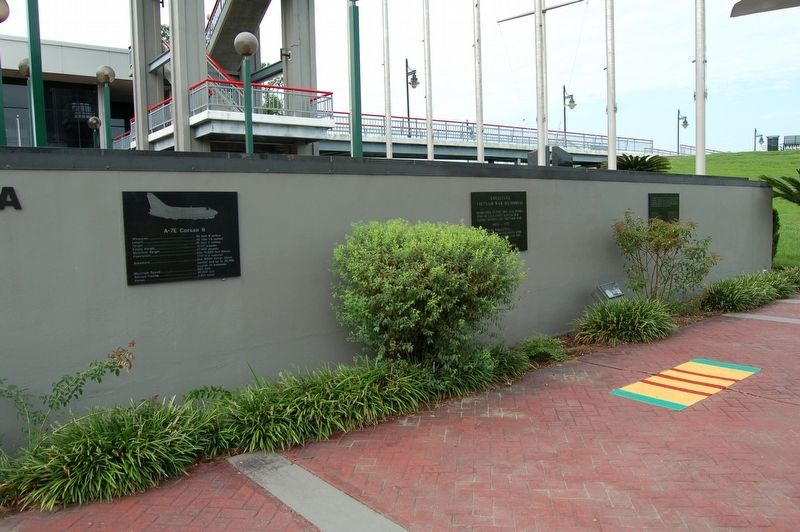
On December 07, 2018, the Honorable Sharon Weston Broome, Mayor-President of the
City-Parish of East Baton Rouge, in cooperation with the Louisiana Naval War Memorial
Commission and the Military Order of the Purple Heart -- Red Stick Chapter 177, . . . — — Map (db m134215) HM WM
During the Spanish domination of Baton Rouge, Repentance Street ran through this area. It was so named because convicted criminals walked along it on their way to receive sentencing at the Commandant's house where the old State Capitol now stands. — — Map (db m89001) HM
Located on the first high bluffs rising above the Mississippi River, Baton Rouge derives its name from the French explorer d'Iberville's 1699 description of a red stick or pole dividing the hunting grounds of the Bayou Goula and Houmas Indians. The . . . — — Map (db m85944) HM
Site of the Baton Rouge College 1838-44, and the Louisiana Institute for the Deaf and Blind 1852-72. A five-story brick building completed in 1858 was used as a general hospital during the Union occupation of the city. It housed the Louisiana State . . . — — Map (db m96680) HM
Here stood the home and shop of Captain Daniel Searles, one of Baton Rouge's early gunsmiths and knife makers. Searles was a maker of the famed Bowie knife. His name is engraved on a knife made for Rezin Pleasant Bowie for presentation to a . . . — — Map (db m87868) HM
Louisiana native, James Moore, was considered the point man of the 1950's Swamp Blues movement. Dubbed Slim Harpo by his wife, he sang in a laid-back style and was a master of the blues harmonica. Although he started out playing juke joints, parties . . . — — Map (db m96603) HM
The D'Artaguiette Brothers, Jean-Baptiste Martin, Navy Commissaire and later director of the Company of the Indies, Bernard Diron, Inspector General and later Commandant at Mobile and Captain Pierre D'Itouralde, Commandant of Illinois, killed in . . . — — Map (db m88775) HM
Baton Rouge gets its name from the first impressions of French-Canadian explorers. Traveling up the Mississippi River in 1699, the group spotted a bloody cypress pole on a river bluff that demarcated hunting territories between indigenous tribes. . . . — — Map (db m96683) HM
By the turn of the twentieth century, Baton Rouge's Third Street had changed from a sleepy row of residences to a bustling commercial center. Because it connected the Old State Capitol with the original site of Louisiana State University (then . . . — — Map (db m98181) HM
Panel 1:
USCGC WHITE ALDER/WLM-541
7 December 1968
In memory and honor
of those shipmates who loyally served
the United States Coast Guard
on board the CGC WHITE ALDER.
They gave the ultimate sacrifice.
On December 7, . . . — — Map (db m126952) HM
Panel 1:
It is August first, 1945, Hunter's Point Naval Shipyard, San Francisco. The KIDD is just completing repairs following the April 11 Kamikaze hit that killed thirty-eight of her crew off Okinawa. It is before the days of television, . . . — — Map (db m85886) HM WM
In memory of the Officers and men of the USS Kidd who gave their lives in the action of 11 April 1945 off Okinawa.
Greishaber, George P., Lieut. (JG) USNR Berwick, Robert A., Ens (SC) USNR Bridgewater, Dorsey C., s 1/C USNR Smith, Addison . . . — — Map (db m137274) WM
Situated on the Mississippi River Levee, the USS KIDD Veterans Memorial features immaculately restored aircraft and naval craft. The Louisiana Memorial Plaza honors the more than 7,000 Louisianans who have died in conflict. The cornerstone of the . . . — — Map (db m117133) HM
Legislators debated passing Federal and State Suffrage Amendments here in 1920. Suffragists held a public rally in support of the 19th Amendment. — — Map (db m177927) HM
This building, erected c. 1835 as a powder magazine for a U.S. Army Post and Arsenal which used this area from 1810-1885, except in 1861-1862 when held by the Confederacy. In 1962 this building was restored and the museum established. — — Map (db m113860) HM
Capitale de l'état. Nommée par Iberville en 1699 d'après le nom indien Iti Humma ou "Baton Rouge". Village fondé en 1721. Passé sous le contrôle des Anglais de 1763 à 1779 et des Espagnols de 1779 à 1810. Il faisait partie de la République de la . . . — — Map (db m85652) HM
To honor and commemorate
the men who fought in the Battle of Baton Rouge
in the War of the American Revolution
September 1779
Which was the only battle of this war
fought outside of the original Thirteen Colonies.
Placed by the Baton . . . — — Map (db m131133) HM WM
On August 3, 1862, Confederate troops from Alabama, Kentucky, Tennessee, Mississippi, and Louisiana under General John C. Breckinridge attacked from the east in an unsuccessful attempt to dislodge Union forces holding the city. Casualties were . . . — — Map (db m85663) HM
Despite the passage of the 1964 Civil Rights Act, the struggle for equality continued.
On August 10, 1967, Bogalusa civil rights activist A.Z. Young, with Robert "Bob" Hicks and Gayle Jenkins, led the march from Bogalusa to Baton Rouge where he . . . — — Map (db m179443) HM
In 1931, when Governor Huey Long commissioned America's tallest state capitol, he probably never guessed he'd be assassinated inside it four years later. Note how the structure's friezes, marble-work and statuary are as elaborate as the political . . . — — Map (db m88738) HM
Castro Carazo, hand-picked by Huey P. Long to head LSU's marching band, lived here where he operated a private music studio. A native of Costa Rica, Carazo wrote the music for Long's campaign song "Every Man a King" as well as the State's official . . . — — Map (db m179069) HM
One of a group of mounds probably constructed about A.D. 1000 during the Cole Creek culture period. Surrounded by a large village area, such mounds served as foundations for sacred buildings and as platforms for the chief to address the tribesmen. . . . — — Map (db m87446) HM
This reproduction of the Liberty Bell was presented to the people of
Louisiana
by direction of The Honorable John W. Snyder Secretary of the Treasury
As the inspirational symbol of the United States Savings Bonds Independence Drive . . . — — Map (db m113863) HM
The first official air mail flight between cities in the United States landed on the LSU athletic field April 10, 1912. After taking off from the City Park Race Course in New Orleans, aviator George Mestache flew a monoplane with a 32-pound pouch of . . . — — Map (db m87473) HM
Here on a bluff of the river stood the old star-shaped Spanish fort from which the West Florida parishes were governed in Spanish colonial days 1779-1810. It was captured by the forces of the West Florida Republic led by Philemon Thomas, Sept 23, . . . — — Map (db m87822) HM
Boom, boom, boom! Cannon fired all day across these grounds on September 21st, 1779, until the British flag finally came down. The Spanish victor's troops included African-Americans, Native-Americans, and French-Acadian refugees, in this, the . . . — — Map (db m138445) HM
According to local tradition, Charles Weick named his newly purchased saloon the day after Fort Sumter was fired on, 1861, and put the cannon out front for atmosphere. It was one of the city's most popular saloons until prohibition. — — Map (db m88273) HM
These four corners were dedicated for public use in 1809 by Antonio Gras and Edith and Richard Devall. A market was to be in the center, and the corners were used for hitching horses and wagons. — — Map (db m87869) HM
One of 200 Historic Hotels of America, the Hilton Baton Rouge Capitol Center was first built in 1927 as the Hotel Heidelberg, the city's first luxury hotel and site of noteworthy social and political events. Governor Huey P. Long kept an unofficial . . . — — Map (db m104254) HM
Public service commissioner, then governor, finally U.S. senator, Huey Pierce Long went from obscure upstate lawyer to flamboyant national figure. Along the way, he built a political dynasty—as well as roads, bridges, hospitals and schools. . . . — — Map (db m87430) HM
Unanimously elected
Commander in Chief of the Continental Army (1775-1783)
President of the Constitutional Convention (1787)
President of the United States of America (1789-1797)
A gift to the people of Louisiana by
The Louisiana . . . — — Map (db m113864) HM
The Louisiana Gold Star Families Memorial Monument pays
tribute to Families who lost a Loved One in the service of the
United States Armed Forces.
The Homeland panel represents the state of Louisiana.
The state seal features a pelican tearing . . . — — Map (db m126714) WM
Since 1636, the Minuteman has kept vigilant watch over our Nation and represents the men and women of the Louisiana National Guard who proudly serve and bravely answer the call of duty. Honored here are those who made the ultimate sacrifice to . . . — — Map (db m145225) HM WM
In 1885, Louisiana State University moved from Mid-State city of Alexandria to this site, taking over the decommissioned Baton Rouge Arsenal. Nicknamed the "Old War Skule" on these grounds LSU saw its first intercollegiate football game, regular . . . — — Map (db m87429) HM
This 1835 building's 4½ foot thick walls were designed to protect gunpowder stored inside—and help contain the explosion if that protection failed. It was part of an army post that covered these grounds from 1810 to 1885. The Civil War . . . — — Map (db m113861) HM
From 1810 to 1888, the area around the State Capitol was an extensive U.S. Army arsenal and supply depot. Today, the last remaining arsenal is a museum that features replicas of powder-filled casks, as well as interpretive information about 19th . . . — — Map (db m98054) HM
Named for company member, John O. Bradford, Old Brad, the first service horse in the Baton Rouge Fire Department, is buried in front of his beloved Washington No. 1 Firehouse. He served 28 years, actively for 15. After retiring, he was allowed to . . . — — Map (db m158615) HM
Site of the
Louisiana State University
1886 - 1925
This marker
erected by the last generation
of the
Cadets of the 'Ole War Skule'
To honor the men and women
who attended or served
Louisiana State University
while on these . . . — — Map (db m85698) HM
Incorporated January 25, 1834, the church was built on this site in 1836, Charles K. Marshall, Pastor. Enlarged under the leadership of the Reverend William E. M. Linfield in 1860, it was used until March 28, 1926, when the congregation moved to a . . . — — Map (db m88303) HM
In 1825, four military barracks were built to support the U.S. Army arsenal that occupied much of today's Capitol Park. A fifth barrack that completed the pentagon arrangement was built so poorly it was demolished shortly after construction. . . . — — Map (db m96740) HM
Begun in 1819, construction dragged on for five years because of epidemic yellow fever. Its fifth building (hence the name "pentagon") soon collapsed into a pile of bricks. But the remaining structures survived both Civil War bombardment and nearly . . . — — Map (db m87472) HM
Constructed 1819-1822 to house U.S. troops. Used as a garrison from 1822-1877 except from 1861-1862 when held by Confederates. From 1886-1925 these buildings and grounds were the site of Louisiana State University. — — Map (db m85704) HM
Little cottage typical of the wood frame residences of early Spanish Town. Originally, the house was one room deep with galleries, front and rear. The original lot, 160 feet wide and extending from North Street to Spanish Town Road was purchased by . . . — — Map (db m87282) HM
Built in the Classic Revival Style between 1846 and 1850 by Nelson Potts, Master Brick Mason, as an example of his craft as well as his home. Potts was one of the major builders of Baton Rouge during the mid-19th century. — — Map (db m87278) HM
En este lugar fué creada la fraternidad Sigma Iota en el año de nuestro Señor de 1904 Convencion de 1929. English translation: Here in this place was created the Sigma Iota Fraternity in the Year of Our Lord 1904 . . . — — Map (db m137720) HM
On this site stood the Spanish Fort captured by the forces of the Republic of West Florida September 23, 1810. Erected by the Historical Society of East & West Baton Rouge January 16, 1917 in celebration of the centennial of the City — — Map (db m242219) HM
On July 7, 1872, Rev. George Bird and the congregation of Shiloh Church dedicated the cornerstone of their new frame church on this site. For more than forty years the Church occupied a prominent place in the life of Spanish Town. In March 1918 this . . . — — Map (db m87371) HM
On September 8, 1935, Dr. Carl Austin Weiss was living here with his family in a small frame cottage. About 9:30 that evening, U.S.Senator Huey P. Long was shot in the corridor just off the house chamber of the State Capitol. Weiss, the alleged . . . — — Map (db m88591) HM
East of this point was Spanish Town, laid out in 1805 by Carlos GrandPré, Governor of Spanish West Florida for the Canary Islanders from Galvez Town that they might continue to live on Spanish soil and help defend the forts. Spanish Town Road is now . . . — — Map (db m88592) HM
Founded in 1805, Spanish Town is Baton Rouge's oldest neighborhood having the oldest architectural history in the area. The surviving buildings represent popular styles from a period of Louisiana's history.
Spanish settlers from the Canary . . . — — Map (db m97968) HM
Built in 1853 to 1856 on the site of two earlier churches. The first erected about 1790 under Spanish rule was called "Our Lady of Sorrows." The first marriage recorded was that of Don Antonio Gras, an early Spanish resident who donated the land. . . . — — Map (db m87854) HM
The Brothers of the Sacred Heart founded St. Vincent's Academy on this site in 1894. In 1929 the school for boys was replaced by a larger facility and renamed Catholic High School. In 1957 the school was moved to its present location on Hearthstone . . . — — Map (db m87444) HM
Built about 1850 by Nathan King Knox and first occupied by the Stewart-Dougherty families, this house was used as a hospital by Union soldiers during the Civil War. It is an excellent example of Classical Revival architecture. — — Map (db m72959) HM
Planted In Loving Memory Of
Influential Louisiana Creole Singer, Songwriter and Accordionist
Amédé Ardoin
March 11, 1898-November 3, 1942
Born near Basile in Evangeline Parish
Amédé Ardoin created the framework for Cajun, Creole and . . . — — Map (db m242218) HM
The former Baptismal fount from St. Joseph Cathedral. The first baptism recorded here was Juan Josef Trahan, son of Juan Marie Trahan of Morlaix, Britanny, France and Adelaida Tulier of Cherbourg, Normandy, France. He was born June 19, 1793 and . . . — — Map (db m93354) HM
This monument honors the brave service and sacrifices of all African-American Veterans
and their families from Louisiana and nationwide. It begins with the 1863 Siege at
Port Hudson, Louisiana, the first time Black soldiers had the opportunity to . . . — — Map (db m232815) HM WM
Look over the water and across time. Do you hear the paddling of Native American dug-outs? Thunderous volleys from the Civil War gunboat pictured above? Perhaps Mark Twain piloting a paddle-wheeler or P.T. Barnum beckoning with his showboat's . . . — — Map (db m88295) HM
The stately Old Governor's Mansion was commissioned in 1929 by Governor Huey P. Long in a style that deliberately mimicked the White House. It replaced a simple frame structure on roughly the same property and served as official residence until . . . — — Map (db m98053) HM
Dedicated in 1932, the Louisiana State Capitol was commissioned by Governor Huey P. Long and was meant to symbolize the state's progress and modernity. At 34 stories, it is the highest state capitol in America and its Art Deco-inspired lines, . . . — — Map (db m96604) HM
To honor
Zachary Taylor
U.S. Army General and twelfth President
of the United States
Known to Americans as
"Old Rough and Ready"
and who lived for a time some 200 yards
southwest of this spot
This marker placed in 1951 by . . . — — Map (db m87482) HM WM
111 entries matched your criteria. The first 100 are listed above. The final 11 ⊳