971 entries match your criteria. Entries 101 through 200 are listed.⊲ Previous 100 — Next 100 ⊳
Spanish-American War Topic
By Nate Davidson, October 18, 2014
Marker next to 16-inch artillery shell in front of Biden Center
| 101 ► Delaware, Sussex County, Lewes, Cape Henlopen State Park — The U.S. Navy at Cape Henlopen — A Century of Service — |
| On Dune Road. | |||
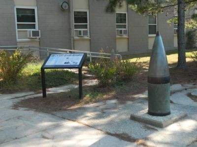
| 102 ► Delaware, Sussex County, Rehoboth Beach — Delaware's Medal of Honor Recipients — |
| On State Road (Delaware Route 1B) just south of Rehoboth Avenue (Delaware Route 1A), on the right when traveling south. | |||
| 103 ► District of Columbia, Washington, Northeast Washington, Kingman Park — In Memory of Eastern High School Alumni — |
| On East Capitol Street Northeast east of 17th Street Northeast, on the left when traveling east. | |||
| 104 ► District of Columbia, Washington, Northwest Washington, Downtown — These Five-Inch Brass Trophy Guns — |
| On Pennsylvania Avenue Northwest at 17th Street Northwest, on the right when traveling east on Pennsylvania Avenue Northwest. | |||
| 105 ► District of Columbia, Washington, Northwest Washington, Dupont Circle — Theodore Roosevelt — Dupont Circle — Diverse Visions | One Neighborhood — |
| On N Street Northwest west of Connecticut Avenue Northwest, on the left when traveling east. | |||
| 106 ► District of Columbia, Washington, Northwest Washington, Federal Triangle — 2 — Grandeur for the People — Make No Little Plans — Federal Triangle Heritage Trail — |
| On Pennsylvania Avenue Northwest at 9th Street Northwest, on the right when traveling east on Pennsylvania Avenue Northwest. | |||
| 107 ► District of Columbia, Washington, Northwest Washington, Former Walter Reed Army Medical Center — Walter Reed Memorial — |
| On Main Drive Northwest at 14th Street Northwest, in the median on Main Drive Northwest. | |||
| 108 ► District of Columbia, Washington, Northwest Washington, Georgetown — Healing in War and Peace — |
| On Reservoir Road Northwest at 39th Street Northwest, on the right when traveling east on Reservoir Road Northwest. | |||
| 109 ► District of Columbia, Washington, Northwest Washington, Theodore Roosevelt Island — Rough and Ready — Theodore Roosevelt Island — George Washington Memorial Parkway, National Park Service, U.S. Department of the Interior — |
| On Upland Trail at Swamp Trail, on the right when traveling north on Upland Trail. | |||
| 110 ► District of Columbia, Washington, Southeast Washington, Navy Yard — "4-in. 40 caliber rifles" — |
| On Isaac Hull Avenue, SE north of Anacostia Riverwalk Trail, on the right when traveling south. | |||
| 111 ► District of Columbia, Washington, Southeast Washington, Navy Yard — Willard Park — Washington Navy Yard — Panel 2 — |
| On Sicard Street Southeast south of Isaac Hull Avenue Southeast, on the right when traveling north. | |||
| 112 ► District of Columbia, Washington, Southwest Washington, East Potomac Park — Cuban Friendship Urn — |
| On Ohio Drive Southwest, 0.2 miles west of Buckeye Drive Southwest, on the right when traveling west. | |||
| 113 ► District of Columbia, Washington, Southwest Washington, Joint Base Anacostia-Bolling (JBAB) — "The Gun" — Hontoria 140 mm. — |
| On Wick Drive west of Defense Boulevard, on the right when traveling west. | |||
| 114 ► Florida, Alachua County, Gainesville — Spanish-American War — Alachua County Veterans Memorial Park — |
| Near SW 41st Place at SW 75th Street, on the left when traveling east. | |||
| 115 ► Florida, Brevard County, Melbourne — Gen. John B. Castleman House |
| On Young Street at Sunny Point Drive, on the left when traveling east on Young Street. Reported missing. | |||
| 116 ► Florida, Brevard County, Melbourne — Spanish-American War — [Melbourne Military Memorial Park] — |
| Near Oak Street south of East Hibiscus Boulevard, on the right when traveling north. | |||
| 117 ► Florida, Charlotte County, Punta Gorda — F-109 — Albert Waller Gilchrist — (1858-1926) — |
| On West Marion Avenue at Harvey Street, on the left when traveling north on West Marion Avenue. | |||
| 118 ► Florida, Duval County, Jacksonville, Springfield — F-1029 — Camp Springfield (Cuba Libre) — |
| On East 5th Street just west of Ionia Street, on the right when traveling west. | |||
| 119 ► Florida, Duval County, Jacksonville, Urban Core — Camp Site of the Forty-Ninth Regiment Iowa Volunteer Infantry — |
| On Main Street N (State Route 5) (U.S. 1), on the right when traveling north. | |||
| 120 ► Florida, Escambia County, Pensacola — Rough Riders — |
| On East Wright Street at North Tarragona Street, on the right when traveling west on East Wright Street. | |||
| 121 ► Florida, Escambia County, Pensacola Beach — Beefing Up Defenses — Fort Pickens — |
| Near Fort Pickens Road, 9.8 miles Pensacola Beach Boulevard (State Road 399). | |||
| 122 ► Florida, Hillsborough County, East Lake-Orient Park — The Philippine-American War 1899 - 1913 — Hillsborough County Veterans Memorial Park — |
| Near U.S. 301, 0.2 miles south of East Dr. Martin Luther King Jr. Boulevard, on the right when traveling south. | |||
| 123 ► Florida, Hillsborough County, Tampa — Clara Barton — 1821-1912 — Founder of the American Red Cross — |
| On Bayshore Boulevard at South Plant Avenue, on the right when traveling south on Bayshore Boulevard. | |||
| 124 ► Florida, Hillsborough County, Tampa — Cradle of Cuban Liberty — |
| On East 7th Avenue (State Road 45) near 14th Avenue. | |||
| 125 ► Florida, Hillsborough County, Tampa — El Chino — Pajarito Restaurant — |
| On 8th Avenue, on the left when traveling west. | |||
| 126 ► Florida, Hillsborough County, Tampa — Orestes Ferrara — |
| On E. 7th Avenue near 17th Street, on the right when traveling east. | |||
| 127 ► Florida, Hillsborough County, Tampa — Picnic Island |
| On Picnic Island Boulevard, 0.4 miles west of Port Tampa Drive, in the median. Reported missing. | |||
| 128 ► Florida, Hillsborough County, Tampa — Roosevelt Elementary School — |
| On South Ferdinand Avenue just north of West Tacon Street, on the left when traveling north. | |||
| 129 ► Florida, Hillsborough County, Tampa — Rough Rider Encampment — |
| On North Armenia Avenue at West Lemon Street, on the right when traveling south on North Armenia Avenue. | |||
| 130 ► Florida, Hillsborough County, Tampa — Rough Riders — |
| On East 7th Avenue (La Séptima) east of Nuccio Pkwy., on the right when traveling east. | |||
| 131 ► Florida, Hillsborough County, Tampa — Rough Riders Encampment — June 1898 |
| On North Howard Avenue north of West Gray Street, on the left when traveling north. Reported missing. | |||
| 132 ► Florida, Hillsborough County, Tampa — Spanish-American War — Hillsborough County Veterans Memorial Park — |
| Near N US Highway 301 (U.S. 301) 0.2 miles south of E Dr. Martin Luther King Jr. Blvd. | |||
| 133 ► Florida, Hillsborough County, Tampa — F-42 — Tampa as Port of Embarkation for Spanish American War — |
| On South West Shore Boulevard at Interbay Boulevard, on the right when traveling north on South West Shore Boulevard. | |||
| 134 ► Florida, Hillsborough County, Tampa — Tampa Bay Hotel — |
| On University Drive near West Kennedy Boulevard. | |||
| 135 ► Florida, Hillsborough County, Tampa — F-31 — Tampa Bay Hotel — |
| On West Kennedy Boulevard near University Drive, on the right when traveling west. | |||
| 136 ► Florida, Hillsborough County, Tampa — Tampa's Oldest Restaurant — 1890 |
| On E. 7th Avenue, on the right when traveling west. Reported permanently removed. | |||
| 137 ► Florida, Hillsborough County, Tampa — The Buffalo Soldiers in Tampa Heights — 1898 — |
| On East Columbus Drive at North Central Avenue, on the left when traveling east on East Columbus Drive. | |||
| 138 ► Florida, Hillsborough County, Tampa — The Rough Riders Passed By Here — |
| On North Franklin Street just north of East Kennedy Boulevard (State Road 60), on the right when traveling south. | |||
| 139 ► Florida, Hillsborough County, Tampa — The Rough Riders Procure a Coal Train — |
| On South Newport Avenue at Kennedy Boulevard (Florida Route 60), on the right when traveling south on South Newport Avenue. | |||
| 140 ► Florida, Hillsborough County, Tampa — The Rough Riders Rode By Here — 1898 — |
| On East 7th Avenue (La Séptima) west of North 22nd Street, on the right when traveling east. | |||
| 141 ► Florida, Hillsborough County, Tampa — United Spanish War Veterans — Tampa's 203 mm Spanish American War Gun — |
| On West Kennedy Boulevard, on the right when traveling west. | |||
| 142 ► Florida, Hillsborough County, Tampa, Port Tampa — The Rough Riders Embark the S.S. Yucatan — |
| On Picnic Island Boulevard at Commerce Street, on the right when traveling south on Picnic Island Boulevard. | |||
| 143 ► Florida, Marion County, Ocala — Ocala Rifles — Ocala - Marion County Veterans Memorial Park — |
| Near East Fort King Street, 0.1 miles south of East Silver Springs Boulevard. | |||
| 144 ► Florida, Monroe County, Key West — Battleship USS Maine — Key West — Florida Keys Historical Military Memorial — |
| Near Wall Street at Tift’s Aly. | |||
| 145 ► Florida, Monroe County, Key West — Carlos Manuel De Cespedes y Cespedes — 1840 - 1915 — Key West Historic Memorial Sculpture Garden — |
| Near Wall Street at Tift’s Aly. | |||
| 146 ► Florida, Monroe County, Key West — Coal Refueling Station — Fort Jefferson — Dry Tortugas National Park — |
| 147 ► Florida, Monroe County, Key West — F-78 — Convent Of Mary Immaculate — (1878) — |
| On Truman Avenue (U.S. 1) at Elizabeth Street, on the right when traveling north on Truman Avenue. | |||
| 148 ► Florida, Monroe County, Key West — 70 — Fort Zachary Taylor — |
| Near Angela Street at Quay Road. | |||
| 149 ► Florida, Monroe County, Key West — Harbor View — |
| Near Angela Street at Quay Road. | |||
| 150 ► Florida, Monroe County, Key West — F-814 — Key West Woman's Club — Martin Hellings House — |
| 151 ► Florida, Monroe County, Key West — Spanish American War — Key West — Florida Keys Historical Military Memorial — |
| Near Wall Street at Tifts Street. | |||
| 152 ► Florida, Monroe County, Key West — Spanish-American War — Veterans Memorial Gardens at Bayview Park — |
| Near Truman Avenue (U.S. 1) near Jose Marti Drive, on the right when traveling east. | |||
| 153 ► Florida, Monroe County, Key West — War of 1898 — On this site the Catholic Convent of the Holy Names of Jesus and Mary was located — |
| On Truman Avenue (U.S. 1) at Elizabeth Street, on the right when traveling north on Truman Avenue. | |||
| 154 ► Florida, Monroe County, Key West — 54 — West Martello — |
| On Atlantic Boulevard at White Street, on the left when traveling south on Atlantic Boulevard. | |||
| 155 ► Florida, Monroe County, Key West — 13 — William Wall Warehouse — Key West Art & Historical Society — |
| On Wall Street at Exchange Street, on the left when traveling north on Wall Street. | |||
| 156 ► Florida, Palm Beach County, Jupiter — F-587 — Sawfish Bay — |
| On State Road A1A, 0.2 miles north of Center Street, on the right when traveling north. | |||
| 157 ► Florida, Pinellas County, Tierra Verde — F-965 — Fort De Soto Batteries and Military Post — |
| Near Anderson Boulevard (State Road 679) 0.4 miles west of Pinellas Bayway. | |||
| 158 ► Florida, Pinellas County, Tierra Verde — Spanish American War Memorial — |
| Near Anderson Boulevard (State Highway 679) 1.5 miles west of Pinellas Bayway South, on the left when traveling west. | |||
| 159 ► Florida, Pinellas County, Tierra Verde — Spanish-American War Cannons from Egmont Key — |
| Near Anderson Boulevard (State Highway 679) 1.5 miles west of Pinellas Bayway South, on the left when traveling west. | |||
| 160 ► Florida, Polk County, Lakeland — Second Mass. Infantry Camp — May 17-30, 1898 — |
| On Lake Morton Drive at South Massachusetts Avenue, on the left when traveling east on Lake Morton Drive. | |||
| 161 ► Florida, Polk County, Lakeland — Site of the Camp of The 10th Cavalry, The “Buffalo Soldiers” — May 14th – June 7, 1898 — |
| On West Peachtree Street at North Virginia Avenue, on the left when traveling west on West Peachtree Street. | |||
| 162 ► Florida, St. Lucie County, Fort Pierce — U.S.S. Maine — |
| Near North Indian River Drive, 0.1 miles south of Seaway Drive (Florida Route A1A), on the left when traveling south. | |||
| 163 ► Florida, Volusia County, Daytona Beach — Spanish–American War — 1898 - 1902 — Tom Staed Veterans Memorial Bridge — |
| On Silver Beach Avenue, 0.5 miles east of City Island Parkway, on the right when traveling east. | |||
| 164 ► Georgia, Athens-Clarke County, Athens — Dedicated to the Veterans of 1898 to 1902 — |
| On E Washington Street at College Avenue, on the right when traveling west on E Washington Street. | |||
| 165 ► Georgia, Ben Hill County, Fitzgerald — Dedicated to the Veterans of 1898 - 1902 — |
| On West Central Avenue (U.S. 319) at Main Street, in the median on West Central Avenue. | |||
| 166 ► Georgia, Chatham County, Savannah, Historic District - North — Chatham Artillery — 1786 — |
| On East Bay Street south of Rossiter Place, on the left when traveling east. | |||
| 167 ► Georgia, Chatham County, Savannah, Midtown — The Georgia Volunteer — Spanish American Monument — |
| On Bull Street at W Park Avenue, in the median on Bull Street. | |||
| 168 ► Georgia, Chatham County, Tybee Island — Battery Hambright — |
| 169 ► Georgia, Chatham County, Tybee Island — 025-58 — Fort Screven — ←—« — |
| On Meddin Drive, 0.1 miles north of Veterans Drive, on the right when traveling north. | |||
| 170 ► Georgia, Chatham County, Tybee Island — 82002393 — Fort Screven — 1897 - 1945 — |
| On N. Campbell Ave. at Soloman Ave., on the left when traveling east on N. Campbell Ave.. | |||
| 171 ► Georgia, Chatham County, Tybee Island — Fort Screven Bakery — Building #97 — |
| On Meddin Avenue near Robinson Avenue, on the left when traveling north. | |||
| 172 ► Georgia, Clay County, Fort Gaines — 030-7 — Fort Gaines Guards — |
| On Washington Street (Georgia Route 39) 0 miles south of Carroll Street, on the right when traveling south. | |||
| 173 ► Georgia, Clayton County, Fort Gillem — 031-AGD-4 — Wheeler Drive — |
| On Wheeler Drive at Hood Avenue, on the right when traveling south on Wheeler Drive. | |||
| 174 ► Georgia, Floyd County, Rome — Spanish-American War Monument — |
| On Broad Street west of Riverside Parkway Northeast, on the right when traveling west. | |||
| 175 ► Georgia, Fulton County, Atlanta, South Downtown — Spanish War Veterans Memorial — 1898 - 1902 — |
| On Martin Luther King Junior Drive Southwest. | |||
| 176 ► Georgia, Glynn County, Brunswick — Dedicated to the Veterans of 1898 -1902 — |
| On G Street at Reynolds Street, on the right when traveling west on G Street. | |||
| 177 ► Georgia, Gwinnett County, Norcross — Rememberance of Confederate, Spanish & World War Soldiers — |
| Near South Cemetery Street at Fairmount Drive Northwest, on the left when traveling south. | |||
| 178 ► Georgia, Hall County, Gainesville — Dedicated to the Veterans of 1898 - 1902 — |
| On Spring Street at Green Street, on the right when traveling east on Spring Street. | |||
| 179 ► Georgia, Lamar County, Barnesville — Barnesville Blues — |
| On Thomaston Street (Georgia Route 36) 0.1 miles north of Holmes Street, on the right when traveling north. | |||
| 180 ► Georgia, Lowndes County, Valdosta — Spanish American War Veterans Memorial — |
| On North Ashley Street (Business U.S. 41) just north of West Central Avenue (U.S. 84/221), on the left when traveling north. | |||
| 181 ► Georgia, Muscogee County, Columbus — 106-16A — Camp Conrad — |
| On Second Avenue (Georgia Route 85) at 32nd Street, on the right when traveling north on Second Avenue. | |||
| 182 ► Georgia, Muscogee County, Columbus — Dedicated to the Veterans of 1898 to 1902 — |
| On Broadway, 0 miles south of 5th Street, in the median. | |||
| 183 ► Georgia, Muscogee County, Columbus — Historic Riverdale Cemetery — |
| On Victory Drive (U.S. 27) 0.1 miles south of 10th Avenue, on the right when traveling north. | |||
| 184 ► Georgia, Muscogee County, Columbus — 106-16 — The Columbus Guards — >>>>-------> — |
| On 9th Street, 0 miles west of First Avenue, on the right when traveling west. | |||
| 185 ► Georgia, Richmond County, Augusta — 121-43 — Birthplace of General Joseph Wheeler — |
| On Wheeler Road at Aumond Road, on the right when traveling west on Wheeler Road. | |||
| 186 ► Georgia, Richmond County, Augusta — 121-27 — Richmond County — |
| On Greene Street near Monument St., on the right when traveling east. | |||
| 187 ► Georgia, Richmond County, Augusta — The Veterans of 1898-1902 — |
| On Greene Street at 9th Street, in the median on Greene Street. | |||
| 188 ► Georgia, Richmond County, Augusta, Laney Walker — Dr. George Nelson Stoney — 1865-1926 — |
| On Laney Walker Boulevard at Marks Street, on the right when traveling west on Laney Walker Boulevard. | |||
| 189 ► Georgia, Richmond County, Augusta, Laney Walker — Rev. Samuel Butler Wallace — 1878-1938 — |
| On Laney Walker Boulevard, 0.1 miles west of C S Hamilton Way, on the right when traveling west. | |||
| 190 ► Georgia, Rockdale County, Conyers — 122-3 — “Fightin’ Joe” Wheeler — |
| On Green Street SW, 0 miles east of Travis Street SW, on the right when traveling east. | |||
| 191 ► Georgia, Spalding County, Griffin — 126-5 — Confederate Camp Milner — |
| On Pimento Avenue, 0 miles south of Camp Northen Road, on the right when traveling north. | |||
| 192 ► Georgia, Walker County, Chickamauga — Camp George H. Thomas — Historic Camp Thomas — |
| Near Cove Road (Georgia Route 341) south of Gordon Street. | |||
| 193 ► Georgia, Walker County, Chickamauga — North and South Reunited — Historic Camp Thomas — |
| Near Cove Road (Georgia Route 341) south of Gordon Street. | |||
| 194 ► Georgia, Walker County, Chickamauga — Sickness at Camp Thomas — Historic Camp Thomas — |
| Near Cove Road (Georgia Route 341) south of Gordon Street. | |||
| 195 ► Georgia, Walker County, Chickamauga — The Town of Lytle — Historic Camp Thomas — |
| Near Cove Road (Georgia Route 341) south of Gordon Street. | |||
| 196 ► Georgia, Wheeler County, Alamo — 153-1 — Wheeler County — |
| On Pearl Avenue near Pine Street, on the right when traveling west. | |||
| 197 ► Illinois, Clinton County, Centralia — Medal of Honor — |
| On Keister Road, 1 mile south of County Road 1000N, on the right when traveling south. | |||
| 198 ► Illinois, Cook County, Chicago, Garfield Park — 132nd Infantry Monument — 2nd Ill. — |
| On South Hamlin Boulevard north of West Washington Boulevard, on the left when traveling south. | |||
| 199 ► Illinois, Cook County, Franklin Park — Veterans Memorial — |
| On Belmont Avenue east of 25th Avenue, on the right when traveling west. | |||
| 200 ► Illinois, Cook County, Hines — Veterans Memorial — |
| On Scott Drive, 0.5 miles 1st Avenue (Illinois Route 171), on the right when traveling north. | |||
971 entries matched your criteria. Entries 101 through 200 are listed above. ⊲ Previous 100 — Next 100 ⊳