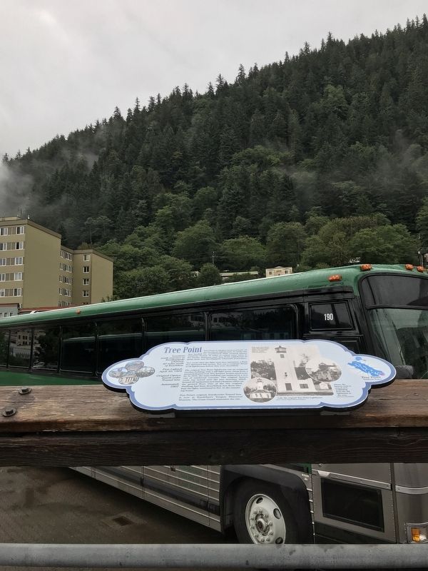
Tree Point is Alaska's most southerly of the Southeast lighthouses. It marks the first landfall for northbound ships crossing Queen Charlotte Sound, 30 miles of coastal water open to the Pacific. Mariners used Tree Point Lighthouse to guide them . . . — — Map (db m181641) HM
Near Mill Street, on the left when traveling east.
The cultural traditions and stylistic glories of Northwest Coast Native artists go back centuries. But the historical period of (obscured) and curating — mainly by non-Natives — is relatively short. Totem poles by tradition were private . . . — — Map (db m182030) HM
On Front Street at Water Street, on the right when traveling south on Front Street.
Shipments of iced halibut from Ketchikan to outside markets was pioneered by F.J. Hunt and H.C. Strong, following similar successful methods with salmon, and a thriving business was built through the construction of two large cold storage . . . — — Map (db m181914) HM
On Front Street at Mission Street, on the right when traveling south on Front Street.
For thousands of years, water has been the common highway for all Northwest Coast Natives. Living at the edge of dense rain forests of great cedar, spruce, and hemlock along one of the world's richest sea coasts, their dependence upon seafood . . . — — Map (db m181977) HM
Near Mill Street, on the left when traveling east.
A city arose at the mouth of Ketchikan Creek early in the 20th century, where Native people had camped for uncountable centuries to fish and hunt, houses, stores, hotels and sawmills uprooted the rainforest skyline in a sort of land-rush flurry of . . . — — Map (db m182027) HM
On Main Street at Grant Street, on the right when traveling north on Main Street.
500 yr. old cedar from Ketchikan, Alaska
carved after ancient Tsimshian culture
By David K. Fison (Nadáam 'Nłomsk)
of the Tsimshian Killer Whale Clan
Anchorage, Alaska April 28, 2001
—————————————————————
Completed in 2001
The . . . — — Map (db m258207) HM
Near Glenn Highway (Alaska Route 1 at milepost 61.6) east of Chickaloon Way, on the left when traveling east.
As mines were sold and finally closed in the Eska area, many people moved closer to the
railroad tracks, to what is now Sutton. Mike O'Neill, former owner of the Alpine Inn, built
this wood frame structure to be Sutton's first gas station and . . . — — Map (db m254980) HM
On Knik-Goose Bay Road, on the right when traveling north.
Joe Redington, Sr.
Born in Oklahoma, February 1, 1917 • Died in Alaska, June 24, 1999
Joe was an accomplished man; homesteader, big-game guide, bush pilot,
commercial fisherman, boat builder, fish-plant manager, and mountain . . . — — Map (db m80410) HM
On Front Street west of Hunter Way, on the right when traveling west.
Running down Front Street and passing this monument to the Iditarod National Historic Trail--Authorized By the US Congress 1978, the Trail begins in Seward, Alaska with Tripod Milepost #0. The trail winds its way through the heart of the . . . — — Map (db m290377) HM
On State Street just north of 12th Avenue, on the left when traveling north.
* Lkóot Aaní (Chilkoot)Lkóot Aaní is the name of the area from Haines to Skagway, and the name originates from Lkóot Áa ("The Lake that Puked" [Chilkoot Lake]), where a massive rock . . . — — Map (db m248858) HM
COMMUNICATION
In 1900, it took a year for the Army to send a message from Interior Alaska to Washington D.C. and receive an answer. To speed communications, the U.S. Signal Corp[s], a branch of the Army, built the Washington to . . . — — Map (db m255857) HM
Standing for over a century, the Telegraph Building is the oldest in the Delta area and all that remains of the original
McCarty Telegraph Station.
Communication Building
Local builder C. Schultz hand-hewed the logs "on three sides as . . . — — Map (db m255778) HM
Welcome to one of the original
McCarty Station buildings.
Constructed in 1907, it contained the
telegraph office and housed
personnel needed to operate and
maintain the Washington to Alaska
Military Cable and Telegraph System . . . — — Map (db m255789) HM
WAMCATS provided communication between the military posts in Alaska and headquarters at Washington, D.C. The soldiers who built, manned and maintained the line persevered through adversity.
Link in the Chain
The Signal Corps constructed . . . — — Map (db m255757) HM
The United States Post Office and Customs House is a rectangular
structure 112' x 48', constructed in 1940-41 under the direction of the New
Deal's Public Works Administration. The building was completed during
the administration of President . . . — — Map (db m301447) HM
Near BIA Route 100 (Route 100) 0.8 miles east of Route 12 (Arizona Route 264) when traveling north.
About the Navajo Code Talkers
During World War II the Japanese possessed the ability to break almost any American military code. Over 400 Navajos, with 29 being the original Navajo Code Talkers, stepped forward and developed the most . . . — — Map (db m51537) HM
On North Garden Avenue near Sherbundy Street, on the left when traveling north. Reported permanently removed.
335 North Garden Avenue
Built in 1905
This is perhaps the oldest building still standing in Sierra Vista. Mr. John Reilly homesteaded the property and received the patent for the land in March of 1911. John Reilly and his wife Ellen sold . . . — — Map (db m27895) HM
Near Hatfield Street near Rucker Street. when traveling east.
Dedicated 9, July 1993
In honor of
Command Sergeant Major
Clovis D. Ice
United States Army
1933 – 1991
CSM Ice was a pioneer in military intelligence, airborne and special forces operations. He was a principal developer of . . . — — Map (db m28234) HM
On North Railroad Avenue, on the right when traveling north.
[Marker mounted to the left of sculpture:]
Born December 31, 1920 to Horace and Faye Allen in Willcox, Rex Elvie Allen was cross-eyed at birth.
As a young boy, Rex sang in the barber shop on this very street. He and his Dad played . . . — — Map (db m28199) HM
On North San Francisco Street north of East Aspen Avenue, on the right when traveling north.
The City of Flagstaff City Council & Historic Sites Commission recognize this property for its Historic & Architectural Significance cited 1988 — — Map (db m157599) HM
On North San Francisco Street north of East Aspen Avenue, on the right when traveling north.
Original proprietors T.A. Riordan David Babbit Architect J. Kennedy Construction by Edivaros & Wiley Los Angeles National Registery of Historic Places Number FHR 107 — — Map (db m157598) HM
On North Leroux Street, on the right when traveling north.
This building was constructed in 1909 by John W. Weatherford, the man who earlier built the adjacent Weatherford Hotel. It was the headquarters for the Arizona Overland Telephone Company, housing its offices and physical plant.
Construction . . . — — Map (db m59966) HM
Maybe those mountains are hard to climb. Those trees so hard to cut.
But the air is pure, the water fine. And we're climbing right out of the rut....
For besides helping ourselves, you see. We are helping Mother and Dad.
- Robert L. . . . — — Map (db m78836) HM
Trans-Canyon Telephone Line,
built in 1935 by CCC workers,
maintained by Mountain Bell,
has been placed on the
National Register of
Historic Places
by the United States
Department of the Interior. — — Map (db m78832) HM
Near Village Loop Drive 0.4 miles west of El Tovar Road, on the right when traveling west.
Originally this building stood at Red Horse, 25 miles south of the Grand Canyon, where it was possibly used as one of the stage stops between the Grand Canyon and Flagstaff. In 1902, Ralph Cameron had it moved to its present site, where, with the . . . — — Map (db m236357) HM
On West Main Street 0.6 miles west of Beeline Highway (Arizona Route 87), on the right when traveling west.
This historic mail trail is dedicated to the memory of the mail riders named below and unknown mail carriers that braved weather, rough terrain and the Verde River to deliver mail 52 miles from Camp Verde to Payson, Arizona from 1884 to 1914.
. . . — — Map (db m36063) HM
On U.S. 70 at milepost 344 near East Sanchez Road/South Bowie Avenue, on the left when traveling east.
Named for Isadore Elkan Solomon, a pioneer settler, who in 1876 burned charcoal here for supplying fuel to the Lesinsky Brothers' Copper Smelter near Clifton. First Treasurer of Graham County. Early day merchant, postmaster, and one of the founders . . . — — Map (db m28059) HM
On U.S. 60 east of Center Street, on the right when traveling west.
This desert town was made famous by the humor of Dick Wick Hall, healthseeker and operator of the laughing gas station. Hall's publication the Salome Sun was filled with extravagant tales of the desert's adaptation of species. He told of his frog . . . — — Map (db m31824) HM
On East Van Buren Street west of 2nd Street, on the right when traveling west.
The Arizona Republic is directly descended from the Valley’s first newspaper, the Salt River Herald, first published January 26, 1878. The weekly newspaper became a semi-weekly, then in 1879, a daily titled the Phoenix Herald. Merging . . . — — Map (db m126695) HM
The upper 26 feet of the mast before you is the top
portion of the main mast of the U.S.S. Arizona and is
known as the signal mast or "pig-stick".
The battleship U.S.S. Arizona (BB 39) was sunk at Pearl
Harbor on December 7, 1941. The . . . — — Map (db m26610) HM
Near North Brown Avenue 0.1 miles south of East First Avenue, on the right when traveling south.
1929 - 1949 U.S. Post Office
1949 - Present Porters Western Wear
Built in 1929 as Scottsdale's first full time post office, this structure served as a gathering place for local townsfolk and nearby Indians awaiting daily mail from . . . — — Map (db m141343) HM
On North Marshall Way 0.1 miles south of East Montencito Way, on the left when traveling south.
The western spirit of adventure is captured in a moment of connection between two Pony Express riders. A legendary American tradition established in 1860 was revived in 1958 by Arizona's Hashknife Pony Express-who have continued to deliver the U.S. . . . — — Map (db m49937) HM
On Frontier Street, on the right when traveling north.
The Old Brick
Post Office
Has been placed on the
National Register
of Historic Places
By the United States
Department of the Interior — — Map (db m29471) HM
On Kingman Wash Access Road, on the left when traveling east.
A Memorial Tribute
to
Anson Smith
1860 - 1935
Editor and Publisher of the Mohave County Miner, acclaimed by President Herbert Hoover for his tireless efforts and support during construction of Boulder Canyon Project and the location of . . . — — Map (db m46819) HM
Near North Pipe Spring Road 0.3 miles north of Arizona Route 389, on the left when traveling north.
A long line of juniper poles — like the one you see here — set 70 yards apart ended Pipe Spring’s isolation. From 1871 on, telegraph wire connected the ranch first to Utah and then to the outside world. By 1880 Mormon settlements from . . . — — Map (db m149370) HM
On North Third Street at Pine Street, on the right when traveling south on North Third Street.
This building has been placed on
The National Register
of Historic Places
By the United States Department of the Interior.
A.T.&T. Building
Built 1930
A good example of Spanish Colonial Revival style with Federal Modern . . . — — Map (db m29395) HM
Near Grandview Avenue near West Beale Street (Business Interstate 40).
Dedicated in Memory of
Charles Metcalfe
1855-1943
He deeded in perpetuity this land as a park for the use of Kingman youth. Recognized as a civic leader and land developer, He proposed development of Hualapai Mountain Park. He held . . . — — Map (db m29362) HM
The “Wish You Were Here” mural was designed by artist JC Amberlyn in cooperation with the Powerhouse Visitor Center as a partnership with Arizona@Work Mohave County. It was completed by four young local artists working under Amberlyn’s . . . — — Map (db m281583) HM
On North Illinois Street at Arizona Boulevard, on the left when traveling north on North Illinois Street.
This memorial is dedicated to the men and women who served our county in war and peace and to a significant era of rich local history.
Camp Florence, an army training facility, once occupied the grounds now known as "Four Parks". Beginning . . . — — Map (db m32440) HM
On North Main Street, on the right when traveling north.
Built in 1874 of unplastered adobe with pitched roofs, this second Edward Nye Fish mercantile store in Florence changed hands to become the, Joseph Collingwood & Co. Store and Wells Fargo office in 1877. Collingwood, Florence's first postmaster, had . . . — — Map (db m26717) HM
On North Quartz Street, on the left when traveling north.
Edward Nye Fish, prominent Tucson merchant, and his partner/manager Joseph Collingwood, first Florence postmaster, opened Florence's first store in this building in 1868.
Building additions from 1867 to 1888 formed a U-shaped complex, and . . . — — Map (db m26708) HM
On North Baily Street, on the left when traveling north.
Called the "New Beer Hall," this single-story, mud-roofed, one-room deep, adobe Sonoran-style house was said to be "the coolest place in town" by owner John Nicholas. In 1890, the Arizona Weekly Enterprise, Florence's second newspaper, leased . . . — — Map (db m26794) HM
On North Granite Street, on the left when traveling north.
Built in 1878 for John P. Clum, Indian agent, editor of Florence's first newspaper, the "Arizona Citizen" and founder of the "Tombstone Epitaph."
Typical of transitional architecture, the home is a Sonoran adobe with an Anglo-influenced roof. . . . — — Map (db m26744) HM
On West Ruggles Avenue, on the right when traveling west.
Civil War veteran Levi Ruggles came to Arizona Territory in 1866 as a U.S. Indian Agent. Recognizing the agricultural potential of this valley, he found an easily fordable crossing on the Gila River and surveyed a townsite here. He called the . . . — — Map (db m26709) HM
On East Cam Correo south of Interstate 10, on the right when traveling east.
Established June 14, 1887. A small conical red peak gave Red Rock its name. Red Rock was a major cattle shipping point via the S.P. Railroad. This post office celebrated its
Centennial in June 1987. — — Map (db m31190) HM
A colorful administrator, he is credited with establishing the basic location of Arizona's billion-dollar Interstate Highway System. He served as State Engineer twice, from 1924 to 1928 and from 1945 to 1951.
He devoted much of his final term to . . . — — Map (db m40780) HM
On Main Street (Arizona Route 89A), on the left when traveling east.
The New State Motor Company building was built of concrete in 1918 under the ownership of Dan Shea. A car dealership and show room were located upstairs and a garage downstairs. Inside the building an elevator delivered cars to the lower floor. A . . . — — Map (db m33151) HM
On Jerome Avenue at Main Street ( Route 89A), on the left when traveling south on Jerome Avenue.
Carl E.C. Whitten, graduate of Jerome High School and son of immigrant parents, worked for the Prescott Evening Courier before moving back to Jerome in 1927. Carl purchased the Verde Copper News which began in Jerome in 1917. He purchased the . . . — — Map (db m33163) HM
Near East Gurley Street east of North Arizona Avenue.
There was a time when progress in Yavapai County was spelled S-P-A-R-K-E-S. Grace M. Sparkes came to Prescott, Arizona Territory, at the age of 14 in 1906. By 1911, she was working for the Yavapai County Chamber of Commerce as Secretary, a job she . . . — — Map (db m33137) HM
On North Cortez Street at East Willis Street, on the right when traveling north on North Cortez Street.
J. I. Gardner came to Prescott with a pack train in 1879 and opened his first mercantile store in 1883. The J. I. Gardner Store was built on this corner in 1890. Gardner's motto was "all goods guaranteed to be first class". They carried every type . . . — — Map (db m41960) HM
On South Main Street south of East 3rd Street, on the right when traveling south.
United States
Post Office
has been placed on the
National Register
of Historic Places
The United States Post Office is a two-story
building of reinforced concrete faced
with native Arizona stone. The design
has strong Beaux-Arts roots, . . . — — Map (db m191672) HM
John Butterfield was born in Berne, New York in 1801 and grew up on a farm amid the technological revolution of the first steamboat, the Erie Canal, the steam locomotive, and the electric telegraph.
In 1857, John Butterfield won a lucrative . . . — — Map (db m84484) HM
On Jackson Street south of McClure Avenue (County Road 923), on the left when traveling south.
The earliest postal area was at Cross Hollows. Records show the Bloomington Post Office was changed to Lowell, March 9, 1881 with Paul F. Lewis, Postmaster. Insets show a 1900 Post Office building on North Jackson Street. The one next door to . . . — — Map (db m93274) HM
On Jackson Place at McClure Avenue (Route 923), on the right when traveling north on Jackson Place.
This marker, set on the Butterfield Stagecoach Road, is placed near the spot where the trail crossed the east-west road between Huntsville and the Robinson settlement in western Benton County. John Robinson, a Revolutionary soldier, settled here . . . — — Map (db m68781) HM
On Poplar Street at 2nd Street, on the right when traveling east on Poplar Street.
This building constructed in 1918-19 cost a total of $75,000 including the site, furnishings, and fixtures. Listed on the National Register of Historic Places, it served as the U.S. Post Office for Rogers for over four decades. These 1918 . . . — — Map (db m90744) HM
On South 1st Street north of West Elm Street, on the right when traveling north.
To commemorate the Centennial passage, through Benton County of the First Westbound Stage coach on the Butterfield Overland Mail Route from St. Louis to San Francisco. Callahan's Tavern, the site of which is about a half a mile northeast of this . . . — — Map (db m216324) HM
On East Rush Avenue at North Main Street (Business U.S. 65), on the left when traveling east on East Rush Avenue.
It was completed in 1903 and served as the Post Office from 1906 - 1965. The three story (plus basement) building was constructed at an original cost of $78,000 with a floor space in excess of 20,000 sq ft. It was constructed of hard-burned, dark . . . — — Map (db m141866) HM
On South 3rd Street at Main Street, on the left when traveling south on South 3rd Street.
In this small log building Albert Pike noted lawyer, poet and mason taught school in 1832. He later went to Little Rock to become editor of the Advocate. — — Map (db m96857) HM
On North Currie Street east of Currie Avenue, on the left when traveling east.
Woolfolk is author of The History of Marion and History of Crittenden County, an award-winning newspaper editor, graduated from Memphis State Law School in 1985 at the age of 68, entered into private practice, and served as Marion . . . — — Map (db m116783) HM
On Military Road east of Cypress Drive, on the right when traveling east.
Designed and built by Major Moore for Thomas Koser, the building was completed December of 1911. The building, which is constructed of native hardwoods, brick and concrete, had pressed tin ceilings and hardwood floors. The hotel had its own water . . . — — Map (db m116726) HM
On East Broadway Boulevard (U.S. 70) at South 2nd Street, on the right when traveling east on East Broadway Boulevard.
The inaugural broadcast of West Memphis' KWEM radio station on February 23, 1947, set the stage for what would become one of the pioneering platforms for Delta blues and the beginnings of the rock 'n' roll sound.
Here at 231 Broadway Boulevard in . . . — — Map (db m221358) HM
Surveyed and town plat filed
March 5, 1914 following building of
the railroad through western Dallas
County 1911-13. School District 10
formed April 11,1914, consolidating
with Sparkman May 23, 1930. Post
office established May 16, 1914. — — Map (db m305049) HM
First town in Dallas County,
established
January 1, 1845, and known as Dallaston until November 1845
when name was
changed to
Princeton. Plat filed October 26, 1846,
incorporated March 4, 1849.
Site of first post
office in county established . . . — — Map (db m305046) HM
On Morning Star Avenue, on the right when traveling west.
Johnny Johnson was born January 19,
1918 to Leroy and Gertrude Johnson in
Arkansas City, Arkansas. This house is his
boyhood home. Johnny Johnson and his
mother relocated to Chicago, Illinois in
1933. He was a renowned
entrepreneur , . . . — — Map (db m299919) HM
Near Harkrider Street (Business U.S. 65) at Markham Street, on the right when traveling south.
In 1883 a bell was installed in the tower of the new three-story brick building at Altus, Arkansas, which housed Central Collegiate Institute (later Hendrix College). It is believed this is the bell which hung in the tower until the building burned . . . — — Map (db m237133) HM
Near U.S. 63 at Main Street (State Route 9), on the right when traveling north.
In 1919, George D. Hay, a young newspaper reporter for the Memphis Commercial Appeal, visited Mammoth Spring while on assignment. Before boarding the train back to the city, Hay was invited to a traditional Ozark musical and marveled at the . . . — — Map (db m192093) HM
On Central Avenue (State Highway 7) just north of Market Street, on the right when traveling north.
Hot Springs Chamber of Commerce Publicity Director Alta Smith created one of the Spa’s best-known promotional concepts. The image of the Earth’s globe resting in a bathtub visually represented the town’s slogan during the 1940’s and 1950’s, “We . . . — — Map (db m264289) HM
On Central Avenue (State Highway 7) just north of Spring Street, on the right when traveling north.
Over 50 years in broadcast • One of the most recognizable faces in the State • 1966 joined KATV which soon became the No. 1 Station in the market • Worked at KHON in Honolulu • Returned to Little Rock in 1982 as anchor on KTHV • Earned many . . . — — Map (db m264792) HM
On Central Avenue (State Highway 7) just north of Spring Street, on the right when traveling north.
The Daily Racing Form’s featured Daily Columnist for 34 years • 1988 honored by the Japan Racing Assn. for his contributions to international racing • 1962 honored by Ontario Jockey Club as a Bright New Writer in Racing Journalism • 1995 honored by . . . — — Map (db m264832) HM
On Central Avenue (State Highway 7) at Spring Street, on the right when traveling north on Central Avenue.
Founder, President Focus on the Family, heard daily worldwide on 4,200 radio stations and 100 TV stations • Layman of the Year 1982, National Association of Evangelicals • Author of 19 best selling books on family life • Producer of 3 films on the . . . — — Map (db m264477) HM
On Central Avenue (State Highway 7) at Spring Street, on the right when traveling north on Central Avenue.
Magna Cum Laude graduate of Ouachita University • Lt. Governor 1993-1996 • 44th Governor of Arkansas 1996-2007 • Host of Fox News television show Huckabee and nationally syndicated radio programs The Mike Huckabee Show and The Huckabee Report • New . . . — — Map (db m264399) HM
On Central Avenue (State Highway 7) at Spring Street, on the right when traveling north on Central Avenue.
Shared You Are Loved message with the world since 1949 • Became the first minister to broadcast a one hour service to 500 stations in 1952 • Cathedral of Tomorrow first and largest televangelism church built in 1958 • One of US . . . — — Map (db m264499) HM
On Central Avenue (State Highway 7) at Spring Street, on the right when traveling north on Central Avenue.
Host of KTHV’s Steve’s Show 1957-65 • 5 time Top TV Personality of AR • Founding Chm • LR Motion Picture & TV Com • AR Entertainers Hall of Fame • U.S. Senate Aide • U.S. Delegate to Partners of Americas Hemispheric Conf • Life Trustee Nat . . . — — Map (db m264957) HM
On West Division Street at South Main Street, on the right when traveling west on West Division Street.
The last bag of mail hung on this pole was October 14, 1967 at Ward, Arkansas. This was also the final day of operation for the Railway Post Office in the state. — — Map (db m161919) HM
On East Division Street at South Main Street, on the right when traveling west on East Division Street.
This two man inspection car was built in 1948 by Fairmont Railway Motors. Signalmen especially, relied on this motor car for transportation as they inspected signals, automatic switches and crossing gates.
Known for its light weight and easy . . . — — Map (db m161915) HM
On Franklin Street east of Highway 278, on the left when traveling west.
The Washington Post Office is the oldest continuous postal facility in Arkansas, having been established as Hempstead Courthouse Post Office, Arkansas Territory, February 23, 1820. This building provided by the Pioneer Washington Foundation -- . . . — — Map (db m244819) HM
On Broad Street at East Main Street, on the right when traveling south on Broad Street.
Authorized 1857. Manufactured
1858. First used 1859. Ringing out
from Independence County's
second courthouse, the first on
this site, this bell summoned
citizens to meetings, warned
them of danger, and called them
to celebrate. Today it . . . — — Map (db m221140) HM
On Arkansas Route 932 at Main Street ( Route 14), on the left when traveling north on Arkansas Route 932.
When the white man came into the White River
valley, Oil Trough Bottom was covered with a
dense canebrake inhabited by bear. Early
hunters rendered the bear oil and stored it
in troughs made from hollowed out tree trunks.
Use of these troughs . . . — — Map (db m221215) HM
On West Main Street (U.S. 64) at Central Street, on the right when traveling east on West Main Street.
This bell was in use at the school at Lone Pine 1921-1953. The bricks in this monument were made on the site and used to build the Hagarville Academy in 1918. — — Map (db m225423) HM
On County Road 6035 0.2 miles east of County Highway 637, on the left when traveling east.
Across Rush Creek, in front of you, are the remains of houses and shops once owned by the Morning Star. Many families lived there over the years, some until the late 1960s. The building nearest you was the Taylor-Medley Store-started by Bill . . . — — Map (db m161937) HM
On North Ash Street at East Johnson Avenue, on the right when traveling south on North Ash Street.
Built in 1911 by a local attorney, R.C. Rose, as Osceola's first telephone office, the building features two louver-covered windows, a cornice dividing the two floors and two square pilasters with corbelled brick separating the upper 8-over-8 . . . — — Map (db m36707) HM
On North Poplar Avenue at West Hale Avenue, on the right when traveling north on North Poplar Avenue.
This 1901 office was the first building in "New Town," having been used continuously as a newspaper office since that time and remains the oldest and tallest commercial building in the city. The "Osceola Times," reporting on life along the Cotton . . . — — Map (db m36408) HM
On 2nd Street at East Ash Street, on the left when traveling north on 2nd Street.
Potts Inn John Kirkbride Potts (1803-1879) was born in Pennsylvania and moved to Arkansas in the 1820s. In 1828 he settled by Galla Creek, eventually acquiring 650 acres of land. Potts went to California in the Gold Rush of 1849: he failed to . . . — — Map (db m225451) HM
On East Ash Street at 2nd Street, on the right when traveling east on East Ash Street.
Historic stage coach tavern erected by Kirkbride Potts with slave labor. This tavern was a station on the Butterfield-Overland Mail. It was operated as a tavern both before and after the existence of the Butterfield-Overland Mail contract. It has . . . — — Map (db m225477) HM
On West Main Street (U.S. 64) at South Denver Avenue, on the right when traveling east on West Main Street.
In 1854, Mr. J. L. Shinn established a business at this location in what was then called a cactus prairie. By 1870, other businesses had been established and residence had been built so the community was incorporated and was named Russellville, . . . — — Map (db m225435) HM
On Radio Drive at U.S. 62, on the left when traveling west on Radio Drive.
In the mid 1950s Elvis Presley's career was just beginning to take off. Elvis had made at least one record at Sun Studio in Memphis when he and his then manager made a stop at this location to request that his record be played on KPOC. He was . . . — — Map (db m207800) HM
Founded in 1876 by W.A. Webber as The Saline County Digest, this was the first newspaper and is the oldest continuously operated business in Saline County. The name was changed to The Review in 1882 and to The Courier in 1883. The original office . . . — — Map (db m104055) HM
On Rogers Avenue at South 4th Street, on the right when traveling south on Rogers Avenue.
Commemorating arrival of the first Butterfield Overland mail coach, St. Louis to San Francisco, arrived in Fort Smith at John Rogers City Hotel, North 2nd and A Streets, 2:00 a.m. September 19, 1858. — — Map (db m236790) HM
After spending his early years on an Arkansas farm and completing college, he joined the Donrey Media Group in 1948 as an advertising salesman. As executive vice president and chief operating officer of the Group, he became a nationally known . . . — — Map (db m285131) HM
On South Izard Street south of Court Avenue, on the left when traveling south.
This bell rang from the bell tower of the magnificent courthouse that graced this site for seventy-nine years before the present structure was built in 1976. The former courthouse was built in 1897 by Judge John S.R. Cowan of Hughes at a cost of . . . — — Map (db m172208) HM WM
On Mount Holly Highway (Arkansas Route 160) 0.4 miles east of Stephens Highway ( Route 57), on the right when traveling east.
Mount Holly Cemetery is the final resting place of 15 Confederate soldiers, including Asa S. Morgan, who in 1861 recruited the El Dorado Sentinels, which became Co. A, 1st Arkansas Infantry. Morgan later served as colonel of the 26th Arkansas . . . — — Map (db m121172) HM
On North Campus Walk north of West Dickson Street, on the left when traveling west.
The most widely implemented automated mail sorting equipment in the world – the Wide Area Bar Code Reader – was developed by the University of Arkansas' College of Engineering. A $50,000 grant from the U.S. Postal Service (USPS) to Professors Dwight . . . — — Map (db m224261) HM
Born in Texas and missed in Oklahoma, the purchase of a Fort Smith newspaper brought Donald W. Reynolds to Arkansas.
From here he built one of the most successful independently owned media companies in America the Donrey Media Group. — — Map (db m305884) HM
5317 entries matched your criteria. Entries 101 through 200 are listed above. ⊲ Previous 100 — Next 100 ⊳