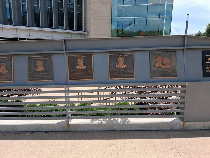
For nearly 60 years Orville Henry chronicled the accomplishments of the Razorbacks, writing with a style unmatched in the history of journalism in Arkansas. From John Barnhill to Frank Broyles to Houston Nutt, Henry was THE authority on Razorback . . . — — Map (db m306048) HM
Settled 1850 by a group of German immigrants led by the Hermann brothers. They established mills and a store and in 1853 secured a post office with the name Hermannsburg. James Hukill was first postmaster. Two of the Hermanns served as . . . — — Map (db m302362) HM
On this site stood the former home of Dr. James W.
Webb (1878 1947) and Mrs. Joy Nelson Webb
(1891-1976). Dr. Webb also owned and operated a
dentist office on this property. Mrs. Webb published
and edited the weekly Prairie Grove . . . — — Map (db m225087) HM
Here on this, the Old Wire Road, was located Fitzgerald's Station on the Butterfield Overland mail route from St. Louis to San Francisco. First trip 1858. Last 1861. Longest and best conducted mail route in the world. 2795 miles. Service twice . . . — — Map (db m59950) HM
NEWSPAPERS were the main source of
public information before the introduction
of radio and television. The Bay Area was
home to several daily newspapers and the
larger publishers produced as many as five
editions released throughout the day. . . . — — Map (db m145341) HM
This building, thought to be Berkeley’s oldest remaining structure, originally stood on the Contra Costa Road, now San Pablo Avenue. Built by Captain William J. Bowen when the area was sparsely populated, it served as an inn, saloon, grocery . . . — — Map (db m53831) HM
Along the ridge behind this panel lies a 52-acre parcel of historical significance. This farmstead known as “Ukraina” was the home of Ukrainian patriot, writer, and publisher Father Agapius Honcharenko. He and his wife Albina lived here for 43 years . . . — — Map (db m26499) HM
“Ukraina” is the site of the farm and burial place of the Ukrainian patriot and exiled orthodox priest Agapius Honcharenko (1832-1916) and his wife Albina. Honcharenko was the first nationally conscious Ukrainian to arrive in the United States. He . . . — — Map (db m146447) HM
This antique fire bell was used to notify Livermore Volunteer Firefighters of a fire in their community from 1875 until replaced by an electric siren in 1919. — — Map (db m204228) HM
This antique fire bell was used to notify Pleasanton Volunteer Firefighters of a fire in their community from 1908 until replaced by an electric siren in 1919. — — Map (db m204231) HM
Originally installed by the Women's Improvement Club in 1932, the Pleasanton Sign has become a familiar landmark and prominent symbol of the community. In 2005, the sign underwent complete restoration, and was rededicated by the City Council on . . . — — Map (db m193940) HM
“…there ought to be a shaft raised to Snow-Shoe Thompson: Not of marble; Not carved and not planted in the valley, but a rough shaft of basalt or of granite, massive and tall, with top ending roughly as if broken short, to represent a life . . . — — Map (db m12028) HM
This marks the home of John Albert Thompson (Snowshoe Thompson) great pioneer of the Sierras and hero of the mountains, who for twenty winters carried the mail over the deep snow of the mountains on his long skies: Giving help to those in need along . . . — — Map (db m21302) HM
John A. “Snowshoe” Thompson (1827-1876) Native of Norway who carried mail across the Sierra Nevada on skis, assisting the needful for twenty years, dwelt and died on this site.
Dedicated on June 30, 1990
Native Sons of the Golden . . . — — Map (db m21301) HM
During the initial five weeks of its operation in 1860, an important remount station of the famous Pony Express was located a few feet from here at Cary’s Barn.
This monument erected by the Historical Society of Alpine County.
National . . . — — Map (db m143520) HM
Historic Woodfords Station, the Eastern Sierra gateway to the goldfields of California, way station of the famed Pony Express, and entrance to Carson Pass on the Emigrant Trail to the Sacramento Valley. Beginning in 1849 with the building of the . . . — — Map (db m195369) HM
This newspaper was started in Volcano October 27, 1855. It was moved to Jackson in April, 1857. The Amador Ledger is the fourth oldest weekly newspaper in California and the oldest in Amador County. This building became the new home of the Amador . . . — — Map (db m44139) HM
Built in the 1870’s, the Norton-Popovich home contains the city’s first telephone, installed in 1896. Virgil Norton was postmaster of Sutter Creek from 1914 – 1931; son John was an engineer at Knight Foundry. The current owner’s father, Sam . . . — — Map (db m42405) HM
Fashioned as either small ornaments or large enough to be heard for miles, bells have long been a part of human history and culture. First appearing around 2000 B.C. as simple percussion instruments, they continue to celebrate special events to this . . . — — Map (db m101587) HM
Present site of one of the last family-founded and-still-operated-by-that-family phone companies in America. Founded by Jim Tower, who strung his first telephone wires in 1895 tacked along posts of barb wire fences, earning himself the colorful . . . — — Map (db m57982) HM
John M. & Mary Ann Smith Jones, lived at this location from 1851 - 1866. They came out west in a prairie schooner. Here John opened the only post office between Martinez and Mission San Jose on May 18, 1852. Mary Ann was his deputy while her . . . — — Map (db m93991) HM
The Clayton Post Office, established on October 4, 1861, is one of the oldest post offices in continuous operation in California. Ensuring its continuation in Clayton was one reason for incorporating the city in 1964.
During the past 140 . . . — — Map (db m24534) HM
This Victorian style house was built around 1885 and was purchased by Adolphus Podva and Mary Alma McPherson for ten gold coins. In 1911, one of their three sons, Roger and his wife Ruby May Oswill, purchased it and lived there until 1977. Ruby May . . . — — Map (db m202118) HM
El Sobrante's first free-standing post office opened in this building in 1957, marking an important milestone in the town's development. The post office was previously located in the adjacent Lee's Variety Store (the Elks Lodge as of 2014) and . . . — — Map (db m94308) HM
In 1860-1861 Pony Express riders stopped in Lafayette 19 times to change horses en route to San Francisco from St. Joseph, Missouri
Lafayette Historical Society
1992 — — Map (db m24461) HM
Dedicated April 23, 1998
Lafayette House
Added Station
By
Diablo Foods
Better Homes Realty - Lafayette
Diamond K. Supply, Ltd.
Lafayette Chamber of Commerce
Lafayette Historical Society
Pony Express Trail Association
{reverse . . . — — Map (db m24916) HM
Built after the Fire of 1904 that consumed the entire block Occupied in 1881 by Contra Costa Telephone Company founded in 1881 by J. Borland which was sold to Pacific Bell Telephone Company in 1892 with R. Borland as superintendent for 40 years . . . — — Map (db m53919) HM
Dedicated April 23, 2000
Morgan House
Pony Express Route
Apr. 23, 1860 - Sep. 8, 1861
Home Station
Apr. 16, 1869 - Sep.8, 1861
By
James Stretesky
Supervisor Gayle B. Uilkema
Martinez Area Chamber of Commerce
Pony Express Trail . . . — — Map (db m24369) HM
Dedicated April 23, 2005
Martinez
By James Stretestky · Julian M. Frazer · Martinez Historical Society · Mayor Rob & Carole Schroder · Supervisor Gayle B. Uilkema · Vice Mayor Mark & Dianne Ross · Tesoro's Golden Eagle Refinery · . . . — — Map (db m19224) HM
A nearby plaque
commemorates the
passage in 1860-1861
of Pony Express riders
from Sacramento to
the San Francisco
terminus. They usually
rode river steamers,
but 20 times the Pony
Express took an
overland route as the
steamers did not . . . — — Map (db m142217) HM
Pony Express Trail
This plaque commemorates the passage in 1860 and 1861 of the Pony Express riders from Sacramento to San Francisco through what is now Orinda.
Sponsored by the City of Orinda's Historical Landmark Committee and the Pony . . . — — Map (db m29913) HM
Built in 1923, this brick building was the home of the Coast Counties Gas and Electric Company which provided utilities to the City of Pittsburgh. The company closed its office in the 1950s and the building became a newspaper publishing and . . . — — Map (db m37423) HM
Constructed in 1873-74, East Brothers Light Station is the older of only two remaining light stations of San Francisco Bay that have remained substantially unchanged. The original 5th order classical (Fresnel) lens was replaced with the present . . . — — Map (db m164491) HM
When James Pomeroy Howe died in
1970, at the age of 91, he left behind
not only his estate and its history, but
also a legacy of intriguing stories of his
adventures here and abroad.
While growing up in Kansas Jim Howe longingly
dreamed of . . . — — Map (db m153429) HM
In the early years, Walnut Creek residents picked up their mail from one of the local merchants on Main Street, who served as postmaster. This brick building served as Walnut Creek's first post office, beginning in 1928. A newer post office opened . . . — — Map (db m93826) HM
The 400-seat Ramona, Walnut Creek's first cinema, opened in 1920 as a silent-movie house. The theater sat on Main Street, next to the Contra Costa Courier newspaper and where Cypress Street now connects to Broadway. It was owned by Theodore . . . — — Map (db m93828) HM
Mount Diablo has always been a guide and landmark to people far bellow, and so it became a natural location for many radio and transmission towers as well.
As early as 1928, the Standard Oil Company and U.S. Dept. of Commerce jointly . . . — — Map (db m103092) HM
The Battery Point Lighthouse is one of the first lighthouses on the California Coast.
Rugged mountains and unbridged rivers meant coastal travel was essential for the economic survival of this region.
In 1855 Congress appropriated $15,000 for . . . — — Map (db m101692) HM
Coloma’s first post office opened in 1849 when, against his wishes, John T. Little was appointed postmaster. The post office, first designated as “Culloma, California Territory,” was changed to “Coloma” in January 1851. This tiny building . . . — — Map (db m215207) HM
Patrick Obein Murphy brought this cannon from Ft. Ross to his namesake Mt. Murphy located behind this site. It’s been said that he fired it to announce the arrival of the mail. — — Map (db m215523) HM
This area held a number of important homes and stores during the gold rush. The first large building in Coloma was built here in 1849 by John T. Little. It contained a store, hotel, restaurant and post office. Little also operated a ferry to cross . . . — — Map (db m215742) HM
Most of Coloma's buildings were wooden, but some were were made of brick or stone to resist fire. This one, known as "Bells Brick Store," was a general merchandise store that also sold feed and grain. The U.S. Post Office was located in this . . . — — Map (db m12207) HM
Robert Bell arrived in 1850 and built a wooden store. When this burned down he erected a brick building in the same location in 1853. It was known as “Bell’s Brick Store,” a general merchandise store that also sold feed and grain. The U.S. Post . . . — — Map (db m215357) HM
Trading post, emigrant stop, and mining camp of the 1850’s. This became one of the remount stations of the Central Overland Pony Express. Here at the Nevada House on April 13, 1860, pony rider William (Sam) Hamilton changed horses while carrying . . . — — Map (db m11571) HM
Send me men to match my mountains.
These are words a great poet said speaking for the brave young nation that needed strong and brave men’s aid.
In memory of
John (Snowshoe) Thompson
who, for twenty successive winters, 1856-1876, . . . — — Map (db m434) HM
(back) The Hawley Grade from April 3, 1860 to November 17, 1860 was used by the Pony Express. On November 18, 1860 the new toll road down Johnson Pass (Echo Summit), today’s Old Meyers Grade, was opened to horse traffic and was now used by . . . — — Map (db m435) HM
This was the site of the most eastern remount station of the Central Overland Pony Express in California. Established as a trading post in 1851 by Martin Smith, it became a popular hostelry and stage-stop operated by Ephraim “Yank” Clement on the . . . — — Map (db m433) HM
This building was used as a
post office from 1854 through
1858. Famous Norwegian skier and
mailman Snowshoe Thompson
picked up his first mail here in
1856. His courage and
perseverance conquered the
impassable winter Sierra Nevada
mountains . . . — — Map (db m193324) HM
Fisher’s Oasis Coffee House and Wadsworth’s Chicago Dining Saloon occupied this site from 1851- 1855. In 1853 F.A. Bee, founder of the Placerville Herald, printed his short-lived newspaper here. Early pioneer doctors, Harvey and Sholer and . . . — — Map (db m65253) HM
This statue commemorates the life
and career of Norwegian American pioneer
and skier, John A. Snowshoe Thompson, who
by his courage and perseverance conquered
the impassable winter Sierra Nevada
mountains to carry mail, medicine and
supplies . . . — — Map (db m193400) HM
A Viking Son of Norway who fulfilled California’s motto:
“Bring Me Men To Match My Mountains”
For twenty winters from 1858 to 1878 he was the lifeline between Utah Territory across the Sierras, and the new state of California. . . . — — Map (db m12750) HM
California’s only Home Station where riders changed on the Pony Express trail. Here, at 8:01 A.M. on April 4, 1860, Sam Hamilton, first eastbound rider, was relieved by Warren Upson who carried the initial mail over the then storm swept Sierras.
. . . — — Map (db m613) HM
This was the site of Sportsman’s Hall, also known as Twelve-Mile House. The hotel operated in the late 1850’s and 1860’s by John and James Blair, a stopping place for stages and teams of the comstock. It became a relay station of the Central . . . — — Map (db m609) HM
The Pony Express originated in 1860, when our nation was divided and civil war threatened. Communication between California and Washington DC took months. Although the Pony Express existed little more than 18 months, it played a major role in the . . . — — Map (db m94642) HM
Dedicated July 1, 2000
Du Roc House
Added Station
July 1, 1861 – Nov. 20, 1861
by
PW Pipe
James Stretesky
Norman & Ann Root
County of El Dorado
American Suzuki Motor Corporation
Pony Express Trail . . . — — Map (db m50321) HM
Built for Captain H.H. Buhne; Humboldt County Bank, other businesses, residences, public hall, rooftop signal service station.
This program made possible through a partnership with property owners Kelly and Kala Martin, Eureka Main Street, and . . . — — Map (db m61275) HM
On Nov. 10, 1908, a deed from George and Edith Connick to Sunset Telephone and Telegraph Company, Block 56, Parcel 5, corner of 6th and “F” Streets was recorded. When Pacific Telephone and Telegraph took over the Sunset Telephone and Telegraph . . . — — Map (db m233368) HM
This was the first building expressly constructed for the Eureka Post
Office Postmaster Frederick Aze, (served as Eureka postmaster for 17
years.) motivated by cramped and ill suited facilities at 612
Second St. had this building constructed at . . . — — Map (db m135482) HM
The 780 prisms and fresnel lenses in this replica of the original Cape Mendocino Light House were hand ground in France, shipped around Cape Horn and originally placed in operation at Cape Mendocino in 1868. The entire mechanical gear and prisms . . . — — Map (db m189002) HM
The Victorian Inn was built in 1890 with completion in 1891, and known as the Russ Building. The structure was originally built to house the Ferndale Bank with the Ferndale Enterprise Newspaper following. There were 33 rooms on the second floor; . . . — — Map (db m65289) HM
A native of Plunkett, Saskatchewan, Canada. Graduated from Stanford University with a degree in Civil Engineering, began work with the Division of Highways in 1936. He worked in many positions and locations throughout his career, becoming State . . . — — Map (db m1509) HM
Lit Dec. 1, 1868 to Mar. 3, 1951.
Built at 422 ft. elevation, the light swept 30 mi. to sea. The perilous waters here claimed nine ships. Mules took supplies to the site, 15 mi. north, the westernmost in the U.S.
Dedicated to the Keepers of . . . — — Map (db m51954) HM
The Mendocino presented a huge challenge to the designers of this lighthouse
The lighthouse’s assigned position was a storm-battered, 400-foot cliff prone to frequent earthquakes and landslides. The compact tower, with its lifesaving beacon, had to . . . — — Map (db m1108) HM
Lit Dec. 1, 1868, the light from its first order Fresnel lens swept 30 miles to sea. Decommissioned in 1951, the structure slowly began to inch toward the 422’ cliff. The light was dismantled in 1998 and moved to Point Delgada, Shelter Cove by . . . — — Map (db m1093) HM
A new home in Shelter Cove. Shelter Cove is not the original home of the Cape Mendocino lighthouse. The lighthouse operated at Cape Mendocino, 35 miles north of here.
The compact metal tower was installed on a cliff at the cape in 1868 . . . — — Map (db m1107) HM
The Trinidad Memorial Lighthouse is one of the most iconic landmarks on the North Coast and a beloved, historical symbol of the Trinidad community. The structure was built in 1949 as a replica of the original 1871 Trinidad Lighthouse, which . . . — — Map (db m139525) HM
The Imperial Valley Press was established in 1901 with the aid of W.F. Holt in the town of Imperial and was known as the Imperial Press. Mr. Holt moved the paper to the new city of El Centro in 1906 and changed the name to the Imperial Valley Press. . . . — — Map (db m105982) HM
Newspapers brought news of wars, politics, local happenings and other important information to the residents of Kern County.
This exhibit displays artifacts reminiscent of Kern County’s first newspaper office, the Weekly Courier. . . . — — Map (db m26087) HM
Came to territory by
covered wagon in 1865
Settled here in 1876
Owned and operated
Gwynne Gold Mine, store
hotel and stage station
cattle rancher, Indian agent
Postmistress — — Map (db m83310) HM
The Whitehouse Saloon
The Whitehouse Saloon was thought to first open as Whitehouse in the late “Teens” under the management of H.B. “Moses” Elder and his brother Emmett Elder. It was closed down by Prohibition in 1920 and operated as . . . — — Map (db m53855) HM
The current building, which was built to house the post office, replaced two older houses. It is now privately owned and houses offices of local businesses.
Across the alley behind the building, there was once a small, tin building that housed . . . — — Map (db m71108) HM
Joseph Weringer, Sr., Born 1855 in Vienna, established the “Weringer Brewery and Bowling Alley” in Bakersfield in 1881. In 1889 he moved here and established the original townsite of Woody, named after pioneer rancher Sparrel Woody. . . . — — Map (db m113825) HM
William Vellenoweth, better known to a generation of Susanville youngsters as Dad Popcorn, had his colorful stand at this location from 1918 to 1931.
This building, constructed in 1901 as the Oakes & Philbrook Furniture Store, also housed the . . . — — Map (db m112617) HM
National Historic Lookout Register
This certificate officially recognizes
Slide Mountain Lookout,
Los Angeles County, California,
as meeting those standards of historic and cultural significance
established by the American . . . — — Map (db m272373) HM
The Schoolhouse Bell once hung in the original Calabasas School, a one
room Victorian style building with a bell tower, which was constructed in
1890 at 24454 Calabasas Road. Around 1925, a new Spanish Colonial
Revival style structure was built . . . — — Map (db m156909) HM
Robert A. Cinader's involvement with the Los Angeles County Fire Department began in 1971 when he filmed a pilot television movie about the county's fledgling paramedic program.
"Emergency" aired in 1972 and ran as a prime time show for five . . . — — Map (db m152460) HM
Into the 1890s, newspapers relied upon skilled compositors to set type by hand,
one character at a time, just as Gutenberg had done four centuries earlier.
Starting in 1882, instrument maker Ottmar Mergenthaler (1854-1899) developed
an . . . — — Map (db m248093) HM
"Dedicated in perpetuity to the service of the people that no good cause shall lack a champion and that evil shall not thrive unopposed."
The Citizen Publishing and Printing Company, established in 1923 by Eugene Donovan was the oldest . . . — — Map (db m50078) HM
This property has been
placed on the
National Register
of Historic Places
by the United States
Department of the Interior.
This building
is named in
honor of
Carlos J.
Moorhead
by Act of
Congress,
Public Law 105-88,
November . . . — — Map (db m209982) HM
Montrose merchants Bill Bailey and Vito Cannella dreamed of establishing a
"It all started in Montrose" National Week of Recognition to honor the American flag. Supported by the Rotary Club, the movement gained national appeal, and, in 1966, . . . — — Map (db m218223) HM
Owensmouth and the West Valley area were served
by two post offices since 1912. In 1931, Owensmouth
became Canoga Park and it was decided to build a
permanent office for the area. This Canoga Park
post office opened in 1939 and is said . . . — — Map (db m211194) HM
Who for twenty winters carried the mail over the mountains to isolated camps, rescuing the lost and giving succor to those in need along the way.
Born 1827. Died 1876.
second marker:
This monument suggested by Miss Eudora . . . — — Map (db m101465) HM
This fountain is a memorial to the gallant pioneers of ’49 of whom Daniel O. McCarthy, patriot, miner, leader, was an outstanding example. He was born Raleigh, N.C., August 24, 1830. Died Los Angeles, August 13, 1919. Through his newspaper “The . . . — — Map (db m101457) HM
A broadcasting icon, Bob Miller is the voice of hockey in Southern California. For 44 years, Miller described the on-ice action to generation of Kings fans with class, enthusiasm and grace. While helping introduce hockey to so many, thus . . . — — Map (db m205065) HM
This block is the site of:
First brick school house in Los Angeles known as School No. 1, built 1854-1855;
Butterfield Overland Mail Company office and corral, 1858-1861;
Office of U.S. Quartermaster, 1861;
Corral for camels from Fort . . . — — Map (db m164547) HM
Southern California's first newspaper, The Los Angeles Star, was founded in this block on May 17, 1851 and for many years exerted a major influence upon this part of the state. Suspended temporarily from 1864 to 1868, it continued later as an . . . — — Map (db m125413) HM
The beacon on top of the Los Angeles City Hall was turned on by President Calvin Coolidge from the White House during the city hall dedication ceremonies April 26, 1928. The light was gratefully dedicated to Charles A. Lindbergh for his contribution . . . — — Map (db m117175) HM
5360 entries matched your criteria. Entries 201 through 300 are listed above. ⊲ Previous 100 — Next 100 ⊳