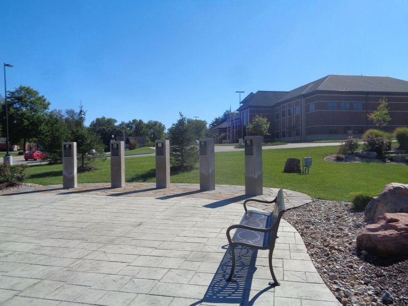
Ninian Edwards, Illinois' third governor, was born in Maryland in 1775. Edwards attended college in Pennsylvania but left to study law in Kentucky, where he became chief justice of the Kentucky Court of Appeals in 1807. Edwards moved to Illinois in . . . — — Map (db m182844) HM
"He was not a perfect man, but the leading aim of his long life was to do right and benefit his fellow men, and in this he was eminently successful." - Article titled "Capt. Benjamin Godfrey." The Alton Telegraph, August 29, 1862
. . . — — Map (db m144941) HM
Oakwood Cemetery was developed by William H. Randolph in 1857, on land settled by his wife's family, the Brookings, in 1834. It was laid out by surveyor Charles Gilchrist - later a Civil War colonel and brevet brigadier general. A former sheriff and . . . — — Map (db m181706) HM
In memory of
Major General
Alexander Macomb
Commander-in-Chief
of the United States Army
1825-1841
Hero of the Battle of Plattsburg, N.Y.
September 11, 1814
Born April 3, 1782
Died June 25, 1841
He served his country during . . . — — Map (db m229621) WM
By the late 1700’s, the Kickapoo people had established a major settlement here, close to fertile fields, abundant game and timber, and important trade routes. Opposed to American expansion, these Native Americans allied with the British during the . . . — — Map (db m157154) HM
Fort Piggott
Revolutionary War Captain James Piggot (1735-1799) was a native of Connecticut who later moved to Pennsylvania and commanded a company of Pennsylvania troops in the battle of Brandywine and Saratoga, among others. After an . . . — — Map (db m244293) HM WM
1775 • 1918
Memorial
in honor of
our sons and daughters
who served their nation
in freedom's cause and in memory
of who gave their those of our number
who gave their last full measure
of devotion in
the six great wars . . . — — Map (db m143598) WM
Robert and Mary McGowan Kidd. Robert Kidd served in Revolutionary War 1774-1778. He settled in this area 1781 with Mary McGowan. Robert Kidd was born 1749 and died 1836. He was buried a half mile south of this Monument. Son John Kidd born . . . — — Map (db m174409) HM WM
The 51 known and all others buried in Morgan County Illinois
George Angel • William Armstrong • Ebenezer Barr • Phillip Boulware
Benjamin Butch • Dennis Coker • Ancil Cox • Peyton Cunningham • Bernard Dawson
Col. Rising Dewey • Joseph C. . . . — — Map (db m287390) WM
These mounds are the timeworn remains of a fort designed to protect the village of Kaskaskia. The town, founded in 1703, was the southern anchor of France's colony in the Illinois Country. During the 1730s, French officials planned to replace the . . . — — Map (db m163784) HM
[East face] In memory of ten U.S. regulars, four Illinois rangers, one woman and one child killed July 19, 1814 in a battle between U.S. soldiers under Lieut. John Campbell and Sac and Fox Indians under their war chief Black Hawk.
. . . — — Map (db m230228) WM
Black Hawk, famous Sauk warrior, was born in 1767 at the Sauk town of Saukenuk on the Rock River, located about one mile west of this spot. Black Hawk was not a chief. He was a warrior and leader of a political faction within the Sauk nation. Black . . . — — Map (db m202051) HM
Migration into Illinois began with the French from 1690 and reached its' peak about 1750 mostly along the Mississippi. English settlement began in Ernest in 1790 but these settlements had important differences in the way they were begun. The French . . . — — Map (db m146830) HM
To Honor the Soldiers of the War of 1812
who lie buried in Sangamon County
Roswell Abel • James Adams • William Archer • James Baker • Jacob Baker • Eli Barbre • Isaac Bates • Oliver Bates • Amor Batterton • Philo . . . — — Map (db m312829) WM
An important trail in the history of Illinois ran atop this ridge. Called the Edwards Trace, an early word for trail, its use reaches back to antiquity when herds of bison and other large mammals traveled along its path. For millennia, prehistoric . . . — — Map (db m156781) HM
On the Pillar
1776 - 1781
1812 - 1814
1846 - 1848
1861 - 1865
1898 - 1898
On the Base
Erected in
1907
in memory of the
Soldiers and Sailors
of
Shelby County
Individual . . . — — Map (db m11131) WM
This Memorial Hall, the first of its kind in the United States, dedicated to our Veterans of all wars, was completed in the year 1903 with dedication ceremonies on June Third of that year by our twenty-sixth President Theodore Roosevelt with these . . . — — Map (db m95722) HM WM
The "Old Well," an important factor in the existence of the fort and its people, saved the fort from Indian fire brands in 1812. Fort Wayne was first built, near by, in 1794. It was rebuilt, on this site, in 1804, and 1815.
Research by . . . — — Map (db m21210) HM
The Last Two American Forts
In 1798, Col. Thomas Hunt began construction on this site of the second American fort at the Three Rivers. this fort, which was completed in 1800, replaced the first, hastily built one erected nearby to the . . . — — Map (db m21219) HM
Wayne Trace
Once the Indian trail to Cincinnati
The route
Of General Harmer's Army in 1790
Of General Wayne's
When leaving the stockade
Christened by Major Hamtramck
"Fort Wayne" in 1794
Also of General Harrison's Army . . . — — Map (db m52749) HM
A tract of 320 acres of land extending west of the St. Joseph River (the modern Bloomingdale and Spy Run neighborhoods) was set aside by an act of Congress in 1808 for the Indian agent William Wells in recognition of his many services to the U.S. . . . — — Map (db m168274) HM
The first Presbyterian minister to conduct services at Fort Wayne was the Rev. Matthew Wallace, an Ohio pastor who served as chaplain to the army under General William Henry Harrison during the War of 1812 and accompanied the troops in the relief . . . — — Map (db m197192) HM
To the memory of
Gen. John Tipton
1786-1839
Founder of Columbus, Indiana
Gen. Joseph Bartholomew
1766-1840
Our county bears his name
Both heroes at Tippecanoe — — Map (db m242302) HM WM
Patrick H. Sullivan, 1794-1879, was the first white settler in Boone County, 1823, and built the first log cabin. In 1857, he bought this site and lived here until 1872. He served in the War of 1812. — — Map (db m67190) HM
Pyrmont. John Wagner built a dam, race and saw mill about a mile South in 1833 and added a grist mill. He sold to John Fisher who sold to John Fetterhoff who built a large frame mill. Joel Wagoner, James Allen, Elias Morkert, J. J. Cripe, Wm. . . . — — Map (db m290913) HM
Built on this site by civilians to protect approximately ten families during War of 1812. Named for landowner David Flora. Ten such forts were built circa 1811-1813 in area that became Daviess County. Area was Knox County, part of Indiana Territory . . . — — Map (db m23211) HM
The Early Inhabitants of the Valley
Centuries before the area was settled by whites, at least two different native tribes inhabited the St Joseph Valley.
The Miami
The Miami were the first recorded tribe known to have lived in . . . — — Map (db m69777) HM
1801 Licensed to trade with the Indians in pelts.
1808 Established here a fur trading post.
1812 Interpreter and guide for Gen. William Henry Harrison prior to and during The War of 1812.
1813 Founded . . . — — Map (db m152032) HM
Twelve members of
Lt. Col. John B. Campbell's command
gave their lives
in the campaign
against the Indian villages
of the Mississinewa
in the War of 1812. — — Map (db m215306) HM
A tribute to those who, in December 1812, displayed the courage to protect their culture and the compassion to embrace another as they departed the battlefield of the Mississinewa. Following the battle, the American commander ordered that captured . . . — — Map (db m233756) HM
Site of battle fought Dec. 18, 1812, in which British-allied Miami Indians were defeated by U.S. troops and Militia under Col. John Campbell. — — Map (db m208561) HM
On Dec. 17, 1812, Lt. Colonel John B. Campbell with 600 mounted troops arrived at this site under orders to destroy the Miami Indian Villages along the Mississinewa River from here to the present site of Peru.
The destruction of the village on . . . — — Map (db m1512) HM
Garfield salutes all things British in Grant County, from the historic 1812 Battle of the Mississinewa to a traditional English meal of Fish 'n Chips at Payne's Restaurant.
To hear more about this Garfield and others on the trail . . . — — Map (db m220139)
Settlers, Isaac and Nancy Sharp, donated this site for the Pleasant Grove school, church, and cemetery. School and regular church services began in 1832 at this location in a log cabin known as the "Sharp Meeting House". The first burial was in 1837 . . . — — Map (db m252675) HM
Marker Front
In Honor of
The men from
Harrison County
killed or died of wounds at the
Battle of Tippecanoe
Nov. 7, 1811
and
War of 1812
Marker's Left Side
Capt. Spier Spencer’s Co.
Mounted Rifleman . . . — — Map (db m9751) HM
Built 1817 - - Home of Col. Thomas Posey, son of Gov. Posey. Col. Posey (1792 - 1863) served as Treasurer of Harrison County; Cashier of Corydon Branch of the Bank of Vincennes; U.S. Military Pension Agent in Indiana; Adjutant General of Indiana; . . . — — Map (db m241643) HM
Our Liberty Confirmed
Despite American Independence from Great Britain, the “Royal Empire” remained strong. The British captured American seamen and forced them to serve in the Royal Navy to help fight French blockades surrounding England. In . . . — — Map (db m304534) HM
Both civil and military, who gave us our country, our flag and our Constitution; to those of 1812, the Mexican, the Civil, the Spanish American and World War; and to all loyal citizens, who have aided the United States by defending and promoting the . . . — — Map (db m200549) WM
Site in town of stockade built in 1812 on old Indian trail for protection of the settlers in this area. Garrisoned by Maj. John Tipton and his militia Rangers in 1813. Marker on the site. — — Map (db m167022) HM
A Pennsylvanian who came to Indiana and established himself on the river site where in 1810 he laid out a town for the county seat of Jefferson County and named it Madison in honor of the then president. He was the first territorial representative . . . — — Map (db m195500) HM
Welcome to
"Grouseland"
Built 1803 - 1804
Home of
William Henry Harrison
Governor Indiana Territory 1800 - 1812
President of the United States 1840
Mansion owned and restored by
Francis Vigo Chapter
Daughters of the . . . — — Map (db m167023) HM
The great Shawnee leader lives on as a symbol of Native pride and pan-Indian identity. In the years 1810 and 1811 Tecumseh defended the rights of his people in meetings in Vincennes with William Henry Harrison, Governor of the Indiana Territory. . . . — — Map (db m61831) HM
Men of Courage, Patriotism and Enterprise who are desirous of serving their country in the honorable capacity of Soldiers in this important crisis of our national affairs, are informed that the subscriber has established a . . . — — Map (db m226432) HM
Captain Zachary Taylor has been placed in command of the garrison near this. To all the qualities which are esteemed for an amicable man, he appears to unite those which form a good officer. In the short time he has been a commander, . . . — — Map (db m226422) HM
Dedicated 1905
In honor of those who served in the Civil,
Mexican, and Spanish-American Wars
and the War of 1812 by the Women of Tri-Creek. — — Map (db m307767) WM
To Indiana's Silent Victors
War with Mexico 1846 1847 1848 Indiana Regiments No's. 1, 2, 3, 4, 5 4585 men
Indian and British War 1811-1812 Battle of Tippecanoe Indians defeated Nov. 7, 1811
War of the Revolution Capture of . . . — — Map (db m105767) WM
The Shawnee orator, diplomat and warrior was born near present-day Dayton, Ohio, in 1768. Tecumseh strove to bond the scattered Native American peoples into a united opposition to white encroachment upon their ancestral lands. In 1791 he joined . . . — — Map (db m132830) HM
North 87 degrees East 437 feet. War Chief Francis Godfroy's Council Chambers. Here May, 1812, twelve tribes of N.W. Territory voted not to join English. Tecumseh objected and joined Canada. Across road Godfroy's trading post and Mt. Pleasant home, . . . — — Map (db m61139) HM
This Memorial erected in Memory of the following soldiers who are buried in this Cemetery.
The exact location of some are unknown. ———————————
Revolutionary War
Thomas Mason • . . . — — Map (db m13280) WM
Built in the year 1835 by Major Isaac Compton Elston. A soldier in the War of 1812 and Black Hawk War. He was then in his thirty-ninth year, a pioneer merchant, banker and financier.
Presented to Wabash College by Major Elston's grandson, Isaac . . . — — Map (db m6427) HM
Estab. Dec. 1829, the Cemetery predates Waynetown (then Middletown) which was estab. July 1830. The last burial was in 1908. William Bratton, the only member of the Lewis and Clark Expedition (1804 - 1806) to be buried in Indiana, is buried here. . . . — — Map (db m81731) HM
A war between Britain and the US. The
immediate causes of the War of 1812 were
a series of economic sanctions against
the US and American outrage at the
British practice of impressment.
US Battle deaths 2,260 — — Map (db m222448) HM
So named because armies of Gen. Wm. H. Harrison (1811) and Gen. Saml. Hopkins (1812) bivouacked nearby.
A busy village during waterpower days, court was held here before the county was judicially organized. — — Map (db m17285) HM
Salmon Lusk and his descendants were accomplished pioneers with land ethic not embraced for another 100 years.
Salmon Lusk
Salmon Lusk was born in Vermont in 1788. After serving in the War of 1812, he was paid in land; a practice . . . — — Map (db m264972) HM
I. Two soldiers, Carnahan and Peyatt, who died from their wounds after the Battle of the Mississinewa below Marion Dec. 20, 1812, on the way back to Ft. Greenville, a third soldier, Jesse Benton, was lost in a quagmire sinkhole west of here, neither . . . — — Map (db m248164) HM
Gen. Harrison's troops took Ft. Detroit, 1813. He went into Canada against British. Tecumseh was killed there 1813 at the Battle of the Thames.
Afterward:
In 1813 the War Dept. sent over 5000 regular US Troop Rangers who burnt the . . . — — Map (db m248160) HM
Indian boundary line established by treaty with Miami Indians at St. Marys, Ohio October 6, 1818. Erected by Mississinewa Chapter, D.A.R. — — Map (db m97227) HM
A fort built in May 1813, by the George Buchanan family, as a defense against the Indians. The miniature replica of the blockhouse, was erected on the same site and was dedicated on August 26, 1927. — — Map (db m200327) HM
When Ripley County was formed in 1818, its name was inspired by the popular War of 1812 hero Eleazer Wheelock Ripley.
He was born April 15, 1782, in Hanover, New Hampshire. Ripley graduated from Dartmouth College (founded by his namesake . . . — — Map (db m100055) HM
A native of Kentucky, was a charter member of the Versailles Masonic Lodge and served as Grand Master of Masons in Indiana in 1846, the only Ripley County Mason to do so. Served in both houses of the Indiana General Assembly and Constitutional . . . — — Map (db m100054) HM
(Side 1)
Kimberlin, a Revolutionary War veteran, was first person to purchase land in what is now Scott County In 1804, he bought Tract 264 of land grant to soldiers of George Rogers Clark. His family settled 1805 in well-built cabin . . . — — Map (db m99663) HM
Pigeon Roost, settled 1809 in Clark County, was attacked on September 3, 1812. Over twenty settlers and an unknown number of Indians were killed. Clark County militia unsuccessfully pursued the remaining Indians. That same month Fort Harrison . . . — — Map (db m99656) HM
A community established here in 1809 was attacked by Indians on September 3, 1812; 15 children and 9 adults were massacred; only one family escaped to spread the alarm. — — Map (db m99659) HM
In memory of the pioneer heroes, Twenty-Two in number, massacred at Pigeon Roost defeat by the Shawnee Indians, Sept. 3, 1812
The Sixty-Third General Assembly of Indiana appropriated Two-Thousand dollars for the erection of this monument. . . . — — Map (db m245539) HM WM
This burial site is for the victims of the Pigeon Roost Massacre in 1812 and was originally marked by only a few stones and a large Sassafras tree. This stump monument denotes the area of the original tree — — Map (db m245523) HM
To commemorate our bicentennial year, this plaque is dedicated in honor of Captain Spier Spencer for whom Spencer County was named. He was a hero who lost his life at the Battle of Tippecanoe in 1811. — — Map (db m243594) HM
A War of 1812 military action occurred in September 1812 three miles west/southwest of here. While escorting supplies from Fort Knox near Vincennes to Fort Harrison at Terre Haute, Sergeant Nathan Fairbanks and approximately a dozen soldiers were . . . — — Map (db m21761) HM
General Wm. H. Harrison's army made its last camp in Sullivan County here at Big Springs on Sept. 29, 1811. Harrison used Benjamin Turman's fort as his headquarters. With spring water available, it was an ideal location for 1000 men including 160 . . . — — Map (db m229777) HM
In tribute to Major Joseph Hamilton Daviess, Grand Master of Masons in Kentucky, who fell in battle here, and to the many Freemasons of General Harrison's command whose valor is held in grateful remembrance. — — Map (db m36281) HM
Urged by the Prophet, Tecumseh's brother, Indians attacked army of Gen. W.H. Harrison Nov. 7, 1811. The victory by Harrison broke Indian power. — — Map (db m69372) HM
William Henry Harrison, first governor of Indiana territory, 1800-1812. General, American forces, battle of Tippecanoe, November 7 1811. 9th President of the United States. — — Map (db m200296)
John Thomas Chunn was born in Trinity Parish, Charles County, Maryland in 1780 to Zachariah and Deborah Turner Chunn. He settled in Clark County, Indiana in 1810 and served as Justice of the Peace. He came to Vincennes in 1811, enlisted in the . . . — — Map (db m289623) HM
Dedicated to the memory of the courageous pioneers who so successfully defended Fort Harrison in the activities which served as a Prologue to The War of 1812 — — Map (db m58414) HM
Built by Gov. Harrison, Oct., 1811, enroute to Tippecanoe to disperse the Indians at Prophet's Town.
Capt. Zachary Taylor defended the Fort against a savage Indian attack, Sept., 1812.
De-activated in 1822. — — Map (db m19796) HM
About 1747 the British encouraged the Miami at Kekionga to leave the French influence for their protection and cheaper trade goods at Pickawillany. The British post near Piqua, Ohio. Osandish, grandfather of Metocinyah, died shortly after he led his . . . — — Map (db m72540) HM
Chief Metocinyah, whose village was destroyed by Campbell's troops during the Mississinewa Expedition of 1812, has been credited with quieting the Miami after the invasion. This service to the Americans is believed to be the reason his band was . . . — — Map (db m215012) HM
Born in New Hampshire and a veteran of the War of 1812, Governor Cass was a skilled maker of treaties.
In 1831 President Andrew Jackson appointed Governor Cass Secretary of War. He later served as Minister to France.
In the mid 1840's, . . . — — Map (db m76578) HM
A veteran of the Battle of Tippecanoe, General Tipton was apointed to the Indian Agency located in Ft. Wayne Indiana, by President Monroe.
John Quincy Adams appointed Major General Tipton Indian Commissionder to oversee treaties with the Indians . . . — — Map (db m76577) HM
Located 40 rods west of this spot. Est. before 1812. Salem's early settlers are buried here including Brocks, Kemps, Hendersons; also John Zink, a ranger with Col. Dawalt, fatally wounded by Indians after the Pigeon Roost Massacre. — — Map (db m74079) HM
The bronze statue of Col. Isaac White is erected and dedicated in the memory of a father, husband and patriot soldier who died at The Battle of Tippecanoe on November 7, 1811. Col. White is the namesake of White County, Indiana. On April 1, 1834 . . . — — Map (db m199739) HM WM
After General William Henry Harrison relieved Fort Wayne, he ordered Colonel James Simrall in September 1812 to prevent further Miami Indian attacks in the area. The Miamis fled as troops destroyed villages, crops, and supplies along Eel River; . . . — — Map (db m1335) HM
Ten Rods North. Site of a Miami trading post 1762. Fortified by Chief Little Turtle 1779. House built for him after Greenville Treaty. Spared when Fort Razed by Colonel Simrall. Sept 1812.
Funded by Col. Augustin de le Balme Chapter, Daughters . . . — — Map (db m222041) HM
1752.......................1812
Site of British Fort
and
Last Home of
Chief Little Turtle
(Me-she-me-noc-quah)
1795.......................1812 — — Map (db m52803) HM
Little Turtle (Mishikinoqkwa), c. 1747–1812, was born and raised here on the Eel (Kenapocomoco) River. The Miami village was destroyed by American troops in 1812 and most of the tribe was removed from Indiana by 1843. — — Map (db m1336) HM
This County was named for Colonel William Whitley, who was born in Virginia, August 17, 1749, and moved to Kentucky in 1775. He built Whitley House, the first brick house West of the Alleghenies, near Sanford, Kentucky.
This adventurous . . . — — Map (db m12239) HM
Miami captive at 14; adopted by Little Turtle; appointed chief scout by Wayne in 1793; granted farm near Ft. Wayne by Congress for "valiant and conspicuous service." Died in Ft. Dearborn Massacre. — — Map (db m58108) HM
Near this location a government trading post, or factory, was established in 1808 for the use of Sac, Fox, Ioway and Des Moines River Sioux. Initially a temporary facility, christened Fort Madison, in the spring of 1809 and garrisoned by a . . . — — Map (db m229237) HM WM
Historic Davenport
In 1829, William C. Redfield declared that Davenport lay opposite the future terminus of a “geographical trunk-line route” between the Atlantic and the Mississippi. Nine years later, in 1838, the Iowa Sun and Davenport . . . — — Map (db m224581) HM
Here was located one of the earliest posts for trading with the Indians established west of the Mississippi River. The Battle of Credit Island was fought August 21, 1814 between the troops of the United States and Great Britain. — — Map (db m228856) HM
Dedicated on August 30 2014 by the city of Davenport and its citizens to commemorate the battle that took place on and around Credit Island on September 4 and 5, 1814.
This was the last battle for control of the upper Mississippi River during . . . — — Map (db m211242) HM WM
2921 entries matched your criteria. Entries 301 through 400 are listed above. ⊲ Previous 100 — Next 100 ⊳