Near Vin Scully Avenue, 0.3 miles east of Stadium Way.
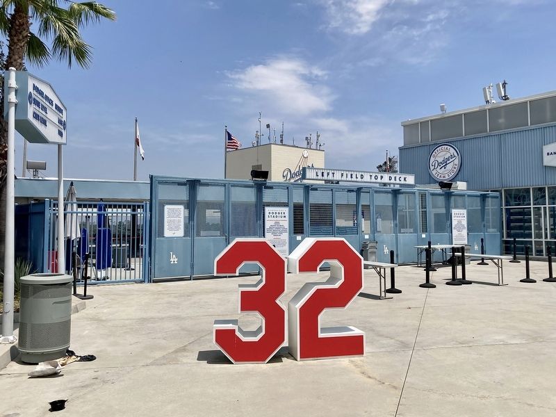
Among the most dominating pitchers in the game's history, the left-hander won 165
games s and compiled 2,396 strikeouts in 2,324.1 innings with 40 shutouts in his 12-year
Dodger career (1955-66). A three-time Cy Young Award winner and National . . . — — Map (db m229152) HM
Thomas Charles Lasorda,
Los Angeles, N.L., 1977-1996.
One of baseball's most engaging personalities
and a great ambassador for his sport. Managed
Dodgers with an impenetrable passion, claiming
to "bleed Dodger blue.” In his 47th . . . — — Map (db m186815) HM
Near Vin Scully Avenue, 0.3 miles east of Stadium Way.
Tommy Lasorda had a tough act to follow when he succeeded future Hall of Famer Walter
Alston as Dodger manager with four games left in the 1976 season. But like Alston,
Lasorda went on to enjoy a lengthy and highly successful tenure at the helm. . . . — — Map (db m229163) HM
Near Vin Scully Avenue, 0.3 miles east of Stadium Way.
The voice of the Brooklyn and Los Angeles Dodgers for a MLB-record 67 seasons from
1950 to 2016, inviting generations of fans to "pull up a chair" and listen to vivid
play-by-play descriptions mixed with colorful stories. Scully's "It's Time for . . . — — Map (db m186843) HM
Walter Emmons Alston was a virtual unknown when he took over the helm of the Brooklyn
Dodgers in 1954, but he became well-known in a hurry. The long-time minor league
skipper guided his first Dodger team to 92 wins and followed that by piloting . . . — — Map (db m229155) HM
Near Multnomah Street, 0.3 miles east of Soto Street, on the left when traveling east.
The speedway originally opened in 1924 and was taken over
by the American Legion Post 127 of Glendale in 1927. Legion
Ascot was the most famous of several Ascot speedways. The
first Ascot was named after England's Ascot horse track.
In its . . . — — Map (db m228798) HM
Near Beverly Boulevard at Genesee Avenue, on the left when traveling south.
This is the site of the ballpark where the Hollywood Stars of the Pacific Coast League
played from May 2, 1939, through September 5,
1957. More than 1,700 games were played in the
park, which had a seating capacity of 11,200.
The Stars . . . — — Map (db m166087) HM
Near Griffith Park Drive, 1 mile north of Crystal Springs Drive, on the right when traveling north.
This plaque is placed to commemorate the centennial
anniversary of golf in Griffith Park. The oldest 18-hole
municipal course West of the Rockies, the original course
opened for play in 1914. It was a model of city course
stewardship and . . . — — Map (db m165741) HM
Near Griffith Park Drive, 1 mile north of Crystal Springs Drive, on the right when traveling north.
On January 5th 1920, World Series-winning Boston Red Sox
pitcher George Herman “Babe” Ruth was playing here on his
favorite Los Angeles golf course. He was approached by New
York Yankees Manager Miller Huggins who had come all . . . — — Map (db m168977) HM
On Hollywood Boulevard just west of Highland Avenue, on the right when traveling west.
For 50 years, the Los Angeles Dodgers have not only led the league in wins, pennants, world championships, and attendance, they have been an agent for social change
and a unifier of fans from all walks of life. — — Map (db m170021) HM
Near Vista Del Mar, 0.6 miles south of Imperial Highway.
The coastal bluffs of Isadore B. Dockweiler State Beach have played host to modern Hang Gliders since 1966, and are considered to be the birthplace of modern Hang Gliding in
the United States. The soft gentle slopes and smooth coastal breezes . . . — — Map (db m118364) HM
Near Pico Boulevard at Patricia Avenue, on the right when traveling east.
On Friday January 6, 1961, the first day of the 35th L.A. Open, Arnold Palmer, voted Golfer of the Year and Professional Athlete of the Year, took a 12 on this hole.
As an inspiration to all golfers, the Los Angeles Junior Chamber of Commerce . . . — — Map (db m170232) HM
Near Figueroa Street south of Exposition Boulevard, on the right when traveling south.
Bud Greenspan's
"16 Days of Glory,"
the official film
of the games of the XXIIIrd Olympiad.
Buried on June 18, 1987
by Mayor Tom Bradley and the Disney Channel.
Time capsule to be opened on July 28, 2034.
second marker: . . . — — Map (db m239675) HM
Near Figueroa Street south of Exposition Boulevard, on the right when traveling south.
Olympian.
International Olympic Committee member.
Sport Administrator.
Anita L. DeFrantz was a vice president of the Los Angeles Olympic Organizing Committee, the group
that staged the highly successful 1984 Olympic Games. The . . . — — Map (db m237937) HM
On Adams Boulevard at Grammercy Place, on the right when traveling west on Adams Boulevard.
Classical Revival style. Architect - Alfred F. Rosenheim. Built 1910. Declared 1978, Historic-Cultural Monument No. 197, City of Los Angeles, Cultural Heritage Commission, Cultural Affairs Department.
This property, Eugene W. Britt House, . . . — — Map (db m185094) HM
Near Charlie Sifford Drive, 0.3 miles west of Western Avenue, on the left when traveling west.
Chester Washington Golf Course is the first golf course
to be integrated in the county. In 1955, events at the site led to the integration of all county-owned golf
courses and the addition of a nondiscrimination clause
to county facility . . . — — Map (db m196868) HM
On Exposition Boulevard, on the right when traveling east.
The ultimate origin of the ancient Olympic Games is lost in the prehistoric past. In the ninth century before the Christian Era the young men of Greece were already accustomed to gather on the sacred grounds of Olympia to honor their god Zeus by . . . — — Map (db m216070) HM
Near Charlie Sifford Drive, 0.3 miles west of Western Avenue, on the left when traveling west.
Charlie Sifford was born on June 2, 1922, in Charlotte, North Carolina. Considered the Jackie Robinson of golf, Sifford made history
when, in 1961, under pressure from the California Attorney General, the PGA permitted Charlie Sifford full . . . — — Map (db m196874) HM
Near Figueroa Street south of Exposition Boulevard, on the right when traveling south.
1939 - Member of the 1939 Tournament All State basketball team
1939-1940 - All Conference Football, Wisconsin Valley Conference
1942 - All American, University of Wisconsin
1943 - All American, University of Michigan
1943-1944 - . . . — — Map (db m237906) HM
Exposition Park, originally named Agricultural Park, was developed in 1876 as a showground for agricultural and horticulture fairs. The property became state land in 1880, the same year USC was founded, but during the 1890s, it fell into private . . . — — Map (db m218541) HM
On Bill Robertson Lane north of Martin Luther King Jr Boulevard, on the right when traveling north.
Writing Sports History in Water and Gold
In California, the old saying goes, whisky is for drinking, and water is for fighting over. At the Los Angeles Swim Stadium, it's for competing in, too.
The 1932 Games of the X Olympiad . . . — — Map (db m189645) HM
On Exposition Boulevard, 0.3 miles east of Vermont Avenue, on the right when traveling east.
From Sin to Science, A Park For The People
For decades into the 20th century, Los Angeles not only fed the world’s imagination with films and television — it fed the world’s bellies, too.
Los Angeles County prided itself on . . . — — Map (db m216967) HM
On Vernon Avenue at Crenshaw Boulevard, on the left when traveling west on Vernon Avenue.
The Jewel of Crenshaw
a historically black advocacy organization that stresses job training and
It's more than fitting that the headquarters of the Los Angeles Urban League,
career advancement, is situated at the base of View . . . — — Map (db m237558) HM
On Crenshaw Boulevard north of Coliseum Street, on the right when traveling north.
A Place For All
Opened in 1958 by a group of Japanese restaurateurs, the Holiday Bowl was for 40 years a culinary and recreational nexus for Crenshaw's African American and Japanese populations, and just about anyone else who came . . . — — Map (db m208108) HM
On Figueroa Street south of Exposition Boulevard, on the right when traveling south.
UCLA Fall 1939-Spring 1941:
First athlete in UCLA history to letter in four sports in the same year:
baseball, football, basketball and track.
Charter member of the UCLA Athletic Hall of Fame - 1984.
Brooklyn Dodgers 1947 - 1956: . . . — — Map (db m231414) HM
Near Figueroa Street south of Exposition Boulevard, on the right when traveling south.
Sports Columnist, The Los Angeles Times, 1961 - 1998.
Pulitzer Prize - 1990.
Baseball Hall of Fame - 1988.
Sports Illustrated 1953-1961.
Time Life 1948-1955.
Los Angeles Examiner 1944-1948.
A great American writer, a . . . — — Map (db m237936) HM
Near Figueroa Street south of Exposition Boulevard, on the right when traveling south.
Joan Benoit Samuelson made history at the 1984 Olympic Games by winning the first Olympic Women's
Marathon, Benoit Samuelson finished the race before a standing, cheering, capacity crowd,
on August 5, 1984, in the Los Angeles Memorial . . . — — Map (db m237903) HM
Near Figueroa Street south of Exposition Boulevard, on the right when traveling south.
Led the Los Angeles bid for the 1984 Olympic Games and revolutionized
the Olympic movement by insistence on private-sector organization,
leading to the most successful games in history. Recipient of the
Olympic Order in 1992, the highest honor . . . — — Map (db m238146) HM
On Childs Way west of Pardee Way, on the right when traveling west.
This plaza, located on the site of the 1984 Olympic village, honors a great Trojan instrumental in bringing the Olympic Games to Los Angeles.
A 1956 graduate of the USC Gould School of Law, he served with distinction on the USC Board of . . . — — Map (db m128301) HM
Near Figueroa Street south of Exposition Boulevard, on the right when traveling south.
President, Los Angeles Memorial Coliseum Commission, 1955, 1967,
1979.
Commissioner, 1953-1981, 1985.
Alternate Commissioner, 1991-92.
Father of the Los Angeles Memorial Sports Arena, the first major
indoor sports facility in . . . — — Map (db m238192) HM
Near Figueroa Street south of Exposition Boulevard, on the right when traveling south.
On Saturday night, October 29, 1960, a plane carrying the California State
Polytechnic College of San Luis Obispo 1960 football team, which was
returning from a football game with Bowling Green State University,
Bowling Green, Ohio, crashed at . . . — — Map (db m238461) HM
Near Figueroa Street south of Exposition Boulevard, on the right when traveling south.
In 1958 Los Angeles joined the ranks of the major league
baseball cities when the Los Angeles Dodgers of the National
League, using the Los Angeles Coliseum as their home field,
played the first game of major league baseball against the . . . — — Map (db m238014) HM
On Figueroa Street at Exposition Park Drive, on the right when traveling south on Figueroa Street.
A Coliseum For All Seasons And Sports
It wasn't the first public building designed to enhance Los Angeles' image, but like its namesake in Rome, it is one of the most enduring.
The huge concrete and steel oval Los Angeles . . . — — Map (db m208554) HM
Near Figueroa Street south of Exposition Boulevard, on the right when traveling south.
This stadium was originally completed in 1923. It was partially redesigned and enlarged for the 1932 Olympic Games. Both designs were by architects John & Donald B. Parkinson. The Coliseum has witnessed many important sports, political, and . . . — — Map (db m116751) HM
Near Figueroa Street south of Exposition Boulevard, on the right when traveling south.
General Manager, Los Angeles Rams 1957 - 1960.
Commissioner, National Football League 1960 - 1989.
He made professional football America's game.
He quarterbacked a league into a legend.
The Super Bowl is his monument... a . . . — — Map (db m237935) HM
Near Figueroa Street south of Exposition Boulevard, on the right when traveling south.
Peter V. Ueberroth was the president of the Los Angeles Olympic Organizing Committee.
The 1984 Los Angeles Olympic Games revitalized the Olympic movement, introduced first-time women's
events, influenced the development of para-athletes, and . . . — — Map (db m230973) HM
Near Figueroa Street south of Exposition Boulevard, on the right when traveling south.
No event in track and field is more challenging, physically or mentally, than the decathlon.
1955 · UCLA freshman Rafer won the Pan American Games decathlon in Mexico City.
1954-58 · He competed under UCLA coaches Craig Dixon and . . . — — Map (db m238101) HM
Near Figueroa Street south of Exposition Boulevard, on the right when traveling south.
For 33 of their 70 years, the Los Angeles Memorial Coliseum was the proud home of the
Rams, and the Rams proud tenants of the Coliseum. When the Rams moved from Cleveland in
1946, they brought big league professional sports to Los Angeles for . . . — — Map (db m237926) HM
On 34th Street just east of Hoover Street, on the right when traveling east.
Trojan Cardinal And Olympic Gold
Among the scholars who have passed
through the University of Southern California have been thousands of star athletes:
All-American football players, Hall of Fame
standouts, a future Oscar winning . . . — — Map (db m238532) HM
Near Figueroa Street south of Exposition Boulevard, on the right when traveling south.
Vin Scully was the enduring voice of summer in Los Angeles.
Scully joined the Dodgers as a play-by-play announcer in 1950, when he was 22. In 1958, he
moved from Brooklyn to Los Angeles with the team, those first four seasons in California, . . . — — Map (db m231148) HM
Near Figueroa Street south of Exposition Boulevard, on the right when traveling south.
He created and directed Helms Athletic Foundation, organized
and served as president of three baseball leagues, compiled
the most extensive sports library in the world, spearheaded
many charity fund-raising athletic events, helped found . . . — — Map (db m239674) HM
On San Pedro Street north of 42nd Place, on the right when traveling north.
Wrigley Field was built by chewing gum
magnate William Wrigley, as a baseball park at
this location in 1925. Over the next 40 years,
the 21,000 seat stadium was home to minor and
major league baseball teams, football games,
boxing matches, . . . — — Map (db m227625) HM
Near Ocean Front Walk south of 18th Avenue, on the right when traveling south.
For over 65 years has promoted a
healthy bodybuilding and fitness lifestyle,
his passion and vision becoming a force
that changed the lives and bodies of
millions of men and women worldwide.
Acknowledged by
Bill Rosendahl,
Councilman, 11th . . . — — Map (db m231067) HM
Near Ocean Front Walk south of 18th Avenue, on the right when traveling south.
Committed December 13, 2009.
To be opened 2059.
Sponsored by: Iron Man Magazine .com
in conjunction with
Councilmember Bill Rosendahl, 11th District;
City of Los Angeles Recreation and Parks. Created and developed by
Joseph and Christine . . . — — Map (db m231062) HM
On Ocean Front Walk south of 18th Avenue, on the right when traveling south.
The Muscle Beach Venice Walk of Fame was created to
recognize the inductees into the Muscle Beach Venice
Bodybuilding Hall of Fame.
Dedicated September 3, 2007,
City of Los Angeles,
Mayor - Antonio R. Villaraigosa. — — Map (db m231069) HM
On South Venice Boulevard at Ocean Avenue, on the right when traveling east on South Venice Boulevard.
These grassy mounds and hard balls pay tribute to the Venice
Tigers, a Pacific Coast League professional baseball team that
played at the Venice Ballpark from 1913-14. That ballpark was
one block East of our site. The Tigers came from, and . . . — — Map (db m178900) HM
On Newmark Avenue at Ramona Avenue, on the left when traveling west on Newmark Avenue.
Over the centuries, torches have been lighted to convey good news,
and with this tradition in mind, this sculpture symbolizing the Olympic torch was dedicated to commemorate the Olympic Field Hockey
competition that took place at East Los . . . — — Map (db m226832) HM
On North Garfield Avenue, on the left when traveling north.
The Pasadena Robinson Memorial sculptures were created through a community effort spearheaded by the Board of Directors of Pasadena Robinson Memorial and the City of Pasadena. The monumental bronze portraitures of Mack and Jackie Robinson focus on . . . — — Map (db m71143) HM
Near Wilson Avenue, 0.2 miles south of California Boulevard, on the left when traveling south.
Official terminus of the first transcontinental
airplane flight. Calbraith (Cal) Perry Rodgers
took off from Sheepshead Bay New York
September 17, 1911, landing here November 5, 1911.
Earlier Flights
Roy Knabenshue piloted his . . . — — Map (db m164203) HM
On North Lake Avenue at Locust Street, on the right on North Lake Avenue.
First Tournament of Roses
Dr. Charles Frederick Holder and Dr. Francis F. Rowland, Founders
1890
First Rose Queen
Hallie Woods
1905
Completion of Rose Bowl Stadium
William L. Leishman
1923
First Telecast of Rose . . . — — Map (db m161036) HM
On North Arroyo Boulevard, 0.2 miles north of Seco Street.
The 1942 Rose Bowl was the 28th Rose Bowl Game. Originally scheduled to be played in the
Rose Bowl Stadium in Pasadena,
California, it was moved to Durham, North Carolina, due to the fears of an attack on the West Coast of the United States . . . — — Map (db m128107) HM
On North Arroyo Boulevard, 0.2 miles north of Seco Street, on the right when traveling north.
On July 10, 1999, the U.S. women’s soccer team secured a win for the ages at the Rose Bowl. On a sweltering day before
a sellout crowd of 90,185 — the
largest ever to watch a
women’s-only event — the U.S.
posted a 5-4 shootout . . . — — Map (db m136525) HM
On Orange Grove Boulevard at Arbor Street, on the right when traveling south on Orange Grove Boulevard.
This official Olympic Flagpole
was used at Squaw Valley, California
in the pageantry ceremonies
of the VIII Olympic Winter Games
held in February 18 - 28, 1960.
Walt Disney, Chairman of Pageantry. — — Map (db m154852) HM
On Portofino Way, on the right when traveling east.
Bill and Bob Meistrell identical twins were born in Boonville, Missouri; Bill on July 30, 1928, and Bob 20 minutes later on July 31st. They started diving as kids in the farm's pond using an oilcan for a helmet, a bicycle pump and a hose for air. . . . — — Map (db m93287) HM
George Freeth was born in Honolulu November 8, 1883 of royal Hawaiian and Irish ancestry. As a youngster he revived the lost Polynesian art of surfing while standing on a board. Henry H. Huntington was amazed at Freeths surfing and swimming . . . — — Map (db m93273) HM
On Montrobles Place east of Los Robles Avenue, on the left when traveling east.
This was the site of ‘Los Robles’, the 400 acre estate of Governor George Stoneman. Here in 1880 President Rutherford B. Hayes was entertained. The first schoolhouse in the San Gabriel Valley, California's first tennis club, and the first municipal . . . — — Map (db m127644) HM
Near Ocean Avenue at Palisades Avenue, on the right when traveling south.
Commemorates the XXIII Olympiad and marathons run through Santa Monica, August 5, 1984 and August 12, 1984, including the first women’s marathon in Olympiad history. — — Map (db m119673) HM
Near East Avenue R west of 90th Street East, on the right when traveling west.
"Future generations will remember Jackie Robinson, not as
the base runner who worried pitchers to their doom, but as the
proud crusader against pompous bigots and timid sentinels
of the status quo -- as the symbol of a new Negro American!" . . . — — Map (db m245849) HM
A great morale builder, Fort McDowell’s bowling alley opened in 1944, sporting six lanes. Fort McDowell’s bowling teams – the “Jail Birds,” “Brass Hats,” and the "McDowell Mermaids” competed against teams from . . . — — Map (db m69299) HM
On Perimeter Road, on the right when traveling north.
If you listen carefully, you can hear the crack of a bat and soldiers cheering as a Fort McDowell “Indian” rounds third base and heads for home – Cole Field. The ball park was home to the men’s baseball team, the . . . — — Map (db m69275) HM
On Tiburon Boulevard (California Route 131) at Main Street, on the right when traveling west on Tiburon Boulevard.
Samuel was born to Catherine and Charles Chapman of Mar West Street in Tiburon on April 11, 1916. He worked in his father’s merchandise store on Main Street and delivered mail for his father who also served as Tiburon’s Postmaster from 1915 to . . . — — Map (db m192548) HM
Near North Avenue at Sixth Street, on the right when traveling west.
1st Organized Team in Gustine History
1933 Season Record
1 win 2 losses 1 tie
Dos Palos 33 • Gustine 7
Merced 0 • Gustine 14
Patterson 0 • Gustine 0
St. Mary’s 13 • Gustine 0
Coached by Charles “Red” Scheflin, All American @ Saint . . . — — Map (db m232770) HM
Carson’s Camp, first private resort in the June Lake Loop, was established by Roy Carson in 1916. The initial camp was in a tent “where fishing is always good”. In 1919 his wife Nancy became camp cook and housekeeper. The first building . . . — — Map (db m50143) HM
On Minaret Road (Route 203) 3 miles west of Mammoth Lakes, on the left when traveling west.
Pioneering Eastern Sierra skier, visionary and entrepreneur, Dave McCoy's passion for skiing began in high school and soon thereafter he joined the Eastern
Sierra Ski Culb. In 1936, Dave was hired by LADWP as a hydrographer, conducting snow . . . — — Map (db m59340) HM
On Crowley Lake Drive, on the right when traveling south.
The first permanent rope tow in the Eastern Sierra was built west of this site on the east slope of McGee Mountain. This predecessor of Mammoth Mountain ski area was constructed here in 1938 because of its dependable snow and nearness to a highway. . . . — — Map (db m2951) HM
John “Bricky” Crivello, a key figure in the Monterey Fisherman’s Union for 67 years, was instrumental in the passage of Senate Bill 1213 which provided unemployment benefits to all California fishermen. Due to Bricky’s relentless . . . — — Map (db m68861) HM
The railroad
A major landmark in the history of the Monterey Peninsula was the Southern Pacific Railroad. Built in 1880, the rail line was intended to bring tourism to this scenic area. In addition to transporting tourists, however, it . . . — — Map (db m55213) HM
On 17-Mile Drive, on the right when traveling north.
Sam Morse was a preservationist long before fashionable. In 1915, he was sent by the Pacific Improvement Company to liquidate its land holdings in the region, including the area now known as Pebble Beach. Instead of pursuing the liquidation, . . . — — Map (db m83309) HM
On Donner Pass Road, on the right when traveling east.
History
Today people travel swiftly along I-80 to their destinations in the Sierra, many times not even staying overnight. When they do stay overnight it is most likely in hotels or rental houses.
It was not always that way. Before I-80 . . . — — Map (db m81970) HM
On Donner Pass Road, on the right when traveling east.
History
When Bill Klien, who would transform skiing himself, invited Hannes Schroll to Donner Summit from Yosemite in 1937, the ski industry was about to change. Hannes was a dare-devil champion skier whose yodels as he tore down mountains . . . — — Map (db m81933) HM
On Donner Pass Road at Old Donner Summit Road, on the right when traveling east on Donner Pass Road.
History
The current building at the head of Donner Pass on Old 40 was built for the Division of Highways in 1931 to serve as a dormitory for highway workers. That was the first winter the road was plowed and on-call workers needed . . . — — Map (db m81881) HM
On Donner Pass Road, on the right when traveling east.
History
William Wilson Wurster was the most “influential unknown architect in California.” He designed many houses and buildings such as Ghirardelli Square, Cowell College at UC Santa Cruz, as well as other U.C. and Stanford . . . — — Map (db m81939) HM
History
The ritual of arriving in early morning by train and taking the 15 minute ride in tractor drawn sleighs was in place for more than ten years after Sugar Bowl opened in 1939. It was the only way to get to Sugar Bowl. It was a cold . . . — — Map (db m81936) HM
On Donner Pass Road, on the right when traveling east.
History
Because there were three lodges built on Forest Service land in the early 1930’s, they have always been referred to as the Tri-Lodges. The first of the three lodges built was der Naturfreund in 1931 (right). This is a private lodge . . . — — Map (db m81969) HM
Downhill ski racing history in the Western Hemisphere first began in California circa 1857, and in this famous Donner Pass of the Sierra Nevada the Auburn Ski Club presents a full exhibition of pioneered manpower transportation and skisport history . . . — — Map (db m60888) HM
History
Today each August hundreds of swimmers take to the 65º water of Donner Lake and swim its 2.7 mile long length. Each swimmer has lots of company.
On August 19 (sic, 18), 1935 though, it was a different story. On that day 17 . . . — — Map (db m129739) HM
Near Gene Autry Way east of State College Boulevard.
Founder of California Angels, 1961. His uniform number 26 was retired in 1982 by the players. Singing cowboy · Actor · Composer · Airforce pilot · Entrepreneur · Baseball fan · Philanthropist · 33rd Degree Mason · Best friend Statue . . . — — Map (db m221623) HM
On Pacific Coast Highway (California Route 1) south of Del Obispo Street, on the right when traveling north.
Best known for his documentary, The Endless Summer, Dana Point resident Bruce Brown was one of surfing's first filmmakers. His work buoyed surfing's image.
Brown understood how to make surf films because he was an avid surfer. When he wasn't . . . — — Map (db m189512) HM
Near Golden Lantern Street south of Dana Point Drive, on the left when traveling south.
In dedication to Don Hansen and Dana Wharf Sportfishing, the first business operating out of Dana Point Harbor. Dana Wharf Sportfishing originated Whale Watching for Orange County and founded the Dana Point Festival of Whales and Dana Point Boat . . . — — Map (db m60798) HM
This plaza is dedicated in memory of Don Hansen, the founder of Dana Wharf Sportfishing and Whale Watching - the first business to operate from Dana Point Harbor in 1971.
Don loved the ocean and was dedicated to the conservation of
marine . . . — — Map (db m233230) HM
On Pacific Coast Highway (California Route 1), on the right when traveling north.
Raised at the Beach
Hobart Laidlaw Alter grew up on a citrus farm in Ontario, California. Fortunately for water-lovers everywhere, his family owned a house in Laguna Beach where he spent weekends and vacations playing in the waves.
In . . . — — Map (db m189514) HM
On Pacific Coast Highway (California Route 1), on the right when traveling north.
Skimming Across the Water
In the mid 1960s, with his surfboard business booming, Hobie turned to something new. Years earlier he had ridden catamaran in Hawaii. He and his friends even built a few to play with. Hobie remembered the thrill and . . . — — Map (db m189515) HM
On Pacific Coast Highway (California Route 1), on the right when traveling north.
Severson wove art into the surfing culture and influences several emerging surf artists. In 1960 he produced a 36-page booklet called The Surfer to promote his film, Surf Fever. He never expected it to do more than create a buzz for his movie, yet . . . — — Map (db m189511) HM
On Pacific Coast Highway (California Route 1), on the right when traveling north.
Phil Edwards rode waves in the '50s and '60s with a style that surpassed other surfers, turning with finesse and walking the board. His friendship with Hobie Alter and Bruce Brown drew him to Dana Point where he worked in Hobie's shop as he became . . . — — Map (db m189513) HM
On Pacific Coast Highway (California Route 1) west of Doheny Park Road, on the right when traveling north.
The Notorious Wave
Back in the day, if you dared, you grabbed your board and headed for Killer Dana. The wave was known as Dana Cove when the weather was calm - but when the surf was over 10 feet, Killer Dana's thick, right-breaking curl . . . — — Map (db m183042) HM
On Pacific Coast Highway (Route 1) west of Doheny Park Road, on the right when traveling west.
Seminal Surfing Story
Filmed in the early 1960s, the documentary The Endless Summer follows two California as they circle the globe to surf. The pair introduce the sport to many who had never seen it, and discover what is now one of the . . . — — Map (db m183024) HM
Near Commonwealth Avenue west of Highland Avenue, on the right when traveling east.
In the autumn of 1908, the land now designated as Amerige Park become the site of the city's first formal high school. On November 18, 1910, a fire of undetermined origin destroyed the building and the decision was made to relocate the high school . . . — — Map (db m192593) HM
On Pacific Coast Highway at Main Street, on the right when traveling north on Pacific Coast Highway.
Duke Kahanamoku, three time Olympic gold medalist swimmer, public servant, goodwill ambassador of the State of Hawaii, and considered by many to be the father of modern surfing. In the early 1920's, the Duke surfed under Huntington's Pier. In his . . . — — Map (db m51964) HM
Near Trabuco Creek Road, on the left when traveling south.
Throughout his life, Reese Imhoff was a true athlete. Known for his power, toughness, and determination, Reese gave his all in whatever he did. Always friendly and encouraging to teammates, Reese enjoyed baseball, lacrosse, and football. He also . . . — — Map (db m188940)
From 1932 to 1938, this redwood surfboard was ridden at Corona de Mar Jetty by Alex and Don MacGillivary. With no fin, the boys would drag one foot to turn the board. — — Map (db m202557) HM
Near Olympiad Road at San Marcos, on the right when traveling north.
Born on December 21, 1959, to Robert Griffith and Florence Deloris Griffith, Florence Delorez Joyner accomplished more in her thirty-eight years on this earth than many people could achieve in one hundred.
Known to millions as Flo-Jo, . . . — — Map (db m189687) HM
Near Olympiad Road at San Marcos, on the right when traveling north.
Florence Joyner Olympiad Park marks the 36th park to be built in the City of Mission Viejo. Dedicated to the memory of Florence Joyner, the 17-acre park reflects her flair for style and her cherished values and ideals, including love of family, . . . — — Map (db m189686) HM
On Olympiad Road just south of Marguerite Parkway, on the right when traveling south.
The Women's Individual Road Race was the first event of the 1984 Summer Olympics and the first time women's cycling event was included in the Olympic program. The race was held at 9:00 am on Sunday, July 29th 1984. Jeannis Longo-Ciprelli of France . . . — — Map (db m189684) HM
This building and adjacent land were dedicated on September 11, 1993 as a training center for the United States Men's 1994 World Cup Soccer Team. — — Map (db m215648) HM
Near San Miguel Drive, 0.3 miles north of Port Sutton Drive, on the right when traveling north.
On this site, May 23, 1971, with a gathering of enthusiasts for personal human flight, began the worldwide sport of Hang Gliding. — — Map (db m125332) HM
Near Chapman Avenue at Glassell Street, in the median.
We the people of Orange dedicate this plaque to the spirit of the Olympic torch run efforts of the American people. Just as the torchbearers had been created by many along the way from its origination in New York City, it was greeted by a cheering . . . — — Map (db m189679) HM
4450 entries matched your criteria. Entries 201 through 300 are listed above. ⊲ Previous 100 — Next 100 ⊳