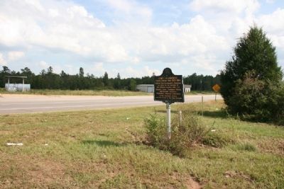
Built by Gen. Ferdinand L. Claiborne as a base for his invasion of the Alabama country with U.S. Regulars, Lower Tombigbee Militia, and friendly Choctaws. Claiborne’s campaign culminated in the American victory over the Creeks at the Holy Ground. — — Map (db m47641) HM
Piache, an Indian town visited by DeSoto in 1540 was near here.
DeLuna made a settlement here, Nanipacna in 1560.
Fort Claiborne was erected on the south bluff, in 1813.
LaFayette was entertained here, 1825.
. . . — — Map (db m47639) HM
Decatur played a key role in the Federal defenses of the vital rail lines in North Alabama. These defenses were configured in a three-tiered system. First, a number of lightly armored gunboats, constructed on the Tennessee River and nicknamed . . . — — Map (db m86476) HM
As Hood’s Army of Tennessee encircled Decatur, sharpshooters advanced upon the Union defenses. Colonel Doolittle’s men responded with heavy artillery and musket fire. During the early afternoon of October 27, the Confederates approached the Federal . . . — — Map (db m28241) HM
Built during Creek War 1813 by Georgia Militia on main Indian trade route to Tombigbee River
U.S. Troops stationed here until 1837 1836 Lower Creeks corralled here for forced removal to the West — — Map (db m26069) HM
Fort Mitchell
Fort Mitchell is located on the Federal Road on the West bank overlooking the Chattahoochee River.
General John Floyd received orders from Governor David B. Mitchell to pick up supplies, cross the Chattahoochee River and . . . — — Map (db m120003) HM
Originally a major path Creek Indians and indigenous tribes who preceded
them, the Federal Road became a postal route as a result of a treaty between
the Creeks and the United States government in 1805. The widening of the
Federal Road occurred . . . — — Map (db m241205) HM
This military graveyard was established soon after Fort Mitchell was built by General John Floyd of the Georgia Militia. Located just south of the stockade, the cemetery was used between 1813 and 1840 during the fort's occupation by Georgia and . . . — — Map (db m26122) HM
Approximately one mile due east of this marker, back down the Old Federal Road, called by frontiersmen and Indians the Three Notched Trail or the Three Chopped Way, stood Fort Mitchell, an early 19th century American fort that in 1836 was one of the . . . — — Map (db m26100) HM
East of here, on the Chattahoochee River, was the "fort among the Apalachicolas," most northern of the Spanish settlements in eastern North America. A palisaded "strong house" built by Captain Enrique Primo de Rivera to check activities of English . . . — — Map (db m101252) HM
Built in 1950, Fort Jabe Brassell has served as a hub for military training and arms storage for the local community by the Alabama Army National Guard and the Armory Commission of Alabama. Between July 1954 and January 1955, the Alabama Army . . . — — Map (db m165538) HM
Russell County occupies land that once sat at the heart of the Creek Nation. Within the county's boundaries were several important Creek towns, many of which would figure prominently in the Creek and Seminole Wars era and the saga of Removal. . . . — — Map (db m111596) HM
1736: First settlement by French at Ft. Tombecbee.
1830: U.S. got Choctaw Indian lands by Treaty of Dancing Rabbit Creek.
1832: County created by Act of State Legislature -- named for Gen. Thomas Sumter, "The Gamecock," South . . . — — Map (db m92663) HM
Built by Andrew Jackson with U.S. Regulars, Tennessee Volunteers and friendly Cherokees and Creeks. Used as advance base during final phases of Creek Indian War, 1813-1814. Military cemetery nearby. — — Map (db m57761) HM
Built in 1735 by British from Carolina in futile attempt to gain trade of the Creek Indians from the French, located at Fort Toulouse, 40 mi. S. Okfuskee was the largest town in Creek Confederacy. — — Map (db m22232) HM
The Tuscaloosa Armory was located on this site from 1938 to 1981 and was home of the famed 31st Infantry (Dixie). In 1968, the Tuscaloosa unit received a brigade headquarters under the command of the 30th Armored Division. In 1973, the 31st Armored . . . — — Map (db m235520) HM
Sergeant William Jasper was a soldier, hero, scout and namesake of Jasper, Alabama. During the June 28, 1776 defense of Charleston against the Royal Navy, Sergeant Jasper courageously retrieved the fallen standard of the 2nd South Carolina . . . — — Map (db m302965) HM
A landmark on the Tombigbee River, the massive limestone bluff called Hobuckintopa
by Choctaw Indians, became the site of Alabama's Territorial Capital.
In 1789, while under Spanish rule, Governor Estevan Miro sent a detachment of soldiers . . . — — Map (db m293768) HM
Spanish Fort 1789, Evacuated to the United
States, 1799; Designated Alabama Territorial
Capital, 1817.
Here was located U.S. Court and Land Offices,
and for some years the seat of justice
of Washington County,
September 28, 1922. — — Map (db m293764) HM
Blockhouse
Spruce, birch, tamarack, moss, weatherproof membrane, canvas
Kolmakovsky Redoubt, 1841
Collector: Al Walsh, 1929
In 2009, the University of Alaska Museum of the North was awarded a $75,000 Save America's
Treasures . . . — — Map (db m256342) HM
In 1799, the Russian American Company (RAC) was established via a 20-year renewable charter
granting a monopoly over trading in Russia's North American holdings. The company focused
on exploiting fur resources in Alaska during the first charter . . . — — Map (db m256337) HM
Commemorating the Founders
of
Port Chilkoot
World War II Veterans
and their families
who bought Fort Wm. H. Seward in 1947
and pioneered their futures here.
Steve Homer • Ted and Mimi Gregg • Carl and Betty Heinmiller • Marty and . . . — — Map (db m70803) HM WM
In 1802 the Russian-American Company sailed into the harbor here to establish its new base of operations - Novo-Arkhangelsk - on the site of an already well-established Tlingit village. The Tlingit resented the invasion and the Russians . . . — — Map (db m308838) HM
Reconstructed here on the site of an original by the National Park Service in 1962 it is a replica of one of the three Russian fortresses that guarded the stockade wall. — — Map (db m308785) HM
The replica blockhouse before you, a symbol of Russia's role in Alaska's history, represents the walled fortifications that defined the limits of its control.
These blockhouses, or watchtowers, each housing cannons, protected the Russian . . . — — Map (db m133826) HM
This place was central to Russia's hopes of establishing a lucrative colony in America.
Finding a Foothold
Starting in the 1740s, Russians were attracted to Alaska's coast by abundant, valuable sea otters. Russia claimed Alaska and . . . — — Map (db m181348) HM
As Alaska evolved from department to district to territory, and finally, to state, this hill went through a series of changes, eventually becoming Baranof Castle State Historic Site.
Who's the Boss?
A short lull followed the excitement of . . . — — Map (db m181369) HM
When the Kiksadi clan of the Tlingit Indians first migrated into this area from the south, they chose this promontory for the erection of their main houses. There were four of these community houses here when Baranof, governor of the . . . — — Map (db m181334) HM
Baranof and his party landed and parleyed with the Kiksadi who refused to permit another settlement. When the Russians attacked this hill they found the Kiksadi had moved to their fort ¼ mile east on Indian River.
After the battle and siege at . . . — — Map (db m181343) HM
Imagine your spouse is appointed as the top official in a distant land. You must now travel thousands of miles to Sitka and make this hill your family's new home.
Elisabeth von Wrangell
Ferdinand von Wrangell, the first governor of Russian . . . — — Map (db m181341) HM
There are two markers on a single kiosk
Apache Pass is a low divide separating the massive Chiricahua Mountains from the Dos Cabezas Mountains. This landscape formed a rugged corridor through which people and goods were moved. The Pass . . . — — Map (db m100810) HM
Pottery fragments found around Apache Spring suggest it was used by prehistoric Mogollon Indians before the Apache arrived. Journals of early Spanish explorers described Apache trails radiating from the spring. The Butterfield Trail was constructed . . . — — Map (db m100823) HM
This massive adobe structure was among the earliest built at the new fort. By the mid-1880s, it had a shingled and pitched roof, attractive porches, kerosene lamps, and landscaping. The kitchen was behind the barracks; the mess hall adjacent.
. . . — — Map (db m100998) HM
Palatable food during the fort's early days was a constant problem; the soil was poor quality, lacking nutrients, and other sources of fresh food were distant. Though neighboring ranches supplied some vegetables and meats, they were still a day's . . . — — Map (db m100956) HM
The fort's most elaborate structure, a two story, Victorian-style mansion, was built in 1884-1885 for about $4,000.00. An expensive home at that time! Among its thirteen rooms (originally designed as a duplex) were a drawing room, a sewing room with . . . — — Map (db m101000) HM
To your right, a spur trail follows a military road 300 yards to the first Fort Bowie ruins.
On July 28, 1862, a 100-man detachment of the 5th California Volunteer Infantry began construction of the primitive fort, completing it two weeks . . . — — Map (db m218624) HM
Enlisted infantrymen found that privacy was not a feature of barracks life. Privates and corporals bunked together in the main room; sergeants occupied small adjoining rooms.
Each soldier stored his military gear and personal belongings on a . . . — — Map (db m101002) HM
Mining activity in Apache Pass started when members of the California Volunteers discovered a, “...gold and quartz bearing ledge...” in 1864. The “Harris Lode” as it became to be known, was later developed by the Apache Pass . . . — — Map (db m100811) HM
Established 1862 following the Battle of Apache Pass, largest conflict in Arizona Indian Wars. Massed Apaches under Cochise and Mangas Coloradas were routed by howitzers fired by California Volunteers attacked in the pass. Fort Bowie overlooked . . . — — Map (db m6994) HM
The Post Cemetery predated the establishment of Fort Bowie, when soldiers of the California Column were interred here in 1862. The area was unfenced until 1878, when a four-foot adobe wall was erected to protect the graves from desecration by post . . . — — Map (db m68858) HM
The equivalent of the modern army post exchange, the post trader offered for sale items not supplied by the army – toilet articles, sewing supplies, tobacco, medicinal cure-alls, fresh vegetables, canned fruits, and a wide variety of . . . — — Map (db m101003) HM
This frame building with a shingled roof was constructed in 1883 to enlarge the storage space available to the quartermaster. The original adobe storehouse, built in 1868, is immediately to the south.
The post quartermaster and his staff . . . — — Map (db m100954) HM
Two years after the 1872 peace agreement with Cochise, the great Apache chief died. Several hundred Chiricahuas were relocated on the San Carlos Indian Reservation. However, Geronimo and over a hundred of his followers escaped the roundup, to begin . . . — — Map (db m100953) HM
Lt. John A. Rucker, 6th Cav. U.S.A. perished in proximity in flooded White River July 11, 1878 attempting to save life of Lt. Austin Henely
Also on this site 1884-1943 ranch headquarters of Gray - Hampe - Rak — — Map (db m42057) HM
Camp Supply served as the base for two companies of Indian Scouts: Company C commanded by 2nd Lieutenant John A. Rucker, and Company D led by 1st Lieutenant Austin Henely. Each Company included between 32 and 40 Scouts who enlisted for 6 months at a . . . — — Map (db m42080) HM
The Bakery was first described in Camp records in May, 1879. It was a log building with an earth roof and an adjacent guardhouse. The nearby storehouse (commissary) was a stockaded tent structure with vertical log walls and a canvas tent roof. In . . . — — Map (db m151079) HM
June, 1876 - The Chiricahua Apache Indian Reservation is abolished. Apaches who are not relocated to other reservations are labeled renegades. Military patrols are sent throughout southeastern Arizona in search of them.
March, 1878 - . . . — — Map (db m42087) HM
Camp Supply became known as Camp Rucker as a result of a tragic incident that took place soon after the camp was established.
On July 11, 1878, a flash flood occurred in White River Canyon (now Rucker Canyon). Lieutenants John A. . . . — — Map (db m151081) HM
The San Pedro Riparian National Conservation Area has a storied past well beyond its designation as a sanctuary for its riparian ecosystem. The following narrative provides a brief history regarding the use of this area as a military installation . . . — — Map (db m250008) HM
Situated on the southern route to the Pacific Ocean, it brought law and order to the Arizona Territory, protecting settlers, miners, travelers and immigrants. Its troops won the surrender of Geronimo. Generals Pershing and Wood served here.
As . . . — — Map (db m27897) HM
Built by Delso Smith as an Army Officer reception center during the Indian wars. Bought by Mr. Schwertner in 1893 and donated to the local Historic Society in 1980.
It is listed on the National Register of Historic Places. — — Map (db m28418) HM
Under the direction of General George Crook this trail was built in the early 1870's. Starting at Fort Whipple, it winds down to Fort Verde then eastward across the Mogollon Rim to Fort Apache covering 200 miles. It was used as a supply route by . . . — — Map (db m67419) HM
Under the direction of General George Crook this trail was built in the early 1870's. Starting at Fort Whipple, it winds down to Fort Verde then eastward across the Mogollon Rim to Fort Apache covering 200 miles. It was used as a supply route by . . . — — Map (db m67420) HM
The fort was never attacked, but welcomed travelers as a short-lived trading post. In 1911, miners expanded the building to use briefly as a crew mess hall. Through the 1930s, it mainly served as a home for various ferry families, USGS employees, . . . — — Map (db m289951) HM
From 1866 to 1868 this outpost of Ft. McDowell served as a departure point for military expeditions against the Tonto and Pinal Apache Indians. — — Map (db m27679) HM
This important military post protected central Arizona settlements from the Tonto Apaches during the Indian wars 1865-1886. Its function as a military post ended in 1890 and it became a reservation by executive order, September 15, 1909 as home of . . . — — Map (db m27681) HM
An adobe-walled refuge against Apaches
Built by the Lehi Pioneers of March 6, 1877
First Mormon colonists in central or southern Ariz.
[Left Column]:
Daniel W. Jones
• Harriet E. Jones
• Daniel P.
• Wiley C.
• Edwin . . . — — Map (db m49930) HM
Western anchor of a military road across Northern Arizona. Near here in 1858 Beale's camel expedition was ferried across the Colorado River on the steamer General Jessup. The fort was abandoned at the start of the Civil War. Was activated again in . . . — — Map (db m274460) HM
A long line of juniper poles — like the one you see here — set 70 yards apart ended Pipe Spring’s isolation. From 1871 on, telegraph wire connected the ranch first to Utah and then to the outside world. By 1880 Mormon settlements from . . . — — Map (db m149370) HM
Pipe Spring, October 1870 to April 1872 — The sound of hammers striking steel drills and chisels rang out on this hillside for more than a year as the walls of Winsor Castle went up. Master stone masons Elijah and Elisha Averett were sent by . . . — — Map (db m149375) HM
Whether we have much or little, one-tenth should be paid in… the people are not compelled to pay their tithing… it is urged upon them only as a matter of duty between them and their God.
President Brigham Young, . . . — — Map (db m272727) HM
Established May 31, 1923
Through effort of Stephen T. Mather and friends
Pipe Springs
Occupied in 1863 by Dr. James M. Whitmore, who, with Robert McIntyre, was killed 4 miles S.E. Of here January 3, 1866 by Navajo and Piute . . . — — Map (db m131296) HM
This camp, established March 25, 1871 by Company F, 12th Infantry commanded by Capt. Thomas Bryne, was located at a spring used by Indians for centuries. It was named for Navy Lt. Edward F Beale who established a wagon road along the 35th parallel. . . . — — Map (db m29411) HM
Built of adobe bricks in 1876, this is the third oldest surviving building at Fort Apache. Originally the Adjutant's Office (administrative office) of the post, it also served variously as post headquarters, military Post Office, telegraph office, . . . — — Map (db m36799) HM
The Club House was constructed by the Bureau of Indian Affairs in 1930 to provide housing and kitchen facilities for unmarried teachers employed at the Theodore Roosevelt School. The building was later converted to a clubhouse for use by the school . . . — — Map (db m36784) HM
These ruins represent the last surviving enlisted men's barracks, on the east end of Barracks Row. Much like Officers' Row defined the north side of the Parade Ground, Barracks Row made up the south side. This adobe barracks was one of two . . . — — Map (db m209362) HM
Throughout the military history of Fort Apache, enlisted men were housed with their units to the south of Officers' Row. The first company quarters, completed in February 1871, were 18 by 20 foot log squad huts built in rows running north and south . . . — — Map (db m36807) HM
The Boys' Dormitory was constructed in 1932. Located on the east end of the fort's Parade Ground, it is on the site of earlier military structures including a telegraph office. Sandstone was quarried for the building's construction from a site . . . — — Map (db m36875) HM
An 1891 fire, sparked by a defective chimney and fanned by high winds, destroyed five sets of wood frame officers' quarters that had been constructed in this area between 1883 and 1886.
Using sandstone quarried just east of the Fort, these two . . . — — Map (db m36779) HM
A classic Victorian mansion, this building clearly represents some of the Army's architectural motivations. Recognizing the difficulties for officers and their families of being assigned to remote posts, the Army built homes such as this one to . . . — — Map (db m36782) HM
Built in 1889 to replace a smaller adobe structure, the Commissary Storehouse served as the Fort's food storage and distribution point until its closure in 1922. A solid building, the storehouse includes a stone cellar that extends three-fourth of . . . — — Map (db m36804) HM
This log cabin is the oldest surviving building at Fort Apache. The westernmost of a series of eight log cabins built in 1871 to form Officers' Row, this cabin was designated the Commanding Officer's Quarters. It was originally an 18 by 20 foot log . . . — — Map (db m36778) HM
This stone guard house was built around 1891 to replace the earlier, bed-bug infested structure still standing about 300 feet to the west of this site. Placed near the original main entrance to the fort, this building provided housing for guards . . . — — Map (db m36805) HM
Constructed in 1888 in the architectural style of Fort Apache's Officers' Row, these residences housed junior officers or non-commissioned officers and their families.
Like other quarters on the east end of Officers' Row, these residences were . . . — — Map (db m36800) HM
This frame officer's quarters in the only one of seven built between 1883 and 1886 to have survived without significant modifications. Like many of the post's residences, it was built around a large central hallway that runs the length of the . . . — — Map (db m36794) HM
These three officers' quarters were constructed between 1883 and 1888 to house junior officers and their families. With clipped-corner porches and symmetrical front elevations, these quarters reflect the architectural style established by the . . . — — Map (db m36796) HM
The first guardhouse at Fort Apache was built of logs and located on this site. In 1876, this stone building – the second oldest surviving structure on the post – was constructed to replace the original log structure. It was replaced as . . . — — Map (db m36806) HM
This large open field between Officers' Row and the enlisted men's Barracks Row was used by the army for drill practice, training, and review. When called to action, troops would assemble here prior to departure. It also provided a prime location . . . — — Map (db m36781) HM
This house was constructed by the Bureau of Indian Affairs around 1930 to house Theodore Roosevelt School teachers and families. It deviates in style, though not in size, from the typical Officers' Row quarters.
Initially the house had a flat . . . — — Map (db m36803) HM
Tucson Air Museum Foundation
of Pima County
Titan II Intercontinental Ballistic Missile Museum
Established May 8, 1986
571st SMS, 390th SMW
Davis-Monthan AFB
Strategic Alert July 1963 – November 1982
National . . . — — Map (db m26926) HM
Camp Lowell was established at this location in 1866 by the U.S. Army in recognition of the strategic military importance of Tucson. The local populace was fearful of Apaches, and the camp provided military protection as well as bringing financial . . . — — Map (db m83013) HM
This disc marks the southeast corner of the old adobe wall that protected Tucson from the Indians in the early days - prior to 1845
Moved to this location in 1955 — — Map (db m26461) HM
Excavations beneath this lawn in 1998 located the west adobe wall of the Tucson Presidio and a portion of the presidio blacksmith shop. The tower at the southwest corner remains buried beneath the nearby city hall parking lot. Soldiers stood guard . . . — — Map (db m83230) HM
The main gate of the presidio was located near what is now Alameda Street, just north of this spot. The gate was built from mesquite timbers and had a platform above, where a guard stood watch. In the late 1860's, the families of Milton Duffield, . . . — — Map (db m83204) HM
For about 80 years, the adobe walls of the Tucson Presidio protected the residents of the area from attacks by Apache groups, who opposed Spanish and Mexican peoples and their native allies beginning in the 1600s. The Spanish military designated the . . . — — Map (db m83211) HM
This marker locates the northwest corner of the adobe wall which surrounded the Royal Spanish Presidio San Agustín del Tucson. In 1776 the new outpost was garrisoned by seventy Spanish cavalry troopers and Indian scouts, transferred from . . . — — Map (db m83212) HM
From here west to the intersection of Craycroft and Fort Lowell Roads stood 2 cavalry barracks, 20 by 145 feet, and 1 band barracks, 20 by 92 feet. The 21 troops of the 2nd, 4th, 5th, and 6th cavalry regiments lived here. The band barracks housed . . . — — Map (db m100691) HM
Planted shortly after Fort Lowell was established in 1873. The trees were irrigated by acequias or open ditches with water diverted from Pantano Wash. The beautiful shade trees made Fort Lowell an oasis in an otherwise barren area. After the fort . . . — — Map (db m26197) HM
The military post, established in 1862
near downtown Tucson, was moved to
this location in 1873. One of many
active forts on the Arizona frontier,
Lowell served also as a major supply
depot, influencing the economy and
social life of the . . . — — Map (db m83031) HM
Largest of the early Arizona military installations
this was the supply base for military posts in southern Arizona during the long warfare against the Apaches. Built in 1873, it was Gen. Nelson A. Miles' headquarters in the final campaign against . . . — — Map (db m83032) HM
The army originally established Camp Lowell in 1866 on the outskirts of Tucson. Because of unsanitary conditions there, in 1873 the army moved the post here, 7 miles northeast of Tucson. Fort Lowell, so designated in 1879, boasted four companies of . . . — — Map (db m100687) HM
Adjutant's Office
The nerve center of Fort Lowell was the 56-by-56-foot adobe building. The post commander and post adjutant made their offices here. When the regimental commander and his staff were on post, they lived in the building. It . . . — — Map (db m100693) HM
The infantry barracks (no longer in existence) were 75 feet north of the hospital. The one-story building, like all of the barracks at Fort Lowell, had walls 20 inches thick, a dirt roof, and a wooden porch. The barracks were 20 feet wide and 145 . . . — — Map (db m100689) HM
7881 entries matched your criteria. Entries 101 through 200 are listed above. ⊲ Previous 100 — Next 100 ⊳