By David Seibert, January 19, 2015
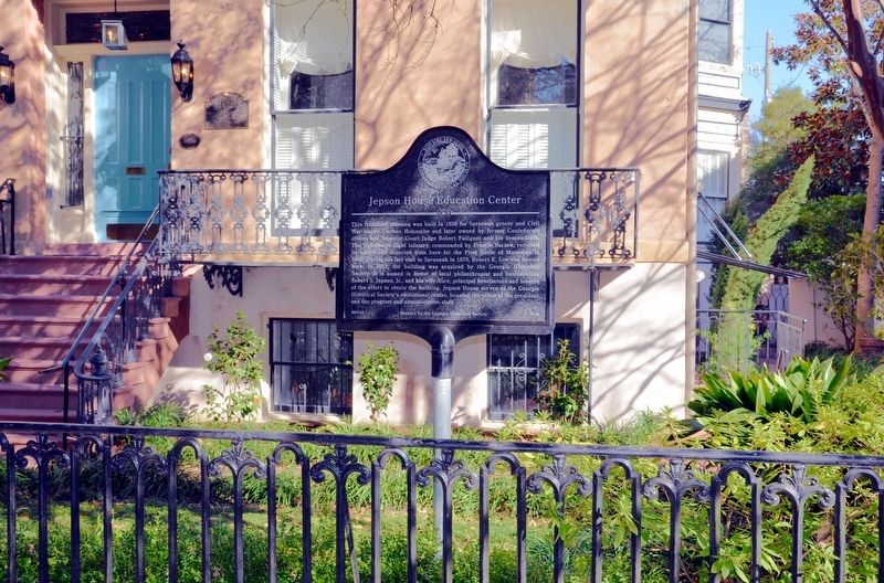
Jepson House Education Center Marker
| On West Gaston Street at Whitaker Street, on the right on West Gaston Street. |
| On Abercorn Street near Charlton Street, on the right when traveling south. |
| On East Gordon Street near Abercorn Street, on the right when traveling north. |
| On Bull Street, on the left when traveling south. |
| On West Bay Street (Georgia Route Conn 25) just east of Fell Street, on the right when traveling east. |
| On West 36th Street, on the right when traveling west. |
| On East Henry Street at Java Place, on the left when traveling west on East Henry Street. |
| On Florance St near W 35th St, on the right when traveling west. |
| On Washington Avenue, on the right. |
| On West 36th Street west of Martin Luther King Jr. Boulevard, on the left when traveling west. |
| On Drayton Street at East Bolton Street, on the right when traveling north on Drayton Street. |
| On West Bay Street (Georgia Route 25 Conn) at Jenks Street, on the right when traveling east on West Bay Street. |
| On Broad Street (Georgia Route 520) 0 miles east of Clarke Duncan Highway (Georgia Route 137), on the left when traveling east. |
| On East Marietta Street, 0 miles north of Elizabeth Street, on the right when traveling north. |
| On Martha Berry Highway (U.S. 27) 0.5 miles south of Hartford Road (Georgia Route 37), on the left when traveling south. |
| On Days Cross Road (County Route 2411) at Cottonhill Road, on the right when traveling east on Days Cross Road. |
| On Jefferson Street, 0 miles west of Jackson Street, on the right when traveling west. Reported missing. |
| On New Hope Church Road (County Route 129) 2.6 miles west of Georgia Route 39, on the right when traveling west. |
| On Floyd Road Southwest, 0.1 miles north of Maran Lane Southwest, on the right when traveling north. |
| On South Park Square NE east of West Park Square NE, on the left when traveling east. |
| Near West Atlanta Street SE, 0.2 miles north of Cemetery Street SE. |
| On Powder Springs Street SE (Georgia Route 360) at Hedges Street SE, on the right when traveling south on Powder Springs Street SE. |
| On Kennesaw Avenue NW, 0 miles north of Stewart Avenue, on the right when traveling north. |
| Near West Atlanta Street SE, 0.1 miles north of Cemetery Street SE. |
| On North Main Street (Business U.S. 319) just south of 1st Avenue Northwest, on the right when traveling south. |
| On 2nd Avenue Southeast at 1st Street Southeast (Business U.S. 319), on the right when traveling west on 2nd Avenue Southeast. |
| Near Scotts Ferry Road (U.S. 221) just north of Apple Lane, on the right when traveling north. |
| On Cobbham Road (State Road 150), on the right when traveling west. |
| On U.S. 280 at Gannon Road, on the left when traveling west on U.S. 280. |
| On Clay Pit Road, 0.1 miles south of Georgia Veterans Road, on the right when traveling south. |
| On Clay Pit Road, 0.1 miles south of Georgia Veterans Road, on the right when traveling south. |
| On South Church Street, 0.1 miles south of Miller Avenue, on the right when traveling south. |
| On Martin Luther King Jr. Drive at South Boulevard Drive, on the right when traveling west on Martin Luther King Jr. Drive. |
| On Martin Luther King Jr. Drive at Progress Street, on the right when traveling west on Martin Luther King Jr. Drive. |
| On Dothan Road (U.S. 84) at Cyrene Road, on the right when traveling west on Dothan Road. |
| On Peachtree Road (Georgia Route 141) at Lanier Drive, on the right when traveling south on Peachtree Road. |
| On Ponce de Leon Avenue (U.S. 78) near Oakdale Road NE, on the right when traveling west. |
| On "Ivy Street" drive on Marist Campus, 0.1 miles west of Ashford-Dunwoody Road, on the right when traveling west. |
| On West Trinity Place just west of Electric Avenue, on the right when traveling east. |
| On Covington Highway (U.S. 278) at Cove Lake Road, on the right when traveling east on Covington Highway. |
| Near John B Gordon Drive, 0.1 miles east of Jefferson Davis Drive, on the right when traveling east. |
| Near John B Gordon Drive, 0.1 miles east of Jefferson Davis Drive, on the right when traveling east. |
| On College Street (U.S. 23) at Harrell Avenue, on the right when traveling east on College Street. |
| On Cotton Street at 2nd Street, on the right when traveling west on Cotton Street. |
| On West 3rd Avenue near North Slappey Boulevard (Business U.S. 82), on the right when traveling west. |
| Near Pine Avenue just west of North Washington Street, on the left when traveling west. |
| On West Broad Avenue at North Washington Street, on the right when traveling west on West Broad Avenue. |
| Near North Jackson Street south of Flint Avenue, on the right when traveling south. |
| Near College Drive, 0.4 miles south of East Oglethorpe Boulevard (Business U.S. 82), on the right when traveling south. |
| On Columbia Hghway (Georgia Route 62) at Martin Road (County Route 25), on the right when traveling west on Columbia Hghway. |
| On Still Road (County Route 15) at Zion Church Road (County Route 7), on the right when traveling east on Still Road. |
| On Central Boulevard (Georgia Route 17) near Simmons Street, on the left when traveling north. |
| On Wallace Drive at Rawls Drive, on the right when traveling south on Wallace Drive. |
| On Roger Shaw Street at South Main Street (U.S. 1), on the left when traveling north on Roger Shaw Street. |
| On Old Chapel Lane, 0 miles east of West Lanier Avenue (Georgia Route 54), on the right when traveling east. |
| On West Lanier Avenue west of Glynn Street N, on the left when traveling west. |
| On Holly Grove Church Road, 0.2 miles east of Robinson Road, on the right when traveling east. |
| Near Everett Springs Road, 0.1 miles north of Floyd Springs Road. |
| On Broad Street at Love Street, on the right when traveling south on Broad Street. |
| On School Circle at Alabama Street, on the right when traveling north on School Circle. |
| On Berry College Entrance Road, 0.1 miles west of Martha Berry Highway (U.S. 27), on the right when traveling west. |
| On Water Wheel Road, on the right when traveling north. |
| On Broad Street west of Riverside Parkway Northeast, on the right when traveling west. |
| On Veterans Memorial Parkway NE (Loop Georgia Route 1) at Martha Berry Highway (U.S. 27) on Veterans Memorial Parkway NE. |
| Near Veterans Memorial Parkway NE (Loop Georgia Route 1) at Martha Berry Highway (U.S. 27). |
| On School Street west of Pilgrim Mill Road, on the left when traveling east. |
| On Spring Street, 0 miles south of West Main Street (U.S. 29), on the right when traveling south. |
| On Providence Church Road (Georgia Route 77) at Shoal Creek Road, on the right when traveling south on Providence Church Road. |
| On Georgia Route 106 at Red Hill School Road, on the left when traveling west on State Route 106. |
| On 15th Street just west of Piedmont Road, on the left when traveling east. |
| On Atlanta Student Movement Boulevard at Chestnut Street NW, on the right when traveling west on Atlanta Student Movement Boulevard. |
| On Atlanta Student Movement Boulevard at Chestnut Street NW, on the right when traveling west on Atlanta Student Movement Boulevard. |
| On Atlanta Student Movement Boulevard at Chestnut Street NW, on the right when traveling west on Atlanta Student Movement Boulevard. |
| On Atlanta Student Movement Boulevard at Chestnut Street NW, on the right when traveling west on Atlanta Student Movement Boulevard. |
| On Centennial Olympic Park Drive at Marietta Street, on the right when traveling south on Centennial Olympic Park Drive. |
| Near Chastain Park Avenue Northwest, 0.1 miles east of Elliott Galloway Way, on the left when traveling east. |
| On Campbellton Road (Georgia Route 166) at Union Road SW, on the right when traveling east on Campbellton Road. |
| On Cherry Street, 0.1 miles west of North Avenue. |
| On North Avenue Northwest at Techwood Drive Northwest, on the right when traveling west on North Avenue Northwest. Reported missing. |
| On Auburn Avenue NE at Jesse Hill Jr. Drive NE, on the right when traveling west on Auburn Avenue NE. |
| On Courtland Street NE at Baker Street NE, on the right when traveling south on Courtland Street NE. |
| On Peachtree Place NE, 0 miles west of Crescent Avenue NE, on the right when traveling east. |
| On Auburn Avenue NE at Howell Street NE, on the right when traveling east on Auburn Avenue NE. |
| On Auburn Avenue NE at Howell Street NE, on the right when traveling east on Auburn Avenue NE. |
| On Courtland Street NE at John Wesley Dobbs Avenue NE, on the right when traveling north on Courtland Street NE. |
| On Auburn Avenue NE at Hilliard Street NE, on the right when traveling east on Auburn Avenue NE. |
| On Auburn Avenue NE at Hilliard Street NE, on the right when traveling east on Auburn Avenue NE. |
| On Auburn Avenue NE at Hilliard Street NE, on the right when traveling east on Auburn Avenue NE. Reported missing. |
| On William Holmes Borders Sr. Drive at Gartrell Street, on the left when traveling north on William Holmes Borders Sr. Drive. |
| On University Place NW at Walnut Street NW, on the left when traveling east on University Place NW. |
| On Harris Street south of Jefferson Avenue, on the right when traveling south. |
| On Summit Road, 0.3 miles east of Freemanville Road, on the right when traveling east. |
| On Mimosa Boulevard at Pratt Street, on the right when traveling south on Mimosa Boulevard. |
| On Sloan Street at Mill Street, on the right when traveling east on Sloan Street. |
| On Georgia Route 52 at Entrance drive to Oakland Elementary School, on the right when traveling east on State Route 52. |
454 entries matched your criteria. Entries 101 through 200 are listed above.
⊲ Previous 100 —
Next 100 ⊳