In 1863 Charles C. Rich with others explored this valley. A group of settlers in eleven wagons traveled through Emigration Canyon in September and founded Paris. Log huts with dirt floors and roofs sheltered 48 men, 40 women, and 30 children during . . . — — Map (db m140162) HM
The pictures below reflect first views of the downtown entering Montpelier from the west in different times in history.
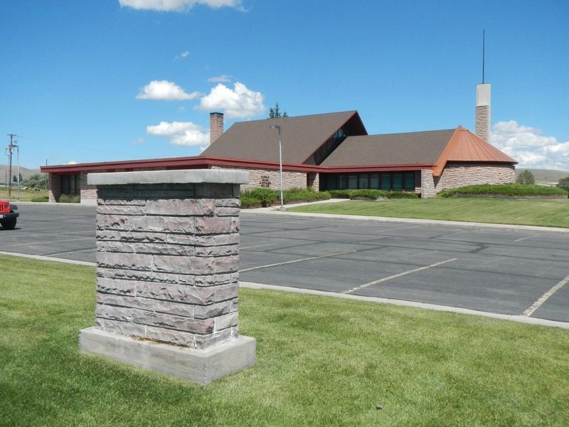
Brennan-Davis Building
The building was built for Edward Burgoyne by Jacob Tueller and Sons prior to 1899. The . . . — — Map (db m90920) HM
Strong Building and Stock Chevrolet
This red brick building, note the brickwork circles, was built for Lish Strong by the Tueller brothers of Paris, Idaho. It became known as the Strong Building. Part of the upper level was also used for . . . — — Map (db m90911) HM
On Aug. 13, 1896, Butch Cassidy and his infamous Wild Bunch of gunmen invaded Montpelier's bank and scooped up more than $16,500 in gold, silver and currency.
Leaving a surprised cashier and his terrified customers, they calmly rode away. A . . . — — Map (db m90806) HM
To load their wagons with salt from the salt springs on Crow Creek, Mormon settlers of Bear Lake Valley followed the Native American Indian trail over this pass about 1865.
In 1868, The Church of Jesus Christ of Latter-day Saints Apostle Charles C . . . — — Map (db m105896) HM
"... the greatest impediment on the whole route from the United States to Fort Hall." - Theodore Talbot, 1843
Near the Wyoming/Idaho border the pioneers face Big Hill, on of the most challenging obstacles of their journey. The dusty . . . — — Map (db m90854) HM
On their way west to Oregon and California, emigrant wagons often crossed high ridges in order to avoid gullies and canyons.
When he came here in 1843, Theodore Talbot noted that he "had to cross a very high hill, which is said to be the . . . — — Map (db m90807) HM
"the steepest and longest ascent we have made on the route..." - James Wilkins
Looking east across the fields is Big Hill, one of the most difficult obstacles along the 2,000-mile Oregon/California Trail. The trail crosses the Thomas . . . — — Map (db m90851) HM
On the hot afternoon of August 23, 1896, Butch Cassidy with two members of his Wild Bunch Gang, Elza Lay and Bob Meeks, robbed The Bank of Montpelier which was originally located in the building across the street from this sign.
The Bank of . . . — — Map (db m90877) HM
Within five years after Apostle Charles C Rich was called to establish a settlement in Bear Lake Valley, 1868, he looked at western Wyoming as a possible expansion of the Mormon community. By 1879 the Bear Lake Stake of the Church of Jesus Christ of . . . — — Map (db m105895) HM
Schmid Building
Carl (Charles) Schmid, a tailor from Freienstein, Switzerland opened a tailor shop in Montpelier in 1892. He named his business Chas Schmid, The Tailor. He made men's suits and coats and did repairs, alterations and dry . . . — — Map (db m90910) HM
Welcome to the Historic Downtown Montpelier Business District on Washington Street!
Take a few minutes to enjoy a walking tour filled with interesting information about this area and its place in history. Also, spend a few minutes visiting . . . — — Map (db m90878) HM
The Crow Creek Road was the link between the Mormon settlements of Bear Lake and Star Valley for 50 years. The 100-mile round trip between Afton, WY and the railhead at Montpelier ID would take a team of horses from 3 to 7 days depending on the . . . — — Map (db m105897) HM
Beginning in Independence, Missouri, the Oregon/California Trail passes through present-day Missouri, Kansas, Wyoming, and Idaho. it ends in Oregon, California or Utah - depending on the destination of the pioneers.
While the . . . — — Map (db m90876) HM
Westward-bound emigrants entered Idaho after crossing Thomas Fork Valley. They soon encountered the climb and descent of Big Hill, witnessed nature's curiosities at Soda Springs, and discovered willing traders at Fort Hall.
In 1843 wagons first . . . — — Map (db m90852) HM
Coming west with Ezra Meeker in 1852, Thomas McAuley decided to build a road to let emigrants bypass Big Hill.
Worst of all Oregon Trail descents, Big Hill needed replacement. Eliza McAuley reported that her brother Tom "fished awhile, . . . — — Map (db m90808) HM
Early sheriff and mayor Fred Cruikshank owned the first Model T Ford Agency in 1909.
Bear Lake Motors
Early sheriff and mayor Fred Locke Cruikshank was the owner of the first Model T Ford Agency in 1909 and closed it down in . . . — — Map (db m90908) HM
This building presently occupied by the News Examiner was built early in the 1900's by the Whitman family. It was used as a dry goods store until it was sold to the Robinsons in 1942 for use as a newspaper building.
Among the features of the . . . — — Map (db m90922) HM
“I have always felt I was at a disadvantage in making a living for my self and family if I did not have a wagon and team.” – John Nield Diary
John and Sarah Broadbent Nield moved their family to Star Valley in 1888 over the . . . — — Map (db m105901) HM
In 1895 the Church of Jesus Christ of Latter-Day Saints built this sandstone structure, consisting of three rooms and a basement, to serve the community as a tithing office. When the Montpelier First Ward was divided in 1916, meetings of the new . . . — — Map (db m140216) HM
"One continual stream of honest looking open harted people going west" - James Cayman, mountain man, captured this sentiment in his diary as he watched pioneers heading west in 1846.
Between 1841 and 1869 nearly 300,000 farmers, . . . — — Map (db m90853) HM
In the spring of 1864, fifteen families of pioneers came from Paris, Idaho and settled Clover Creek, the name used until President Brigham Young changed it to Montpelier. After building crude homes the settlers erected a large building of logs, . . . — — Map (db m105874) HM
Early Montpelier was well known for its pine trees placed down the center of Washington Street. As U.S. Highway 89 became more popular to the traveling public, the trees were finally cut down amid much discussion throughout the town.
Rich . . . — — Map (db m90907) HM
The streetscape of Montpelier has changed through the years. The early years of this Oregon Trail town began with only horse power including wagons and horseback. Streets were packed dirt with hitching posts. With the advent of the horseless . . . — — Map (db m90880) HM
Grove C. Gray built a brick building in 1907 to house the second bank of Montpelier. On June 25, 1910, two men attempted to rob this bank by dynamiting the vault. While attempting to dynamite the vault, they jostled a loaded pistol that was on top . . . — — Map (db m90909) HM
In 1848, Pegleg Smith established a trading post on the Oregon Trail at Big Timber somewhere near here on the river.
Some travelers called it "Fort Smith", though it had only four log cabins and some Indian lodges. Packing a plow and tools . . . — — Map (db m90805) HM
By 1881, just five years following the opening of the Crow Creek Freight Road, freighters had started calling this canyon by that name. Snowslides were frequent on snowy, windy days as drifts would build up on the shale ridge. Unable to hold the . . . — — Map (db m105894) HM
Bank of Montpelier's Impact on Local Banking History
Residents of Bear Lake county have discussed the Butch Cassidy bank robbery for years with varied endings. Not unlike fishermen's boastings, tales of the exact amount of Butch's loot will . . . — — Map (db m90879) HM
On April 7, 1852, seventeen-year-old Eliza Ann McAuley, with her older brother Thomas and sister Margaret, left Mount Pleasant, Iowa, to travel overland to California. For a time they were accompanied by the "Eddyville Company," led by William Buck . . . — — Map (db m90850) HM
A bad ford gave trouble to wagon trains crossing this stream on the trail to California and Oregon in 1849.
In that year, gold-seeking 49'ers developed a shortcut that crossed here. Then emigrants built two bridges here in 1850. But an . . . — — Map (db m90804) HM
Clinging to the white shale formation a mile east (on the Crow Creek Rd.) is the White Dugway. There was moisture in the shale and when frost had it in its grip the road was very slippery. Freighters learned to be cautious as a wagon or sleigh could . . . — — Map (db m105899) HM
Past travel and settlement across the rugged lands of the Bear Lake Valley were strongly influenced by the valley's hydrologic features. The shifting rivers, sloughs, and marshes presented natural barriers and were prone to flooding. This often . . . — — Map (db m140215) HM
The region comprising Bear Lake County has alway been an important juncture for overland travel. From the 1800s onward, migrants on the Oregon and California trails traversed the area, relying on knowledge garnered by Native Americans, early . . . — — Map (db m140213) HM
Settled in 1864, the community of Ovid was among the first permanent settlements in the Bear Lake Valley. Its first residents were predominantly Scandinavian immigrants, and the first home was a dugout cabin constructed by Thomas C. Peterson. Over . . . — — Map (db m140214) HM
In honor of
Charles Coulson Rich
1809-1893
Pioneer builder of the west.
Major-General of the Nauvoo Legion
Alderman of the City of Nauvoo, in the time of Joseph Smith.
Pioneer of Utah, 1847.
Chairman of the first committee . . . — — Map (db m105849) HM
Paris, Idaho was settled in the fall of 1863. Two years later a building used for church, school and recreation was erected by James Nye and others, of logs hauled from George Sirrine's sawmill It was 20' X 60' with two large rooms and a stage at . . . — — Map (db m105873) HM
This pioneer Idaho town was founded Sept. 26, 1863 when a wagon train brought more than 30 families of Mormon colonizers.
More pioneers soon followed, some living in huts of quaking aspen and others building log cabins for the mild first . . . — — Map (db m105836) HM
Designed by one of Brigham Young's sons, this imposing Romanesque tabernacle was built between 1884 an 1889 by skilled local craftsmen.
Swiss stone masons cut and carved red sandstone that horse and ox teams hauled from a canyon 18 miles . . . — — Map (db m105848) HM
The Thomas Sleight Cabin was built in the fall of 1863 by Thomas Sleight and Charles Atkins, who with their wives, Marianne and Ann, occupied it together during the first winter of the settlement of Paris, Idaho.
It was first finished with . . . — — Map (db m105866) HM
Erected in Honor of
Gutzon Borglum
Born in the village of St. Charles
Idaho, March 25, 1867
He is internationally known for
his painting and sculptoring
and most famous for Mount
Rushmore National Monument
Gutzon . . . — — Map (db m105878) HM
In May, 1864 Brigham Young called Swan Arnell, Sr., Charles G. Keetch, Sr., Robert Pope, and Johh Windley with their families to settle here. Soon others followed. Charles Windley was the first child born in the village. The town site was surveyed . . . — — Map (db m105869) HM
When their annual Montana plains buffalo hunt proved futile in 1876, North Idaho's Coeur d' Alene Indians needed to move from Cataldo to a better farming area.
So in 1877 their Jesuit mission was relocated here. After their community grew . . . — — Map (db m122035) HM
... was a man who had many gifts to share. Perhaps the largest gift he ever bestowed was this state park; 4,400 acres of which he donated in 1955, in memory of his mother Mary Minerva McCroskey. Virgil was anything but a selfish man. He received . . . — — Map (db m122032) HM
If these walls could talk, many interesting stories would be told. Using materials from the surrounding area, James (Jerry) G. Marsh constructed this log building in 1933 & 1934, and it was the first tavern in Benewah County to have a beer license. . . . — — Map (db m122022) HM
Dedicated in memory of pioneer women, Mary Minerva McCroskey State Park has a forested skyline drive that offers spectacular views of forest, farms, and distant mountains.
Virgil T. McCroskey devoted his life to preserving trees and . . . — — Map (db m122036) HM
The Coeur d’Alene people are the earliest inhabitants of this area.
The natural wealth of the forests, rivers, and lakes sustained their existence for countless generations on five million acres of ancestral land.
Their lifestyle was . . . — — Map (db m110383) HM
T"nt"nmi, was one of the last Coeur d'Alenes to leave permanent residence along the lake, after tribal members were assigned farm homes under the Allotment Act.
At Hnpetptqwe’n, he hosted regular gatherings and celebrations, where guests . . . — — Map (db m110411) HM
John Mullan was the Army officer who in 1859-1862 surveyed and built the Mullan Road
from Walla Walla, Washington to Fort Benton, Montana.
The road was to connect the Missouri and the Columbia, and Congress approved in 1855.
Indian . . . — — Map (db m110031) HM
Capt. John Mullan U.S. Army
Capt. John Mullan, US Army, Constructor and surveyor.
He was directed to mark a wagon and railroad route from Fort Benton, Montana to Walla Walla, Washington from 1853-1855.
He built the actual road . . . — — Map (db m110000) HM
Loggers used the splash dam system in the Marble Creek basin between 1915 and 1931.
In 1923, Rutledge Lumber Company spent $16,352.25 building the dam depicted in this mural.
Splash dams stored enough water to “flush” logs down . . . — — Map (db m109997) HM
“A locomotive without wheels…”
The Willamette donkeys were fueled by wood or oil, which generated steam to turn drums that were spooled with cable.
Cables of 8,000 to 12,000 feet length were common.
Because of the long . . . — — Map (db m109998) HM
It served as a Men's Club until 1906 then as a home and treatment center for "Doc" Thompson into the 1920's. Purchased & restored by Raleigh Hughes after 1926. Purchased by the Centennial Committee in 1989.
— — Map (db m122625) HM
Before the construction of the Post Falls Dam in 1906 the water level of the lake was lower from what you see now. In those days there were Coeur d'Alene camps near here at Ch'mi'wes, the land between Round and Benewah or Chatcolet Lakes. Plentiful . . . — — Map (db m122619) HM
Established November 4, 1842, by Father Nicolas Point, S.J.
Eagerly sought by the Coeur d'Alene Indians, the Black Robed missionaries supervised the building of a log cabin, and in the spring, began to teach "the mysteries of plowing and . . . — — Map (db m122109) HM
St. Maries, named by Jesuit Father Pierre DeSmet during the 1840s, sits at the confluence of the "Shadowy" St. Joe and St. Maries rivers. It was recognized as a settlement in the 1880s. Incorporated as a village in 1902, and as a city in 1913, it . . . — — Map (db m122624) HM
Ranger Edward Pulaski and his crew of over 40 men took refuge from the fire on August 30 in the War Eagle mine tunnel on Placer Creek.
All survived except for five men and two horses. — — Map (db m122620) HM
Designed to connect the Missouri and the Columbia, this military wagon road was constructed past here in 1859.
Swamps in the St. Joe valley has to be corduroyed with logs, and 70 men spent a week digging out sidehills south of here and . . . — — Map (db m122114) HM
During W.W. I, St. Maries was a hotbed of International Workers of America (I.W.W.) unionizing activities. In December 1917, Sheriff E. Noland raided their headquarters near here and arrested secretary William Nelson for advocating sabotage. . . . — — Map (db m122104) HM
The Saint Maries River Valley was said to have the largest single stand of white pine in the world. Homesteaders and lumberjacks flocked here by wagon road and boats to take advantage of vast stands of western white pine, fir, tamarack and cedar. . . . — — Map (db m122621) HM
In 1879 the U.&N. Railroad Co. named their water stop, Basalt. Henry R. Whitmill settled in Cedar Point in 1884. Andrew O. Inglestrom filed on land, 1885. Others followed, built canal, homes, L.D.S. church house, cheese factory, two stores, saloon, . . . — — Map (db m231263) HM
Big Butte
Towering 2500 feet high, two over lapping rock domes form a 300,000 year-old butte that dominates this lava plain.
After a hot flow of molten rhyolite (acidic rock) boiled up through older lava, a second rhyolite dome pushed up a . . . — — Map (db m103820) HM
A log structure was erected one half mile north of this site in 1864, which served as a stage station. The Ben Holliday stages use it as a stopping place as did the freighters who passed this way. Mail was unofficially handled here for more than a . . . — — Map (db m124480) HM
Molten rock, forced upward for 30 to 50 miles through fissures in the earth, has cooled into the hard lava found here.
Continued pressure from below has made great cracks in the contorted surface. This lava solidified only a few thousand . . . — — Map (db m108346) HM
Three Buttes
Rising above this level plain of lava flows and windblown soils these high landmarks are recent additions to Idaho’s landscape.
East Butte (farthest east) flowed up and cooled quickly about 600,000 years ago, while Big Southern . . . — — Map (db m103818) HM
has been designated a
Registered National
Historic Landmark
under the provisions of the historic sites act of August 21, 1935. This site possesses exceptional value in commemorating and illustrating the history of the United States . . . — — Map (db m108309) HM
First habitation in this region was built by Nathaniel J. Wyeth on Snake River 14 miles west of this monument July 15, 1834 and named for Henry Hall, senior member of Wyeth's firm.
The original stockade, 80 feet square was purchased by Hudson's . . . — — Map (db m124481) HM
This area was crossed by many trails used by the ancestors of the Shoshone and Bannock people. Some trails connected hunting and gathering grounds; others marked traditional ceremonial lands of the various Shoshone and Bannock bands. Among the . . . — — Map (db m108542) HM
(Three panels are mounted in a kiosk located near the Fort Hall Indian Reservation Museum)Panel 1:
Shoshone and Bannock Tribes
Before settlers came to this region, Shoshone and Bannock tribal members moved with . . . — — Map (db m108545) HM
The Shoshone-Bannock Tribes Dedicate This Memorial in Honor of the Men and Women Who Served Their Country in the Armed Forces of World Wars I and II
World War I Volunteers
Andrew F. Cutler • Joseph S. Cutler • Richard M. Creasey • . . . — — Map (db m124482) WM
The Fort Bridger Treaty of 1868 is among the most important documents created between the U.S. government and the Shoshone-Bannock Tribes. In addition to affirming the establishment of the Fort Hall Reservation, the Fort Bridger Treaty reserved the . . . — — Map (db m108541) HM
The south part of this area, known as Presto, was settled in 1870 by the Burrell, Just and Shoemaker families. In 1883 the Pritchett family came to Cedar Hollow. Later the Goshen, and the Christensen Monson, Hansen, Jensen, Teeples, Stoddard . . . — — Map (db m140400) HM
Moreland, Bingham County, Idaho, was carved out of flat, sagebrush-covered land inhabited by snakes and jackrabbits. It received its name from a remark made by an apostle of the Church of Jesus Christ of Latter-day Saints While visiting the area he . . . — — Map (db m140398) HM
"Teachers affect eternity: they can never tell where their influence stops."
The Alridge School was originally located on Cedar Creek off the Blackfoot River Road and was relocated in September of 1999.
The schoolhouse was donated to Bingham . . . — — Map (db m140453) HM
General Stores have been in wide use since the late 1860's. Some of the first General Stores were created in Paris, France as a means of attracting more business. The settling of the Wild West was a contributor to the growing number of General . . . — — Map (db m140455) HM
Before the close of 1885 the families of James Mitchell, A.T. Lawrence, Darius Allen, Joshua Adams, Felix, Heber, Frank and Ann Husband, Albert Christiansen and N.G. Mickelson settled here. Soon other followed. These settlers were organized into a . . . — — Map (db m140402) HM
Barns are a testament to our rural foundations. They are perhaps one of the greatest monuments of an almost forgotten way of life. These rustic buildings represent a time when people led a simpler, more provincial lifestyle.
The Barn was . . . — — Map (db m140452) HM
Water from deep snow that falls on high mountain ridges north of here is stored each Spring in this reservoir to irrigate farm land near Shoshone and Richfield.
Big Wood River flows past some hills that separate this valley from a broad plain . . . — — Map (db m110116) HM
(Five panels in the kiosk deal with the history of Goodale's Cutoff and the surrounding area)
Idaho's Emigrant Trails
Westward-bound emigrants entered Idaho after crossing Thomas Fork Valley. They soon encountered the climb . . . — — Map (db m110138) HM
Rich strikes in 1879 led to a rush in the lead and silver mines of this valley. The famous Minnie Moore Mine alone produced a total of $8.4 million worth of ore.
Mining quickly brought a railroad and prosperity. The Ketchum smelter pioneered . . . — — Map (db m110115) HM
An old emigrant road headed west across Camas Prairie and then descended to the valley below on its way to rejoin the Oregon Trail 28 miles west of here.
This route, discovered by Donald Mackenzie's fur trade party in 1820, came into use for . . . — — Map (db m125602) HM
As the pioneers passed through this parched landscape they were happy to find any available water.
Most water is soaked up like a giant sponge when it reaches the lava fields, but here, small creeks to the north cover the porous lava rock with a . . . — — Map (db m109897) HM
The original building on this site, called the Bullion Block, was constructed in 1882. It was at this time that Hailey became the county seat of Alturas County after a bitterly fought election with Bellevue, and the existing county seat, Rocky Bar. . . . — — Map (db m110109) HM
J.C. Fox, the original owner of the building and one of Hailey's founders, had it erected in 1920 after operating a general store three doors up the street for almost forty years. He served as mayor for two years and was vice-president of the Hailey . . . — — Map (db m110113) HM
The J.J. Tracy Building was built as a drug store in 1906 by John J. Tracy. Already a pharmacist at the age of twenty-two, Tracy migrated to the West, spending three months in Kelton, Utah where he met William T. Riley, an entrepreneur and early . . . — — Map (db m110111) HM
In 1934, Julio Astoriquia and his wife Maria Astoriquia invested their hard-saved money to buy two lots on Main Street in Hailey for construction of a hotel. Julio emigrated from the Basque region of Spain to the United States in 1913. He worked as . . . — — Map (db m110114) HM
The Watt Building is connected in local memory with W.H. Watt, who had the building erected as a bank. An 1889 fire that demolished the business district of Hailey left few buildings still standing. The rear portion of the building, which may date . . . — — Map (db m110108) HM
Searching the mountain wilderness for beaver, Alexander Ross came up Wood River and discovered this summit, Sept. 18, 1824.
Leading a large brigade of Hudson's Bay Company trappers, he wondered whether he ever could get through unknown . . . — — Map (db m110051) HM
After Warren P. Callahan located a rich lead-silver mine here, April 26, 1876, thousands of eager treasure-hunters joined in a rush to Wood River in 1880
Successful prosectors discovered valuable lodes from here to Bellevue. Galena has a . . . — — Map (db m110052) HM
Pioneering explorer Alexander Ross visited the valley in search of beaver in 1821. The Hudson's Bay Company reported the area as "promising." Ketchum's short mining era began in 1879, after the Sheepeater War and the relocation of the Native . . . — — Map (db m110105) HM
Rising as a small stream in the valley to the south, the Salmon winds 420 miles across Idaho before flowing into Snake River.
Discovered in 1895 by Lewis and Clark, and explored with great difficulty by fur traders and prospectors, the . . . — — Map (db m110050) HM
Gold discoveries on Beaver Creek in 1879 led to mining activity near here that summer, but major production was delayed until 1886.
By 1885, Sawtooth City had three saloons, two restaurants, a meat market, a store, a Chinese laundry, and . . . — — Map (db m110045) HM
When Sun Valley Lodge was built in 1936, Union Pacific engineers developed chair lifts to transport skiers uphill.
Starting with two modest ski slopes on Dollar Mountain and Proctor Mountain, chair lifts were used for all Sun Valley ski . . . — — Map (db m110054) HM
The First Congregational Church of Ketchum, Idaho was built in 1884 during expansion of the Church across America. By the late 1840's, Christian abolitionists gained strength in the struggle against slavery. Unwilling to remain in the union of . . . — — Map (db m110106) HM
Horace Lewis began the "Ketchum Fast Freight Line" soon after the town was founded on August 2, 1880. The first load of ore was carried from the Elkhorn mine to the railroad at Kelton, Utah. These monstrous wagons with six-foot wheels known as "The . . . — — Map (db m110104) HM
Levi Smiley found gold on Smiley Creek in 1878, and E.M. Wilson discovered a still richer lode 8 miles above here near Vienna, on June 4, 1879.
Before shutting down in 1886, Vienna was a thriving mining camp with a $200,000 twenty-stamp . . . — — Map (db m110048) HM
The Payette River is named for Francois Payette, a French-Canadian trapper and early explorer of the major tributaries of the Snake River. At that time, British, Canadian, and American fur companies competed for the region's abundant natural . . . — — Map (db m119236) HM
1109 entries matched your criteria. Entries 101 through 200 are listed above. ⊲ Previous 100 — Next 100 ⊳