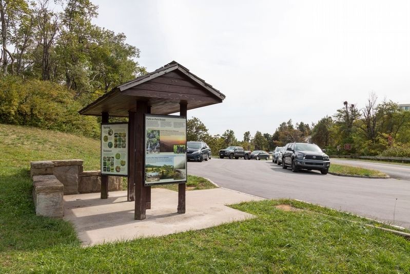
On Appalachian National Scenic Trail 0.1 miles north of Rockfish Gap Turnpike (U.S. 250), on the right when traveling north.
Shortly after Congress authorized the creation of two new eastern national parks—Shenandoah and Great Smokey Mountains—President Franklin Roosevelt saw great opportunity in constructing the first "national rural parkway" to connect the new parks. . . . — — Map (db m170604) HM
Near Three Notched Mountain Highway (U.S. 250) 0.8 miles north of Interstate 64, on the left when traveling west.
During Restoration of the Blue Ridge Tunnel, measures were taken to minimize disturbance of wildlife. With removal of bulkheads from the center, the passage can now provide additional, ideal wintering habitat for bats and year-round habitats for . . . — — Map (db m255039) HM
Near Three Notched Mountain Highway (U.S. 250) 0.8 miles north of Interstate 64, on the left when traveling west.
Census records and other documents prove that hundreds of the Irish immigrants who worked on the Blue Ridge Railroad resided in Augusta county. Many rented houses or built shanties that lined both sides of the Rockfish Gap Turnpike. From the bottom . . . — — Map (db m196501) HM
On MIddle River Road (County Route 736) north of Union Church Road (County Route 732), on the left when traveling north.
George Moffett (1735–1811), a prominent regional military and civic leader, had joined the Augusta County militia by 1758. He participated in the French and Indian War (1756–1763), led a militia company at the Battle of Point Pleasant in . . . — — Map (db m30460) HM
On Churchville Avenue (U.S. 250) just west of Buffalo Gap Highway (State Route 42), on the left when traveling west.
Born near Churchville on 25 Feb. 1843, Hanger joined the Churchville Cavalry at Phillipi, W.Va., on 2 June 1861, where the next morning he was wounded. The resulting amputation of his leg was probably the first of the Civil War. He convalesced at . . . — — Map (db m255040) HM
On Churchville Road (U.S. 250) just west of Eagle Rock Lane (County Route 721), on the left when traveling west.
Near this spot in 1764, Shawnee Indians killed John Tremble (Trimble) in the last such event in Augusta County. During the preceding decade, a series of conflicts between Native Americans and European settlers occurred along the western frontier of . . . — — Map (db m30461) HM
On Middle River Road (County Route 736) north of Union Church Road, on the left when traveling north.
Mount Pleasant, a venerable stone dwelling exemplifying traditional Shenandoah Valley domestic architecture, was erected on the 1740 land grant to John Moffett from King George II. Originally known as Moffetts Bottom, early probate records reflect a . . . — — Map (db m30448) HM
On East Side Highway (U.S. 340), on the left when traveling north.
Five miles east, formerly known as Woods’ Gap. Michael Woods, his three sons and three Wallace sons-in-law (Andrew, Peter, William), coming from Pennsylvania via Shenandoah Valley, crossed through this pass into Albemarle County in 1734 – . . . — — Map (db m16644) HM
On Tinkling Spring Road (County Route 805), on the right when traveling north.
This was first the Southern Branch of the “Triple Forks of Shenandoah” Congregation, which called John Craig as pastor in 1741. A church was completed here about 1748; two other buildings have succeeded it. Beginning with 1777, James Waddel, the . . . — — Map (db m122178) HM
On John Lewis Road north of Woodrow Wilson Avenue, on the right when traveling north.
Groundbreaking for the Woodrow Wilson General Hospital was June 26, 1942. The hospital was named after Woodrow Wilson, the 28th president of the United States and a native of the neighboring city of Staunton. The federal government acquired 652 . . . — — Map (db m106827) HM WM
On Hornet Road north of Woodrow Wilson Avenue, on the left when traveling north.
The U.S. Army, needing stateside medical facilities during World War II, broke ground for Woodrow Wilson General Hospital here in June 1942. Named for the former U.S. president born in nearby Staunton, the hospital consisted of about 135 . . . — — Map (db m106826) HM
On Jefferson Highway (U.S. 250) at Woodrow Wilson Avenue (Virginia Route 358), on the left when traveling east on Jefferson Highway.
In 1947 the Woodrow Wilson Rehabilitation Center became the first
state comprehensive rehabilitation
center in the United States. Operated
by the Virginia Department of
Rehabilitative Services, this residential facility offers various . . . — — Map (db m50617) HM
On Lee Highway (U.S. 11) south of Fort Defiance Road (County Route 616), on the right when traveling south.
Soon after the Civil War ended in 1865, Confederate veteran Charles S. Roller began teaching at the Old Stone Church nearby at Ft. Defiance. By 1874 he had founded Augusta Male Academy and incorporated military discipline into its classical . . . — — Map (db m11900) HM
Near Lee Highway (U.S. 11) at Pentecost Lane, on the left when traveling north.
In 1865, after returning from the Civil War, Professor Charles S. Roller began educating other returning veterans of the Confederacy in a small house near the old stone church. In 1874, Augusta Male Academy was founded in the current museum . . . — — Map (db m162829) HM
On Old Stone Church Lane just west of Lee Highway (U.S. 11), on the right when traveling south.
This, the oldest Presbyterian house of worship in Virginia, is an eloquent memorial to the liberty-loving, god-fearing Scotch-Irish folk who first settled this part of the valley.
Through their arduous labors the building was completed in 1747 . . . — — Map (db m89111) HM
On Lee Highway (U.S. 11) just south of County Route 616, on the right when traveling south.
The Augusta Stone Church, Virginia's oldest Presbyterian church in continuous use west of the Blue Ridge Mountains, opened on 22 Jan. 1749. It replaced a log meetinghouse built shortly after the congregation's founding in 1740. At the outbreak of . . . — — Map (db m155473) HM
Near Lee Highway (U.S. 11) north of Willow Spout Road (County Route 742), on the left when traveling north.
In Commemoration
of the visit of
The President of the
United States,
Dwight D. Eisenhower,
to the
Augusta Military Academy
October 27, 1960 — — Map (db m162833) HM
Near Lee Highway (U.S. 11) north of Willow Spout Road (Virginia Route 742), on the left when traveling north.
Dedicated to
Julian Quarles, '35
for his service to his
country, his commitment
to AMA and honoring the
75th anniversary of his
graduation from AMA. — — Map (db m162830) HM
On Lee Highway (U.S. 11) just south of County Route 616, on the left when traveling south.
John Craig, born in County Antrim, Ireland, and educated in Edinburgh, Scotland, immigrated to America in 1734. Ordained pastor in 1740 of the two churches known as Augusta Stone and Tinkling Spring, Craig was Virginia's first settled Presbyterian . . . — — Map (db m155472) HM
Near Lee Highway (U.S. 11) north of Willow Spout Road (Virginia Route 742), on the left when traveling north.
This 1886 bell was
the school bell for many
years. It was said the
bell could be heard
3 miles away. It was
housed in the bell tower
of the Roller-Robinson
House, now the AMA
Alumni House and
Museum. It was donated
by Sam Clegg, '60 — — Map (db m162831) HM
On Battlefield Road (Virginia Route 608) 0.4 miles south of Piedmont Road, on the right when traveling south.
(front)
Brigadier General William E. "Grumble" Jones
Confederate Army of the Valley District
Battle of Piedmont
Just north of here on this field on the afternoon of June 5, 1864, Brig. Gen. William E. "Grumble” Jones fell . . . — — Map (db m267954) HM WM
On Grand Cavern Road 0.2 miles west of South River Road, on the left when traveling west.
In memory of these Augusta County families and land owners displaced to form Shenandoah National Park
Alexander •
Archer •
Barnhart •
Beard •
Berry •
Black Rock Springs Co •
Bruce •
Claytor •
Cline •
Craig • . . . — — Map (db m308016) HM
On Grand Cavern Road 0.2 miles west of South River Road, on the right when traveling west.
Up the hill to your left is the entrance to Grand Caverns, known as Weyers Cave during the Civil War. Discovered in 1804, it soon became a tourist attraction. During the Shenandoah Valley campaigns of 1862 and 1864, numerous Union and Confederate . . . — — Map (db m308014) HM
On Circle Lane (County Route 668) at Weyers Cave Road ( Route 254), on the right when traveling north on Circle Lane.
George Caleb Bingham, a renowned American genre painter of the 19th century, was born in a frame house just north of here on 20 March 1811. Bingham moved to Missouri in 1819, where he began painting portraits in the 1830s and later specialized in . . . — — Map (db m13620) HM
On Grand Cavern Road west of South River Road, on the left when traveling west.
The Creation of Shenandoah National Park
This stone chimney was placed here to honor the people of the Blue Ridge Mountains who lost their homes, land and livelihood when Shenandoah National Park was formed in the 1930s. The memorial . . . — — Map (db m308045) HM
On Battlefield Road north of Patterson Mill Road, on the right when traveling south.
"The Battle is scarcely more than mentioned... yet the regiments engaged suffered as terribly and fought as bravely as any equal body of troops in any battle of the war..." - Union Lt. Col. Thomas E. Wildes 116th Ohio Infantry . . . — — Map (db m290354) HM
On Eastside Highway (U.S. 340) 0.1 miles north of Teter Road.
Rockingham County. Rockingham County was formed from Augusta County in 1777. Harrisonburg was established as the county seat in 1780. Settlers migrating south and west along the Great Wagon Road, a route first developed by Native Americans, . . . — — Map (db m308013) HM
On Grand Cavern Road west of South River Road, on the left when traveling west.
"There was just worlds of people lived back in that mountain."
— Rufus Cline, 1902-1986, New Hope, Augusta County
From the Shenandoah National Park Oral History Collection, James Madison University
On Grand Cavern Road west of South River Road, on the left when traveling west.
This garden honors Miss Gladys E. Kellow who purchased the Grand Caverns and surrounding acreage from Holly Stover, Inc. of Washington, D.C. in 1943.
Miss Kellow and her Mother, Mrs. Dorothea Kellow personally devoted their entire time . . . — — Map (db m308054) HM
Near Blue Ridge Parkway (at milepost 6), 6 miles south of Howardsville Turnpike ( Route 610), on the right when traveling south.
Unwanted pests and wildlife threatened crops. The scarecrow, or hay-man, was developed to deter animals from disturbing gardens. Lime and other materials were used to keep worms and insects at bay. Edge plantings helped keep rodents from eating . . . — — Map (db m146206) HM
Near Blue Ridge Parkway (at milepost 6), 6 miles south of Howardsville Turnpike ( Route 610), on the right when traveling south.
The challenge of growing sufficient crops created hard work for farmers, who kept a wary eye out for late frosts, droughts, and excessive rain. Any of these weather conditions could prevent them from raising an adequate supply of food and threaten . . . — — Map (db m146203) HM
Near Blue Ridge Parkway (at milepost 6), 6 miles south of Howardsville Turnpike ( Route 610), on the right when traveling south.
When fertile bottom farm land was not available or too expensive for 19th century homesteaders, mountain land provided a difficult but usually viable alternative. A mountain plot could yield a variety of crops that made it possible to sustain a . . . — — Map (db m146202) HM
The rambling stone walls seen nearby are remnants of “hog-walls.” Built in the early 1800’s they provided winter work for slaves of valley plantations and were mended yearly to control the wanderings of half-wild hogs that foraged for . . . — — Map (db m161496) HM
Near Blue Ridge Parkway (at milepost 6), 6 miles south of Howardsville Turnpike ( Route 610), on the right when traveling south.
Imagine what it was like to farm here? Fertile land was scarce and had to be carefully used to provide food and income for families. The rocky, thin soil on the sloping small plots made the work difficult. The limited growing season, population . . . — — Map (db m146204) HM
Near Blue Ridge Parkway (at milepost 6), 6 miles south of Howardsville Turnpike ( Route 610), on the right when traveling south.
After the American Revolution, prosperous farms filled the fertile Shenandoah Valley, growing food for Eastern cities. On nearby mountains like this one, descendants of Scots-Irish Protestants and other dispossessed people scraped together savings . . . — — Map (db m146205) HM
On Middlebrook Village Road (Virginia Route 252) at Cherry Brove Road (County Route 670), on the left when traveling south on Middlebrook Village Road.
Nestled here in the countryside south of Staunton,
along historic Middlebrook Road, is one of the
oldest villages in the region. William and Nancy
Scott sold the first 27 lots in April 1799 to
Scots-Irish and German settlers. In 1851, . . . — — Map (db m50388) HM
On Mt. Tabor Road (County Route 694) 0.1 miles north of Middlebrook Road ( Route 252), on the left when traveling north.
Shenandoah Valley circuit-riding preacher Paul
Henkel formed Mount Tabor Lutheran Church
about 1785, several miles to the east. It shared a
log building with St. John’s, a Lutheran and
Reformed union congregation. Under the direction
of David . . . — — Map (db m255044) HM
On Mt. Tabor Road (County Route 694) 0.9 miles north of Middlebrook Road ( Route 252), on the left when traveling north.
Near this spot stood the frame dwelling of David Frederick Bittle, pastor of Mt. Tabor Lutheran Church, in which he began in the Fall of 1842, with the assistance of Christopher C. Baughman, also a Lutheran minister, a school for young men called . . . — — Map (db m292671) HM
On Lee-Jackson Highway (U.S. 11) at the Avenue of Trees, on the left when traveling south on Lee-Jackson Highway.
This Avenue of Trees, sponsored by Clemmer-McGuffin Post 13, American Legion and Auxiliary, was given in loving memory by the people of Staunton and Augusta County in memoriam 1917-1918. — — Map (db m50605) HM
On Iron Works Road (County Route 809) at Route 42, on the right on Iron Works Road.
Colonists first settled Mossy Creek in the 1740s. Mossy Creek Iron Works was founded by 1775, when partners Henry Miller and Mark Bird began operating an iron furnace, forge, and mills here. The ironworks became an important industrial enterprise . . . — — Map (db m1841) HM
On North River Road (County Route 730) just east of Stokesville Road and Old C&W Railroad Road (County Route 718/763), on the left when traveling east.
The village of Stokesville, established by 1901,
became a boomtown after the Chesapeake Western
Railway was extended here in 1902. Tram lines
into the mountains brought timber to the rail
head. Lumber mills, bark tanneries, a stave and
heading . . . — — Map (db m98139) HM
On Salem Church Road (County Route 804) at Burke’s Mill Road, on the right when traveling north on Salem Church Road.
Salem Evangelical Lutheran Church traces its existence to 1789 when Shenandoah Valley circuit preacher Paul Henkel held services for the German community in a schoolhouse nearby at Seawright Springs. By 1805, the congregation had built a frame . . . — — Map (db m30445) HM
On Battlefield Road (County Route 608), on the left when traveling south. Reported permanently removed.
The Battle of Piedmont, fought on June 5, 1864 between Union Gen. David Hunter and Confederate Gen. William E. "Grumble" Jones, ended here. It began more than a mile northeast when the 12,000-man strong Federal army, whose mission was to scour the . . . — — Map (db m155471) HM
On Battlefield Road (Virginia Route 608) 0.3 miles north of Dam Town Road ( Route 616), on the right when traveling north.
The Battle of Piedmont, fought on June 5, 1864 between Union Gen. David Hunter and Confederate Gen. William E. "Grumble" Jones, ended here. It began more than a mile northeast when the 12,000-man strong Federal army, whose mission was to scour . . . — — Map (db m279922) HM
On Battlefield Road (County Route 608) just south of Piedmont Road, on the right when traveling south.
On 5 June 1864, Confederate Brig. Gen. William E.
“Grumble” Jones deployed his 5,600-man force to
stop Union Maj. Gen. David Hunter’s advance on
Staunton. The main battle line formed just south of
here. Jones repulsed two assaults by Hunter. . . . — — Map (db m155468) HM
On Battlefield Road (Virginia Route 608) 0.3 miles north of Patterson Mill Road ( Route 778), on the left when traveling north.
Mid-Afternoon
Confederate Gen. William E. Jones was preparing to launch his counterattack when he was alerted to Thoburn's fast-approaching troops to your right. Jones "ran his horse out between the lines" to examine the situation and then . . . — — Map (db m279791) HM
On Battlefield Road (Virginia Route 608) 0.1 miles south of Piedmont Road, on the right when traveling south.
Morning
Union commander Gen. David Hunter ordered his army to attack, unaware that Confederate Commander Gen. William E. Jones had brought thousands of reinforcements from southwest Virginia and east Tennessee.
After an initial advance . . . — — Map (db m279814) HM
On Battlefield Road (Virginia Route 608) 0.1 miles south of Piedmont Road, on the right when traveling south.
Late Morning
After DuPont's artillery bombardment, Col. Augustus Moor reinforced his brigade with the 28th Ohio. The brigade advanced over the crossroad in front of you and charged across this ground towards the Confederate position behind . . . — — Map (db m279818) HM
On Battlefield Road (Virginia Route 608) 0.3 miles north of Dam Town Road ( Route 616), on the right when traveling north.
has been registered as a
Virginia Historic Landmark
pursuant to the authority vested in the Virginia Historic Landmarks Commission Act of 1966 — — Map (db m285722) HM
On Battlefield Road (Virginia Route 608) 0.4 miles north of Patterson Mill Road ( Route 778), on the right when traveling north.
Here on June 5, 1864, was fought the Battle of Piedmont for the possession of Staunton.
Union Forces under Gen. David Hunter 12,015 men and suffered a loss of 130 killed and 650 wounded. Confederate forces numbering 5,600 men under Gen. . . . — — Map (db m193109) HM
On Battlefield Road (Virginia Route 608) 0.3 miles north of Patterson Mill Road ( Route 778), on the left when traveling north.
As the Confederates retreated south towards Waynesboro, Hunter marched into Staunton the next day, destroying military stores and seizing Confederate clothing and munitions depots. Days later he captured Lexington and burned the Virginia Military . . . — — Map (db m279746) HM
On Battlefield Road (Virginia Route 608) 0.1 miles south of Piedmont Road, on the right when traveling south.
Late Morning
In late May 1864, Union Gen. David Hunter led an army south in the Shenandoah Valley, targeting Staunton, a critical rail and supply center for the Confederate war effort. Gen. William E. Jones, the Confederate commander in . . . — — Map (db m279812) HM
On Battlefield Road (Virginia Route 608) 0.3 miles north of Patterson Mill Road ( Route 778), on the left when traveling north.
Mid-Afternoon
Having turned back two Union assaults across the ground to your left, Confederate Gen. William E. Jones shifted troops in preparation for a counterattack - but his aggression would cost him and his army dearly.
Union Gen. . . . — — Map (db m279789) HM
On Lee Highway (U.S. 11) 0.1 miles north of Tye River Turnpike ( Route 56), on the right when traveling north.
The Rev. John Blair, a minister influenced by the Great Awakening, organized New Providence Presbyterian Church about 1746. The congregation moved to a site seven miles west of here about 1760, and the present Greek Revival-style sanctuary was . . . — — Map (db m172318) HM
On Steeles Lane (Virginia Route 937) 0.6 miles east of Raphine Road ( Route 606), on the right when traveling east.
Where Cyrus Hall McCormick invented and in 1831 demonstrated the first successful reaper to introduce the era of farm mechanization is designated an Historic Landmark of Agricultural Engineering by American Society of Agricultural Engineers. — — Map (db m172943) HM
On Coal Road at Mount Torrey Road, on the right when traveling west on Coal Road.
This 30,000 acre wildlife management area was set aside in 1935 by the combined efforts of the Waynesboro Game and Fish Protective Association, the Virginia Department of Game and Inland Fisheries, the Virginia Wildlife Federation and . . . — — Map (db m282625) HM
Near Howardsville Turnpike 0.2 miles west of Mt Torrey Road, on the left when traveling west.
Christian Balsley, a Revolutionary War soldier, and his wife Anna Elizabeth Coiner were the founders of the Balsley family of Virginia. They came from Pennsylvania in 1790 to settle here
in Sherando. Their graves, along with many members of . . . — — Map (db m282627) HM WM
On Cedar Green Road 0.2 miles Parkersburg Turnpike ( Route 254), on the right when traveling west.
A rural African-American school stood here by 1874. In 1927 a two-room elementary school serving Cedar Green and Smokey Row communities was built. The Augusta County Training School (Cedar Green School), the county’s first black consolidated school, . . . — — Map (db m59711) HM
On Lee Jackson Highway (U.S. 11) at Howardsville Road ( Route 701), on the right when traveling south on Lee Jackson Highway.
Two miles west. The first church was built by Colonel Robert Doak in 1779. Captain James Tate, an elder, led in the battles of Cowpens and Guilford Courthouse (1781) a company drawn mainly from this church. In the churchyard 23 Revolutionary . . . — — Map (db m32104) HM
Near Middlebrook Avenue (Virginia Route 252) west of South Augusta Street, on the left when traveling south.
This reproduction of an 1857 lithograph of Staunton from Sears Hill depicts the community on the eve of the Civil War. Most of the buildings seen in this view have been replaced by newer structures.
Edward Beyer, a graduate of Dusseldorf . . . — — Map (db m175020) HM
On North Augusta Street 0.1 miles north of Pump Street, on the right when traveling north.
The Pannell's Inn, a beacon of hospitality in the local African- American community in Staunton, Virginia, during a time of segregation and discrimination, stood proudly at 613 N. Augusta Street. Its three-story planked Victorian structure, adored . . . — — Map (db m274096) HM
On Lee Jackson Highway (U.S. 11) at Howardsville Road ( Route 701), on the right when traveling south on Lee Jackson Highway.
Five miles west is the birthplace of Virginia Institute, founded in 1842 by David F. Bittle, assisted by Christopher C. Baughman. Chartered on January 30, 1845, as Virginia Collegiate Institute, the school was moved to Salem, Virginia, in 1847, and . . . — — Map (db m32079) HM
Near Middlebrook Avenue (Virginia Route 252) west of South Augusta Street, on the left when traveling south.
(left panel)
Staunton Historic Districts
1 Beverley Historic District
2 Newtown Historic District
3 Wharf Area Historic District
4 Gospel Hill Historic District
5 Stuart Addition Historic District
* You Are Here - Woodrow . . . — — Map (db m175021) HM
On North Augusta Street (Business Local Route 11) north of Oakenwald Street, on the right when traveling north.
Funeral "parlors" were among the first businesses opened by African Americans after slavery was abolished. Undertaking was a promising profession for any aspiring black entrepreneur. The funeral director was a well-respected, and well-dressed, . . . — — Map (db m273563) HM
Near Lambert Street west of North Augusta Street (Business U.S. 11), on the right when traveling west.
Staunton, Virginia has been called the "Queen City" because of the economic, social, and cultural influences which converged there in its role as the seat of Augusta County, once the largest county in the United States. Fairview Cemetery presents a . . . — — Map (db m274392) HM
On Sudbury Street east of Montgomery Avenue, on the right when traveling east.
The first independent black denomination of churches in America began in 1794 when Richard Allen established a church in Philadelphia that became the African Methodist Episcopal (AME) Church. Allen, a former slave who had purchased his freedom, . . . — — Map (db m274081) HM
On West Johnson Street at Stafford Street, on the left when traveling west on West Johnson Street.
The end of the Civil War launched a new era for African American education in Staunton. Religious missionaries and agents of the Freedmen's Bureau arriving in the city found the newly freed African Americans eager to learn. Progress was rapid . . . — — Map (db m274073) HM
On Lee Jackson Highway (U.S. 11) at Spottswood Road ( Route 620), on the right when traveling south on Lee Jackson Highway.
Two and a half miles northwest. As early as 1748 a log meeting house stood there. In 1793 a stone church (still standing) was built. In 1859 it was succeeded by a brick church, which gave way to the present building in 1918. In the graveyard rest . . . — — Map (db m23759) HM
On Tinkling Spring Road (Virginia Route 608) at Stuarts Draft Highway (U.S. 340), on the right when traveling south on Tinkling Spring Road.
John Colter, born in Stuart's Draft about 1775, was a member of the northwest expedition led by Meriwether Lewis and William Clark (1804-1806). During his subsequent, solitary explorations of the West, Colter traversed the area now comprising . . . — — Map (db m46393) HM
On Parkersburg Turnpike (Virginia Route 254) east of Charlbrooke Lane, on the right.
On March 19, 1862, a weary column shuffled by the road in front of you. They were not soldiers marching to a battle, but dozens of pacifist conscientious objectors who were being herded to Staunton, and then prison.
Desperate for recruits, . . . — — Map (db m308002) HM
On Glebe School Road (Virginia Route 876) south of Baylor Mill Road, on the right when traveling south.
The vestry of Augusta Parish purchased 200 acres here in 1749 to serve as a glebe, farmland set aside to support the minister. Just to the southwest, on a portion of this property, the parish established the first public cemetery in the vicinity. . . . — — Map (db m159738) HM
On Parkersburg Turnpike (Route 254), on the right when traveling west.
In 1862, West View was a village of about 15 buildings including a flour mill, post office, store, wagon shop and saw mills. About 3,000 soldiers camped in the surrounding fields from April 20 to May 6. Confederates under Gen. Edward . . . — — Map (db m15788) HM
On Mill Place Parkway (County Route 1943) south of Laurel Hill Road (County Route 612).
Newlyweds Anna Mary Robertson Moses (later
knows as Grandma Moses) and her husband
Thomas arrived in Augusta County from New
York in 1887. Renting several farms before purchasing Mt. Airy, a large brick Federal style
house built in 1880. The . . . — — Map (db m77511) HM
On Lee Highway (U.S. 11) south of Willow Spout Road (County Route 742), on the right when traveling south.
Here stood, from the early 19th century until the mid-1900s, the tavern and stagecoach stop first owned by Peter Hanger. In 1848 its second proprietor, Samuel Harnsbarger, planted a willow tree in a spring here, across the newly-constructed Valley . . . — — Map (db m11811) HM
On Lee Jackson Highway (U.S. 11) at Tye River Turnpike ( Route 56), on the right when traveling north on Lee Jackson Highway. Reported permanently removed.
This church, seven and a half miles west, was organized by John Blair in 1746. Five successive church buildings have been erected. The first pastor was John Brown. Samuel Brown, second pastor, had as wife Mary Moore, captured in youth by Indians . . . — — Map (db m122187) HM
Near Three Notched Mountain Highway (U.S. 250) 0.8 miles north of Interstate 64, on the left when traveling north.
Dr. Robert Sumter Griffith's life involved railroads. Even the fact that he practiced medicine in Waynesboro is because of the railroad. The popular physician, never seen without his round wire spectacles and his trademark western bowtie, was born . . . — — Map (db m237790) HM
Near Goose Creek Road (Virginia Route 640) 0.5 miles south of Jefferson Highway (U.S. 250), on the left when traveling south.
I am the Star Spangled Banner..... conceived in 1777 out of the love America bore for Liberty and Honor. I am the memorial of countless heroes who shed their blood to preserve this sacred heritage. I have inspired generations of gallant men . . . — — Map (db m197524) WM
Near Three Notched Mountain Hwy (U.S. 250) 0.8 miles north of Interstate 64, on the left when traveling north.
Tunneling in the 1850s often required timbered vertical shafts. Workers were hoisted down in buckets to the tunnel level, where they blasted horizontally into the mountain. Meanwhile other men blasted into it sideways from both portals. In theory, . . . — — Map (db m234138) HM
On Skyline Drive, on the right when traveling south.
Although work began on Skyline Drive in 1933, the vision of extending the scenic roadway to connect to the planned Blue Ridge Parkway was not realized until 1939 when the final section, Jarman Gap to Rockfish Gap was completed. Rangers welcomed . . . — — Map (db m95954) HM
Near Three Notched Mountain Highway (U.S. 250) 0.8 miles north of Interstate 64.
Deaths of laborers and their family members were frequent along the Blue Ridge Railroad. Pneumonia, tuberculosis, and heart disease took a heavy toll. About thirty-three Irish men, women, and children living in shanties near the tunnel perished . . . — — Map (db m237793) HM
Near Three Notched Mountain Highway (U.S. 250) 0.9 miles north of Interstate 64, on the left when traveling north.
The Blue Ridge Tunnel was constructed between 1849 and 1859 beneath Rockfish Gap in the Blue Ridge Mountains of central Virginia. The tunnel first opened in 1858 to allow rail access through Afton Mountain. It was designed by French immigrant . . . — — Map (db m172945) HM
On April 20, 1862, the Confederate garrison left Fort Johnson to protect Staunton, and to avoid being cut off from the rear by another advancing Union Army. Lt. Pryor describes the retreat from the mountain.
February 23, 1862
My Dear Penelope,
I write a few lines this morning to let you know that I am well & doing as well as I have since Iv been in the service. Well, Dear, wee had an alarm Friday knight about two oclock, and the way . . . — — Map (db m16776) HM
Near U.S. 250 4.8 miles east of State Route 614, on the right when traveling west.
Union forces now occupied Fort Johnson and were moving to capture Staunton. “Stonewall” Jackson, moving with speed and secrecy, had arrived at the foot of Shenandoah Mountain and moved west to defeat Union Generals John C. Fremont and R.H. Milroy . . . — — Map (db m255356) HM
Camp Shenandoah April 9th, 1862 My Dear Penelope, I take the opportunity this morning to write you a few lines to let you know that I am yet in the land of the living and enjoying good health. I thought last week that it was done . . . — — Map (db m16777) HM
Camp Shenandoah April 18th, 1862 My Dear Penelope, I take the opportunity this evening to write you a few lines to let you know that I am yet in the land of the living &, thank God, enjoying good health. Wee are now looking out for a fight here; . . . — — Map (db m16781) HM
On Shenandoah Mountain Drive (Route 250), on the right when traveling west.
Confederate troops, the remnant of the Army of the Northwest commanded by Brig. Gen. Edward “Allegheny” Johnson, constructed this fortification about 1 Apr. 1862 to protect the Shenandoah Valley, the “Breadbasket of the . . . — — Map (db m15791) HM
After surviving the Battle of McDowell, in which he lost many comrades, Lt. “Shep” Pryor was later wounded in battle near Culpepper, Virginia. He survived the war, returned to his beloved Penelope, and became Sheriff of Sumter County, Georgia. . . . — — Map (db m16785) HM
Highland County. Area 422 square miles. Formed in 1847 from Pendleton and Bath, and given its name because of its mountains. The Battle of McDowell, 1862, was fought in this county.
Augusta County. Area 1006 square . . . — — Map (db m30389) HM
On Shenandoah Mountain Drive (U.S. 250) at Ramsey's Draft North, on the right when traveling west on Shenandoah Mountain Drive.
The Battle of McDowell began three miles to the southeast (near the intersection of Routes 629 and 716) when Confederates were fired upon by Union cavalry on May 7, 1862. After skirmishing, Federals rushed to the base camp here, sounding the . . . — — Map (db m62920) HM
On Weyers Cave Road (Virginia Route 256) west of Airport Road (County Route 771), on the right when traveling west.
One mile west at Weyers Cave on April 30, 1927, twenty-eight students of vocational agriculture formed the Future Farmers of Virginia which became the Future Farmers of America in 1928 at Kansas City. The organization has grown to include all of . . . — — Map (db m30414) HM
On Lee Highway (U.S. 11) south of Summit Church Road, on the left when traveling south.
Rockingham County. Area 876 square miles. Formed in 1778 from Augusta, and named for the Marquis of Rockingham, British statesman. John Seiver, of Tennessee, was born in this county. In it took place the battles of Cross Keys . . . — — Map (db m12369) HM
On County Route 687 at Post Office Drive, on the right when traveling west on County Route 687.
The Tidewater Hardwood Company built a lumber mill and company town here, 192–1922, naming it Bacova, a contraction for Bath Co., Va. Narrow-gauge railroads brought the logs to the mill. The company paid
workers in scrip redeemable for rent, . . . — — Map (db m70219) HM
On Cowpasture River Highway (Virginia Route 42) 5.3 miles north of Interstate 64, on the right when traveling north.
Alleghany County. Formed in 1822, from Bath, Botetourt and Monroe, and named for the Alleghany Mountains. At Fort Mann a battle took place between settlers and Indians led by Cornstalk, 1763.
Bath County. Formed in 1790, from Augusta, . . . — — Map (db m207848) HM
Near Sam Snead Highway (U.S. 220) at Main Street, on the left when traveling south.
The Boiler Spring's naturally hot mineral waters have made The Homestead internationally renowned as a Spa Resort since 1766. These clear waters emerge from deep beneath the earth, flowing constantly at 105° F year-round, and have been greatly . . . — — Map (db m287535) HM
1658 entries matched your criteria. The first 100 are listed above. Next 100 ⊳