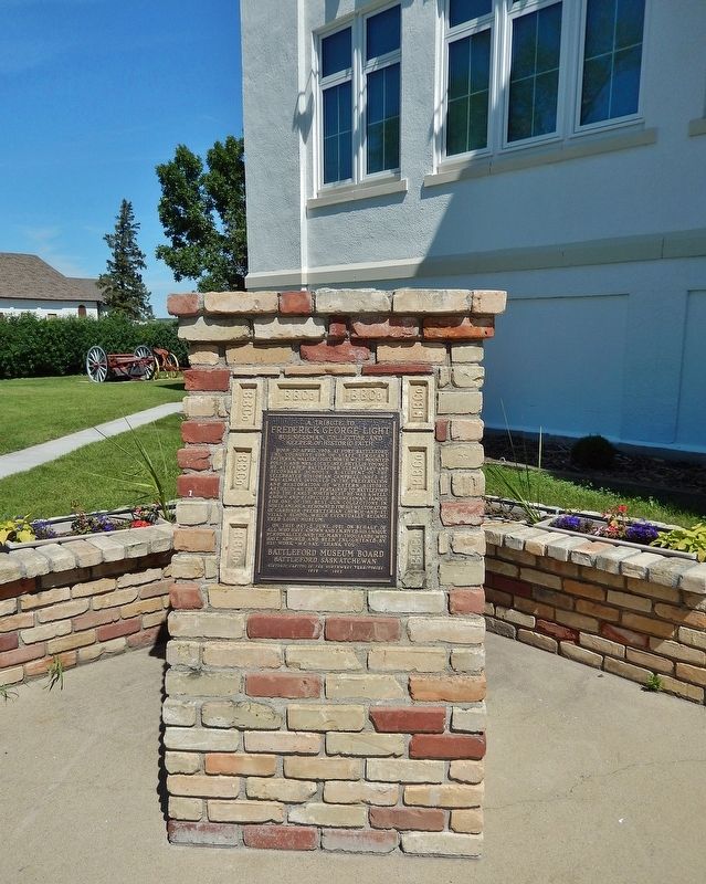
On Central Avenue at 20th Street West, on the right when traveling north on Central Avenue.
Born 20 April, 1908, at Fort Battleford, the youngest son of Staff Sergeant Frederic Walter Light, North West Mounted Police, and Mrs. Light (Nee Phyllis Young), he attended Battleford elementary and secondary schools. A student of the celebrated . . . — — Map (db m289900) HM
On Old Saskatchewan Highway 4 (Provincial Highway 658) 1.1 kilometers west of Provincial Highway 4, on the left when traveling west.
Constructed of local brick in 1877-78 this was the first land registry office in the North-West Territories and the oldest known brick building in Saskatchewan. Containing records of all private and public land in the Territories, this office . . . — — Map (db m212000) HM
Near Central Avenue just north of Campbell Innes Way, on the right when traveling north.
Here in July 1876, Superintendent James Walker established a post of the North-West Mounted Police in the heart of the Cree country. "The Fort" grew to a strength of 200. During the uprising of 1885 it gave refuge to more than 400 people . . . — — Map (db m202597) HM
Near 3 Avenue West 0.5 kilometers south of Old Saskatchewan Highway 4 (Provincial Highway 658), on the left when traveling south.
"It must be the largest and finest house in all the land." Lt.-Gov. David Laird Battleford was the capital of the Northwest Territories from 1876 to 1883. From here at Government House, the territorial government managed a vast expanse of . . . — — Map (db m211931) HM
On 3 Avenue West 0.4 kilometers south of Old Saskatchewan Highway 4 (Provincial Highway 658), on the left when traveling south.
Between 1877 and 1883, the North-West Territories, an area then comprising over two-thirds of Canada, were administered from this location. As the centre of government for this region, Government House contained the offices and chambers of the . . . — — Map (db m211919) HM
On 3 Avenue West 0.4 kilometers south of Old Saskatchewan Highway 4 (Provincial Highway 658), on the right when traveling south.
In 1876 Government House, the seat of government for the North-West Territories, was constructed. The North-West Council held its annual sessions here in 1878, 1879 and 1881. In 1883, the seat of government was transferred to Regina. From 1883 to . . . — — Map (db m211929) HM
Near 3 Avenue West 0.5 kilometers south of Old Saskatchewan Highway 4 (Provincial Highway 658), on the left when traveling south.
Government House became an industrial school for First Nations youth when the capital of the Northwest Territories shifted to Regina in 1883. Operated by the Church of England, Battleford Industrial School was one of more than a dozen such schools . . . — — Map (db m211933) HM
On Old Saskatchewan Highway 4 (Provincial Highway 658) 1.1 kilometers west of Provincial Highway 4, on the left when traveling west.
The Land Registry Office building is the only original Government Ridge structure still standing. Constructed in 1877, the registry office recorded all land sales in the Northwest Territories. The outside walls are almost half a metre thick and one . . . — — Map (db m211999) HM
On 2 Avenue West just south of 25 Street, on the right when traveling south.
Between 28 March and 24 April 1885 almost 600 people — most of the white and Métis population of the area — took refuge in the North-West Mounted Police post here in anticipation of a general Indian uprising in support of Riel. Although . . . — — Map (db m220990) HM
On Old Saskatchewan Highway 4 (Provincial Highway 658) 1.1 kilometers west of Provincial Highway 4, on the right when traveling west.
The North-West Territories Act of 1875 provided for the administration of the territories by a resident Lieutenant-Governor and an appointed Council. The North-West Council held its first session in 1877 at Fort Livingstone while permanent . . . — — Map (db m289980) HM
Near 3 Avenue West 0.5 kilometers south of Old Saskatchewan Highway 4 (Provincial Highway 658), on the left when traveling south.
Government House spent most of its remaining years in the care of Oblate priests, who purchased the site in 1931 and turned it into a seminary called the Oblate House of Studies. St. Thomas College, a boarding high school for students in grades 9 . . . — — Map (db m211941) HM
On 3 Avenue West 0.4 kilometers south of Old Saskatchewan Highway 4 (Provincial Highway 658), on the right when traveling south.
[English] In February 1876 Battleford, on the projected rail and telegraph lines, was chosen as the site of the new capital of the North-West Territories, and that summer construction was begun on quarters for the . . . — — Map (db m211899) HM
Near 3 Avenue West 0.5 kilometers south of Old Saskatchewan Highway 4 (Provincial Highway 658), on the left when traveling south.
When the Seventh-day Adventist Church agreed to rent the Government House property for $5 per year in 1915, it may have sounded like a wonderful deal. However, the 10-year arrangement left the church responsible for costly maintenance and any . . . — — Map (db m211939) HM
On 2 Street South (Old Provincial Highway 658) at Provincial Highway 4, on the left when traveling east on 2 Street South.
Telegraph Flat was named in 1876 when the Dominion Telegraph Company opened its western terminus office on this site. In the same year the Hudson's Bay Company built a nearby trading post, and the North-West Mounted Police established its . . . — — Map (db m289967) HM
Near 3 Avenue West 0.5 kilometers south of Old Saskatchewan Highway 4 (Provincial Highway 658), on the left when traveling south.
The landmark that came to be known as "Old Government House" burned to the ground on June 7, 2003, a victim of vandalism. It was a sad end to a historic structure created as a seat of government but used far longer as a place of learning. Over a . . . — — Map (db m211942) HM
On 2 Street South (Old Provincial Highway 658) at Provincial Highway 4, on the left when traveling east on 2 Street South.
The Saskatchewan Herald was founded on this site in 1878 by Patrick G. Laurie. It was the first newspaper in the Territories. Laurie brought in his printing press by ox-cart from Fort Garry, a trek of 72 days. His own publisher, editor, . . . — — Map (db m289983) HM
Near Anderson Street (Provincial Highway 783/212) 0.5 kilometers west of Louis Riel Trail (Provincial Highway 11), on the right when traveling west.
[Français] Pédagogue remarquable, Mademoiselle Dorval fut la première institutrice diplômée de la Saskatchewan. Originaire du Québec, elle s'établit dans l'Ouest en 1877, devint membre de l'Ordre de Saint-François et consacra le . . . — — Map (db m202598) HM
On Railway Avenue just west of Main Street, on the left when traveling west.
The engine pictured on this sign is Canadian National #1158. Built by the Montreal Locomotive Works in April 1913, this engine was one of fifty G-16-a class constructed during the years 1912-1913. ——————————— They were built for Canadian National . . . — — Map (db m212315) HM
On Provincial Highway 4 8.6 kilometers north of Provincial Highway 26, on the left when traveling north.
The Village of Cochin is named after Father Louis Cochin, a pioneer missionary among the Cree Indians. For many years he resided among the Indians who wintered on the shores of Jackfish Lake. Fr. Cochin is best remembered as the priest who was . . . — — Map (db m211900) HM
On 2 Avenue just north of 2 Street East, on the right when traveling north.
1980To commemorate the original Meota School erected in 1914. The two story building was built of red brick from the Meota Brickyard. For 60 years it was used continuously and for a number of years had grades from 1-12. It was demolished in 1974 . . . — — Map (db m211889) HM
On Wright Street at Railway Avenue, on the left when traveling west on Wright Street.
In Memory Of Pte. George Spencer • Pte. Edward J. Foster • Pte. Charles Mann • Pte. Herbert Green • Pte. Fredrick R. Henderson • Pte. Alfred E. Brown • Pte. Robert J. Thompson • Lce. Cpl. Charles Lancaster • Capt. Weslesleg T. W. Long • Pte. James . . . — — Map (db m211882) WM
On 100 Street (Saskatchewan Route 4) just north of 13 Avenue, on the right when traveling south.
The City of North Battleford is pleased to honour the many citizens who have served our country in the armed conflicts throughout our history. Their supreme sacrifice, dedication and courage will always live on. Typical of this service, dedication . . . — — Map (db m203899) HM WM
On Railway Avenue (Provincial Highway 3/4) just north of Main Street, on the right when traveling north.
To Our Pioneers who worked so hard by the will of God to clear this land and break the sod To Our Citizens who walked the path of those gone by to bear their torch and carry it high A Welsh emigrant, Mr. Edwin Dando Hoskins . . . — — Map (db m211898) HM
Near 1 Street East 0.2 kilometers north of Railway Avenue (Provincial Highway 674), on the right when traveling north.
Dedicated to all who had a part in 97 years’ operation of Paynton School Division and School The first school opened in 1906 with six students. A single room, it was located south of the tracks and was later moved to Railway Avenue, where it . . . — — Map (db m212200) HM
On Central Avenue just north of 11th Street East, on the right when traveling north.
[English] This building is one of the few 19th century town halls still standing on the Prairies. It was built in 1892-1893, two years after the first railway arrived in town and over ten years before Prince Albert was incorporated as a city. . . . — — Map (db m196893) HM
On River Street at Central Avenue, on the right when traveling west on River Street.
On March 21st, 1887, Council passed a bylaw to establish a fire department for the Town of Prince Albert, Northwest Territories. There were two fire halls originally built, one on the east flat and the other on Central Avenue where City Hall now . . . — — Map (db m196896) HM
On Central Avenue north of 11th Street East, on the right when traveling north.
In 1892 the council of the burgeoning town of Prince Albert commissioned the architectural firm of F. J. Rostrick and Son of Hamilton to design a town hall/opera house. Built by A. and W. B. Goodfellow of locally produced brick, the building was a . . . — — Map (db m196894) HM
Near Central Avenue just north of 11 Street East, on the right when traveling north.
[English] A charismatic orator, John Diefenbaker served as Canada’s 13th prime minister from 1957 to 1963. Born in Ontario and raised in Saskatchewan, he was an accomplished defence lawyer and Member of Parliament for some forty . . . — — Map (db m203717) HM
On 19 Street West just east of 3 Avenue West, on the right when traveling west.
[English] This was John Diefenbaker’s home as he rose through the ranks to become leader of the federal Progressive Conservative Party and Prime Minister of Canada. In 1947, he bought this Tudor Revival home with his wife, Edna . . . — — Map (db m203702) HM
On 7 Street at Maple Avenue, on the left when traveling west on 7 Street.
Dedicated to the memory of the pioneers, teachers and pupils of Cando and district. Cando School was officially founded in 1914. It was located on the site of the present Roman Catholic Church. In 1952 a new three room school was . . . — — Map (db m211872) HM
On Main Street at 2 Street, on the right when traveling north on Main Street.
In commemoration of the first settlers who arrived in the Hague district on May 3, 1895 Village of Hague incorporated on August 25, 1903 with Klaas Dyck the first elected overseer — — Map (db m203736) HM
On 6 Street at 2 Avenue, on the right when traveling east on 6 Street.
Five times World Wheat Champion of the Rosthern District He received his Doctors’ degree for his extension work with The Queens University on cereal grains — — Map (db m203735) HM
On 2 Avenue at 6 Street, on the left when traveling north on 2 Avenue.
Pioneer Rosthern businessman He built the first residence and store in Rosthern in 1892 Justice of the Peace and M.L.A. from 1905-1911 — — Map (db m203747) HM
On Provincial Highway 312 at Provincial Highway 683, on the right when traveling west on Provincial Highway 312.
Mennonite settlers who arrived in this area in 1892 held church services in private homes until 1896, when the first church of the conference of Mennonites in the North-West Territories was built on this site. The Mennonite community had organized . . . — — Map (db m8531) HM
On Broadway Avenue North at Burrows Avenue West, on the right when traveling south on Broadway Avenue North.
This water tower was purchased from the Prince Albert Penitentiary in 1927 & moved here the following year. The light on top of the tower was put into service in April 1929. Sometime later the frost-free casing was built. The tower was in use until . . . — — Map (db m196891) HM
On Railway Avenue 0.1 kilometers north of 1 Street South, on the right when traveling north.
In memory of all those of Canada’s Armed Forces who gave their lives in the conflicts of W.W. I 1914-1918 W.W. II 1939-1945 Korea — — Map (db m211883) WM
On Provincial Highway 26 0.1 kilometers north of Railway Avenue East, on the right when traveling north.
This windmill was erected by the people of Edam and District to celebrate the 75th anniversary of the Province of Saskatchewan and to honour the original Dutch settlers, some from Edam, Holland who homesteaded in this area during the period 1904 – . . . — — Map (db m211875) HM