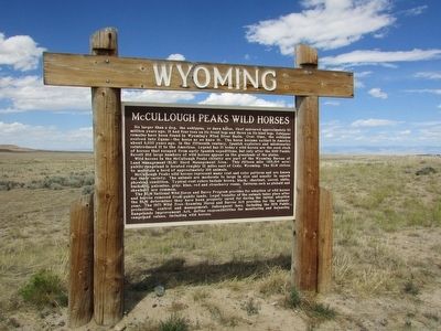
On Greybull Hwy (U.S. 20 / 16), on the left when traveling west.
No larger than a dog, the eohippus, or dawn horse, first appeared approximately 55 million years ago. It had four toes on its front legs and three on its hind legs. Eohippus remains have been found in Wyoming’s Wind River Basin. Over time, . . . — — Map (db m86912) HM
On Greybull Hwy (U.S. 20 / 16), on the left when traveling west.
This region is totally unfit for either rail or wagon roads and can only be traversed with the greatest of difficulty. - U.S. Army Lieutenant Henry Mayandier, while attempting to map a wagon route across the Big Horn Basin in . . . — — Map (db m86910) HM
On East Main Street at South Mountain View Street, on the left when traveling east on East Main Street.
This statue by artist/sculptor, Steve Wirth, depicts Byron Sessions, survey map case in hand, as he prepares to oversee the construction of the Sidon Canal.
It was the policy of the Church of Jesus Christ of Latter-Day Saints, often . . . — — Map (db m91254) HM
On Alternate U.S. 14A at milepost 35, on the right when traveling east.
Following Mormon settlement of the Salt Lake Valley beginning in 1847, church leaders envisioned colonization of the entire inter-mountain region. In following decades, Mormons emigrated from Utah into Idaho, Arizona and Wyoming. Seeking to . . . — — Map (db m91252) HM
Near South Division Street near 1st Street South, on the right when traveling north.
In 1900 the prophet and president of The Church of Jesus Christ of Later-day Saints, sent settlers to northern Wyoming under direction of Apostle Abraham Owen Woodruff. They wee to establish two communities, Byron and Cowley, and build the Sidon . . . — — Map (db m190065) HM
On South Division Street near Main Street (State Highway 789), on the right when traveling north.
In 1900, Lorenzo Snow, prophet and president of The Church of Jesus Christ of Later-day Saints, sent settlers to northern Wyoming under direction of Apostle Abraham Owen Woodruff. They were to establish two communities, Byron and Cowley, and build . . . — — Map (db m190064) HM
On Road 2 North near Road 3 North, on the left when traveling east.
The Deaver Reservoir equalizing, or regulating reservoir missing word(s) serves water to about 1,800 acres on missing word(s) Frannie Division of the Project. For 75 years, the reservoir provided the domestic water supply for . . . — — Map (db m190068) HM
Douglas Fir Bark BeetleThe Douglas fir bark beetle enters the bark where it introduces a fungi and creates galleries in the phloem – the layer under the bark that transports nutrients from the leaves throughout the tree. The galleries . . . — — Map (db m88169) HM
The prominent hill to the east is known as Sheep
Mountain. It is the surface expression of an upward
fold in the earths crust that geologists refer to as
an anticline. Sheep Mountain is a text book example
of an anticline fold. It is 15 miles . . . — — Map (db m308135) HM
On Dry Medicine Lodge Creek 0.1 miles north of County Road 52, on the left when traveling north.
For at least 10,000 years, the area where Medicine Lodge Creek flows out of the Bighorn Mountains has provided a home for humans.
Discovering Ancient Cultures In 1968, the University of Wyoming began an eight-year archaeological . . . — — Map (db m163208) HM
On Dry Medicine Lodge Creek, on the left when traveling north.
Petroglyphs and pictographs often preserve the only known records created by our human predecessors. The rocks are found at Medicine Lodge, some believe to be as old as 2500 years, has barely wasted the affects of time and weather. Mosaic of . . . — — Map (db m163206) HM
On Alternate Route 14A at milepost 74 near Forest Road 651, on the right when traveling east.
Big Horn Basin in northwest Wyoming is bound on the west by the Beartooth and Absaroka Mountains, on the south are the Wind River and Owl Creek ranges, on the north the Pryor Mountains and on the east are the Big Horns. The Basin is nearly . . . — — Map (db m91289) HM
Near U.S. 14A at milepost 74 near 651, on the left when traveling east.
These two plaques offer brief history of the Bighorn Basin.
Bighorn Basin -- It's Creation
Before you lies the Bighorn Basin, which has its southern end in Wyoming and extends into Montana. Six hundred million years of . . . — — Map (db m91305) HM
Near Forest Road 12 near U.S. 14A, on the left when traveling west.
Several of the prehistoric trails that led through the Big Horn Mountains intersect here. The first people using these trails may have entered the area on the very same path you are now using, as long as 10,000 years ago! Over time, possibly due to . . . — — Map (db m91307) HM
On U.S. 14A at milepost 79 near 130, on the right when traveling west.
The large rocks next to you are granite. These were formed within the earth's crust 1 billion years ago. Their exposure is the result of the eroding forces of wind, water, and ice. This granite contains quartz and resembles the rock containing gold . . . — — Map (db m91320) HM
On East Main Street (U.S. 310) near Montana Avenue, on the right when traveling east.
The Flying Tigers were American boys from 41 of our states, fighter pilots trained in our own Army and Navy, who became members of the new A.V.G. (American Volunteer Group) employed by the government of Generalissimo Chiang Kai-shek to protect the . . . — — Map (db m91260) HM WM
Near Alternate U.S. 14A at milepost 59 near Crystal Creek Road, on the right when traveling south.
Side A
One of the largest cattle operations in the Wyoming Territory, the Mason-Lovell Ranch moved its headquarters here in 1883. At its peak the ranch grazed cattle from Thermopolis, Wyoming to the Crow Reservation in Montana. . . . — — Map (db m91280) HM
On U.S. 14A at milepost 79 near Forest Road 130, on the right when traveling west.
Medicine Mountain to your left, was named for the Medicine Wheel, a stone circle that lies atop a ridge below its summit. Designated a National Historic landmark, this symbol remains a mystery as the builders and purpose of the Medicine Wheel remain . . . — — Map (db m91319) HM
Thousands of stone circles lie scattered over the Northern Plains and Rocky Mountains. What were they used for?
Over 100 of these stone circles are known as Medicine Wheels. The Bighorn Medicine Wheel is probably the most well known and sacred . . . — — Map (db m169029) HM
The white man called it the Medicine Wheel, but to many Native Americans Indians it is, "The Place Where the Eagle Lands." To many people it is a sacred place, and there are few that leave without experiencing something outside the ordinary.
It . . . — — Map (db m169030) HM
Near 12 near U.S. 14A. Reported permanently removed.
"Eventually one gets to the Medicine Wheel to fulfill one's life." -- Old Mouse, Arikara
High in the Big Horn Mountains at nearly 10,000 feet above sea level, lies the Medicine Wheel - a place of worship, a National Historic Site, and an . . . — — Map (db m169026) HM
Raptors are graceful hunters of Bighorn Canyon. The location is ideal home for these birds of prey because of the abundance of food and excellent nesting spots. Watch for these magnificent birds in action. — — Map (db m62158) HM
On Alternate U.S. 14A at milepost 71 near Old U.S. Highway 14A, on the left when traveling east.
Reconstruction of 52 miles of US 14A between Big Horn Lake and Burgess Junction, began with a bridge and causeway at the lake in the mid-60s. The mountain project was described as "one of the most difficult" in the Department's history.
Then, . . . — — Map (db m91285) HM
On East Main Street (U.S. 310) near Montana Avenue, on the right when traveling east.
was developed for the U.S. Army during WWII by the Willys Motor Company. Its tough four-wheel drive made it the first all-terrain vehicle. By 1945 over 500,000 had been delivered to the Army and other branches of the armed forces. The Jeep was also . . . — — Map (db m91259) HM
On West Main Street (U.S. 310) near Alternate U.S. 14A, on the right when traveling east.
In honor of
The Mormon Colonists
of the Big Horn Basin
who, under the leadership of
Abraham O. Woodruff, first camped near this site in May 1900. These pioneers, under many difficulties, established towns, notably Byron, Cowley and . . . — — Map (db m91255) HM
On U.S. 14A at Old U.S. Highway 14A, on the left when traveling east on U.S. 14A.
For many years, the northern most road over Wyoming's Big Horn mountains was commonly referred to as the Dayton-Kane Road. It connected those two towns on opposite sides of the mountain, the latter now just a memory beneath the waters of Big Horn . . . — — Map (db m91284) HM
Near Forest Road 12, 1.7 miles north of Federal Highway 14A, on the left when traveling north.
A National Historic Landmark
Located on Medicine Mountain, the Medicine Wheel is one of North
America's most important and well preserved Native American
sacred landscapes which has played and continues to play an
essential role in the . . . — — Map (db m169033) HM
The earthbound journey begins . . . . . . when a raindrop or snowflake hits the upper slopes of the Big Horn Mountains. It joins other drops and gains momentum seeking the path of least resistance. Say “goodbye” to the drop as it . . . — — Map (db m88182) HM
The hillside below the cliffs is managed as a wildlife winter range. Elk and deer in the Big Horn Mountains live at high elevations during the summer, but move down to the lower areas during the winter. The Forest Service helps maintain this winter . . . — — Map (db m153241) HM
The presence of humans in the Big Horn Basin goes back more than 10,000 years. Evidence suggests that the prehistoric people were nomadic hunters and gatherers. Indians inhabited this area until 1878. In the late 1870s settlers, ranchers, and . . . — — Map (db m88172) HM
The large, granite building blocks of Shell Canyon are an extraordinary 2.5 billion years old. Called basement or bedrock, they form the bottom layer covering the molten material in the earth’s core. At some point, the huge plate of bedrock . . . — — Map (db m88189) HM
The red cliff face to your left flanks Sunlight Mesa. At the top is Elephant Head Rock, so named because of its shape. The triangle-shaped mountain to the right is named Pyramid Peak. To your far right is a prominent rock-topped mountain called . . . — — Map (db m68892) HM
If you are a seeker of waterfalls . . . . . . . mark Shell Falls as unique in terms of waterfall origin. Waterfalls form in three basic ways: 1. Where Hard Meets Soft Falls commonly form where a hard, resistant streambed meets a softer one. . . . — — Map (db m88179) HM
Shell Creek nourishes a rich diversity of flowering plants, which in turn attracts tiny winged visitors. Hummingbirds are noted for their uncanny ability to hover in the air like helicopters. By turning their wings upside-down on the backstroke, . . . — — Map (db m89166) HM
Water is a scarce commodity in the arid west. Wherever streams and rivers flow, you will find the pathways of early exploration and travel, the magnets of human settlement. Shell Creek is no exception. Archaeologists discovered evidence that . . . — — Map (db m88186) HM
Can water really move mountains? Bit by bit, grind of water rippling over rock wears the mountain away. In a more dramatic fashion, run-off from melting snow during May and June creates a massive force capable of muscling huge boulders downstream. . . . — — Map (db m88168) HM
On U.S. 14 1 mile west of Forest Road 17, on the right when traveling west.
In June 1959, a tornado roared over the south rim of the canyon directly before you. Its path was along Granite Creek to your left and through what used to be Granite Creek Campground. One person was killed. The twister ripped up timber and laid it . . . — — Map (db m71500) HM
So, what is an “Oasis” anyway? The dictionary defines it as “a green area in a dry, arid region.” What makes it so green? If you guessed WATER, then you were right. Most of this area gets less than ten . . . — — Map (db m88192) HM
2.5 billion years of geologic history lie exposed in the canyon walls of Shell Creek. Gradual cutting action by Shell Creek eventually exposed the basement granite layer that lies above the earth’s molten core. However, Shell Canyon itself formed . . . — — Map (db m88178) HM
Fire has a number of beneficial effects. It eliminates diseased and dying trees, recycles nutrients back into the soil, and starts the cycle of growth again by allowing sunlight to reach the ground, stimulating the growth of grass. The Forest . . . — — Map (db m88171) HM
By the late 1800s, settlers were already trying to wring a livelihood from the harsh environment in Shell Canyon and the valley below. Average precipitation here is less than ten inches per year and land suitable for cultivated crops is scarce. . . . — — Map (db m131490) HM
On Big Springs Drive near Buffalo Street, on the right when traveling north.
History:
Originally the Hot Springs were included in the Shoshone Indian Reservation Treaty of 1868. In the years following the Hot Springs gained the reputation as having "Health Giving Properties", and eventually the U.S. Congress . . . — — Map (db m97695) HM
The Original Bridge was built to connect the Big Spring with the Fremont Spring, the Pleasant View Hotel and Sanitarium, and the Elk pasture. Later it also provided access to the Hopewell Hospital which eventually became the first county hospital. . . . — — Map (db m97655) HM
The red cliffs seen in and around the park are called the Red Peak Formation - part of the Chugwater Group. This rock outcrop is composed of fine-grained sandstone and is up to 600 feet thick. The brick red color is caused by oxidation of iron . . . — — Map (db m97658) HM
In April of 1896 a treaty was signed whereby the Shoshone and Arapahoe Tribes gave the legendary Sacred Springs of Healing to the United States government and, subsequently, to the state of Wyoming. Upon signing the treaty, Chief Washakie . . . — — Map (db m97759) HM
On U.S. 20 near Gebo Oil Field Road, on the right when traveling north.
The Bridger Trail crossed the Bighorn River near this location in 1864. Passing over the Bridger Mountains to the southeast, the trail came down Kirby creek, crossed the river and proceeded north to the Yellowstone River, then west to the gold . . . — — Map (db m97784) HM
Thermal features at Hot Springs State Park differ from those found in Yellowstone, which are heated by magma near the earth’s surface. The hot spring water found here originates in the Owl Creek Mountains to the south, where surface water seeps down . . . — — Map (db m97691) HM
Near Big Springs Drive near Buffalo Street, on the right when traveling north.
Long before the arrival of fur trappers in the West, Native Americans discovered the hot mineral springs found in the park. The Shoshone Indians called the springs “Bah Guewana” – meaning smoking water, and the Crow Indians called . . . — — Map (db m97692) HM
In the foreground across the river are the Rainbow Terraces formed of mineral deposits called travertine. The Big Spring produces 127° mineral water and as it makes its way down the terraces the water temperature changes and different colors of . . . — — Map (db m86916) HM
On Sneider Point Road near Pasture Road when traveling south.
In 1884 Joe Sneider with Ed Crapon passing through this area, noticed steam rising from the hot springs. Mistaking it for smoke and suspecting a hostile Indian Camp, the area was scouted from this point before descending to the valley. — — Map (db m97708) HM
Near Buffalo Street near Arapahoe Road, on the left when traveling south.
1890 - 1900
Ollie Koshear • Jesse Burson • Augernose Jane • J.A. McGrey • Jack Berry • Ralph Gellerno • Elton Perry • unknown woman • unknown man
ERECTED BY WASHAKIE CHAPTER
DAUGHTERS OF THE AMERICAN REVOLUTION
1962 — — Map (db m241043) HM
On Buffalo Street near Arapahoe Road, on the left when traveling south.
During the late 1800s, difficult travel and lack of housing did not discourage people from visiting the springs. Upon their arrival, some people pitched tents, while others cut temporary dugouts into the hillsides. Travelers entering the valley saw . . . — — Map (db m97709) HM
The reds, oranges, yellows, and greens that paint the hot spring's pools and streams are actually heat-loving (thermophilic_ microscopic life forms (microbes). Microbes which include algae, are visible when vast numbers cluster together. The . . . — — Map (db m97653) HM
On West Pioneer Street at Tepee Street, on the left when traveling north on West Pioneer Street.
The “Tepee Fountain” was built in 1909 to vent steam from hot mineral water that was piped throughout the park. As water flows over the structure, it cools and deposits layer upon layer of travertine. This process is similar to the formation of . . . — — Map (db m97743) HM
On East Park Street near Pioneer Road, on the right when traveling north.
The town of Thermopolis sprang to life as travelers journeyed to its hot mineral springs. The Plaza Hotel, originally known as the Callaghan Apartments, was on of six hotels built in the park in the early 1900s. The beautiful two-story structure . . . — — Map (db m97758) HM
Walter Manly Haynes was born July 31, 1893 in Nebraska, the son of Mr. and Mrs. Aaron Haynes, The family move to Hot Springs County in the early 1900's. He and his brother, Rollie, signed their select service registration on June 5, 1917. In . . . — — Map (db m97761) WM
On U.S. 20 near South Yellowstone Road (Wyoming Highway 173).
This river begins in the Absaroka (ab-sore-uh-ka) Mountains located 90 miles to the northwest. It runs southeast, then swings north and flows through two mountain ranges before it joins the Yellowstone River at Bighorn, Montana, 180 miles northeast . . . — — Map (db m97650) HM
Near U.S. 20 near South Yellowstone Road (Wyoming Highway 173).
To native Indians, mountain men, and early settlers, the Wedding of the Waters was a special place. Here, after carving its way through rocks more than three billion years old, the Wind River ends its journey and the Bighorn River begins. . . . — — Map (db m97652) HM
On White Sulphur Road near Big Springs Drive, in the median.
White Sulphur Spring is one of many attractions in the park. In the early 1890s a bathhouse and dance pavilion were built nearby. Unfortunately, a fire destroyed the buildings in 1899.
Early settlers in the area recognized the therapeutic values . . . — — Map (db m97701) HM
See this natural phenomenon while you are in Thermopolis. Monument hill, pictured here, and visible from this site, overlooks the "Big Spring"
(map with arrows and diagram)
See other springs and beautiful terraces created by the mineral . . . — — Map (db m97783) HM
On Wyoming 120 (State Highway 120), on the left when traveling south.
The agriculture producers of the Big Horn Basin invite you to enjoy our majestic mountains, pristine streams, and lush meadows. These meadows aren’t here for aesthetics; man has strived to irrigate this dry rocky land to make his cows comfortable. . . . — — Map (db m88968) HM
On Wyoming 120 (State Highway 120), on the left when traveling south.
Less conspicuous than the pronghorn antelope and the golden eagle is an even more ancient inhabitant of the high plains and valleys of Wyoming, the prairie rattlesnake. Feared by many and respected by most, these pit vipers (so-called because of . . . — — Map (db m88972) HM
On Belfry Highway (State Highway 120) near State Highway 292, on the right when traveling south.
Several area landmarks, including Bennett Buttes, Bennett Creek, and Little Rock Creek, are now named for Captain Andrew S. Bennett and Little Rock, a Crow interpreter for the U.S. Army, who lost their lives when the Army attacked a camp of Bannock . . . — — Map (db m167161) HM
In 1877, The Nez Perce Indians of Idaho led by Chief Joseph, fled the U.S. Army. They crossed the Clark's River near this point, while trying to outrun the soldiers to Canada. — — Map (db m167145) HM
On Belfry Highway (State Highway 120) near State Highway 292, on the right when traveling south.
"The tired horses came to an abrupt stop at the Dilworth post office. The needed no whoa-ing. The wagon loaded with mail and freight had jostled in and out of ruts, up and down hills, across streams and along washed out roads." . . . — — Map (db m167159) HM
On State Highway 120 near State Highway 292, on the left when traveling south.
Three panels make up this marker.
(panel 1:)
For thousands of years the fertile Wallowa Valley was home to many Nimiipuu, or Nez Perce people. A treaty in 1855 affirmed Nez Perce ownership of this homeland. Competition for . . . — — Map (db m167146) HM
On Powell Highway (Alternate U.S. 14) near Happy Trails Road, on the left when traveling north.
On September 10th 1880, Victor Arland and John F. Corbett set up the first mercantile establishment in the Big Horn Basin on the Indian Trace that follows Trail Creek. Looking to the cattlemen for business, they moved to Cottonwood Creek in 1883, . . . — — Map (db m91138) HM
Near W Yellowstone Avenue (U.S. 20), on the right when traveling west.
Off in the distance in front of you, a large red butte lies against a much larger mountain, Rattlesnake Mountain. Flowing down the valley is Trail Creek, named for the ancient Indian trail that crosses the Shoshone River at the Indian ford in the . . . — — Map (db m87571) HM
On North Fork Hwy (U.S. 14) 1.2 miles east of Verner Road, on the right when traveling east.
This 48-inch diameter valve is one of two which were originally installed at the base of the Buffalo Bill Dam in 1922 to supply water to the Shoshone Powerplant and low level river outlet works. The two valves were operational until they were . . . — — Map (db m104003) HM
On North Fork Hwy (U.S. 14) 1.2 miles east of Verner Road, on the right when traveling east.
Ball Plug
This large wood and concrete ball plug was one of two used to halt the flow of water through the 42-inch diameter power outlet works conduits, located in the base of the dam. The balls facilitated the repair and maintenance of downstream . . . — — Map (db m104004) HM
Near Demaris Drive near West Yellowstone Avenue (U.S. 14).
Belle Drewry was born in 1867, just two years after the Civil War. Her birth place and family are unknown. It is known that she left home at an early age and changed her name. Belle was a rather attractive young woman; about five foot six inches . . . — — Map (db m91077) HM
On North Fork Hwy (U.S. 14) 0.5 miles east of Verner Road, on the right when traveling east.
Buffalo Bill Reservoir
The Shoshone Project Story
The development by the U.S. Reclamation Service of the great irrigation project in the lower Shoshone valley required sacrifice of their land by the settlers living in the upper part of the . . . — — Map (db m104001) HM
On Southfork Road (State Highway 291) near Davis Draw Road, on the right when traveling south.
John Colter, famed among the famous breed of "Mountain Men," passed this landmark late in the fall of 1807 while on business for the fur trader Manuel Lisa. Searching for Indians in order to conduct trade, he also hunted salt caves reputedly . . . — — Map (db m91010) HM
Near W Yellowstone Avenue (U.S. 20), on the right when traveling west.
Cedar Mountain, the mountain in front of you to the left of the canyon, was known to the Crow Indians as “the mountain of spirits.” Early settlers told of finding Indian tree burials on its northeast slope. Unfortunately, those sites . . . — — Map (db m87566) HM
On W Yellowstone Avenue (U.S. 20), on the right when traveling west.
John Colter, veteran of the Lewis and Clark Expedition, notably self-sufficient mountain man and indefatigable explorer, was the first white man known to have reconnoitered this locale. In 1807, possibly traveling alone but probably escorted . . . — — Map (db m86150) HM
On W Yellowstone Avenue (U.S. 20) west of Demaris Drive, on the right when traveling west.
Colter’s Hell is a large, mostly extinct, geyser basin. Today, there are a few hot springs, and vents which release sulphurous gasses along the Shoshone River. This site includes some of the world’s largest extinct geyser cones and thermal pools. . . . — — Map (db m86147) HM
On Dead Indian Hill Road (aka Crandall Road) (State Highway 296) near County Highway 103, on the right when traveling west.
This pass is the summit of Dead Indian Hill. Through this portal great herds of wild game seasonally migrant from the mountains to the plains. This high pass was the gate way for countless Indian hunting and war parties, and through this portal . . . — — Map (db m189985) HM
On Dead Indian Hill Road (aka Crandall Road) (State Highway 296) near County Highway 103, on the right when traveling west.
September 9, 1877. The Nez Perce knew that General Howard was at least a day behind the and Colonel Sturgis had moved his forces to the Stinking Water (Shoshone River).
The Nez Perce, led by Lean Elk and Joseph, sensed an opportunity to escape. . . . — — Map (db m190076) HM
On Sheridan Avenue at 8th Street, on the right when traveling west on Sheridan Avenue.
This sandstone from the Big Horn Basin is dedicated to the memory of Dr. Dewitt Dominick. It honors the lifetime work of Dr. Dominick with the Indian people of the west and his dedication as a Trustee of the Buffalo Bill Historical Center. . . . — — Map (db m305548) HM
On Powell Highway (Alternate U.S. 14) near Happy Trails Road, on the left when traveling north.
In the early 1890s, Thomas Lanchbury was hired by the Bell stage and freight line to build a stage station near Eagle's Nest Springs in Wyoming. The Eagle's Nest Stage Station was the midway point on the run between Red Lodge, Montana and Meeteese, . . . — — Map (db m91134) HM
On W Yellowstone Avenue (U.S. 20) 0.1 miles west of Demaris Drive, on the right when traveling west.
Looking west is the Shoshone Canyon, named for the Shoshoni Indians, who hunted in the region. However, most of the Big Horn Basin had been Crow territory until the Fort Laramie Treaty of 1868. West of the canyon, the north and the south forks of . . . — — Map (db m87558) HM
Near Demaris Drive near West Yellowstone Avenue (U.S. 14).
Jim White was born in Missouri in 1828. He found his way into the southwest as a young man, where he was a freighter with ox-drawn wagons.
When the Civil War broke out in 1861, Jim White served the Confederate Army as a grain buyer and wagon . . . — — Map (db m91080) HM
Near Demaris Drive near West Yellowstone Avenue (U.S. 14).
John Johnston was born of Scotch-English descent in New Jersey in 1824. Johnston, described as a 6'6", 250 pound giant, came west in the early 1840's as a trapper. He began his career in the Medicine Bow mountains of Wyoming, gradually working . . . — — Map (db m91019) HM
Near W Yellowstone Avenue (U.S. 20), on the right when traveling west.
The rocky ridge you are now crossing marks the southern edge of Lee Street, one of the original roads of Cody City. Wagon ruts, phone wires and rock cairn lot markers have been found along its path. In memory of Jerry Housel and Mary Elaine Housel . . . — — Map (db m87580) HM
On W Yellowstone Avenue (U.S. 20) 0.1 miles west of Demaris Drive, on the right when traveling west.
Buffalo Bill Cody and some business partners established the Shoshone Irrigation Co. in 1894. Work began on the Cody Canal to bring water for crop irrigation from the South Fork of the Shoshone River, around the south side of Cedar Mountain. The . . . — — Map (db m87556) HM
On Demaris Drive near West Yellowstone Avenue (U.S. 14).
On this site in 1895, Western scout and showman William F. ("Buffalo Bill") Cody laid out the original townsite of Cody, Wyoming, which he named in his honor. Today Old Trail Town preserves the lifestyle and history of the Frontier West through a . . . — — Map (db m91011) HM
On Dead Indian Hill Road (aka Crandall Road) (State Highway 296) near County Road 103, on the right when traveling west.
The ridge you are standing on was the last significant barrier for more than 600 Nez Perce Indians and their 2,000 horses as they fled the pursuing U.S. Cavalry. After the battle of the Big Hoel a month earlier, they drew knew the Army did not . . . — — Map (db m190091) HM
On Greybull Highway at Lt. Childers St., on the right when traveling west on Greybull Highway.
This memorial is dedicated to those special men and women
who served so courageously and when
called upon to do so, sacrificed without
hesitation while serving with the Office of
Strategic Services (OSS) during World War Two. — — Map (db m300813) WM
Near Demaris Drive near West Yellowstone Avenue (U.S. 14).
Phillip Henry Vetter was born February 7, 1855 near Woodstock, Shenandoah County, Virginia. He was killed by a grizzly bear on the Greybull River in Wyoming in 1892.
A few years after the Civil War, Phillip's family came West by wagon train and . . . — — Map (db m91072) HM
On Sheridan Avenue, on the left when traveling west.
The pioneer stagecoach drivers of the Old West were as fiercely independent as any men the country has ever seen. They were men of whang-leather toughness, who were accustomed to the harshness of frontier life. They never failed to laugh in . . . — — Map (db m87199) HM
On Greybull Highway at Lt. Childers Street, on the right when traveling west on Greybull Highway.
This memorial is dedicated to those who have suffered and
sacrificed as prisoners of war, and to those who are still
missing. You are not forgotten and we will never rest until you
are all returned home and accounted for. — — Map (db m300891) WM
On Greybull Highway at Lt. Childers Street, on the right when traveling west on Greybull Highway.
Powder River Let'er Buck!
The shoulder insignia, a black bucking bronco on a gray background with two
black rings, was adopted and proudly worn on the left shoulder of the uniforms
of the Wyoming troops. This insignia was designed by . . . — — Map (db m301169) HM WM
On Greybull Highway at Lt. Childers Street, on the right when traveling west on Greybull Highway.
This memorial is dedicated to the
people of the Republic of Korea who
have shown their sincere
appreciation for the service and the
sacrifices men and women from
Wyoming have made while
protecting their freedom. They have
generously supported . . . — — Map (db m300753) WM
296 entries matched your criteria. The first 100 are listed above. Next 100 ⊳