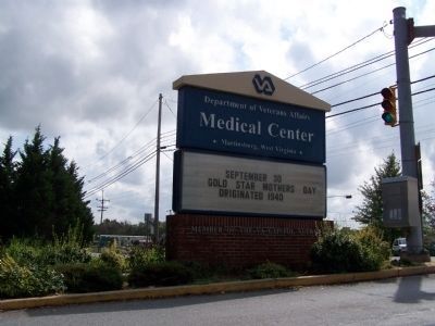
On Baker Road at Charles Town Road (West Virginia Route 9), in the median on Baker Road.
Established as the Newton D. Baker General Hospital, U.S. Army. Named for Newton D. Baker, native of Martinsburg and Secretary of War, World War I. Opened for patients in 1944. It became Veterans Administration Center in 1946. — — Map (db m12784) HM
On Flaggs Crossing Road at Blairton Road on Flaggs Crossing Road.
Named for the property owners this stone bridge built in 1832 across Opequon Creek was major improvement for travellers on Warm Springs Road connecting Alexandria and Bath, Va., site of famous mineral waters. The Berkeley County Court established a . . . — — Map (db m12849) HM
On Winchester Pike (U.S. 11) north of Old Mill Road, on the right when traveling north.
Two miles west is the site of the first house in present West Virginia. It was built by Col. Morgan Morgan who came from Delaware in 1726. It was destroyed and the one now there was built in 1800 by another Morgan. — — Map (db m57717) HM
On Runnymeade Road (County Route 26) at Soldier Drive, on the right when traveling west on Runnymeade Road.
300 yards west is one of the oldest Episcopal churches in West Virginia. Built in 1740 by Morgan Morgan. Five Revolutionary soldiers buried in church yard. Used as a barracks during war between the states. — — Map (db m134064) HM
On Winchester Pike (U.S. 11) just north of Old Mill Road, on the right when traveling north.
Erected by the State of West Virginia. In commemoration of the first settlement within the present boundaries of said State, which was made by Col. Morgan Morgan, a native of Wales, and Catherine Garretson, his wife, in the year 1726 on a tract . . . — — Map (db m1169) HM
On the northbound Welcome Center and Rest Stop (Interstate 81) north of the state line, on the right when traveling north. Reported permanently removed.
After stunning victories at Fredericksburg and Chancellorsville, Virginia, early in May 1863, Confederate Gen. Robert E. Lee carried the war through Maryland, across the Mason and Dixon Line and into Pennsylvania. His infantry marched north through . . . — — Map (db m1975) HM
On Runnymeade Road (County Route 26) 0.2 miles west of Winchester Avenue (U.S. 11), on the left when traveling west.
Due west of this tablet, 650 feet, is the Boyd House in which died, July 17, 1863, Brig.-Gen. James Johnston Pettigrew, of North Carolina, C. S. A. At Gettysburg he commanded and led Heth’s Division in the assault on Cemetery Ridge, July 3; and . . . — — Map (db m305317) HM WM
On Runneymead Road 0.5 miles west of Goldmiller Road, on the right when traveling east.
Originally built 1731-34 as second home of Morgan Morgan-first white settler in West Virginia. Rebuilt with some of original logs in 1976 as a State and County Bicentennial project. It was here during the Revolution that James Morgan, the grandson . . . — — Map (db m12798) HM
On Runnymeade Road (County Route 26) at Soldier Drive, on the right when traveling west on Runnymeade Road.
At Bunker Hill in 1726, Colonel Morgan Morgan founded the first permanent settlement of record in what is now West Virginia. In commemoration of this event, the state of West Virginia has erected a monument in Bunker Hill State Park, and has . . . — — Map (db m134056) HM
On Winchester Pike (U.S. 11) north of Old Mill Road, on the right when traveling north.
Morgan Morgan, a native of Wales, established his home at Bunker Hill before 1732, and was leader in Eastern Panhandle’s early development. His sons gave name to Morgantown, and fought in Indian and Revolutionary Wars. — — Map (db m1176) HM
On Winchester Pike (U.S. 11) south of Hatchery Road (County Route 11/8).
Named for Gen. William Darke, veteran of the Revolution and the Indian wars. He saved the remnants of St. Clair’s army from massacre in 1791 when badly defeated by the Miami Indians. His son, Capt. Joseph Darke, lost his life. — — Map (db m167181) HM
Near Saint Andrews Drive 0.2 miles south of Hammonds Mill Road (West Virginia Route 901), on the left when traveling south.
As he advanced south from the Potomac, Union Gen. Robert Patterson sent Gen. James Negley's brigade along a smaller road to the west to guard his right flank. Company I of the 15th Pennsylvania Infantry moved ahead of Negley's main body as . . . — — Map (db m303403) HM
Near Saint Andrews Drive 0.2 miles south of Hammonds Mill Road, on the left when traveling south.
The opposing infantry marched towards each other along the Williamsport Pike, a mile to your front. A skirmish line of McMullen's Rangers led the Union advance, followed by Col. John Starkweather's 1st Wisconsin Infantry. Nearing the Porterfield . . . — — Map (db m303404) HM
On Williamsport Pike (U.S. 11) at Hammonds Mill Road (County Route 901), on the right when traveling south on Williamsport Pike.
On the morning of July 2, 1861, Federal troops under General Robert Patterson crossed the Potomac River from Maryland and marched toward Martinsburg. Confederate Colonel Thomas J. Jackson’s command marched from Camp Stephens, four miles north of . . . — — Map (db m58078) HM
On Williamsport Pike (U.S. 11) 0.2 miles north of Campus Drive (West Virginia Route 901), on the right when traveling north. Reported permanently removed.
On the morning of July 2, 1861, Federal troops under General Robert Patterson crossed the Potomac River from Maryland and marched toward Martinsburg. Confederate Colonel Thomas J. Jackson’s command marched from Camp Stephens, four miles north of . . . — — Map (db m180733) HM
On Williamsport Pike (U.S. 11) 0.2 miles north of Beall Road, on the right when traveling north. Reported permanently removed.
On the morning of July 2, 1861, Federal troops under Gen. Robert Patterson crossed the Potomac River from Maryland and marched south toward Martinsburg. Colonel Thomas J. Jackson sent his men north from their camp north of town to block them and . . . — — Map (db m255737) HM
On Hammonds Mill Road (West Virginia Route 901) at St. Andrews Drive (County Route 3/1), on the right when traveling west on Hammonds Mill Road. Reported permanently removed.
Here at Stumpy’s Hollow on the morning of July 2, 1861, Confederate Lieutenant Colonel J.E.B. Stuart captured a Union infantry company almost single-handedly. The Federals—Company I, 15th Pennsylvania Volunteers—were acting as skirmishers in . . . — — Map (db m256875) HM
On Hammonds Mill Road (West Virginia Route 901) at Williamsport Pike (U.S. 11), on the right when traveling west on Hammonds Mill Road.
On the morning of July 2, 1861, Federal troops under General Robert Patterson crossed the Potomac River from Maryland and marched toward Martinsburg. Confederate Colonel Thomas J. Jackson’s command marched from Camp Stephens, four miles north of . . . — — Map (db m277066) HM
On Williamsport Pike (U.S. 11) at Foster Drive, on the right when traveling south on Williamsport Pike.
Early on July 2, 1861, Union forces under Maj. Gen. Robert Patterson crossed the Potomac River from MD to march on Martinsburg. Alerted to the enemy's movements by Stuart's cavalry, Col. Thomas Jackson fought a masterly delaying action that led . . . — — Map (db m206003) HM
On Encampment Road east of Williamsport Pike (U.S. 11), on the left when traveling south.
During the Civil War, the strategically important Valley Turnpike crossed the stream just above the small waterfall here. Two battles were fought nearby. The first occurred on July 2, 1861, half a mile south on the Porterfield Farm. On the . . . — — Map (db m256847) HM
On Saint Andrews Drive (County Highway 3/1) south of Hammonds Mill Road (State Route 901), on the left when traveling south.
The Confederates had four cannons at the Battle of Hoke's, although only one ,vas used in the fighting.
These guns belonged to the 1st Rockbridge Artillery; which had been organized in Lexington, Virginia (in Rockbridge County) in April . . . — — Map (db m303395) HM
Near Saint Andrews Drive 0.2 miles south of Hammonds Mill Road ( Route 901), on the left when traveling south.
Before dawn on July 2, 1861, with the Great Comet of 1861 bright in the sky above, Union Gen. Robert Patterson's troops splashed across the Potomac River at Williamsport, 6 miles northeast of here, watched by a small crowd of civilians—and by . . . — — Map (db m303402) HM
On Williamsport Pike (U.S. 11), on the right when traveling north.
In Memory of General “Stonewall” Jackson This tablet is erected by the Berkeley County Chapter United Daughters of the Confederacy to commemorate an instance of General Jackson’s remarkable bravery at all times in the face of the gravest . . . — — Map (db m41626) HM
Near Saint Andrews Drive 0.2 miles south of Hammonds Mill Road ( Route 901), on the left when traveling south.
Hoke's Run Battlefield Park is a shining example of how preserving battlefields protects more than history. That preservation work also safeguards the natural world around us, protecting the very qualities that make the Shenandoah Valley such a . . . — — Map (db m303401) HM
Near Saint Andrews Drive 0.2 miles south of Hammonds Mill Road, on the left when traveling south.
The Confederate line began to crumble as Union artillery fire took its toll and Federal infantry threatened the southern flanks.
A two-gun section of the 4th U.S. Artillery had come onto the field with the 11th Pennsylvania Infantry. Capt. . . . — — Map (db m303407) HM
On Saint Andrews Drive (County Road 3/1) at Hammonds Mill Road (State Route 901), on the right when traveling south on Saint Andrews Drive.
Here on the morning of July 2, 1861, Confederate Lt. Col. J.E.B. Stuart almost single-handedly captured most of a company of Union infantrymen. The Federals—Co. I., 15th Pennsylvania Volunteers—were acting as skirmishers in advance of a flanking . . . — — Map (db m291614) HM
Near Saint Andrews Drive (County Road 3/1) 0.2 miles south of Hammonds Mill Road (State Route 901), on the left when traveling south.
As the firing grew in intensity around the Porterfield Farm, Union Col. Phaon Jarrett's 11th Pennsylvania arrived on the field. Seeing the 1st Wisconsin already engaged, Jarrett moved his troops west of the pike. His men quickly found themselves . . . — — Map (db m303406) HM
Near Saint Andrews Drive 0.2 miles south of Hammonds Mill Road ( Route 901), on the left when traveling south.
The first pitched Civil War battle in the Shenandoah Valley, the Battle of Hoke's Run, took place here on July 2, 1861, when Confederate troops under Col. Thomas J. Jackson (the future "Stonewall") attempted to block the advance of a Union force . . . — — Map (db m303397) HM
On Williamsport Pike (U.S. 11) east of Ripple Way, on the right when traveling west.
By an act of the Virginia House of Burgesses, 1744, a ferry was established extending from the mouth of the Canagochego Creek in Maryland across the Patowmack to the Evan Watkins Landing, about 250 yards southeast. This landing was also the entrance . . . — — Map (db m131795) HM
On Williamsport Pike (U.S. 11) east of Temple Drive, on the right when traveling west.
West Virginia
(Berkeley County)
"The Mountain State"—western part of the Commonwealth of Virginia until June 20, 1863. Settled by the Germans and Scotch-Irish. It became a line of defense between the English and French during . . . — — Map (db m131797) HM
On Dominion Road 0.1 miles south of Gerrardstown Road, on the left when traveling south.
Built by John Hays, 1743. Became home of Reverend David Gerard, who founded Gerrardstown in 1787. His father was Reverend John Gerard, the first Baptist Minister west of the Blue Ridge Mountains. — — Map (db m12793) HM
On Gerrardstown Road (West Virginia Route 51) 0.1 miles east of Reunion Corner Road, on the left when traveling west.
Established as a town, 1787. Named for John Gerrard, first pastor of Mill Creek Baptist Church, which was organized by early settlers about 1743. The congregation reorganized after Indian hostilities during the French and Indian War. — — Map (db m12791) HM
On Gerrardstown Road (West Virginia Route 51) just north of Dominion Road, on the right when traveling north.
Members of the
Gerrardstown Community who have
proudly served their country in time of conflict
Dedicated in 2004
World War I
Davis Crim • Ashton Faircloth • George Maseur • Frank Miller • Carl Wiest
World War II . . . — — Map (db m148878) WM
On Runnymeade Road (County Road 26) 0.4 miles west of Goldmiller Road (County Road 24), on the right when traveling west.
This property
has been placed on the
National Register
of Historic Places
by the United States
Department of the Interior
Zaquill Morgan House
1761
[Lower plaque:]
A
Berkeley
County
Historic
Landmark . . . — — Map (db m148875) HM
On East Main Street (West Virginia Route 9) just north of South Mary Street ( Route 901), on the right when traveling south.
National Register [of Historic Places] Structure
by
U. S. Dept. of Interior
Hedgesville Historic District
Est. 1978
[Lower plaque:]
circa
1842 — — Map (db m148850) HM
On North Mary Street (West Virginia Route 901) south of East Poplar Street.
This boulder marks the site on Camp Hill where the batteries were fired during the War Between the States in the raid on the federal blockhouse, located at North Mountain. On July 4, 1864, the 14th, 16th, and 17th Regiments of General McCausland's . . . — — Map (db m154841) HM
On Hedgesville Road (West Virginia Route 9) near Mt. Zion Street, on the right.
Site of stockade fort built during the early Indian wars. Mt. Zion Episcopal Church was built soon after. A mile west is the tavern, built, 1740–1750, by Robert Snodgrass on land patented in 1732 by William Snodgrass, pioneer settler. — — Map (db m990) HM
On Bodine Street north of Hedgesville Road ( Route 9), on the left when traveling east.
During the French and Indian War (c. 1750) Virginia Militia Col. George Washington supervised the construction of Fort Hedges, a stockade fort built along the Warm Spring Road at the heavily-traveled Skinner's gap atop North Mountain (740 feet . . . — — Map (db m117316) HM
On Winter Camp Trail north of Toboggan Hill Trail, on the right when traveling north.
This pre-historic Indian burial mound was partially destroyed during construction of a coal haul road in the 1940's. The mound was restored in 1998 by Potomac Valley Properties, Inc, developer of The Woods. It is cared for by The Woods . . . — — Map (db m297724) HM
On Martinsburg Road or Hedgesville Road (West Virginia Route 9) west of Rustic Tavern Road, on the right when traveling west.
Morgan County. Formed, 1820, from Berkeley and Hampshire. Named for Gen. Daniel Morgan of the Revolutionary Army. Many of his renowned “Riflemen” were from the Eastern Panhandle, where he once lived. Famed Berkeley Springs here.
Berkeley . . . — — Map (db m1112) HM
On North Mary Street (West Virginia Route 901) just north of West Ash Street.
National Register [of Historic Places] Structure
by
U. S. Dept. of Interior
Hedgesville Historic District
Est. 1978
[Lower marker:]
Payne-Kreglow House
circa
1905
Restored by James W. Poisal, Jr., . . . — — Map (db m148856) HM
On Route 9 Bike Path 0.2 miles south of Short Road (County Road 36/1), on the right when traveling south.
The Shaw Run Wetland Complex is a calcareous fen. A "fen" is defined as low land covered wholly or partly with water. fed by Shaw Spring and Shaw Run, the wetland is a unique type of wetland for West Virginia because of its marl substratum (layer . . . — — Map (db m150612) HM
On Route 9 Bike Path south of Short Road (County Route 9/19), on the right when traveling north.
Stone House Mansion, predominantly Georgian in style, was constructed in 1757, and is one of the oldest stone structures in Berkeley County. The property is listed in the National Register of Historic Places for its association with the Hite vs. . . . — — Map (db m167518) HM
Fresh from victory at the Second Battle of Manassas, Gen. Robert E. Lee’s Army of Northern Virginia crossed the Potomac River on September 4-6, 1862, to bring the Civil War to Northern soil and to recruit sympathetic Marylanders. Union Gen. . . . — — Map (db m276872) HM
On West King Street east of Winchester Avenue (Business U.S. 11), on the left when traveling west.
“Big Apple Time Capsule”
Dedicated: Oct 19, 1990 – Re-open in year of 2040
Sponsor: Martinsburg Jaycees
This “community pride project” is an attempt to preserve the Apple Capital city and surrounding areas of . . . — — Map (db m1212) HM
On East John Street east of South Water Street, on the right when traveling west.
This structure was constructed of native limestone by Revolutionary War General Adam Stephen, founder of Martinsburg. Restored by the City of Martinsburg and the Adam Stephen Memorial Association, Inc. — — Map (db m132404) HM
On East John Street east of South Water Street, on the right when traveling west.
Adam Stephen (1720-1791) had a close acquaintance with George Washington through their association with Lord Fairfax and from their military involvements from the French & Indian War through the American Revolution. Stephen was present with . . . — — Map (db m167507) HM
On North Queen Street (West Virginia Route 9/45) south of West Race Street, on the right when traveling south.
This building is dedicated
to the memory of
the gallant officers and men
of the
Armed Forces of the United States
who gave their lives that we might live
Freedom from want
Freedom from fear
Freedom from oppression . . . — — Map (db m269288) WM
On Queen Street (U.S. 11) at King Street (U.S. 11), on the right when traveling north on Queen Street.
The colonial village of Martinsburg was established by law enacted by the General Assemply of the Commonwealth of Virginia on October 21, 1778. Martinsburg’s founder was General Adam Stephen, a noted soldier of the American Revolutionary War. . . . — — Map (db m167514) HM
On East Race Street east of North Spring Street, on the left when traveling east.
The roundhouse is the sole surviving cast-iron framed roundhouse and is an important example of mid-19th century industrial building design. Designed by Albert Fink, in collaboration with Benjamin H. Latrobe, it represents an early use of . . . — — Map (db m1199) HM
On East Race Street east of North Spring Street, on the left when traveling east.
The re-construction of the Baltimore and Ohio Railroad Roundhouse and Shop Complex commenced soon after the end of the American Civil War in 1865. This complex included two roundhouses and two significant shop buildings. The centerpiece of the . . . — — Map (db m167682) HM
On North Queen Street (U.S. 11) at East Commerce Street, on the right when traveling north on North Queen Street.
One of the most noted female spies for the Confederacy, Boyd was born in Martinsburg in 1844. After she killed a Union soldier in 1861 who was threatening her mother, Belle began spying on local Union troops. Her efforts at the Battle of Front . . . — — Map (db m206099) HM
On East Race Street at North Spring Street when traveling east on East Race Street. Reported permanently removed.
Isabelle “Belle” Boyd, the Confederate spy, lived here during part of her childhood. The ten-year-old and her family moved here in 1853 and left in 1858 for a dwelling (no longer standing) on South Queen Street. According to Boyd, when Union Gen. . . . — — Map (db m63496) HM
On East Race Street at Spring Street, on the right when traveling east on East Race Street.
Built in 1853 by Benjamin Reed Boyd, a merchant, Confederate soldier and the father of Belle Boyd. Belle Boyd was a famous Confederate spy, author and actress. — — Map (db m149428) HM
On East Race Street at North Spring Street, on the right when traveling east on East Race Street.
Isabelle "Belle" Boyd, the Confederate spy, lived here during part of her childhood. The ten-year-old and her family moved here in 1853 and left in 1858 for a dwelling (no longer standing) on South Queen Street. According to Boyd, when Union Gen. . . . — — Map (db m280015) HM
On East Race Street. Reported permanently removed.
This is one of the last surviving antebellum buildings in the area. It was constructed shortly after the Baltimore and Ohio Railroad reached Martinsburg in 1842. The adjacent railroad yards twice were Confederate Gen. Thomas J. “Stonewall” Jackson’s . . . — — Map (db m208792) HM
On East Martin Street east of North Spring Street, on the left when traveling east.
This is one of the last surviving antebellum buildings in the area. It was constructed shortly after the Baltimore and Ohio (B&O) Railroad reached Martinsburg in 1842. The adjacent railroad yards twice were Confederate Gen. Thomas J. “Stonewall” . . . — — Map (db m280723) HM
On South Queen Street (West Virginia Route 9) at East King Street on South Queen Street.
One of the earliest brick buildings constructed in Martinsburg. Home of Rear Admiral Charles Boarman, who served in the War of 1812 and the Civil War. — — Map (db m132397) HM
On South Queen Street (West Virginia Route 45) north of Buxton Street, on the left when traveling north.
Built, 1812, by Elisha Boyd, general in the War of 1812, on land bought from Gen. Adam Stephen. Mansion noted for its fine workmanship. Home of his son-in-law, Charles J. Faulkner, Minister to France, and his grandson, U.S. Senator Faulkner. — — Map (db m983) HM
On South Queen Street (West Virginia Route 9/45) south of East Addition Street, on the right when traveling south.
Born in Martinsburg, July 6. 1806. Member of Virginia legislature and served in Congress, 1851-1859. In 1860 he was appointed Minister to France but was arrested in 1861 on charges of negotiating sales of arms for the Confederacy. Enlisted in . . . — — Map (db m203911) HM
On West King Street (U.S. 11) at South Queen Street (State Highway 45) on West King Street.
Martinsburg, strategically located on the Valley Turnpike (present day U.S. Route 11) and the Baltimore and Ohio Railroad, was a major transportation center and the northern gateway to the Shenandoah Valley. Both sides contested for it frequently . . . — — Map (db m167591) HM
On Charles Town Road (West Virginia Route 9) east of Variform Drive (County Route 9/14). Reported unreadable.
Local lawyer and newspaper editor, F. Vernon [unreadable], established the Continental Clay ?Brick works on a portion of his family farm in [unreadable]. Ten beehive kilns were initially constructed to fire the bricks after they were molded. . . . — — Map (db m132440) HM
On South Water Street at East John Street, on the right when traveling north on South Water Street.
This home was provided with electric service in 1890 by the Edison Electric Illuminating Company, a predecessor of the Potomac Edison Company
Commemorated 3 December 1969 — — Map (db m132406) HM
On Williamsport Pike (U.S. 11) 0.4 miles north of Warm Springs Ave., on the right when traveling north.
During the French and Indian War, Fort Neally was captured and its garrison massacred, Sept. 17, 1756. Many settlers in the vicinity also were killed. Among captives was Isabella Stockton, later wife of William McCleery, Morgantown. — — Map (db m12790) HM
Here was home of General Adam Stephen, founder of Martinsburg and county's first sheriff. Was famous as fighter in French and Indian Wars, and as major general in the American Revolutionary War. — — Map (db m12786) HM
On East John Street, on the right when traveling west.
Founder of Martinsburg, First Sheriff of Berkeley County, Statesman, Soldier, Surgeon National Register of Historic Places Oct. 15, 1970 — — Map (db m12788) HM
On East Burke Street at North Spring Street on East Burke Street.
On this site Harry Flood Byrd was born
June 10, 1887
Member of the Virginia Senate, 1916-1925
Governor of Virginia, 1926-1930
U.S. Senator from 1933.
— — Map (db m132399) HM
On West Martin Street west of Raleigh Street, on the left when traveling west.
Born 1848 in Hardy Co. A Civil War vet., Storer College graduate, teacher and principal at local Sumner School. Published Pioneer Press (1882), first African American paper in state. First of race to pass state bar exam (1887); argued two . . . — — Map (db m1210) HM
On South Queen Street (West Virginia Route 9) north of Bulldog Boulevard, on the left when traveling north.
He was commander of a division in the Revolution. Voted for the adoption of the federal constitution while a member of the Virginia Assembly. Granted 130 acres of land for the site of Martinsburg and was the first sheriff of Berkeley County. — — Map (db m132409) HM
On North Queen Street (West Virginia Route 9) at West Burke Street, on the left when traveling north on North Queen Street.
One of Martinsburg's Gothic Revival masterpieces and once its central marketplace. The structure has been used commercially with the Masons and Odd Fellows halls overhead. — — Map (db m132400) HM
On Edwin Miller Boulevard (West Virginia Route 9) east of Interstate 81, on the left when traveling west.
Founded, 1778, by Gen. Adam Stephen. Named for Thomas Martin, nephew of Lord Fairfax. Home of Admirals Charles Boarman and C.K. Stribling. Locomotives seized here, 1861, in Jackson’s raid were drawn by horses to Winchester, Va. — — Map (db m1973) HM
On King Street (U.S. 11) near North Maple Avenue, on the left when traveling east.
Martinsburg. Established, 1778, by Gen. Adam Stephen. Named for Col. Thomas Martin, nephew of Lord Fairfax. Home of Admiral C.K. Stribling and Admiral Charles Boarman. In Jackson’s raid, 1861, captured B&O locomotives were drawn by horses to . . . — — Map (db m1976) HM
On East Commerce Street just north of East race Street, on the right when traveling north. Reported permanently removed.
In April 1861, as the Civil War erupted, Confederate forces seized the Baltimore and Ohio Railroad from Harpers Ferry west. On May 24, Gen. Joseph
E. Johnston ordered Col. Thomas J. (later “Stonewall”) Jackson to destroy
the rolling stock here . . . — — Map (db m149430) HM
On East Race Street at Commerce Street, on the left when traveling east on East Race Street.
In April 1861, as the Civil War erupted, Confederate forces seized the Baltimore and Ohio Railroad from Harpers Ferry west. On May 24, Gen. Joseph E. Johnston ordered Col. Thomas J. (later "Stonewall") Jackson to destroy the rolling stock here at . . . — — Map (db m282715) HM