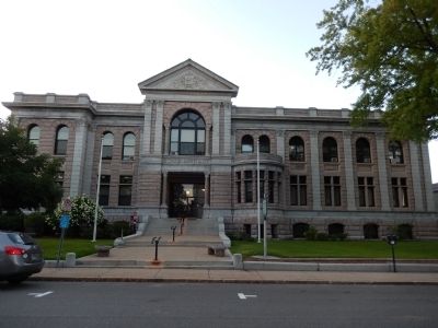
On Park Street just east of North State Street, on the right when traveling west.
Since 1920, New Hampshire has held its presidential primary election before any other state. Changes in New Hampshire law in 1949 made the primary a direct selection of presidential aspirants, not a mere choice of delegates pledged to specific . . . — — Map (db m115923) HM
June 17, 1775 Strength United is Stronger New Hampshire American Revolution Bicentennial Commission East Marker: Colonel John Stark commanded 900 New Hampshire men at the rail fence and at the stone wall on the Mystic River shore against the . . . — — Map (db m115949) HM
On Emmitsburg Road (Business U.S. 15), on the right when traveling north.
(Front):July 2, 1863. Engaged, 224. Killed, 20; Wounded, 73; Died of wounds, 6. Our union is river, lake, ocean, and sky; Man breaks not the medal, when God cuts the die. 12th N.H. Vol's. (Left and Right):1st Brig. 2nd Division. 3rd . . . — — Map (db m17343) HM WM
On Ayres Avenue at Sickles Avenue, on the left when traveling west on Ayres Avenue.
(Text Displayed on Plaques, presented counterclockwise) (First Plaque):Here July 2, 1863, from 5 p.m. till 7 the 5th N.H. Vols. stood and fought. Total engaged 182. Killed or mortally wounded 31. Total killed and wounded 81. (Second . . . — — Map (db m15597) HM WM
SGT Nathaniel C. Barker, USA • LTC Richard N. Batchelder, USA
PVT John W. Boutwell, USA • PVT Carlton N. Camp, USA
CAPT Clinton A. Cilley, USA • 2LT Charles D. Copp, USA
LTC John Coughlin, USA • SGT Samuel H. Craig, USA
PFC George Dilboy, . . . — — Map (db m236223) WM
On Park Tour Road, on the left when traveling south.
“I dedicate this gun to the American Cause.” Colonel Joseph Cilley In honor of Enoch Poor Brigadier-General of the New Hampshire troops Joseph Cilley Colonel of the First Regiment Henry Dearborn Colonel of the Second Regiment . . . — — Map (db m10084) HM
Near Taneytown Road (State Highway 134), on the right when traveling north.
On this ground Edgell's 1st New Hampshire Battery Light Artillery fired three hundred and fifty-three rounds of ammunition July 2nd and 3rd, 1863 Erected by the State of New Hampshire July 3rd. 1912 — — Map (db m16619) HM
Erected in honor of Brigadier General John Stark and the 1400 New Hampshire men who came to the defense of Vermont in August 1777. Assembling at Fort Number Four in Charleston, New Hampshire, Stark and his troops crossed the Green Mountains to . . . — — Map (db m77022) HM
On Mannering Street at 2nd Street, on the left when traveling east on Mannering Street.
There are more than 1,500 named cultivated lilac specimens! Here at The Avenues, dozens of lilac shrubs and trees are planted for public enjoyment, and descriptions of these cultivars are provided below.
Purple Lilac, Syringa vulgaris . . . — — Map (db m280751) HM
This is the site of the longest continuous stream gaging in New Hampshire. Daily measurement of the level of the Pemigewasset River was begun here in 1886 by the Locks and Canals Company of Lowell, Massachusetts, which controlled flowage in the . . . — — Map (db m74576) HM
Near Sudley Road (State Road 234), on the right when traveling north.
July 21, 1861 11:00 a.m. 2nd Brigade (Burnside), Second Division (Hunter) Army of Northeastern Virginia, USA 2nd New Hampshire Infantry Col. Gilman Marston "With the 71st New York State Militia on its left, the 2nd New Hampshire rushed to . . . — — Map (db m9734) HM
On Lempster Street at Pitkin Road, on the left when traveling south on Lempster Street.
On nearby Allen Road on December 4, 1939, the New Hampshire Electric Cooperative set its first utility pole, an important event in bringing electric service to the farms, mills, and homes of the New Hampshire countryside. A group of citizens . . . — — Map (db m230344) HM
Extending 36 miles from Piscataqua Bridge in Durham to the Merrimack River in East Concord, this highway was originally a toll road. The first of more than 80 New Hampshire turnpikes built by private corporations in the nineteenth century, this was . . . — — Map (db m77814) HM
Near New York State Route 67, on the left when traveling east.
A memorial commemorating the record of the New Hampshire troops under the command of John Stark in this import and decisive engagement August 16, 1777 — — Map (db m36762) HM
Near Masonic Temple Driveway 0.3 miles west of Callahan Drive, on the left when traveling north.
The New Hampshire Freemasons commemorated the 200th anniversary of the death of George Washington at the redstone quarry in Redstone, N.H. on September 14, 1999. This historic mine supplied most of the pink and green granite used in the . . . — — Map (db m250452) HM
On 401 National Avenue (Business Virginia Route 7), on the right when traveling east.
(Front): New Hampshire erects this monument to the memory of her brave sons of her 14th Regiment who fell in battle Sept. 19, 1864 upon this field and are here buried in one common grave. Capts. W.H. Chaffin. W.A. Fosgate. Lieuts. H.S. Paul. . . . — — Map (db m81313) WM
On Main Street (New Hampshire Route 11), on the right.
Honor Roll
This memorial is dedicated to the men and women who served their country for the cause of freedom
1941 World War II 1945 4 rows of names are inscribed.
Those who made the supreme sacrifice 8 names are inscribed.
1950 Korea 1953 . . . — — Map (db m96745) WM
On Franklin Pierce Highway (New Hampshire Route 9) at Pond Brook Road, on the right when traveling west on Franklin Pierce Highway.
In 1772 "the people called Methodist" held their first religious meeting in this state on the James Robertson farm, 1.2 miles north of here, on Christian Street, with Philip Embury as the preacher. On June 20, 1803, Francis Asbury spoke here using . . . — — Map (db m85918) HM
On Rum Hill Road (U.S. 302), on the right when traveling south.
Settled in 1766 by Jaasiel Harriman whose cabin was near the Great Rock. His nine year old daughter Mercy carried dirt in her apron to the top of this unique rock formation. Here she planted corn, pumpkins and cucumbers, making the first garden . . . — — Map (db m74569) HM
In Honor of the men and women of Durham who served in the armed forces of there country.There are several markers that make up this memorial. Each monument is inscribed with the names of those who served. — — Map (db m96443) WM
On Main Street (New Hampshire Route 12) at Olcott Lane on Main Street.
Carlton attended Charlestown schools, starring in basketball, soccer and baseball at Charlestown High School. He played professional baseball for the Boston Red Sox and the Chicago White Sox from 1969 to 1993, where he set several records including . . . — — Map (db m74583) HM
On Bouton Street at Church Street, on the right when traveling south on Bouton Street.
On this historical site built – 1751 the first framed meeting house where the New Hampshire Convention ratified the Federal Constitution thereby assuring its adoption June 21, 1788 A memorial to the soldiers of this town who took part in the . . . — — Map (db m105458) HM
On March 3, 1860, Abraham Lincoln delivered his final of four speeches in New Hampshire at Exeter Town Hall. Lincoln had strong ties to Exeter due to the influence of Amos Tuck, of this town, who is credited with the creation of the Republican . . . — — Map (db m88050) HM
On 17th Street Northwest at S Street Northwest, on the right when traveling north on 17th Street Northwest.
At 1740 New Hampshire Ave. (above) stands the Dove House (1898). The private home has been converted into a 12-unit condominium, including a single unit with a loft in the former high-ceilinged ballroom.
The Art Deco Carlyle Suites at . . . — — Map (db m128038) HM
One of the thirteen original colonies
Capital-Concord
While the French were the first to explore this area, it was John Smith’s explorations, maps, and reports of the region in 1614 which led to its eventual settlement. In 1622, John Mason . . . — — Map (db m194678) HM
August 29, 1862 3:00 p.m. 1st Brigade (Grover), Second Division (Hooker) Third Corps (Heintzelman), Army of the Potomac, USA 2nd New Hampshire Infantry Col. Gilman Marston “There was a crash of Rebel musketry, an answering roar of . . . — — Map (db m40532) HM
Grenier Army Air Field
Manchester Londonderry 1941-1966
Named for Lt Jean Grenier, Army Air Corps pilot killed flying mail in Utah in 1934.
During WWII over 52000 crewmembers receive final training in over 9000 B-17, B-24,
and other combat . . . — — Map (db m119750) HM WM
A Living History
"Nature weaves a particular spell of her own to capture and enchant all who make her acquaintance."
-Description on an early scenic postcard of Twin Mountain
Vivid examples of . . . — — Map (db m280684) HM
On Kentucky Route 7 at Brushy Road, on the right when traveling south on Kentucky Route 7.
Built 6 miles west in 1846 on a tract of 30,000 acres by Samuel Seaton and others. Stone stack is 35 feet high, 10 feet across inside. Charcoal fueled, steam-powered air blast. In 22 weeks of 1854, produced 970 tons of iron, hauled in pigs by . . . — — Map (db m144394) HM
On Main Street (Route 11), on the right when traveling north.
Main inscription Dedicated to the memory of those who enlisted from Alton in the War of 1861-65. Died in defense of their country and sleep in unknown graves. Erected by M.H. Savage Post GAR
Side 1 Issac C. Rollins Died at Yorktown . . . — — Map (db m96739) WM
On Main Street (New Hampshire Route 11), on the right when traveling north.
Main inscription Viet Nam Conflict Honor Roll
followed by 2 rows of 70 names.
Reverse inscription Dedicated Mar 30 1987 Erected by Town of Alton and American Legion Post 72 — — Map (db m96743) WM
On Main Street, on the right when traveling south.
In honor of the 12th Regt. NH Vols. who fought in the war of 1861-1865 for the preservation of the Union. Erected by Major E.E. Bedee — — Map (db m96730) WM
1941-1945 Meredith Honor Roll
There are 3 panels of inscribed names, with 4 starred names, indicating they gave their lives in the conflict — — Map (db m96732) WM
On Pearl Street at Hanover Street, on the right on Pearl Street.
In 1915 the congregation of the People's Baptist Church which had been meeting in the South Ward Hall for more than twenty-five years, brought this 1857 building for $1200. Though officially Baptist, its membership was multidenominational. For . . . — — Map (db m115984) HM
Near Submarine Way north of Bypass U.S. 1, on the left when traveling west.
This memorial is dedicated to the 78 men who lost their lives serving their country on the submarine USS Capelin SS289 in the Celebes Sea in December 1943 — — Map (db m186259) WM
Located in Market Square Seat of Colonial Government, 1758 - 1776 The Declaration of Independence was read from the Building, July 18, 1776 President George Washington spoke from the Balcony, October 31, 1789 — — Map (db m76461) HM
On North 3rd Street at 1st Avenue North on North 3rd Street.
Designed by a renowned Grand Forks architect, Joseph Bell DeRemer, this three-story colonial red Harvard brick structure was trimmed with Bedford stone. It was built by the Dinnie Brothers Construction Company and connected to the Security . . . — — Map (db m169721) HM
Near Railroad Station Road 0.2 miles north of W Northfield Road, on the right when traveling north.
Erected By The States Of
Massachusetts
New Hampshire
And Vermont
1897
Under agreements made by their
Commissioners June 13 & Oct 26 1894
defining the Boundary Line between
them established by Royal Decree 1740.
The South . . . — — Map (db m289976) HM
This building originally served a large Shaker community in Canterbury, New Hampshire, as a one-story horse and carriage stand. The simple, unadorned commercial structure was expanded in 1850 to provide storage space for brooms made and sold by . . . — — Map (db m109172) HM
On Main Street (U.S. 3/202) south of Capitol Street, on the left when traveling south.
Near this site, on land just north of the Governor Hill Block at 58-62 North Main Street, was the first home in Concord of Isaac Hill, printer, bookseller, publisher, U.S. Senator and Governor of New Hampshire. It was here that Hill began his . . . — — Map (db m117580) HM
On Railroad Street just east of Main Street, on the right when traveling east.
The trail segment you are on traverses the heart of Keene's post Civil War industrial activity. Some of the industries still present such as J.A. Wright & Co. date many years back in Keene's history. Many of the buildings, which can be seen along . . . — — Map (db m151896) HM
On State Highway 26, on the left when traveling east.
New Hampshire has held the first-in-the-nation presidential primaries since 1920. With the first presidential "beauty contest" in 1952, our citizens have personally met the candidates and by popular ballot have declared their preference for their . . . — — Map (db m74566) HM
On North Main Street at Capitol Street, on the right when traveling south on North Main Street.
The State Capitol Building of New Hampshire was built in 1816-19 by Stuart J. Park. It is constructed of New Hampshire granite quarried in Concord. The original part was occupied June 2, 1819 and is the nation's oldest State Capitol in which a . . . — — Map (db m77813) HM
On North Main Street at Capitol Street, on the right when traveling south on North Main Street.
This reproduction of the Liberty Bell was presented to the people of New Hampshire by direction of The Honorable John W. Snyder Secretary of the Treasury As the inspirational symbol of the United States Savings Bonds Independence Drive . . . — — Map (db m76426) HM
On Main Street south of Depot Street, on the left when traveling south.
Established 1985 Downtown National Historic District Newport, New Hampshire Newport's Downtown National Historic District contains a wide variety of historic buildings dating back to the early 1900s. Their diverse architectural styles include . . . — — Map (db m263661) HM
On North Main Street (U.S. 3) at Capitol Street, on the left when traveling north on North Main Street.
Honoring New Hampshire History
The State House grounds hold the state's foremost display of sculpture and memorials, many fashioned from local granite.
After Concord became the state capital in 1808, its citizens donated land to erect . . . — — Map (db m115908) HM
On Main Street (U.S. 302) east of Maple Street ( Route 142), on the right when traveling east.
Under your feet there is a stream that has always flowed here. In the 18th century settlers from
the seacoast traveling into the north country followed a path that crossed this stream. When
a group of them decided to stay in this . . . — — Map (db m280641) HM
On Keyser Street at Wadleigh Hill Road, on the right when traveling east on Keyser Street.
The "Summer Business" flourished around Kezar Lake and North Sutton Village from the late 1800's to about 1950. People from the cities came to the rural lands and lakes of Sutton where farmers accepted boarders into their homes. Some of the . . . — — Map (db m161497) HM
On Main Street (U.S. 202) at Hopkinton Road ( Route 103), on the right when traveling east on Main Street.
The
Stanley Tavern
Hopkinton, New Hampshire
is listed in the
National Register
of Historic Places
by the United States
Department of the Interior
1791 — — Map (db m141432) HM
On New Hampshire Avenue Northwest just south of V Street Northwest, on the right when traveling north.
The Northumberland
Apartments
Erected 1909 - 1910
Albert H. Beers, Architect
Harry Wardman, Builder
was listed in the District of Columbia
Inventory of Historic Sites and in
the National Register of Historic Places,
U.S. . . . — — Map (db m212704) HM
On New Hampshire Route 12 at Plains Road on New Hampshire Route 12.
Southerly on Old Church Road is located the first Roman Catholic edifice in New Hampshire. It was erected in 1823 under the direction of the Reverend Virgil Horace Barber, S.J. The building serves St. Mary's parish and contained the first Roman . . . — — Map (db m109414) HM
On 2nd New Hampshire Turnpike north of Center Road, on the left when traveling north.
We thank you for your service
[Armed Services Emblems]
————————————————
POW ☆ MIA ☆ KIA
You Are Not Forgotten
In memory of many
In honor of all
Thank You — — Map (db m230283) WM
Near Fort Fisher Boulevard South (U.S. 421) 0.2 miles north of Battle Acre Road, on the right when traveling south.
Some of the heaviest fighting took place in the area in front of you. The "Bloody Gate," as it was referred to by veterans of Fort Fisher, was the entry point of the Wilmington Road into the fort. According to the fort commander Col. William Lamb, . . . — — Map (db m278907) HM
Near Taneytown Road (State Highway 134), on the right when traveling north.
Army of the Potomac Artillery Reserve Third Volunteer Brigade Capt. James F. Huntington 1st New Hampshire Battery Capt. Frederick M. EdgellJuly 2d and 3d Engaged on Cemetery Hill. 1st Ohio Battery H Lieut. George W. NortonJuly 2d and 3d . . . — — Map (db m16815) HM WM
On Chase Road (SR 12A) at Bridge Street on Chase Road (SR 12A).
Built in 1866 at a cost of $9,000, this is the longest wooden bridge in the United States and the longest two-span covered bridge in the world. The fourth bridge at this site, the 460-foot structure was built by Bela J. Fletcher (1811-1877) of . . . — — Map (db m74586) HM
On Calef Highway (New Hampshire Route 125) 0.1 miles north of Beauty Hill Road, on the right when traveling north.
Granted in 1719 to encourage industrial development in the province and called New Portsmouth, this two-mile wide strip of land was set aside to provide homesites for imported workers at the Lamprey Ironworks. Wood from this strip was converted to . . . — — Map (db m152149) HM
On Base Station Road 5.9 miles east of U.S. 302, on the left when traveling east.
Completed in 1869 for $139,500, this unique railway was built through the genius and enterprise of Herrick and Walter Aiken of Franklin and Sylvester Marsh of Campton. Over three miles long, the average grade to the 6,293-foot summit is one foot in . . . — — Map (db m77797) HM
On U.S. 302 0.4 miles east of Rosebrook Road, on the right when traveling east.
Mount Washington Hotel. Standing to the east, the Mount Washington Hotel was completed in 1902 as one of the largest, most modern grand hotels in the White Mountains, one of the few built in a single campaign. Designed by New York architect . . . — — Map (db m77641) HM
On Clinton Street (New Hampshire Route 13) 1 mile south of I-89, on the right when traveling south.
The Great Hurricane of 1938 devastated New England's forests. As a result, Turkey Pond was used to store almost 12 million board feet of salvaged white pine logs, more than anywhere in New England. From 1941 to 1943. the H. S. Durant mill, . . . — — Map (db m129592) HM
Near Ceres Street north of Bow Street, on the right when traveling north.
The Wharves at Bow and Ceres Streets at the base of Spring Hill (as the site was called) were once bustling hubs of waterfront commerce. Built in the late eighteenth century, the waterfront wharves were most active during the Piscataqua region's . . . — — Map (db m115968) HM
On New Hampshire Route 119 at Templeton Turnpike, on the left when traveling south on New Hampshire Route 119.
In honor and memory of Brigadier General James Reed Born at Woburn, Mass. Jan. 8, 1723 Died at Fitchburg, Mass. Feb 13, 1807 One of the proprietors of Monadnock No. 4, and a founder of this town. A leader in its civil and religious life. . . . — — Map (db m152116) HM WM
On Chocorua Mountain Highway (New Hampshire Route 16) 0.8 miles north of Chocorua Lake Road, on the left when traveling north.
In several versions, the legend’s sequence relates the mysterious death of Chocorua’s son while in the care of a settler named Campbell. Suspicious of the cause, the Pequawket chieftain took revenge on the settler’s family. Then, in retaliation, . . . — — Map (db m152078) HM
On White Mountain Highway (New Hampshire Route 16) at Route 16B, on the right when traveling north on White Mountain Highway.
Was fought between 1722 and 1725 against several tribes of eastern Indians. The principal campaigns took place in the Ossipee region and led to the eventual withdrawal of the Indians to the north. Commemorated in Colonial literature by “The Ballad . . . — — Map (db m152069) HM
On Main Street (U.S. 4) at Library Road, on the right when traveling north on Main Street.
Born to a prominent family in Grafton, J. Sarah
Barney graduated valedictorian from Boston
University with degrees in medicine and surgery
in 1896. A founding doctor at Franklin Hospital,
where she practiced from 1910 to her retirement,
Dr. . . . — — Map (db m261129) HM
On Main Street (U.S. 5) 0.1 miles north of School Street, on the right when traveling north.
Samuel Morey, resident of Orford and later Fairlee, successfully operated a steamboat on the Conn. River in 1793. Making over 4000 experiments, this early scientist patented an internal combustion engine in 1826 to anticipate the age of the motor . . . — — Map (db m32118) HM
Near Sullivan Lane 0.2 miles east of Wentworth Road.
Replaced by the New Hampshire Daughters of the American Revolution commemorating the capture of the fort by New Hampshire Patriots December 14, 1774. — — Map (db m135324) HM
On Main Street (U.S. 302) east of Maple Street, on the right when traveling west.
This marble-fronted edifice has been the town’s Post Office since February 14, 1935.
The mansion of Dr. William J. Beattie (1865-1913), a founder of Littleton Hospital, had occupied the site before the construction of this Georgian Revival . . . — — Map (db m116229) HM
On Main Street at Union Street, on the left when traveling north on Main Street.
The waters of Suncook River were harnessed in the 1730’s, eventually powering saw and grist mills, forge shops, and paper mills. The first cotton factory, owned by Major Caleb Stark, was built here in 1811. By 1900, Pembroke Mill, Webster Mill, . . . — — Map (db m115837) HM
Near NW Railroad Street near NW Curtis Street, on the left when traveling west.
Delaware, 1st State
December 7, 1787
1609 • Henry Hudson visited Delaware Bay
1638 • Swedish colonists established Fort Christina, Delaware's first permanent settlement, and founded the colony of New Sweden
1655 • Dutch captured New . . . — — Map (db m47214) HM
On Silver Lake Road east of River Road, on the left when traveling east.
The history of Lochmere, in the broadest sense, is the history of human use of the Winnipesaukee River. Navigable by canoe, the river served as a major transportation and communications route and, with falls and rapids, it has served as a source . . . — — Map (db m261116) HM
On Commercial Street at Stark Street, on the right when traveling north on Commercial Street.
She stands here, for thousands
of 19th century working women:
Industrial revolutionaries who broke
with the past to earn their living,
making history and creating the future.
In 1880 one third of Manchester's population,
3385 women, . . . — — Map (db m117686) HM
On Court St. at Church St., on the left when traveling east on Court St..
Dedicated to the memory of
Brigadier General Enoch Poor
by the New Jersey Society
of the Sons of the American Revolution:
Born at Andover, Mass., June 21, 1736;
Died near Hackensack, N.J., Sept. 8, 1780.
In command of a New . . . — — Map (db m6812) HM
Near New Hampshire Avenue Northwest just south of Georgia Avenue Northwest (U.S. 29), on the right when traveling south.
The facade of the original house for Engine Company 24 was located at 3702 Georgia Avenue, N.W. just north of this site. Built in 1911, the firehouse was designed by Luther Leisenring and Charles Gregg. It originally housed horses and horse-drawn . . . — — Map (db m149476) HM
Front Dedicated to soldiers and patriots of the American Revolution who are buried in IowaDecember 28, 1846 Iowa Our liberties we prize our rights we will maintainReverse George Perkins, N. and S. Carolina, Lee County William . . . — — Map (db m48277) HM
Near Grant Street just south of South Main Street ( Route 108), on the left when traveling south.
Concerts were held on Central Square in front of the Parson Main Monument in the early 1900's. As crowds and traffic increased there was a need for a new location for the band and people to assemble. In 1914 Miles Dustin, local-builder, designed . . . — — Map (db m152156) HM
On North Nash Street south of Key Boulevard, on the right when traveling south.
Mark Felt, second in command at the FBI, met Washington Post reporter Bob Woodward here in this
parking garage to discuss the Watergate scandal. Felt provided Woodward information that exposed the Nixon Administration’s obstruction of the FBI's . . . — — Map (db m55498) HM
Near Plank Road (Virginia Route 3) east of Stuart Drive, on the right when traveling east.
The climactic fighting of the Battle of Chancellorsville took place in the woods and fields around Fairview. Here on the morning of May 3, 1863, Union troops struggled to maintain their position long enough to allow General Hooker time to . . . — — Map (db m295255) HM
On Lafayette Road (U.S. 1) at Kensington Road (New Hampshire Route 84), on the left when traveling north on Lafayette Road.
On his way to Portsmouth after
entering New Hampshire on Saturday,
October 31, 1789, President Washington
accompanied by a splendid procession
of the military and state dignitaries,
halted for a short time here in
Hampton Falls. He greeted and . . . — — Map (db m260676) HM
On Hunking Street west of Mechanic Street, on the right when traveling west.
Colonel Tobias Lear
was born in this house in 1760.
He was George Washington’s Secretary
from 1783 to 1799.
Washington visited here in 1789.
This tablet is placed by the Society
of the Sons of the Revolution
of the State of New . . . — — Map (db m115969) HM
On Exeter Road (New Hampshire Route 85) at Summer Street, on the right when traveling north on Exeter Road.
After establishing a fishing settlement in what
is now called Dover Point, Edward Hilton, Sr.
(1596-1671) settled in the “New fields” section
of Exeter in the 1630s. Hilton's first known
residence was located near the Hilton Burying
Ground, . . . — — Map (db m260729) HM
On New Hampshire Route 10 at 2nd New Hampshire Turnpike/Lempster Mountain Road, on the right when traveling south on New Hampshire Route 10.
Born at Lempster, N.H., Aug. 17, 1814
Died at Boston, Mass., June 14, 1895
Minister in Boston 47 years
President of Tufts College 13 years
Overseer of Harvard College
Patron of Art • Leader in all reforms
This tablet is . . . — — Map (db m230359) HM
On Barnstead Road (New Hampshire Route 107) 0.1 miles south of High Street, on the right when traveling south.
Raised in Barnstead and educated in Pittsfield, this heroic
fighter pilot and leader of men fought in every theater of
war from World War II through Vietnam. He was the first
U.S. Army Air Force pilot to encounter the Luftwaffe
during World War . . . — — Map (db m260939) HM
Near State Street north of Marcy Street, on the right when traveling north.
The revival of Portsmouth’s commerce after the American Revolution spurred the development of new roads, bridges, and wharves. In 1795, several leading merchants incorporated as the Proprietors of the Portsmouth Pier.
This private company . . . — — Map (db m116003) HM
On U.S. 302 0.1 miles south of Hurricane Mountain Road, on the right when traveling south.
Since Thomas Cole's visit in 1828, New Hampshire's splendid scenery has been an enduring inspiration to countless landscape artists. From 1850 to 1890 this region was particularly favored for their easels. Benjamin Champney (1817-1907), New . . . — — Map (db m74557) HM
On Daniel Webster Highway (U.S. 3) north of Woodbury Street, on the right when traveling north.
Was the original town, chartered by Massachusetts Bay Colony in 1673, which embraced parts of New Hampshire and Massachusetts. The New Hampshire portion of this area, following determination of the province boundary in 1741, was subsequently . . . — — Map (db m88053) HM
946 entries matched your criteria. The first 100 are listed above. Next 100 ⊳
Thin black lines indicate changes in relevance. Between each pair of lines entries are ordered geographically but all have the same relevance.
* Inflectional forms of words are their plurals, singulars, and possessives as well as gramatical tenses and similar variations.