By Mark Hilton, November 19, 2019
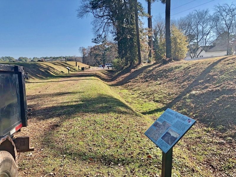
View south from marker, along Allatoona Pass trail, towards parking lot.
| Near Old Allatoona Road SE, 2.9 miles east of Interstate 75, on the left when traveling south. |
| Near Old Alltatoona Road SE, 0.4 miles north of Allatoona Landing Road SE, on the right when traveling north. |
| Near Old Allatoona Road SE, 0.4 miles Allatoona Landing Road SE, on the right when traveling north. |
| Near Old Alltatoona Road SE, 0.4 miles north of Allatoona Landing Road SE, on the right when traveling north. |
| Near Old Alltatoona Road SE, 0.4 miles north of Allatoona Landing Road SE, on the right when traveling north. |
| Near Old Alltatoona Road SE, 0.4 miles north of Allatoona Landing Road SE, on the right when traveling north. |
| On Old Alltatoona Road SE, 0.4 miles north of Allatoona Landing Road SE, on the right when traveling north. |
| Near Old Allatoona Road SE, 0.4 miles north of Allatoona Landing Road SE, on the right when traveling north. |
| Near Old Allatoona Road SE, 0.4 miles north of Allatoona Landing Road SE, on the right when traveling north. |
| Near Old Allatoona Road SE, 0.4 miles north of Allatoona Landing Road SE, on the right. |
| Near Old Allatoona Road SE, 0.4 miles Allatoona Landing Road SE, on the right when traveling north. |
| On Cassville Road (Georgia Route 293) 0.1 miles south of Goodyear Avenue, on the right when traveling south. |
| Near Old Allatoona Road Southeast, 1.5 miles east of Interstate 75, on the left when traveling east. |
| On South Tennessee Street (Georgia Route 293) 0 miles north of Brook Drive, on the right when traveling north. |
| Near West Main Street (Georgia Route 113) 0.1 miles west of South Public Square, on the right when traveling west. |
| On South Tennessee Street (Georgia Route 293) 0.1 miles north of Brook Drive, on the right when traveling north. |
| Near West Main Street (Georgia Route 113) west of South Public Square, on the right when traveling west. |
| On West Cherokee Avenue at North Erwin Street, on the right when traveling west on West Cherokee Avenue. |
| Near Unnamed road, 1 mile south of Georgia Route 20 Spur. |
| Near West Main Street (Georgia Route 113) west of South Public Square, on the right when traveling west. |
| Near West Main Street (Georgia Route 113) west of South Public Square, on the right when traveling west. |
| Near West Main Street (Georgia Route 113) west of South Public Square, on the right when traveling west. |
| Near North Erwin Street east of Cassville Road (Georgia Route 293), on the left when traveling east. |
| On Georgia Route 293 at Old River Road, on the right when traveling north on State Route 293. |
| On Indian Mound Road, 0.8 miles east of Douthit Ferry Road, on the left when traveling south. |
| Near Georgia Route 20 Spur, 1 mile Georgia Route 20 Spur. |
| On Rockmart Highway (Georgia Route 113) 0.4 miles east of Dallas Highway SW (Georgia Route 61), on the right when traveling west. |
| Near West Main Street (Georgia Route 113) west of South Public Square, on the right when traveling west. |
| On Joe Frank Harris Parkway (U.S. 41) at Old River Road, on the right when traveling north on Joe Frank Harris Parkway. |
| On Tennessee Road (U.S. 411) at Old Tennessee Road, on the right when traveling north on Tennessee Road. |
| On West Main Street at North Bartow STreet, on the right when traveling west on West Main Street. |
| Near West Main Street (Georgia Route 113) west of South Public Square, on the right when traveling west. |
| On Georgia Route 293, 0.1 miles north of Old River Road, on the right when traveling north. |
| On West Main Street (Georgia Route 113) at Friendship Plaza, on the right when traveling west on West Main Street. |
| Near West Main Street (Georgia Route 113) west of South Public Square, on the right when traveling west. |
| On South Public Square, 0.1 miles south of West Cherokee Avenue, on the right. |
| Near West Main Street (Georgia Route 113) west of South Public Square, on the right when traveling west. |
| On West Cherokee Avenue, 0.1 miles west of South Bartow Street, on the right when traveling east. |
| Near West Main Street (Georgia Route 113) west of South Public Square, on the right when traveling west. |
| Near Old Allatoona Road Southeast, 1.5 miles east of Interstate 75, on the left when traveling east. |
| Near Old Allatoona Road SE, 2 miles east of Interstate 75, on the left when traveling east. |
| Near West Main Street (Route 113) west of South Public Square, on the right when traveling west. |
| Near Old Allatoona Road Southeast, 1.5 miles east of Interstate 75, on the left when traveling east. |
| Near West Main Street (Georgia Route 113) west of South Public Square, on the right when traveling west. |
| Near West Main Street (Georgia Route 113) west of South Public Square, on the right when traveling west. |
| On Old River Road, 2.5 miles east of Joe Frank Harris Parkway (U.S. 41), on the left when traveling north. |
| On Euharlee Road at Milam Bridge Road, on the right when traveling east on Euharlee Road. |
| Near Old Allatoona Road Southeast, 1.5 miles east of Interstate 75, on the left when traveling east. |
| Near Old Allatoona Road Southeast, 1.5 miles east of Interstate 75, on the left when traveling east. |
| Near Old Allatoona Road Southeast, 1.5 miles east of Interstate 75, on the left when traveling east. |
| Near Old Allatoona Road Southeast, 1.5 miles east of Interstate 75, on the left when traveling east. |
| Near Old Allatoona Road Southeast, 1.5 miles Interstate 75, on the left when traveling east. |
| On East Church Street at North Museum Drive, on the right when traveling west on East Church Street. |
| Near North Erwin Street, 0.1 miles east of Cassville Road (Georgia Route 293). |
| On North Public Square, 0 miles north of West Main Street (Georgia Route 61), on the right when traveling north. |
| On Rockmart Highway (Georgia Route 113) 0.1 miles west of Kincannon Road SW, on the right when traveling west. |
| Near West Main Street (Georgia Route 113) west of South Public Square, on the right when traveling west. |
| Near Old Allatoona Road, 2 miles east of Interstate 75, on the left when traveling east. |
| On Simpson Circle NE at Harvey Knight Road NE, on the right when traveling north on Simpson Circle NE. |
| Near West Main Street (Georgia Route 113) west of South Public Square, on the right when traveling west. |
| Near West Main Street (Georgia Route 113) west of South Public Square, on the right when traveling west. |
| On West Main Street at School Street, on the right when traveling west on West Main Street. |
| Near Old Allatoona Road Southeast, 1.5 miles east of Interstate 75, on the left when traveling east. |
| Near West Main Street (Georgia Route 113) west of South Public Square, on the right when traveling west. |
| On West Main Street (Georgia Route 113) at Friendship Plaza, on the right when traveling west on West Main Street. |
| Near West Main Street (Georgia Route 113) west of South Public Square, on the right when traveling west. |
| Near West Main Street (Georgia Route 113) west of South Public Square, on the right when traveling west. |
| Near West Main Street (Georgia Route 113) west of South Public Square, on the right when traveling west. |
| Near Old Allatoona Road Southeast, 1.5 miles east of Interstate 75, on the left when traveling east. |
| On Cassville Road NW, on the right when traveling south. |
| On Cassville Road NW (Old Route 41), on the right when traveling south. |
| On Joe Frank Harris Parkway (U.S. 41) at Willow Lane NW, on the right when traveling north on Joe Frank Harris Parkway. |
| On Cassville-White Road at Shinall Gaines Road NW, on the right when traveling east on Cassville-White Road. |
| On Mac Johnson Road at Alisha Circle, in the median on Mac Johnson Road. |
| Near Chunn Facin Road NW at Shinall Gaines Road, on the right when traveling east. |
| On Mac Johnson Road NW, 0.4 miles north of Joe Frank Harris Parkway (U.S. 41), on the left when traveling north. |
| Near Cassville-White Road at Shinall Gaines Road NW. |
| On Joe Frank Harris Parkway (U.S. 41) at Cassville Road, on the right when traveling north on Joe Frank Harris Parkway. |
| Near Mac Johnson Rd. NW, on the left when traveling north. |
| On Joe Frank Harris Parkway (U.S. 41) 0.1 miles south of Willow Lane, on the right when traveling south. |
| On Cassville Road Northwest at Joree Road Northwest, on the right when traveling south on Cassville Road Northwest. |
| On Joe Frank Harris Parkway (U.S. 41) at Willow Lane NW, on the right when traveling north on Joe Frank Harris Parkway. |
| On Fire Tower Road at Gaddis Road, on the right when traveling east on Fire Tower Road. Reported missing. |
| On Cassville Road NW, on the left when traveling south. |
| On Cassville Road NW (Old Route 41), on the left when traveling south. |
| On Old Allatoona Road at Allatoona Landing Road, on the left when traveling south on Old Allatoona Road. |
| On Main Street (Georgia Route 293) at Gaston Westbrook Avenue, on the left when traveling north on Main Street. |
| On North Main Street SE (Georgia Route 293) at Sandtown Road SE, on the right when traveling west on North Main Street SE. |
| On Covered Bridge Road SW, 0.2 miles south of Euharlee Road SW, on the right when traveling north. |
| On Covered Bridge Road SW, 0.1 miles west of Covered Bridge-Stilesboro Road SW, on the right when traveling west. |
| On Hall Station Road, 0.1 miles south of Old Hall Station Road, on the right when traveling south. |
| On East Railroad Street at Shaw Street, on the left when traveling west on East Railroad Street. |
| On Kingston Highway (Georgia Route 293) at Martin Circle, on the left when traveling west on Kingston Highway. |
| On Law Road, 1.2 miles north of Kingston Highway (Georgia Route 293), on the left when traveling north. |
| On West Main Street at Johnson Street, on the left when traveling east on West Main Street. |
| On West Main Street at Elliott Street, on the right when traveling east on West Main Street. |
| On Main Street at Park Street, on the right when traveling west on Main Street. |
| On Cemetery Street south of Johnson Street, on the right when traveling north. |
| On Park Street, 0.1 miles north of Main Street, on the right when traveling north. |
7017 entries matched your criteria. Entries 301 through 400 are listed above.
⊲ Previous 100 —
Next 100 ⊳