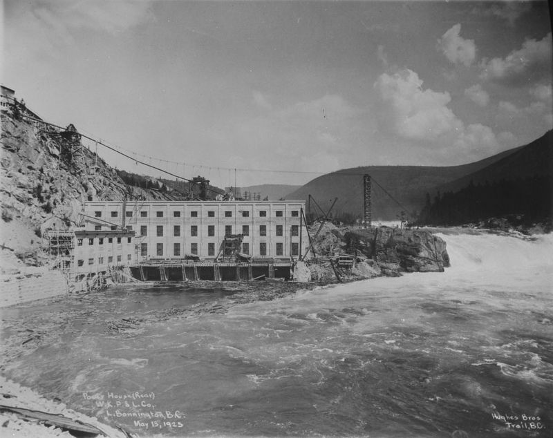
Canada Dept. of Mines & Technical Surveys via Library & Archives Canada PA-015550 (Public domain), May 13, 1925
West Kootenay Power & Light Co. power house, Lower Bonnington Dam
| On Nelson Nelway Highway (Provincial Highway 3A) 0.2 kilometers east of South Slocan Village Road, on the right when traveling east. Reported missing. |
| On Brilliant Road 0.5 kilometers east of Gorkoff Road, on the right when traveling east. |
| On British Columbia 6 0.2 kilometers south of Crescent Valley Road, on the right when traveling south. |
| On Highway 3A 0.3 kilometers south of View Road, on the right when traveling south. |
| On Broadway Street West at 3 Avenue NW, on the left when traveling west on Broadway Street West. |
| On Broadway Street West at 4 Avenue NW, on the right when traveling west on Broadway Street West. |
| On Broadway Street West at 5th Avenue NW, on the right when traveling west on Broadway Street West. |
| On 5 Avenue Northwest at 1 Street NW, on the left when traveling north on 5 Avenue Northwest. |
| On Nelson Nelway Highway (Provincial Highway 3A) 0.2 kilometers west of Government Road, on the right when traveling west. |
| On Vernon Street at Ward Street, on the right when traveling east on Vernon Street. |
| On Eastman Avenue at Davis Street, on the left when traveling north on Eastman Avenue. |
| On Crowsnest Highway (Provincial Highway 3) 3 kilometers south of Salmo Ski Hill Road, on the left when traveling south. |
| On Slocan Star Street 0.3 kilometers east of Sandon Road, on the left when traveling east. |
| On Kootenay Highway (Provincial Highway 93/95) 1.3 kilometers north of Burns Avenue, on the left when traveling north. |
| On Van Horne Street South (Provincial Highway 3) south of 5th Avenue South, on the right when traveling south. |
| On Wardner Fort Steele Road, on the right when traveling east. |
| On Provincial Highway 93/95 close to St. Mary's Street. |
| On Wardner Fort Steele Road, on the right when traveling east. |
| On Kootenay Highway (Provincial Highway 3) 0.8 kilometers east of Ha Ha Creek Road, on the left when traveling south. |
| On Crowsnest Highway (Provincial Highway 3/95) 0.4 kilometers south of Half Moon Avenue, on the right when traveling south. |
| On Crowsnest Highway (Provincial Highway 3/95) 0.3 kilometers south of Half Moon Avenue, on the right when traveling south. |
| On Kootenay Highway (Provincial Highway 93) 2.2 kilometers south of Stanley Street, on the right when traveling south. |
| On Crowsnest Highway (Provincial Highway 3) just north of British Columbia-Alberta boundary line, on the left when traveling west. |
| On Crowsnest Highway (Provincial Highway 3) 3.3 kilometers south of Douglas Fir Road, on the right when traveling south. |
| On Crowsnest Highway (Provincial Highway 3) 0.4 kilometers west of Elk Valley Coal Road, on the right when traveling west. |
| On Kootenay Highway (Provincial Highway 93) 0.7 kilometers south of Simpson River Trailhead, on the right when traveling north. |
| On Banff-Windermere Highway (Provincial Highway 93), on the right when traveling north. |
| On Banff-Windermere Highway (Provincial Highway 93), on the right when traveling north. |
| On Banff-Windermere Highway (Provincial Highway 93), on the right when traveling north. |
| On Laurier Street 0.2 kilometers south of Daly Street, on the left when traveling south. |
| On Main Street, on the left when traveling east. |
| On Crowsnest Highway (Provincial Highway 3) at Boundary Smelter Road, on the right when traveling east on Crowsnest Highway. |
| On British Columbia 395 0.1 kilometers east of Crowsnest Highway (Provincial Highway 3), on the left when traveling east. |
| On Crowsnest Highway (Provincial Highway 3) 2 kilometers west of Wilgas Lake Rest Area, on the left when traveling west. |
| On Crowsnest Highway (Provincial Highway 3) 3.4 kilometers west of Stewart Creek Road, on the left when traveling west. |
| On Smelter Viewpoint at Butte Avenue, on the right when traveling south on Smelter Viewpoint. |
| On Smelter Viewpoint at Butte Avenue, on the left when traveling north on Smelter Viewpoint. |
| On Crowsnest Highway (Provincial Highway 3) just west of Beamish Street, on the right when traveling west. Reported permanently removed. |
| On 5th Avenue at Florence Street, on the right when traveling east on 5th Avenue. |
| On BC-3B (Provincial Highway 3B) at Paterson-Trail Highway (Provincial Highway 22), on the right when traveling west on BC-3B. |
| Near Paterson-Trail Highway (Provincial Highway 22) 1.1 kilometers north of King George Park Road, on the right when traveling west. |
