1005 entries match your criteria. The first 100 are listed. ⊳
Historical Markers and War Memorials
in Greater Princeton Region
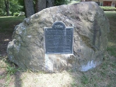
By Deb Hartshorn, July 18, 2010
Bear Tavern Road Marker
1 ► New Jersey, Mercer County, Ewing Township — Bear Tavern Road —  |
| On Bear Tavern Road (County Route 579) 0.1 miles south of Jacobs Creek Road, on the left when traveling south. | |||
| 2 ► New Jersey, Mercer County, Ewing Township — Temple-Ryan Farmhouse — |
| Near Federal City Road at Violet Cox Drive. | |||
| 3 ► New Jersey, Mercer County, Ewing Township, Hopewell Township — Mercer Airport — |
| On Bear Tavern Road (County Route 579) 0.2 miles south of Nursery Road (County Route 579), on the left when traveling south. | |||
| 4 ► New Jersey, Mercer County, Ewing Township, West Trenton — An Historic Crossroad — |
| On Bear Tavern Road at West Upper Ferry Road, on the left when traveling south on Bear Tavern Road. | |||
| 5 ► New Jersey, Mercer County, Ewing Township, West Trenton — 234 — Church Cemetery — at Ewing Presbyterian Church — American Presbyterian and Reformed Historical Site — |
| On Scotch Road 0.2 miles north of Carlton Avenue, on the right when traveling south. | |||
| 6 ► New Jersey, Mercer County, Ewing Township, West Trenton — Hopewell Church — |
| Near Sullivan Way. | |||
| 7 ► New Jersey, Mercer County, Ewing Township, West Trenton — In Memory of their Revolutionary Ancestors — |
| On River Road (New Jersey Route 175) just north of W Upper Ferry Road (County Route 634), on the left when traveling north. | |||
| 8 ► New Jersey, Mercer County, Hamilton Square, Mercerville-Hamilton Square — Hamilton Square Honor Roll — New Jersey — |
| On Nottingham Way at Mercer Street, on the left when traveling east on Nottingham Way. | |||
| 9 ► New Jersey, Mercer County, Hamilton Square, Mercerville-Hamilton Square — World War I Monument — Honor Roll — |
| On Nottingham Way at Mercer Street, on the left when traveling east on Nottingham Way. | |||
| 10 ► New Jersey, Mercer County, Hamilton Township — Discover Abbott Marshlands — D&R Canal State Park — |
| On Delaware and Raritan Canal State Park Trail 0.1 miles south of Interstate 295, on the left when traveling south. | |||
| 11 ► New Jersey, Mercer County, Hamilton Township — Pearl Harbor Memorial Extension — |
| On New Jersey Turnpike (Interstate 95) 1 mile south of Interstate 195, on the right when traveling south. | |||
| 12 ► New Jersey, Mercer County, Hamilton Township, Mercerville — 3 of 12 — Route of Washington’s March — |
| Near Hamilton Ave. | |||
| 13 ► New Jersey, Mercer County, Hamilton Township, Mercerville — 6 of 12 — Route of Washington’s March — |
| On Quakerbridge Road 0.2 miles north of Flock Road, in the median. | |||
| 14 ► New Jersey, Mercer County, Hamilton Township, Mercerville — 8 of 12 — Route of Washington’s March — |
| On Quakerbridge Road at Hughes Drive, on the right when traveling north on Quakerbridge Road. | |||
| 15 ► New Jersey, Mercer County, Hamilton Township, Mercerville-Hamilton Square — 4 of 12 — Route of Washington’s March — |
| On Klockner Road 0.1 miles north of Hamilton Avenue, on the right when traveling north. | |||
| 16 ► New Jersey, Mercer County, Hamilton Township, Mercerville-Hamilton Square — 5 of 12 — Route of Washington’s March — |
| Near Christine Avenue. | |||
| 17 ► New Jersey, Mercer County, Hamilton Township, White Horse — World War II Memorial — ⛤ — |
| On Lakeside Boulevard just south of Spicer Avenue, on the right when traveling north. | |||
| 18 ► New Jersey, Mercer County, Hightstown — East Windsor Township Civil War Monument — |
| On Stockton Street at Rogers Ave. on Stockton Street. | |||
| 19 ► New Jersey, Mercer County, Hightstown — Hightstown — |
| On Main Street (New Jersey Route 33). | |||
| 20 ► New Jersey, Mercer County, Hightstown — Hightstown World War II Memorial — |
| On N Main Street (New Jersey Route 33), on the right when traveling north. | |||
| 21 ► New Jersey, Mercer County, Hightstown — Memorial Park — |
| On North Main Street (New Jersey Route 33) at Franklin Street ( Route 33), on the right when traveling north on North Main Street. | |||
| 22 ► New Jersey, Mercer County, Hightstown — The Railroad in Hightstown — |
| On North Main Street (New Jersey Route 33) at Franklin Street ( Route 33), on the right when traveling south on North Main Street. | |||
| 23 ► New Jersey, Mercer County, Hightstown — The Smith House — |
| On Stockton Street (County Route 571) just west of South Main Street ( Route 33), on the right when traveling east. | |||
| 24 ► New Jersey, Mercer County, Hopewell — Delaware and Bound Brook Railroad Historic District — |
| On Van Dyke Road, on the right when traveling south. | |||
| 25 ► New Jersey, Mercer County, Hopewell — Highland Cemetery — |
| On Hopewell - Wertsville Road just north of Washington Avenue, on the right when traveling north. | |||
| 26 ► New Jersey, Mercer County, Hopewell — Hopewell Academy — |
| On West Broad Street (County Route 518), on the left when traveling west. | |||
| 27 ► New Jersey, Mercer County, Hopewell — Hopewell Call To Duty — |
| On Hopewell - Princeton Road, on the right when traveling south. | |||
| 28 ► New Jersey, Mercer County, Hopewell — Joab Houghton — |
| On Broad Street (County Route 518), on the right when traveling west. | |||
| 29 ► New Jersey, Mercer County, Hopewell — John Hart — Signer of The Declaration Of Independence — |
| On Hart Avenue, on the right when traveling west. | |||
| 30 ► New Jersey, Mercer County, Hopewell — Mount Rose The Landform — Lawrence Hopewell Trail — |
| Near Pennington Rocky Hill Road 0.2 miles west of Carter Road, on the left when traveling west. | |||
| 31 ► New Jersey, Mercer County, Hopewell Township — Family Farming — Lawrence Hopewell Trail — |
| On Pennington Rocky Hill Road (County Route 624) 0.1 miles south of Old Mill Road, on the right when traveling south. | |||
| 32 ► New Jersey, Mercer County, Hopewell Township — Hart’s Corner Schoolhouse — |
| On Scotch Road at Washington Crossing Pennington Road, on the left when traveling north on Scotch Road. | |||
| 33 ► New Jersey, Mercer County, Hopewell Township — Horsin’ Around — Lawrence Hopewell Trail — |
| On Pennington Rocky Hill Road (County Route 624) at Elm Ridge Road (County Route 625), on the right when traveling south on Pennington Rocky Hill Road. | |||
| 34 ► New Jersey, Mercer County, Hopewell Township — Mount Rose Distillery — Lawrence Hopewell Trail — |
| On Pennington Rocky Hill Road just north of Bailey Drive, on the right when traveling north. | |||
| 35 ► New Jersey, Mercer County, Hopewell Township — Parks for the People — Lawrence Hopewell Trail — |
| Near Federal City Road 0.5 miles east of Rosedale Way, on the right when traveling north. | |||
| 36 ► New Jersey, Mercer County, Hopewell Township — Watershed Reserve — Lawrence Hopewell Trail — |
| On Titus Mill Road at Wargo Road, on the right when traveling west on Titus Mill Road. | |||
| 37 ► New Jersey, Mercer County, Hopewell Township, Ewing Township — Bridges, Roads, and Railroads of Jacobs Creek — |
| On Jacobs Creek Road. | |||
| 38 ► New Jersey, Mercer County, Hopewell Township, Ewing Township — Geography & Historic Landscape of Jacobs Creek — |
| On Jacobs Creek Road. | |||
| 39 ► New Jersey, Mercer County, Hopewell Township, Ewing Township — Washington’s March to Trenton — December 26th, 1776 — “My Noble Men! Press Onward! On!” — |
| On Jacobs Creek Road. | |||
| 40 ► New Jersey, Mercer County, Hopewell Township, Titusville — Continental Lane — |
| Near Brickyard Road. | |||
| 41 ► New Jersey, Mercer County, Hopewell Township, Titusville — Henry Phillips House — |
| On Hunter Road. | |||
| 42 ► New Jersey, Mercer County, Hopewell Township, Titusville — Johnson Ferry House — |
| Near Brickyard Road. | |||
| 43 ► New Jersey, Mercer County, Hopewell Township, Titusville — Prelude to Victory — |
| Near River Road. | |||
| 44 ► New Jersey, Mercer County, Hopewell Township, Titusville — Site of Crossing — |
| Near River Road. | |||
| 45 ► New Jersey, Mercer County, Hopewell Township, Titusville — The March to Trenton — December 26, 1776 — Washington Crossing State Park — |
| Near Washington Crossing Pennington Road. | |||
| 46 ► New Jersey, Mercer County, Hopewell Township, Titusville — The Site of Washington’s Crossing — |
| On River Drive north of Washington Crossing Pennington Road, on the right when traveling north. | |||
| 47 ► New Jersey, Mercer County, Lambertville — Village Store — |
| On Harbourton Mount Airy Rd. at Harbourton Rocktown Rd., on the left when traveling south on Harbourton Mount Airy Rd.. | |||
| 48 ► New Jersey, Mercer County, Lambertville, Titusville — Howell Living History Farm — Women’s Heritage Trail — Women in Farm Live — |
| On Woodens Lane. | |||
| 49 ► New Jersey, Mercer County, Lawrence Township — "Hello London" — |
| Near Cold Soil Road west of Keefe Road, on the left when traveling west. | |||
| 50 ► New Jersey, Mercer County, Lawrence Township — “Keep Mum - The World Has Ears” — |
| Near Cold Soil Road west of Keefe Road, on the left when traveling west. | |||
| 51 ► New Jersey, Mercer County, Lawrence Township — A Mill and a Bridge in the Back Country — Lawrence Hopewell Trail — |
| Near Province Line Road 0.5 miles north of Ettl Circle, on the left when traveling north. | |||
| 52 ► New Jersey, Mercer County, Lawrence Township — Educational Testing Service HQ — (Don't Forget That #2 Pencil) — Lawrence Hopewell Trail — |
| On Assessment Road west of ETS Drive, on the left when traveling south. | |||
| 53 ► New Jersey, Mercer County, Lawrence Township — From Indian Path to Asphalt Highway — Lawrence Hopewell Trail — |
| On Province Line Road at Lawrenceville Road (U.S. 206), on the right when traveling north on Province Line Road. | |||
| 54 ► New Jersey, Mercer County, Lawrence Township — Going Silent — |
| Near Cold Soil Road west of Keefe Road, on the left when traveling west. | |||
| 55 ► New Jersey, Mercer County, Lawrence Township — Lewisville Road — |
| On Lewisville Road 0.5 miles east of Franklin Corner Road, on the left when traveling east. | |||
| 56 ► New Jersey, Mercer County, Lawrence Township — Lewisville Road — Lawrence Hopewell Trail — |
| On Lewisville Road 0.7 miles east of Franklin Corner Road (County Route 546), on the right when traveling east. | |||
| 57 ► New Jersey, Mercer County, Lawrence Township — London Towers — |
| Near Cold Soil Road west of Keefe Road, on the left when traveling west. | |||
| 58 ► New Jersey, Mercer County, Lawrence Township — Pole Farm District — |
| Near Cold Soil Road at Keefe Road, on the left when traveling west. | |||
| 59 ► New Jersey, Mercer County, Lawrence Township — Province Line — Lawrence-Hopewell Trail — |
| On Province Line Road at Audubon Lane, on the right when traveling south on Province Line Road. | |||
| 60 ► New Jersey, Mercer County, Lawrence Township — Revolutionary War Site |
| On Lawrenceville Road (U.S. 206), on the left when traveling south. Reported missing. | |||
| 61 ► New Jersey, Mercer County, Lawrence Township — Revolutionary War Site — [Shabakunk Creek] — |
| On Lawrenceville Road (U.S. 206) 1 mile north of Princeton Pike, on the right. | |||
| 62 ► New Jersey, Mercer County, Lawrence Township — 9 of 12 — Route of Washington’s March — |
| On Quakerbridge Road just north of Nassau Park Boulevard, in the median. | |||
| 63 ► New Jersey, Mercer County, Lawrence Township — Spring Grove — Birthplace of David Brearley — |
| On Lewisville Road just west of Princeton Pike, on the right when traveling west. | |||
| 64 ► New Jersey, Mercer County, Lawrence Township — The "Pole Farm" — |
| On Cold Soil Road west of Keefe Road, on the left when traveling west. | |||
| 65 ► New Jersey, Mercer County, Lawrence Township — The “Pole Farm” Map — |
| On Cold Soil Road north of Keefe Road, on the left when traveling west. | |||
| 66 ► New Jersey, Mercer County, Lawrence Township — Welcome to the 1761 Brearley House — |
| Near Meadow Road at Lawrence Hopewell Trail, on the left when traveling south. | |||
| 67 ► New Jersey, Mercer County, Lawrence Township, Lawrenceville — A Timeline of AT&T's Pole Farm — |
| On Cold Soil Road west of Keefe Road, on the left when traveling west. | |||
| 68 ► New Jersey, Mercer County, Lawrence Township, Lawrenceville — Arctic Parkway — (and other roads to nowhere) — Lawrence Hopewell Trail — |
| On Bergen Street just south of Stonerise Drive, on the right when traveling south. | |||
| 69 ► New Jersey, Mercer County, Lawrence Township, Lawrenceville — Brearley Oak — Lawrence Hopewell Trail — |
| On Princeton Pike (County Route 583) at Lenox Drive, on the right when traveling south on Princeton Pike. | |||
| 70 ► New Jersey, Mercer County, Lawrence Township, Lawrenceville — First Town Hall — 1931 – 1944 — |
| On Lawrenceville Road (Main Street) (U.S. 206) 0.2 miles north of Gordon Avenue, on the right when traveling south. | |||
| 71 ► New Jersey, Mercer County, Lawrence Township, Lawrenceville — John Moore’s Tavern — 1804 – 1817 — |
| On Lawrenceville Road (Main Street) (U.S. 206) 0 miles Gordon Avenue, on the right when traveling south. | |||
| 72 ► New Jersey, Mercer County, Lawrence Township, Lawrenceville — Johnson Trolley Line — |
| On Craven Lane just north of George Street, on the left when traveling north. | |||
| 73 ► New Jersey, Mercer County, Lawrence Township, Lawrenceville — Johnson Trolley Line — Lawrence-Hopewell Trail — |
| On Phillips Avenue at James Street, on the left when traveling north on Phillips Avenue. | |||
| 74 ► New Jersey, Mercer County, Lawrence Township, Lawrenceville — Lawrence House, 1840 — |
| On Lawrenceville Road (Main Street) (U.S. 206) 0.2 miles north of Gordon Avenue, on the right when traveling south. | |||
| 75 ► New Jersey, Mercer County, Lawrence Township, Lawrenceville — 328 — Maidenhead Church — American Presbyterian and Reformed Historical Site — |
| On Lawrenceville Road (Main Street) (U.S. 206) 0 miles Gordon Avenue, on the right when traveling north. | |||
| 76 ► New Jersey, Mercer County, Lawrence Township, Lawrenceville — Princeton Pike — Lawrence Hopewell Trail — |
| On Princeton Pike (County Route 583) at Lenox Drive, on the right when traveling north on Princeton Pike. | |||
| 77 ► New Jersey, Mercer County, Montgomery, Skillman — Province Line Road — |
| On Province Line Road at Hopewell - Rocky Hill Road (County Route 518), on the right when traveling south on Province Line Road. | |||
| 78 ► New Jersey, Mercer County, Mount Rose — The Historic Village of Mount Rose — |
| On Cherry Valley Road at Hopewell Princeton Road, on the right when traveling west on Cherry Valley Road. | |||
| 79 ► New Jersey, Mercer County, Pennington — Bicentennial of the Birth of George Washington — |
| On Blackwell Road (County Route 546) at Pennington Road ( Route 31), on the right when traveling west on Blackwell Road. | |||
| 80 ► New Jersey, Mercer County, Pennington — Birthplace of John Hart — (c. 1713-1779) — |
| Near Pennington Road (State Road 31) north of Interstate 295, on the right when traveling north. | |||
| 81 ► New Jersey, Mercer County, Pennington — British Horses — |
| On South Main Street (County Road 640) south of East Delaware Avenue, on the right when traveling north. | |||
| 82 ► New Jersey, Mercer County, Pennington — Delaware and Bound Brook RR — |
| On Reading Street (New Jersey Route 31 at milepost 7), 0.5 miles north of Ingleside Avenue (County Route 631), on the right when traveling north. | |||
| 83 ► New Jersey, Mercer County, Pennington — Pennington — |
| On S Main Street at E Delaware Avenue, on the right when traveling north on S Main Street. | |||
| 84 ► New Jersey, Mercer County, Princeton — “The Washington-Rochambeau Historic Route” — |
| On Stockton Street, on the left when traveling south. | |||
| 85 ► New Jersey, Mercer County, Princeton — 250th Anniversary of Princeton University — |
| Near Nassau Street, on the right when traveling east. | |||
| 86 ► New Jersey, Mercer County, Princeton — 250th Anniversary of Princeton University — |
| On Nassau Street at Palmer Square, on the right when traveling west on Nassau Street. | |||
| 87 ► New Jersey, Mercer County, Princeton — Aaron Burr — |
| Near Greenview Avenue, on the left when traveling north. | |||
| 88 ► New Jersey, Mercer County, Princeton — Albert Einstein — 1879 - 1955 — |
| On Bayard Lane (U.S. 206) at Stockton Street, on the right when traveling south on Bayard Lane. | |||
| 89 ► New Jersey, Mercer County, Princeton — Annis' Grotto — |
| Near Stockton Street (U.S. 206) just west of Monument Drive, on the right when traveling west. | |||
| 90 ► New Jersey, Mercer County, Princeton — Bainbridge House — |
| On Nassau Street (New Jersey Route 27) at Washington Road (County Route 526), on the left when traveling north on Nassau Street. | |||
| 91 ► New Jersey, Mercer County, Princeton — Battle of Princeton — |
| Near University Place, on the right when traveling north. | |||
| 92 ► New Jersey, Mercer County, Princeton — Betsey Stockton — Women’s Heritage Trail — Witherspoon Street Presbyterian Church — |
| On Witherspoon Street. | |||
| 93 ► New Jersey, Mercer County, Princeton — Burial Site of those who fell in the Battle of Princeton — |
| Near Mercer Road. | |||
| 94 ► New Jersey, Mercer County, Princeton — Bystander to Battle — The Thomas Clarke House — Princeton Battlefield State Park — |
| Near Mercer Road. | |||
| 95 ► New Jersey, Mercer County, Princeton — Campsite of The Army of Louis XVI, King of France — |
| On Stockton Street at Bayard Street on Stockton Street. | |||
| 96 ► New Jersey, Mercer County, Princeton — Colonel John Haslet — |
| On Stockton Street at Bayard Street on Stockton Street. | |||
| 97 ► New Jersey, Mercer County, Princeton — Colonnade and Gravesite — |
| On Mercer Street 0.5 miles north of Parkside Drive, on the right when traveling south. | |||
| 98 ► New Jersey, Mercer County, Princeton — Crossing the Canal at Washington Road — Delaware & Raritan Canal State Park — |
| On Washington Road (County Route 526) at Campus Meadows Drive, on the right when traveling west on Washington Road. | |||
| 99 ► New Jersey, Mercer County, Princeton — Demonstration Garden — Gift of Colleen Goggins — |
| Near Stockton Street (U.S. 206) west of Monument Drive, on the right when traveling west. | |||
| 100 ► New Jersey, Mercer County, Princeton — English Boxwood Plants — |
| Near Nassau Street, on the right when traveling east. | |||
1005 entries matched your criteria. The first 100 are listed above. Next 100 ⊳