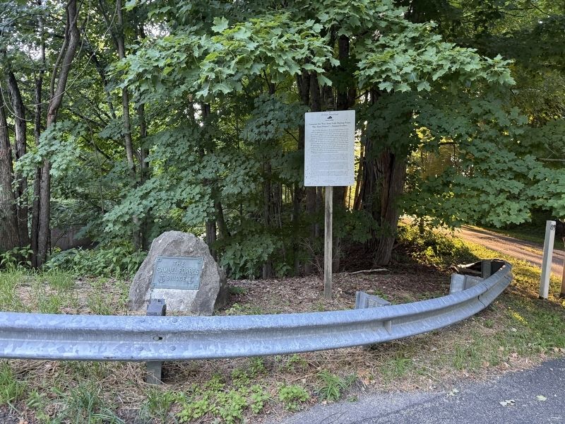
On Lower Road 0.7 miles west of Furnace Hill Road, on the right when traveling west.
Here on the Blackberry River, Samuel Forbes (1729-1827) developed and ran an empire of iron works that provided cannon and ship anchors during the Revolutionary War and iron nails, tools and mill parts during the subsequent early development of . . . — — Map (db m304230) HM
On Main Street at Railroad Street, on the left when traveling west on Main Street.
The Town of Canaan, established in 1738, is known as Falls Village because of the Great Falls of the Housatonic where a power company dam was built in 1912-13. Early industrial prominence resulted from a saw mill and grist mill built at the Falls . . . — — Map (db m41850) HM
On Main Street at Railroad Street, on the left when traveling west on Main Street.
[ stone on left ]
Dedicated to The Honor
Of Those of Our Town
Who Served and Sacrificed
In Love of Our Country
[ bronze plaque ]
World War I
Alfred C. Abbe • Harry Beebe • Harry S. Blake • Alfred J. Brown • Carroll W. . . . — — Map (db m41851) WM
On Colebrook Road at Smith Hill Road, on the right when traveling north on Colebrook Road.
[ front ]
Colebrook
The last town in colonial Connecticut to be settled, Colebrook was named after a town in Devonshire, England. The reason is now unknown, The year 1765 saw Benjamin Horton, leader of a trickle of settlers, arrive amid . . . — — Map (db m30003) HM
On Colebrook Road (Route 183) at Stillman Hill Road (Connecticut Route 182), on the right when traveling south on Colebrook Road.
In front of you stands the Hale Barn, a vanishing example of 18th century barns that once graced much of the Connecticut countryside. Today, it is owned by the Colebrook Land Conservancy and is protected along with the 38 acres upon which it . . . — — Map (db m30240) HM
On Colebrook Road at Bunnell Street, on the right when traveling north on Colebrook Road.
Originally located in front of its large namesake boulder across the road, it was moved to its present location in 1971.
Used from 1779 until 1911, it had several different names as school districts were added to the growing town.
To . . . — — Map (db m30006) HM
On Pine Street at Bolton Hill Road, on the left when traveling south on Pine Street.
Cornwall
This area was once part of the Western Lands ordered surveyed by the Legislature in 1731. Yale Lands were surveyed and three hundred acres were set aside for income for Yale College in 1732. At an auction in Fairfield in 1738 the town was . . . — — Map (db m41824) HM
On Pine Street at Bolton Hill Road, on the right when traveling south on Pine Street.
[ left plaque ]
Korea
June 27, 1950 – January 31, 1955
Bailey, Harold L. Jr. • Blakey, James • Cavanaugh, Harold F. • Chamberlain, Paul H. Jr. • Cobleigh, Doris • Cobleigh, Herbert • Frost, Atec C. • Frost, John A. • Frost, . . . — — Map (db m41826) WM
On Pine Street at Bolton Hill Road, on the right when traveling south on Pine Street.
[ upper plaque ]
Cornwall Honor Roll
1914 World War 1918
Peter L. Barrett • Fred J. Bate • William L. Behn • Harry W. Breen • R. William Carlson • Abraham B. Cohen • Benjamin J. Cole • Francis P. Cole • Robert T. Davison • Stanley P. . . . — — Map (db m41829) HM
On Bolton Hill Road at Pine Street, on the left when traveling west on Bolton Hill Road.
Site of the First Foreign Mission School which from 1817 to 1826 trained young men of many races to act as Christian Missionaries among their peoples. — — Map (db m41831) HM
On Pine Street at Bolton Hill Road, on the right when traveling south on Pine Street.
This tree is dedicated to the people and community spirit that helped Cornwall recover from the July 10, 1989 tornado. Town leaders at that time were:
Richard Dakin First Selectman
Patsy Van Doren Selectman
Steve Hedden . . . — — Map (db m41830) HM
On Cornwall Hollow Road (Connecticut Route 43) at Ford Hill Road, on the left when traveling north on Cornwall Hollow Road.
This memorial including ordnance used in the Mexican and Civil Wars and given by the government of the United States is in honour of Major General John Sedgwick Commander of the Sixth Corps Army of the Potomac who gave his life for the preservation . . . — — Map (db m37482) HM
On North Street (Connecticut Route 63) at Elementary Drive, on the right when traveling north on North Street.
[ front ]
Goshen
The town was settled in 1738 and incorporated in 1739. Many of the early residents came from Wallingford and Farmington. The Congregational Church was founded in 1740. An Episcopal society existed prior to 1776. During . . . — — Map (db m30229) HM
On North Street (Connecticut Route 63) at Elementary Drive, on the right when traveling north on North Street.
Dedicated To Our Comrades Of Goshen
Who Established And Maintained Freedom For Our Country
Civil War 1861 - 1865
Abbott, Newton T. • Adams, Charles G. • Adams, Lyman A. • Adams, William L. • Albin, Charles H. • Albin, William E. • Allyn, . . . — — Map (db m30234) HM
On North Street (Connecticut Route 63) at Elementary Drive, on the right when traveling north on North Street.
[ front ]
Dedicated To Our Comrades Of Goshen
Who Established And Maintained Freedom For Our Country
French And Indian War 1754 - 1763
Dibble, Joel • Doud, John • Gaylord, Timothy • Humphrey, Ashbel • Humphrey, Manna • Humphrey, . . . — — Map (db m30231) HM
On North Street (Connecticut Route 63) at Elementary Drive, on the right when traveling north on North Street.
Dedicated To
The Men And Women Of Goshen Who Served Their
Country During The Korean War And Vietnam Eras
Almstedt Joseph • Angelovich John A. • Anstett Gerald L. • Anstett Richard W. • Barker Frederic T. • Barrett John J. • Benedict Gordon • . . . — — Map (db m100408) WM
On North Street (Connecticut Route 63) at Elementary Drive, on the right when traveling north on North Street.
A Tribute to The Valor
of the
Men of Goshen
Who Fought For
Freedom and Humanity
In The World War
1917 – 1919
John A. Beckwith • Charles A. Bushey • Alec Cabanna • Clifford H. Colby • * Joseph Czerna • Frederick S. Dean • Harry B. . . . — — Map (db m30230) HM
On North Street (Connecticut Route 63) at Elementary Drive, on the right when traveling north on North Street.
Dedicated To
The Men and Women of Goshen
Who Served Their Country
In World War II
Nasef W. Abraham • Julius S. Aeschliman • Russell Aeschliman • George Andrews • Lorrain Apley • Lyman Baldwin • William H. Benjamin • Raymond E. Bodach • Edward . . . — — Map (db m30233) HM
Near Sharon Turnpike (Connecticut Route 4) at Apley Road, on the right when traveling west.
In recognition of his exemplary military service in the Asiatic Pacific Campaign during World War II from April 1941 until October 1945 -- 3 1/2 years as a Prisoner of War – the American Legion Post 46 Goshen-Cornwall dedicates this plaque . . . — — Map (db m30237) HM
On Litchfield Road (Connecticut Route 118) at South Road, on the right when traveling east on Litchfield Road.
Harwinton
The town was settled in 1731, named in 1732 from Harry(tford) and Win(dsor), and became incorporated in October, 1737. Located on the Hartford-Litchfield Turnpike, Harwinton was primarily an agricultural community with many part-time . . . — — Map (db m29788) HM
On Litchfield Road (Connecticut Route 118) at South Road, on the right when traveling east on Litchfield Road.
Dedicated To Those Who Served Our Country
World War I
Balch, Walter • Casson, Walter • Delay, Edmond • Hamm, Michael Sr. • Hooper, Frederick J. • Pregna, Joseph • Pregna, William • Reynolds, Alfred H. • Weingart, Fred
World War . . . — — Map (db m29789) WM
On Bentley Drive 0.5 miles south of Litchfield Road ( Route 118), on the left when traveling south.
Liberty Tree Memorial
This American Liberty Elm was named after "The Liberty Tree: Our Country's first Symbol of Freedom." On the morning of August 14, 1765, the people of Boston awakened to discover two effigies suspended from an elm tree in . . . — — Map (db m29765) HM
On Bentley Drive 0.1 miles south of Litchfield Road ( Route 118), on the right when traveling south.
Watering Trough & Fountain
Circa Early 1900s
Memorial by Catlin Family Descendants
The carved stone drinking fountain and horse watering trough provided gravity-fed spring water during the early twentieth century, whenhorses and oxen pulled the . . . — — Map (db m29787) HM
On Kent Cornwall Road (U.S. 7) at Cobble Road, on the left when traveling south on Kent Cornwall Road.
Flanders District, center of the First Division of land, housed the original Proprietors. Cobble Brook provided water and power for forges, tannery, cider, grist, fulling, and sawmills. Here were the first two churches, the school, general store, . . . — — Map (db m37884) HM
On South Main Street (U.S. 7) at Maple Street & Bridge Street ( Route 341), on the left when traveling north on South Main Street.
A Tribute of
Honor and Gratitude
to her citizens
who fought for
Liberty and Union
1861 – 1865
Erected by the people of Kent
1885 — — Map (db m41017) HM
On Maple Street 0.1 miles east of South Main Street (U.S. 7), on the right when traveling east.
To Honor All Kent Veterans Who Defended
Our Country During Peace And War
Korean War
Ackerman John • Andrews Thomas Lester • Andrews, III Orville A. • Bartlett George H. • Bartlett Henry M. • Bartlett Rod • Becker Frank • Bertine Arthur • . . . — — Map (db m41087) HM
On Kent Cornwall Road (U.S. 7) at Studio Hill Road, on the right when traveling north on Kent Cornwall Road.
Seven Hearths
1751-1754 Built by John Beebe Jr.
1919-1978 Home of George Laurence Nelson
1979- Kent Historical Society
On the National Register of Historic Places — — Map (db m41090) HM
On Kent Cornwall Road (U.S. 7) 0.4 miles north of Carter Road, on the right when traveling north.
To Honor The Men Of
Camp Macedonia
Company 1191
Established 1935
Civilian Conservation Corps
1933-1942
Created By
President Franklin D. Roosevelt
Renewing The Country's Natural Resources
And Challenging The Human Spirit
Of A . . . — — Map (db m41092) HM
On Kent Cornwall Road (U.S. 7), on the right when traveling north.
This viewpoint extends the museum sites of the Connecticut Impressionist Art Trail – Connecticut’s Millennium Legacy Trail – to the outdoor settings that artists portrayed at the turn of the 20th century in a manner that came to be . . . — — Map (db m46710) HM
On Kent Cornwall Road (U.S. 7) 0.4 miles north of Carter Road, on the right when traveling north.
Welcome to Kent Falls State Park
Kent Falls, was designated Connecticut's eighteenth state park in 1919 with a gift of 200 acres from the White Memorial Foundation. Other parcels were purchased or donated to reach its present area of over 295 . . . — — Map (db m144292) HM
On West Street (U.S. 202) at Meadow Street ( Route 63), on the right when traveling west on West Street.
[ front ]
Litchfield
The "Greenwoods" or "Western Lands" of Connecticut were explored in 1715 by John Marsh of Hartford, purchased for fifteen pounds from the Potatuck Indians, who called the area "Bantam", and first settled in 1720. In . . . — — Map (db m229370) HM
On East Street (U.S. 202) at North Street ( Route 63), on the left when traveling west on East Street.
Litchfield Historic District
Has Been Designated A
Registered National
Historic Landmark
Under the Provisions of the
Historic Sites Act of August 21, 1935
This Site Possesses Exceptional Value
In Commemorating or Illustrating
The . . . — — Map (db m229364) HM
On East Street (U.S. 202) at North Street ( Route 63), on the left when traveling west on East Street.
In Honor Of Those From Litchfield
Who Served In Korean War 1950 – 1955
Raymond H. Adkins • Kenneth A. Ainger • Raymond Ainger, Jr. • Donald S. Allvin • Joseph S. Altieri • Richard W. Archer • Truman R. Archer • Wayne R. Archer • Irving W. . . . — — Map (db m229369) WM
On East Street (U.S. 202) at North Street ( Route 63), on the left when traveling west on East Street.
[ south side ]
Pro Patria
[ east side ]
Roll Of Honor
Died
Norman L. Barber, Co. A 8. C.V. I. Harwinton, Ct. Oct 12, 1863
Hatteras Inlet Jan. 30, 1862
Francis E. Barber, Co. E. 8. C.V. I.
New Berne
George W. . . . — — Map (db m229946) HM
On East Street (U.S. 202) at North Street ( Route 63), on the left when traveling west on East Street.
In Honor Of Those From Litchfield
Who Served In Vietnam War 1964 – 1975
George J. Acerbi • Lawrence Adkins • Ross B. Adkins • Elizabeth H. Allcroft • Jack R. Anglevich • Will E. Anglevich • Truman R. Archer • David L. Arnold • George C. Banks, . . . — — Map (db m229367) HM
On East Street (U.S. 202) at North Street ( Route 63), on the left when traveling west on East Street.
In Honor Of
The Men Of Litchfield
Who Rendered Service In
The World War
1917 – 1919
Duval Allen • Paul Allen, Jr. • Leslie F. Andrews • Stanley Axelby • William Axelby • Charles I. Bachman • George H. Baldwin • Robert L. Baldwin • Thomas C. . . . — — Map (db m229363) HM
On East Street (U.S. 202) at North Street ( Route 63), on the left when traveling west on East Street.
In Honor Of Those From Litchfield
Who Served In World War II 1941 – 1947
[ 480 names are listed, front and back. The stars next to the following names indicate they gave their lives. ]
Baldi, Albert M. • Banker, Douglas • Bigenwalt, Charles . . . — — Map (db m229368) HM
On South Street (Connecticut Route 63) at Wolcott Street, on the right when traveling south on South Street.
Oliver Wolcott Jr. Home
Presented by
Helen J. Fitzgerald
to the
Litchfield Historical Society
in loving memory
of her husband
Harold Fitzgerald
1878 - 1948 — — Map (db m229365) HM
On East Street (U.S. 202) at North Street ( Route 63), on the left when traveling west on East Street.
Here stood the church in which
Lyman Beecher preached 1810 – 1826
One half mile north stood the home
where were born
Harriet Beecher Stowe – 1811
Henry Ward Beecher – 1813 — — Map (db m229362) HM
Near South Street (Connecticut Route 65) north of Wolcott Street, on the right when traveling south.
Stone Walls
as increased farming began to change Litchfield's landscape, farmers discovered large deposits of granite and gneiss rocks in the ground. The farmers dug up and hauled away these stones as the land was cleared for crops and . . . — — Map (db m230289) HM
Near South Street (Connecticut Route 63) north of Wolcott Street, on the right when traveling south.
Kitchen gardens, like the one kept by Tapping Reeve and his family, provided reliable sources of food for Litchfield families and occupied a central role in the household economy of 18th-century America. Compared to agricultural fields, kitchen . . . — — Map (db m230287) HM
Near South Street (Connecticut Route 63) north of Wolcott Street, on the right when traveling south.
The cultivation of fruit trees was once a major component of family farming in Litchfield. During the 18th and 19th centuries, many families kept small orchards on their land. Apple trees are not native to North America, but became an important . . . — — Map (db m230286) HM
On Whites Wood Road at Russell Street, on the left when traveling west on Whites Wood Road.
[ west side ]
Wadhams
The battle is fought,
the victory won.
Rest, Soldiers, Rest.
[ north side ]
Edward Wadhams
1st Sergt.
Co. E. 8. Regt. C.V.
Killed near Fort Darling Va.
May 16, 1864
Aged 27
[ . . . — — Map (db m31161) HM
On West Street at North Street, on the right when traveling west on West Street.
In honor of those from Litchfield who served in the War on Terrorism
David E. Kilbourn •
Joseph E. Dos Santos •
Diane B. Easter •
Christopher J. Lawrence •
Michael A. King •
Matthew W. Southard •
Louis J. Persico III • . . . — — Map (db m230251) WM
Near South Street (Connecticut Route 63) north of Wolcott Street, on the right when traveling south.
The relationship between residents and the land has shaped our community for as long as people have lived here. Litchfield was founded on the traditional territory of the Potatuck people, who cultivated crops, foraged, fished, and hunted on the . . . — — Map (db m230253) HM
On Bantam Road (U.S. 202) at Vanderpoel Avenue, on the right when traveling west on Bantam Road.
Dedicated
to all veterans
of
World War II
December 7, 1991
in commemoration
of the
50th Anniversary
of Japan's
attack On Pearl Harbor
December 7, 1941
* * *
Presented
to the
Borough of Bantam, CT
by . . . — — Map (db m29139) HM WM
On Bantam Road (U.S. 202) at Bantam Lake Road, on the left when traveling west on Bantam Road.
Site Of Birthplace Of
Horace Bushnell
April 14, 1802
Feb. 17, 1876
Noted Theologian For Whom
Hartford's
Bushnell Park
And
Bushnell Hall
Were Named — — Map (db m29137) HM
On Main Street at Camphill Road, on the right when traveling west on Main Street.
[ south side ]
"That the generations to come
might know them."
Lincoln
Lieut. Horace Hubbard
Co. H. 2. C.H.A.
killed Bat. Winchester Va.
Sept. 19, 1864 Æ. 33.
Hiram T. Cooley
Co. D. 2. C.H.A.
killed Bat. . . . — — Map (db m28116) HM
On South Street (Connecticut Route 61) at East Street ( Route 109), on the right when traveling south on South Street.
Originally called South Farms, this area was settled in the 1720's as part of the frontier town of Litchfield. The land was surveyed by Captain John Marsh in 1715 and was purchased for fifteen pounds from the bantam tribe of the friendly . . . — — Map (db m28399) HM
On East Shore Road at Van Winkle Road, on the right when traveling west on East Shore Road.
In Memory Of
Margaret Whitlock White 1869-1941
Alain Campbell White 1880-1951
Through whose generosity and foresight the White Memorial Foundation was created to hold in trust for the benefit and enjoyment of present and future generations . . . — — Map (db m58644) HM
On this plot was raised in 1739, the first
meeting house of New Hartford and on these
very foundations the second church was built
in 1829. After 1854 it was no longer used as a place
of worship and was finally removed in 1929.
For . . . — — Map (db m102033) HM
In this Area in the Past.....
Prehistorically, the mountains at Satan’s Kingdom blocked water flow, creating a lake extending northwest for several miles. Geological forces later forced water to cut through the rock, to form the gorge through . . . — — Map (db m93816) HM
On Main Street (U.S. 44), on the right when traveling south.
This American Liberty Elm was named after “The Liberty Tree: Our Country’s first Symbol of Freedom.” On the morning of August 14, 1765, the people of Boston awakened to discover two
effigies suspended from an elm tree in protest of the hated Stamp . . . — — Map (db m93049) HM
On Main Street (U.S. 44) at Church Street, on the left when traveling west on Main Street.
In 1732 the Connecticut General Assembly gave Hartford and Windsor permission to establish seven towns in the colony’s Western Lands. New Hartford was given to 182 Hartford taxpayers who became the new town’s proprietors. They organized and hired . . . — — Map (db m92607) HM
On Main Street at Bridge Street, on the right when traveling north on Main Street.
New Hartford Remembers
Those Who Served In The
1917 World War 1919
Adams Edwin C • Banfield William G • Bartolucci Antonio • Brennan Daniel • Brochu Andrew • Brochu Joseph • Brown Nicoll • Caine Howard P • Caine William H Jr • Carlo Michael • . . . — — Map (db m29846) HM
On Town Hill Road (Connecticut Route 219) at Highland Avenue, on the left when traveling east on Town Hill Road.
[ south side ]
Erected
1892
To The Memory Of
New Hartford
Soldiers And Sailors,
Who Served In The War
Of The Rebellion.
1861. 1865.
[ east side ]
17th Conn. Infantry
Francis E. Coe
12th . . . — — Map (db m29794) HM
On Main Street (U.S. 44) at Church Street, on the right when traveling east on Main Street.
Dedicated to the honor and sacrifice of our men and women who served our country in World War II.
Let none forget they gave their all
and faltered not when came the call.
Barella, Richard • Delaney, Paul E. • Dickinson, Leonard • Parrott, . . . — — Map (db m289404) WM
On Litchfield Road (Connecticut Route 272) at Greenwoods Road East (U.S. 44), on the right when traveling north on Litchfield Road.
In the heart of the Green Woods on what was later the Hartford-Albany Turnpike, Norfolk was settled in 1744 by Cornelius Brown of Windsor. The town was incorporated in 1758 with forty-four voters at the first town meeting. A meeting house was . . . — — Map (db m29687) HM
On Greenwoods Road East (U.S. 44) at Litchfield Road ( Route 272), on the left when traveling west on Greenwoods Road East.
[ west face ]
To The Memory Of The
Soldiers From This Town
Who Died For Their Country
In The War Of The Rebellion
Adjt. Samuel C. Barnum Died June 15, 1864.
Lieut. Hiram D. Gaylord Nov. 18, 1863
Corp. Theodore S. Bates . . . — — Map (db m29688) HM
On Greenwoods Road East (U.S. 44) at Litchfield Road ( Route 272), on the left when traveling west on Greenwoods Road East.
[ left plaque ]
Korea
1950 1953
Anstett, John W. • Barbour, Frederick S. • Bazzano, John C. • Beecher, Casil W., Jr. • Bennett, James A. • Blatz, William A. • Bruey, Lyle D. • Capocefalo, John A., Jr. • Colwell, Leo F. • Cook, . . . — — Map (db m30015) WM
On Greenwoods Road West (U.S. 44) at North Street ( Route 272), on the right when traveling west on Greenwoods Road West.
[ south plaque ]
1917 The World War 1918
In honor of those who gave and those
who offered their lives for liberty
the people of Norfolk have built
this monument and crowned it with
The Liberty Bell
in the faith that it will . . . — — Map (db m29685) HM
Near Lower Road west of Furnace Hill Road, on the right when traveling east.
Ironworking here in East Canaan began in the late 1750s when Samuel Forbes and his son-in-law, John Adam, built a forge just west of this site. They made wrought iron articles for farms and mills as well as ship anchors. It is hard to believe . . . — — Map (db m304216) HM
Near Lower Road at Furnace Hill Road, on the left when traveling west.
Iron forges came early to the Blackberry River, with the first Catalan forge built in 1739 downstream from this point. About this time young Samuel Forbes (1729-1827) arrived on the scene, first learning and then leading the development of the . . . — — Map (db m41979) HM
Near Lower Road at Furnace Hill Road, on the left when traveling west.
Casting Arch
This arch was used to gain access to the hearth area of the furnace. It is the largest of the four arches in the furnace structure. It is from this opening that molten iron flowed into sand molds to form the iron "pigs" that . . . — — Map (db m41976) HM
On East Canaan Road (U.S. 44) at Lower Road, on the right when traveling east on East Canaan Road.
This memorial
was erected by the
citizens & friends
of
East Canaan Conn
1928
In memory of
those who answered
their country's call
1917 – 1918
In memory of
those who . . . — — Map (db m41853) WM
On Lower Road west of Furnace Hill Road, on the right when traveling east.
Hercules Turbine
Beckley Furnace was a blast furnace and as such it required a source of compressed air to operate. The nearby dam supplied the power to operate the air pump that provided that air. While evidence suggests that the original . . . — — Map (db m304222) HM
On Lower Road west of Furnace Hill Road, on the left when traveling west.
Displayed here is a hydraulic turbine made by the James Leffel Company in Springfield, Ohio. This machine was discovered in 2004 during a project to improve trail landscaping on the site, It was buried at a depth of about 12 feet and was only . . . — — Map (db m304225) HM
Near Lower Road at Furnace Hill Road, on the left when traveling west.
This 10-ton chunk of iron formed in the hearth area of the furnace. While there are a number of things that can cause the formation of a salamander this one was probably due to a failure in the masonry of the hearth which allowed molten iron to . . . — — Map (db m41981) HM
Near East Canaan Road (U.S. 44) at Lower Road, on the right when traveling east.
This Land Was Deeded To
The Church By
Samuel Forbes
As a Burying Ground
In 1823
Names of the 126 Bodies
Who Rest Here Are Recorded
in the
"Book of Rememberance." — — Map (db m41854) HM
On Lower Road 0.6 miles west of Furnace Hill Road, on the left when traveling west.
On this historic site in 1739, Carl "Great" Barrington was killed when a meteor the size of a Kia Sorento fell from the sky, causing the massive limestone crater still visible down the road. Most of Carl is buried here, under this last piece of . . . — — Map (db m304228) HM
On Lower Road west of Furnace Hill Road, on the right when traveling east.
Inside this stone wall lies the remains of the water turbine that provided the power for the air blast needed for the Beckley furnace. Part of the turbine is still present inside the cylindrical enclosure. The long pipe or penstock, was used to . . . — — Map (db m304224) HM
Near Lower Road at Furnace Hill Road, on the left when traveling west.
One of three such arches, this opening was used to route hot blast air to the furnace. Simulated piping has been installed in this arch to show how it could have looked when the furnace was in operation. Basically the piping consists of a main . . . — — Map (db m41982) HM
On Lower Road west of Furnace Hill Road, on the left when traveling west.
You are standing in front of the remains of an iron furnace. This facility, Beckley Furnace, operated from 1847 until 1919, making it one of the last of its kind to operate in the United States. Originally, this site consisted of several . . . — — Map (db m304227) HM
Near Lower Road at Furnace Hill Road, on the left when traveling west.
You are standing in front of the remains of an iron furnace. This facility, Beckley Furnace, operated from 1847 until 1919, making it one of the last of its kind to operate in the United States. Originally, this site consisted of several . . . — — Map (db m41975) HM
Near Squire Road 0.1 miles west of Southbury Road ( Route 67), on the left when traveling west.
This Land Has Been Given To
The Roxbury Land Trust
In Memory Of
Sp4 Brian E. Tierney
Who Gave His Life At Age Nineteen
In Loyal Service To His Country In Vietnam.
He Was Awarded The Distinguished Service Cross
For Extraordinary Heroism . . . — — Map (db m82662) WM
On North Street (Connecticut Route 67) at Ranney Hill Road, on the left when traveling north on North Street.
To The Memory Of
Cadet Charles K. Hodge
of the
U.S. Military Academy
And A Member
Of The Third Class
Of 1839-40
[ north side ]
He Died Suddenly
Whilst On A Visit To His Parents
At Roxbury Conn.
on the
Thirty First Of . . . — — Map (db m43515) HM
On Church Street (Connecticut Route 67) at Wellers Bridge Road on Church Street.
North Face:Col. Seth Warner of the Army of the Revolution Born in Roxbury, CT May 17, 1743 A resident of Bennington, VT from 1765 to 1784 Died in his native parish Dec 25, 1784
West Face:Captor of Crown Point Commander of the . . . — — Map (db m20320) HM
Near Mine Hill Road 0.5 miles west of Hodge Road, on the right when traveling west.
Recognized on the National Register of Historic Places, Mine Hill is the site of a 19th century iron mine and furnace complex. The Roxbury Land Trust acquired the 360-acre preserve in 1978. The significant stone and brick structural remains of the . . . — — Map (db m20555) HM
On North Street (Connecticut Route 67) 0.1 miles north of Chalybes Road, on the left when traveling north.
1713 - First structure by white settlers built near Shepaug River.
1732 - 33 – First meeting house erected. Old Roxbury Road.
1743 – Roxbury parish established by Connecticut General Assembly.
Birthplace of three cousins of . . . — — Map (db m17761) HM
On North Street (Connecticut Route 67) at Ranney Hill Road, on the left when traveling north on North Street.
The Town of Roxbury
Honors Her Sons & Daughters
Who Served During Times of War
World War I
John Francis Acton • Percy Peck Beardsley • John Milo Bolt • John Grimes Butler • Robert Callahan • Harold Collins • John H. Collins • Richard W. . . . — — Map (db m43513) WM
On South Street 0.1 miles south of Wellers Bridge Road, on the right when traveling south.
In memory of those who served in World War II from Roxbury, Conn.
Killed In Action
David A. Barker • Harold C. Collins • Paul C. MacDonald
Served
James M. Acton, Jr. • James McK. Beatty • Harold Beers • John J. Berger • Murray G. Bernays . . . — — Map (db m20344) HM
On Wellers Bridge Road at Baker Road ( Route 67), on the left when traveling west on Wellers Bridge Road.
This 112-Acre Parcel Has Been Preserved
In Perpetuity
Since Sept. 11, 2002
By The Roxbury Land Trust
Edward F. and Elizabeth M. Orzech
Whose Family Established Their Farm Here
In 1924 — — Map (db m42529) HM
Near Mine Hill Road 0.5 miles west of Hodge Road, on the right when traveling west.
Wilbur R. Shook
1913 – 1981
President, Roxbury Land Trust
1978 – 1981
Under his dedicated leadership
this mine hill preserve
was established
as a wilderness area
October 10, 1982 — — Map (db m186892) HM
On East Main Street near Cobble Road, on the left when traveling south.
This is the roadbed for a single-track railroad originally running from Hartford to Millerton constructed in 1871. In 1888 the tracks were extended to the Poughkeepsie Bridge, making it the main trunk line across the Hudson River. Passenger . . . — — Map (db m42043) HM
On Main Street at Library Street, on the left when traveling south on Main Street.
Nation's First Public Library
In 1803, Caleb Bingham established in Salisbury the first library in the United States open to the public free of charge. The collection was expressly created for use by young people nine to sixteen years of age . . . — — Map (db m42100) HM
On Main Street at Academy Street, on the left when traveling south on Main Street.
The Town of Salisbury was incorporated in 1741. The Congregational meeting house, built 1749-1751, in the exact center of the town, survives as the core of the present Town Hall. The original agrcultural settlement was rich in iron ore deposits, . . . — — Map (db m42047) HM
304 entries matched your criteria. Entries 101 through 200 are listed above. ⊲ Previous 100 — Next 100 ⊳