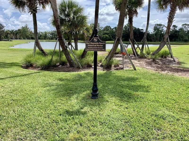
Near West Indiantown Road (Florida Route 706) at Carver Avenue, on the right when traveling west.
Cinquez Park commemorates the resilient history of one of the oldest African American settlements in Palm Beach County. Beginning in 1904, more than 15 pioneer families from north Florida and South Carolina settled in central Jupiter, homesteading . . . — — Map (db m146224) HM
On DuBois Road 0.5 miles north of Jupiter Beach Road, on the left when traveling north.
Built in 1898 by Harry and Susan DuBois, the DuBois Pioneer Home is one of the oldest surviving historic homes in Palm Beach County. Inspired by Harry's childhood on the Jersey Shore, the "House on the Hill" is an example of Victorian Shingle . . . — — Map (db m152567) HM
On Old Dixie Highway (State Road 811) 0.2 miles south of Federal Highway (U.S. 1), on the right when traveling north.
Fort Jupiter was located three miles west on Loxahatchee River, erected January 1838 by troops commanded by Major General Thomas S. Jessup, establishing base for operations in the Seminole Indian Wars. Jupiter Lighthouse, approximately one mile . . . — — Map (db m96947) HM
On South Loxahatchee Drive at 2nd Street, on the left when traveling north on South Loxahatchee Drive.
This building was constructed in 1927 to serve the town’s approximately 100 white students from grades one through twelve. Prior to its construction, students were transported by boat to attend schools along the Loxahatchee River including the 1891 . . . — — Map (db m97071) HM
Near West Indiantown Road (State Road 706) 1.3 miles west of Florida's Turnpike (Interstate 95), on the left when traveling west.
On January 24, 1838, Major General Thomas S Jesup, commanding 1,500 men, the largest army of Second Seminole War (1835-42), marched to the headwaters of the Loxahatchee River, where he defeated approximately 300 Red and Black Seminoles in the last . . . — — Map (db m99904) HM
Jupiter Inlet Lighthouse began protecting ships at sea on July 10, 1860. Now, we honor the U.S. Lighthouse Service crew who built it and the keepers who endured wilderness, wars and storms to keep the light beaming for 150 years. We are proud to be . . . — — Map (db m235588) HM
Near Dubois Road 0.5 miles north of Jupiter Beach Road, on the left when traveling north.
Jupiter Inlet Midden I is an ancient shell mound built by Indians known as Jeaga. A description of these Indians by Jonathan Dickinson was first published in 1699. This shell mound is the site of the village of Hobe where the Dickinson shipwreck . . . — — Map (db m96948) HM
Near Ocean Trail Way 0.3 miles north of Jupiter Beach Road, on the left when traveling north.
During the 17th century, Spanish galleons and merchant ships navigated the treacherous waters off the Florida coast. These vessels carried silver and gemstones from the mines of Mexico and Peru. They routinely ran a narrow gauntlet of shallow water, . . . — — Map (db m96952) HM
Near Captain Armour's Way 0.3 miles south of South Beach Road (Road 707), on the left when traveling south.
Designed by George G. Meade, later Federal commander at Gettysburg. First lighted July 10, 1860. Dark during the War Between the States and its mechanism hidden by Southern sympathizers. Relighted June 28, 1866, it has not missed a night in over . . . — — Map (db m96951) HM
Dedicated June 2, 1973
by
U.S. Coast Guard
Lt. Richard Harvey
Lightkeeper BMI K.C. Campbell
Loxahatchee Historical Society, Inc.
President, Ethel Gravett
Charter President, Dr. John Ray
Placed on the National Register of Historical . . . — — Map (db m226867) HM
On Limestone Creek Road north of Australian Street, on the right when traveling south.
Education was a challenging priority for the African-American community of Limestone Creek. Denied access to Jupiter’s nearby public schools by segregation laws, the community opened its own school in 1905. The “Jupiter Colored School,” . . . — — Map (db m95663) HM
On Clocktower Drive at West Indiantown Road (State Road 706), in the median on Clocktower Drive.
After the second Battle of the Loxahatchee (January 24, 1838) during the Second Seminole War (1835-1842), Maj. Gen. Thomas S. Jesup directed Maj. William Lauderdale, Commander of the Tennessee Battalion of Volunteers to cut a trail south from Ft. . . . — — Map (db m97073) HM
On Church Street 0.2 miles east of Limestone Creek Road, on the left when traveling east.
Mount Carmel Missionary Baptist Church, a cornerstone of Jupiter’s African American community, was organized in 1902 by the Reverend J. A. Wannamaker and the pioneer families of Simmons, Campbell, Ford, Bush, and Davis. These early settlers arrived . . . — — Map (db m95675) HM
Near West Indiantown Road (State Road 706) 1.3 miles west of Florida's Turnpike (Interstate 95), on the left when traveling west.
On January 15,1838, during the Second Seminole War.The Seminoles met and defeated U.S. forces in the first battle of the Loxahatchee River.Trying to end the war,Maj. Gen. Thomas Jesup brought several columns of troops to south Florida, including . . . — — Map (db m99906) HM
On State Road A1A 0.2 miles north of Center Street, on the right when traveling north.
The waterfront location of today’s Sawfish Bay Park played a major role in the prehistoric and historic settlement of the Jupiter area. First inhabited during the Archaic Period 5,000 years ago, this site provided access to an intricate . . . — — Map (db m96953) HM
On Jupiter Lighthouse Park west of Coast Guard Way, on the right when traveling east.
For centuries, the Native Americans who became Seminoles enjoyed this area. Once a peaceful wilderness, they named the river we now call Loxahatchee the "Locha Hatchee or Turtle River. During the Seminole Wars (1818-1858), the brilliant Seminole . . . — — Map (db m213652) HM
On Winding Lake Drive 0.1 miles east of Cassie Holy Court, on the right when traveling east.
During the 2nd Seminole Indian War and after the Battle of Loxahatchee Jan. 24, 1838, the Tennessee Volunteers and Militia camped on this site. One mile east, the U.S. Army Regulars established Old Fort Jupiter. — — Map (db m96969) HM
On Ocean Boulevard (State Road A1A) at Coopers Road, on the right when traveling south on Ocean Boulevard.
The Jupiter and Lake Worth (J. & L.W.) Railway crossed this site running 7 ½ miles from Jupiter Inlet to Juno at the north end of Lake Worth. A hack line originally operated on the same route, transporting visitors and freight with wagons . . . — — Map (db m127261) HM
On Van Kessel Parkway 0.1 miles east of Ocean Boulevard (State Road A1A), on the right when traveling north.
To mark the location of the
U.S. Jupiter Life Saving Station
1886-1896
and as a memorial to those gallant men who manned it, of which the following remained and founded families in this locality:
Captain John R. Carlin
John H. Grant . . . — — Map (db m96949) HM
On Jupiter Lighthouse Park at Coast Guard Way, on the right when traveling east on Jupiter Lighthouse Park.
"Chickee” is the Seminole word for house. This one was built by Jim Billie, Chairman of the Seminole Tribe of Florida. The structure represents a significant era in the history of the Seminole and Miccosukee Tribes of Florida. Hunted by U.S. . . . — — Map (db m213653) HM
On Van Kessel Parkway 0.1 miles east of Ocean Boulevard (State Road A1A), on the right when traveling north.
In 1885, the only United States Life Saving Station on the Florida East Coast was built at this site. Charles R. Carlin, a former British sailor and Assistant Keeper at the Jupiter Inlet Lighthouse, oversaw construction and served as the Station’s . . . — — Map (db m96950) HM
Near Captain Armour's Way 0.3 miles south of Beach Road, on the right when traveling south.
The U.S. Navy constructed this building (circa 1939) on land included in the Federal Jupiter Lighthouse Reservation established by President Franklin Pierce in 1854. Built as Married Men's Quarters, the two-story wood-frame building had six . . . — — Map (db m83278) HM
Designed by George G. Meade, later Federal commander at Gettysburg. First lighted July 10, 1860. Dark during War Between the States and its mechanism hidden by Southern sympathizers. Relighted June 28, 1866, it has not missed a night in over 100 . . . — — Map (db m297768) HM
Near Jimmy Buffett Memorial Highway (State Highway A1A) north of Jupiter Beach Road, on the right when traveling north.
Most historians agree that the name Jupiter had its origin during the time the British controlled Florida between 1763–1783. Spain had ceded Florida to Britain at that time and when the British examined the Spanish maps for this area, they found . . . — — Map (db m297718) HM
At 01.32 hours on 23 Feb, 1942, the unescorted and unarmed W.D. Anderson American Steam Tanker was torpedoed by the German Submarine, U-504, about 12 miles northeast of the Jupiter Lighthouse. Eight officers and 27 crewmen were lost. A sole survivor . . . — — Map (db m297730) HM
On Park Avenue just east of 6th Street, on the right when traveling west.
Boston entrepreneur Harry S. Kelsey founded Kelsey City in 1921. He envisioned his town as a resort mecca and winter retreat for wealthy northerners. The Town hall was designed by architect Bruce Kitchell in 1927 and was built by Arnold Construction . . . — — Map (db m97053) HM
On Park Avenue east of Old Dixie Highway, on the right when traveling east.
This monument is the last remaining part of the Kelsey City Gates. The structure towered over the current Old Dixie Highway, at Watertower Road and proclaimed Kelsey City (Lake Park) as the “Gateway to the Palm Beaches.” . . . — — Map (db m153509) HM
Coastal Patrol Base No. 3 at Lantana Airport was one of three 90-day experimental bases established on the east coast of the United States to assist with anti-submarine patrols. Civilian aviators flew missions up to 60 miles out to sea between Palm . . . — — Map (db m63179) HM
On Lake Avenue (State Road 802) just west of North Federal Highway (State Road 5), on the left when traveling east.
Site of the first schoolhouse erected in the Town of Lake Worth in 1912 - a frame building twenty-four by thirty-six feet. Initial enrollment was twenty-four pupils. In February 1916, building was replaced on this site by a concrete building - the . . . — — Map (db m96615) HM
On North Dixie Highway (U.S. 1) at Lake Avenue, on the right when traveling south on North Dixie Highway. Reported missing.
Site of building erected in 1915 as the first Town Hall of Lake Worth, chartered in 1913. Civic and social affairs before 1915 were conducted in a wooden building nearby, known as the Club House or Auditorium. J.W. Means served as mayor in 1913, and . . . — — Map (db m96616) HM
On South Lakeside Drive at 5th Avenue South, on the left when traveling south on South Lakeside Drive.
The James Homestead and Post Office are an important part of Lake Worth's history before the birth of the city. In 1885, an African American couple, Samuel and Fannie James, were two of the first people to file claim for a homestead in the area. Two . . . — — Map (db m193845) HM
Near South Congress Avenue north of 6th Avenue South, on the right when traveling north.
The earliest junior colleges in Florida were established under private auspices, beginning in 1907 with Palmer College at DeFuniak Springs. The first public junior college was instituted by the Palm Beach County school board during the Depression . . . — — Map (db m96618) HM
On Wingfield Street at Washington Avenue, on the right when traveling south on Wingfield Street.
African Americans and Bahamians settled this neighborhood in an unincorporated area between Lake Worth and Lantana around 1914. Then known as the “Quarters,” it provided multi-family housing and private residences for agricultural workers. In 1926, . . . — — Map (db m251257) HM
On South A Street 0.1 miles north of 12th Avenue South, on the right when traveling south.
When the City of Lake Worth incorporated in June 1913, it consisted of a post office, several stores, a church, bank, school, a newspaper, and around seven hundred residents, but no designated cemetery. Burials had to be conducted in the . . . — — Map (db m250964) HM
On Cardinal Lane south of Julia Heights Drive, on the left when traveling north.
The Chapel of the Holy Spirit, formerly known as the Minerva Chapel, is one of the oldest buildings in Palm Beach County. This eclectic style building was first used as a tea house for the Royal Poinciana Hotel in Palm Beach, which was built by . . . — — Map (db m96495) HM
On North Arnold Avenue at West Lantana Road (State Road 812), on the right when traveling north on North Arnold Avenue.
Evergreen Cemetery was established by the Evergreen Cemetery Company in 1892 as a final resting place for local families. The cemetery’s land was purchased by M.B. Lyman, Lantana’s founder. Lyman, who is buried in the cemetery, served as the town’s . . . — — Map (db m96619) HM
On North Lake Trail 0.1 miles Tangier Avenue, on the right when traveling north.
East of this marker is the Episcopal Church of Bethesda-By-The-Sea built in 1894 (last service held Easter Sunday April 12, 1925). Most of the worshippers came by boat as there was no roadway to the church, which was bordered on the east by an . . . — — Map (db m96713) HM
Palm Beach was named for the cocoanut groves that were once common along the eastern shore of Lake Worth. It was this natural feature that first attracted Henry Flagler to the area, leading him to build the world’s largest resort in Palm Beach, as . . . — — Map (db m292674) HM
Near South Lake Trail at Pendleton Lane, on the right when traveling south.
The Cocoanut Grove House, once Florida’s only hotel on the east coast between Titusville and Key West, stood at this location. The hotel was originally built in 1876 by Elisha Newton “Cap” Dimick as a private residence for his family Dimick was . . . — — Map (db m96696) HM
On North Lake Trail 0.1 miles north of Tangier Avenue, on the right when traveling north.
Oldest standing house in Palm Beach built in 1891 by Henry Maddock for his home. Parts of the house were assembled in New York and brought by barge to Palm Beach, as this was the only means of transportation. — — Map (db m96711) HM
On South County Road (State Road A1A) south of Via Bethesda, on the right when traveling north.
The original church constructed in 1889 on the eastern shore of Lake Worth was the first Protestant church building in southeast Florida. The present edifice, erected in 1926 as a monument to international friendship, has served all races, nations, . . . — — Map (db m95676) HM
On Royal Poinciana Way (Florida Route A1A) 0.3 miles west of Bradley Place, on the right when traveling west.
During the late 1800s, Henry Morrison Flagler built numerous resort hotels and a railroad network, the Florida East Coast Railway, along the east coast of Florida. In 1894, Flagler constructed the Royal Poinciana Hotel in Palm Beach, which became . . . — — Map (db m157236) HM
On Jimmy Buffett Memorial Highway at Brazilian Avenue, on the right when traveling east on Jimmy Buffett Memorial Highway.
Gold Star Memorial
A tribute to Gold Star Families whose loved ones paid the ultimate price defending the United States of America; their sacrifice will not be forgotten.
Dedicated to the residents who have served the United States of . . . — — Map (db m292603) WM
On Royal Poinciana Way at Cocoanut Row, in the median on Royal Poinciana Way.
Henry Morrison Flagler was born in Hopewell, New York in 1830 to a family of modest means.The son of a Presbyterian minister, He left home at the age of 14 to work with relatives in Ohio, beginning as a clerk in a small store. Through many years . . . — — Map (db m153506) HM
On South Ocean Boulevard (State Road A1A) 0.1 miles north of Ibis Way, on the left when traveling south.
Founded in 1886 as a community project, the Little Red Schoolhouse was the first one-room school built in southeast Florida. With $200 of limber from the Dade County School Board, the men of the community, led by George W. Lainhart, volunteered . . . — — Map (db m96658) HM
On Jimmy Buffett Memorial Highway at Brazilian Avenue, on the right when traveling east on Jimmy Buffett Memorial Highway.
Dedicated to the Residents of the Town of Palm Beach
who served their country during World War II
December 7, 1941 – August 14, 1945
With special recognition to the West Palm Beach Chapter American Red Cross
Dedicated 1985
Yvelyne de . . . — — Map (db m292615) WM
On North County Road at Sunrise Avenue, on the right when traveling north on North County Road.
Paramount Theatre
has been placed on the
National Register
of
Historic Places
by the United States
Department of the Interior
December 12, 1973 — — Map (db m164860) HM
On Cocoanut Row 0.2 miles south of Royal Poinciana Way (State Road A1A), on the right when traveling south.
The Royal Poinciana Hotel, built by Henry M. Flagler, was opened February 11, 1894. One of the largest wooden structures in the world at the time, the hotel cost over $1 million. Its rooms accommodated 2,000 guests and its dining room seated 1,600. . . . — — Map (db m96706) HM
Near South Lake Trail 0.1 miles west of Cocoanut Row, on the left when traveling south.
Constructed in 1886 by R.R. McCormick, a Denver railroad developer, Sea Gull cottage was purchased by Henry Flagler in 1893 and became Flagler’s first winter residence in Palm Beach. The Royal Poinciana, Flagler’s first resort hotel in Palm Beach, . . . — — Map (db m114828) HM
On South Ocean Boulevard (State Road A1A) at Worth Avenue, on the left when traveling south on South Ocean Boulevard.
Erected and opened to the public in 1925, the pier extended out 1,095 feet from this point. For over forty years, it was a favorite town attraction, featuring a coffee shop, cocktail lounge, restaurant, tackle shop and fishermen’s lockers. A series . . . — — Map (db m96698) HM
(First plaque)
The Earl E. T. Smith Preservation Park
In honor of Ambassador Earl E. T. Smith
The Preservation Foundation of Palm Beach
(Second plaque)
Earl E. T. Smith was a respected civic and political leader whose . . . — — Map (db m292511) HM
Near Cocoanut Row just south of Whitehall Way, on the right when traveling south.
This Interdenominational Chapel was the earliest church organization in Dade County (of which Palm Beach County was a part). The chapel was founded in 1884 under the auspices of the Home Missionary Society of the Congregational Church by Rev. A.B. . . . — — Map (db m96701) HM
Whitehall
(Henry Morrison Flagler Museum)
has been designated a
National Historic Landmark
This site possesses national significance in commemorating the history of the United States of America
2000
National Park Service . . . — — Map (db m292673) HM
On MacArthur Boulevard just north of Northlake Boulevard, on the right when traveling north.
These two Banyan trees (Ficus benghalensis), with a combined limb spread encompassing one-half acre, form the entrance to the City of Palm Beach Gardens. Palm Beach Gardens was developed by insurance magnate and philanthropist John D. . . . — — Map (db m97049) HM
On North Military Trail (State Road 809) at Burns Road, on the right when traveling north on North Military Trail.
On March 20, 1959, John D. MacArthur, multi-millionaire insurance magnet and landowner, announced plans to develop almost 4,000 acres and provide homes for 55,000 people in a new community. Mr. MacArthur envision the City streets lined with trees . . . — — Map (db m142113) HM
On U.S. 1 0.2 miles north of PGA Boulevard (State Road 786), on the right when traveling north.
About three hundred feet east of this marker, stood the Dade County Court House at Juno, the county seat from 1890 to 1900. Juno — since abandoned
— was the southern terminus of the "Celestial Railroad" from Jupiter to Juno, and the . . . — — Map (db m104645) HM
Near North Dixie Highway 0.1 miles north of Banyan Boulevard, on the right when traveling north.
Palm Beach County (established in 1909) had its first County offices in an old school house in West Palm Beach. In 1913, the Palm Beach County Board of County Commissioners approved the construction of a new courthouse designed by Wilber Burt . . . — — Map (db m96755) HM
On South Flagler Drive at Barcelona Road, on the right when traveling north on South Flagler Drive.
Ann Norton Sculpture Gardens
This home, designed by architect Maurice Fatio, was built in 1925. Wealthy Chicago industrialist and art collector Ralph Norton purchased the house in 1935, and hired Marion Sims Wyeth to redesign it with . . . — — Map (db m155535) HM
On Clematis Street 0.1 miles west of South Quadrille Boulevard (U.S. 1), on the right when traveling west. Reported missing.
For over 100 years, Clematis Street (named after the Clematis flower has been the primary retail street in West Palm Beach. It was a shell-topped road in 1893, when Henry Flagler (1830-1913) began to develop West Palm Beach as the commercial . . . — — Map (db m214261) HM
On Flagler Drive, on the right when traveling south.
Dedicated to the City of West Palm Beach through the West Palm Beach Bicentennial Committee in 1976 by Mrs. Crystal Eggert in memory of her late husband Johnny — — Map (db m156928) HM
On North Flagler Drive north of Butler Street, on the right when traveling north.
The Dr. Martin Luther King Jr. landmark Memorial was completed in 2004, commemorating his life, work and civil rights activism. The largest of its kind in Florida and southern parts of the United States, the landmark embodies his fight to bring . . . — — Map (db m180056) HM
On South Flagler Drive at Pershing Way, on the left when traveling south on South Flagler Drive.
In 1876, Benjamin Lanehart homesteaded land that is now the north end of El Cid. He started the first commercial pineapple operation in the area, and this fruit soon dominated the local agriculture. Soon afterward, Elizabeth Wilder Moore settled . . . — — Map (db m96659) HM
On North Rosemary Avenue 0.1 miles north of 25th Street, in the median.
For over 85 years, Evergreen Cemetery has been the final resting place of some of the City’s most influential black citizens, as well as a cross-section of many unnoted black citizens who contributed to the development of West Palm Beach. In 1913, . . . — — Map (db m96631) HM
On North Clematis Street at North Narcissus Avenue, on the left when traveling west on North Clematis Street.
Flagler Park, formerly known as City Park, has been an important public space in West Palm Beach since the founding of the community. The town site for West Palm Beach was laid out in 1893 as a grid pattern of streets running north - south and . . . — — Map (db m181816) HM
On South Dixie Highway (U.S. 1) at Park Place, on the right when traveling south on South Dixie Highway.
This site was originally the southeast corner of an eighty-acre parcel purchased by George L. Marsteller of Charleston, South Carolina, in 1884 for $100. Two blocks to the north, between South Dixie Highway and South Olive Avenue, the Lakeside . . . — — Map (db m96695) HM
On Flamingo Avenue at Georgia Avenue, in the median on Flamingo Avenue.
There are 501 contributing structures within the Flamingo Park subdivision, which was officially platted on May 17, 1921, with more than 76 building permits issued in 1923. Built on the highest of all coastal ridges between downtown West Palm Beach . . . — — Map (db m96692) HM
On 5th Street east of North Quadrille Boulevard (U.S. 1), on the right when traveling west.
With the construction of the Board of Health Laboratory in 1921, Palm Beach County secured its first state building. Still considered an area of the country that was just being settled, establishing an outpost for public health was an essential . . . — — Map (db m96716) HM
On Florida Avenue at Palm Street, in the median on Florida Avenue.
In response to the heavy influx of new residents into South Florida at the turn of the century and the introduction of the automobile, local developers and real estate agents purchased the less expensive land outside of the West Palm Beach downtown . . . — — Map (db m134745) HM
On North Tamarind Avenue at 25th Street, on the left when traveling north on North Tamarind Avenue.
On September 16, 1928, a hurricane came ashore near the Jupiter lighthouse and traveled west across Palm Beach County to Lake Okeechobee. This deadly hurricane destroyed hundreds of buildings and left millions of dollars in property damage. Many of . . . — — Map (db m114693) HM
On Division Avenue at 11th Street, on the right when traveling south on Division Avenue.
Built in 1917, Industrial was the first high school built for African Americans in Palm Beach County and South Florida. In 1950, after the construction of Roosevelt High School, Industrial became Palmview Elementary, with Ulysses B. Kingsley as . . . — — Map (db m152656) HM
On South Olive Avenue north of Mango Promenade, on the right when traveling south.
(side 1)
Platted from 1912 to 1936, the Mango Promenade Historic District was one of West Palm Beach's earliest upper-middle class suburbs. It is significant for its history and variety of architectural styles. The district features early . . . — — Map (db m210622) HM
On North Tamarind Avenue at Palm Beach Lakes Boulevard, on the right when traveling north on North Tamarind Avenue.
Named to the National Register of Historic Places in 1992, the Northwest Historic District was one of South Florida’s first African American settlements. From the 1920s to the 1960s, due in part to legally enforced segregation, the Northwest became . . . — — Map (db m153590) HM
On Northwood Road at North Dixie Highway (U.S. 1), on the right when traveling west on Northwood Road.
Northwood Road was platted in the early 1920s by the Pinewood Development Company. This historic commercial district consists of the businesses along Northwood Road between Broadway Avenue to the west and Dixie Highway to the east. Six buildings . . . — — Map (db m155589) HM
On Spruce Avenue south of 35th Street, on the right when traveling north.
1884, The Reverend Elbridge Gale retired to the area later to be known as Old Northwood. He was the first to build a cabin on the west side of Lake Worth. Gale grew mango trees and one of his trees became the first grafted Mangonia to bear fruit. . . . — — Map (db m84585) HM
On North Olive Avenue at 2nd Street, on the right when traveling north on North Olive Avenue.
Dedicated March 15, 1898, on the southeast comer of Rosemary and Datura Streets. In 1902, it was moved to this site donated by Henry Flagler and served the Catholic community until 1913, when the new church was dedicated. The old church was then . . . — — Map (db m96757) HM
On South Sapodilla Avenue at Hibiscus Avenue, on the left when traveling north on South Sapodilla Avenue.
In 1886, the first settlers on the Island of Palm Beach built a one room school which still stands on the island as the oldest school in southeast Florida. The students were transported by boat until the school closed in 1901 and was relocated in . . . — — Map (db m96759) HM
Near Gardenia Street 0.1 miles south of Fern Street when traveling west.
This Mediterranean Revival style building housed Palm Beach Junior College, Florida’s first public community college, when it was established here in 1933. The college outgrew these facilities after the Second World War and moved in 1948 to . . . — — Map (db m96761) HM
On South Dixie Highway (U.S. 1) north of Cranesnest Way, on the right when traveling north.
The Lakeside Cemetery Association(LCA), formed in 1891, was composed of a group of the earliest pioneer families of what is today Palm Beach County(part of Dade County until 1909). In 1895 the LCA purchased this site to be used as a private . . . — — Map (db m155463) HM
On South Tamarind Avenue 0.1 miles north of Evernia Street, on the left when traveling north.
The Seaboard Air Line Railway Station has played an important role in the history of West Palm Beach and Palm Beach County. It is a unique example of early 20th century railroad architecture in the Mediterranean Revival style. The Station opened . . . — — Map (db m96762) HM
On Fifth Street at North Flagler Drive, on the left when traveling east on Fifth Street.
Founded in 1934, the West Palm Beach Fishing Club (WPBFC) is among the last of Florida's great angling clubs. It was pivotal in boosting Florida tourism during and after the Great Depression and promoting the appeal of sport fishing. The club’s . . . — — Map (db m127264) HM
On South Flagler Drive at Plymouth Road, on the right when traveling north on South Flagler Drive.
The Belair Historic District lies between South Flagler Drive and South Dixie Highway. It is bounded by Plymouth Road on the south and Pilgrim Road to the north. The area was part of a Homestead Act land grant given to South Carolina author James . . . — — Map (db m246235) HM
On A E Backus Avenue at North 2nd Street, on the right when traveling west on A E Backus Avenue.
Albert Ernest "Bean" Backus was a talented and revered Florida landscape artist. He is remembered for his impressionistic paintings of Florida and the Caribbean and the mentorship he gave to many of the Highwaymen, most notably Alfred Hair and . . . — — Map (db m202765) HM
On A E Backus Avenue at North 2nd Street, on the right when traveling west on A E Backus Avenue.
A.E. “Beanie” Backus Studio, 122 Backus Avenue
Zora Neale Hurston was a friend and guest of Ft. Pierce native, A.E. "Beanie" Backus, who painted Florida landscapes for over 50 years. Born in 1906, Beanie was largely self taught and painted . . . — — Map (db m202636) HM
This module was a training device used by the UDT recovery teams during the Apollo space missions to prepare for the actual splashdowns. As it hit the water, the Frogmen connected a flotation collar around the capsule to prevent it from sinking. . . . — — Map (db m186205) HM
Near Florida Route A1A 0.3 miles south of Jackson Way, on the right when traveling north.
These obstacles were used for training by Frogmen during World War II. They were placed here on the beaches of Fort Pierce between 1943 and 1945 and were removed in February 1991. Four types of obstacles were found on Normandy beaches on June 6, . . . — — Map (db m186561) HM
Near Florida Route A1A 0.3 miles south of Jackson Way, on the right when traveling north.
The Combatant Craft Assault (CCA) is a fast boat operated by Naval Special Warfare Group 4 Special Boat Teams; SBT 12 & SBT 20.
The CCA’s primary role is medium range maritime interdiction operations (MIO) in medium-to-high threat . . . — — Map (db m186355) HM
Near Interstate 95 2 miles north of Orange Avenue ( Route 68), on the right when traveling south.
The light of freedom still burns brightly in our world today because of the service and sacrifice of America’s men and women in uniform.
Our Nation’s servicemen and women have fought the forces of tyranny and won victories for liberty, human . . . — — Map (db m185760) WM
Near Interstate 95 at milepost 133, 0.2 miles north of Orange Avenue (Route 68), on the right when traveling north.
The light of freedom still burns brightly in our world today because of the service and sacrifice of America’s men and women in uniform.
Our Nation’s servicemen and women have fought the forces of tyranny and won victories for liberty, human . . . — — Map (db m200750) WM
On Avenue D at North 16th Street, on the left when traveling east on Avenue D.
Former Chronicle Newspaper Headquarters, 1529 Avenue D
Florida was still segregated when innovative publisher C.E. Bolen, a leader in the Ft. Pierce black community, began publication of The Chronicle a weekly newspaper written by . . . — — Map (db m202541) HM
On Avenue D at North 15th Street, on the right when traveling west on Avenue D.
Constructed in 2009, the Florida Highwaymen Obelisk is a central feature of The Highwaymen Heritage Trail, a self-guided commemorative trail and complimentary website honoring the Florida Highwaymen, a loose association of black Florida artists . . . — — Map (db m202735) HM
Near Florida Route A1A 0.3 miles south of Jackson Way, on the right when traveling north.
This Iranian gunboat, Swedish made and armed with Russian weapons, is one of two boats recovered by SEALs during Operation Earnest Will in the Persian Gulf [1987-1988]. One boat was recovered adrift following a brief surface engagement. This boat . . . — — Map (db m186493) HM
This L.C.P.L. is dedicated as a Memorial to the 13 Members of Inshore Undersea Warfare Groups 1 through 5, stationed in Vietnam, who gave their all for their beliefs and their Country while serving in the US Navy.
SN Daniel E. Moore, Jr. • SN . . . — — Map (db m186203) WM
Near North 13th Street at Avenue D, on the right when traveling north.
For his dedication, commitment and service of 26 years to the City of Fort Pierce. He was the first African-American employed by the City as a Pipefitters Foreman and he perished during an underground inspection cave-in at 1525-1529 Avenue D, May . . . — — Map (db m202800) HM