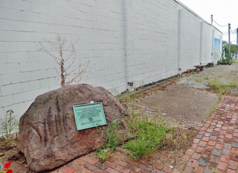
This tablet marks the site of Palmyra, the first county seat of Edwards County, settled April 22, 1815. Edwards County at that time embraced one third of the State of Illinois and a part of Michigan and Wisconsin, extending to Upper Canada. Twenty . . . — — Map (db m186500) HM
The keel of the USS Wabash was laid down January 21, 1970 at the General Dynamics shipyard in Quincy, Mass. It was commissioned on Nov 20, 1971 at the Boston Naval Shipyard. Captain Robert P. Chrisler was in command.
The USS Wabash was a . . . — — Map (db m154606) HM
To the lasting memory of all her sons who fought for the Stars and Stripes in all wars; those who fought and lived; those who fought and died; those who gave much; and those who gave all; Citizens of Wabash County, erect this monument. . . . — — Map (db m186504) WM
The music for this song was composed by Jonathan Edwards Spilman in 1836. He entered the ministry in 1858 and became pastor of the First Presbyterian Church in 1881. This church had been organized by his brother Benjamin F. Spilman on November 25, . . . — — Map (db m177871) HM
This house was built by early settler John Craw prior to 1817. In 1835 it was purchased by John M. Robinson, U.S. Senator (1831-43) and Illinois Supreme Court Justice (1843). The house was later occupied by his daughter Mrs. Robert Stewart and his . . . — — Map (db m177875) HM
Colonel Everton J. Conger, who commanded the troops capturing, Abraham Lincoln's assassin, John Wilkes Booth, built this house in 1871. He practiced law in Carmi, became a Federal judge in Montana Territory, and later moved to Hawaii where he was an . . . — — Map (db m177874) HM
This building was erected in 1828 by James Ratcliff, nicknamed "Old Beaver" because of his energy. He was a founder of Carmi (1816), an inn-keeper, merchant, and postmaster, and White County's first Clerk, Recorder and Probate Judge. Abraham . . . — — Map (db m177869) HM
Alma mater of United States Senators William E. Borah, Idaho, and Wesley L. Jones, Washington. This educational institution was chartered by the Cumberland Presbyterian Church (1873). From the 1890's until 1935 it was a public school. It was . . . — — Map (db m177845) HM
In 1816 the Reverend James McGready of Kentucky organized Sharon, the first Presbyterian church in Illinois, with Peter Miller, James Mayes and James Rutledge as ruling elders. Three miles northeast of this site B.F. Spilman, active Presbyterian . . . — — Map (db m154623) HM
This church was the cradle of Methodism in White County. Early pioneers risked Indian raids to worship in the cabins of Robert Land and John Hanna. In 1812 presiding elder Peter Cartwright sent circuit rider John Smith to this settlement. This . . . — — Map (db m177839) HM
Founded in 1812 while this part of the country was still a wilderness, and before Illinois was a state, Big Prairie Church was one of the oldest Methodist churches in Illinois at the time it was closed in December 2017. Early settlers Robert . . . — — Map (db m177843) HM
The first trading post was established here in 1830 by James Gray and Robert Walden. A post office was opened here in 1836. Later, a two-story frame building was erected here by the Empire Milling Company and this corner was known as 'Empire . . . — — Map (db m61809) HM
This home was built by the Gray Family, the family that gave Grayville it's name. When completed in 1896, it was the finest home in this area and one of the first to have electric lights, running water, and steam heat. Slave quarters and a stable . . . — — Map (db m177850) HM
This building was erected in 1895 by the Gray Family for their Gray Bank on the bottom floor and the Gray Opera house on the second floor. The Opera House was the center of entertainment for many years. — — Map (db m61785) HM
In the 1830's, James Gray's Stables and Slave Quarters were located here. Later, he donated the barn to the city to use as a city hall and police station. In 1866, the city built a two story building with a jail in the basement. The second story was . . . — — Map (db m61788) HM
On this corner was located the roughest, toughest saloon in the history of Grayville. It was opened after the Civil War by Mike Smith, who made a fortune in illegal whiskey and gambling. The saloon was torched in 1881 and re-built and was finally . . . — — Map (db m177852) HM
The first Presbyterian Church in Grayville was organized in 1850 under the leadership of Mrs. Thomasann Gray. In 1868 the members built a small wooden Church on this corner of the cemetery, a gift from a member of the Gray Family.
It was . . . — — Map (db m61781) HM
Established by James R. Gray
First Internment - 1831
Obelisk Erected - 1901
Church Plaza Constructed - 2005
Memorial Plaza and Fountain Dedicated - 2007 — — Map (db m61782) HM
On this site was the home of Thomasanne Payne, Authoress of the Song 'Sleep Soldier Sleep' which she wrote in honor of James Bethel Gresham from Evansville, Indiana. He was the first American Soldier to die in World War I. The song was accepted . . . — — Map (db m61784) HM WM
On July 1, 1838, the Vincennes to Shawneetown Stage Coach Line began operations and made regular stops at a log cabin hotel located on this corner. The stage carried passengers and provided mail service for the first time in this area. — — Map (db m61787) HM
The first business in Norris City was Harper, Ritchie and Company founded in 1871 which sold general merchandise. So on, there were two Blacksmith shops, one harness shop, and one hotel. In 1904 Norris City State Bank was erected. By 1907 there . . . — — Map (db m305148) HM
As the pioneers arrived in the Norris City Area, many brought their religious customs and church preference with them and soon established their houses of worship. At first, they met in homes, but later started building log churches from the . . . — — Map (db m305232) HM
Norris City owes its existence to the railroads that crossed here, the Springfield and Illinois Southeastern was built in 1870 and 1871 and later became the Ohio and Mississippi. The Cairo and Vincennes was built through the town in 1872 and . . . — — Map (db m306286) HM
The first school in town was built in 1871 and was called The Little Red School House. It served the town until 1908, when a new school was built. It consisted of the elementary grades and 1-year high school. In 1926, a 4-year High School was . . . — — Map (db m305268) HM
The Oil Boom brought many Oil Companies to Norris City and one of the biggest was Sohio Oil Company, an American Oil producing, transporting, refining and marketing Company starting up in 1870 and lasted until 1911 when it split into Sohio and . . . — — Map (db m305229) HM
Norris City owes its existence to the railroads, which came through in 1871. Because of the railroads, Norris City was chosen for the Texas Eastern Terminal. In the early 40's, oil was shipped from Texas to other parts of the Country, but the . . . — — Map (db m305151) HM
Before the bombing of Pearl Harbor on December 7, 1941, and entry of the United States into World War II, 95 percent of the crude oil delivered to east coast oil refineries was transported by tanker ships with 90 percent of that oil from Texas . . . — — Map (db m154609) HM
Benton County formed by General Assembly in 1840. Oxford first county seat; Fowler became second, 1874. Designed in Second Empire Style by Gorden P. Randall and built 1874 by Levi L. Leach. Located at geographical center of county on land donated by . . . — — Map (db m21487) HM
In perpetual memory of those whose selfless service fought for honor, freedom, country.
With malice toward none, with charity for all, with firmness in the right as God gives us to see the right, let us strive on to finish the . . . — — Map (db m307022) WM
BP Wind Farms Fowler Ridge
Facilities at a glance
Fowler Ridge 1
Project owner: Subsidiaries of BP Wind and Dominion Resources
Power purchaser: Dominion Energy Marketing Inc, Indiana Michigan Power | Appalachian Power . . . — — Map (db m240929) HM
(Tablet 1)
This boulder marks a boundary line between United States territory and Indian lands which existed for fourteen years.
At St. Mary's Ohio on October 2, 1818, a treaty was made and concluded between Jonathan Jennings, Lewis . . . — — Map (db m71919) HM
In October 1818, Purchasing Commissioners Lewis Cass, Benjamin Parke and Governor Jonathan Jennings acquired Indian claims on the land shown on this marker. About one-third of modern Indiana, was involved in this transaction. — — Map (db m21517) HM
This lot is dedicated to the memory of
Vincent and Eileen Schwartz
lifetime residents of Fowler, Indiana
They proudly served our country during WWII Vince in the Army Eileen in the Navy Both were active members of the American Legion . . . — — Map (db m240678) WM
Standard-bred colt (sire Joe Patchen, dam Zelica) foaled 1896 Oxford, Benton County; raised by Daniel A. Messner, Jr. on this farm. A natural pacer, trained for harness racing, a very popular sport in late 1800's and early 1900's. Dan Patch began . . . — — Map (db m8546) HM
Construction began on the Wabash and Erie Canal in 1832 to connect Lake Erie to the Ohio River, making travel and trade easier and cheaper. Towns along the route prospered as increased commerce fostered urban and agricultural growth. By 1846, the . . . — — Map (db m305786) HM
In fall 1846, residents of Covington and Attica skirmished at Lock 35 over lack of water to Covington. Heavy rains eventually resolved the problem. Competition among canal towns over water control was often intense. First boat reached Attica 1846 . . . — — Map (db m305785) HM
Ladies Library Association of Attica, created 1885, deeded its library building to city; city library opened 1902 with a collection of 1,500 books. Funds from Andrew Carnegie made it possible to build a new library here on land originally owned . . . — — Map (db m3317) HM
Platted 1832
Addition 1836
Population in 1840 - - 800
First polling place in Davis Township.
Many years Largest Town South of Chicago. — — Map (db m9874) HM
Doctor – Educator – Builder – Financier.
Attica, Indiana Doctor, 1839–1845
Founder: Indiana Hospital for Insane.
Chicago Mercy Hospital: City of Evanston, Ill.
Northwestern University - U. of Denver.
Rush . . . — — Map (db m9947) HM
Historic Landmarks of Fountain County
Award presented to
Dr. Peter and Ann Petrich
for the Restoration and Preservation of This
Italianate Style House built c. 1850 — — Map (db m7969) HM
Milford Home
has been placed on the
National Register
of Historic Places
by the United States
Department of the Interior
Built 1845 — — Map (db m9310) HM
American Indians frequented this area, rich in natural resources. The ravine provided water from natural springs, marl for lime, and clay for bricks for nineteenth-century residents of Attica, platted 1825. City became owner of ravine 1906 when . . . — — Map (db m3311) HM
John Feuristien - Co. D - 113 Eng.
Robert L. Goans - Battery C - 150 F.A.
Edward Harty - 306 U.S. Inf.
Arch Hope
Earle Ireland - 131 U.S. Inf.
Lloyd Ireland - Battery B - 70 F.A.
Frank J. Kight - Battery C - 6 F. A.
Chas. W. . . . — — Map (db m22801) HM
Historic Landmarks of Fountain County
award Presented to Craig and Dawn Dixon for Restoration and Preservation of 413 Washington Street Covington, In. Built 1903 — — Map (db m7906) HM
The 1st wife of Governor David Wallace and Mother of General Lew Wallace, soldier, author of Ben Hur, statesman & diplomat, is here buried. She influenced the lives of two important Hoosiers. — — Map (db m3382) HM
Fountain County Court House
1937
has been placed on the
National Register of Historic Places
by the United States Department
of the Interior — — Map (db m37241) HM
1826 - - 1926
Fountain County Centennial Memorial
Erected by The Richard Henry Lee Chapter Daughters of the American Revolution in Memory of The Pioneers and Illustrious Dead of Fountain County and In Honor of our Heroes Who Have Defended us in . . . — — Map (db m7907) WM
Historic Landmarks of Fountain County
Award Presented to Fountain County Art Council
for Restoration and Preservation of
Fountain County Clerk's Building Built 1842. — — Map (db m21155) HM
has been designated a
National Natural Landmark
This site possesses exceptional value as an illustration of the nation's natural heritage and contributes to a better understanding of the environment — — Map (db m10093) HM
Shawnee Township
Wabash - Erie Canal
1846 - 1875
The Canal extended from Toledo, Ohio to Evansville, Indiana. Construction on the 376 mile section in Indiana began in 1832 and completed through Fountain County in 1846.
One to six horses in . . . — — Map (db m20364) HM
World War - I
Orel A. Smith, Born 1898, 32nd Co. 6th Marine Vol., Killed In Action, Nov. 2, 1918 • Lieut. W. E. G. Cooper, Born March 29, 1888, Killed In Action at Chateau Thierry, July 20, 1918 • Claude L. Wilkinson, Born June 9, 1893, Killed . . . — — Map (db m7884) WM
David J. Ratliff platted his farm land just North of State Street through which the new Chicago, Attica, & Southern railway passed. The town was named after the foreman of the construction crew. The town South of State Street was Fountainville until . . . — — Map (db m36101) HM
Silver Island Cemetery
Established 1832
A Historic Cemetery Listed in
Indiana’s Cemetery and Burial Grounds
Registry of the Indiana Department of
Natural Resources
Installed 2013 Indiana Historical Bureau . . . — — Map (db m77555) HM
Richland Township
Site of National Corn Husking Contest in 1935.
4 Blocks West - - -
Cobb Farms and L.K. Mitchell and Family Hosts.
Lawrence Pitzer of Fountain County Represented Indiana and later became National Champion in 1939. . . . — — Map (db m3405) HM
Salt discovered by Norbourn Thomas in 1829.
Capacity: 200 bushel of salt every 24 hours.
Depth 1,135 feet - Deepest in the United States at that time.
Artesian water of Medicinal value was discovered.
Became a Health Spa in 1921.
Water . . . — — Map (db m20482) HM
Birch - Colvert Cemetery
Also Known As
Stone Bluff Cemetery
Beneath this hallowed ground rests the souls of many long-forgotten loved ones. Their gravestones destroyed by the hand of man: and the physical boundaries of . . . — — Map (db m77583) HM
This original stone and bell donated to the Tangier community by the family of Paul E. Patton who graduated with the class of 1950 — — Map (db m163064) HM
HISTORIC LANDMARKS
OF FOUNTAIN COUNTY, INC.
Award
Presented to
BOOE - INLOW - D'ARLIER
CHARITABLE FOUNDATION
for the restoration
and preservation of the
Prairie / Craftman House
D'Arlier Cultural Center
Built in . . . — — Map (db m19174) HM
Famous orator - Representative in Congress, 1861-66, 1869-73; U.S. Senator, 1877–1897; chief promoter of the building of the Library of Congress. — — Map (db m3232) HM
Erected by the town of Veedersburg in memory of Cal Scherer who used old Curfew Bell over 30 years.
—Board of Trustees: Leon L. Ewbank, L. R. Owens M.D., Leon Wiggins. — — Map (db m34092) HM
Historic Landmarks of Fountain County
Award presented to
Lee and Mike Ramsey
for restoration and preservation of
115 North Main Veedersburg, IN
Built 1886 — — Map (db m9010) HM
John Gilmore entered first land in Township — 1826.
Alanson Savage built steam saw mill produced timbers for “Plank Road” — 1840.
Rev. Jones organized Methodist Church — 1852.
Early Families: Furrs, Booes, . . . — — Map (db m3805) HM
Peter and James Layton, half brothers, came from New York, 1853. Here was the train stop for the residents of the area of the Plank Road ½ mile south. There a blacksmith shop, grocery, the stage stop, “Halfway House” were located. — — Map (db m3466) HM
Church: Established by United Brothers in 1828.
Building erected 1847 - Used until 1900.
Cemetery 1837 to present time.
The last resting place of pioneers and soldiers who served our country in seven wars. — — Map (db m3403) HM
1919 - 1991
American Legion
Veedersburg Post 288
In Memory of those from
Veedersburg & Vanburen Twp.
who served, and those who
gave their lives in the
service of their Country.
(Left Side):
World War . . . — — Map (db m7779) WM
Built 1934 for "Boy Scouts" by W.P.A. - Local Workers Guy Smith - Project Mgr., Logs - Walter Marshall Farm, Bricks - Veedersbrg Paving. — — Map (db m34089) HM
(Engraved near the top are the Seals of the United States Army, United States Navy, United States Army Air Corps, United States Marine Corps, and United States Coast Guard) — — Map (db m7804) WM
One of the most iconic brand names in the world of sports has its origins here in the town of Veedersburg. The famed Indianapolis Motor Speedway is known the world over as “The Brickyard”, because the track surface was once composed entirely of . . . — — Map (db m175835) HM
Scott, Hultz, and Sigler commissioners appointed by State Legislature to form the newly formed Fountain County Seat of Justice, met here at William B. White Home.
He erected the County's first mill here near the covered bridge, the County's . . . — — Map (db m20411) HM
Organized in 1832 by German speaking families of the Evangelical Lutheran Church of Rowen County, North Carolina. Migrating to Indiana in 1828. August 7, 1836 Jacob and Elizabeth Linebaugh Bowman deeded land for the First Church and Cemetery. — — Map (db m10027) HM
( At Top - - Canal Map & Points of Interest )
Here is a section of the Wabash & Erie Canal still visible in Gibson County. Construction of the approx. 460 mi. canal. The longest in North America. Began in 1832 & was completed in 1853. One . . . — — Map (db m47806) HM
Established 1840 A Historic Cemetery Listed In Indiana's Cemetery and Burial Grounds Registry of The Indiana Department of Natural Resources — — Map (db m63745) HM
Side 'One'
Born 1799 in North Carolina. Purchased land 1818 in Gibson County. Cockrum and Jacob Warrick Hargrove laid out the town of Oakland (now Oakland City) on January 15, 1856. Cockrum and his son William Monroe Cockrum, along with . . . — — Map (db m47807) HM
Decorated soldier Aaron Fisher was born at Lyles Station and joined the U.S. Army at age 15. He was assigned to the 9th Cavalry and later the 24th Infantry, both historic Buffalo Soldier units, and served in the Southwest and in the Mexican . . . — — Map (db m285507) HM
Princeton abounds in fertile soils from the seasonal flooding of the Wabash, Patoka & White Rivers. Fertile silts were deposited in the riverbeds by glacial outwash at the end of the last glacial period. Archeological records indicate that Native . . . — — Map (db m190588) HM
By 1862, the Union Army’s need for new recruits could no longer be met by volunteers; in March 1863, U.S. Congress passed the Enrollment Act authorizing a national draft. Drafted or enrolled men of means could hire substitutes to serve in their . . . — — Map (db m238485) HM
( 1864 Monument )
Erected
by the Survivors of
the 58th Reg. Ind. Vol.
To the memory of
their deceased comrades
in arms
1864
Honor the Flag
( 1914 Bronze Plaque )
This monument was erected by the 58th . . . — — Map (db m48100) WM
491 entries matched your criteria. Entries 101 through 200 are listed above. ⊲ Previous 100 — Next 100 ⊳