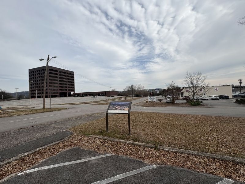
The first headquarters for the Manhattan Project were in the offices of the US Army Corps of
Engineers North Atlantic Division on the 18th floor of a skyscraper in lower Manhattan, NY.
Across multiple New York City sites, the Manhattan Engineer . . . — — Map (db m293569) HM
Built in 1943 near the main business district (Jackson Square), this standard Army chapel was soon known with the Manhattan Project as "The Chapel-on-the-Hill". On 30 September 1943 it was dedicated for Jewish, Catholic, and Protestant worship. The . . . — — Map (db m112102) HM
The Manhattan Project was a monumental undertaking that required a massive population of
employees/residents. Since its establishment in 1942, the high-security town of Oak Ridge
jumped to a population of 75,000 by 1945. Due to security concerns, . . . — — Map (db m293570) HM
On a route that was first authorized to be "cut and cleared" in 1787, the Rock Pillar Bridge 60 yards to the north-northeast was built in the early 1900's. This road became known as the Emery Road and was one of the earliest routes used in the . . . — — Map (db m89677) HM
Realizing early on the need for a place for Secret City visitors to stay, construction of the Guest
House began in the spring and finished in July of 1943, one of the first buildings finished during
the Manhattan Project. Unlike other structures . . . — — Map (db m293577) HM
The Guest House provided accommodations for visitors to the Clinton Engineering Works (Oak Ridge) during the time of the Manhattan Project, which led to the development of the atomic bomb. The Guest House hosted such dignitaries as physicists J. . . . — — Map (db m114613) HM
The Robertsville Community was settled in 1804 by Collins Roberts, who had received a 4,000-acre land grant in this region. Robertsville was one of four communities in the area that predated Oak Ridge. The community was dispersed in 1942 when the . . . — — Map (db m176887) HM
The Scarboro Community was founded by three brothers in the early 1790s. Jonathan, David and James Scarborough traveled from Virginia and settled here. Scarboro was one of four area communities that predated Oak Ridge. The community remained largely . . . — — Map (db m32575) HM
It was also the home of the only elementary, Junior high, and Black High School in Oak Ridge. Under the leadership of Principal Arizona Officer, the Scarboro School with grades one through six continued to operate as a community school until 1967. . . . — — Map (db m263874) HM
Before the Manhattan Project, a spring-fed lake known as the "Duck Pond once provided water for horses and cattle along Emory Road, an early route used in the settlement of Middle Tennessee. During World War II, a town sprung up seemingly . . . — — Map (db m215321) HM
Outdoor recreation was essential for Oak Ridge residents' morale
during the Manhattan Project. Tennis courts, baseball diamond
and a pool were built. Tennis courts, however, were used for
more than just tennis. Being one of the few places in town . . . — — Map (db m293572) HM
With the threat of war looming, Anderson County residents voted overwhelmingly against secession in 1861. When Confederate forces occupied East Tennessee and established a conscription center at nearby Clinton, Unionists slipped into Kentucky to . . . — — Map (db m112103) HM
In December 1942 University of Chicago physicists demonstrated that the newly discovered element plutonium could be made using a “pile” of uranium and graphite blocks. Aware that Germany was seeking to develop a weapon of unprecedented . . . — — Map (db m112351) HM
The top priority of the secret wartime Oak Ridge project was the Y-12 plant. That was the code name given to the process considered the best bet for separating weapon-grade uranium-235 (U-235) from U-238. This isotope separation process was the . . . — — Map (db m112349) HM
The Electromagnetic Separation Plant was a Manhattan Project facility built in 1943 to separate U-235 from U-238. Material for the first atomic bomb was produced here. In place of unavailable copper, nearly 14,000 tons of silver were borrowed from . . . — — Map (db m263872) HM
Convicts cut trees from Militia Hill and surrounding hillsides in 1892 so soldiers could spot attacking miners. Many of those trees were American chestnuts. Convicts and soldiers could not know that a fungus carried by Chinese chestnuts, brought to . . . — — Map (db m102280) HM
Soldiers of the Tennessee National Guard became easy targets for miners positioned on higher ground after trees were cut from Fort Anderson. Convicts then dug these breastworks to provide cover from attacking miners.
War correspondents from . . . — — Map (db m102279) HM
Welsh miners from the Knoxville Iron and Coal Company began mining coal at the foot of this hill in 1867, but were replaced by convict laborers during a strike in 1877. After convicts were brought to a mine in Briceville in July 1891, miners and . . . — — Map (db m101896) HM
After the Civil War, southern states leased convicts to private industry to cope with a growing number of convicts and dwindling state budgets. The system degenerated to where primarily young African-Americans were being arrested and forced to work . . . — — Map (db m101897) HM
Country Music songwriter and performer Dean Dillon was born Larry Dean Fynn on March 26, 1955, in Lake City, Tennessee (later renamed Rocky Top). Although Dillon began his career as a performer, he became renowned as a songwriter. His work includes . . . — — Map (db m248181) HM
Soldiers responded to attack by firing cannons from here into the Miners Nest encampment on Walden Ridge, located south of the Wye Gap. Soldiers also shot cans filled with mud through the Wye Gap into the town of Coal Creek to signal that the town . . . — — Map (db m102281) HM
The Tennessee National Guard built Fort Anderson on Militia Hill in 1892 to restore order during the Coal Creek War. The fort is located off Vowell Mountain Road, and listed on the National Register of Historic Places.
According to the Tennessee . . . — — Map (db m101893) HM
In 1877, convicts replaced striking Welsh miners in the Knoxville Iron and Coal Company Mine, located in the hollow to the south. Prison records show that 131 convict miners died there from 1877 to 1893, while others were caught igniting methane gas . . . — — Map (db m101892) HM
Fort Anderson was built here on Militia Hill in January 1892 as a base for the Tennessee National Guard to protect convict laborers and restore order. Hostilities escalated with as many as 2500 miners from Tennessee and Kentucky participating in the . . . — — Map (db m102277) HM
The Tennessee Coal Mining Company in Briceville dismissed convict labor in February 1892 and sold stock in the company to miners. Subsequent attempts to convince Gov. Buchanan to remove troops from the watershed failed, so miners attacked at this . . . — — Map (db m102284) HM
The arrival of General Carnes with the bulk of the state militia overwhelmed the miners by the late summer of 1892. Although they lost the final battle, Coal Creek miners won the war when newly-elected Gov. Peter Turney fulfilled a campaign promise . . . — — Map (db m102282) HM
Agricultural land in the region was owned and being farmed by 1880. Younger sons of farmers sought opportunities in mining, learning new job skills from experienced Welsh miners. Mining also offered opportunities for African-Americans who comprised . . . — — Map (db m101895) HM
In the 1940s, the City of Alcoa established a fire hall independent from the Aluminum Company of America (ALCOA). The City acquired its first fire truck in 1942, an open-cab 1940 Ford. The first fire hall, near the intersection of Springbrook Road . . . — — Map (db m274810) HM
In 1916, the Babcock Lumber & Land Company acquired 350 acres along Pistol Creek where saw and planing mills were constructed to process lumber the Company was timbering in Monroe County. At the time, Babcock was the nation's leading producer of . . . — — Map (db m195377) HM
Bassel School was constructed in 1923 to provide a new school for children in the Bassel community. The new school was dedicated February 1, 1924. The school contained eight grades.
Captions (clockwise from top left)
• Bassel School . . . — — Map (db m195403) HM
Two miles west, the second Monday of September 1795, the County Court of Pleas and Quarter Sessions
first met at the home of Abram Wear. William Wallace was chairman, John McKee, clerk and Littlepage
Sims, sheriff. Nine justices attended the first . . . — — Map (db m279850) HM
Alcoa schools for black citizens played a vital role in the growth and development of Alcoa. From 1916 to 1926, classes were held in one-room buildings and on the top floor of the Commercial Building. The first building on this site was completed . . . — — Map (db m195398) HM
Alcoa High School began participating in athletics, as the Red Tornadoes, in the fall of 1924. The gymnasium was added in 1927. Alcoa High School played its home basketball games there until 1954.
Captions (clockwise from top . . . — — Map (db m195370) HM
The Aluminum Company of America (ALCOA) had completed about 300 homes in the Springbrook community by September 1920, and another 14 deluxe homes for Company officials. These homes were built to provide housing for workers in the new Sheet Mill, . . . — — Map (db m300810) HM
The V. J. Hultquist family home was constructed in 1925. The same year, the Aluminum Company of America (ALCOA) constructed a home for the family of E. M. Chandler, who supervised the Sheet Mill from 1924 to 1946. He also managed the North Plant . . . — — Map (db m195372) HM
Hunt Field was the home of the Maryville-Alcoa
Twins baseball team that won the 1953 Class-D
Mountain States League Pennant. This 1,750-seat
ballpark, built in the 1940s, averaged an
attendance of about 1,550 for 62 home games.
Major league . . . — — Map (db m195413) HM
By Tennessee Private Act Chapter No. 510, the City of Alcoa was incorporated effective July 1, 1919. Initially, there were three city commissioners, C. L. Babcock, mayor; S. A. Copp, and W. V. Arnold. V. J. Hultquist was appointed city manager, . . . — — Map (db m195396) HM
Initial Plant & Town Site Construction In 1913, the Aluminum Company of America (ALCOA) began construction of a reduction plant for the production of aluminum. A townsite, including the Bassel community, was also constructed for Company workers . . . — — Map (db m195405) HM
Millennium
Manor
This property
is listed in the
National Register
of Historic Places
by the United States
Department of the Interior
1937 — — Map (db m195410) HM
The Nicely's Grocery Store building, built in 1939, stands as a proud reminder of the neighborhood grocery store where customers could purchase groceries on a credit account, and the store made home deliveries. When the building was new, the Masonic . . . — — Map (db m195376) HM
When the Aluminum Company of America (ALCOA) established the City of Alcoa, a commitment was made to establish one acre of park for each 100 residents. Springbrook Park was established in 1925. More than 3,000 shade trees and 6,000 flowering shrubs . . . — — Map (db m195363) HM
Springbrook Pool, originally known as Alcoa Swimming Pool, opened June 13, 1931. Unemployed residents were allowed to work on construction of the pool in lieu of paying street tax, and the Aluminum Company of America (ALCOA) provided pipe and . . . — — Map (db m195375) HM
Springbrook School was built in 1921 for grades 1-12, including, until 1939, Alcoa High
School. The school was the City's first major school construction project. Today's park
grounds lying between the concrete pad and the creek were the school's . . . — — Map (db m195367) HM
The Charles M. Hall School, constructed on East Howe Street in 1926, provided education to African American students in grades one through twelve until 1968, when it closed due to desegregation. It was part of the new City of Alcoa's efforts to . . . — — Map (db m263878) HM
The Commercial Building was constructed by the Aluminum Company of America (ALCOA) in 1919. Commercial businesses for the Hall community were located there, and until Charles M. Hall School was opened in 1926, the school for African American youth . . . — — Map (db m195399) HM
In March 1931, City Manager V. J. Hultquist, informed city .commissioners that work had begun on a proposed lake in Springbrook Park to be located adjacent to the swimming pool. Initially known as Mirror Lake, it was later named the Lily Pond. . . . — — Map (db m195373) HM
The Hall community, earlier known as Peniel, then Walnut Hill, was established in 1916 when the Aluminum Company of America (ALCOA) built 137 two- and three-room homes for African American workers who had been recruited and hired to build the local . . . — — Map (db m195401) HM
The Aluminum Company of America (ALCOA) constructed the North Plant in 1941 to support the nation’s war effort during World War II. At the time the plant opened it was the world’s largest aluminum sheet mill and the world’s largest factory under . . . — — Map (db m300812) HM
The West Plant
The Aluminum Company of America (ALCOA) opened the Sheet Mill, later known as the West Plant, on this property in 1920. It was the nation’s largest aluminum fabrication plant. At one time, the nation’s entire supply of ALCOA . . . — — Map (db m300809) HM
This village, 8 mi. W., was founded by a colony of Quakers from New Garden,
N. C., in the 1790's. The Newberry Meeting officially recognized it in 1808. The first Friends' organization in the county, it is the only one surviving. Friendsville . . . — — Map (db m150763) HM
The city of Friendsville hereby recognizes the Friendsville community for contributing their talents to the stone profession.
Tennessee pink marble is a historic reminder of days past when the railroad ran through
Friendsville. This block of . . . — — Map (db m150767) HM
Members of the Religious Society of Friends (Quakers) came to Blount County in the 1790s looking for a place to worship in peace. Hardworking and industrious, opposing war and slavery, they developed the land and founded the prosperous settlements . . . — — Map (db m81361) HM
In 1807, Sam Houston arrived at this 419-acre site with his widowed mother and eight brothers and sisters. The homesite was located just above the spring on the hill. Sam Houston served as general, President of Texas, Governor of Tennessee and . . . — — Map (db m150793) HM
About 2 miles northeast. Attacked Oct. 13, 1788, by 300 Indians under John Watts, the half breed. Defenders held out until ammunition was exhausted. 28 were taken prisoner; 17 slaughtered and bodies burned. Thereafter the locality was called the . . . — — Map (db m90458) HM
Lane, John E (KIA) • Hearon, Marlow M • Henry, Walter S • Hester, Thurman O • Hipsher, Henry N • Hollingshead, Denver KIA • Huffstetler, John H • Huskey, Eugene E • Hutson, Luther C • Ingram, John J Jr • Ivey, Charles K • Jackson, Taylor G • . . . — — Map (db m150832) WM
Yellow Sulphur Springs was developed on a modest scale by Jesse Kerr in 1859. In 1885, Nathan McCoy, of Indiana, built an elaborate hotel here. John Hanlon took it over in 1900, and operated it until the outbreak of World War I. It burned in 1933. — — Map (db m107919) HM
This Presbyterian church was
established in 1786. Its first pastor
was the Rev. Gideon Blackburn
who served an extensive circuit
in the area. Elizabeth Paxton
Houston, mother of Sam Houston,
is buried here. — — Map (db m150789) HM
In memory of soldiers and patriots
of the American Revolution
who settled in Blount County George Berry • Thomas Berry • John Biggs • Benjamin Bingham • Joseph Black Sr. • Andrew Bogle • Joseph Bogle Sr. • Joseph Bogle Jr. • John Boyd Sr. • . . . — — Map (db m150826) WM
In honored glory
Lest we forget: This monument dedicated to all those gallant heroes of Blount County , living and dead, who have fought in all wars to preserve the American way of life.
The people who have no interest in the past have no hope . . . — — Map (db m150798) WM
On Abram’s Creek, near the site of the early Cherokee village, Chilhowee, William and Robert James established a water-powered cotton and woolen spinning and weaving factory. A charter for the business was issued in 1846 and the mill was evidently . . . — — Map (db m58501) HM
Stockade enclosing about two acres extending southwest to large spring at base of bluff. Scene of many privations, perils and heroic encounters. — — Map (db m107578) HM
Maryville and Blount County were both founded on July 11, 1795 – nearly a year before Tennessee became a state. Maryville was founded around John Craig’s Fort (Fort Craig), which was built in the 1780s for protection from Indian attacks. The fort . . . — — Map (db m299703) HM
A three-story brick building was erected 1872-74 on this site to train blacks as teachers. Institute was begun in 1867, in a log house ½ mile north, and later moved into a new building, financed mainly by friends. By 1879, it had trained 80 . . . — — Map (db m81362) HM
March 2, 1793 – July 26, 1863
Born In Rockbridge County VA
Moved To TN in 1807
Taught At This Schoolhouse In 1812
Attended Porter Academy In 1813
Joined Army In 1813 In Maryville, TN
Studied Law In Nashville, TN In 1818
U.S. . . . — — Map (db m1733) HM
Citizen of Blount County 1806-1818
Enlisted at Maryville in War 1812
Congressman from Tennessee 1823-1827
Governor of Tennessee 1827-1829
Liberator of Texas San Jacinto April 21,1836
President Republic of Texas 1836-1838, 1841-1844 . . . — — Map (db m150794) HM
Established by James Houston in 1785, it stood about 300 yards east on Little Nine Mile Creek. From here, in 1786, John Sevier led 160 horsemen against the Cherokee towns. In 1788, the Kirk family was massacred about three miles south; shortly . . . — — Map (db m58500) HM
Site of the original settlement of Maryville. Here Captain John Craig in 1785 erected a fort on Pistol Creek to protect settlers from Indian raids. In 1793 as many as 280 men, women, and children lived within its walls for several months, surviving . . . — — Map (db m58839) HM
Louis Philippe, Duke of Orleans
and later king of France, lived in
exile in the United States in 1797.
Following a route designed by
President George Washington he
toured the South in that year. On
April 29 he spent the night here
at Woods . . . — — Map (db m150836) HM
Founded in 1819 by the Synod of Tennessee, Presbyterian Church in the USA, as The Southern and Western Theological Seminary, its first president was Rev. Isaac Anderson, D.D. Its original buildings were on Broadway at College Street. Receiving its . . . — — Map (db m36993) HM
During the antebellum period, Blount County supported abolitionism. In 1822, local Quakers and other residents formed an abolitionist society, and in the decades following, local clergymen preached against the evils of slavery. When the county . . . — — Map (db m69452) HM
Dedicated with great affection and esteem by former students to the memory of Professor Charles William ("Bill Joe") Henry (1878-1935) and Mrs. Leola Landon Henry (1884-1966). Married January 1904. Founders and operators of Maryville Polytechnic . . . — — Map (db m107920) HM
7 ½ mi. S, this resort was termed the Saratoga of the South in stagecoach days. First advertised in 1832; Daniel Foute built a log hotel there in 1837. In 1853, Asa Watson, of Mississippi, built the Seven Gable Hotel. Sidney Lanier spent much . . . — — Map (db m81363) HM
Montvale Springs and Chihowee Mountain, eight miles south of Maryville, were inhabited by Native Americans for thousands of years. In 1832 Dantel Foute constructed a road from Maryville and built Montvale Springs Hotel, one of Tennessee's first . . . — — Map (db m293476) HM
This Presbyterian church was founded in 1786 by Rev. Archibald Scott, of Virginia. In 1792, Rev. Gideon Blackburn built a log church here; the stones in the present wall are from a church which replaced it in 1829; the brick church replaced it in . . . — — Map (db m28733) HM
Chartered in 1806. Opened in 1808. Occupied two Maryville sites from 1808 to the Civil War. Reopened at Wildwood in 1872 on a five acre tract donated by Thomas J. Pritchett and wife Mary. Academy land and buildings were deeded to Blount County in . . . — — Map (db m150839) HM
Dr. Samuel Pride, first Worthy Master of the New Providence Masonic Lodge, built his house here. Maj. Gen. W. T. Sherman, enroute to the relief of Burnside at Knoxville, billeted himself here. From 1878 to 1900 it was the Friends’ Normal Institute. . . . — — Map (db m58509) HM
Maj. Gen. W. T. Sherman, U.S.A., arrived in Blount County with 25,000 men, Dec. 5, 1863, to relieve Gen. Ambrose Burnside besieged at Knoxville by Gen. James Longstreet. The 15th Corps camped around Maryville, the 11th around Louisville and the 4th . . . — — Map (db m58836) HM
Three miles south is the school-house built in 1796 by Andrew Kennedy and Henry McCulloch for their children. Sam Houston taught here in 1811 or 1812. He later became Governor of Tennessee, Commander-in-Chief of the Texas Army, President of the . . . — — Map (db m273812) HM
On the hill to the south, beside the Great War and Trading Path, later the Federal Road, Samuel Henry, Sr., built a fort by 1792. The half-breed John Watts and 200 followers attacked it in August, 1793. Henry’s first mill was authorized in 1795. He . . . — — Map (db m58508) HM
Erected near Indian
War Path
1790
Gift of descendants of
Josias Gamble
and Ann Gamwell
Marker placed by
Mary Blount Chapter
DAR 1940 — — Map (db m195414) HM
For more than 200 years the Black Sulfur Spring has been a landmark location in Blount County. The spring and 215 acres was bought from David Delzell in 1834 to become one of three primary mineral springs for Daniel Foute's 6,500 acre Montvale . . . — — Map (db m164837) HM
Methodism began in Maryville with Camp Meetings on "Methodist Hill" by 1804 and included visits by Bishop Francis Asbury in 1809 and 1813. Mount Gilead Methodist Meeting House began around 1811 and was chartered as a Methodist Church on November . . . — — Map (db m299701) HM
Built by Mr. Pete Hood c. 1910
has been placed on the
National Register
of Historic Places
by the United States
Department of the Interior — — Map (db m184598) HM
In April 2017, a crack was discovered in the original Broadway bell. Because the bell could not be repaired, a historically accurate replacement bell was purchased from Lower Bells, Loudon, TN.
The new bell was installed in November 2018. Once . . . — — Map (db m299702) HM
Here, where Blount County's first courthouse stood, Sam Houston "took a dollar from the drum", thus marking his first enlistment in the United States Army, March 24, 1813. This culminated in his command of the Army of Texas, which decisively . . . — — Map (db m28579) HM
William B. Scott, Sr., a free Black, migrated to East Tennessee in 1847 after increased racial tension in North Carolina. He made harnesses and saddles in Blount County’s Quaker community of Friendsville until the Civil War. In Knoxville, during . . . — — Map (db m107600) HM
Nicholas Bartlett built a mill 300 ft. downstream about 1785. When Blount County was created in 1795, its mill-pond was a turning point from the Stock Creek boundary to run toward Bay's Mountain. The mill was used as a fort in the Indian troubles . . . — — Map (db m109333) HM
Knox County
Established 1792; named in honor of
Maj. Gen. Henry Knox
Washington's Chief of Artillery in the Revolutionary War. Secretary of War in Washington's Cabinet. One of the founders and first secretary of the Society of the . . . — — Map (db m109332) HM
Early settlers coming down the Great War & Trading Path in 1784-85 camped here; it was the scene of their first death and burial. In 1786 the Rev. Archibald Scott of Virginia organized a Presbyterian congregation in the area; the church was built . . . — — Map (db m81365) HM
One mile south, near a large spring, Robert McTeer built a fort and mill in 1784. A branch of the Great War and Trading Path passed nearby. Reportedly, the first school in what later became Blount County was held here; it was also the first polling . . . — — Map (db m261730) HM
The chimney nearby marks the location of a tollhouse on the Tennessee
River Turnpike, which operated in 1829. Connecting Blount County, Tenn.,
with Macon County, N.C., across the Great Smokies, it was an important
route in livestock commerce . . . — — Map (db m264840) HM
In the early 1900s family farms covered the valley. Self-sufficiency was the rule in those days, but most people made use of the mill, the country store, and the blacksmith shop. The buildings assembled here represent part of a typical mountain . . . — — Map (db m58475) HM
In Honor of the Civilian Conservation Corps 1933 – 1942 whose hands built roads, trails, bridges, buildings, campgrounds, and picnic areas in Great Smoky Mountains National Park for the benefit and enjoyment of the people. “If you . . . — — Map (db m58440) HM
Rich Mountain Road near the Missionary Baptist Church provided the first settlers access into Cades Cove. Originally a path used by the Cherokee, this route was eventually widened into a wagon road. By the mid-1800s, five roads led into and out . . . — — Map (db m281410) HM
This Irish patriot, exiled from his homeland for revolutionary newspaper activities, settled in the cove about two miles from here in 1855. After a short stay he moved to Knoxville. The rest of his life was taken up with lecture tours and newspaper . . . — — Map (db m56818) HM
557 entries matched your criteria. Entries 101 through 200 are listed above. ⊲ Previous 100 — Next 100 ⊳