Near Rachels Lane 0.3 miles east of Hermitage Road.
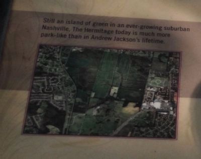
At first glance, The Hermitage Landscape may seem largely untouched by time. Look more closely, however, and discover the changes brought by over 200 years of labor...living...and a changing America.
White Americans and their slaves first . . . — — Map (db m85360) HM
Near Rachels Lane 0.3 miles east of Hermitage Road.
Elegant as it is, The Hermitage Mansion is also a prime example that, indeed, beauty sometimes does lie “in the eye of the beholder.” Andrew Jackson's visitors got their first good look at his home as they rounded the graceful curves of . . . — — Map (db m85366) HM
As was common at large plantations, Jackson hired a white overseer on an annual contract to supervise farm operations, particularly the lives and work of the enslaved. The overseer's contract began on January 1, after the previous year's crop had . . . — — Map (db m85477) HM
Near Rachels Lane 0.3 miles east of Hermitage Road.
This log building was not part of Andrew Jackson’s Hermitage. In 1929, a fire destroyed one of Jackson’s original barns. To help replace it, The Ladies’ Hermitage Association purchased and moved this log building from the nearby Hunter's Hill . . . — — Map (db m52416) HM
Near Rachels Lane 0.3 miles east of Hermitage Road.
Andrew Jackson's strong sense of family extended beyond those he embraced during his lifetime.
Reaching into the future to touch generations yet to come, he deeded a small portion of the garden in trust to serve as a family cemetery. Stones . . . — — Map (db m85372) HM
Near Rachels Lane 0.7 miles Hermitage Road, on the right when traveling east.
At a time when America was growing in more than material ways, the Jacksons, too, were touched by matters spiritual. In the early 1800s, the stresses of a young nation on the move to new political, geographic, and economic areas produced rapid . . . — — Map (db m182530) HM
The remains of the North Cabin stood near this spot until 1988 when it was dismantled because of structural instability. The foundation of the chimney is the only part of the building visible. The North Cabin was a one-story log dwelling with a . . . — — Map (db m85478) HM
Near Rachels Lane 0.3 miles east of Hermitage Road.
Of all the enticements Tennessee offered settlers, one promised both survival and a future: Water. Falling from above, bubbling up from below, flowing in broad river “highways”: Water.
Two natural free-flowing springs made The . . . — — Map (db m81428) HM
Near Rachels Lane 0.3 miles east of Hermitage Road.
Rarely do facts alone uncover the past. Scholarship, judgment, and analysis all have roles in interpreting evidence, and hints, of long-ago lives. So it is with these stones marking the location of a building that Hermitage archaeologists have named . . . — — Map (db m52410) HM
Near Rachels Lane 0.3 miles east of Hermitage Road. Reported permanently removed.
In 1915, The Ladies' Hermitage Association planted this double line of trees to serve as the border for a new entryway intended for visitors arriving by automobile. Each tree came from a battlefield where Andrew Jackson fought, such as the Plain of . . . — — Map (db m214554) HM
Near Rachels Lane 0.3 miles east of Hermitage Road.
The stately trees and park-like grounds of today’s Hermitage bear scant resemblance to the working plantation of Andrew Jackson’s time. As the farm developed, trees were cleared to make room for fields and pastures.
By the time the first . . . — — Map (db m52408) HM
On Rachels Lane 0.9 miles east of Hermitage Road when traveling east.
In 1834, Andrew Jackson Donelson began plans for his eventual return to Tennessee when Jackson's presidency ended in 1837. Donelson chose to build a new home on his land adjoining The Hermitage. There he could be near Andrew Jackson, as he had been . . . — — Map (db m182561) HM
On Lebanon Pike (U.S. 70) at Rachels Lane, on the right when traveling east on Lebanon Pike.
Designed by Jos. Reiff, who was also builder of the Hermitage, this house was built in 1836 for Andrew J. Donelson, Jackson's namesake and secretary. A West Point graduate, Donelson was at one time minister to Prussia, and held other offices. In . . . — — Map (db m147680) HM
On Morgan Road 0.6 miles east of Whites Creek Pike (U.S. 431), on the left when traveling east.
Named for the Paradise brothers, early settlers from North Carolina, this ridge was home to the Joelton Air Force Station from 1956-61, when the 799th Aircraft Control and Warning Squadron operated here as a part of the integrated continental . . . — — Map (db m147786) HM
On Neelys Bend Road at Hospital Drive, on the right when traveling west on Neelys Bend Road.
Two miles east on Cumberland River was Neely's Lick, later called Larkin's Sulphur Spring. Here, in the fall of 1780 William Neely was killed and his daughter Mary captured by Indians. Carried by her captors to Michigan, she escaped after two years, . . . — — Map (db m147699) HM
On Cheyenne Boulevard 0.1 miles north of Pallas Drive, on the right when traveling north.
In June 1904 near this spot, "The Morning Star" moored for repairs. Seventh-day Adventist visionary Ellen White, mother of boat owner Edson White, saw the nearby Ferguson Farm for sale and told educators Edward A. Sutherland and Percy T. Magan to . . . — — Map (db m162447) HM
On Hospital Drive 0.1 miles north of Neelys Bend Road, on the left when traveling north.
Madison College was founded in 1904 as Nashville Agricultural Normal Institute by Seventh-day Adventists on a farm of 412 acres. A sanitarium and campus industries were integral to the plan of work and study for students training for careers in . . . — — Map (db m147701) HM
On Gallatin Pike North (U.S. 31E) at Rivergate Parkway, on the right when traveling south on Gallatin Pike North.
After Col. John Donelson was killed in 1785, his widow and family continued to live here in a log house. In 1789 lawyers Andrew Jackson and John Overton boarded with the Donelsons. Here Jackson met Rachel, the Donelson's youngest daughter. They . . . — — Map (db m147702) HM
On Neelys Bend Road just north of Nix Pass, on the right when traveling north.
In 1943, with a $1000 loan from a friend, Douglas G. Odom, Sr., his wife Louise, and their children - Doug Jr., Richard, Judy, and June - started a four-hog a day sausage business. Before selling the company in 2012, the three generation . . . — — Map (db m147698) HM
On Gibson Drive 0.2 miles north of Due West Avenue, on the left when traveling north.
This stone, Monterey-style house was built in 1925 and purchased in 1952 by “Mr. Country,” Carl Smith, just weeks before his marriage to June Carter, of the famed Carter Family. The farm remained home to June and daughter Carlene . . . — — Map (db m147478) HM
On Hillsboro Road south of Tennessee Road 254, on the right when traveling north.
Created in 2014, this park protects one of the few remaining undisturbed Mississippian period villages in Davidson County. The Native Americans who lived here were part of a landscape of farms, villages, and mound centers that flourished along the . . . — — Map (db m247864) HM
As was the case with many upper-class Southern families in the 19th and early 20th century, the Overton's engaged in the breeding of fine horses. However, Travellers Rest was not devoted solely to breeding one type of horse until 1929. Jacob . . . — — Map (db m247941) HM
On Granny White Pike, on the right when traveling south.
The Federal XVI Corps attacked southward along this road. After violent artillery bombardment, McArthur's Division took the hill to the west about 4:00 p.m., precipitating the rout of Hood's Army. This hill is named for Col. W. M. Shy, 20th Tenn. . . . — — Map (db m53351) HM
Near Harding Pike (U.S. 70S) 0.1 miles north of Leake Avenue, on the right when traveling north.
The Belle Meade Distillery once stood 3 miles east of Belle Meade Farm on the Harding Pike (where St. Thomas Hospital stands today). The location was known as Bosley Springs, the waters from which feed the Richland Creek that runs in front of . . . — — Map (db m158321) HM
Near Harding Pike (U.S. 70S) 0.2 miles north of Leake Avenue, on the right when traveling north.
(overview)
In September 1864, after Union Gen. William T. Sherman defeated Confederate Gen. John Bell Hood at Atlanta, Hood led the Army of Tennessee northwest against Sherman’s supply lines. Rather than contest Sherman’s “March to . . . — — Map (db m68971) HM
Near Harding Pike (U.S. 70S) 0.2 miles north of Leake Avenue when traveling north.
Confederate Gen. William Hicks “Billy” Jackson (1835–1903), who acquired Belle Meade Plantation after the war, served with distinction throughout the Western Theater of the Civil War. He was an excellent horseman, a skill that . . . — — Map (db m68973) HM
On Elm Hill Pike west of Massman Drive, on the right when traveling east.
Arthur Redmond, a European brewer who immigrated to Nashville in 1815, established a brewery and bakery on Chicken Pike, now Elm Hill Pike. Situated along the east side of Mill Creek near Foster's and Buchanan's mills, he brewed porter and ale and . . . — — Map (db m151769) HM
On Massman Drive 0.2 miles north of Elm Hill Pike, on the left when traveling north.
No original records Survive för this burial ground of the Buchanan family and friends. Early interments likely include Samuel Buchanan, evidently killed by Indians outside the station walls in 1786, and John Buchanan, Sr., killed inside the . . . — — Map (db m175151) HM
On Massman Drive 0.2 miles north of Elm Hill Pike, on the left when traveling north.
The Cumberland Settlements
In the winter of 1779 - 1780, the family of John and Jane Trindle Buchanan was among the earliest permanent American settlers of the bend in the Cumberland River where the city of Nashville, Tennessee is now . . . — — Map (db m175150) HM
On Massman Drive 0.2 miles north of Elm Hill Pike, on the left when traveling north.
A lasting monument to the early pioneers and defenders of Nashville who sacrificed their lives and who now lie in peace including Revolutionary War patriot, John "Major" Buchanan and his wife, Sarah “Sally” Ridley Buchanan. — — Map (db m175152) HM
On Elm Hill Pike west of Massman Drive, on the right when traveling west.
One of Cumberland settlements,
established here in 1780. The fort
was attacked, Sept. 30, 1792, by about
300 Creeks and Lower Cherokees
under Chiachattalla. Aided by the
heroism and efficiency of Mrs.
Buchanan and other women in . . . — — Map (db m147557) HM
These three log cabins, likely homes for tenant farmers, were
already here when the Tennessee Department of Agriculture
relocated to this site in 1957. We do not know the exact date
of the cabins' construction or their original location(s). . . . — — Map (db m205349) HM
Near Doctor Walter S Davis Boulevard west of Schrader Lane, on the right when traveling east.
"In looking over my 44 years as coach, I know that we accomplished monumental things at TSU and the Olympics. This Plaza stands as a witness to those deserving student athletes who helped to make the tradition." Coach Ed Temple Tigerbelles . . . — — Map (db m209505) HM
On Cumberland Place at Burton Hills Blvd, on the right when traveling south on Cumberland Place.
In 1929 Andrew M. Burton, a founder of the Life and Casualty Insurance Co., and his wife, Lillie Armstrong, purchased a two-story Greek Revival house built c.1853 by Felix Compton. They renovated the house and added several outbuildings. Following . . . — — Map (db m285885) HM
Near Harding Pike (U.S. 70S) 0.1 miles north of Leake Avenue, on the right when traveling north.
In 1884 the dairy house was completed with walls measuring two feet thick made of ashlar limestone, perfect for the cool keeping of dairy products. Nashville stonemason, Con
Callaghan, constructed the building in the Romanesque Revival style and . . . — — Map (db m158285) HM
On 28th Avenue North, on the left when traveling north.
A Pearl High School graduate, Don Q. Pullen received undergraduate and master's degrees from Tennessee State University and did further graduate study at the University of Denver and Juilliard School of Music. A member of Omega Psi Phi Fraternity, . . . — — Map (db m309947) HM
Indigenous populations lived in the Cumberland Valley of
Middle Tennessee in large villages such as Mound Bottom in
present-day Cheatham County. They were the first farmers of
Tennessee and grew corn, beans, and squash for their own
sustenance . . . — — Map (db m205342) HM
On John A Merritt Boulevard at Ed Temple Blvd, on the right when traveling west on John A Merritt Boulevard.
Edward Stanley Temple coached the legendary Tennessee State University Women's Track and Field team from 1950-1994. His Tigerbelle dynasty won 34 national championships. Forty Tigerbelle Olympians earned one or more academic degrees and won a . . . — — Map (db m259969) HM
During the 1930 collapse of Caldwell's financial empire and
subsequent Great Depression, the State of Tennessee lost its
sizable financial assets invested in The Bank of Tennessee.
The State took legal action to recover these funds and
learned . . . — — Map (db m205347) HM
On Donelson Pike (State Highway 255) at Ezell Road, on the right when traveling north on Donelson Pike.
In 1805 Jeremiah Ezell (1775-1838) moved here from Virginia and purchased 17 acres of land on Mill Creek. In 1816 he served on the Court of Pleas for Davidson County. In 1888, his grandson, Henry Clay Ezell, built this brick vernacular Queen Anne . . . — — Map (db m147166) HM
On Buena Vista Pike south of Briley Parkway (Tennessee Highway 155), on the right when traveling south.
Frederick Stump was born in Lancaster Co., Pa. He married Ana c. 1757, Ann Snavely c. 1766, and Catherine Gingery in 1816. He had at least 8 children. In 1761 he founded Stumpstown, Pa. In 1768 he was jailed in Carlisle, Pa. for killing several . . . — — Map (db m162444) HM
On Nolensville Pike (Alternate U.S. 41) at Zoo Road, on the right when traveling south on Nolensville Pike.
Michael Dunn had a brick house built
on this site c. 1810. By 1839, the family
enslaved at least 14 people. The house was
renovated after the Civil War and named
Grassmere by Dunn's grandson, William
Dickson Shute. Shute's . . . — — Map (db m272834) HM
Near Harding Pike (U.S. 70S) 0.1 miles north of Leake Avenue, on the right when traveling north.
In 1820 John Harding immensely improved his quality of life by constructing a six-room, brick federal style house on his property. Not long after finishing his new home he set to work on another improvement, building an ice house. An ice . . . — — Map (db m158324) HM
On Doctor Walter S Davis Boulevard, on the right when traveling south.
The total height of the TSU Olympian is 46 feet. It is constructed
using the slip roller technique, a process that allows an artist to
bend sheets of metal at incremental degrees between rollers.
Jane-Allen McKinney, Assistant Professor of Art at . . . — — Map (db m209506) HM
In 1865 one hundred thirty six (136) enslaved men, women, and children at Belle Meade Farm gained their freedom. With this freedom they gained the right to choose where they would live and work. Seventy-two (72) farm workers continued under the . . . — — Map (db m68986) HM
On Jefferson Street at 26th Avenue N, on the left when traveling west on Jefferson Street.
Jackie Shane began her pioneering career as a transgender soul singer and musician on Jefferson Street during the 1950s. After moving to Canada, she helped create the Toronto Sound and had her first hit in 1962, "Any Other Way." Tired of others . . . — — Map (db m257329) HM
On Nolensville Pike (Alternate U.S. 41) 0.1 miles north of Strasser Drive, on the right when traveling north.
On the site of this house was home of John Haywood, a Supreme Court Justice in North Carolina. Founder (1820) of the Antiquarian Society, forerunner of the Tennessee Historical Society and author of the basic histories of the state, he is known as . . . — — Map (db m182312) HM
On Jefferson Street at 28th Ave N, on the left when traveling west on Jefferson Street.
Born and reared in Washington, D.С., Јоверh "Yusef" Harris graduated from Morehouse College and moved to Nashville in 1977 to pursue his doctorate at Vanderbilt University. Inspired by the Black Studies/Psychology . . . — — Map (db m258003) HM
On West Heiman Street at Ed Temple Boulevard, on the right when traveling west on West Heiman Street.
J. Frankie Pierce was born during or shortly
after the Civil War. In 1921, she founded the
Tennessee Vocational School for Colored Girls
and served as its first superintendent until 1939.
The founding of this school was aided by the
Negro . . . — — Map (db m166306) HM
Near Hillsboro Pike at Woodmont Boulevard, on the right when traveling north.
Justin Potter had a passion for Scouting that began when his son Jasan, Jr Wee-Buddy joined Scouting Jet (or "Pop" to his
family) played a key role in the establishment of Camp Boxwell at the Narrows of the Harpeth and worked to involve underserved . . . — — Map (db m249034) HM
Early Tennessee settlers did not have access to year-round fresh produce like we do today.
General stores were often miles away and sold dried goods and seeds for growing your own
food in kitchen gardens like this. Common plants were onions, . . . — — Map (db m205314) HM
In 1976 Kurdish Immigrants began arriving in Nashville and continued to emigrate here, fleeing persecutions in Iran, Iraq, Syria and Turkey were they were ethnic minorities following the Treaty of Lausanne. In 2022, around 20,000 Kurds lived in . . . — — Map (db m214619) HM
On Nolensville Pike (Alternate U.S. 31) at Winston Avenue West, on the right when traveling south on Nolensville Pike.
Soon after the Civil War, freed slave families established farms and dairies in this community named for Lake Providence Missionary Baptist Church. The church was
founded in 1868 by Rev. Larry A. Thompson, a traveling missionary. The first church . . . — — Map (db m147128) HM
Luke Lea (1879-1945) envisioned this park, gave to the city in 1927 the original 868 acres, and asked that the land be named for his father-in-law, Percy Warner. Founder of the Nashville Tennessean, Lea was a key developer of Belle Meade, a U.S. . . . — — Map (db m68993) HM WM
Near Harding Pike (U.S. 70S) 0.1 miles north of Leake Avenue, on the right when traveling north.
In 1839 William Giles Harding commissioned the construction of a limestone burial vault for his recently deceased wife, Mary Selena McNairy Harding. This vault eventually became the final resting place for five generations of Harding-Jackson . . . — — Map (db m158319) HM
On Franklin Road south of Old Hickory Blvd (Tennessee Highway 254), on the right when traveling south.
Dr. Albert H. Noble, a pharmacy graduate of the University of Nashville,
built his drug store on this site in 1929. Brentwood was little
more than a wide spot in a dusty, gravel road. That same year the road
became a Federal Highway and was . . . — — Map (db m313191) HM
On 17th Avenue North north of Herman St, on the right when traveling north.
Following her graduation from Fisk University in 1932, Pearl Sanders married fellow alum Isaiah T. Creswell (1902-1992) and settled on Fisk's campus. She worked at Fisk for 40 years curating the Alfred Stieglitz Collection at the Carl Van Vechten . . . — — Map (db m284256) HM
Percy Warner (1861-1927) was a pioneer in electric utilities and hydroelectric development in the South. As chairman of the Park Board, he expanded Nashville’s park system. Preservation of this natural area was one of his greatest civic projects. . . . — — Map (db m68992) HM
On White Bridge Pike, on the right when traveling north.
A Transportation History-
The corridor that comprises the approximately 2.75 miles of Richland Creek Greenway is rich in Nashville transportation history. McConnell Field, now McCabe Golf Course, was Nashville's first municipal airport. The . . . — — Map (db m267382) HM
On Robertson Academy Road 0.2 miles west of Franklin Pike (U.S. 31), on the left when traveling west.
Was established by an Act of the
Tennessee General Assembly Sept. 13,
1806, which provided for an academy
in each of the then 27 counties.
The school has operated continuously since that time. — — Map (db m151594) HM
The International Society of Arboriculture and The National Aborist Association jointly recognize this significant tree in this bicentennial year as having lived here during the American Revolution.
— — Map (db m256524) HM
Near Harding Pike (U.S. 70S) 0.2 miles north of Leake Avenue, on the right when traveling north.
Due to the lack of records kept by slave owners, including those at Belle Meade, it is often difficult to piece together the full story of the daily lives and experiences of enslaved individuals. In particular, and particularly disheartening, is . . . — — Map (db m158289) HM
Near Harding Pike (U.S. 70S) 0.1 miles north of Leake Avenue, on the right when traveling north.
In 1865 one hundred thirty six (136) enslaved men, women, and children at Belle Meade Farm gained their freedom. With this freedom they gained the right to choose where they would live and work. Seventy-two (72) farm workers continued under . . . — — Map (db m158315) HM
Held here at Sulpher Dell in August 1916. Judged a success due to Catherine T. Kenny and fellow leaders of TN Equal Suffrage League. — — Map (db m263463) HM
On Murfreesboro Pike (U.S. 41) at Dell Parkway, on the right when traveling south on Murfreesboro Pike.
In 1832, the Tenn. legislature approved the state's first asylum, established in 1840 southwest of Nashville. The State bought this land in 1848, after activist-reformer Dorothea Dix and asylum staff called for improved facilities. Prominent . . . — — Map (db m147132) HM
On Centennial Boulevard/John A Merritt Boulevard, on the left when traveling east.
Established in 1912 for the education of Negro citizens, Tennessee State University merged with UT-Nashville in 1979 and has become a major comprehensive urban university. Development from normal school to university progressed as follows: Tenn. A & . . . — — Map (db m5512) HM
Tennessee Agricultural & Industrial State Normal School for Negroes first opened its doors to 247 students in 1912. This site gave birth to a new era of public higher education for African Americans in the state of Tennessee, with emphasis on . . . — — Map (db m182179) HM
Rogers Caldwell, "the J.P. Morgan of the South,” purchased
the acreage that would later become the Ellington
Agricultural Center from descendants of the Ewing family.
Caldwell was a Nashville native who established Caldwell and
Company in 1917, . . . — — Map (db m205343) HM
On Jackson Street at 17th Avenue N, on the right when traveling west on Jackson Street.
During the Civil War, the hill upon which Fisk University sits today (one of the highest points in Nashville) was a Confederate fort. Upon its capture by Union troops, it was used as an army barracks until after the war had ended, at which point . . . — — Map (db m284259) HM
Near Harding Pike (U.S. 70S) 0.2 miles north of Leake Avenue, on the right when traveling north.
William Giles Harding, the owner of Belle Meade Plantation, was an ardent Confederate supporter who provided thousands of dollars to help arm Tennessee’s Confederate forces. He served on the state’s Military Armaments Committee. In March 1862, he . . . — — Map (db m81481) HM
Near Hillsboro Pike just north of Woodmont Boulevard, on the right when traveling north.
This statue is dedicated to
William James "Billy Jim" Vaughn
He has been Scoutmaster of Troop #1 at Brentwood United Methodist Church since 1935. During these years of his continuous leadership Billy Jim has influenced thousands of boys and . . . — — Map (db m249037) HM
On Hillsboro Pike at Woodmont Blvd (Tennessee Road 155), on the right when traveling south on Hillsboro Pike.
Woodmont Christian Church Sanctuary 1949. Woodmont Christian Church was founded in 1943 as a mission of the downtown Nashville congregation Vine Street Christian Church, which traces its origins back to 1820. Noted Nashvile architect Edwin . . . — — Map (db m261676) HM
On Kirkwood Avenue at 12th Ave S, on the right when traveling east on Kirkwood Avenue.
Mary Childress, a cousin of Sarah Childress Polk, married Jesse Benton, brother of Thomas Hart Benton, in 1817. Following her husband's death in 1843, she moved to Tennessee and in 1852 purchased 38 acres on the Middle Franklin Turnpike (now . . . — — Map (db m269494) HM
On Blairfield Drive, on the right when traveling east.
Nashville barber Alfred Z. Kelley was lead
plaintiff in Kelley v. Board of Education, a federal lawsuit filed Sept. 23. 1955, on behalf of his son Robert and 20 other African American
children. In December, the suit was amended
to include two . . . — — Map (db m146420) HM
On Crossings Boulevard west of Mt. View Road, on the right when traveling west.
Alice Thompson (1777-1828) married Revolutionary War veteran Edward Collinsworth (1759-1816) in Dec. 1795, after spending two years as a captive at the Muscogee (Creek) tribal town Kialegee, in present-day Alabama. Alice and Edward reared seven . . . — — Map (db m207153) HM
On Blue Hole Road 0.3 miles south of Antioch Pike, on the left when traveling south.
Antioch High School opened here in the fall
of 1933, after community members from Antioch,
Cane Ridge and Mims (Bakertown) signed
petitions to the Board of Education urging them
to choose Antioch, not Una, as the school
location. Previously the . . . — — Map (db m224208) HM
On Antioch Pike 0.1 miles north of Goodwin Road, on the right when traveling north.
The Mill Creek Valley Turnpike Company was incorporated by the Tenn. Gen. Assembly on Jan. 21, 1846. Starting near the four mile mark of Nolensville Pike, the road went through Mill Creek valley, "crossing main Mill creek at or near Rains' mills, . . . — — Map (db m277758) HM
On Old Hickory Boulevard 0.1 miles east of Cane Ridge Road, on the right when traveling west.
Cane Ridge Cumberland Presbyterian Church, built in 1859, replaced a log building which occupied land donated by Edwin Austin & Thomas Boaz in 1826. One of the best known pastors was Hugh Bone Hill who also preached at the Jerusalem Church in . . . — — Map (db m146619) HM
On Reeves Road 0.1 miles east of McBride Road, on the left when traveling east.
Located near Mill Creek, Locust Hill is one of the earliest brick homes in Middle Tennessee. Built c. 1805, it was home to the Charles Hays family until after the Civil War. The Federal-style house features intricately carved mantles and millwork, . . . — — Map (db m147404) HM
On Cane Ridge Road 0.4 miles north of Old Hickory Boulevard, on the right when traveling north.
In 1871, District 6 school commissioners John Briley, Benjiah Gray and Jason Austin bought one acre of land from James Thompson for an African American school. In 1873, African American members of the Benevolent Society of Olive Branch No. 38 . . . — — Map (db m147704) HM
On Smith Springs Road 0.2 miles east of Old Anderson Road, on the left when traveling east.
Construction of the J. Percy Priest Dam and
Reservoir began on June 2, 1963. The U.S.
Army Corps of Engineers project was named
for Priest, a teacher and Tennessean editor who
served in Congress from 1940 until his death
in 1956. Several small . . . — — Map (db m205206) HM
On Dana Way east of Crossings Blvd, on the right when traveling south.
"George Richards and his wife, Fanny Rogers Richards, emigrated to America from Middlezoy County Somerset, England. He was for many years the manager of the gardens at Edgefield's Fatherland Estate and of those at the Tennessee Asylum, later Central . . . — — Map (db m286673) HM
On Church Street, on the left when traveling east.
Wilkins Tannehill, who greeted the Marquis de
Lafayette here in 1825, laid the cornerstone of this
Classical Revival building. It served as the Tennessee
State Capitol from 1827-29 during the administration
of Gov. Sam Houston and as the . . . — — Map (db m301805) HM
On 5th Avenue North north of Church Street, on the left when traveling north.
On 13 February 1960, 124 students from Nashville's Historically Black Colleges and Universities walked into Woolworth's, Kress, and McClellan's, sat down at the lunch counters and asked to be served to no avail. The students also targeted . . . — — Map (db m219765) HM
On 5th Avenue North north of Church Street, on the left when traveling north.
Sarah Estell, a free black woman in the slavery era, ran an ice cream parlor and sweet shop near here.
She overcame the many hurdles faced by free persons of color, and her venture thrived.
Her catering firm met the banquet needs of the city's . . . — — Map (db m81470) HM
On Union Street at 5th Avenue, on the left when traveling north on Union Street.
On October 7, 1915, Dr. George Curtis, Albert F. Ganier, Judge H.Y. Hughes, Dr. George R. Mayfield, Dixon Merritt, and A.C. Webb met at Faucon's Restaurant, 419 Union Street, approximately 50 feet east of here, to found the Tennessee Ornithological . . . — — Map (db m61939) HM
On Rep. John Lewis Way North south of Union Street, on the right when traveling north.
This beautiful old building has a story as rich as the music that once echoed from it's walls. It all began in the 1870s, when a young Jesse French moved to Nashville from England. He fell in love with music, started playing piano in a local band, . . . — — Map (db m308504) HM
Near University Park Drive at Belmont Blvd, on the right when traveling east.
As a tribute to the legacy and impact of the Nashville Christian Institute and its many alumni, Lipscomb University partnered with the Metropolitian-Nashville Historical Commission to place a historical marker at the original location of NCI. A . . . — — Map (db m270295) HM
Near University Park Drive at Belmont Blvd, on the right when traveling east.
Mary Eddy Jones (1902-2000) was the wife of pioneering automotive industry entrepreneur Fred Jones of Oklahoma City. His company was one of the largest Ford dealers in the world with diversified interests in automotive parts remanufacturing, energy, . . . — — Map (db m270296) HM
On Windsor Drive at Blackburn Avenue, on the left when traveling west on Windsor Drive.
Platted in 1915 by developer Johnson Bransford. Belle Meade Golf Links is one of the early subdivisions that arose from the dissolution of the world-famous Belle Meade Plantation. This small residential district represents early 20th century . . . — — Map (db m147106) HM
Near Leake Avenue east of Harding Pike (U.S. 70S).
In 1807 John Harding purchased 250 acres of land on the “east side of the Richland Creek including Dunham's Old Station”, and added a second room to the cabin for his growing family. The farm was strategically located on the Chickasaw Trail, . . . — — Map (db m158279) HM
On Leake Avenue at Park Hill Drive, on the right when traveling west on Leake Avenue.
In 1927 8.25 acres of the Belle Meade Plantation were acquired from its owner Walter O. Parmer to use for a new school. Parmer School opened that fall as a one-room school with grades 1-3. In 1928 the school was transformed into a modern brick . . . — — Map (db m147103) HM
Four score and seven years ago our fathers brought forth on this continent, a new nation, conceived in Liberty, and dedicated to the proposition that all men are created equal.
Now we are engaged in a great civil war, testing . . . — — Map (db m247932) HM WM
On Colice Jeanne Road 0.1 miles south of U.S. 70S, on the left when traveling south.
Bellevue High School opened in 1931, serving almost 100 students. The first senior class graduated in 1933. A new high school opened across the street in 1970, and the former high school became a junior high. Amid community protests, Bellevue High . . . — — Map (db m248335) HM
On Gower Road 0.1 miles north of Hickory Trail Drive, on the right when traveling north.
Centenary United Methodist Church
Rev. William Gower built the first Gower's Chapel on his farm in 1805. A larger chapel, erected in 1850 on Gower land, also served as the local schoolhouse. On Oct. 5, 1884, the newly named Centenary Methodist . . . — — Map (db m147425) HM
On Colice Jeanne Rd at U.S. 70S, on the left when traveling south on Colice Jeanne Rd.
This cabin was the home of Revolutionary War captain Abraham Louis DeMoss, wife Hannah, and their nine children after he bought land near here in 1800. DeMoss named his home Belle Vue, French for “beautiful view” which became the name of this entire . . . — — Map (db m174300) HM
Near Tennessee Route 100 0.4 miles west of Old Hickory Road ( Highway 254), on the left when traveling west.
Edwin Warner (1870-1945) succeeded his brother Percy on the Park Board in 1927 and served for eighteen years. He personally directed the acquisition of most of the Warner Park acreage and supervised WPA development of the property. Warner organized . . . — — Map (db m147109) HM
The Newsom Crushed Stone and Quarry Company
The Newsom Crushed Stone and Quarry Company began operation at this site in 1904. A number of quarries were dug here and the largest later became the Hidden Lake. The limestone quarried was used in . . . — — Map (db m247861) HM
Hidden Lake is a small area but its history and experiences run miles deep. The lake itself began its life as a limestone quarry until it flooded and was abandoned. Though the lake is next to the Harpeth River, it is tucked away between two bluffs, . . . — — Map (db m247863) HM
2766 entries matched your criteria. Entries 101 through 200 are listed above. ⊲ Previous 100 — Next 100 ⊳