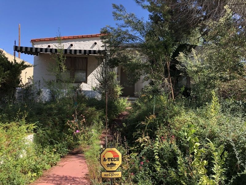
On Amherst Drive Northeast north of Grand Avenue Northeast, on the right when traveling north.
A Registered Cultural Property
State of New Mexico
Built in 1930 by carpenter Alvin Emerich and wife Augusta this Mediterranean house contributes to the Monte Vista and College View Historic District.
SR No. 1774 . . . — — Map (db m235672) HM
On Campus Boulevard Northeast east of Wellesley Place Northeast, on the left when traveling east.
A Registered Cultural Property
State of New Mexico
Purchased in 1931 by G. Allen Lowery for $5,000. This Mission Revival house contributes to the Monte Vista and College View Historic District.
SR No. 1774 . . . — — Map (db m235815) HM
On Campus Boulevard Northeast at Tulane Place Northeast, on the right when traveling west on Campus Boulevard Northeast.
A Registered Cultural Property
State of New Mexico
Built in 1929 for $5,000 by contractor Marion L. Porter. This Mediterranean house contributes to the Monte Vista and College View Historic District.
SR No. 1774 . . . — — Map (db m235813) HM
On Amherst Drive Northeast south of Marquette Avenue Northeast, on the left when traveling south.
A Registered Cultural Property
State of New Mexico
Built in 1935 by carpenter Harold M. Trott who lived at 2918 Campus Blvd. This Spanish Pueblo Revival house contributes to the Monte Vista and College View Historic District.
SR . . . — — Map (db m235673) HM
On Aliso Drive Northeast south of Marquette Avenue Northeast, on the right when traveling south.
Built in 1941. This Spanish-Pueblo Revival house contributes to the Monte Vista and College View Historic District.
SR 1774
A Registered Cultural Property
State of New Mexico — — Map (db m235589) HM
On Solano Drive Northeast south of Marquette Avenue Northeast, on the left when traveling south.
A Registered Cultural Property
State of New Mexico
Constructed 1932 in the Monte Vista & College View Historic District. Lovingly restored by Master Builder Henry Pettine, Jr., alongside & for his son and daughter, 2012.
SR No. . . . — — Map (db m235597) HM
On Solano Drive Northeast south of Marquette Avenue Northeast, on the left when traveling south.
First occupied in 1932 by AT&SF boilermaker Aubrey T. Rogers and family, this Mediterranean style house contributes to the Monte Vista and College View Historic District.
SR 1774
A Registered Cultural Property
State of New . . . — — Map (db m235601) HM
On Campus Boulevard Northeast west of Carlisle Boulevard Northeast, on the right when traveling west.
A Registered Cultural Property
State of New Mexico
This Architectural Streamline Moderne home is a contributing structure to the Monte Vista and College View Historic District.
SR No. 1774
Historical Society of New . . . — — Map (db m235683) HM
On Campus Boulevard Northeast at Carlisle Boulevard Northeast, on the right when traveling west on Campus Boulevard Northeast.
A Registered Cultural Property
State of New Mexico
Built in 1929 by carpenter Wm. Kenworthy. This SW Vernacular house contributes to the Monte Vista and College View Historic District.
SR No. 1774
Historical Society . . . — — Map (db m235669) HM
On Aliso Drive Northeast north of Marquette Avenue Northeast, on the right when traveling north.
A Registered Cultural Property
State of New Mexico
First occupied by telephone lineman James Burchfield and his wife Annie in 1940. This Spanish Pueblo Revival house contributes to the Monte Vista and College View Historic . . . — — Map (db m235591) HM
On Montclaire Drive Northeast at Courtney Avenue Northeast, on the right when traveling north on Montclaire Drive Northeast.
A Registered Cultural Property
State of New Mexico
This house was first owned by Louis & Caroline Herrera. It contributes to the Broadmoor Addition Historic District.
SR No. 2070
Historical Society of New . . . — — Map (db m235571) HM
On Hermosa Drive Northeast south of Roma Avenue Northeast, on the left when traveling south.
Monte Vista and College View National Register Historic District. Built 1930.
SR 1774
A Registered Cultural Property
State of New Mexico — — Map (db m235633) HM
On Hermosa Drive Northeast south of Roma Avenue Northeast, on the left when traveling south.
A Registered Cultural Property
State of New Mexico
First occupied in 1931 by Guy Boldes and Ruth Boldes. This Mediterranean house contributes to the Monte Vista and College View Historic District.
SR No. 1774 . . . — — Map (db m235632) HM
On Amherst Drive Northeast at Roma Avenue Northeast, on the right when traveling north on Amherst Drive Northeast.
A Registered Cultural Property
State of New Mexico
Built in 1931 by carpenter Harold M. Trott who lived at 2918 Campus Blvd. This Mediterranean house contributes to the Monte Vista and College View Historic District.
SR No. . . . — — Map (db m235678) HM
On Solano Drive Northeast south of Roma Avenue Northeast, on the left when traveling south.
Built in 1937 by Charles McDuffie. Original cost $3,000. Southwest Vernacular home with Mediterranean style porch. Contributes to the Monte Vista and College View Historic District.
SR 1774
A Registered Cultural Property
State of . . . — — Map (db m235596) HM
On Solano Drive Northeast north of Roma Avenue Northeast, on the left when traveling north.
A Registered Cultural Property
State of New Mexico
Home of Clarence R. Sousea who lived here sixty years. A contributing property to the Monte Vista and College Park Historic District.
SR No. 1774
Historical Society . . . — — Map (db m235593) HM
On Hermosa Drive Northeast south of Lomas Boulevard Northeast, on the left when traveling south.
A Registered Cultural Property
State of New Mexico
Built 1931 by Jack Dalton. In the 1930s it was the last home in northeast Albuquerque. A contributing property to the Monte Vista and College View Historic District.
SR No. . . . — — Map (db m235634) HM
On Amherst Drive Northeast south of Marquette Avenue Northeast, on the right when traveling south.
A Registered Cultural Property
State of New Mexico
Built 1929 by C. J. Brennan for Homa and Alma Lee, residents from 1929 to 1974. A contributing structure to the Monte Vista and College View Historic District.
SR No. 1774 . . . — — Map (db m235679) HM
On Carlisle Boulevard SE at Silver Avenue SE, on the left when traveling south on Carlisle Boulevard SE.
Immanuel Presbyterian Church Built between 1949 and 1956, it bespeaks Albuquerque’s suburban growth, John Meen’s Territorial Revival architecture, and faith. A Registered Cultural Property State of New Mexico — — Map (db m180826) HM
On Monte Vista Boulevard Northeast at Campus Boulevard Northeast, on the right when traveling west on Monte Vista Boulevard Northeast.
A Registered Cultural Property
State of New Mexico
Designed by T. Charles Gaastra. Dedicated February 1, 1931. An exceptional example of the Mediterranean Style and a landmark of its historic neighborhood.
State Register #830 . . . — — Map (db m235816) HM
On Tucker Avenue NE at Yale Boulevard NE, on the right when traveling west on Tucker Avenue NE.
The Honorable Mary Coons Walters
(1922 - 2001)
Ms. Walters, who was a transport pilot during World War II, was the only woman in her UNM law school class when she graduated at age 40. She served on the state Court of Appeals and as a . . . — — Map (db m45331) HM
Near North Plaza Street Northwest east of San Felipe Street Northwest, on the right when traveling west.
"Deposition With Six Figures"
is an original sculpture by
William Rodwell, an American artist.
Mr. Rodwell created the piece in 1968
while living and working in Pietrasanta,
Italy, in the region of Tuscany.
The figures were cast in . . . — — Map (db m293517) HM
On North Plaza Street NW at San Felipe Street NW, on the left when traveling west on North Plaza Street NW.
In 1706, New Mexico Governor Francisco Cuervo y Valdes founded the new Villa de Albuquerque (now spelled Albuquerque). Here, the Camino Real wound its way through a series of farming and ranching communities to a nearby ford, linking the road . . . — — Map (db m179424) HM
On North Plaza Street NW west of San Felipe Street NW, on the right when traveling west.
Dedicated to the prisoners of war and those missing in action whose supreme sacrifice has helped keep our nation ever free 200th · 515th Placed by Richard L. Cordova, ex-POW Chairman of San Felipe Restoration Project Bicentennial Year . . . — — Map (db m180895) WM
On San Felipe St., NW at S Plaza St NW, on the right when traveling north on San Felipe St., NW.
Built in 1706 and occupied for many generations by the Armijo family who were prominent in local history. This hacienda was gay with social life.
During the turmoil of the early settlement the Mexican, Spanish and American Civil War . . . — — Map (db m703) HM
Confederate Soldiers who
served in Gen Sibley's Brig
with Maj Trevanion T Teel
were buried here when Conf
Flag was flying over Old Albuqerque
in April 1862 — — Map (db m6677) HM
On Romero Road NW just south of Rio Grande Boulevard NW, on the right.
Illustrious son of the Province of Asturias Spain, Governor of New Mexico.
Sculpture funded by the City of Albuquerque 1% for Arts Program as per City Council Resolution 57, 1984.
Buck McCain, Artist, Santa Fe Bronze, Inc. Foundry. . . . — — Map (db m70364) HM
On Romero Street NW at Church Street NW, on the left when traveling south on Romero Street NW.
Historic site of Our Lady of Angels First public school in Albuquerque. Directed by sisters Blandina, Isadora, Berchmanns, Mary and Fidela. Sisters of Charity September 21, 1881 Marker by New Mexico Chapter Daughters of Founders & . . . — — Map (db m180881) HM
Near North Plaza Street NW west of San Felipe Street NW, on the left when traveling west.
In this plaza were enacted A.D. 1706
by Governor and Captain General Don Francisco Cuervo Y. Valdez ceremonies incident to the founding of the Villa of Albuquerque named after the Spanish Viceroy Don Francisco Fernandez de la Cueva Enriquez Duke of . . . — — Map (db m45271) HM
On 19th Street NW north of Old Town Road NW, on the right when traveling south.
In February 1706 several families participated in the founding of Albuquerque but the names of only 22 are preserved in the historical record. Within those families were many women honored as being founders of La Villa San Felipe de . . . — — Map (db m45230) HM
Cast in the foundry of Cyrus Alger & Company of Boston, Massachusetts, and originally designed to be mule-pack artillery, the Model of 1835 12-Pounder Mountain Howitzer was the smallest U.S. cannon of the period and could fire a 12-pound exploding . . . — — Map (db m45274) HM
On Romero Street NW at Old Town Road NW, on the left when traveling south on Romero Street NW.
1706-The Villa of "Alburquerque" was founded by Don Francisco Cuervo y Valdes, Governor of the Spanish province of New Mexico. It stood on the Camino Real (Royal Road), which ran between Mexico City and Santa Fe. It became the . . . — — Map (db m45278) HM
First marker on left:
San Felipe de Alburquerque, named for King Phillip V of Spain and the Duke of Alburquerque was, founded in 1706 by Gov. Francisco Cuervo Valdez with 30 families from Bernalillo accompanied by soldiers to protect . . . — — Map (db m119449) HM
On North Plaza Street NW, on the right when traveling west.
Oldest church in Albuquerque. Has continuously served the community without interruption since 1706. Originally founded and served by the Franciscan Friars, this parish church has been served successively by the Secular Clergy of Durango, Mexico . . . — — Map (db m119451) HM
Near North Plaza Street Northwest at Romero Street Northwest, on the right when traveling west.
Sister Blandina Convent
Foundation stones laid May 1881;
completed September 1881.
Occupied by Sisters of Charity,
teachers at Our Lady of Angels
School (1881-1887).
Covent, school, infirmary and
(1934 - 1945) U.S. Post . . . — — Map (db m293516) HM
While Confederate Brigadier General H. H. Sibley was assembling the bulk of his army at Santa Fe, Union Colonel E.R.S. Canby moved 1200 men from Fort Craig to occupy Albuquerque – "If it can be done without serious loss." Though outnumbered . . . — — Map (db m45270) HM
On North Plaza Street NW west of San Felipe Street NW, on the right when traveling west.
1706 1793 1796 Today
In recognition of the significant role
it has played in the history of our City,
State and Country, San Felipe de Neri
Church is on the registers of historic
places. San Felipe de Neri Church
has unceasingly served as . . . — — Map (db m180893) HM
On San Felipe Street NW north of Church Street NW, on the right when traveling north.
You are currently standing at the entrance to Patio
Escondido Mall in Old Town Albuquerque. This mall
area was once home to the Sagrada, a school of the
sacred arts founded by Sister Giotto Moots in 1969.
Sister Giotto, a graduate and dean . . . — — Map (db m181104) HM
Near Piedras Marcadas Canyon Trail north of Jill Patricia Street NW.
Piedras Marcadas Canyon The warmth of the sun, the whispers of the wind, the volcanic boulders, native plants, and desert animals are what the Pueblo people and other visitors to this volcanic landscape valued. Ancestral Puebloans were . . . — — Map (db m183130) HM
Near Piedras Marcadas Canyon Trail north of Jill Patricia Street NW, on the right when traveling west.
Piedras Marcadas Trail
About 200,000 years ago a series of volcanic
eruptions began to create this slope of eroded
volcanic boulders. The first two fissure eruptions yielded extensive amounts of liquid
lava which flowed naturally . . . — — Map (db m183133) HM
On Piedras Marcadas Canyon Trail north of Jill Patricia Street NW, on the right when traveling west.
Piedras Marcadas Trail
The majority of these petroglyphs were made
by the ancestors of modern Pueblo people. The Ancestral Puebloans made petroglyphs by
carefully removing the desert varnish with hand-held stone tools to expose the . . . — — Map (db m183134) HM
On Piedras Marcadas Canyon Trail west of Jill Patricia Street NW, on the right when traveling west.
Piedras Marcadas Trail
Identification of some petroglyphs is based
on interpretations by today's Pueblo people.
We cannot say for certain what all the images
represent, nor is it appropriate for modern
Pueblos to reveal the meaning of an . . . — — Map (db m183168) HM
On Piedras Marcadas Canyon Trail west of Jill Patricia Street NW when traveling west.
Piedras Marcadas Trail
Petroglyphs represent a valuable record of
cultural expression and human occupation
in the Rio Grande valley. They have deep
spiritual significance to modern Pueblo
groups as well as other indigenous people
such . . . — — Map (db m183170) HM
La Jornada (The Journey), the bronze sculptural grouping on the corner along with the adjacent earthen work Numbe Whageh (Our Center Place) make up the City of Albuquerque's 1% for the Arts Funds Cuarto Centenario Memorial. The memorial . . . — — Map (db m71142) HM
“Jornada De Paz”
Meaning "Journey of Peace" as the party made their expedition peaceful by not carrying weapons
In 1692 - 12 years following the 1680 Pueblo Revolt in New Mexico, the Spanish Crown . . . — — Map (db m45444) HM
On Mountain Road NW at 19th Street NW, on the right when traveling east on Mountain Road NW.
On January 26, 1598, amid embraces and farewells, Governor Juan de Oñate left Santa Barbara, in present day Chihuahua, leading an expedition bound for New Mexico. Nearly 600 settlers accompanied him, along with Mexican Indian allies and Franciscan . . . — — Map (db m45443) HM
On 1st Street SW north of Gold Avenue SW, on the right when traveling north.
An electric streetcar system in Albuquerque was constructed in 1904 to replace the horse-drawn trolleys. Two streetcar companies were established, one for the downtown Albuquerque and Old Town Plaza areas (the Albuquerque Traction Company) and . . . — — Map (db m45447) HM
On Gold Avenue Southwest at 2nd Street Southwest, on the right when traveling west on Gold Avenue Southwest.
The Central Bank Building shown in this 1905 view stood at
the northwest corner of Gold Avenue and Second Street.
Central Bank and other financial establishments at Gold and
Second gave the intersection the name "Bankers' Corner.
Central . . . — — Map (db m236623) HM
Near 4th Street Southwest north of Coal Avenue Southwest, on the right when traveling north.
God's plan
Building love at first site since 1880...
For 110 continuous years, God has blessed our city through
the many who have worshipped and worked here in his service.
We do now resolve to keep this faithfulness growing
as we . . . — — Map (db m236622) HM
On Gold Avenue Southwest at 1st Street Southwest, on the right when traveling west on Gold Avenue Southwest.
This view of Gold Avenue, looking west from First
Street, was taken about 1890 during the New Mexico
Territorial Fair parade. Gold Avenue was the financial,
professional, and governmental center of downtown
Albuquerque. The domed building at the . . . — — Map (db m235908) HM
On 1st Street SW at Gold Avenue SW, on the right when traveling north on 1st Street SW.
Harvey Girls
In 1883, the Fred Harvey Company hired women to serve in its diners and hotels along the Atchison, Topeka and Santa Fe Railway. Thousands of respectable, intelligent women were recruited from the Midwest and East Coast to come . . . — — Map (db m45326) HM
On Gold Avenue Southwest east of 3rd Street Southwest, on the right when traveling east.
Built 1894. Originally the home and office of Dr. Walter G. Hope. An example of downtown Albuquerque's post-railroad buildings.
Site No. 768
A Registered Cultural Property
State of New Mexico — — Map (db m235909) HM
On 1st Street SW, on the right when traveling north.
Hotel Alvarado was constructed in 1902 and demolished in 1970 in spite of local efforts to preserve it. The hotel and depot complex, shown in this 1908 photograph looking west, was designed by Santa Fe Railroad architect Charles Whittlesey in . . . — — Map (db m45446) HM
On Gold Avenue Southwest east of 9th Street Southwest, on the left when traveling east.
Constructed in 1906, this building was originally the residence of Clarence Hudson, one of Albuquerque's first advertising men.
Site No. 839
A Registered Cultural Property
State of New Mexico — — Map (db m235914) HM
On Central Avenue Southwest at 3rd Street Northwest, on the right when traveling east on Central Avenue Southwest.
This photograph shows the 1898 Territorial Fair
parade passing along the 300 block of Railroad
(Central) Avenue. Railroad Avenue was the main
thoroughfare of Albuquerque's New Town, and it
linked the railroad depot to Old Town Plaza. . . . — — Map (db m236626) HM
On 1st Street Southwest at Central Avenue Southwest, on the right when traveling south on 1st Street Southwest.
The corner of Railroad (Central) Avenue and Front (First) Street was prime real estate in 1882. The railroad had built its depot here in 1880, spurring the founding of Albuquerque's New Town. This view shows the first hotels, saloons, and stores . . . — — Map (db m235904) HM
On 8th Street Southwest at Central Avenue Southwest (U.S. 66), on the right when traveling north on 8th Street Southwest.
Designed by architect A. W. Boehning, Sr., this Art Deco style building was completed in 1931.
Site No. 784
A Registered Cultural Property
State of New Mexico — — Map (db m235917) HM
On 2nd Street Southwest north of Coal Avenue Southwest, on the right when traveling north.
The Coal Avenue Viaduct was built one block south of
this location in 1901. Before its construction, trains
unloading at the depot often kept wagon traffic from
crossing the railroad tracks and traveling to and from
the Huning Highlands . . . — — Map (db m293631) HM
Near Tingley Drive Southwest west of Alcalde Place Southwest, on the left when traveling west.
1900's
The Rio Grande was once a meandering
river and flooded all the way to where you
are standing. At the turn of the century
levees were built here to prevent flooding.
1933
Mayor Tingley and the Middle
Rio Grande Conservancy . . . — — Map (db m236631) HM
On Tramway Road NE (State Road 556 at milepost 5.6), 0.5 miles west of Federal Road 333, on the right when traveling east.
In 1912, State Librarian Lola Chávez de Armijo filed a gender discrimination law suit after the governor sought to replace her by court order, claiming that as a woman, she was unqualified to hold office under the constitution and laws of New . . . — — Map (db m45333) HM
On Tramway Road NE east of Sandia Heights Road NE, on the left.
The "Green Chair” was installed on the Easy Street beginner hill in 1967. It was built by a company from Denver Colorado called Miner-Denver. It was a small company that installed chairlifts from 1967 to 1970. Although short-lived, Miner-Denver . . . — — Map (db m180830) HM
On Central Avenue Southeast (U.S. 66) east of Buena Vista Drive Southeast, on the right when traveling east.
Opened in 1935 as part of the Pig Stand chain, it offered “Wholesome Food and Service” to walk-in and drive-in customers.
SR 1566
A Registered Cultural Property
State of New Mexico — — Map (db m235896) HM
On Spruce Street Southeast at Hazeldine Avenue Southeast, on the left when traveling south on Spruce Street Southeast.
Roosevelt Park offers an excellent example
of a municipal park created under the New
Deal. The project was begun by the Civil
Works Administration (CWA) in 1933 and
completed the following year by the Works
Progress Administration (WPA). Over . . . — — Map (db m235822) HM
On Bridge Boulevard SE at Broadway Boulevard SE, on the right when traveling west on Bridge Boulevard SE.
Attorney, public servant, and activist, Graciela Olivárez was a high school dropout who became the first woman graduate of Notre Dame Law School where an award is presented each year in her name. She led national anti-poverty efforts and ensured . . . — — Map (db m45225) HM
Near Lomas Boulevard NE at Tulane Drive Northeast, on the left when traveling east.
Dedicated to the members
of the 200 and 55 C.A.A.A.
of New Mexico who served in
the Philipines in World War II
In grateful appreciation and
honor to those living, and
those who made the supreme
sacrifice, this monument has
been . . . — — Map (db m235812) WM
On Lomas Boulevard Northeast at Amherst Drive Northeast, on the right when traveling west on Lomas Boulevard Northeast.
This Memorial honors the sacrifice of the Veterans of the U.S. Army, 200th and 515th Coast Artillery (AA) Regiments.
The names of the men who served are listed according to their regimental batteries . . . — — Map (db m235697) HM WM
On Lomas Boulevard Northeast at Amherst Drive Northeast, on the right when traveling west on Lomas Boulevard Northeast.
A Registered Cultural Property
State of New Mexico
A living monument to the soldiers of the 200th and 515th Coast Artillery (AA) regiments who served and sacrificed in the Philippines during World War II.
SR #1783 . . . — — Map (db m235685) HM WM
On Sunport Boulevard west of Yale Boulevard Southeast, on the right when traveling east.
"This memorial is dedicated to the
eternal memory of the thousands
of people who perished in the
terrorist attacks of September 11, 2001.
Although spirited from the material life,
they remain forever with us in
thought, word and deed. This . . . — — Map (db m236633) WM
On Sunport Loop SE west of Sunport Boulevard, on the right when traveling west.
A flame burns on this spot and in the hearts of the people of this state and nation as a reminder of the sacrifices of those who have served in the Vietnam conflict.
The prisoners of war and those missing in action in that conflict are not and . . . — — Map (db m187258) WM
On Sunport Loop Southeast west of Sunport Boulevard, on the left when traveling west.
"Greater love hath no man than this, that a man lay down his life for his friends." John 15:13
In loving honor of Officer Germaine Casey of the Rio Rancho Police Department who, on the 27th of August 2007, selflessly gave his life in the . . . — — Map (db m187256) HM
On Atrisco Road NW north of Mojave Street NW, on the right when traveling north.
Boca Negra Canyon Boca Negra, the “black mouth,” is considered
the birthplace of Petroglyph National Monument. Through the efforts of private citizen groups in
the 1960s, this area became Indian Petroglyph State Park, which later became the . . . — — Map (db m182696) HM
Boca Negra Canyon
Cliff Base Trail
The boulder on your left is a good example of desert varnish,
the darkening of the rock's surface in response to natural
elements. Over the years the exposed surface of basalt darkens
in color due to . . . — — Map (db m182902) HM
Boca Negra Canyon
Cliff Base Trail
Archeologists, currently using relative dating methods along
the escarpment, are arriving at the conclusion that the 23,000
petroglyphs found in the monument were created between
1000 B.C. — A.D. 1700. . . . — — Map (db m182865) HM
Boca Negra Canyon
Cliff Base Trail
Notice the unusual and varied texture of this basalt boulder.
Basalt is generally considered to be the most common extrusive igneous rock on Earth, composed mostly of calcium-rich
plagioclase and . . . — — Map (db m182866) HM
Boca Negra Canyon
Cliff Base Trail
Notice how the volcanic escarpment curves around the island-like field of native plants in the
middle of Boca Negra Canyon. This is an example of what geologists call reverse or inverted
topography. At . . . — — Map (db m182875) HM
Boca Negra Canyon
Macaw Trail
The majority of these petroglyphs were made by the
ancestors of modern Pueblo people. The Ancestral
Puebloans made petroglyphs by carefully removing the
desert varnish with hand-held stone tools which . . . — — Map (db m182821) HM
Boca Negra Canyon
Macaw Trail
Native vegetation is commonly featured in petroglyphs. This
yucca pod image conveys the importance of many native plant
species to the Ancestral Puebloans. The entire plant, from its
root to the tip of its . . . — — Map (db m182858) HM
On Mesa Point Trail east of Atrisco Drive NW, on the left when traveling east.
Boca Negra Canyon Mesa Point Trail
Petroglyphs represent a valuable record of cultural expression
and human occupation in the Rio Grande valley. They have
deep spiritual significance to modern Pueblo groups as well as
other indigenous . . . — — Map (db m182697) HM
On Mesa Point Trail east of Atrisco Drive NW, on the left when traveling east.
Boca Negra Canyon Mesa Point Trail
About 200,000 years ago a series of volcanic eruptions
began to create this slope of eroded volcanic boulders.
The first two fissure eruptions yielded extensive amounts
of liquid lava which flowed . . . — — Map (db m182699) HM
Boca Negra Canyon Mesa Point Trail
Notice the human figure in front of you which appears to be
wearing a mask and headdress. Some petroglyphs are easily
recognizable, however the original and true meanings are known
only by their creators . . . — — Map (db m182701) HM
Boca Negra Canyon Mesa Point Trail
Several stacked rock structures like this one are found in the
monument and are protected as archeological resources. This
structure has naturally eroded to its present state. Local
archeologists believe . . . — — Map (db m182703) HM
On Mesa Point Trail east of Atrisco Drive NW, on the right when traveling east.
Boca Negra Canyon Mesa Point Trail
Due to extended periods of drought, the Pueblo people
searched for permanent sources of surface water that would
sustain their agricultural lifestyle. Many people settled along
the Rio Grande which . . . — — Map (db m182722) HM
On Mesa Point Trail east of Atrisco Drive NW when traveling east.
Boca Negra Canyon Mesa Point Trail
Identification of some petroglyphs is based on interpretations
by today's Pueblo people. We cannot say for certain what all
the images represent, nor is it appropriate for modern Pueblos
to reveal the . . . — — Map (db m182724) HM
Boca Negra Canyon
Cliff Base Trail
Although some images are easily recognizable (such as these
human footprints) according to modern Pueblo people, it is
culturally insensitive to reveal the meanings of some petroglyphs. While these . . . — — Map (db m183107) HM
Petroglyph National Monument What type of rock is this? The rock that makes up the West Mesa escarpment is vesicular basalt. The basalt flow originated from fissures marked by five volcanic spatter cones that be seen along the western horizon . . . — — Map (db m182820) HM
Boca Negra Canyon
Cliff Base Trail
Notice that the prehistoric petroglyphs face south or
southeast. Perhaps this placement was deliberate to the
orientation of the daily rising sun. It is also thought that
many of the images were made . . . — — Map (db m182859) HM
Boca Negra Canyon
Cliff Base Trail
The placement of petroglyphs was deliberate based on the
boulder's orientation to the sun and the surrounding landscape.
Some boulders contain petroglyphs on east-facing sides while
other boulders have . . . — — Map (db m183109) HM
Boca Negra Canyon
Cliff Base Trail
Authentic petroglyphs are valuable and irreplaceable cultural
resources that provide us with insight of the prehistoric
civilizations that once thrived here. Protecting these cultural
treasures is a . . . — — Map (db m182876) HM
Boca Negra Canyon
Cliff Base Trail
There are many complex and dynamic reasons why the
Ancestral Puebloans made their petroglyphs here. Some
possible reasons are based on cultural and spiritual beliefs.
Some Native Americans believe . . . — — Map (db m182862) HM
Boca Negra Canyon
Cliff Base Trail
Archeologists refer to these images as being made in the Rio
Grande style. This style developed rather suddenly around
the year 1300, coinciding with a dramatic increase in the local
population and the . . . — — Map (db m182903) HM
340 entries matched your criteria. Entries 101 through 200 are listed above. ⊲ Previous 100 — Next 100 ⊳